Images of Old Hawaiʻi

  • Home
  • About
  • Categories
    • Ali’i / Chiefs / Governance
    • American Protestant Mission
    • Buildings
    • Collections
    • Economy
    • Missionaries / Churches / Religious Buildings
    • General
    • Hawaiian Traditions
    • Other Summaries
    • Mayflower Summaries
    • Mayflower Full Summaries
    • Military
    • Place Names
    • Prominent People
    • Schools
    • Sailing, Shipping & Shipwrecks
    • Voyage of the Thaddeus
  • Collections
  • Contact
  • Follow

January 19, 2014 by Peter T Young Leave a Comment

Moku

Prior to European contact, each of the major islands or independent chiefdoms in the Hawaiian chain comprised a mokupuni (island.) Over the centuries, as the ancient Hawaiian population grew, land use and resource management also evolved.

The traditional land division of pre-contact Hawaiians was based on the sustainability and self-reliance within ahupuaʻa (community watershed areas) as well as within larger regions (moku) and lastly individual sovereign islands (mokupuni.)

The mokupuni were subdivided into land units of varying sizes, and the largest division was the moku (district – literally: interior island,) administered by high-ranking chiefs.

They were either relatives of the high chief of the island, trusted supporters or high ranking individuals who pledged their support to the high chief but were allowed to remain relatively independent.

Each island was divided into several moku or districts, of which there are six in the island of Hawaiʻi, and the same number in Oʻahu. There is a district called Kona on the lee side and one called Koʻolau on the windward side of almost every island.  (Alexander)

It appears that the six districts on the islands of O‘ahu and Hawai‘i, and the system of developing smaller manageable units of land became formalized in the reigns of Māʻilikūkahi and ʻUmi-a-Līloa, respectively (about the time Columbus was sailing across the Atlantic.)

Māʻilikūkahi is noted for clearly marking and reorganizing land division palena (boundaries) on O‘ahu.  Palena, or possibly an evolved term “palena ʻāina” are place boundaries.  (Beamer)

Defined palena brought greater productivity to the lands; lessened conflict and was a means of settling disputes of future aliʻi who would be in control of the bounded lands; protected the commoners from the chiefs; and brought (for the most part) peace and prosperity.

Fornander writes, “He caused the island to be thoroughly surveyed, and boundaries between differing divisions and lands be definitely and permanently marked out, thus obviating future disputes between neighboring chiefs and landholders.”

Kamakau tells a similar story, “When the kingdom passed to Māʻilikūkahi, the land divisions were in a state of confusion; the ahupuaʻa, the ku, the ʻili ʻāina, the moʻo ʻāina, the pauku ʻāina, and the kihapai were not clearly defined.”

“Therefore, Māʻilikūkahi ordered the chiefs, aliʻi, the lesser chiefs, kaukau aliʻi, the warrior chiefs, puʻali aliʻi, and the overseers (luna) to divide all of Oʻahu into moku, ahupuaʻa, ʻili kupono, ʻili ʻāina, and moʻo ʻāina.”

Malo gives a detailed description of the kuleana that a kālaimoku aliʻi who divided lands for Mōʻī had to fulfill:  “There are two important aspects in being a kālaimoku, to take care of the aliʻi, and to take care of the makaʻāinana, for these two reasons the kālaimoku guides the aliʻi at his side, with the careful attention to these two things, things were to be done properly.”  (Malo, Beamer)

What is commonly referred to as the “ahupuaʻa system” is a result of the firm establishment of palena (boundaries.)  This system of land divisions and boundaries enabled a konohiki (land/resource manager) to know the limits and productivity of the resources that they managed.

In the late-1400s, through warfare and alliances with other chiefs, ʻUmi gained control of the entire Island of Hawaiʻi. ʻUmi made himself the aliʻi nui, or high chief, for the whole island.

ʻUmi divided his island into separate moku, or districts. These moku were subdivided into smaller sections called ahupuaʻa.

In the time of ʻUmi, son of the great chief Līloa, the Hawaiian islands were divided into political regions. The four mokupuni (larger islands) of Kauaʻi, Oʻahu, Maui, and Hawaiʻi were divided into moku (districts).

The smaller islands of Molokaʻi, Lānaʻi and Kahoʻolawe became moku of Maui, and Niʻihau a moku of Kauaʻi.

Traditionally, the Island of Kaua‘i was divided into five moku (districts): Haleleʻa, Kona, Koʻolau, Nāpali and Puna. However, after the battle of Wahiawa in 1824, the land of Kaua‘i was redistributed and district boundaries changed. The new district names became: Hanalei, Kawaihau, Līhuʻe, Kōloa and Waimea.  (Cultural Surveys)

For ease in collecting annual tribute, the moku were subdivided into ahupuaʻa, land sections that usually extended from the mountain summits down through fertile valleys to the outer edge of the reef in the sea (or if there was not reef, one-mile from shore.)

The size of the ahupuaʻa depended on the resources of the area with poorer agricultural regions split into larger ahupuaʻa to compensate for the relative lack of natural abundance. Each ahupuaʻa was ruled by an aliʻi or local chief and administered by a konohiki.

These natural land divisions were the result of the flow of water over the land (streams or springs.)

From the earliest days, streams were among the most important natural resources sought after by native Hawaiians. Battles were fought and lives sacrificed for the right to use stream water.

The Hawaiians called freshwater wai, and considered it to be sacred. People using wai from streams took only what was absolutely necessary. They were expected to share the wai with others. This was done without greed or selfishness.

Such practices gave Hawaiians their word for law which is kanawai, or the “equal sharing of water.” Water was so valuable to Hawaiians that they used the word “wai” to indicate wealth. Thus to signify abundance and prosperity, Hawaiians would say waiwai.

In keeping with this concept of wealth being fresh water, the traditional land tenure system in ancient Hawaii had at its very core the presence of streams, or kahawai. Although of many shapes and sizes, each ahupua’a consisted of three area types: mountain, plain and sea.

The image shows the Moku of Oʻahu (ksbe.) In addition, I have added other related images in a folder of like name in the Photos section on my Facebook and Google+ pages.

Follow Peter T Young on Facebook  Moku

Prior to European contact, each of the major islands or independent chiefdoms in the Hawaiian chain comprised a mokupuni (island.) Over the centuries, as the ancient Hawaiian population grew, land use and resource management also evolved.
The traditional land division of pre-contact Hawaiians was based on the sustainability and self-reliance within ahupuaʻa (community watershed areas) as well as within larger regions (moku) and lastly individual sovereign islands (mokupuni.)
The mokupuni were subdivided into land units of varying sizes, and the largest division was the moku (district – literally: interior island,) administered by high-ranking chiefs.
They were either relatives of the high chief of the island, trusted supporters or high ranking individuals who pledged their support to the high chief but were allowed to remain relatively independent.
Each island was divided into several moku or districts, of which there are six in the island of Hawaiʻi, and the same number in Oʻahu. There is a district called Kona on the lee side and one called Koʻolau on the windward side of almost every island.  (Alexander)
It appears that the six districts on the islands of O‘ahu and Hawai‘i, and the system of developing smaller manageable units of land became formalized in the reigns of Māʻilikūkahi and ʻUmi-a-Līloa, respectively (about the time Columbus was sailing across the Atlantic.)
Māʻilikūkahi is noted for clearly marking and reorganizing land division palena (boundaries) on O‘ahu.  Palena, or possibly an evolved term “palena ʻāina” are place boundaries.  (Beamer)
Defined palena brought greater productivity to the lands; lessened conflict and was a means of settling disputes of future aliʻi who would be in control of the bounded lands; protected the commoners from the chiefs; and brought (for the most part) peace and prosperity.
Fornander writes, “He caused the island to be thoroughly surveyed, and boundaries between differing divisions and lands be definitely and permanently marked out, thus obviating future disputes between neighboring chiefs and landholders.”
Kamakau tells a similar story, “When the kingdom passed to Māʻilikūkahi, the land divisions were in a state of confusion; the ahupuaʻa, the ku, the ʻili ʻāina, the moʻo ʻāina, the pauku ʻāina, and the kihapai were not clearly defined.”
“Therefore, Māʻilikūkahi ordered the chiefs, aliʻi, the lesser chiefs, kaukau aliʻi, the warrior chiefs, puʻali aliʻi, and the overseers (luna) to divide all of Oʻahu into moku, ahupuaʻa, ʻili kupono, ʻili ʻāina, and moʻo ʻāina.”
Malo gives a detailed description of the kuleana that a kālaimoku aliʻi who divided lands for Mōʻī had to fulfill:  “There are two important aspects in being a kālaimoku, to take care of the aliʻi, and to take care of the makaʻāinana, for these two reasons the kālaimoku guides the aliʻi at his side, with the careful attention to these two things, things were to be done properly.”  (Malo, Beamer)
What is commonly referred to as the “ahupuaʻa system” is a result of the firm establishment of palena (boundaries.)  This system of land divisions and boundaries enabled a konohiki (land/resource manager) to know the limits and productivity of the resources that they managed.
In the late-1400s, through warfare and alliances with other chiefs, ʻUmi gained control of the entire Island of Hawaiʻi. ʻUmi made himself the aliʻi nui, or high chief, for the whole island.
ʻUmi divided his island into separate moku, or districts. These moku were subdivided into smaller sections called ahupuaʻa.
In the time of ʻUmi, son of the great chief Līloa, the Hawaiian islands were divided into political regions. The four mokupuni (larger islands) of Kauaʻi, Oʻahu, Maui, and Hawaiʻi were divided into moku (districts).
The smaller islands of Molokaʻi, Lānaʻi and Kahoʻolawe became moku of Maui, and Niʻihau a moku of Kauaʻi.
Traditionally, the Island of Kaua‘i was divided into five moku (districts): Haleleʻa, Kona, Koʻolau, Nāpali and Puna. However, after the battle of Wahiawa in 1824, the land of Kaua‘i was redistributed and district boundaries changed. The new district names became: Hanalei, Kawaihau, Līhuʻe, Kōloa and Waimea.  (Cultural Surveys)
For ease in collecting annual tribute, the moku were subdivided into ahupuaʻa, land sections that usually extended from the mountain summits down through fertile valleys to the outer edge of the reef in the sea (or if there was not reef, one-mile from shore.)
The size of the ahupuaʻa depended on the resources of the area with poorer agricultural regions split into larger ahupuaʻa to compensate for the relative lack of natural abundance. Each ahupuaʻa was ruled by an aliʻi or local chief and administered by a konohiki.
These natural land divisions were the result of the flow of water over the land (streams or springs.)
From the earliest days, streams were among the most important natural resources sought after by native Hawaiians. Battles were fought and lives sacrificed for the right to use stream water.
The Hawaiians called freshwater wai, and considered it to be sacred. People using wai from streams took only what was absolutely necessary. They were expected to share the wai with others. This was done without greed or selfishness.
Such practices gave Hawaiians their word for law which is kanawai, or the “equal sharing of water.” Water was so valuable to Hawaiians that they used the word “wai” to indicate wealth. Thus to signify abundance and prosperity, Hawaiians would say waiwai.
In keeping with this concept of wealth being fresh water, the traditional land tenure system in ancient Hawaii had at its very core the presence of streams, or kahawai. Although of many shapes and sizes, each ahupua’a consisted of three area types: mountain, plain and sea.
The image shows the Moku of Oʻahu (ksbe.) In addition, I have added other related images in a folder of like name in the Photos section on my Facebook and Google+ pages.
Follow Peter T Young on Facebook  
Follow Peter T Young on Google+    
© 2014 Hoʻokuleana LLC

Filed Under: Hawaiian Traditions, Place Names Tagged With: Kona, Palena, Molokai, Kanawai, Maui, Moku, Umi-a-Liloa, Kauai, Lanai, Koolau, Niihau, Hawaii, Mailikukahi, Hawaii Island, Kahoolawe, Oahu, Ahupuaa

August 26, 2012 by Peter T Young Leave a Comment

Kauai Path

Some waaay cool stuff has been going on in Kaua‘i that other communities could follow.  Various communities across the island are working together to define and build multi-use paths in their regions.

Kauai Path, Inc, a 501 (c) (3) non-profit advocacy organization, serves as a central coordinator and is working with Kaua‘i residents to preserve, protect and extend access via non-motorized multi-use paths for communities on Kaua‘i.

A board of directors leads Kauai Path, and several interest groups participate in various committees that report to the board.  These committees manage such aspects as the Path Ambassadors and Friends of the Path programs, fund raising, volunteer activities, outreach and planning.

A multi-use path or trail is typically separated from the roadway for use by bicyclists, pedestrians, skaters, runners, dog walkers, and others using non-motorized modes of transportation.  Most contemporary multi-use trails are designed in compliance with the Americans with Disabilities Act (ADA), and so are handicap accessible, except as noted.

The proposed path networks are not envisioned as the widening of our existing roadways.  Rather, they are seen as separate greenways or “linear parks,” isolated from roadways to the greatest extent possible, where people can safely ride to work, walk to school, push baby carriages and exercise with friends through tranquil settings.

The benefits to communities of a multi-use path system are many:

  • Reduction of Automobiles & Emissions
  • Increased Social Engagements
  • Health, Recreation & Fitness
  • Reduced Dependence on Fossil Fuels
  • Quality of Life
  • Safe Routes to School
  • Tsunami Evacuation
  • Smart Growth-Integrated Land Use & Transportation Solutions

For visioning purposes, Kauai Path divides the island into four major segments, North Shore, East Side, South Shore and West Side.  These respective communities have been working together on their respective needs, designs, and locations for their community paths.

The North Shore community recently released a North Shore Path Alternatives Report. (http://nspath.kauaistyle.com/wp-content/uploads/2012/03/NSPAR_final.pdf)

The East Side calls their path system “Ke Ala Hele Makalae” (“The Path that Goes by the Coast”) and has completed phases that generally follow the coast and eventually will link Nawiliwili to Anahola.

As of early 2012, there is approximately seven completed miles of  Ke Ala Hele Makalae. One section meanders through and connects Lydgate Beach Park to Wailua Beach Park, and the rest links Kapa‘a to Ahihi Point. Construction to connect those two sections, and to extend the path into the Kawaihau Road residential area, is currently under way.

On the South Shore, the community’s primary project is implementation of the comprehensive Kōloa Poʻipū Area Circulation Plan ( http://www.charlier.org/index.php?id=19,180,0,0,1,0 ).

That plan includes bicycle and pedestrian improvements to Hapa Trail, a two-mile long roadway that directly links Kōloa town to the Poʻipū Beach area.  It was basically abandoned when Poʻipū Road was developed in the 1950s.

Associated with this, Holo Holo Kōloa Scenic Byway was recently named a State Scenic Byway and is in the process of developing a Corridor Management Plan.  That plan will identify and address additional multi-modal alternatives in the area.

We are working with the Kōloa /Poʻipū communities in preparing the Corridor Management Plan for the Scenic Byway.

Earlier this year, the West Side Path Alternatives Report was distributed to the community.  That plan identifies several potential alternative routes within and connecting the communities of Waimea and Kekaha. (http://www.kauaipath.org/files/content/WS_Path_Alternatives.pdf)

These programs are part of Mayor Carvalho’s Holo Holo 2020 vision whose goals may be achieved by creating these alternative transportation modes for all communities on Kaua‘i.

Complementing this is the County’s Kaua‘i Multimodal Land Transportation Plan.  This project is in the process of developing a comprehensive plan (coordinated with the Hawai‘i DOT Land Transportation Plan) for public transit, bicycling, pedestrians and vehicular traffic on County roads.

There is a lot we can learn from the Kaua‘i community from this important project.  More images are added to a folder of like name in the Photos section on my Facebook page.

http://www.facebook.com/peter.t.young.hawaii

© 2012 Hoʻokuleana LLC

Filed Under: General Tagged With: Hawaii, Kauai, Kauai Path

May 22, 2012 by Peter T Young Leave a Comment

Banana Poka Round-Up – Sunday, May 27 – Kōkeʻe

It’s a forest education fair for the whole family with a funny name – the Banana Poka Round-Up!
An invasive pest from South America, the Banana Poka vine, with its gorgeous bubble-gum pink blossoms, is the “poster weed” for this zany annual event.
It is just one of the many threats to the health and diversity of Hawaiian forests – and also a fabulous craft material.  The Round-Up always features a huge tent where you can learn how to make a basket out of the pest.
Held in early summer, May 27, 2012, in Kanaloahuluhulu Meadow, the event features basket making, great live music, exhibits by organizations and agencies that work to save the environment, along with lots of activities for kids – face-painting, hiking, painting from nature, as well a walking stick from guava saplings.
Right after the Memorial Moment and Pedal to the Meadow Biking winners, a Crowing Contest is held – everyone from little kids to adults join in!
Banana Poka Round-Up enters third decade of forest fun May 27, 2012
Sponsored by Hui o Laka since 1989, the 23rd annual Round-Up includes several new features, including being the finish line for the second annual Pedal to the Meadow bike race, a Kekaha-to-Kōkeʻe race that begins at 7:00 am Sunday morning.
Schedule:
07:00 am   Start Pedal to the Meadow bike race, a Kekaha-to-Kōkeʻe race
09:00 am   Early finishers of bike race
10:00 am   Start Banana Poka Round-Up
10:00 am   Banana Poka Basketmaking
10:00 am   Harry Koizumi
11:00 am   Paul Tokioka
12 noon    Memorial Moment
12:15 pm  Pedal to the Meadow Results
12:30 pm Russell the Rooster Crowing Contest
12:30 pm   Family hike on the Berry Flats Loop
01:00 pm   Banana Poka Basketmaking
02:00 pm   Banana Poka Basketmaking
04:00 pm   Pau Banana Poka Round-Up
Daylong    Ikebana Flower arranging and hiking stick whittling
Also, please consider joining Hui O Laka (I am a new and proud member.)
Kōkua Kōkeʻe (Hui o Lakaʻs stewardship program) is looking for new members so it will be able to grow into the first ongoing (as in year-round and continuous) natural resources management program that is NOT funded by government.
They want to expand this forest ʻohana before their 60th anniversary and dedication of the CCC Camp in 2013!
It really does not matter what level folks join at … here’s a link to their website: http://www.kokee.org

Filed Under: General Tagged With: Hui O Laka, Hawaii, Kauai, Kokee

May 12, 2012 by Peter T Young Leave a Comment

Holo Holo Kōloa Scenic Byway – Wins Historic Preservation Commendation from Historic Hawaii Foundation

We are proud and honored that the Local Scenic Byway Committee, Mālama Kōloa, Kōloa Community Association, Poʻipū Beach Resort Association and Hoʻokuleana LLC were awarded the 2012 Historic Preservation Commendation for the Holo Holo Kōloa Scenic Byway project from the Historic Hawaiʻi Foundation.
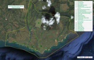
Holo Holo Kōloa Scenic Byway is situated on the South Shore of the island of Kauaʻi (in the Old Kōloa Town, running down and through the Poʻipū Beach resort area – out through Māhāʻulepu.)
Here, there are many scenic, natural and recreational qualities that travelers along the Byway may experience and enjoy.  Along the coastal area of Poʻipū there are popular beaches for swimming, surfing, snorkeling, scuba or sunset watching. 
But the focus of interest along the Holo Holo Kōloa corridor is the region‘s history and the role this area played in helping to shape Hawaiʻi‘s socio-economic past, present and future.
As noted in Carol Wilcox’s book, The Kauaʻi Album, “The history of Kōloa is in many ways Hawai‘i’s history in microcosm.”
Holo Holo Kōloa gives the traveler a look at the historic and socio-economic evolution of the Hawaiian Islands.  Here many “firsts” took place that ultimately guided this transformation.
This is a corridor with many stories to tell, under the backdrop of its impressive scenic beauty.
Last year, the State Department of Transportation designated Holo Holo Kōloa as a State Scenic Byway.
We assisted in the designation process and are now working with the community in preparing the Corridor Management Plan (CMP) for the project.
The CMP is prepared to address issues related to management of the corridor, but, more importantly, is used to submit the application to Federal Highways for National designation.
State and National Scenic Byways designations recognize roads that exhibit one or more six core intrinsic qualities – scenic, natural, historic, recreational, archaeological or cultural – contributing towards a unique travel experience.
Overall, the Scenic Byways Program is for:
  • roads that tell a special story;
  • roads with outstanding intrinsic qualities that need recognition or protection; and
  • roads that will benefit from a coordinated strategy for tourism and economic development

 There are over 20 primary Points of Interest along the corridor, including Tree Tunnel, Kōloa Sugar Monument, Old Kōloa Town, Kōloa Sugar Mill, several Churches, National Tropical Botanical Garden, various Puʻu and Bays.
Archaeological and Historic sites include Kāneiolouma, Kōloa Field System, Luahinealapiʻi (Hapa Road,) Prince Kuhio Park/Hoʻia Heiau, Kihahouna Heiau, Makauwahi Cave, Waiʻōpili Heiau and Keolewa Heiau.
This is our second Scenic Byway and Corridor Management Plan assignment.  We previously prepared the Plan for Royal Footsteps Along the Kona Coast, on Ali’i Drive on the Big Island (the first CMP to be approved in the State.)
We are also very proud of that project; Royal Footsteps received several awards, including Historic Preservation Commendation from Historic Hawaii Foundation; Environment/Preservation award from the American Planning Association-Hawai‘i Chapter; and Pualu Award for Culture and Heritage from the Kona-Kohala Chamber of Commerce.
In the coming weeks, I will be sharing some of the highlights on some of the Point of Interest sites that are included in the Scenic Byway.

Filed Under: General, Place Names, Economy Tagged With: Hawaii, Kauai, Historic Hawaii Foundation, Koloa, Hookueana LLC, Holo Holo Koloa Scenic Byway

March 30, 2012 by Peter T Young Leave a Comment

Holo Holo Kōloa Scenic Byway – Preservation Commendation

I am honored and proud to share with you some great news we just received concerning a project we are working on.
Holo Holo Kōloa Scenic Byway will be recognized with a Preservation Commendation from Historic Hawai‘i Foundation at its 2012 Preservation Honor Awards ceremony for outstanding efforts in preservation through planning and designation of the Holo Holo Kōloa Scenic Byway.
This award is being given to Kōloa Community Association, Mālama Koloa, Po‘ipū Beach Resort Association, HDOT Hawai’i Scenic Byways Program and Ho‘okuleana LLC.
Holo Holo Kōloa Scenic Byway, recently designated a State Scenic Byway, is situated in the historic
Old Kōloa Town and runs down and through the Po’ipu Beach resort area on Kaua‘i’s South Shore.
This region is steeped in history and its various points of interest tell the stories of Hawaii’s people and its evolving socio-economic past.
Along this corridor are significant historic, archaeological, cultural, natural, recreational and scenic resources.
Holo Holo Kōloa gives the traveler a look at the historic and socio-economic evolution of the Hawaiian Islands.
Here many “firsts” took place that ultimately guided this transformation.  This is a corridor with many stories to tell, under the backdrop of its impressive scenic and natural beauty.
We have been assisting Holo Holo Kōloa Scenic Byway in the State designation process, as well as preparing the Corridor Management Plan for the Scenic Byway.
This is our second Scenic Byway project.  We also prepared the Corridor Management Plan for the Royal Footsteps Along The Kona Coast.
Royal Footsteps also received a Historic Hawai‘i Foundation Preservation Commendation, as well as an APA-Hawai‘i Environment-Preservation Award and a Kona-Kohala Chamber of Commerce Pualu Award for Culture & Heritage.

Filed Under: General Tagged With: Hawaii, Kauai, Historic Hawaii Foundation, Koloa, Holo Holo Koloa Scenic Byway, Award

  • « Previous Page
  • 1
  • …
  • 17
  • 18
  • 19

Images of Old Hawaiʻi

People, places, and events in Hawaiʻi’s past come alive through text and media in “Images of Old Hawaiʻi.” These posts are informal historic summaries presented for personal, non-commercial, and educational purposes.

Info@Hookuleana.com

Connect with Us

  • Email
  • Facebook
  • LinkedIn
  • Twitter
  • YouTube

Recent Posts

  • Hawaiian Room
  • Normal School
  • Pohaku O Kauai
  • Andover Theological Seminary
  • Queen of the Silver Strand
  • Lanai Tsunami
  • Maliko Gulch Inverted Siphon

Categories

  • Missionaries / Churches / Religious Buildings
  • Hawaiian Traditions
  • Military
  • Place Names
  • Prominent People
  • Schools
  • Sailing, Shipping & Shipwrecks
  • Economy
  • Voyage of the Thaddeus
  • Mayflower Summaries
  • American Revolution
  • General
  • Ali'i / Chiefs / Governance
  • Buildings

Tags

Albatross Al Capone Ane Keohokalole Archibald Campbell Bernice Pauahi Bishop Charles Reed Bishop Downtown Honolulu Eruption Founder's Day George Patton Great Wall of Kuakini Green Sea Turtle Hawaii Hawaii Island Hermes Hilo Holoikauaua Honolulu Isaac Davis James Robinson Kamae Kamaeokalani Kamanawa Kameeiamoku Kamehameha Schools Lalani Village Lava Flow Lelia Byrd Liliuokalani Mao Math Mauna Loa Midway Monk Seal Northwestern Hawaiian Islands Oahu Papahanaumokuakea Marine National Monument Pearl Pualani Mossman Queen Liliuokalani Thomas Jaggar Volcano Waikiki Wake Wisdom

Hoʻokuleana LLC

Hoʻokuleana LLC is a Planning and Consulting firm assisting property owners with Land Use Planning efforts, including Environmental Review, Entitlement Process, Permitting, Community Outreach, etc. We are uniquely positioned to assist you in a variety of needs.

Info@Hookuleana.com

Copyright © 2012-2024 Peter T Young, Hoʻokuleana LLC