Images of Old Hawaiʻi

  • Home
  • About
  • Categories
    • Ali’i / Chiefs / Governance
    • American Protestant Mission
    • Buildings
    • Collections
    • Economy
    • Missionaries / Churches / Religious Buildings
    • General
    • Hawaiian Traditions
    • Other Summaries
    • Mayflower Summaries
    • Mayflower Full Summaries
    • Military
    • Place Names
    • Prominent People
    • Schools
    • Sailing, Shipping & Shipwrecks
    • Voyage of the Thaddeus
  • Collections
  • Contact
  • Follow

August 10, 2024 by Peter T Young Leave a Comment

Pōhakuloa CCC Camp

In 1876, the legislature passed “An Act for the Protection and Preservation of Woods and Forests” in response to water crisis in Honolulu due to deforestation and decrease in stream flow Nuʻuanu Stream, the main source of water for Honolulu. 

In 1882, the first government tree nursery was established to provide tree seedlings for reforestation of mauka lands above Honolulu. 50,000 tree seedlings are planted on the denuded slopes of Tantalus (Honolulu). (DLNR-DOFAW)

In 1903, the Hawaii Territorial Legislature passed Act 44 establishing the Board of Agriculture and Forestry, predating the USDA Forest Service by one year. Act 44 expanded on the Forestry Act of 1876 and provided the legal vehicle for the creation of reserves encompassing private as well as public lands.

The Forest Reserve System was created by the Territorial Government of Hawai’i through Act 44 on April 25, 1903.  It was cooperative arrangement between the Hawai‘i Sugar Planters Association and the territorial government.

Plantations needed wood for fuel, but they also needed to keep the forests intact to draw precipitation from the trade winds, which in turn fed the irrigation systems in the cane fields below. (DLNR-DOFAW)

The first Territorial forester, Ralph S Hosmer, suggested that the forest had been declining in the uplands as a result of fire, grazing and insects. In order to preserve the forest, it was necessary to keep the ungulates out. From 1924 to 1926 hundreds of thousands of pigs, sheep, cattle and goats were reportedly removed from Hawaii’s Territorial forests.

But the planters were also worried about hunters in the woods starting fires from their camps. Likewise, the commercial ranchers were also wary of individual hunters who could also shoot cattle from the ranch.  (Peter Mills)

Then the US economy took a hit … after a decade of national prosperity in the Roaring Twenties, Americans faced a national crisis after the Crash of 1929. The Great Depression saw an unemployment rate of more than twenty-five percent in the early 1930s. (pbs)

As a means to make work Franklin Delano Roosevelt authorized the New Deal; the Civilian Conservation Corps (CCC) succeeded the Emergency Conservation Work agency, which started in 1933. In 1939, the CCC became part of the Federal Security Agency. (It was eliminated in 1943.) (UH Mānoa)

The purpose of the CCC and its predecessors was to provide employment in forestry and conservation work. It “brought together two wasted resources, the young men and the land, in an effort to save both.” (NPS)

From FDR’s inauguration on March 4, 1933, to the induction of the first CCC enrollee, only 37 days had elapsed. The goals of the CCC according to the law were: “1) To provide employment (plus vocational training) and 2) To conserve and develop ‘the natural resources of the United States.’”

By the end of the third year, there were 2,158-CCC camps in the nation and 1,600,000-men had participated in the program. (NPS)

There were five primary CCC camps built in Hawaiʻi (the CCC Compound at Kokeʻe State Park, the most intact today; what is now a YMCA camp at Keʻanae on Maui; a research facility on the Big Island; Hawaiian Homes Property with only two buildings remaining on the Big Island; and part of Schofield Barracks in Wahiawa on Oʻahu.) Other temporary campgrounds were spotted in work areas around the Islands. (NPS)

While the first 57 CCC enrollees on Hawaiʻi Island began working in 1934, it was not until June of 1935 the first CCC camp was established (in Hawai‘i National Park – as Hawai‘i Volcanoes National Park was originally called), which housed 200 enrollees.

The territorial foresters’ camp at Keanakolu was expanded into a Civilian Conservation Corps (CCC) field camp. All of these buildings are still standing today.

Additional camps were also constructed around Mauna Kea Forest Reserve boundaries to house crews of CCC enrollees. In 1935, a CCC camp was at Pōhakuloa.  It included a cluster of buildings and tents that included a recreation/ dining hall, two bunkhouses, two cottages, seven cabins, and seven outbuildings.

Pu‘u Pōhakuloa is a cinder cone overlooking the PTA headquarters area on the Saddle Road.  Pōhakuloa means long stone.  It also refers to a deity of the forest lands that extended across Mauna Loa towards Mauna Kea. Pōhakuloa, the deity, was a form of the akua Kū, a lover of Poliʻahu, a patron of canoe makers, and in his human form an ʻolohe expert and woodworker,

The hill gives its name to the respective Pōhakuloa references in this area.  One early name was associated with a Civilian Conservation Corps (CCC) camp in this area.

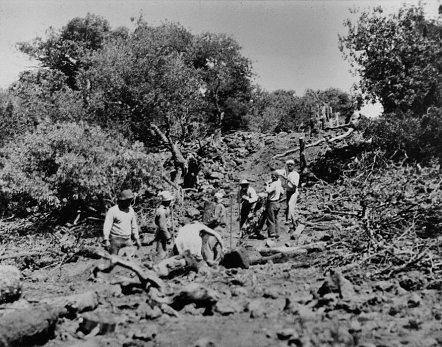
The Civilian Conservation Corps (CCC) undertook fencing, road building and visitor facilities on Mauna Kea.  The CCC built a stone cabin at Hale Pōhaku, which gained its name (house of stone) from that structure. The cabin at Hale Pōhaku provided a shelter for overnight hikers, hunters and snow players.

In 1935-36, as part of the effort to eradicate wild sheep from the mountain, the CCC took on the project of building a fence around the Mauna Kea Forest Reserve (over 60 miles of fencing).  Sheep drives were then carried out in an attempt to eliminate the sheep from the reserve.

The CCC brought water down to Pōhakuloa from a mountain spring … “The CCC days … Up the gulch, up on the mountain, remember, they tapped one of the springs up there …”

“Yes, they had one of the pipes going up.  You can see the pipe when you go, it’s coming down.” (Jess Hannah; Maly) “[T]hat water for Pōhakuloa, there’s a spring, Hopukani Spring.  CCC boys built the pipeline.” (Davd Woodside; Maly) The spring provided a “continuous supply of pure water.” (Bryan; ASM) (Spring water is no longer used; water is trucked in from Hilo or Waimea.)

The advent of World War II brought an end to the CCC program, as the remaining manpower and funding for the program were redirected toward the war effort.

By July 1, 1942, all Territory of Hawaiʻi CCC camps were closed, transferred to the military, or abandoned.  The Army operated Camp Pōhakuloa between 1943 and 1945.  The army also took over the old CCC camp house at Pōhakuloa and used it during the war.

After the end of the CCC programs and World War II, the old CCC facilities at Pōhakuloa were primarily used by staff of the Territorial Divisions of Forestry, Fish and Game including lodging by sheep and bird hunters or by other members of the public seeking recreational accommodations.

“Sheep hunters usually gather at Pohakuloa, the lodge maintained by the Hawaiian Board of Forestry and Agriculture. Here they spend the night under piles of blankets (because of the 6,500 foot elevation, the nights are almost always cold) and start out before sunrise for the mountain ridges.”

“They climb to the ten thousand foot elevation, where wild sheep and goats are in abundance. The Board of Forestry encourages hunting, as the animals have caused serious erosion by eating vegetation, and some authorities believe that the sheep and goats will never be entirely exterminated.”

“In its desire to provide hunting facilities, the Territory maintains not only Pohakuloa lodge, with its bedding accommodations for fifty people, but smaller lodges at Kemole and Kahinahina.” (Paradise of the Pacific, May 1948; Maly)

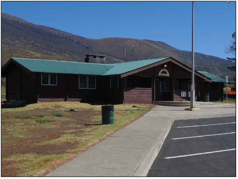
In 1954, the Division of Territorial Parks was created, and the former CCC facilities became part of Pōhakuloa Park, also called “Pohakuloa Hunting Lodge”.

The division began a series of improvements that would eventually replace the existing CCC cabins with all new buildings. (No physical evidence of the original CCC structures remain, as they were removed by 1968.)

In August 1962, DLNR’s Division of State Parks officially assumed all responsibility for administering these facilities and booking overnight accommodations. Forestry, Fish and Game staff continued to use a number of older structures.

The transformation of the Pōhakuloa CCC camp into the Pōhakuloa Park and later Mauna Kea State Recreation Area happened between 1961 and 1970.

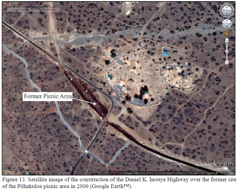
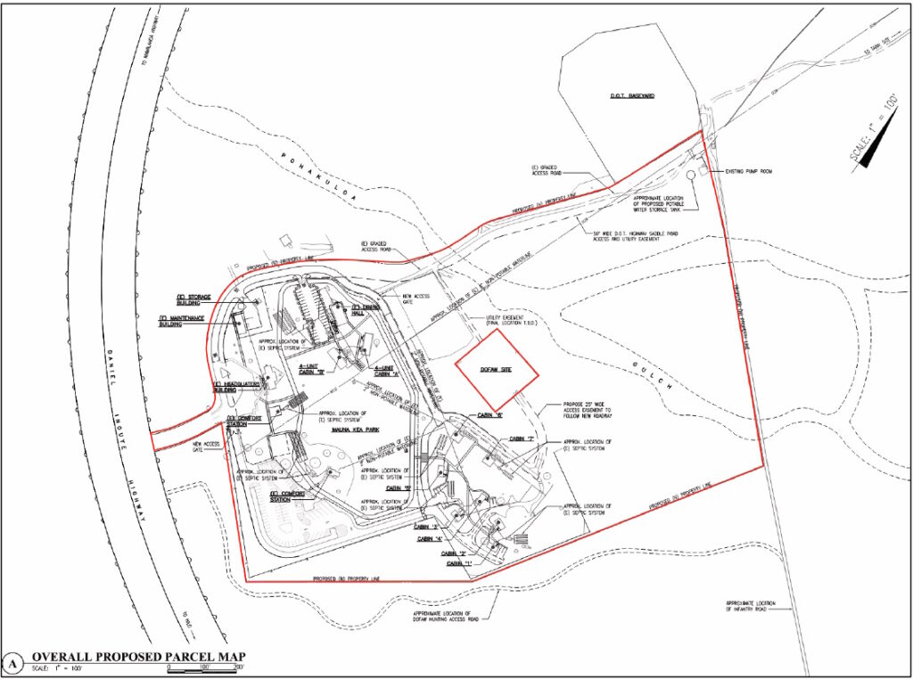
The first of these improvements was a picnic area south of the Saddle Road from the CCC cabins. In 1961, major improvements to the Park began with the addition of new cabins. The first three cabins, variously called the “Housekeeping,” “Family,” or “Vacation” cabins, were built northeast of the former CCC complex, followed by two more the following year.

These five identical cabins, built on post-and-pier foundations, were prefabricated cedar structures manufactured by Loxide Structures of Tacoma, Washington. The cabins were roofed with cedar shakes and were replaced with corrugated metal in 1989.

Each of these cabins was named after a native Hawaiian plant as illustrated by a wooden plaque near its door with the plant name. In 1963, the existing comfort station was built, using a combination of fir, pine, and hollow tile.

A new headquarters building, caretaker’s cabin, and a storage building were constructed. Each of these were pre-fabricated by Pan-Abode Company in Washington State. The buildings are tongue-in-groove cedar log cabins built on post-and-pier foundations and roofed with cedar shakes.

The two “Family” cabins (now the ADA accessible cabins) were also built near the cluster of vacation cabins on the other side of the recreation area. These cabins, like the other new buildings, were prefabricated tongue-ingroove cedar kit cabins supplied by the Pan-Abode Company.

With the construction of the Comfort Station, the park’s picnic area was relocated from south of Saddle Road to its present location.

At its meeting on March 28, 2014, BLNR approved the management transfer of the State Park to the Department of Parks and Recreation, County of Hawai‘i; and approved the withdrawal of the park area from the Mauna Kea Forest Reserve and set aside to the County for park purposes.

The park was renamed Gilbert Kahele Recreation Area in 2019.  The late Hawai‘i Island State Senator, Gilbert Kahele, “worked just down the road from the recreation area for 34 years as Director of the Public Works Division at the Pōhakuloa Training Area.”

“When he served in the state legislature he was instrumental in achieving park improvements by way of the transfer of the management to Hawai‘i County.” (Kahele; DLNR Release) Lots here is from Cultural Surveys, ASM and Rosendahl.)
© 2024 Ho‘okuleana LLC

Filed Under: Economy, General, Buildings, Place Names, Prominent People Tagged With: Mauna Kea, Civilian Conservation Corps, CCC, Pohakuloa, Pohakuloa Training Area, Gilbert Kahele, Hawaii

July 20, 2024 by Peter T Young Leave a Comment

Ka Houpo o Kāne

E ui aku ana au ia oe,
Aia i hea ka Wai a Kane?
Aia i lalo, i ka honua, i ka Wai hu,
I ka wai kau a Kane me Kanaloa
He waipuna, he wai e inu,
He wai e mana, he wai e ola,
E ola no, ea!

One question I ask of you:
Where flows the water of Kane?
Deep in the ground, in the gushing spring,
In the ducts of Kane and Loa,
A well-spring of water, to quaff,
A water of magic power-
The water of Life!
Life! O give us this life!
(Emerson; Unwritten Literature of Hawaii)

Precipitation includes rain, snow, and fog drip. Evapotranspiration is the water that is either evaporated directly into the atmosphere or that which is used by plants and transpired back into the atmosphere. Runoff is the component that contributes to streamflow.

Groundwater recharge is the component of precipitation that percolates into the subsurface and is not lost to the atmosphere via evapotranspiration.  (Intera)

Fresh water travels down into the earth through a process called percolation. On the Hawaiian Islands, water first percolates through soil, if present, then through porous volcanic rock to the water table within the lava. (BWS)

During the volcanic eruptions that created the Hawaiian Islands, molten rock beneath the surface flowed up from the center of the volcanoes; dikes formed when magma stopped flowing to the surface, then cooled over time to form dense, nonporous rock.

Fresh water percolating down between the dikes compartment becomes trapped between the nearly impenetrable walls of the dikes. The water can only escape when its level rises and overflows the walls of the dike, or when great internal pressure causes leakage. Sometimes a freshwater spring will form above ground when such water spews from a dike. (BWS)

Sometimes percolating water becomes trapped when it meets layers of fine volcanic ash or clay-like soil that occur between the remnants of Hawaii’s ancient underground lava flows.  This perched water can no longer seep downward, so it collects and moves sideways, sometimes appearing as a spring (BWS)

“Ka-houpo-o-Kāne (literally, The-bosom-of Kāne), is the sacred region of Mauna Kea (between the 10,000 – 11,000 foot elevation), in which are found the springs fed by Ka-wai-hū-a-Kāne; by a rivulet from Waiau to the head of Pōhakuloa Gulch.” (“Houpokāne is mistakenly written Hopukani on most maps dated after 1900.”) (Maly)

Ka Houpo o Kāne represents the springs of the island of Hawaii. (Vredenburg)  “The area identified as Ka-houpo-o-Kāne is situated below Waiau, on the southwestern slopes of Mauna Kea, in the land of Ka‘ohe.”

“The god Kāne is believed to be foremost of the Hawaiian gods, and is credited with creation, procreation, light, waters of life, abundance, and many other attributes.”

“A land being likened to the chest of Kāne, can imply that the land was cherished and blessed by the god Kāne. … SN Hale‘ole’s tradition of Lā‘ie-i-ka-wai (In Kū ‘Oko‘a 1862-1863), records that “Kahoupokane” was one of three companions of Poli‘ahu. The other two companions were Lilinoe and Waiau.”

“The area identified as Ka-houpo-o-Kāne is situated below Waiau, on the southwestern slopes of Mauna Kea, in the land of Ka‘ohe.” (Maly)

“One of the primary attributes of Kāne are the wai ola (life giving waters), sacred springs and water sources made by Kāne around the islands, to provide for the welfare of the people and the land). Interestingly, at Kahoupo-o-Kāne are found the waters of Pōhakuloa, Hopukani, and Waihū (also known by the name “Ka-wai-hū-a-Kāne”).   (Maly)

“A spring on the southern side of the mountain, called ‘Wai Hu,’ is believed by the natives to be connected with [Lake Waiau].” (Pacific Commercial Advertiser, Sep 14, 1892)

“The few small springs on the glaciated peak of Mauna Kea in Hawaii are fed by ground water perched on and in glacial drift deposits. Their presence is note-worthy because of the light they throw on geologic history and on hydrologic principles rather than for the amount of water produced.”

“Springs in Hawaii fall into two chief categories: (1) high-level springs fed by ground-water bodies perched on or confined by intrusive bodies, ash beds, or modem or ancient soils and (2) basal springs fed from a great body of ground water which is kept in hydrostatic balance with sea water at a few feet above sea-level.” (Wentworth & Powers)

“Conditions on Mauna Kea favor rapid percolation of most rain and meltwater from the winter snow. Toward higher elevations rock-weathering becomes progressively more physical in type.”

“The largest springs on Mauna Kea are found at several points in the Waihu branch of Pohakuloa Valley, on the southwest slope between 8,900 and 10,400 feet.”

“The upper part of the Waihu springs area forms, in summer, a notably green little valley with many small patches of lush grass quite in contrast to the almost complete barrenness of the surrounding terrane, which is above timber line.”

“In the area to the east and up the slope from the springs are numerous small heaps of pre-European stone adz workings.  Certain lava caves contain evidence of habitation, suggesting that the springs were frequented by adz workers.”

“In addition to these larger springs there are some dozens of smaller seeps where trickling water or greener vegetation shows the emergence of small amounts of ground water.” (Wentworth & Powers)

© 2024 Ho‘okuleana LLC

Filed Under: Economy, Hawaiian Traditions Tagged With: Water, Houpo O Kane, Ka-wai-hu-a-Kane, Kahoupokane, Spring, Hawaii, Mauna Kea, Pohakuloa

April 5, 2023 by Peter T Young Leave a Comment

Halepōhaku

As part of the New Deal Program, to help lift the United States out of the Great Depression, Franklin D Roosevelt established the Civilian Conservation Corps in 1933. The CCC or Cs as it was sometimes known, allowed single men between the ages of 18 and 25 to enlist in work programs to improve America’s public lands, forests, and parks. (NPS)

President Roosevelt proposed that the CCC “be used in simple work, not interfering with normal employment, and confining itself to forestry, the prevention of soil erosion, flood control, and similar projects …”

… and argued that “this type of work is of definite, practical value, not only through the prevention of great present financial loss, but also as a means of creating future national wealth”.

On March 31, 1933, Congress passed a bill under the title “Emergency Conservation Work” (ECW) and on April 5, 1933, President Roosevelt signed Executive Order 6101 which officially established the ECW Program, administered under the auspices of the CCC.

The CCC had two main objectives – to employ hundreds of thousands of unemployed young men in conservation work and to provide vocational training, and later education training, for enrollees. (PCSI, OMKM)

Enrollment periods lasted six months and enrollees could opt to re-enroll for additional six-month periods for up to two years. Four distinct enrollment categories existed – Junior enrollees; Local Experienced Men; World War I veterans; and American Indians and residents from US Territories.

Juniors comprised 85% of enrollees and were single men between the ages of 18 and 25, whose families were on relief aid. Two groups of older men, Local Experienced Men and Veterans of World War I each comprised 5% of enrollees.

Territorial enrollees comprised 1% of total CCC enrollment and were not subject to age or marital status restrictions and were permitted to live at home and work on nearby projects

For many, just the prospect of three meals and a bed were enough to get young men to enroll. As jobs and income were incredibly scarce, the CCC for a lot of these young men was their first job.

The CCC provided room, board, clothing, transportation, medical and dental care, and a monthly salary of $30 per enrollee, $25 of which would be sent straight to their families, while the other five was for the worker to keep. (NPS)

The CCC was officially inaugurated in 1933 in the Hawaiian Territory under the supervision of the Territorial Forestry Commission and the Hawaiian National Park, but the first Corps work projects were not begun until 1934. (PCSI, OMKM)

Frank Harrison Locey, the President of the Board of Commissioners of Agriculture and Forestry, wrote that: “It appears to me that the CCC camp is a kindergarten in a way.”

“They take young boys in, do not work them too hard but harden them for normal employment. That is why I call it a kindergarten or a stepping stone to future labor.”

The CCC aimed to supplement on-the-job training with a formal educational program. Approximately half of the CCC enrollees had less than an eighth-grade education and suffered from illiteracy. To remedy this situation, evening instruction in the camps taught remedial reading and writing skills, general education courses, and specialized vocational classes.

Acting Territorial Forester, Leicester Winthrop Bryan, reported that: “In addition to the good done to the youth of this Island through giving them an opportunity to earn money we have tried to teach them to live together, to work, to learn some useful trade, to continue their education, to improve their health and to become better citizens.”

“We feel that a large number of these boys have left our camps in a much better condition to go out in the world and earn their living and be better citizens.”  (PCSI, OMKM)

The stone cabins at the present location of the mid-level astronomy facilities on the Mauna Kea Access Road (the Halepōhaku Rest Camp) were constructed by members of the CCC in Hawai`i in 1936 (Rest House 1) and 1939 (Rest House 2). (The Comfort Station was constructed by the Territory of Hawai‘i’s Division of Forestry in 1950.)

Hale Pohaku literally ”stone house,” refers to the two stone cabins constructed by the Civilian Conservation Corps in 1936 and 1939 at an elevation of 9,220 feet on the southern slope of Maunakea. L. W. Bryan, who served as the Territorial Forestry Office and helped with the construction of the “stone houses,” also named them Hale Pohaku. (Cultural Surveys)

In the first entry of the Halepōhaku Register Log (1939) LW Bryan wrote that the “Halepohaku Rest Camp” was constructed by the CCC under the direction of the Territorial Division of Forestry by CCC Foreman Yoshinobu Hada. (The letters “Ha” and the date “1936” were inscribed into mortar near the doorway of Rest House 1 – presumably referring to Foreman Hada.)

In articles published in Paradise of the Pacific, Bryan described Rest House 1 and identifies its’ early usage, writing that: “Halepohaku is well named for the stone rest-house located there. This house is within the Mauna Kea Forest Reserve and is available for use by any one.”

“It is located in a sheltered spot, near 9,500 feet, at the upper edge of the timber line. Fire wood is plentiful and a 2,000 gallon water tank, fed by gutters from the house roof, furnishes a supply of good clean water.”

“A 3 x 5 foot built in stove furnishes ample warmth and a suitable place to cook and the size of the fire box is such that the cutting of fire wood is an easy matter. The house door is never locked and the only charge made is that each occupant is requested to leave the place clean, not to waste the water and to prepare a small supply of fire wood for the next fellow.”

“Aside from a stove, a table and benches, this building is unfurnished. … Halepohaku is only two miles from where the car is left and makes an excellent stopping place for the night.”

“The cabins replaced a complex of buildings near Ho‘okomo, at the 7,800 foot elevation, which had been used by Forestry personnel who were building and maintaining the Forest Reserve fence and by workers constructing the road to Hale Pohaku.”

“The cabins at Hale Pohaku were placed under the jurisdiction of the State Parks Division of the Department of Land and Natural Resources (DLNR) in 1962. Hale Pohaku was never officially designated as a State Park.”  They later were included under the lease to the University of Hawai‘i.

Per the 1977 Mauna Kea Master Plan, “The Hale Pohaku facility will consist of mid-level facilities for necessary research personnel for the summit, a central point for management of the mountain, and a day-use destination point for visitors and primitive overnight camping facilities.” Master Plan 1977;7

While hunting on Mauna Kea as a kid, we overnighted at Halepōhaku (well before astronomy’s mid-level facilities were built (1983)), as well as in the Pu‘u La‘au cabin above the Kilohana Girl Schout Camp.

© 2023 Ho‘okuleana LLC

Filed Under: Economy, General, Buildings Tagged With: Mauna Kea, Civilian Conservation Corps, CCC, Halepohaku, Hale Pohaku, LW Bryan, Hawaii

April 8, 2022 by Peter T Young Leave a Comment

Island Summits

He ‘Ohu Ke Aloha; ‘A‘ohe Kuahiwi Kau ‘Ole
Love is like mist; there is no mountaintop that it does not settle upon

“… as the sun shining in his strength dissipated the clouds, we had a more impressive view of the stupendous pyramidal Mauna Kea, having a base of some thirty miles, and a height of nearly three miles.  Its several terminal peaks rise so near each other, as scarcely to be distinguished at a distance.”

“These, resting on the shoulders of this vast Atlas of the Pacific, prove their great elevation by having their bases environed with ice, and their summits covered with snow, in this tropical region, and heighten the grandeur and beauty of the scene, by exhibiting in miniature, a northern winter, in contrast with the perpetual summer of the temperate and torrid zones below the snow and ice.”

“The shores along this coast appeared very bold, rising almost perpendicularly, several hundred feet, being furrowed with many ravines and streams. From these bluffs, the country rises gradually, for a few miles, presenting a grassy appearance, with a sprinkling of trees and shrubs.”

“Then, midway from the sea to the summit of the mountain, appeared a dark forest, principally of the koa and ʻōhia, forming a sort of belt, some ten miles in breadth-the temperate zone of the mountain.”  (Bingham at first sight of the Islands, 1820)

And when you think about high elevation places in the Hawaiian islands, of course you have to talk about that basic dichotomy between the lower elevation places where people live.

And in old times, the lower elevations would have been called the Wao Kanaka. Wao being a word that means “zone” and “Kanaka” being a person. So the Wao Kanaka is a zone in which people belong.

When you rise above that zone, you enter into a realm in which all of the living things there are not there because of human activity. They flourish as the result of the activity of the gods, or the Akua. And so that zone is called the Wao Akua. And the transition from Wao Kanaka to Wao Akua is not taken lightly.  (Gon)

The Islands’ peaks are considered the piko (summit or center of the land) and are considered sacred.  The places upon which clouds nestle are considered wao akua, the realm of the gods.  Clouds cover the actions of the gods while they walk the earth. The higher the piko, the closer to heaven, and the greater the success of prayers. (Maly)

Let’s look at Hawaiʻi’s peaks, the highest point on each Island as we move down the Island chain.

Niʻihau – Pānīʻau (1,281-feet)

Ni‘ihau was formed from a single shield volcano approximately 4.89-million years ago, making it slightly younger in age than Kaua‘i. It is approximately 70-square miles or 44,800-acres.  It’s about 17-miles west of Kauaʻi.

Pānīʻau, the island’s highest point, is 1,281-feet; approximately 78% of the island is below 500-feet in elevation.   Located inside Kauai’s rain shadow, Ni‘ihau receives only about 20 to 40-inches of rain per year.  Ni‘ihau has no perennial streams.  (DLNR)

Kauai – Kawaikini (5,243-feet)

Geologically, Kauai is the oldest of the main inhabited islands in the chain. It is also the northwestern-most island, with Oʻahu separated by the Kaʻieʻie Channel, which is about 70-miles long. In centuries past, Kauai’s isolation from the other islands kept it safe from outside invasion and unwarranted conflict.

Near the summit (Kawaikini) is Waiʻaleʻale; in 1920 it passed Cherrapunji, a village in the Khasi hills of India, as the wettest spot on Earth (recording a yearly average of 476-inches of rain.)

Oʻahu – Kaʻala (4,025-feet)

The Waiʻanae Mountains, formed by volcanic eruptions nearly four-million years ago, have seen centuries of wind and rain, cutting huge valleys and sharp ridges into the extinct volcano.  Mount Kaʻala, the highest peak on the island of Oʻahu, rises to 4,025-feet.

Today, only a small remnant of the mountain’s original flat summit remains, surrounded by cliffs and narrow ridges. It’s often hidden by clouds.

Molokai – Kamakou (4,961-feet)

The island was formed by two volcanoes, East and West, emerging about 1.5-2-million years ago.  The cliffs on the north-eastern part of the island are the result of subsidence and the “Wailua Slump” (a giant submarine landslide – about 25-miles long that tumbled about 120-miles offshore – about 1.4-million years ago.)

Kamakou is part of the extinct East Molokai shield volcano, which comprises the east side of the island.   It and much of the surrounding area is part of the East Maui Watershed partnership and the Kamakou Preserve.  A boardwalk covers part of the rainforest and bog to protect the hundreds of native plants, birds, insects and other species there.

Lānai – Lānaihale (3,337-feet)

The island of Lānai was made by a single shield volcano between 1- and 1.5-million years ago, forming a classic example of a Hawaiian shield volcano with a gently sloping profile.  (SOEST)  The island of Lānai is about 13-miles long and 13-miles wide; with an overall land area of approximately 90,000-acres, it is the sixth largest of the eight major Hawaiian Islands.

“At the very summit of the island, which is generally shrouded in mist, we came upon what Gibson (an early (1861) Mormon missionary to the islands) called his lake – a little shallow pond, about the size of a dining table.  In the driest times there was always water here, and one of the regular summer duties of the Chinese cook was to take a pack mule and a couple of kegs and go up to the lake for water.”  (Lydgate, Thrum)

Maui – Haleakalā (10,023-feet)

Haleakalā was thought to have been known to the ancient Hawaiians by any one of five names: “Haleakalā,” “Haleokalā,” “Heleakalā,” “Aheleakalā” and “Halekalā.” (Hawaiʻi National Park Superintendent Monthly Report, December 1939)

Haleakalā is best known in stories related of the demi-god Māui; he is best known for his tricks and supernatural powers. In Hawaiʻi, he is best known for snaring the sun, lifting the sky, discovering the secrets of fire, fishing up the islands and so forth.  (Fredericksen)

Kahoʻolawe – Lua Makika (1,477-feet)

Kahoʻolawe is the smallest of the eight Main Hawaiian Islands, 11-miles long and 7-miles wide (approximately 28,800-acres;) it is seven miles southwest of Maui.  The highest point on Kahoʻolawe is the crater of Lua Makika at the summit of Puʻu Moaulanui, which is about 1,477 feet above sea level.

Located in the “rain shadow” of Maui’s Haleakalā, rainfall has been in short supply on Kahoʻolawe.  However, nineteenth century forestry reports mentioned a “dense forest” at the top of Kahoʻolawe.  Historically, a “cloud bridge” connected the island to the slopes of Haleakalā.  The Naulu winds brought the Naulu rains that are associated with Kahoʻolawe (a heavy mist and shower of fine rain that would cover the island.)

Hawaiʻi – Mauna Kea (13,796-feet)

Nani Wale ʻO Mauna Kea, Kuahiwi Kūhaʻo I Ka Mālie (Beautiful is Mauna Kea, standing alone in the calm) expresses the feeling that Mauna Kea is a source of awe and inspiration for the Hawaiian people. The mountain is a respected elder, a spiritual connection to one’s gods.   (Maly)

A significant pattern archaeologists note in their investigations is the virtual absence of archaeological sites at the very top of the mountain. McCoy states that the “top of the mountain was clearly a sacred precinct that must, moreover, have been under a kapu and accessible to only the highest chiefs or priests.”  (Maly)

ʻĀina mauna, or mountain lands, reflects a term used affectionately by elder Hawaiians to describe the upper regions of all mountain lands surrounding and including Mauna Kea.  (Maly)

© 2022 Hoʻokuleana LLC

Filed Under: General, Hawaiian Traditions Tagged With: Niihau, Kaala, Kamakou, Hawaii, Kawaikini, Hawaii Island, Paniau, Oahu, Mauna Kea, Molokai, Lanaihale, Haleakala, Summits, Maui, Kahoolawe, Kauai, Lanai

October 1, 2021 by Peter T Young 1 Comment

‘E hoi kaua, he anu.

Let us return; ‘tis cold.’

The following is an account written by Hiram Bingham and his ascent with Kauikeaouli (Kamehameha III) in 1830 to the ‘frigid apex of Mauna Kea.’  What follows is pulled directly from Bingham’s ‘A Residence of Twenty-One Years in the Sandwich Islands.’

(T)he king set out with a party of more than a hundred, for an excursion further into the heart of the island, and an ascent to the summit of Mauna Kea. To watch over and instruct my young pupil, and to benefit my health, I accompanied him. The excursion occupied nearly five days, though it might have been accomplished much sooner.

Crossing in a southerly direction the plain of Waimea, some on horseback and some on foot, the party ascended a small part of the elevation of the mountain, and being in the afternoon enveloped in dense fog, they halted and encamped for the night.

The next day they passed over the western slope of the mountain to the southern side thence eastward along a nearly level plain, some seven thousand feet above the level of the sea, to a point south of the summit, and encamped out again, in the mild open air.

In the course of this day’s journey, the youthful king on horseback, pursued, ran down, and caught a yearling wild bullock, for amusement and for a luncheon for his attendants. A foreigner lassoed and killed a wild cow.

The next day was occupied chiefly in ascending in a northerly direction, very moderately. Our horses climbed slowly, and by taking a winding and zigzag course, were able, much of the way, to carry a rider. Having gained an elevation of about ten thousand feet, we halted and encamped for the night, in the dreary solitudes of rocks and clouds.

When the night spread her dark, damp mantle over us, we found ourselves in the chilly autumnal atmosphere of the temperate zone of this most stupendous Polynesian mountain. Below us, towards Mauna Loa, was spread out a sea of dense fog, above which the tops of the two mountains appeared like islands.

We found it a pretty cold lodging place. Ice was formed in a small stream of water near us, during the night. As the company were laying themselves down, here and there, upon the mountain side, for sleep, I observed that the king and Keoniani, subsequently premier, and a few others, having found a cave about four feet high, ten wide, and eight deep, made by a projecting rock, which would afford a shelter from a shower, and partially from wind and cold, had stretched themselves out to sleep upon the ground in front of it.

I was amused to see that their heads protruded somewhat more than six feet from the mouth of the cave, and asked, “Why do you not sleep under the rock, which is so good a sleeping house for you?”

Keoniani, always ready, replied, “We don’t know at what time the rock will fall.” Whether the apprehension that the firm rock might possibly fall upon the head of the king that night or their unwillingness that any ignoble foot should walk above it, or some other fancy, were the cause of his declining the shelter, did not appear.

In the morning we proceeded slowly upwards till about noon, when we came to banks of snow, and a pond of water partly covered with ice. In his first contact with a snow bank, the juvenile king seemed highly delighted. He bounded and tumbled on it, grasped and handled and hastily examined pieces of it, then ran and offered a fragment of it in vain to his horse.

He assisted in cutting out blocks of it, which were wrapped up and sent down as curiosities to the regent and other chiefs, at Waimea, some twenty-eight miles distant.

These specimens of snow and ice, like what are found in the colder regions of the earth, excited their interest and gratified their curiosity, and pleased them much; not only by their novelty, but by the evidence thus given of a pleasant remembrance by the youthful king.

After refreshing and amusing ourselves at this cold mountain lake, we proceeded a little west of north, and soon reached the lofty area which is surmounted by the ‘seven pillars’ which wisdom had hewed out and based upon it, or the several terminal peaks near each other, resting on what would otherwise be a somewhat irregular table land, or plain of some twelve miles circumference.

Ere we had reach’d the base of the highest peak, the sun was fast declining and the atmosphere growing cold. The king and nearly all the company declined the attempt to scale the summit, and passing on to the north-west crossed over, not at the highest point, and hastily descended towards Waimea.

John Phelps Kalaaulana, who had been in New England, the only native in the company who seemed inclined to brave the cold and undertake the labor of reaching the top, accompanied me, and we climbed to the summit of the loftiest peak.

The side of it was composed of small fragments of lava, scoria, and gravel lying loose and steep. The feet sank into them at every step. Our progress was slow and difficult, by a zigzag and winding course. Respiration was labored, and the air taken into the lungs seemed to supply less aid or strength than usual.

I repeatedly laid myself down panting to take breath and rest my exhausted muscles. On gaming the lofty apex, our position was an awful solitude, about 14,500 feet above the level of the sea, where no animal or vegetable life was found. No rustling leaf, or chirping bird, or living tenant of the place attracted the eye or ear.

Maui could be distinctly seen at the distance of one hundred miles over the mountains of Kohala. The immense pile of lava, once chiefly fluid, which constitutes the stupendous Mauna Loa, rose in the south-west, at the distance of thirty miles, to a height nearly equal to that of Mauna Kea, where we stood. Very light clouds occasionally appeared above us.

Down towards the sea over Hilo and Hamakua the clouds were dark and heavy, floating below our level, and towards the north, were apparently rolling on the earth to the westward towards Waimea and Kawaihae, while the wind on our summit was in the opposite direction.

As the sun disappeared the cold was pinching. We occasionally cringed under the lee of the summit for a momentary relief from the chilling blast. While taking some trigonometrical observations my fingers were stiffened with the cold, and Phelps repeatedly cried out with emphasis, ‘E hoi kaua, he anu. Let us return; ’tis cold.’

The image is a drawing of Mauna Kea, as seen from Waimea (Harry Wishard.)

© 2021 Hoʻokuleana LLC

Mauna Kea Wishard
Mauna Kea Wishard

Filed Under: Place Names, Ali'i / Chiefs / Governance, Missionaries / Churches / Religious Buildings Tagged With: Hawaii, Hawaii Island, Kauikeaouli, Kamehameha III, Mauna Kea, Harry Bingham

  • « Previous Page
  • 1
  • 2
  • 3
  • 4
  • 5
  • Next Page »

Images of Old Hawaiʻi

People, places, and events in Hawaiʻi’s past come alive through text and media in “Images of Old Hawaiʻi.” These posts are informal historic summaries presented for personal, non-commercial, and educational purposes.

Info@Hookuleana.com

Connect with Us

  • Email
  • Facebook
  • LinkedIn
  • Twitter
  • YouTube

Recent Posts

  • ʻĪmaikalani
  • About 250 years Ago … Give Me Liberty, Or Give Me Death
  • Herbert, William & Jack
  • Lake Waiau
  • Silva’s Stores
  • Jones Act
  • Lady in Waiting

Categories

  • Ali'i / Chiefs / Governance
  • Buildings
  • Missionaries / Churches / Religious Buildings
  • Hawaiian Traditions
  • Military
  • Place Names
  • Prominent People
  • Schools
  • Sailing, Shipping & Shipwrecks
  • Economy
  • Voyage of the Thaddeus
  • Mayflower Summaries
  • American Revolution
  • General

Tags

Albatross Al Capone Ane Keohokalole Archibald Campbell Bernice Pauahi Bishop Charles Reed Bishop Downtown Honolulu Eruption Founder's Day George Patton Great Wall of Kuakini Green Sea Turtle Hawaii Hawaii Island Hermes Hilo Holoikauaua Honolulu Isaac Davis James Robinson Kamae Kamaeokalani Kameeiamoku Kamehameha Schools Lalani Village Lava Flow Lelia Byrd Liberty Ship Liliuokalani Mao Math Mauna Loa Midway Monk Seal Northwestern Hawaiian Islands Oahu Papahanaumokuakea Marine National Monument Pearl Pualani Mossman Quartette Thomas Jaggar Volcano Waikiki Wake Wisdom

Hoʻokuleana LLC

Hoʻokuleana LLC is a Planning and Consulting firm assisting property owners with Land Use Planning efforts, including Environmental Review, Entitlement Process, Permitting, Community Outreach, etc. We are uniquely positioned to assist you in a variety of needs.

Info@Hookuleana.com

Copyright © 2012-2024 Peter T Young, Hoʻokuleana LLC

Loading Comments...