Images of Old Hawaiʻi

  • Home
  • About
  • Categories
    • Ali’i / Chiefs / Governance
    • American Protestant Mission
    • Buildings
    • Collections
    • Economy
    • Missionaries / Churches / Religious Buildings
    • General
    • Hawaiian Traditions
    • Other Summaries
    • Mayflower Summaries
    • Mayflower Full Summaries
    • Military
    • Place Names
    • Prominent People
    • Schools
    • Sailing, Shipping & Shipwrecks
    • Voyage of the Thaddeus
  • Collections
  • Contact
  • Follow

August 9, 2022 by Peter T Young Leave a Comment

August 9, 1871 Hurricane

A couple newspaper accounts of the impacts of the August 9, 1871 hurricane (estimated to be category 3) and its impact in Kohala:

“DD Baldwin (plantation manager) writes: ‘On Wednesday of last week a fearful tornado swept through the district, spreading desolation and ruin in its track, demolishing Mr. Wright’s mill building and a large portion of the thatched houses in the district; throwing down our flume; uprooting large trees, and prostrating our cane fields.’

‘The wind commenced about 6 o’clock A.M. from the North, and rapidly rotating to the West and South, and increasing in fury, reached its climax about 9 AM when it suddenly lulled into a calm fearfully in contrast with the rain the storm had so rapidly wrought.”

“The wind was accompanied with torrents of rain which raised the streams to an unprecedented height and swept away fences and trees.’”

‘We had as usual commenced our morning grinding when the rain drove in under our boilers, extinguished our fires and drenched our whole mill building with a deluge of water and it was with the utmost difficulty that our sugar on hand in kegs and the bins were saved.’”

“‘Our loss in juice on hand was considerable. The fall of our steam chimney of course prevents grinding now, but we are puting up a new one, and shall commence again next week. The portion of our flume prostrated is In our cane fields, and we continue to run down wood to a point near the cane.”

“But by far the greatest damage is to our cane fields, more particularly those belonging to next years crop, which I fear will seriously effect my estimates.’”

“The Rev. Mr. Bond relates: ‘The storm commenced about 6 AM and increased at 10 AM The greatest fury was say from 9 to 9½ or 9¾, torrents of rain came with it. The district is swept as with the besom of destruction.’”

“‘About 150 houses were blown down, trees in ravines torn up like wisps of grass, cane stripped and torn, as never before and even the grass forced down and made to cleave to the earth.’”

“‘The main houses on the plantation, though flooded, remain in position. Cooper’s shop and several of the people’s houses moved from 2 to 10 feet off their foundations. The damage is variously estimated at $1,000 to $10,000. I should say $5,000 is a fair estimate.’”

“‘In our garden there is scarcely a whole tree of any kind remaining. A mango tree 15 inches in diameter was snapped as a pipe stem, just above the surface of the ground. Old solid kukui trees which had stood the storms of a score of years were torn up and pitched about like chaff.’”

“‘Dr. Wright’s mill and sugar house, the trash and dwelling house for manager, or head man, were all strewn over the ground. We were and are most thankful that the storm came in the daytime, and also that it was limited in its duration. These are the large drops of mercy mingled in the cup.’”

“The number of houses destroyed at Waipio, we understand to have been 27. At Waimea but little damage was done except to the road between that place and Kawaihae which we are informed, was seriously damaged in places by the torrents of water.”

“Other portions of Hawaii seem to have escaped the injurious effects of the storm. At Hilo a strong wind blew during the day, and in the districts of Kona and Kau a vast amount of rain fell without wind.”

“The storm seems, so far as we can judge, to have been a cyclone, moving from SE to NW its most destructive force having been felt in a diameter of from 150 to 200 miles.”

“As the China steamer from San Francisco would probably have been somewhere to the NW of these islands at the time of the storm, it is not improbable that we may hear of her encountering the gale.” (Hawaiians Gazette, August 23, 1871)

“The Storm on Hawaii. All accounts agree that the late storm was more severe in Kohala than elsewhere on the Islands. One hundred and twenty-two houses are reported as blown down in that district, and twenty-eight in Waipio. and some houses moved eight or ten feet from the foundations.”

“The plantations of Dr. Wight and of the Kohala Sugar Co., have suffered severely in buildings and growing crops.”

“The entire damage throughout Maui and Hawaii resulting from this gale, has been roughly estimated at $200,000 ; and we do not consider this as too high, taking into account the present actual losses together with the prospective decrease in produce.”

“Hilo and Kona appear to have escaped the wind on this occasion, and enjoyed copious rains.” (Pacific Commercial Advertiser, August 26, 1871)

© 2022 Ho‘okuleana LLC

Filed Under: General, Buildings, Economy Tagged With: Hawaii, Hurricane

August 8, 2022 by Peter T Young Leave a Comment

Honouliuli

The island of Oʻahu is divided into 6 moku (districts), consisting of: ‘Ewa, Kona, Koʻolauloa, Koʻolaupoko, Waialua and Waiʻanae. These moku were further divided into 86 ahupua‘a (land divisions within a moku.)

‘Ewa was divided into 12-ahupua‘a, consisting of (from east to west): Hālawa, ‘Aiea, Kalauao, Waimalu, Waiau, Waimano, Mānana, Waiʻawa, Waipi‘o, Waikele, Hōʻaeʻae and Honouliuli.

‘Ewa was at one time the political center for O‘ahu chiefs. This was probably due to its abundant resources that supported the households of the chiefs, particularly the many fishponds around the lochs of Puʻuloa (“long hill,) better known today as Pearl Harbor. (Cultural Surveys)

Each had fisheries in the harbor, floodplains with irrigated kalo and fishponds, and interior (lower kula valley streams/gulches) and mountain forests.  One of these, Honouliuli, had a large coastal area, including what it is typically referred to as the “ʻEwa Plains.”  (Kirch)

Honouliuli includes lands extending from the mountains, to the watered plains where loʻi kalo (taro pond fields) and loko ia (fishponds) were developed, to the arid plains and rich fisheries on the ocean. Along the ocean-fronted coast of Honouliuli are noted places in lore and ancient life, such as Keahi, Kupaka, Keoneula (Oneula), Kualakai, Kalaeloa and Koʻolina.  (Maly)

Honouliuli (dark bay) includes a wide plain back of Puʻuloa (Pearl Harbor) and Keahi (a point west of Pearl Harbor) where the homeless, friendless ghosts were said to wander about. These were the ghosts of people who were not found by their family ʻaumakua or gods and taken home with them, or had not found the leaping places where they could leap into the nether world.  (Pukui)

In 1793, Captain George Vancouver described this area as desolate and barren:  “From the commencement of the high land to the westward of Opooroah (Puʻuloa – Pearl Harbor) was … one barren rocky waste, nearly destitute of verdure, cultivation or inhabitants, with little variation all to the west point of the island. …”

In 1839, Missionary EO Hall described the area between Pearl Harbor and Kalaeloa as follows: “Passing all the villages (after leaving the Pearl River) at one or two of which we stopped, we crossed the barren desolate plain”.  (Robicheaux)  In the 1880s, these lands were being turned over to cattle grazing and continued through the early-1900s.

Nearby Moku ʻUmeʻume (Ford Island) provided pili grass for house thatching. Ewa’s house builders gathered their pili grass for house thatching here until the time came when foreign shingles were introduced, then thatching was discontinued.

It was also covered with kiawe trees; it was noted that the kiawe forests there and the Honouliuli region supplied much of the fuel for kitchen fires in Honolulu.

Reported in 1898, a few fishermen and some of their families built shanties by the shore where they lived, fished and traded their catch for taro at ‘Ewa.  Their drinking water was taken from nearby ponds, and it was so brackish that other people could not stand to drink it. (Cameron; Maly)

James Campbell, who arrived in Hawaiʻi in 1850, ended up in Lāhainā and started a sugar plantation there in 1860 (later known as Pioneer Mill.)  He also started to acquire lands in Oʻahu, Maui and the island of Hawaiʻi.

In 1876, he purchased approximately 15,000-acres at Kahuku on the northernmost tip of Oʻahu from HA Widemann and Julius L Richardson. In 1877, he acquired from John Coney 41,000-acres of ranch land at Honouliuli.

Many critics scoffed at the doubtful value of his Honouliuli purchase. But Campbell envisioned supplying the arid area with water and commissioned California well-driller James Ashley to drill a well on his Honouliuli Ranch.

In 1879, Ashley drilled Hawaiʻi’s first artesian well; James Campbell’s vision had made it possible for Hawaiʻi’s people to grow sugar cane on the dry lands of the ʻEwa Plain.

“At 240 feet the water commenced to overflow. The bore was continued to 273 feet, the flow increasing and coming to rise from one-half to two-thirds of an inch crown above the pipe, 7 inches in diameter.  This success was a happy surprise to the community. (There was) a sheet of pure water flowing like a dome of glass from all sides of the well casing, and continuing to flow night and day, without diminution.”  (Congressional Record, 1881)

What they discovered was vast reservoirs of artesian water; the groundwater here is composed of a freshwater lens that generally moves toward the ocean but is impeded by a wedge of caprock that overlies the volcanic rock near the coast.  (Nellist, Bauer)

When the first well came in at Honouliuli the Hawaiians named it “Waianiani” (crystal waters.)  (Nellist) The ʻEwa Plain has been irrigated with ground water since 1890. By 1930, Ewa Plantation had drilled 70 artesian wells to irrigate cane lands; more were drilled later.

It was some years after the first artesian wells were brought in before there was a general understanding of the formation of the coastal caprock and its vital importance in the creation and functioning of the artesian reservoirs.

Discovery of artesian water at Honouliuli was beyond question the most important single contribution to the development of Oʻahu and Honolulu as we know the island and city today.  (Nellist)  (The flow from the well continued for 60-years until it was sealed by the City and County of Honolulu in 1939.)

In 1889, Campbell leased about 40,000-acres of land for fifty years to BF Dillingham (of Oʻahu Railway and Land Co;) after several assignments and sub-leases, about 7,860-acres of Campbell land ended up with Ewa Planation.

By 1923, Ewa Plantation was the first sugar company in the world to raise ten tons of sugar per acre and, by 1933, the plantation produced over 61,000-tons of sugar a year.

Ewa Plantation was considered one of the most prosperous plantations in Hawaiʻi and in 1931 a new 50-year lease was executed, completing the agreement with Oʻahu Railway and Land Company and beginning an association with Campbell Estate.

By 1936, ʻEwa Plantation Company was the first plantation to have a fully mechanized harvesting operation and by 1946 tests were made to convert the hauling of cane from railroads to large trucks.

During WWII, Japanese Americans were put in internment camps in at least eight locations on Hawaiʻi; one of those sites was at Honouliuli Gulch.  The forced removal of these individuals began a nearly four-year odyssey to a series of camps in Hawaiʻi and on the continental United States.

They were put in these camps, not because they had been tried and found guilty of something, but because either they or their parents or ancestors were from Japan and, as such, they were deemed a “threat” to national security.

In 1962, Castle and Cooke purchased majority control of ʻEwa Plantation Company stock and in 1970 ʻEwa Plantation Company merged with Oʻahu Sugar Company in Waipahu (the ʻEwa mill closed in the mid-1970s after the sale; the mill was demolished in 1985.)

Campbell became known by the Hawaiians as “Kimo Ona-Milliona” (James the Millionaire).  Despite his success in sugar, his interests turned to other matters, primarily ranching and real estate.

When James Campbell died on April 21, 1900, the Estate of James Campbell was created as a private trust to administer his assets for the benefit of his heirs (in 2007, the James Campbell Company succeeded the Estate of James Campbell.) The Estate played a pivotal role in Hawaiʻi history, from the growth of sugar plantations to the growing new City of Kapolei.

© 2022 Hoʻokuleana LLC

Filed Under: General, Place Names, Economy, Prominent People Tagged With: Ewa, Ewa Plantation, Puuloa, Hawaii, Oahu, Honouliuli, Pearl Harbor, James Campbell, Internment

August 7, 2022 by Peter T Young 1 Comment

Haleakalā, Hualālai and Kīlauea

Volcanoes … yes.  But that is not what this story is about.

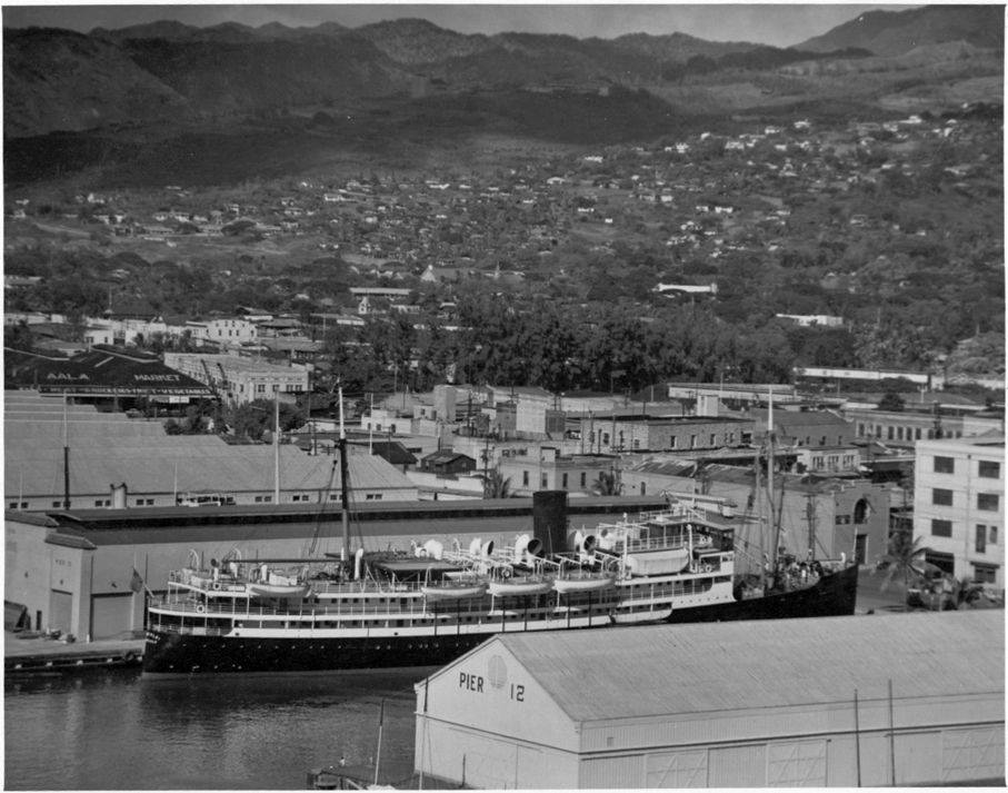
These are some of the names of inter-island steam ships that operated between the Islands; and in the day, they were the only way to get from here to there, when you travelled inter-island.

Competitors Wilder Steamship Co (1872) and Inter-Island Steam Navigation Co (1883) ran different routes, rather than engage in head to head competition.

Inter-Island operated the Kauaʻi and Oʻahu ports plus some on Hawaiʻi.  Wilder took Molokaʻi, Lānaʻi and Maui plus Hawaiʻi ports not served by Inter-Island. Both companies stopped at Lāhainā, Māʻalaea Bay and Makena on Maui’s leeward coast.  (HawaiianStamps)

Mahukona, Kawaihae and Hilo were the Big Island’s major ports; Inter-Island served Kona ports, Kaʻū ports and the Hāmākua ports of Kukuihaele, Honokaʻa and Kūkaʻiau.  Wilder served Hilo and the Hāmākua stops at Paʻauhau, Paʻauilo and Laupāhoehoe.

For Inter-Island’s routes, vessels left Honolulu stopping at Lāhainā and Māʻalaea Bay on Maui and then proceeding directly to Kailua-Kona.

From Kailua, the steamer went south stopping at the Kona ports of Nāpoʻopoʻo on Kealakekua Bay, Hoʻokena, Hoʻopuloa, rounding South Point, touching at the Kaʻū port of Honuʻapo and finally arriving at Punaluʻu, Kaʻū, the terminus of the route.  (From Punaluʻu, five mile railroad took passengers to Pahala and then coaches hauled the visitors to the volcano from the Kaʻū side.)

Wilder’s steamers left Honolulu and stopped at the Maui ports of Lāhainā, Māʻalaea Bay and Makena and then proceeded to Mahukona and Kawaihae. From Kawaihae, the steamers turned north, passing Mahukona and rounding Upolu Point at the north end of Hawaiʻi and running for Hilo along the Kohala and Hāmākua coasts, stopping at Laupāhoehoe.  (Visitors for Kilauea Crater took coaches from Hilo through Olaʻa to the volcano.)

Later, inter-island trade was carried almost exclusively by the Inter-Island Steam Navigation Co, the successor to the firm of Thomas R Foster & Co (the original founders of the company) and which, in 1905, acquired the Wilder Steamship Co.  (Congressional Record)

“The Inter-Island Steam Navigation Co, established in 1883, own(ed) and operate(d) a fleet of first-class vessels engaged exclusively in the transportation of passengers and freight between ports on the islands of the Hawaiian group.” (Annual Report of the Governor, 1939)

Regular sailings of passenger vessels are maintained from Honolulu four times weekly to ports on the island of Hawaiʻi, four times weekly to Molokaʻi, twice weekly to Kauaʻi, three times weekly to Lānaʻi and daily, except Monday and Saturday, to ports on the island of Maui. Included in the fleet are 12 passenger and freight vessels.”  (Report of the Governor, 1930)

During the 1920s, 30s, and 40s, Inter-Island Steam Navigation had the SS Haleakalā, Hualālai, Kilauea and Waiʻaleʻale. There were others that carried 12-passengers such as the SS Humuʻula, which was primarily a cattle boat.

Haleakalā, a steel screw steamer, was built by Sun Ship, Chester, PA in 1923 for the Inter-Island Steam Navigation Company. She first arrived at Honolulu March 15, 1923 and put on the Hilo route with accommodations for 261 cabin and 90 deck passengers.

She was later laid up as a reserve vessel when the Hualālai was put into service; resold and renamed several times, Haleakala was sold for scrap and demolished February 2, 1955.

Hualālai, a twin-screw steel steamer, was built at Bethlehem Shipbuilding, San Francisco, CA in 1929.  After inter-island use, she was later, sold, resold and renamed a couple of times, and later scrapped in May 1960.

Waiʻaleʻale, another passenger ship, was a twin-screw steel steamer put into service by the Inter-Island Steam Navigation Company in June 1928. After the war, she was put under the Philippine flag, later returned to Honolulu in 1948 and scrapped in September 1954.

Others included Kilauea, put into passenger and freight service in 1911, Hawaiʻi in October 1924 and Humuʻula in 1929.

Once aboard, the purser collected the $5 fare.  Of course, cabins were available, but more expensive at $10.  Most passengers selected steerage, which was the lowest fare. (Rodenhurst)

The steerage area was a large open area aft, on the second deck. Wooden slats covered the steel deck. People would stake out their space with mats and luggage, then settle down to eat their food. (Rodenhurst)

“Twice a week the Inter-Island Steam Navigation Company dispatches its palatial steamers, “Waiʻaleʻale” and “Hualālai,” to Hilo, leaving Honolulu at 4 pm on Tuesdays and Fridays, arriving at Hilo at 8 am the next morning. From Honolulu, the Inter-Island Company dispatches almost daily excellent passenger vessels to the island of Maui and twice a week to the island of Kauaʻi.”  (The Mid-Pacific, December 1933)

“There is no finer cruise in all the world than a visit to all of the Hawaiian Islands on the steamers of the Inter-Island Steam Navigation Company. The head offices in Honolulu are on Fort at Merchant Street, where every information is available, or books on the different islands are sent on request.”

“Tours of all the islands are arranged.  Connected with the Inter-Island Steam Navigation Company is the world-famous Volcano House overlooking the everlasting house of fire, as the crater of Halemaʻumaʻu is justly named.  A night’s ride from Honolulu and an hour by automobile and you are at the Volcano House in the Hawaii National Park on the Island of Hawaiʻi, the only truly historic caravansary of the Hawaiian Islands.”  (The Mid-Pacific, December 1933)

“Many steamers each week call at ports of Hawaiʻi from Honolulu.  The Inter-Island company has a fine steamer on this run for tourists, and (added) a steamer with a capacity of 350 passengers, large and commodious as any ocean liner, to carry passengers on the ‘Volcano run,’ making two trips a week.”  (Taylor)

When James A Kennedy joined Inter-Island in 1900 it was in an early stage of its development, and it had become a corporation when he retired from the presidency and general managership in 1924. He remained a member of the board of directors.

In 1928, his son, Stanley C Kennedy, a Silver Star Navy pilot, convinced the board of directors of Inter-Island Steam Navigation of the importance of air service to the Territory and formed Inter-Island Airways.

Young Kennedy had visions of flying for many years.  But it was not until the Great War that Stanley Kennedy was to pilot an airplane.  Dissatisfied with a Washington desk job, the naval officer talked his way into flight training in Pensacola, Florida.  In short order, Ensign Kennedy sported wings as Naval Aviator No. 302.  (hawaii-gov)

On November 11, 1929, Inter-Island Airways, Ltd introduced the first scheduled air service in Hawaiʻi with a fleet of two 8-passenger Sikorsky S-38 amphibian airplanes. The first flight from Honolulu to Hilo with stops on Molokaʻi and Maui took three hours, 15 minutes.  (It was later renamed Hawaiian Airline.) (hawaii-gov)

Eventually, in 1950, the inter-island ships were sold and the business closed down as air travel took over. “It was sad to have another part of Hawaiʻi’s past fade into history. Nevertheless, these once-in-a-lifetime experiences will remain in my memory forever.”  (Rodenhurst)

© 2022 Hoʻokuleana LLC


Filed Under: Sailing, Shipping & Shipwrecks Tagged With: Hawaiian Airlines, Wilder Steamship, Hawaii, Inter-Island Steam Navigation, Inter-Island Airways

August 6, 2022 by Peter T Young 1 Comment

Hui Kawaihau

When Kalākaua ascended to the throne in 1874, he named his youngest brother, William P Leleiōhoku, the heir apparent.

Leleiōhoku was educated at Saint Alban’s College (forerunner to ʻIolani School.)  An accomplished musician, he founded several choral societies. One of them was called Hui Kawaihau.

The Hui Kawaihau name was based on a nickname for an American missionary woman in town who preferred iced water (‘Kawaihau’) over some of the alcoholic libations the others were enjoying.

Leleiōhoku composed several songs, including, Adios Ke Aloha, Aloha No Wau I Ko Maka, Nani Wali Līhuʻe, Moani Ke Ala, Ke Kaʻupu, He Inoa No Kaʻiulani (a different song from the one with the same name by Liliʻuokalani), Nani Waipiʻo, Hole Waimea (this one was co-written with his singing club.)

He also wrote Kaua I Ka Huahuaʻi (Johnny Noble adapted most of the melody and kept most of the same lyrics of this one, and changed the spelling of the title, for his 1926 song Hawaiian War Chant (Taua I Ta Huahuaʻi.))

The Hui Kawaihau choral group had about fifteen members; it was more social than business.  When Leleiōhoku died in 1877, King Kalākaua reorganized the Hui into a business group.

Among the twelve hui charter organizers were some well-known names, including King Kalākaua; Governor Dominis, the King’s brother-in-law; Colonel George W. Macfarlane; Captain James Makee; Col. Curtis P. ʻIaukea; Governor John M. Kapena of the Island of Oahu; J. S. Walker and C. H. Judd; and Koakanu, a high chief of Kōloa, on Kauaʻi.

Their first order of business was to sign on more members and contract for the cultivation of sugar cane on land in Kapaʻa, on Kauaʻi.

The twelve organizers signed up thirty-two resident members.  About the first of August, 1877, the members of the Hui – over twenty men, with about the same number of women and children – set out from Honolulu, on the steamer “Kilauea,” on the voyage to their new home on Kauaʻi.

At the time, the districts of Hanalei and Līhuʻe shared a common boundary.  Kawaihau was set apart by the King, who gave that name to the property lying between the Wailua River and Moloaʻa Valley.  A bill was introduced into the legislature and the eastern end of Hanalei District was cut out and Kawaihau became the fifth district on the island of Kauaʻi.

About the time the Hui was started, Captain James Makee obtained a concession from the King to build a sugar mill at Kapaʻa and establish a plantation there.  He was the first manager of the Plantation, and had agreed with Kalākaua to grind in his mill all the cane grown by the Hui.

The contract with the Makee Sugar Company (under which each members of the Hui who came to Kauaʻi had signed separately with the plantation) required each of them to plant two hundred and forty acres of cane the first year, and they were to receive, in payment for their cane, two-fifths of the returns from the sale of the sugar obtained from it.

Each planter was required to plow his own portion of the tract and to buy his own seed-cane for planting.  A portion of the seed cane came from the neighboring Līhuʻe Plantation, ten miles to the south, and the balance they brought from Lāhainā.

Upon Makee’s death in 1878, his son-in-law, Col. ZS Spalding took over management of the new sugar venture.  Spalding also started the neighboring Keālia Sugar Plantation.  In the 1880s, Spalding built the “Valley House,” a Victorian-style wooden mansion, one of the finest on the island.

From 1877 to 1881, Hui Kawaihau was one of the leading entities on the eastern side of the Island of Kauaʻi, growing sugar at Kapahi, on the plateau lands above Kapaʻa.

As part of the infrastructure of the new plantation, the Makee Landing was built in Kapaʻa during the early years of the Makee Sugar Plantation.   Today, in place of the old Makee Landing, a breakwater is located on the north side of Mōʻīkeha Canal.

The Hui members all worked their share of the plantation – cultivating, irrigating and weeding the sugar cane under their supervision.  But they were all new to the business of growing cane – being mostly city men from Honolulu – all clerks and office men, etc.

The first crop was quite successful, netting the Hui over $17,000, from which was deducted the expense paid by the King for the Hui’s transportation to Kauaʻi, and the preliminary operations there – about $5000, which left enough to pay the members nearly $500 apiece, after paying the expenses.

In spite of the successful opening of the enterprise, it soon encountered dark days.  For nearly four years, troubles were increasing.

Colonel Spalding advised them to sell out to the Plantation, and thus end all their troubles; but they would not agree.

By 1881, four years after the favorable opening of the Hui’s plantation efforts, the members, disheartened and discouraged, had all drifted away, their property and leasehold rights, etc., passing into the hands of Colonel Spalding, the successor of Captain Makee as the head and principal owner of the Makee Sugar Company.

The Hui Kawaihau of Kauaʻi had passed into history.

In 1933, the Līhuʻe Plantation Co. purchased all of the outstanding Makee Sugar Co. stock and in the next year the mill was dismantled and combined with the Līhuʻe factory.  (Lots of information here from “The Hui Kawaihau” by Charles S Dole and The Friend, April, 1920.)

© 2022 Hoʻokuleana LLC

Filed Under: General, Economy, Place Names Tagged With: Hawaii, Kalakaua, Sugar, Kauai, Leleiohoku, Lihue Plantation, James Makee, Kapaa, Kawaihau

August 5, 2022 by Peter T Young Leave a Comment

Placial vs Spatial

In modern land description, the context is ‘spatial’ – we tend to reference things by their location, area and use – 123 Main Street, 10,000-square feet, residential.

Look at any map, GPS orientation or recall how you describe a place, etc, it’s all about space and location; you learn where you are and the physical context of it.

In old Hawaiʻi, it was the nature of ‘place’ that shaped the practical, cultural and spiritual view of the Hawaiian people.

In Hawaiian culture, natural and cultural resources are one and the same.  Traditions describe the formation (literally the birth) of the Hawaiian Islands and the presence of life on, and around them, in the context of genealogical accounts.

All forms of the natural environment, from the skies and mountain peaks, to the watered valleys and lava plains, and to the shore line and ocean depths are believed to be embodiments of Hawaiian gods and deities.  (Maly)

“The ancients gave names to the natural features of the land according to their ideas of fitness. … There were many names used by the ancients to designate appropriately the varieties of rain peculiar to each part of the island coast; the people of each region naming the varieties of rain as they deemed fitting. … The ancients also had names for the different winds.”  (Malo)

Hawaiians named taro patches, rocks, trees, canoe landings, resting places in the forests and the tiniest spots where miraculous events are believed to have taken place.  (hawaii-edu)  There were names for everything, and multiple names for many.

Place names are often descriptive of: (1) the terrain, (2) an event in history, (3) the kind of resources a particular place was noted for or (4) the kind of land use which occurred in the area so named. Sometimes an earlier resident of a given land area was also commemorated by place names.  (Maly)

“Cultural Attachment” embodies the tangible and intangible values of a culture – how a people identify with, and personify the environment around them.

It is the intimate relationship (developed over generations of experiences) that people of a particular culture feel for the sites, features, phenomena and natural resources etc, that surround them – their sense of place. This attachment is deeply rooted in the beliefs, practices, cultural evolution and identity of a people.  (Kent)

In ancient Hawai‘i, most of the common people were farmers, a few were fishermen.  Access to resources was tied to residency and earned as a result of taking responsibility to steward the environment and supply the needs of aliʻi.  Tenants cultivated smaller crops for family consumption, to supply the needs of chiefs and provide tributes.

In this subsistence society, the family farming scale was far different from commercial-purpose agriculture.  In ancient time, when families farmed for themselves, they adapted; products were produced based on need.  The families were disbursed around the Islands.  An orderly delineation became needed.

Māʻilikūkahi is noted for clearly marking and reorganizing land division palena (boundaries) on O‘ahu.  Defined palena brought greater productivity to the lands; lessened conflict and was a means of settling disputes of future aliʻi who would be in control of the bounded lands; protected the commoners from the chiefs; and brought (for the most part) peace and prosperity.  (Beamer, Duarte)

Fornander writes, “He caused the island to be thoroughly surveyed, and boundaries between differing divisions and lands be definitely and permanently marked out, thus obviating future disputes between neighboring chiefs and landholders.”

Kamakau tells a similar story, “When the kingdom passed to Māʻilikūkahi, the land divisions were in a state of confusion; the ahupuaʻa, the ku, the ʻili ʻāina, the moʻo ʻāina, the pauku ʻāina, and the kihāpai were not clearly defined.”

“Therefore, Māʻilikūkahi ordered the chiefs, aliʻi, the lesser chiefs, kaukau aliʻi, the warrior chiefs, puʻali aliʻi, and the overseers (luna) to divide all of Oʻahu into moku, ahupuaʻa, ʻili kupono, ʻili ʻaina, and moʻo ʻāina.”

What is commonly referred to as the “ahupuaʻa system” is a result of the firm establishment of palena (boundaries.)  This system of land divisions and boundaries enabled a konohiki (land/resource manager) to know the limits and productivity of the resources that he managed.

Ahupuaʻa served as a means of managing people and taking care of the people who support them, as well as an easy form of collection of tributes by the chiefs.  Ultimately, this helped in preserving resources.

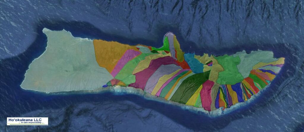
A typical ahupuaʻa (what we generally refer to as watersheds, today) was a long strip of land, narrow at its mountain summit top and becoming wider as it ran down a valley into the sea to the outer edge of the reef.  If there was no reef then the sea boundary would be about one and a half miles from the shore.

When the Hawaiians lived on the land as farmers and gatherers they became intimately acquainted with and named countless features and places.

Hawaiian customs and practices demonstrate the belief that all portions of the land and environment are related; the place names given to them tell us that areas are of cultural importance.  (Maly)

This Placial versus Spatial context reflects the relationship of the people to the land.

“Sense of place is about the feeling that emanates from a place as a combination of the physical environment and the social construct of people activity (or absence of) that produces the feeling of a place.  …  People seek out Hawaiʻi because of the expectation of what its sense of place will be when they get there.”  (Apo)

“Sense of place helps to define the relationships we have as hosts and guests, as well as how we treat one another and our surroundings.”  (Taum)

“In the Hawaiian mind, a sense-of-place was inseparably linked with self-identity and self-esteem.  To have roots in a place meant to have roots in the soil of permanence and continuity.”

“Almost every significant activity of his life was fixed to a place.”

“No genealogical chant was possible without the mention of personal geography; no myth could be conceived without reference to a place of some kind; no family could have any standing in the community unless it had a place; no place of significance, even the smallest, went without a name; and no history could have been made or preserved without reference, directly or indirectly, to a place.”

“So, place had enormous meaning for Hawaiians of old.”   (Kanahele)

© 2022 Hoʻokuleana LLC

Filed Under: Place Names Tagged With: Hawaii, Mailikukahi, Ahupuaa, Palena, Cultural Attachment

  • « Previous Page
  • 1
  • …
  • 178
  • 179
  • 180
  • 181
  • 182
  • …
  • 562
  • Next Page »

Images of Old Hawaiʻi

People, places, and events in Hawaiʻi’s past come alive through text and media in “Images of Old Hawaiʻi.” These posts are informal historic summaries presented for personal, non-commercial, and educational purposes.

Info@Hookuleana.com

Connect with Us

  • Email
  • Facebook
  • LinkedIn
  • Twitter
  • YouTube

Recent Posts

  • Bahá’í
  • Carriage to Horseless Carriage
  • Fire
  • Ka‘anapali Out Station
  • Lusitana Society
  • “Ownership”
  • ‘Holy Moses’

Categories

  • Place Names
  • Prominent People
  • Schools
  • Sailing, Shipping & Shipwrecks
  • Economy
  • Voyage of the Thaddeus
  • Mayflower Summaries
  • American Revolution
  • General
  • Ali'i / Chiefs / Governance
  • Buildings
  • Missionaries / Churches / Religious Buildings
  • Hawaiian Traditions
  • Military

Tags

Albatross Al Capone Ane Keohokalole Archibald Campbell Bernice Pauahi Bishop Charles Reed Bishop Downtown Honolulu Eruption Founder's Day George Patton Great Wall of Kuakini Green Sea Turtle Hawaii Hawaii Island Hermes Hilo Holoikauaua Honolulu Isaac Davis James Robinson Kamae Kamaeokalani Kamanawa Kameeiamoku Kamehameha Schools Lalani Village Lava Flow Lelia Byrd Liliuokalani Mao Math Mauna Loa Midway Monk Seal Northwestern Hawaiian Islands Oahu Papahanaumokuakea Marine National Monument Pearl Pualani Mossman Queen Liliuokalani Thomas Jaggar Volcano Waikiki Wake Wisdom

Hoʻokuleana LLC

Hoʻokuleana LLC is a Planning and Consulting firm assisting property owners with Land Use Planning efforts, including Environmental Review, Entitlement Process, Permitting, Community Outreach, etc. We are uniquely positioned to assist you in a variety of needs.

Info@Hookuleana.com

Copyright © 2012-2024 Peter T Young, Hoʻokuleana LLC


Loading Comments...