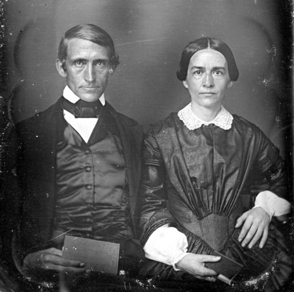
Images of Old Hawaiʻi

  • Home
  • About
  • Categories
    • Ali’i / Chiefs / Governance
    • American Protestant Mission
    • Buildings
    • Collections
    • Economy
    • Missionaries / Churches / Religious Buildings
    • General
    • Hawaiian Traditions
    • Other Summaries
    • Mayflower Summaries
    • Mayflower Full Summaries
    • Military
    • Place Names
    • Prominent People
    • Schools
    • Sailing, Shipping & Shipwrecks
    • Voyage of the Thaddeus
  • Collections
  • Contact
  • Follow

January 11, 2022 by Peter T Young Leave a Comment

Glimpse of Honolulu Life in early-1870s

The following is from a ‘Story’ by Clara Lydia (Moseley) Sutherland (granddaughter of Hiram Bingham and daughter of Hiram’s first child Sophia – and, my great grandmother). She gives glimpses of life as a teacher at Kawaiahaʻo Female Seminary and a look of Honolulu in the early-1870s.

Before she “was fifteen, a wonderful thing happened to me which probably changed the whole course of my life. Two of my mother’s sisters, Aunt Lydia and Aunt Lizzie, returned to Honolulu, the home of their birth and engaged in teaching in a school for Hawaiian girls which was called Kawaiahaʻo Seminary.”

“My Aunt Lydia was Principal of this school and she wrote to my mother asking if she couldn’t spare me and let me come out and teach music to her girls, knowing that I was musically inclined.”

She left her home in Union City, Michigan to join them. “Uncle Hiram (II) met us at the wharf that Sunday morning we arrived, and when we reached the house my three aunts gave me such a warm and cordial welcome that I was no longer homesick, but oh! so glad to be here on terra firma.” (Clara Lydia Sutherland)

“Very soon after my arrival in Honolulu I began taking piano lessons from Mr. Mueller, a German teacher. I also took some French lessons from him.”

“Aunt Lydia wished to give me every advantage in the way of music, so she had me take pipe organ lessons from Mr. Atkinson, the organist at Kawaiaha‘o Church.”

“The organ then in use had to be pumped by hand, so when I went over to the church to practice I always took one of the school girls to do the pumping.”

“After I had gained some confidence in the use of the pedals I substituted occasionally for Mrs. Agnes Judd, who was the regular organist at Fort Street Church.”

“This church was thus named because it stood on the corner of Fort and Beretania streets nearly opposite the Catholic Church. Mr. Frear, father of Judge Frear was its pastor at that time.”

“Some years after, it merged with Bethel Church of which Rev. S. M. Damon was pastor. They built a beautiful church on the corner of Beretania and · Richards St. and named it Central Union, and Dr. Beckwith was its first pastor.”

“About two miles out from town at the entrance of Manoa Valley was a school called Punahou (meaning ‘new spring’) and thus named because of the spring which has existed there from time immemorial.”

“This property, consisting of several acres, was given by Boki, one of the chiefs, to my grandfather for educational purposes, so in 1842, a school was started there for the benefit of the children of the missionaries.”

“When I came to the Islands in 1872 this was as yet a small school, compared to its present status. There were only about fifty pupils and there were only two buildings, both built of adobe.”

“One of these was for the Principal and the three teachers and the few pupils who came from the other Islands. The other was the Schoolhouse. The latter is still in existence and is now used by the Music Faculty and called ‘Old Music Hall’.”

“At that time the upper floor was one big schoolroom, and the rooms downstairs were used for classrooms. Mr. E. P. Church was the Principal, and his wife and Miss Haven and Mr. Chickering were the other three teachers.”

“Here I went to school for two years, and it is one of my happy memories, as I loved my teachers and my studies and made friendships which have lasted all my life.”

“Mr. Chickering, my Latin teacher, was my ideal of all that was fine and noble and manly, and I nearly lost my heart to him even at the age of 16.”

“There were no street cars in Honolulu in those days, so the school kept two omnibuses driven by boys living at the school. One went up Nuʻuanu Valley to pick up all the scholars living in that section, and the other took those of us who lived in town, and in the few scattered houses on the plains between Punahou and town.”

“There was not much to be seen but algeroba (kiawe) trees on that dry and dusty plain. King Street was the only thoroughfare.
There was no one living in Manoa Valley except a few natives in their grass huts.”

“That was only a place where we went for picnics on horseback. The bus called for some of us about 8:30 am as school began at 9 o’clock. We used to have some pretty jolly times riding back and forth, and I can remember how certain girls would have a crush on the driver and want to sit up next to him.”

“Human nature has not changed since time began, and there was plenty of flirtation and romance in those days, but we would have been considered very discreet and modest by the present generation.”

“We would take an orange or banana to school to eat at noon, but no regular lunch, so I used to come home between two and three PM nearly starved.”

“They always kept my dinner warm for me in the oven and how I did enjoy the taro! We had it nearly every day instead of potato or rice. That is probably what made me gain in weight so fast, as I had not then learned to eat poi.”

“I was a very busy girl at this time, for besides my school and my piano and organ practice I was giving piano lessons to ten or twelve of the girls in my aunt’s school.”

“I would give one before going to school in the morning, and one or two more in the afternoon. There was an old piano in the dining room where I taught, and on which the girls practiced.”

“In the back parlor was a new one, belonging to Sally King, a half white, and one of my pupils. She and I did our practicing on this.”

“Our nearest neighbors were the Castles and Cookes. The Castles lived next door and the Cookes just across the street in the old Mission House, where my grandparents and some of the other missionaries had lived.”

“This was the first frame house erected in Honolulu, the material for it having been sent around Cape Horn in 1821. It is still in existence, having been carefully preserved by the friends of the missionaries on account of its associations.”

“‘Mother Cooke’, as she was lovingly called by all who knew her, was living here at this time with her three sons, Charlie, Frank and Clarence.”

“The three daughters and oldest son, Joe, had all left the family roof, and were living in homes of their own. Charlie was married but living in the same house with his mother and occupying a three room apartment or wing which had been built onto the east end of the house.”

“These rooms should have been called ‘Honeymoon Haven’ as it is where each of Mother Cooke’s four sons began their married life.”

“The Castles were a large family of nine children, and I came to know them very well, especially the younger ones, George, James, Carrie, Helen and Henry.”

“Carrie, who was nearest my age, was as fond of music as I, and we enjoyed playing duets together …. Mr. Barnard, Clerk of the Court, an elderly gentleman who played the violin, used to give us each an evening a week when he would come to the house and play with us, thus helping us greatly in reading and in our appreciation of good music.”

© 2022 Hoʻokuleana LLC

Punahou School, Photograph attributed to Charles Burgess-1866
Punahou Omnibus
Punahou Omnibus
Punahou Omnibus-1890
Kawaiahao Church in 1885-Look towards Diamond Head
Kawaiahaʻo_Female_Seminary,_Honolulu,_c._1867
Manoa-Lantana and Kiawe-PP-59-6-006
Manoa_valley-BM
Manoa_valley-BM
Manoa-PP-1-4-024
Manoa-PP-1-4-024

Filed Under: General, Missionaries / Churches / Religious Buildings, Place Names, Schools, Economy Tagged With: Kawaiahao Seminary, Kulaokahua, Hiram Bingham, Hawaii, Clara Sutherland, Punahou, Kawaiahao Church, Sophia Bingham, Kiawe, Nuuanu, Manoa

March 19, 2020 by Peter T Young Leave a Comment

ʻIli Lele

Ahupuaʻa are land divisions that served as a means of managing people and taking care of the people who support them, as well as an easy form of collection of tributes by the chiefs.  Ultimately, this helped in preserving resources.

A typical ahupuaʻa (what we generally refer to as watersheds, today) was a long strip of land, narrow at its mountain summit top and becoming wider as it ran down a valley into the sea to the outer edge of the reef.  If there was no reef then the sea boundary would be one-mile from the shore.

Ahupuaʻa contained nearly all the resources Hawaiians required for survival.  Fresh water resources were managed carefully for drinking, bathing and irrigation.

Mauka lands provided food, clothing, household goods, canoes, weapons and countless other useful products.  Within the coastal area and valleys, taro was cultivated in lo‘i; sweet potato, coconut, sugar cane and other food sources thrived in these areas.  The shore and reefs provided fish, shellfish and seaweed.

In ancient Hawaiian times, relatives and friends exchanged products.  The upland dwellers brought poi, taro and other foods to the shore to give to kinsmen there.  The shore dweller gave fish and other seafood.  Visits were never made empty-handed but always with something from one’s home to give.

Some ahupuaʻa were further subdivided into units (still part of the ahupuaʻa) called ʻili. Some of the smallest ahupuaʻa were not subdivided at all, while the larger ones sometimes contained as many as thirty or forty ʻili, each named with its own individual title and carefully marked out as to boundary.

Occasionally, the ahupuaʻa was divided into ʻili lele or “jumping strips”.  The ʻili lele often consisted of several distinct pieces of land at different climatic zones that gave the benefit of the ahupuaʻa land use to the ʻili owner: the shore, open kula lands, wetland kalo land and forested sections.

The gift of land to Hiram Bingham, that later became Punahou School, had additional land beyond the large lot with the spring and kalo patches where the school is situated (Ka Punahou) as part of the initial gift – the land was an ʻili lele.

Punahou included a lot on the beach near the Kakaʻako Salt Works (‘Ili of Kukuluāeʻo;) the large lot with the spring and kalo patches where the school is situated (Kapunahou) and also a forest patch on the steep sides of Manoa Valley (ʻIli of Kolowalu, now known commonly referred to as Woodlawn.)  (Congressional Record, 1893-94)

‘Ili of Kukuluāeʻo is an ‘ili lele (before the reclamation of the reefs, it was on the mauka side of the beach trail (now Ala Moana Boulevard) on the Diamond Head side of the Kakaʻako peninsula).  Included with this were the fishing rights over the reef fronting the property.

In addition to this makai, coastal property, there was an associated larger lot with a spring and kalo land, and another piece of forest land on the slopes of Mānoa Valley.

In 1829, the land was given to Hiram Bingham – who subsequently gave it to the American Board of Commissioners for Foreign Missions (ABCFM) – to establish Punahou School.

The ‘Ili of Kukuluāeʻo was bounded on Honolulu side by “Honolulu;” the mauka by “Kewalo;” and “Koula;” the Waikīkī side by “Kālia” and extended seaward out to where the surf breaks (essentially the edge of the reef.)  It included fishing grounds, coral flats and salt beds.

The land was owned by the King (Kauikeaouli – King Kamehameha III) and was originally awarded to the King as LCA 387, but he returned it to the government.

It’s not clear how/when the makai land “detached” from the other Punahou School pieces, but it did and was given to the ABCFM (for the pastor of Kawaiaha‘o Church.)

Testimony related to the land noted: “The above land was given by Boki to Mr. Bingham, then a member of the above named Mission and the grant was afterwards confirmed by Kaahumanu.“

“This land was given to Mr. Bingham for the Sandwich Island Mission by Gov. Boki in 1829… From that time to these the S. I. Mission have been the only Possessors and Konohikis of the Land.”

“The name of the Makai part is Kukuluāeʻo. There are several tenants on the land of Punahou whose rights should be respected.”

Interestingly, there are two other ʻili lele, with ʻIli Lele of Kukuluāeʻo, that make up what is now known as Kakaʻako, ‘Ili Lele of Ka‘ākaukukui and ʻIli Lele of Kewalo.

‘Ili Lele of Ka‘ākaukukui was awarded to Victoria Kamāmalu, sister of Kamehameha IV and Kamehameha V. This was on the Honolulu side of Kakaʻako and the associated fishing area included in this ʻili makes up most of what is now known as Kakaʻako Makai (the Kakaʻako peninsula.)

Kaʻākaukukui held Fisherman’s Point and the present harbor of Honolulu; then kalo land near the present Kukui street, and a large tract of forest at the head of Pauoa Valley.

ʻIli Lele of Kewalo was awarded to Kamakeʻe Piʻikoi, wife of Jonah Piʻikoi (grandparents of Prince Kūhiō;) the award was shared between husband and wife.  The lower land section extended from Kawaiahaʻo Church to Sheridan Street down to the shoreline.

The ʻIli Lele of Kewalo had a lower coastal area adjoining Waikīkī and below the Plain (Kulaokahu‘a) (270+ acres,) a portion makai of Pūowaina (Punchbowl) (50-acres, about one-half of Pūowaina,) a portion in Nuʻuanu (about 8-acres) and kalo loʻi in Pauoa Valley (about 1-acre.)

The image shows the three portions of the ʻili lele initially given to Hiram Bingham; the buff outline notes the present boundaries of the school and the blue background notes the three properties included in the initial gift.  This helps to illustrate the nature and benefits of ʻili lele – makai resource land, kalo land with water source and mauka forest land.

Follow Peter T Young on Facebook 

Follow Peter T Young on Google+ 

Follow Peter T Young on LinkedIn  

Follow Peter T Young on Blogger

© 2020 Hoʻokuleana LLC

Punahou-Ili_Lele-Property_Outline-Google_Earth
Kewalo-Bishop-Reg1090 (1884)-(Kewalo_Kaakaukukui_and_Kukuluaeo)
Kakaako-noting-ili_lele-(Kewalo_is_above_Kaakaukukui_and_Kukuluaeo)
Honolulu_Harbor_to_Diamond_Head-Wall-Reg1690-1893

Filed Under: Hawaiian Traditions, Place Names Tagged With: Waikiki, Pauoa, Hiram Bingham, Ili Lele, American Board of Commissioners of Foreign Missions, Kolowalu, Punahou, Ili, Kewalo, Kulaokahua, Kakaako, Kukuluaeo, Kaakaukukui, Kauikeaouli, Kamehameha III, Hawaii, Ahupuaa

March 6, 2020 by Peter T Young 2 Comments

Try And Leave This World A Little Better Than You Found It

The Boy Scout movement was founded in England by Sir Robert Baden-Powell in 1908. As a military officer, he had noticed that soldiers in his regiment, while well educated in the classroom sense, were ill prepared for the field: “Tell one of them to ride out alone with a message on a dark night and ten to one he would lose his way.”

While stationed in India, he discovered that his men did not know basic first aid or the elementary means of survival in the outdoors. Baden-Powell realized he needed to teach his men many frontier skills, so he wrote a small handbook called Aids to Scouting, which emphasized resourcefulness, adaptability and the qualities of leadership that frontier conditions demanded.

Baden-Powell wanted to develop men who were more at ease in the world. “I wanted them to have courage, from confidence in themselves and from a sense of duty; I wanted them to have knowledge of how to cook their own grub; in short, I wanted each man to be an efficient all-round reliable individual.”

In August 1907, he gathered about 20 boys and took them to Brownsea Island in a sheltered bay off England’s southern coast. They set up a makeshift camp that would be their home for the next 12 days.

The next year, Baden-Powell published his book Scouting for Boys, and Scouting continued to grow. That same year, more than 10,000 Boy Scouts attended a rally held at the Crystal Palace; two years later, membership in Boy Scouts had tripled.

Because of growing demand for the scouting experience by younger boys, in 1914, Baden-Powell began implementing a program for them that was based on Rudyard Kipling’s Jungle Book. The Wolf Cub program began in 1916, and since that time, Wolf Cubbing has spread to other European countries with very little change.

A strong influence from Kipling’s Jungle Book remains today. The terms “Law of the Pack,” “Akela,” “Wolf Cub,” “grand howl,” “den” and “pack” all come from the Jungle Book. At the same time, the Gold and Silver Arrow Points, Webelos emblem and Arrow of Light emblem are taken from American Indian heritage.

The seeds of Scouting were growing in the United States. On a farm in Connecticut, a naturalist and author named Ernest Thompson Seton was organizing a group of boys called the Woodcraft Indians; and Daniel Carter Beard, an artist and writer, organized the Sons of Daniel Boone.

But first, an American businessman had to get lost in the fog in England. Chicago businessman and publisher William D. Boyce was groping his way through the fog when a boy appeared and offered to take him to his destination. When they arrived, Boyce tried to tip the boy, but the boy refused and courteously explained that he was a Scout and could not accept payment for a Good Turn.

Intrigued, the publisher questioned the boy and learned more about Scouting. He visited with Baden-Powell as well, and became captured by the idea of Scouting. When Boyce boarded the transatlantic steamer for home, he had a suitcase filled with information and ideas.  On February 8, 1910, Boyce incorporated the Boy Scouts of America.

That same year, a Hawaiʻi artist and outdoorsman by the name of David Howard Hitchcock discovered Scouting in California, and brought it home to Hawaiʻi.

“The boy scout movement, so popular in England, and which aims to develop patriotism, discipline, courage, thrift, helpfulness and cheerfulness in boys is described by Francis Buzzell in an illustrated article in the August Popular Mechanics.”

“He says: “The general organization, and the symbolism of the scout movement are essentially military, but the strict military discipline, and especially the routine of incessant military drill, are almost entirely lacking.”

“General Baden-Powell, chief scout of all the boys In the British Empire, appoints scout commissioners to organize branches, Inspect scout corps, and help scout masters.”  (Hawaiian Star, July 27, 1910)

“The ‘Boy Scout’ movement has spread to Hawaii. … The movement was founded in America by Ernest Thompson Seton, but did not attract much attention until the foundation of a similar organization in England by Sir Robert SS Baden-Powell, the hero of Mafeking. General Powell’s organization spread like wildfire and over 400,000 boys are enrolled in England.”

“The object of the movement, as defined by Sir Robert, “is to seize the boy’s character in its red-hot stage of enthusiasm and to weld it into the right shape and encourage and develop its individuality, so that the boy may become a good man and a valuable citizen for our country.”  (Hawaiian Star, September 3, 1910)

A newspaper article noted the first meeting: “The Boy Scout movement in Honolulu will be started tonight at the meeting at the K. of P. (Knights of Pythias) Hall. All the parents in the city are invited to hear Colonel Bullard of the regular army tell about the boy scouts of America at eight o’clock in the K. of P. Hall.”  (Honolulu Star, September 20, 1910)

Within months of returning home, Hitchcock, a Punahou School graduate, set up Hawaii’s first local troop – Scout Troop 1, the famed Rainbow Patrol (because of the wide range of nationalities represented in its membership) sponsored by Punahou and still in existence today.

The first troop included Hitchcock’s sons, Harvey (1917) and Dickson (1920) Hitchcock, Dudley Pratt (1918,) Walter (1919) and Fred (1920) Vetlesen, Ronald von Holt (1917,) Fred Waterhouse (1918,) Sam Wilder III (1917) and Donald Young (1918.)

According to Hitchcock:  “About 1910 I went to California and saw boys in pairs and in small groups camping out as Boy Scouts but with no such organization back of them as now exists.”

“Visiting such men as could be found who were interested, I obtained all the data then available with a series of photographs from the East illustrating (Boy Scout) activities and with these came back to Honolulu where I proceeded to organize a troop which at first consisted of one patrol.”

In later years the patrol was renamed Troop 1 to codify its status as Hawaiʻi’s original Boy Scout troop; it includes not only the students of Punahou, but also boys attending schools located all over the island of Oahu.

Hawaiʻi has a royal link to Boy Scouts.  In 1913, Queen Lili‘uokalani presented a silk Hawaiian flag with her royal crest “Onipaa” (Lit., fixed movement – steadfast, established, firm, resolute, determined)  and the lettering in gold “The Queen’s Own Troop,” which she had sewn herself.  That flag was recently donated to the Bishop Museum.

“This flag symbolizes the Queen’s recognition of Scouting as a positive and productive outlet to encourage young men and women to become leaders for life and contributing citizens who give back to their community,” Rick Burr, executive director of the Aloha Council said.  (Bishop Museum)

At the time of the Queen’s death, “Roger Burnham, Scout commissioner, sent a letter to Colonel CP Iaukea, stating that inasmuch as the Queen had given the Boy Scouts a flag they wanted to do what they could to help in the funeral exercises.”

“Colonel Iaukea accepted their offer and the Scouts will have a place assigned them in the funeral procession. The Scouts will doubtless also be used as messengers throughout the week.”  (Honolulu Star-Bulletin, November 13, 1917)

Perhaps the most unique aspect of Scouting is that – unlike many other activities –it doesn’t focus on competition – it focuses on achievement. Something everyone experiences in Scouting and strives for in their day to day lives.

To not only Be Prepared – but to do a good turn every day. To be trustworthy, loyal, helpful, friendly, courteous, kind, obedient, cheerful, thrifty, brave, clean and reverent – as well as to do one’s duty to God and country.

Because of this early community support Scouting was quickly organized and grew. And because of those early community leaders Scouting established a deeply rooted heritage in Hawaiʻi.

Scouting has grown in the United States from 2,000 Boy Scouts and leaders in 1910 to millions strong today. From a program for Boy Scouts only, it has spread into a program including Tiger Cubs, Cub Scouts, Webelos Scouts, Boy Scouts, Varsity Scouts, and Venturers.

The Aloha Council is flourishing geographically as well – encompassing not only Hawaii, but Guam, American Samoa, Marianas, Marshall Islands, Micronesia and Palau. In all – the Aloha Council covers the largest geographical area in the world – over 8,000,000-square miles on both sides of the equator and date line.

After Baden-Powell’s death in 1941, a letter was found in his desk that he had written to all Scouts. It included this passage: “Try and leave this world a little better than you found it.”  (Lots of information here from Troop 1 and Aloha Council.)

Follow Peter T Young on Facebook 

Follow Peter T Young on Google+ 

Follow Peter T Young on LinkedIn  

Follow Peter T Young on Blogger

© 2020 Hoʻokuleana LLC

Filed Under: Prominent People, Schools, General Tagged With: Hawaii, David Howard Hitchcock, Punahou, Boy Scouts, Robert Baden-Powell

December 3, 2019 by Peter T Young Leave a Comment

Kulaokahu‘a

On January 9, 1847, the Polynesian reported there were 1,386 buildings in Honolulu, 1,337 of these were residences: 875 made of grass; 345 adobe; 49 coral; 49 wood and 29 stone/coral below, wood above.

Washington Place was built that year by future-Queen Liliʻuokalani’s father-in-law.

Excluding visiting sailors, foreigners made up only some 6 per cent of Honolulu’s approximately 10,000-residents.

Following a road realignment program directed by Kuhina Nui Kīnaʻu (Kaʻahumanu II) to straighten out the streets, Honolulu was linked by four “big paths” or alanui: Beretania and Queen bordered it in the north and south and Alakea and Nuʻuanu defined its eastern and western limits.

Nearly two-decades before (about 1830,) Queen Ka‘ahumanu ordered that a wall be built in the Makiki area to keep cattle from the inland residential areas. The stone wall also marked a path across Makiki which was first called Stonewall Street; this former path is now covered by Wilder Avenue.

The government decreed that after May 4, 1850 no horses, cattle, or other animals could run at large there; more than 30 years later agents were being appointed to take up strays. (Greer)

Beyond Honolulu’s limits there were few residences other than the grass houses of Hawaiians. The population was growing toward and up Nuʻuanu, but Honolulu was hemmed on the Diamond Head end by the barren plains called Kulaokahuʻa.

Kulaokahu‘a translates as “the plain of the boundary.”

Kulaokahu‘a was the comparatively level ground below Makiki Valley (between the mauka fertile valleys and the makai wetlands.) This included areas such as Kaka‘ako, Kewalo, Makiki, Pawaʻa and Mōʻiliʻili.

“It was so empty that after Punahou School opened in July 1842, mothers upstairs in the mission house could see children leave that institution and begin their trek across the barren waste. Trees shunned the place; only straggling livestock inhabited it.” (Greer)

This flat plain would be a favorable place to play maika, a Hawaiian sport which uses a disc-shaped stone, called an ‘ulu maika, for a bowling type of game.

Pukui states that the name makiki comes from the type of stone used to make octopus lures. This is the same type of stone that was used to make ‘ulu maika, and some have speculated that the name of the ahupua‘a (Makiki) may have originated from its association with the maika sport rather than, or addition to, the making of octopus lures.

There were several horse paths criss-crossing the Kulaokahu‘a Plains. In the 1840s, it was described as “nothing but a most exceedingly dreary parcel of land with here and there a horse trail as path-way.” (Gilman) The flat plains were also perfect for horse racing, and the area between present-day Piʻikoi and Makiki Streets was a race track.

The Plains were described as dry and dusty, without a shrub to relieve its barrenness. There was enough water around Makiki Stream to grow taro in lo‘i (irrigated fields,) and there was at least one major ʻauwai, or irrigation ditch.

From 1840 to 1875, only a few unpaved roads were in the area, generally along the present course of King, Young, Beretania and Punahou Streets. These roads or horse paths “ran a straggling course which changed as often as the dust piled up deep”. (Clark)

“As early as 1847 a number of sales took place of lots in Honolulu, Kulaokahuʻa plain, Manoa and Makawao.” (Interior Department, Surveyor’s Report, 1882)

In the Great Mahele, the Kulaokahu‘a Plains were awarded to the Crown. On July 11, 1851, an Act was passed confirming certain resolutions of the Privy Council of the previous year, which ordered “that a certain portion of the Government lands on each island should be placed in the hands of special agents to be disposed of in lots of from one to fifty acres in fee simple, to residents only, at a minimum price of fifty cents per acre.” (Interior Department, Surveyor’s Report, 1882)

Between the years 1850 and 1860, nearly all the desirable Government land was sold, generally to Hawaiians. The portions sold were surveyed at the expense of the purchaser. (Interior Department, Surveyor’s Report, 1882) Most of the Kulaokahuʻa lands were not included.

Clark noted that “the settling of the Plains did not come until the 1880s, after water was brought from Makiki Valley.” Kulaokahu‘a became more hospitable when water became available from springs and artesian wells, and would gradually be transformed into an attractive residential district in the 1880s.

A notation concerning an 1878 article in the Pacific Commercial Advertiser notes a new 400,000-gallon Makiki reservoir (to be completed June 1879) to supply the Kulaokahuʻa plains and Waikikī, and eventually Kapiʻolani Park. (Krauss)

In marketing material advertised in the Pacific Commercial in 1881, the area is described as, Beretania, King, Young, Victoria, Lunalilo and Kinau Streets, no taro patches, good roads, plenty of water, best of soil, beautiful scenery and pure air. (Krauss)

The Daily Bulletin on July 13, 1882 noted, “Mr. Philip Milton has some fine grape vines growing at his residence on King street, Kulaokahuʻa Plains. They are now bearing. A specimen of the grapes may be seen in the show window at Messrs. JW Robertson & Co.’s store. Those fond of eating this delicious fruit may have an opportunity of purchasing the article from AW Bush on Fort Street, who will have a small lot for sale.”

When looking at renaming the place in 1883, names suggested were Artesia, because of wells sunk there, also Bore-dumville, and Algarroba (kiawe) because the area was then covered with trees, thickly shaded. (Krauss)

Never-the-less, in 1892, Thrum noted that to get to Mānoa “for nearly a mile the road leads by or along pasture fields with no visage of tree or shrub other than the lantana pest … and passes along Round Top of Ualakaʻa”.

Follow Peter T Young on Facebook 

Follow Peter T Young on Google+ 

Follow Peter T Young on LinkedIn  

Follow Peter T Young on Blogger

© 2019 Hoʻokuleana LLC

No._2._View_of_Honolulu._From_the_Catholic_church._(c._1854)-Honolulu_to_Waikiki
Kulaokahua_GoogleEarth
Paul_Emmert_-_'Diamond_Head_from_Aliapaakai_(Salt_Lake)',_c._1853-59
No._2._View_of_Honolulu._From_the_Catholic_church._(c._1854)-Honolulu_to_Waikiki-Detail
McKinley_School_Grounds-1905
Kakaako-From the cupola of Old Plantation, looking across the fish pond to the Ward’s beachfront lands, Kukuluae‘o-(avisionforward)
Edward_Clifford_(1844-1907)_-_'Diamond_Head,_Honolulu',_watercolor_painting,_1888
George_Henry_Burgess_-_'Queen_Street,_Honolulu',_watercolor_over_graphite_painting,_1856
Looking_makai_out_of_Manoa_Valley1900
Kawaiahao Church in 1885-Look towards Diamond Head
Kulaokahua_Lots-Lawa-Reg1100-1885
Kulaokahua-Plains-Reg1253
Honolulu_Harbor_to_Diamond_Head-Wall-Reg1690 (1893)-(portion_development_in_Kulaokahu‘a-and-wetlands_below_in_Kewalo)
Trails from Punchbowl Street to Waialae as described by 'I'i

Filed Under: Place Names Tagged With: Hawaii, Oahu, Punahou, Hawaiian Mission Houses Historic Site and Archives, Makiki, Kulaokahua

November 25, 2019 by Peter T Young 2 Comments

Tantalus

Tantalus is located in the Koʻolau mountain range in the Kona district of the island of O‘ahu. The ridges that carry Tantalus Drive and Round Top Drive surround Makiki Valley. Within this valley, three streams, Kānealole, Moleka and Maunalaha, eventually drain into Māmala Bay off of the Honolulu Plain.

Early Hawaiians grew taro near the mouth of Makiki Valley where runoff from the three streams created ideal agricultural conditions.

Archaeologists speculate that by the 1600s the lowland forests had been extensively harvested and that approximately eighty-percent of the land below 2,000-feet elevation was altered.

Puʻu ʻŌhiʻa, its traditional name, had been given the name “Tantalus” during a hiking excursion by the Punahou student hiking club, the Clan Alpine (mid-1800s.)

The students began their hike at Pu‘u ‘Ualaka‘a. As night approached, they found themselves at the edge of the ridge overlooking Poloke Valley. Unable to continue due to the thick undergrowth, the boys were forced to give up their ascent. Versed in Greek mythology, the students named the mountain ‘Tantalus’. (National Register)

(The mythological Tantalus was condemned to an afterlife of insatiable hunger and thirst due to unreachable pools of water and overhanging fruit.)

‘Round Top’ and ‘Sugar Loaf’ were also named by early Punahou students; these names appear on an 1873 ‘Map of Makiki Valley’ surveyed by William De Witt Alexander.

Mo‘olelo (Hawaiian stories) indicate that Pu‘u ‘Ualaka‘a was a favored locality for sweet potato cultivation and King Kamehameha I established his personal sweet potato plantation here.

Pu‘u translates as “hill” and ‘ualaka‘a means “rolling sweet potato”, so named for the steepness of the terrain. Within the valley is a quarry where the basalt outcrop was chipped into pieces to make octopus lures. That is believed to be the origin of the word ‘makiki’ – a type of stone used for weights in octopus lures.

Historical attempts at cultivation in the Makiki-Tantalus area included a coffee plantation by JM Herring along Moleka Stream in the late-1800s (valley conditions proved too wet for coffee beans to flourish) and Hawai‘i’s first commercial macadamia nut plantation along the west side of Pu‘u ‘Ualaka‘a. Rows of macadamia nuts trees from the original orchard remain today.

Due to the close proximity to Honolulu Harbor, the Makiki-Tantalus forest underwent severe deforestation in two periods. In the first period, heavy timber was cut for the sandalwood trade with China from 1815 to 1826.

In the second period, 1833 to 1860, wood was primarily harvested as fuel for the whaling trade to render whale blubber into oil. By the late-1800s most of Makiki was bare, denuded of trees. The native forest was gone.

As early as 1846, the Kingdom of Hawai‘i was facing development pressure from the public regarding the Makiki-Tantalus watershed. The barren hillsides were heavily eroded and the quantity and quality of fresh water in the streams was compromised.

That same year, King Kamehameha III passed a law declaring forests to be government property. In 1876, the Kingdom passed the “Act for the Protection and Preservation of Woods and Forests” including watershed preservation. In 1880, further legislation was enacted to protect all watershed areas that contributed domestic water supplies in the Makiki, Tantalus, Round Top and Pauoa area.

Despite the establishment of the protected area, 1890s legislation allowed citizens to acquire residential property on Tantalus.

The beginnings of Tantalus and Round Top drives date to 1892. The 10-mile drive was completed as gravel roads in 1917, and first paved in 1937. The Tantalus-Round Top road is a 10-mile drive that begins near the entrance to Pūowaina (Punchbowl -National Memorial Cemetery of the Pacific.)

The Biennial Report of the Minister of the Interior to the Legislative Assembly of 1892 states that the Tantalus carriage road “begins at the Punchbowl Road, forming a junction with the same at the rear of the hill, at an elevation of about 285 feet, and follows a 5% grade up the ridge known as the forest ridge, to the narrow ridge, dividing Makiki from Pauoa Valley, at an elevation of about 1450 feet; then around the South Slope of Tantalus and head of the ravines leading into Makiki, to a point by the Pond just above ‘Sugar Loaf.’”

The roadway climbs Tantalus Drive along the Kalāwahine ridge between Pauoa and Makiki Valleys and then descends along Round Top Drive on the ridge linking Pu‘u ‘Ōhi‘a (Mount Tantalus, 2,013-feet,) Pu‘u Kākea (Sugarloaf, 1,408-feet) and Pu‘u ‘Ualaka‘a (Round Top, 1,052-feet,) then past Maunalaha Valley Road to Makiki Street.

The continuing development of the carriage road was reported in the June 1898 issue of the Paradise of the Pacific, “Myth of Mountain Tantalus”: “At every turn are new sections of the glorious and ever expanding panorama of ocean and sky; of mountain, town and plain, including large portions of the island.”

“But the richest part of the road above where it cuts through the upper wildwood of koa and kukui, intermingled with luxuriant fern and wild ginger- all overhanging the deep canyons. One is here in another world – cool, green, moist…it is a long and tedious climb to Tantalus, but once there, the lingering visitor will never regret or forget its romance and the melancholy cadence of its winds.”

In 1906, the Civic Federation of Honolulu brought Charles Mulford Robinson, a well-known civic adviser from Rochester, New York for a survey of streets, parks and public works in Honolulu. He recommended securing the top of Tantalus for “the one great park for Honolulu that cities now are learning to secure and save for the people, that they may get close to nature, forgetting the fences and survey lines which civilization has thrown like a network of prison walls upon the world.”

The Tantalus-Round Top stretch is the first roadway on Oʻahu to be placed on the state historic register. Kūhiō Highway on Kauaʻi and Hana Highway on Maui are on the state and national registers of historic places. (According to Historic Roads, a national group dedicated to preserving old thoroughfares, there are 97 roads in the nation listed as historic.) (Info from Historic Hawaiʻi Foundation and National Register.)

Follow Peter T Young on Facebook 

Follow Peter T Young on Google+ 

Follow Peter T Young on LinkedIn  

Follow Peter T Young on Blogger

© 2019 Hoʻokuleana LLC

Buggies on Mt. Tantalus, Honolulu, 1900s.
Round_Top_Sugar_Loaf-Tantalus-(UniversityOfHawaiiMuseum)
Alexander_Scott_-_Diamond_Head_from_Tantalus',_oil_on_canvas,_c.1906-8
Diamond_Head_from_Tantalus-1935
Makiki_Valley-Tanatalus-Alexander-DAGS-Reg1038-1873
Makiki_Valley-Tanatalus-Newton-DAGS-Reg2521-1911
OLYMPUS DIGITAL CAMERA
Tantalus_Round_Top_(HHF)-Map
OLYMPUS DIGITAL CAMERA
View from Tantalus Hill-(vic&becky)-1954

Filed Under: Place Names Tagged With: Puu Ualakaa, Sugar Loaf, Round Top, Hawaii, Oahu, Punahou, Makiki, Tantalus

  • « Previous Page
  • 1
  • 2
  • 3
  • 4
  • 5
  • 6
  • …
  • 9
  • Next Page »

Images of Old Hawaiʻi

People, places, and events in Hawaiʻi’s past come alive through text and media in “Images of Old Hawaiʻi.” These posts are informal historic summaries presented for personal, non-commercial, and educational purposes.

Info@Hookuleana.com

Connect with Us

  • Email
  • Facebook
  • LinkedIn
  • Twitter
  • YouTube

Recent Posts

  • Bill Anderson
  • Foreign Mission School
  • 250 Years Ago … Common Sense
  • Molokini
  • Russell Hubbard
  • Kaʻau
  • 250 Years Ago … New York Provincial Company of Artillery is Formed

Categories

  • General
  • Ali'i / Chiefs / Governance
  • Buildings
  • Missionaries / Churches / Religious Buildings
  • Hawaiian Traditions
  • Military
  • Place Names
  • Prominent People
  • Schools
  • Sailing, Shipping & Shipwrecks
  • Economy
  • Voyage of the Thaddeus
  • Mayflower Summaries
  • American Revolution

Tags

Albatross Al Capone Ane Keohokalole Archibald Campbell Bernice Pauahi Bishop Charles Reed Bishop Downtown Honolulu Eruption Founder's Day George Patton Great Wall of Kuakini Green Sea Turtle Hawaii Hawaii Island Hermes Hilo Holoikauaua Honolulu Isaac Davis James Robinson Kamae Kamaeokalani Kameeiamoku Kamehameha Schools Lalani Village Lava Flow Lelia Byrd Liberty Ship Liliuokalani Mao Math Mauna Loa Midway Monk Seal Northwestern Hawaiian Islands Oahu Papahanaumokuakea Marine National Monument Pearl Pualani Mossman Quartette Thomas Jaggar Volcano Waikiki Wake Wisdom

Hoʻokuleana LLC

Hoʻokuleana LLC is a Planning and Consulting firm assisting property owners with Land Use Planning efforts, including Environmental Review, Entitlement Process, Permitting, Community Outreach, etc. We are uniquely positioned to assist you in a variety of needs.

Info@Hookuleana.com

Copyright © 2012-2024 Peter T Young, Hoʻokuleana LLC


Loading Comments...