An urban legend, urban myth, urban tale or contemporary legend, is a form of modern folklore consisting of stories that may or may not have been believed by their tellers to be true.
As with all folklore and mythology, the designation suggests nothing about the story’s genuineness, but merely that it is in circulation, exhibits variation over time and carries some significance that motivates the community in preserving and propagating it.
For one, the scenarios are the same:
• A couple parks on a dark, isolated road (or a Lover’s Lane)
• The car won’t start
• The girlfriend gets spooked
• The boyfriend says he’ll go get help
• He tells her not to go out, no matter what
• He doesn’t return
• There’s a strange scratching or tapping sound on the car roof
• Finally, the Police help her out, but tells her not to look back
• The boy is hanging from the tree
Sound familiar?
It’s the basis for the “Morgan’s Corner” spooky story at the Pali. It’s also the foundation for similar stories across the country. It may have some basis of fact some place, but no records indicate this ever happening here in Hawaiʻi.
Having said that, reportedly, some UH folks went to the reputed Morgan’s Corner on the Windward side of Old Pali Road and “took photographs looking up into the tree, and when the film was developed, the seventh frame contained a large white object.”
“The photographer, 10 witnesses and the chemical laboratory that analyzed the image for processing errors vouched for the image’s authenticity. … it appeared to be a body hanging from the tree, photographed from below.” (Burlingame)
Hmmm.
Wait … there really is a ‘Morgan’s Corner’ (well, sort of.) And, a murder did happen there; and, it’s on the Old Pali Road (on the town side of the Pali.)
This story ended with a change in a significant law in the Islands.
It happened at the “S” turn on Nuʻuanu Pali Drive. Dr Morgan lived on the mauka side of the road – but the story is not about him.
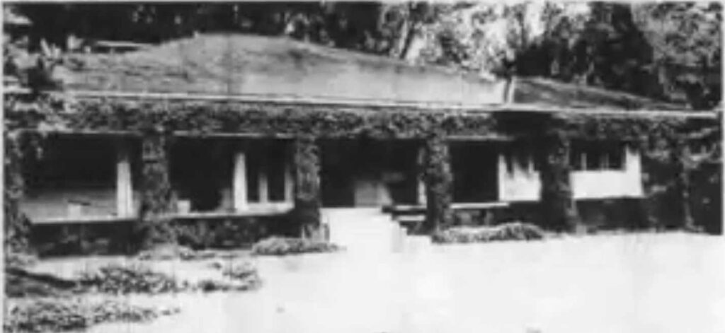
Across the street, at 3939 Pali Road (now known as Nuʻuanu Pali Drive – where a condo project now sits, just above the small waterfall) lived Mrs Therese Adele Wilder (widow of William Chauncey “Chan” Wilder.) That’s where this story took place.
On March 11, 1948, inmates James Majors (21) and John Palakiko (19) escaped from a prison work crew. They made their way to Nuʻuanu and, looking for food, they came across – and into – Wilder’s home.
Wilder, in her late-60s, was attacked – she died.
“Her hands were bound, she was gagged, and there were traces of what appeared to be dried blood about her nose and mouth. There was evidence of a blow on the head, but (her physician) said that she might have died from suffocation brought about by the gag which the intruders forced into her mouth.” (Honolulu Star-Bulletin, March 16, 1948)
Majors and Palakiko were charged. There was public hysteria, irate community leaders, newspaper calls for “swift justice” and, later, confessions from the two.
Both men were convicted and sentenced to hang.
So, what about the significant law change?
Between August 18, 1897 and September 16, 1943, 47 people were executed at Oʻahu Prison under Hawai‘i’s capital punishment law. All were male.
They ranged in age from 19 to 61. One was Caucasian, 3 were Hawaiian, 24 were Filipino, 10 were Japanese, 6 were Korean and 3 were Puerto Rican. (hawaii-edu)
The last recorded execution in Hawai‘i had occurred on January 7, 1944.
With respect to the Majors-Palakiko case, while Honolulu attorney Harriet Bouslog had not represented the men at trial she had followed it closely.
On the eve of the scheduled execution, she swiftly took up the death-row appeals after being challenged by a friend at a dinner party: “I’ll bet you can’t do anything about it.”
She convinced Territorial Governor, Oren E Long, to grant a brief stay of execution. Even after “the lengthiest hearing in the history” of the Territorial Supreme Court, Bouslog failed to obtain relief.
She immediately filed an appeal and requested a stay of execution. … It was 4 am. The prisoners were being given last rites.
Appeals to the federal Court of Appeals and to the United States Supreme Court followed without success. (hawaii-edu)
However, the lengthy legal process enabled a groundswell of public support for the two to develop, especially when folks learned of claims of police brutality and forced confessions.
In 1954, new governor, Samuel W King, granted a commutation of both sentences to life in prison.
Following this, the legislature passed House Bill 706 on June 4, 1957. It called for revising the law relating to capital punishment by providing “a sentence of imprisonment at hard labor for life not subject to parole.”
Governor King signed it the following day, thus abolishing the death penalty in Hawaiʻi.
Then, in 1962, Governor John Burns pardoned the men (after their executions had been stayed five times.)