Images of Old Hawaiʻi

  • Home
  • About
  • Categories
    • Ali’i / Chiefs / Governance
    • American Protestant Mission
    • Buildings
    • Collections
    • Economy
    • Missionaries / Churches / Religious Buildings
    • General
    • Hawaiian Traditions
    • Other Summaries
    • Mayflower Summaries
    • Mayflower Full Summaries
    • Military
    • Place Names
    • Prominent People
    • Schools
    • Sailing, Shipping & Shipwrecks
    • Voyage of the Thaddeus
  • Collections
  • Contact
  • Follow

November 16, 2021 by Peter T Young Leave a Comment

Bison

Bison had survived for 2 million years until humans arrived.  In the 1500s, an estimated 30-60 million of these shaggy brown beasts roamed widely across the interior of Canada, the United States, and far Northern Mexico.  (BBC, Ogden)

Scientists and historians estimate that there were at least 30 million bison roaming the country before Euro-American settlement of the West. (NPS, McAfee)

Then, Buffalo Started to Disappear

The 1849 discovery of gold in California initiated a relentless stream of prospectors and other settlers through the Platte River Valley. Heavy subsistence hunting along the trail divided the existing bison herd into separate Southern and Northern herds.  (PERC)

In just a few short years, cattle replaced the American bison as the leading, cloven-hoofed, grass-eating mammal on the Great Plains. In 1850, millions of bison ranged the grasslands and were the main natural resource for the region’s American Indians.

By 1850, subsistence hunting and habitat destruction had removed all of the bison east of the Mississippi, leaving perhaps 15 million on the Great Plains. (PERC)

“Buffaloes travel in a straight line. When they were moving and encountered a herd of Texas cattle they invariably bored right through the herd, turning neither to right nor left. It was just the same if but one or a dozen buffaloes were on the move – they walked straight through.” (James H. Cook as told to Eli S. Ricker, May 23, 1907)

In 1868, the steel rails of the transcontinental railroad created a barrier that bison did not like to cross.  (Nebraska Studies)  Construction of the Union Pacific through the valley made the division of the herd permanent, as the wary bison simply evacuated the railroad corridor.  (PERC)

Prior to 1870, hunting pressure on bison west of the Mississippi was modest. Plains Indians effectively managed bison herds as common property, engaging in subsistence hunting and in harvesting the vaunted “buffalo robe” (used for carriage throws and heavy fur coats) for sale to eastern markets.

Though the robes were valuable, they could be harvested only in the winter and only from bison living in high northern latitudes—an arduous and risky undertaking at best. Hence, the western bison continued to thrive.  (PERC)

Then in 1870, a process was developed that so bison hides could be commercially tanned into soft, flexible leather. This happened at the same time there was a high demand for leather to make the belts that powered machines in the Industrial Revolution.

There were huge markets in England, France, and Germany. Bison hunters poured onto the Great Plains.  (Nebraska Studies)

Bison hides from which the hair had been removed (called flint hides) were superb for making the soles of boots and industrial belts.  European armies and factories were a huge market, and within months of the tanning innovation, orders for bison hides poured into America.  (PERC)

Most people tend to think the hides were valued because they made fine robes or coats. But that wasn’t really the case.  During the 1870s,  industrial growth skyrocketed in the US and Europe, and demand for leather industrial belts expanded.

Cowhide tended to stretch and factory workers would have to occasionally stop production to tighten belts by cutting out sections.

The epidermal layer in buffalo hide is up to three times thicker than that of cattle and has wider spaced sub-dermal collagen fibers making it more durable and flexible, and better suited for use in industrial conveyor and drive belts.  (Bell, Dodge City Daily Globe)

The price that hunters received for a flint hide jumped from $0 in 1870 to about $2.80 in 1871, and stayed in the range of roughly $2.30 – $2.80 for the next 15 years.

A good hunter could bring several thousand hides to market in a season, but could expect pay of only about $50 per month as a ranch hand. It is little surprise then, that many hundreds of men quickly entered the business of hunting bison. (PERC)

“Commercial hunting by North American aboriginals and Euroamericans for meat and hides was the primary cause of the decline. Other contributing factors included subsistence hunting, indiscriminate slaughter for sport, and transection of the plains by railroads.” (Isenberg)

“Environmental factors such as regional drought, introduced bovine diseases, and competition from domestic livestock and domestic and wild horses also played a role.”

“Additionally, because bison provided sustenance for North American aboriginals and commodities for their barter economy, the elimination of bison was viewed by Euroamericans as an efficient method to force the aboriginal population onto reserves and allow for continued western development.”  (Isenberg)

In the Islands at this Time – ‘A City in a Grove’

“When the whalers began to frequent (Honolulu Harbor) place in numbers, a town soon sprung up, and by the year 1820, Honolulu contained some six or seven thousand inhabitants.  To-day its population is reckoned at 17,000, a larger number than the capital of the important British Colony of New Zealand could recently boast.”

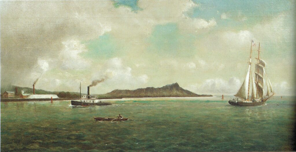
“The First view of Honolulu, on approaching it from the sea, has been variously described by visitors, some of whom have expressed great disappointment, whilst others have gone into raptures over the scene.

“Unless, however, from exaggerated descriptions the traveler has been led to expect something extremely wonderful and unusual, I do not understand how anyone can fail to be charmed with the view of Honolulu and its surrounding scenery as seen from the deck of an approaching vessel, especially after many days’ confinement on shipboard, with nothing but the waste of waters around him.”

“It is true that the hills of Oahu have not the same luxurious clothing of vegetation that is common in many of the island groups of the Southern Pacific. It is true also that the town has no characteristic buildings of a striking nature to arrest attention.”

“Nevertheless, Honolulu is a prettier place to look at from the sea than nineteen out of twenty port tropics or elsewhere. It has rightly been called ‘a city in a grove.’”

Click the following link for more on Bison and the Islands at the time:

https://imagesofoldhawaii.com/wp-content/uploads/Bison.pdf

© 2021 Hoʻokuleana LLC

Filed Under: General, Place Names, Economy Tagged With: Bison, Buffalo

November 10, 2021 by Peter T Young Leave a Comment

Early Brew Crew

Beer is produced by the saccharification (breaking into sugars) of starch and fermentation of the resulting sugar.  There are eight basic steps to the standard commercial brewing process: milling, mashing, wort separation, boiling, chilling, fermenting, conditioning and packaging.  (Barth)

Journal entries show Captain James Cook was the first to make beer in the Islands.  On December 7, 1778 he notes, “Having procured a quantity of sugar cane; and having, upon a trial, made but a few days before, found that a strong decoction of it produced a very palatable beer, I ordered some more to be brewed, for our general use.”

“A few hops, of which we had some on board, improved it much. It has the taste of new malt beer; and I believe no one will doubt of its being very wholesome. And yet my inconsiderate crew alleged that it was injurious to their health.”  (Cook)

While the crew “would (not) even so much as taste it”, Cook “gave orders that no grog should be served … (he) and the officers, continued to make use of this sugarcane beer, whenever (they) could get materials for brewing it.”  (Cook)

I realize some purists might suggest beer needs cereal grain to be brewed, and sugar is not a grain.  However, beer, ultimately, is the fermentation of sugar.  (BTW, starch is a primary product of photosynthesis, and is found in sugarcane stalks.  (Figueira))

Other early beer references show experiences with the brew.  On June 29, 1807, Iselin notes, “Went on shore with some Englishmen, etc., who took us to their houses, where they displayed beer and a kind of gin, a spirituous liquor distilled of the tea root (ʻōkolehao,) said to be drank freely in the Isles.”  (Isaac Iselin)

For early indications of new plants and production from those plants in the Islands, most attention turn to Don Francisco de Paula Marin.  Marin was a Spaniard who arrived in the Hawaiian Islands in 1793 or 1794 (at about the age of 20.)

His knowledge of Western military weapons brought him to the attention of Kamehameha, who was engaged in the conquest of O‘ahu.  Marin almost immediately became a trusted advisor to Kamehameha I.

Marin was responsible for introducing and cultivating many of the plants commonly associated with the Islands.  And, he is reportedly the first Island resident to brew beer. His journal entry for February 2, 1812 recorded the making of “a barrel of beer.”  On December 7, 1815, he wrote, “This day I made a little oil and a barrel of beer for Captain Tela (Tyler.)”  (Schmitt)

We even see some references to beer (brewing and drinking) in missionary journals.  On November 19-20, 1824, missionary Elisha Loomis notes, “Yesterday and today I have been engaged in making beer and vinegar from a root called tee, which grows plentifully in these islands. It is the most sweet of any vegetable I ever tasted. The juice is nearly as sweet as molasses.”

On October 31, 1832, Clarissa Armstrong (wife of Reverend Richard Armstrong) noted, “Capt. Brayton has given me a little beer cask – it holds 6 quarts – Nothing could have been more acceptable.  I wanted to ask you for one, but did not like to. O how kind providence has been & is to us, in supplying our wants. The board have sent out hops – & I have some beer now a working. I should like to give you a drink.”

On July 24, 1836, Clarissa Armstrong notes (during an illness:) “We had a bottle of wine of which I drank … All the nourishment I took after leaving Honolulu til we reached Wailuku was two biscuit about the size of small crackers, & a bit of dried beef. Drinks were my nourishment. Limes grow at Oahu & I obtained some for the voyage, which furnished me pleasant drink. Also a little beer which I had made.”

Hawaiʻi’s first full-scale brewery appeared in 1854. From April 15 to October 21, 1854, The Polynesian carried a weekly one-column advertisement headed “Honolulu Brewery.-Genuine Beer.”  (Schmitt)

The copy continued: “Brewry in Honolulu, Fort street, opposite the French Hotel, are now prepared to supply families, hotels, boarding houses and bar rooms, in bottles or in kegs.  This Beer is made of barley and hops only, contains no alcohol, nor any ingredient whatever injurious to health, can be recommended to the public as the best and most wholesome beverage ever made on these islands, and we hope, therefore, to obtain the favor of public patronage. All orders will be punctually attended to. Captains and passengers will be accommodated at the shortest notice. JJ Bischoff L Co (Polynesian, September 30, 1854)

They later changed the ad, and dropped the “no alcohol” reference, “Honolulu Brewery Malt Beer. The undersigned having established a Brewery in Honolulu, Fort St., opposite the French Hotel, are now prepared to supply families, hotels, boarding houses and bar rooms, in kegs or in bottles. All orders will be punctually attended to. Captains and passengers will be accommodated at the shortest notice.  JJ Bischoff & Co. (Polynesian, August 4, 1855)

Willard Francis and Thos. Warren started Hawaiian Brewery in March 1865; apparently the partnership didn’t last long.  On February 10, 1866, Francis was advertising the brewery for sale, noting that he intended to leave the Islands.  At the same time, Warren was advertising for “a No. 1 Brewer” for the Oʻahu Brewery.  (PCA, Feb. 10, 1866)

Other breweries followed this initial effort. Gilbert Waller National Brewery Co. in Kalihi produced steam beer from January 1888 until 1893 or thereabouts.  (Schmitt)

Then came one of Hawaiʻi’s notable beers, Primo, that started production on February 13, 1901.  “The Honolulu Brewing and Malting Co Ltd will deliver their Primo lager either in kegs or bottled by July 1st. Orders received will be promptly filled.”  (Hawaiian Star, June 27, 1901)

Another paper that day noted an early ‘Buy Local’ marketing theme, “The building up of home industries made the United States what it is today. The Honolulu Brewing and Malting Co have a home production ‘Primo Lager Beer’ why not order some when it is the equal of any beer brewed?”  (Honolulu Republican, June 27, 1901)

Primo also touted the apparent health benefits of drinking beer, “Every doctor knows how beer benefits. If you need more strength or vitality, he will prescribe it. For run-down, nervous people, there is no better tonic and nutrient than a glass of good Primo Beer with meals. Primo Beer, the best tonic.”  The brewery was later renamed Hawaiʻi Brewing Co.

The first American beer to be marketed in an aluminum can was Primo, in October 1958. The 11-ounce “Shiny Steiny,” developed by the Hawaiʻi Brewing Corp with the help of Kaiser, was heavily promoted but failed to achieve popularity, and it was eventually withdrawn.  (Schmitt)

A lasting legacy of the early brew crew is the Royal Brewery on Queen Street.  It was built in 1899 to the specifications of the Honolulu Brewing and Malting Company.  It was constructed from materials shipped in from San Francisco and New York in 1899-1900 and was the original home of Primo.  (They stopped brewing beer there in 1960.)

© 2021 Hoʻokuleana LLC


Filed Under: General, Economy, Prominent People Tagged With: Hawaii, Beer, Captain Cook, Missionaries, Richard Armstrong, Don Francisco de Paula Marin, Elisha Loomis, Royal Brewery, Primo

November 6, 2021 by Peter T Young 1 Comment

Portlock

Recent work that I have been involved with in the Portlock area on O‘ahu, reminded me of the namesake for the place, explorer and fur trader Nathaniel Portlock.

Nathaniel Portlock was born in about 1748 in Norfolk, Virginia, where his grandfather had emigrated, probably from the English south-west, around 1685. Nathaniel’s father died in 1752, leaving his wife Rebecca (formerly Ballard, who had previously been a widow with a daughter from a previous marriage).

Nathaniel’s father’s will left his property, and stay and board, to “my Daughter in Law Nancey Ballard a Negro … said children [Paul and Nathaniel] [and] their mother”.

After Portlock’s father’s death, his mother Rebecca quickly remarried a third time to a Richard Scott, who became guardian to her three surviving Portlock children and had others with her.

At about the age of 24, Nathaniel Portlock entered the British Royal Navy and was one of the loyal colonists of America, known as the “American Loyalists;” he later left that country on the close of the War of Independence.

(It is not clear what relationship a certain John Portlock had with Nathaniel; but John was born in 1765 in Shenandoah Co., Virginia and in 1781 volunteered to serve in the Virginia Regiment and fought and was “slightly wounded’ in the American Revolutionary War. It is an interesting situation if they are related.)

On March 30, 1776, he served as master’s mate on Captain James Cook’s third Pacific voyage aboard the Discovery. Portlock was transferred to the Resolution, also on the expedition, in August 1779.

Cook’s third and final voyage (1776-1779) of discovery was an attempt to locate a North-West Passage, an ice-free sea route which linked the Atlantic to the Pacific Ocean. Cook commanded the Resolution while Charles Clerke commanded Discovery. (State Library, New South Wales)

“Cook had chosen his subordinates well or had been lucky. The officers of the third voyage were a remarkably intelligent group of men.” (Captain Cook Society)

“All the great remaining voyages of the eighteenth century drew on Cook’s officers. Bligh, Portlock, Vancouver, Colnett, Riou, and Hergest all got their commands and served with great distinction. These men then passed on their skills to a second generation of men such as Flinders and Broughton.” (Mackay, Captain Cook Society)

Nathaniel Portlock and George Dixon, observed the commercial benefits that the development of the fur trade in the region could bring. In 1785, a group of London merchants formed the “King George’s Sound Co” (also known as Richard Cadman Etches and Company).

They proposed to carrying on the fur trade from the western coast of America to China, bringing home cargoes of tea from Canton for the East India Company. They bought two boats; Portlock and Dixon were selected to sail them (Dixon also previously sailed with Cook to Hawai‘i) and they set off on an expedition to North America to establish a foothold for fur trappers.

Portlock commanded the 1785-1788 expedition from the ship King George, while Dixon captained the Queen Charlotte. The purpose of the expedition was to investigate the potential of the Alaskan fur trade and to resume Cook’s search for a Northwest Passage through the continent.

The pair left England on August 29, 1785, and took nearly a year to reach Alaska, rounding Cape Horn and touching at Hawaiʻi on the way, first arriving off the coast of Kaʻū, May 24, 1786.

These were the first English ships to reach Hawai‘i following Captain Cook’s first arrival there in 1778. During the course of their 3-year expedition, they made three trips to Hawaiʻi.

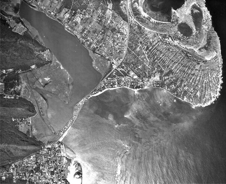
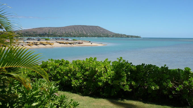
A favorite anchorage on Oʻahu for Portlock was at Maunalua Bay (which Portlock named King George’s Bay). He named the Waikiki area (Diamond Head to Honolulu) Queen Charlotte’s Bay.

The East point of the Maunalua Bay (Koko Head) Portlock named Point Dick, “in honour of Sir John Dick, the first patron of this voyage,”) and the West point (Diamond Head) that Portlock named “Point Rose, after George Rose Esq. secretary of the treasury, the second worthy patron of our undertaking.” (Portlock)

Portlock also mentioned what is probably Kuapā Pond that he described as, “a little salt water river that has a communication with King George’s Bay.”

Portlock wrote about the early challenges of getting fresh drinking water in the region as they “found that we could not water at this place without an infinite deal of trouble …”

“… besides the danger of losing our casks, getting the boats dashed to pieces against the rocks, and the inconvenience of carrying our casks so far amongst a multitude of Indians, which would make it necessary to have an armed force on shore.”

“Towards evening the surgeon returned on board with the convalescents, and informed me, that the inhabitants had behaved in a very quiet inoffensive manner, though they were rather incommoded by the multitudes which curiosity brought about them.”

“By this time all our water from the ground tier was got to hand, and the cables coiled down. The inhabitants now brought us water in such plenty, that by noon on the 4th all our empty casks were filled”.

He noted, “As good water in any quantity may be procured at this island with the greatest facility for small nails and buttons, it undoubtedly must be the safest and most expeditious method any person can adopt who may chance to touch here, to barter for their water in the manner we did.” (Portlock)

“No chiefs of consequence paid us a visit as yet: the inferior chiefs indeed came on board without any scruple, and some of them slept with us every night. Amongst rest I had a daily visit from an old priest, who always brought by way of present, a small pig, and a branch of the cocoa-nut·tree.” (Portlock)

Maunalua was thought to be well-populated in ancient times. Maunalua was known for its offshore fishing resources, a large fishpond, and sweet potato cultivation. Taro was farmed in wet areas, sweet potato was grown in the drier regions and a series of fishing villages lined the coast. (McElroy) Part of that area now carries the Portlock name.

© 2021 Hoʻokuleana LLC

Filed Under: Prominent People, Sailing, Shipping & Shipwrecks, Economy Tagged With: Portlock, Nathaniel Portlock, Maunalua, Hawaii, Kamehameha Schools, Oahu, Captain Cook, Leahi, Diamond Head, Maunalua Bay

November 5, 2021 by Peter T Young 1 Comment

The “Sweet” Road

At the turn of the century (going into the 1900s) road repairs were in the news. A lot.  A good indication was “Kamaaina’s” July 20, 1912 letter to the Star-Bulletin editor,

“Just once in the last sixteen years have repairs been made on Kalakaua avenue. All other roads and public thoroughfares in Honolulu; have received attention, but apparently this one has been forgotten.”

“Certainly the neglect Is not due to the fact that Kalakaua avenue does not need it nor to the failure of residents and property owners to protest; the dust is so heavy that on windy days the homes nearby are almost untenable, and in wet weather portions of this road are almost impassable.’ (Star-Bulletin, July 20, 1912)

Before we go on, we should address some of the terms used in the day:

Asphalt – a mixture of dark bituminous pitch with sand or gravel bonded with a sticky, black, highly viscous liquid or semi-solid form of petroleum or coal tar and coal-tar pitch

Bitulithic – essentially, the maximum aggregate size was 75 mm ranging down to dust. The concept was to produce a mix which could use a more “fluid” binder than used for sheet asphalt.

Bitumen – a black viscous mixture of hydrocarbons obtained naturally or as a residue from petroleum distillation

Concrete – created using a concrete mix of cement, coarse aggregate, sand, and water.

Macadam – angular aggregate over a well-compacted subgrade; maximum aggregate sizes was that “no stone larger than will enter a man’s mouth should go into a road” – coal tar added as binder

Warrenite – a thin, approximately 25 mm thick layer of sheet asphalt placed on top of the hot, uncompacted Bitulithic

Road work was delayed … different people preferred different solutions, and once decisions were made, they were challenged.

The February 7, 1911 Hawaiian Star editorial expressed the community’s frustration, “Road Making – The art of road-making here does not seem to have profited much by experience.”

“For years this administration or that has tried its hand, but if permanent records of methods and results were kept they do not appear to have made an impression.”

“Each road superintendent, as he comes along, tries a new scheme which may, as was the case with the last paving of King street, simply repeat past errors.”

“Yet there ought, by this time, to be a definite formula for street building, not to be lightly departed from, which would assure the most suitable rock, the most satisfactory binding material and a uniform cost per yard for construction of plain work, sources of supply and aspects of topography being equal, at all times.”

“During the regime of H. E. Cooper in the Public Works office two ways of road-making were tried on Kalakaua avenue, the plan was to judge between the two. The highway has had a long test; and in its worst spots the road is better than some that have been built since by other plans.”

“The question that occurs is, have the original plans been saved; is all the necessary data in hand; and if Kalakaua avenue were rebuilt would the lessons already learned from the Cooper experiment be applied? The Star does not say they wouldn’t be. But if they were not, the fact would not cause, surprise. . .”

“‘Observer,’ an intelligent writer on this subject in the morning paper says: ‘Our lava rock is poor material for road-making. It soon turns into mud or blows away as dust. Coral makes an admirable road for wet or dry weather.’”

“If this is a fact, why wasn’t lava rock thrown out for coral long ago? Yet it is being used right along as if experience taught nothing.  Is this good business policy?” (Hawaiian Star, February 7, 1911)

The October 30, 1904 Pacific Commercial Advertiser editorial called for experimentation, “Local Street Paving. The smoothness of a macadamized road in Honolulu wears off in about a year and if there is much travel or rain the road needs to be repaired or rebuilt in three years. Obviously this is a bad showing.”

“Macadam of the right sort should hold its form for seven or eight years unless disturbed meanwhile by the laying of pipes; but the trouble in Honolulu is that our road-building material, friable volcanic rock, is not adapted to wear and tear. If we had granite to break up, our highways would not create such an endless bill of costs.”

“A trial is about to be made of asphalt on one of the business streets, a substance which may keep its smoothness of surface better than macadam, but which is a radiator of heat. On a warm day the asphaltum surface of the Naval docks is almost unbearable.”

“In Washington the streets, which are paved with this material, affect the thermometers all along the way. Still if asphaltum highways prove durable and therefore less expensive than macadam …”

“… the public here may not complain of the higher temperature. It is an offset also for solar discomfort to have the springy, rubber-like feeling of asphalt under one’s carriage wheels.”

“A good plan, in experimenting with our streets, would be to try several pavements in a distance, on one highway, of a few blocks. Then any casual tax payer could tell how the same volume of travel affects different building materials.”

“If it ever comes to that, the Advertiser hopes the pavements of Sydney, N. S. W., will have, consideration. Some years ago the United States Consul General there reported that noiseless pavement; laid a decade before on the Sydney street of heaviest traffic had shown no signs of deterioration.”

“This pavement had pounded and rolled rock at the bottom, with one foot lengths of eucalyptus trunks on end between curb and curb, the spaces or crevices between each trunk length being filled with gravel and concrete and the top presenting a smooth surface of asphalt which protected the wood from rain. It was found that the eucalyptus grew harder with the years.”

“As eucalyptus is readily procurable here some experiments with it might not come amiss.” (Commercial Pacific Advertiser, October 30. 1904)

In addition to eucalyptus, there were thought of Ohia block paving, “That bitullthic paving for King street will be decided upon by, the Board of Supervisors tonight looked like a foregone conclusion this morning.”

“The road committee, It Is under stood, will report unanimously In favor of J. A Gilman’s bid for paving King street with bitulithic, and although some of the Supervisors are rather inclined in favor ohia wood block paving, they will probably not carry out the opposition tonight in the face of a majority for bitulithic.”

“Supervisors Murray and McCleilan are said to favor giving ohia block paving a fair try-out in Honolulu. The others believe that as the bitulithic paving bid was by far the lowest, it should be adopted.” (Evening Bulletin, December 5, 1911)

Edward Scott in ‘Saga’, recalls one of the alternatives that didn’t work – he called it “Honolulu’s Sweetest Memory – ‘Molasses Streets,’”

“Shortly after the turn of the century, W ‘Willie’ Wall, city engineer of Honolulu, hit upon the idea of paving King Street and Kalakaua Avenue with a mixture of bagasse, (cane refuse from sugar making), crushed lava, and beach sand.”

“Willie went to work immediately and laid down a large section of thoroughfare, attracting head-scratching engineers and flies to what would become Honolulu’s ‘sweetest memory.’”

“This concoction rolled out smoothly and all went well until the first heavy rain, which melted Wall’s ‘rock candy’ roadway turning it into a sticky quagmire.”

“Here was a sidewalk superintendent’s Utopia as owners of vehicles found that the gluey mess stuck like hardening cement. Dozens of suggestions were made. Undaunted, Wall called for more crushed lava.”

“When the rainy season set in again, Kalakaua Avenue once more turned into a syrupy tide, the aromatic flow oozing down the gutters until it merged in a swirling mess covering the duck and taro ponds off McCully Street.”

“Until his dying day ‘Willie’ Wall maintained that, given time, he could have made his molasses streets work. True or not the experiment, in retrospect, remains the city’s sweetest and stickiest memory.” (Scott, Saga, 413)

© 2021 Hoʻokuleana LLC

Filed Under: General, Economy Tagged With: Sugar, Road

November 4, 2021 by Peter T Young Leave a Comment

Honokahua

The traditional moku (district) of Kāʻanapali consisted of five major stream valleys Honokōwai, Kahana, Honokahua, Honolua and Honokōhau), all of which were extensively terraced for wet taro (loʻi) in early historic and later times.

Honokahua Valley has been described as having wet taro (loʻi) lands, although not in great abundance.  Sweet potatoes were reportedly grown between Honokōhau and Kahakuloa Ahupuaʻa, presumably on lower kula lands. South of Kapalua Resort, Kahana Ahupuaʻa, was known as a place of salt gathering for the people of Lāhainā.

There are six bays located on Maui’s west shore whose names begin with the word Hono. These bays and coves are collectively known as Hono a Piʻilani.  From South to North, six of the identified bays are Honokōwai (bay drawing fresh water), Honokeana (cave bay), Honokahua (sites bay,) Honolua (two bays), Honokōhau (bay drawing dew) and Hononana (animated bay).

The Kāʻanapali District is noted for an alaloa (a path or trail) that reportedly encircled the entire island. Walker wrote: “The north end of Maui also is traversed by a paved trail. Sections of it can be seen from Honolua to Honokōhau to Kahakuloa. It is paved with beach rocks and has a width of four to six feet.”  (PBR)

According to oral tradition, Piʻilani unified the entire island of Maui, bringing together under one rule the formerly-competing eastern (Hāna) and western (Wailuku) multi-district kingdoms of the Island.   In the 1500s, Chief Piʻilani (“stairway to heaven”) unified West Maui and ruled in peace and prosperity.  His territory included the six West Maui bays, a place he frequented.

Piʻilani’s prosperity was exemplified by a boom in agriculture and construction of heiau, fishponds, trails and irrigation systems.  Famed for his energy and intelligence, Piʻilani constructed the West Maui phase of the noted Alaloa, or long trail (also known as the King’s Highway.)

His son, Kihapiʻilani laid the East Maui section and connected the island.  This trail was the only ancient pathway to encircle any Hawaiian island (not only along the coast, but also up the Kaupō Gap and through the summit area and crater of Haleakalā.)

Four to six feet wide and 138-miles long, this rock-paved path facilitated both peace and war.  It simplified local and regional travel and communication, and allowed the chief’s messengers to quickly get from one part of the island to another.  The trail was used for the annual harvest festival of Makahiki and to collect taxes, promote production, enforce order and move armies.

Missionaries Richards, Andrews and Green noted in 1828, “a pavement said to have been built by Kihapiʻilani, a king … afforded us no inconsiderable assistance in traveling as we ascended and descended a great number of steep and difficult paries (pali.)” (Missionary Herald)

When chief Kekaulike died, his younger son Kamehamehanui (uncle to Kamehameha I) was named heir to rule Maui. In 1738, Kauhi‘aimokuakama (Kauhi,) his older brother, began to wage war to win the title of ruling chief.

Battles were fought across West Maui, from Ukumehame to Honokōwai.  Kamehamehanui engaged the forces of his uncle from Hawai‘i to fight with him, whose troops numbered over 8,000, and Kauhi brought troops of warriors from O‘ahu.

“What was this war like? It employed the unusual method in warfare of drying up the streams of Kaua‘ula, Kanaha and Mahoma (Kahoma – which is the stream near Lahainaluna.) The wet taro patches and the brooks were dried up so that there was no food for the forces of Ka-uhi or for the country people.”  (Kamakau)

“The hardest fighting, even compared with that at Napili and at Honokahua in Kāʻanapali, took place on the day of the attack at Puʻunene.”   (Kamakau)

The war ended with the battle Koko O Nā Moku (“Bloodshed of the Islands.”) Over several days, the blood of fallen warriors from both sides flowed from a stream into the shorebreak and caused the ocean to turn red.  (Kamehamehanui won.) (Kāʻanapali Historical Trail)

In 1765, Kahekili inherited all of Maui Nui and O‘ahu and was appointed successor to his brother Kamehamehanui’s kingdom (not to be confused with Hawai‘i Island’s Kamehameha I.)

Kapalua Resort is situated along this coast between Honokahua and Honokeana.

Agricultural use of the property for pineapple cultivation began in approximately 1912 when Honolua Ranch (which included the property) was converted from a cattle ranch into a pineapple plantation. By the 1920s, pineapple had been planted across West Maui from Miihinahina ahupua’a to Kahakuloa ahupua’a A cannery was built in Honokahua in 1914 and, in 1923, Honolua Ranch became Baldwin Packers, Ltd.

In 1962, Maui Land & Pineapple Company, Inc. was formed when Baldwin Packers merged with Maui Pineapple Company. Maui Land & Pineapple Company, Inc., created the wholly-owned subsidiary named Kapalua Land Company, Ltd., which conceived of and developed the master-planned Kapalua Resort featuring the Kapalua Bay Hotel at the shore of Honokahua ahupuaʻa. The hotel opened in 1978, beginning the change of the former ranch and pineapple lands of Honokahua into a world-class destination resort complex.

Starting in 1987, to prepare for proposed ocean-side construction of the Ritz Carlton at Kapalua more than 900 ancestral native Hawaiian burials were excavated from sand dunes at Honokahua, Maui.  When the extent of the burials became more widely known, native Hawaiians from around the state staged protests.

Eventually a plan was devised in September 1989 for the proper reburial of the native Hawaiian remains disinterred.  Associated with that, the state paid $6-million for a perpetual preservation easement and restoration of the burial site.  A 14-acre site is now a historical and cultural landmark.

In addition, as a result of this, Hawaiʻi’s burial treatment law, passed in 1990, gives unmarked burials, most of which are native Hawaiian, the same protection as modern cemeteries. The law:

  • Burial Sites Program was set up within DLNR’s Historic Preservation Division
  • Burial Councils were set up at Kaua’i-Ni’ihau, O’ahu, Maui-Lānaʻi, Molokaʻi and Big Island
  • Procedures to deal with the inadvertent discovery of human skeletal remains were established
  • If human remains are found during a construction project, construction, there stops and if the remains appear to have been buried 50 or more years, procedures were established to preserve them in place or relocate them
  • Provided penalties for unauthorized alteration, excavation or destruction of unmarked burial sites

“Honokahua changed the history of Hawaiʻi. They have set precedent that we will never ever go back to this complacency and complete disregard for the iwi of our kupuna. Honokahua has created the laws, Honokahua is the law, this stands as the kahili (feather standard, a sign of royalty) for all burial sites from here on to perpetuity. This is the battleground, this is the piko (navel, umbilical cord) of these new laws.”  (Naeole, DLNR)

Now, Kapalua at Honokahua includes The Ritz-Carlton, the Ritz-Carlton Club and Residences at Kapalua Bay, the Kapalua Spa, eight residential subdivisions, two championship golf courses (The Bay and The Plantation,) ten-court tennis facilities, several restaurants, and over 800 condominiums, single-family homes and residential lots.  (In 2006, the Kapalua Bay Hotel was taken down.)  Fleming Beach Park is at Honokahua Bay.

© 2021 Hoʻokuleana LLC


Filed Under: Place Names, Economy Tagged With: Honolua, Kaanapali, Honokahua, Kekaulike, Kauhi, Hawaii, Baldwin Packers, Maui, Kahekili, Na Hono A Piilani, Maui Land and Pineapple, Kapalua

  • « Previous Page
  • 1
  • …
  • 120
  • 121
  • 122
  • 123
  • 124
  • …
  • 242
  • Next Page »

Images of Old Hawaiʻi

People, places, and events in Hawaiʻi’s past come alive through text and media in “Images of Old Hawaiʻi.” These posts are informal historic summaries presented for personal, non-commercial, and educational purposes.

Info@Hookuleana.com

Connect with Us

  • Email
  • Facebook
  • LinkedIn
  • Twitter
  • YouTube

Recent Posts

  • Idlers
  • Loch Na Garr
  • About 250 Years Ago … Articles of Confederation
  • Government Employees Mutual
  • ‘Mama, Mama, my dear old Mama!’
  • Wailupe Naval Radio Station
  • 11th hour of the 11th day of the 11th month

Categories

  • Schools
  • Sailing, Shipping & Shipwrecks
  • Economy
  • Voyage of the Thaddeus
  • Mayflower Summaries
  • American Revolution
  • General
  • Ali'i / Chiefs / Governance
  • Buildings
  • Missionaries / Churches / Religious Buildings
  • Hawaiian Traditions
  • Military
  • Place Names
  • Prominent People

Tags

Albatross Al Capone Ane Keohokalole Bernice Pauahi Bishop Charles Reed Bishop Downtown Honolulu Eruption Founder's Day George Patton Great Wall of Kuakini Green Sea Turtle Hawaii Hawaii Island Hermes Hilo Holoikauaua Honolulu Isaac Davis James Robinson Kamae Kamaeokalani Kamanawa Kameeiamoku Kamehameha Schools Lalani Village Lava Flow Lelia Byrd Liberty Ship Liliuokalani Mao Math Mauna Loa Midway Monk Seal Northwestern Hawaiian Islands Oahu Papahanaumokuakea Marine National Monument Pearl Pualani Mossman Quartette Queen Liliuokalani Thomas Jaggar Volcano Waikiki Wake

Hoʻokuleana LLC

Hoʻokuleana LLC is a Planning and Consulting firm assisting property owners with Land Use Planning efforts, including Environmental Review, Entitlement Process, Permitting, Community Outreach, etc. We are uniquely positioned to assist you in a variety of needs.

Info@Hookuleana.com

Copyright © 2012-2024 Peter T Young, Hoʻokuleana LLC

Loading Comments...