Images of Old Hawaiʻi

  • Home
  • About
  • Categories
    • Ali’i / Chiefs / Governance
    • American Protestant Mission
    • Buildings
    • Collections
    • Economy
    • Missionaries / Churches / Religious Buildings
    • General
    • Hawaiian Traditions
    • Other Summaries
    • Mayflower Summaries
    • Mayflower Full Summaries
    • Military
    • Place Names
    • Prominent People
    • Schools
    • Sailing, Shipping & Shipwrecks
    • Voyage of the Thaddeus
  • Collections
  • Contact
  • Follow

June 22, 2024 by Peter T Young Leave a Comment

Lahaina, i ka malu ‘ulu o Lele

Lahaina, i ka malu ‘ulu o Lele

(Lahaina, in the shade of the breadfruit trees of Lele) (Pukui, 1983, No. 1936) (Lele is an earlier name for Lahaina.)

Hālau Lahaina, malu i ka ‘ulu

(Lahaina is like a large house shaded by breadfruit trees) (Pukui, 1983, No. 430).

In 1898, Albert Kaleikini, a student at Lahainaluna, went on an excursion to Pu‘u Pa‘upa‘u.  (Pa‘upa‘u (lit. drudgery (servants were weary of bringing water to bathe the chief’s child)) is a hill above Lahainaluna School on Maui.)

Though David Malo did not die at Pa‘upa‘u, he wanted to be (and was) buried there (Malo died October 21, 1853).  Pu‘u Pa‘upa‘u has a symbol from Malo’s school (he was one of the first students enrolled at Lahainaluna Seminary).   A large ‘L’ (standing for Lahainaluna, reportedly put there in 1929) is visible from most parts below.

Beholding the spectacular view from Pu‘u Pa‘upa‘u, Kaleikini was moved to write “Lahainaluna”, which became the school’s Alma Mater. (Lahainaluna 150th reunion) It’s first verse is:

O ka Malu ‘ulu o Lele (Nō e ka ‘oi)

Nā kualono nani ē (kū kilakila)

Me ka ua kilikilihune (Aʻo Hālona)

Hoʻopulu  i ke oho o ka palai

Oh, the land of shadow of the flying breadfruit

The wonder of lands

With the every spraying delightful showers (of Halona)

Wetting the foliage of the ferns

“Lahaina District was a favorable place for the high chiefs of Maui and their entourage for a number of reasons: the abundance of food from both land and sea; its equable climate and its attractiveness as a place of residence …”

“… it had probably the largest concentration of population, with its adjoining areas of habitation; easy communication with the other heavily populated area of eastern and northeastern West Maui, ‘The Four Streams,’ and with the people living on the western, southwestern and southern slope of Haleakala; and its propinquity to Lanai and Molokai.” (Handy and Pukui)

“The southern shores of western Maui were perhaps second only to Puna, Hawaii, as a favorable locality for breadfruit culture. … Puna on Hawaii was the district most famous for its breadfruit.” (Handys and Pukui) At Puna in 1823, Ellis noted “Groves of cocoa-nut and bread-fruit trees are seen in every direction, loaded with fruit, or clothed with luxuriant foliage.”

“Brigham (in 1911) wrote that ‘at Lahaina on Maui, were as fine trees forty years ago as any I have seen in Samoa or Fiji.’ …  Lahaina is referred to in chants as Ka malu ‘ulu o Lele, ‘The breadfruit-shade of Lele.’” (Handys and Pukui)

In ancient Hawai‘i, most of the makaʻāinana (‘common people’) were farmers, a few were fishermen.  Tenants cultivated smaller crops for family consumption, to supply the needs of chiefs and provide tributes.

“The people had ample cultivable land in the moist upland from two to four miles inland at altitudes of one thousand to twenty-five hundred feet. … The soil is most fertile, being formed from the decay of recent lava flows.”

“There the natives found their chief means of subsistence, and, in good seasons, were sufficiently fed.  In bad seasons there were droughts, and more or less of ‘wī,’ or famine.”  (Bishop)

The food plants of Hawaiʻi can be divided into three groups: those known as staple foods (the principal starchy foods – kalo (taro,) ʻuala (sweet potato,) ʻulu (breadfruit,) etc;) those of less importance (to add nutrients and variety to the diet;) and those known as famine foods.  (Krauss)

In 1819, Arago noted, “The environs of Lahaina are like a garden. It would be difficult to find a soil more fertile, or a people who can turn it to greater advantage; little pathways sufficiently raised, and kept in excellent condition, serve as communications between the different estates. …”

“The space cultivated by the natives of Lahaina is about three leagues in length (~9-miles), and one (~3 miles) in its greatest breadth. Beyond this all is dry and barren; everything recalls the image of desolation.” (Arago)

Ellis noted (about 1823), “we found ourselves within about four miles of Lahaina, which is the principal district in Maui, on account of its being the general residence of the chiefs, and the common resort of ships that touch at the island for refreshments.”

“The appearance of Lahaina from the anchorage is singularly romantic and beautiful. A fine sandy beach stretches along the margin of the sea, lined for a considerable distance with houses, and adorned with shady clumps of kou trees, or waving groves of cocoanuts.”

“The level land of the whole district, for about three miles, is one continued garden, laid out in beds of taro, potatoes, yams, sugar-cane, or cloth plants. The lowly cottage of the farmer is seen peeping through the leaves of the luxuriant plantain and banana tree, and in every direction white columns of smoke ascend, curling up among the wide-spreading branches of the bread-fruit tree.”

“The sloping hills immediately behind, and the lofty mountains in the interior, clothed with verdure to their very summits, intersected by deep and dark ravines, frequently enlivened by glittering waterfalls, or divided by winding valleys, terminate the delightful prospect.” (Ellis, Polynesian Researches)

“The settlement is far more beautiful than any place we have yet seen on the islands.  The whole district, stretching nearly three miles along the sea-side, is covered with luxuriant groves, not only of the cocoanut, but also of the bread-fruit and of the kou”  (American Missionary, CS Stewart was resided in the Hawaiian Islands from 1823 to 1825)

For thousands of years, Ulu (Breadfruit) was a staple food in Oceania.  It is believed to have originated in New Guinea and the Indo-Malay region and was spread throughout the vast Pacific by voyaging islanders.

The breadfruit is multipurpose, it may be eaten ripe as a fruit or under-ripe as a vegetable – it is roasted, baked, boiled, fried, pickled, fermented, frozen, mashed into a puree, and dried and ground into meal or flour.

It was a canoe crop – one of around 30 plants brought to the Hawaiian Islands by the Polynesians when they first arrived in Hawaiʻi.

“This tree, whose fruit is so useful, if not necessary, to the inhabitants of most of the islands of the South Seas, has been chiefly celebrated as a production of the Sandwich Islands; it is not confined to these alone, but is also found in all the countries bordering on the Pacific Ocean.”  (Book of Trees, 1837)

“If a man plant ten breadfruit trees in his life, which he can do in about an hour, he would completely fulfil his duty to his own as well as future generations.” (Joseph Banks, 1769)

“Breadfruit is spoken of as ‘ai kameha‘i, meaning that it is a food (‘ai) that simply reproduces itself ‘by the will of the gods,’ that is, by sprouting. It is not planted by means of seeds or slips.” (Handys and Pukui)

© 2024 Ho‘okuleana LLC

Filed Under: Place Names, Hawaiian Traditions Tagged With: Hawaii, Maui, Ulu, Lahaina, Lele, Canoe Crop, Breadfruit, Famine Foods, Lahaina i ka malu ulu o Lele

June 21, 2024 by Peter T Young Leave a Comment

Hale O Aloha

The Young Men’s Christian Association (YMCA) was founded in London, England, on June 6, 1844, in response to unhealthy social conditions arising in the big cities at the end of the Industrial Revolution (roughly 1750 to 1850).

Growth of the railroads and centralization of commerce and industry brought many rural young men who needed jobs into cities like London. They worked 10 to 12 hours a day, six days a week.

By 1851 there were 24 Ys in Great Britain, with a combined membership of 2,700. That same year the Y arrived in North America: It was established in Montreal on November 25, and in Boston on December 29.  (YMCA)

“One of the most interesting foreign YMCA’s of this period was that of Honolulu formed … by ten young Americans, (including) the Association’s first president, Sanford B. Dole”.  (Hopkins)

“In Spring 1869 in Honolulu, three friends met at Peter Cushman Jones’s home and decided to form the Young Men’s Christian Association of Honolulu.”

“In the first year, many community leaders joined the YMCA Honolulu, including Sanford B. Dole, Theo H. Davies, and Samuel M. Damon.” (UH)

“From 1887 to 1922, Hawaii newspapers ran the ‘YMCA Notes,’ which reported the local YMCA news, including club meetings and events (e.g. preparing for boy summer camp). The content would usually fit in one to two columns and appear in a middle page of the newspaper.”  (UH)

Then, associated camps started to form across the Islands.  “Dr and Mrs WD [William Drake] Westervelt at a meeting of the YMCA board at noon today presented the board the keys to their mountain home near Kilauea, symbolic of the deed which had already been executed ….”

“The property consists of five acres of fine timber land with improvements of two houses, garages, water tanks and equipment. … In speaking of the gift Dr Westervelt said ‘We want that beautiful mountain home, 4,000 feet above sea level, to be available for a vacation home and center for Christian workers and, as the YMCA sees fit, for groups pf boys and girls.’” (Star Bulletin, Nov 16, 1933)

“If it is possible to develop there, particularly for the boys of Hawaii Island, a camp similar to the fine Harold Erdman camp on Oahu, it will be our pleasure. We have every confidence in the YMCA and are glad to turn over the property without strings. For it to be used in the interest of youth and character building.” (Westervelt, Sat Bulletin Nov 16, 1933)

“Camp Westervelt is the former volcano home of Mr and Mrs WD Westervelt, who, seeing the need of a YMCA camp to accommodate parties … deeded the home over to the YMCA during the past year.” (Star Bulletin, July 14, 1934)

Then “the gift of a five-acre lot on the Volcano Road adjoining Camp Westervelt, the YMCA Volcano campsite” was donated by Mrs Catherine W Deacon and her three sons as a memorial to the three sons’ aunt, Francis M Wetmore. “It is the plan of the Hawaii County YMCA to enlarge their volcano campsite whenever finances permit.” (Hawaii Tribune Herlad, April 27, 1935)

“Camp Westervelt has been used extensively during the past several years”. Then, in 1937 the YMCA announced plans for “the construction of a new and larger volcano camp building”; [t]he new building will be located on the Deacon property, which adjoins the present Camp Westervelt site.”

Then, “Due to the sustained and sustaining generosity of Mr Frank C Atherton; to the old-time open-handedness of the Rev and Mrs WD Westervelt; to the unflagging interest of our own Dr Thomas A Jaggar, who has other matters on his mind than seismic disturbances …”

“… there has been quietly and unostentatiously created at 28 miles from Hilo on the Volcano road a resort for the foregathering of Christian young men which is splendid monument to the quality and cumulative interest of all those persons who are interested in the betterment of their fellow men.”

“In these rather troublesome days when the minds of men appear to be centered upon politics, labor troubles, or other definitely worldly matters, the enterprising and alert persons who have other aims in life than political preferment, or personal ambitions …”

“… have established … one of the best builded and adequately and comfortably arranged YMCA camps to he found within the jurisdiction of that useful institution in the vicinity of cities where the membership is counted by the thousand, instead of by the score, as is the case of the Hilo YMCA.”

“Not the least of the many attractive features of this well-designed gathering place for young men is the unique feature of the Fireplace of Friendship, and it is a distinctive pleasure to chronicle the fact that Supervisor August S Costa brought to this fine occasion the kindly greetings of the board of supervisors, and that the Hawaii county band was also present to add its quota of harmony to this important event.” (Hawaii Tribune Herald, Oct 12, 1938)

“Built of lava-rock masonry, the construction includes ‘100 stones sent from 34 countries and coins from 56 countries, as well as 1200 friendship tokens, bought by individuals at 25 cents to $100 each to honor friends’”. (NPS)

The tradition of the Friendship Fireplace is to exemplify “world brotherhood, peace or friendship” hence the different stones from around the world were “in keeping with the spirit of the fireplace that arrowheads and such implements of war should find their proper place in decorating a fireplace of friendship as well”. (NPS)

“This ideal of a “Christian Brotherhood” promoted to the young men involved in YMCA manifested in the construction of the “Fireplace of Friendship” at the Lodge. Hardly a new idea, Friendship fireplaces began in the YMCA Seattle, Washington chapter under the leadership of Tracy Strong. The Friendship Fireplace at Hale-o-Aloha was similar to the fireplace at Camp Erdman.” (NPS)

“[T]he objective of the fireplace was to promote a perspective in the boys and a value at the camp that extended beyond its isolated, rural locale.” (NPS)

Now known as Kilauea Lodge and operated as a B&B lodge/restaurant, the property was added to the National Register of Historic Places in 2013; its contributing elements include the YMCA Lodge, Dormitory, and Bunkhouses, the Westervelt Caretaker’s Cottage, two original redwood water tanks, and four entrance and exit stone pillars placed along the front semi-circular driveway. (HHF)

© 2024 Ho‘okuleana LLC

Filed Under: Economy, General, Buildings, Missionaries / Churches / Religious Buildings, Place Names, Prominent People Tagged With: Volcano, YMCA, Kilauea Lodge, Hale O Aloha, WD Westervelt, Camp Westervelt, Catherine Deacon, Friendship Fireplace, Fireplace of Friendship, Hawaii

June 20, 2024 by Peter T Young Leave a Comment

Nāpali

Kauai nui moku lehua pane‘e lua i ke kai
Great Kauai of the lehua groves which seem to move two-by-two to the shore (Maly)

Kauai is the oldest of the eight main Hawaiian islands, and the island consists of one main extinct shield volcano estimated to be about 5-million years old, as well as numerous younger lava flows (between 3.65-million years to 500,000-years old). The island is characterized by severe weathering.  (DLNR)

Historically, it was divided into several districts and political units, which in ancient times were subject to various chiefs—sometimes independently, and at other times, in unity with the other districts. These early moku o loko, or districts included Nāpali, Haleleʻa, Koʻolau, Puna and Kona (Buke Mahele, 1848; May.)

Although Nāpali, on the northwestern portion of the Island, is remote and difficult to access, many may not realize that for about a thousand years, Hawaiians lived along the Nāpali coast, farming, fishing and worshiping.  There are irrigation ditches, terraced fields, house platforms, heiau (temples and shrines) and graves.”

“The design of these places took into account the natural topography and environment, and as a result these ancient sites often blend into the landscape. … The aspects of the land that Hawaiians sought for their sites – level ground, ocean access and availability of fresh water (hold true today.)”  (DLNR)

The Nāpali valleys were intensively cultivated and the larger valleys such as Kalalau were densely inhabited. Taro was raised in terraced loʻi along the streams and other crops such as bananas, sugar cane and sweet potato were grown above the loʻi.

Other plants including wauke and mamaki for bark cloth and kukui nuts for food and oil for light were grown in the gulches.  There were overland trails connecting many of these valleys and these areas were also accessed via canoe.  (Handy; Maly)

Land use records from 1856-1857 show that lands in Kalalau, Pohakuao and Honopu valleys were being used for the cultivation of kalo, olona and kula. In the late-1800s Hanakoa and Hanakāpīʻai were also used for coffee cultivation. Kalalau was abandoned in 1919 and then used for cattle grazing in the 1920 for a limited time.  (DLNR)

“The mountains along the shore, for eight or ten miles, are very bold, some rising abruptly from the ocean, exhibiting the obvious effects of volcanic fires; some, a little back, appear like towering pyramids”.  (Hiram Bingham, 1822)

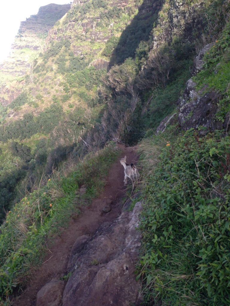
“There is a tract of country on the west coast of the island, through which no road is practicable.”  (Bowser, 1880; Maly) “For twenty miles along the northwestern coast of Kauai there extends a series of ridges, none less than 800-feet high, and many nearly 1,500-feet, terminating in a bluff that is unrivalled in majesty. Except for a very narrow, dangerous foot-path, with yawning abysses on each side, this bluff is impassable.”    (The Tourist’s Guide, Whitney, 1895)

The trail was originally built around 1860 (portions were rebuilt in the 1930s) to foster transportation and commerce for the residents living in the remote valleys.

Local labor and dynamite were used to construct a trail wide enough to accommodate pack animals loaded with oranges, taro and coffee being grown in the valleys. Stone paving and retaining walls from that era still exist along the trail.

It traverses 5-valleys over 11-miles, from Hāʻena State Park to Kalalau Beach, where it is blocked by sheer, fluted cliffs (pali;) it drops to sea level at the beaches of Hanakāpīʻai and Kalalau. The first 2 miles of the trail, from Hāʻena State Park to Hanakāpīʻai Beach, make a popular day hike.  (DLNR)

“Innumerable streams, forming wonderful cascades as they leap hundreds of feet in their tempestuous decent, pour over this bluff in the rainy season, and become mist before they reach the ocean. Beyond the raging surge, unbroken by any protecting reef, dashes against the precipitous walls of rock.”

“(T)he tourist can see all that has been described from Wednesday morning until Saturday evening, when the steamer returns to Honolulu.  If, however, he has time and the inclination to remain another week, there are many points of interest that can tempt him to make a longer stay, sights and scenes that can never be forgotten…”  (The Tourist’s Guide, Whitney, 1895)

“Here, about mid-way of what the natives call the Parre (Pali,) we landed, where is an acre or two of sterile ground, bounded on one side by the ocean, and environed on the other by a stupendous rock, nearly perpendicular, forming at its base a semicircular curve, which meets the ocean at each end. In the middle of the curve, a stupendous rock rises to the height, I should say, of about 1,500-feet.” (Bingham)

“Like Kalalau they had a trail from the table land above over the top of Kamaile and zigzagging down through the cliffs some 3,000-feet to the valley below but even this trail was difficult. At one place you have to jump a crevice only three feet wide but it goes down straight like a chimney and if you slipped you would only fall 800 feet to the rocks below. They call it the Puhi.”  (Knudsen, late-19th-century)

“(At) Nuʻalolo Kai the fishermen built and kept their canoes and the beach must have been lined with them for the landing is most always safe as the channel is narrow and a big reef to the north protecting it.” (Knudsen)

“During the Māhele, the King granted lands to the Kingdom (Government), the revenue of which was to support government functions. In the Nāpali District, the ahupuaʻa of Kalalau, Pohakuao, Honopu, Hanakāpīʻai and one-half of Hanakoa were granted to the Government Land inventory.”

“Portions of the lands that fell into the government inventory were subsequently sold as Royal Patent Grants to individuals who applied for them. The grantees were generally long-time kamaʻāina residents of the lands they sought… Thirty grants were sold in the Nāpali District to twenty-seven applicants; the lands being situated in Kalalau and Honopu.” (Hawaiian Government, 1887; Maly)

The upper region of the area was put into Territorial Forest Reserve (Nā Pali – Kona Forest Reserve) for protection in 1907. Even before that time, the concern for native forest prompted cattle eradication activities in this area during 1882 and 1890.

For most backpackers in good condition, hiking the 11-miles will take a full day. Camping permits for the Kalalau Trail are only issued for Kalalau Valley however the permits allow for 1-night camping (each way) at Hanakoa. Hanakoa and Kalalau, are the only two authorized areas for camping along the Kalalau trail.

Hanakoa is roughly 6 miles from the trailhead. Hikers are encouraged to stop/camp at Hanakoa if they possess a permit for Kalalau and need a break or anticipate bad weather. A stopover at Hanakoa, counts as one night, and therefore reduces the total number of nights permitted at Kalalau.

DLNR State Parks does not offer stand alone “hiking permits.” In order to hike from Haena State Park to Hanakāpī‘ai Beach or Hanakāpī‘ai Falls visitors need to purchase Parking and Entry Reservations for Hā‘ena SP. Make parking and entry reservations at www.gohaena.com. 

In order to hike past Hanakāpī‘ai Beach along the Kalalalau Trail a valid camping permit for Napali Coast State Wilderness Park is required whether or not you choose to camp.

Other than hiking the coast, the only way to legally access shore areas in Nāpali Coast State Wilderness Park is by boat. Personal or rented kayaks and guided kayak tours may land at two permitted areas, and motorized raft tours take passengers on shore at Nu’alolo Kai. These zodiac tours enjoy a scenic view of the coast, with snorkeling, lunch and guided tour through an archaeological complex.

One of the nicest ways to see Nāpali Coast is by paddling down the coast. This activity is permitted only during the summer months, between May 15 and September 7. Unpredictable sea conditions make it potentially unsafe during the remainder of the year. The most popular way to travel by kayak is to start from the Ha’ena (eastern) end of the coast and pull out at Polihale Beach, on the western end of the coast. This takes advantage of the prevailing currents and trade winds

Day use landings are allowed at Miloliʻi during the summer (May 15 through Labor Day) without a permit. No other boat landings are permitted within the park. Kayak landings are prohibited at all other beaches in the park, including Hanakāpīʻai, Honopu and Nuʻalolo Kai. (This only summarizes some of DLNR’s rules; review and know the rules before you go.)

© 2024 Hoʻokuleana LLC

Filed Under: Place Names Tagged With: Hawaii, Kauai, Na Pali, Nualolo Kai, Milolii, Honopu, Napali, Kalalau

June 18, 2024 by Peter T Young Leave a Comment

How American Protestant Missionaries Felt About Slavery

“Believing that the fact of our separation from the land of our birth for the work of Christ among the evangelized, does not weaken our obligation to co-operate with our brethren there, in averting the displeasure of heathen for national sins; …”

“… believing, moreover, that the field of our labors, as Christian philanthropists, ‘is the world;’ that we are solemnly commanded to do good to all men as we have opportunity; …”

“… that it is our privilege to sympathize with all who in the spirit of the gospel are making special efforts for the downtrodden slave; and especially that we cannot be guiltless if we neglect to remember those that are in bonds as bound with them; …”

“… and to seek, by all lawful means, to con’er upon all, the inestimable boon of civil and religious liberty; therefore, we do hereby agree, seeking the blessing and guidance of God, to form ourselves into an Anti-Slavery Society”. (Preamble, Constitution of the Sandwich Island Anti-Slavery Society, they formed June 9, 1841)

“The object of this Society shall be to assist in the entire extermination of slavery, by our prayers to God for the release of the enslaved, and by co-operating with those who are engaged in this good work.”

Officers chosen were, Dr Thomas Lafon, President; Reverend JS Green, 1st Vice President; Reverend T Coan, 2nd Vice President, Reverend L Andrews, Recoding Secretary and Mr SN Castle, Corresponding Secretary.

The formation of the Hawaiian Anti-Slavery Society was a culmination of an early antislavery movement in Hawai‘i that was mostly concentrated between the years 1837 and 1841. (Coleman)

Early reminders of American slavery to folks in the Islands were Anthony Allen and Betsey Stockton.

Allen, a former slave, came to the Islands in 1811. Called Alani by the Native Hawaiians, Allen served as steward to Kamehameha the Great and he acquired a parcel of about six acres. He married a Hawaiian woman and had three children who survived into adulthood. (HHS)

He “resided at Waikiki, lived as comfortably, and treated us as courteously, as any who had adopted that country before our arrival.” (Hiram Bingham)

John Papa ʻĪʻī, a neighbor of Allen, in his testimony confirming rights to the land, told how Allen acquired his land: “The Allens got this land from an old high Priest – Hewa hewa. … this land was given him in the time of ‘’Kamehameha I’.” (HJH)

By 1820, Allen owned a dozen houses, “within the enclosure were his dwelling, eating and cooking houses, with many more for a numerous train of dependents. There was also a well, a garden containing principally squashes, and in one part, a sheepfold in which was one cow, several sheep, and three hundred goats.” (Sybil Bingham Journal)

In addition to his farming, Allen provided overnight accommodations – one of the earliest known hotel uses in Waikīkī. Several references note his property as a “resort.” (Hawaiʻi’s first “hotel” may be attributed to Don Francisco de Paula Marin, sometime after 1810 on Marin’s property at Honolulu Harbor.)

Reverend Charles Stewart notes of Allen’s place in his journal, “… it is a favourite resort of the more respectable of the seamen who visit Honoruru. …” With it, he had a popular bowling alley.

He entertained often and made his property available for special occasions. “King (Kauikeaouli – Kamehameha III) had a Grand Dinner at A. D. Allen’s. The company came up at sunset. Music played very late.” (Reynolds – Scruggs, HJH)

Allen died of a stroke on December 31, 1835, leaving behind a considerable fortune to his children. In tribute to Allen, Reverend John Diell noted, “The last sun of the departed year went down upon the dying bed of another man who has long resided upon the island.”

“He was a colored man, but shared, to a large extent, in the respect of this whole community. … He has been a pattern of industry and perseverance, and of care for the education of his children. … In justice to his memory, and to my own feelings, I must take this opportunity to acknowledge the many expressions of kindness which we received from him from the moment of our arrival.”

Stockton was born in 1798 in Princeton, New Jersey, as a slave owned by the family of Robert Stockton, Esq. She was presented as a gift to the Stockton’s eldest daughter and her husband, the Reverend Ashbel Green (who was later the President of Princeton College (later known as Princeton University.)) Around 1817, Ashbel Green freed her.

Stockton often spoke to Green about her wish to journey abroad, possibly to Africa, on a Christian mission. Green introduced her to Charles S Stewart, a young missionary, newly ordained in 1821, who was about to be sent by the American Board of Commissioners for Foreign Missions (ABCFM) to Hawaiʻi.

Through a special agreement between Green, the Stewarts and the ABCFM, Stockton joined the mission both as a domestic in the Stewart household and was commissioned by the ABCFM as a missionary. She became the first single American woman sent overseas as a missionary.

Intelligent, industrious and frugal, she was aptly described as a devoted Christian, not only because of her constant attendance at church and her faith in God, but also because she supported the interests of the church, secured clothes for her students, and helped to heal the sick while continuing her domestic work to help the Stuarts. (Jackson)

Stockton has asked the mission to allow her “to create a school for the makaʻāinana (common people.) Stockton learned the Hawaiian Language and established a school in Maui where she taught English, Latin, History and Algebra. (Kealoha)

“It shows that a sincere desire to accomplish a good purpose need not be thwarted by other necessary engagements, however humble or exacting.” (Maui News, May 5, 1906)

Betsey Stockton set a new direction for education in the Islands. Stockton’s school was commended for its teaching proficiency, and later served as a model for the Hilo Boarding School and also for the Hampton Institute in Virginia, founded by General Samuel C. Armstrong. (Takara)

After residing in Hawaii for over two years, Betsey Stockton relocated to Cooperstown, New York, with the Stewarts. In subsequent years, she taught indigenous Canadian Indian students on Grape Island.

She later “led a movement to form the First Presbyterian Church of Colour in Princeton, New Jersey, in 1848.” In addition, between the period of 1848 to 1865, Stockton moved to Philadelphia to teach Black children.

Betsey Stockton made pioneering endeavors as a missionary in Hawaii, but her legacy is not well known. Still, Stockton’s school “set a new direction for education in the Islands … (It) served as a model for the Hilo Boarding School.”

Her teaching program have influence Samuel C Armstrong, the founder of Hampton Institute, who also worked as a missionary in Hawaii during this period. After a full and productive life of service for the Lord, Betsey Stockton passed away in October of 1865 in Princeton, New Jersey. (Johnson)

The 1852 Constitution of the Islands noted, “Slavery shall, under no circumstances whatever, be tolerated in the Hawaiian Islands: whenever a slave shall enter Hawaiian territory he shall be free; no person who imports a slave, or slaves, into the King’s dominions shall ever enjoy any civil or political rights in this realm; but involuntary servitude for the punishment of crime is allowable according to law.”

The first shot of the American Civil War was fired at Fort Sumter off the coast of South Carolina on April 12, 1861. Almost five months later, on August 26, 1861, Kamehameha IV issued a Proclamation that, in part, stated, “hostilities are now unhappily pending between the Government of the United States, and certain States thereof styling themselves ‘The Confederate States of America.’”

With the Proclamation, the King also stated “Our neutrality between said contending parties.” The discussion of neutrality versus partisanship had to include the reality that the Hawaiian kingdom had no standing army, and most importantly, no navy to protect its harbors if supporting either the Union or Confederacy brought the other side’s vessels to threaten the principal cities of Honolulu or Lāhainā. (Illinois-edu)

Likewise, while the majority of foreigners in Hawaiʻi were Americans from New England who supported the Union cause with great fervor, leadership and advisors to the King included European ties who believed that the Confederacy would succeed in securing its independence.

King Kamehameha IV declared a neutral stance but held largely Unionist sympathies – as did the majority of people living in Hawaiʻi. (NPS)

Prior to the Civil War, whaling and related activities were the primary economic engine of the Kingdom of Hawaiʻi. The war enabled Hawaiʻi to fill part of the void left by the absence of then-blockaded southern exports, including sugar.

Hawaiian-grown sugar soon replaced much of this southern sugar through the duration of the conflict. By the end of the war, over thirty extremely prosperous plantations were in operation and expanded to new levels previously unheard of before the war’s commencement.

© 2024 Hoʻokuleana LLC

Slavery-shackles-WC
Slavery-shackles-WC

Filed Under: Ali'i / Chiefs / Governance, Missionaries / Churches / Religious Buildings Tagged With: Hawaii, Slavery, Hawaiian Anti-Slavery Society

June 17, 2024 by Peter T Young Leave a Comment

Makawao

Makawao (literally ‘forest beginning’) is an ahupuaʻa in Hāmākuapoko, Maui.  It’s an area with both wet and dry forests.

Growing here were koa, sandalwood and ʻōhiʻa lehua; maile and ferns thrived in these forests.  In the drier regions of Makawao, sweet potato was cultivated extensively, as it was in Kula.

The landscape began its transformation following the gift of (and subsequent kapu on killing) cattle and sheep from Vancouver to Kamehameha in 1793.

The cattle numbers increased, in places to the point of becoming a dangerous nuisance.  Roaming wild cattle destroyed gardens, scared the population and were a general nuisance.

Then, on June 21, 1803, Captain William Shaler (with commercial officer Richard Cleveland,) gave Kamehameha a mare and a stallion at Lāhainā.   Soon the horses, like the cattle, were roaming freely across the Islands.

Kamehameha I employed “a varied crew with unsavory reputations who had immigrated to the islands to escape their pasts” as bullock hunters to capture the animals.  (DLNR)  The earliest Hawaiian bullock hunters hunted alone, on foot, and used guns and pit traps.  (Mills)

Most histories credit Kauikeaouli (Kamehameha III) with the idea of hiring vaqueros to manage the cattle.   Joaquin Armas arrived in Hawai‘i on April 4, 1831 and stayed in Hawai‘i at the bequest of the King.

Armas had grown up in Monterey, where undoubtedly he learned how to rope cattle and process hides.  He and others began working for the Hawaiian monarchy and teaching the Hawaiians their techniques.  (Mills)

Hawaii’s cowboys became known as paniolo, a corruption of español, the language the vaquero spoke. The term still refers to cowboys working in the Islands and to the culture their lifestyle spawned.

Missionary Hiram Bingham noted, “several striking exhibitions of seizing wild cattle, chasing them on horseback, and throwing the lasso over their horns, with great certainty, capturing, prostrating, and subduing or killing these mountain-fed animals, struggling in vain for liberty and life.”

By the 1800s, agriculture in the region had transitioned from a subsistence activity to a commercial one.  A market was developed to supply whalers who stopped to replenish their supplies; Upcountry Maui provided vegetables, meat and fruit.

In the early days only sweet potatoes had been obtainable at the Islands, but after 1830, if not sooner, cultivation of the Irish potato was taken up and during the 1840s and 1850s became of great importance.

It was shortly before 1840 that Irish potatoes were first grown in Upcountry, which proved to be so well adapted to them that it soon came to be called the ‘potato district.’ (Kuykendall)

“I had here the first glimpse at the extensive Irish potatoe region. It ranges along the mountain between 2,000 and 5,000 feet elevation, for the distance of 12-miles. The forest is but partially cleared, and the seed put into the rich virgin soil.  The crop now in the ground is immense.”  (Polynesian, July 25, 1846)

Despite claims that “the soil in this area of Maui grows rocks” due to the many areas of exposed bedrock and scattered boulders and gravels in the surrounding fields, crop production expanded exponentially in the first half of the nineteenth century with sweet potato, potatoes, corn, beans and wheat.  (DLNR)

In addition to the changing landscape, there were changes in land tenure.

Kameʻeleihiwa stated that Makawao District was the first area in Hawai‘i to experiment with land sales. In January 1846, land was made available for eventual ownership to the makaʻāinana (commoners.)

Makawao land was reportedly sold for $1-per acre; this would mark the beginning of land grants. Experimental lots purchased by Hawaiians ranged from 5 to 10-acres, with a total land area of approximately 900-acres of grant lands purchased in Makawao.  (DLNR)

Today, Makawao continues the Paniolo tradition and proudly proclaims its community as Paniolo Country.

© 2024 Hoʻokuleana LLC

Filed Under: Place Names Tagged With: Makawao, Hawaii, Maui, Horse, William Shaler, Cattle, Paniolo

  • « Previous Page
  • 1
  • …
  • 91
  • 92
  • 93
  • 94
  • 95
  • …
  • 661
  • Next Page »

Images of Old Hawaiʻi

People, places, and events in Hawaiʻi’s past come alive through text and media in “Images of Old Hawaiʻi.” These posts are informal historic summaries presented for personal, non-commercial, and educational purposes.

Info@Hookuleana.com

Connect with Us

  • Email
  • Facebook
  • LinkedIn
  • Twitter
  • YouTube

Recent Posts

  • Fire
  • Ka‘anapali Out Station
  • Lusitana Society
  • “Ownership”
  • ‘Holy Moses’
  • Mikimiki
  • Doubtful Island of the Pacific

Categories

  • Prominent People
  • Schools
  • Sailing, Shipping & Shipwrecks
  • Economy
  • Voyage of the Thaddeus
  • Mayflower Summaries
  • American Revolution
  • General
  • Ali'i / Chiefs / Governance
  • Buildings
  • Missionaries / Churches / Religious Buildings
  • Hawaiian Traditions
  • Military
  • Place Names

Tags

Albatross Al Capone Ane Keohokalole Archibald Campbell Bernice Pauahi Bishop Charles Reed Bishop Downtown Honolulu Eruption Founder's Day George Patton Great Wall of Kuakini Green Sea Turtle Hawaii Hawaii Island Hermes Hilo Holoikauaua Honolulu Isaac Davis James Robinson Kamae Kamaeokalani Kamanawa Kameeiamoku Kamehameha Schools Lalani Village Lava Flow Lelia Byrd Liliuokalani Mao Math Mauna Loa Midway Monk Seal Northwestern Hawaiian Islands Oahu Papahanaumokuakea Marine National Monument Pearl Pualani Mossman Queen Liliuokalani Thomas Jaggar Volcano Waikiki Wake Wisdom

Hoʻokuleana LLC

Hoʻokuleana LLC is a Planning and Consulting firm assisting property owners with Land Use Planning efforts, including Environmental Review, Entitlement Process, Permitting, Community Outreach, etc. We are uniquely positioned to assist you in a variety of needs.

Info@Hookuleana.com

Copyright © 2012-2024 Peter T Young, Hoʻokuleana LLC


Loading Comments...