Images of Old Hawaiʻi

  • Home
  • About
  • Categories
    • Ali’i / Chiefs / Governance
    • American Protestant Mission
    • Buildings
    • Collections
    • Economy
    • Missionaries / Churches / Religious Buildings
    • General
    • Hawaiian Traditions
    • Other Summaries
    • Mayflower Summaries
    • Mayflower Full Summaries
    • Military
    • Place Names
    • Prominent People
    • Schools
    • Sailing, Shipping & Shipwrecks
    • Voyage of the Thaddeus
  • Collections
  • Contact
  • Follow

May 7, 2025 by Peter T Young 1 Comment

Kawaihae Harbor

Kawaihae is also generally referenced as Pelekane, which means ‘British,’ possibly named after the Young and the Davis families who lived there (when Isaac Davis (born in Pembrokeshire, Wales) died in 1810, his friend and co-advisor to Kamehameha, John Young (an Englishman born in Liverpool,) looked after Davis’ children.)

The vicinity around what is now Kawaihae Harbor (“the water of wrath”) has been the scene of many important events, from the killing of Kamehameha’s rival and cousin, Keōua in 1791, to interactions with foreign visitors, including Captain George Vancouver of Great Britain, Otto von Kotzebue of Russia, and dignitaries from France, the United States and other nations.

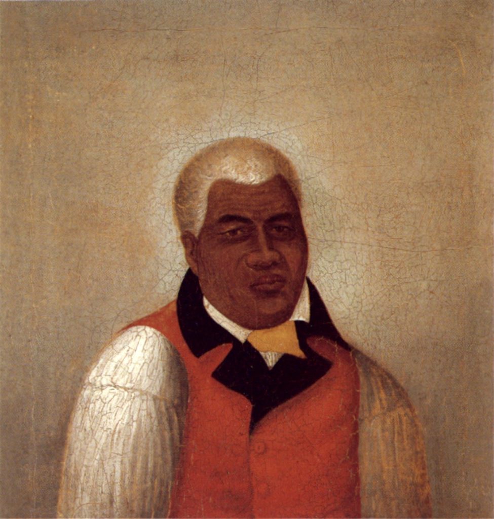
Kamehameha had a house here.  Following his death in 1819 and the succession of Liholiho to rule as Kamehameha II, Kawaihae served as the initial Royal Center for Liholiho, who sought consolidation of his forces and consecration of his leadership role, there.  (Kelly)

When the Pioneer Company of the American Protestant missionaries arrived the next year, they first stopped at Kawaihae; this is where the missionaries first learned that the kapu system had been abolished and heiau were destroyed.

Kawaihae’s position as the center of inter-island trade and transport on northwest Hawai‘i is detailed in a description published in the Merchant’s Magazine and Commercial Review in 1858:

“Kawaihae is a small village in the bay of the same name in the western shore of Hawaii…It derives its importance from being the port of the rich and extensive grazing uplands of Waimea, one of the finest agricultural districts of the islands, which has not yet developed its full resources.”

“Forty or fifty whale ships have annually visited this port for the last few years, to procure salted beefs and Irish potatoes, which are considered the finest produced in the islands.“

Features of the village in 1861 were described by Charles de Varigny, the secretary of the French Consulate in Honolulu (who later served Kamehameha V as finance minister and minister of foreign affairs.)

Varigny observed how much of the village was given over to its commercial functions: “The village consists chiefly of a single large wooden structure which serves as a country store and warehouse for the products of the district. Around the shop are clustered several makeshift buildings providing annexes for further storage.”

“A small wharf serves for the departure and landing of travelers. At a short distance from shore floats an old stripped-down vessel, its melancholy hull balancing at anchor and providing storage for products arriving from Honolulu.” (pacificworlds)

Over time, Kawaihae and Waimea (up the hill) developed a synergistic relationship.  The area was a canoe landing area, whether for commerce or combat.  (This is where Maui’s chief Kamalālāwalu landed in his assault against Lonoikamakahiki’s Hawaiʻi forces (Lono won.))  But Kawaihae’s presence was really focused on commerce as a landing site.

A 1914 map of Kawaihae Village shows a concentration of development along the shoreline; the uplands of the Kawaihae region remained undeveloped pasture land.

During WWII war years (1941-1945,) Kawaihae’s role as the shipping outlet for Waimea was intensified.  Troops were shipped in and out through Kawaihae. At the southern end of the bay, in Kawaihae 2, amphibious landing exercises were conducted and military emplacements were set up in the area of Puʻukohola Heiau.

The war in the Pacific had been over less than a year when on April 1, 1946, an earthquake off the Aleutian Islands caused a tsunami that devastated the Hawaiian Islands.  Although no lives were lost at Kawaihae, its effects wiped out commercial fishing activity there and it was reported that the tsunami “…was the beginning of the end for the Kawaihae Fishing Village. People left.”  (Cultural Surveys)

The old landing had been destroyed in the 1946 tsunami and the one built in 1937 had proven unsafe in high seas. By the 1950s, the need for improved harbor facilities at Kawaihae was apparent.

The Kawaihae Deep-Draft Harbor project was authorized by the US Congress in 1950; to be constructed were: “an entrance channel 400 feet wide, approximately 2,900 feet long, and 40 feet deep; a harbor basin 1,250 feet square and 35 feet deep; and a breakwater with a maximum crest elevation 13 feet above low water and approximately 4,400 feet long, of which 3,200 feet would be protected with heavy stone revetment.”

The harbor was created by dredging part of an extensive coral reef which extended 4,000-feet seaward and ran along the shore more than a mile south of Kawaihae town; the reclaimed reef area created a coral flat peninsula that extends approximately 1,000-feet makai (seaward) of the piers across the natural reef, forming a beach along the south harbor boundary and terminating at the outer breakwater.

The harbor’s construction was hailed as an “economic shot in the arm,” for sugar planters in the Kohala region of the island would no longer had to ship their crops overland to Hilo or to Kailua-Kona. The harbor would serve military needs as well. The Army was about to acquire a 100,000-acre training site nearby and could unload supplies at Kawaihae Harbor.  (Cultural Surveys)

At the completion of construction in 1959 (officially dedicated on October 5, 1959,) the Kawaihae facilities included an inter-island terminal, mooring areas, and a large harbor basin with a wide entrance channel.  Harbor modifications in 1973 widened the entrance channel and enlarged the basin (a little over 71-acres.)

The South Kawaihae Small Boat Harbor entrance channel and 850-foot West breakwater was constructed as part of Operation Tugboat and completed in December 1970.  As part of Project Tugboat, the Army used conventional high explosives to blast an 830-foot entrance channel, 120-feet wide/12-feet deep and a 200 by 200-foot turning basin.

(“Project Tugboat” was conducted by the Army’s Nuclear Cratering Group; perhaps because of this, some suggest nuclear explosives were used to clear the small boat harbor.  However, twelve 10-ton charges of an aluminized ammonium nitrate slurry explosives (placed 36-feet deep and 100 to 120-feet apart) were used; they were meant to simulate the yield of a nuclear explosion, but were not radioactive.)

After years of delay, it was recently announced that a project to improve the eastern portion of Kawaihae Small Boat Harbor is moving forward.  Among the improvements are a 445-foot long floating dock, as well as a 47-foot-long access ramp, gangway and 25 berthing stalls. Later a paved access road and new water system is planned.

© 2025 Hoʻokuleana LLC


Filed Under: General, Place Names, Prominent People, Sailing, Shipping & Shipwrecks, Economy Tagged With: Liholiho, Kamehameha II, John Young, South Kohala, Kawaihae, Puukohola, Pelekane, Hawaii, Hawaii Island, Isaac Davis, Kamehameha

December 23, 2023 by Peter T Young Leave a Comment

Luahinewai

“Kekaha wai ‘ole na Kona” (“waterless Kekaha of the Kona district”) speaks of Kekaha, the portion of North Kona extending north of Kailua Bay from Honokōhau to ʻAnaehoʻomalu.  It is described as “a dry, sun-baked land.”

Here is Kīholo, situated within the ahupuaʻa of Puʻuwaʻawaʻa.  Kīholo (lit. the Fishhook) refers to the legend which describes how in 1859 the goddess Pele, hungry for the ‘awa and mullet, or ʻanae, which grew there in the great fishpond constructed by Kamehameha I, sent down a destructive lava flow, grasping at the fish she desired.  (DLNR)

This place name may have been selected as a word descriptive of the coastline along that part of the island where the east-west coast meets the north-south coast and forms a bend similar to the angle between the point and the shank of a large fishhook. There is no confirmation for this theory, except for our knowledge that Hawaiian place names have a strong tendency to be descriptive.  (Kelly)

While only a handful of houses are here today, in ancient times, there was a fishing village with many more that called Kīholo home.

Here, too, is Luahinewai, an anchialine pond/pool – (these are shoreline pools without surface connection to the sea, having waters of varying salinity and showing tidal rhythms (Brock.))  Luahinewai (old lady’s water) is said to refer to a water-formed supernatural moʻo (lizard) that lived there.

Of Luahinewai, JWHI Kihe writes (in Ka Hoku o Hawaiʻi; Maly:) “There is a large pond near Kīholo and Laemanō; it is a famous bathing place of the chiefs of ancient times. The water there is cold, and causes the skin to tingle. Because it is so cold, it is like ice water.”

“It is said that there is an opening in this pond by which an old woman (luahine) enters. And there below the pond, are said to be laid out the bones of the chiefs of ancient times.”

“This pond is about five fathoms deep at its deepest point near the center of the pond. That too, is where the water is coldest. And if you should dive in and pass this area, you will find the cold water and not be able to stay there long. You will quickly retreat and wrap yourself up with a cloth.”

“The one who dives into it at its deepest point, will also see that his/her skin will turn red like the red coral. There are also pebbles at the bottoms of this pond, and it is a good thing, as you will not strike your foot upon any rocks.”

“The chiefs and fearless warriors of ancient times have passed from this side of the dark waters of death, and the bathing pool of Luahine Wai remains with its beauty, playing in the ocean mist and the gentle blowing of the breezes. This generation too, shall pass, and the next generation that follows, but Luahinewai shall remain as was found in the beginning.”

Luahinewai was a famous rest stop during canoe voyages along the coast.  (Ulukau) “… the ship sailed, pausing at Luahinewai to bathe and visit with that strange water in the lava.  After an enjoyable stop at the water with the pretty pebbles, they again sailed.”  (ʻĪʻi)

In 1790, Kamehameha I and his chiefs were living at Kawaihae. Following advice of a priest from Kaua‘i, Kamehameha undertook the reconstruction of the heiau Pu‘u Koholā, to dedicate it as a house for his god Kūkaʻilimoku.  During this time, “thousands of people were encamped on the neighboring hillsides.”

According to Kamakau, Kamehameha “… summoned his counselors and younger brothers, chiefs of the family and chiefs of the guard, all the chiefs, lesser chiefs, and commoners of the whole district. Not one was allowed to be absent except for the women, because it was tabu to offer a woman upon the altar; a man alone could furnish such a sacrifice.”

“The building of the heiau of Pu‘u Koholā was, as in ancient times, directed by an expert—not in oratory, genealogy, or the prophetic art, but by a member of the class called hulihonua who knew the configuration of the earth (called kuhikuhi pu‘uone.)”

“Their knowledge was like that of the navigator who knows the latitude and longitude of each land, where the rocks are, the deep places, and the shallow, where it is cold and where warm, and can tell without mistake the degrees, east or west, north or south. Such knowledge, taught on Kauai, one could apply anywhere in the world; so Kapoukahi had instructed Ha‘alo‘u (a chiefess relative of Kamehameha’s) to the letter.”

“As soon as the heiau was completed, just before it was declared free, Kamehameha’s two counselors, Keaweaheulu and Kamanawa (who resided at Kīholo,) were sent to fetch Keōua, ruling chief of the eastern end of the island of Hawaiʻi”

“Keōua was living in Kaʻū mauka in Kahuku with his chiefs and warriors of his guard. Keaweaheulu and his companion landed at Ka‘iliki‘i and began the ascent to Kahehawahawa … Close to the extreme edge of the tabu enclosure of Keōua’s place the two … messengers rolled along in the dirt until they came to the place where Keōua was sitting, when they grasped his feet and wept.”

“We have come to fetch you, the son of our lord’s older brother, and to take you with us to Kona to meet your younger cousin, and you two to be our chiefs and we to be your uncles. So then let war cease between you.”

Keōua agreed to accompany his uncles. Some of the party traveled by foot overland, while Keōua and some of his trusted counselors and guards traveled with the messengers by canoe.

“They left Kailua and went as far as Luahinewai at Kekaha, where they landed the canoes. Keōua went to bathe, and after bathing he cut off the end of his penis (ʻomuʻo), an act which believers in sorcery call “the death of Uli,” and which was a certain sign that he knew he was about to die.

(“The death of Uli” refers to death caused by the vengeance of the sorcerer, since Uli is the goddess worshipped by Sorcerers. The part cut off is used for the purpose of sorcery so that those who do a man to death may themselves be discovered and punished.)  (DLNR)

They kept on their course until near Mailekini, when Keʻeaumoku and some others carrying spears, muskets, and other weapons broke through the formation of the fleet, surrounding the canoes of Keōua, separating them from those of Keaweaheulu and his followers and calling to Kamanawa to paddle ahead.

Keōua rose and called to Kamehameha, “Here I am!” Kamehameha called back, “Stand up and come forward that we may greet each other.”

Keōua rose again, intending to spring ashore, when Keʻeaumoku thrust a spear at him, which Keōua dodged, snatched, and thrust back at Keʻeaumoku, who snatched it away. Keōua and all those who were with him on the canoe were killed… By the death of Keōua, Kuʻahuʻula and his placing in the heiau of Pu‘u Kohola the whole island of Hawaii became Kamehameha’s.”

© 2023 Hoʻokuleana LLC

Filed Under: Ali'i / Chiefs / Governance, Place Names Tagged With: Hawaii Island, Kamehameha, Keoua, Kekaha, Kiholo, Puukohola, Luahinewai, Hawaii

October 27, 2023 by Peter T Young Leave a Comment

The Last Battle

Kamehameha I began a war of conquest, winning his first major skirmish in the battle of Mokuʻōhai (a fight between Kamehameha and Kiwalaʻo in July, 1782 at Keʻei, south of Kealakekua Bay on the Island of Hawaiʻi.)  Kiwalaʻo was killed.

By 1795, having fought his last major battle at Nuʻuanu on O‘ahu with his superior use of modern weapons and western advisors, he subdued all other chiefdoms (with the exception of Kauai).

Then, Kamehameha launched his first invasion attempt on Kauai in April of 1796. About one-fourth of the way across the ocean channel between O‘ahu and Kauai a storm thwarted Kamehameha’s warriors when many of their canoes were swamped in the rough seas and stormy winds, and then were forced to turn back.

With Hawaiʻi Island under Kamehameha’s control, conflict, there, supposedly ended with the death of Keōua at Kawaihae Harbor in early-1792 and the placement of the vanquished chief’s body in the Heiau ‘o Puʻukoholā at Kawaihae.

However, after a short time, another chief entered into a power dispute with Kamehameha; his name was Nāmakehā (the brother of Kaʻiana, a chief of Kauai who had been killed in the Battle of Nuʻuanu.)

Previously, Kamehameha asked Nāmakehā (who lived in Kaʻū, Hawai‘i) for help in fighting Kalanikūpule and his Maui forces on O‘ahu, but Nāmakehā ignored the request.

Instead, Nāmakehā prepared a rebellion against Kamehameha to take place on Hawai‘i Island.

Hostilities erupted between the two that lasted from September 1796 to January 1797.

Kamehameha, on Oʻahu at the time, returned to his home island of Hawaiʻi with the bulk of his army to suppress the rebellion.  The battle took place at Kaipalaoa, Hilo.

Kamehameha defeated Nāmakehā.  The undisputed sovereignty of Kamehameha was thus established over the entire Island chain (except Kauai and Niʻihau.)

This was the final battle fought by Kamehameha to unite the archipelago.  (Kamehameha negotiated a settlement with King Kaumualiʻi for the control of Kauai and Niʻihau, in 1810.)

Although Kamehameha’s warriors had won the battle over Nāmakehā, they then turned their rage upon the villages and families of the vanquished. It so happens that this included the family of ʻŌpūkahaʻia, who had had supported Nāmakehā.  They fled to the mountains and hid for several days in a cave.

The warriors found the family and ultimately killed ʻŌpūkahaʻia’s parents and infant brother.  (ʻŌpūkahaʻia was captured, later trained as a Kahuna under his uncle, traveled to the continent and ultimately turned to Christianity and was the inspiration for the American missionaries to come to Hawaiʻi.)

Interestingly, it was about the same time of the Nāmakehā Rebellion that Kamehameha decreed Ke Kānāwai Māmalahoe (The Law of the Splintered Paddle.)

A story suggests that Kamehameha I was fighting on the Island of Hawaiʻi.  Chasing a couple fishermen (presumably with the intention to kill them), his leg was caught in the reef and, in defense, one of the fisherman hit him on the head with a paddle, which broke into pieces.

Kamehameha was able to escape (because the fisherman fled, rather than finishing him off.)  The story continues that Kamehameha learned from this experience and saw that it was wrong to misuse power by attacking innocent people.

Later, Kamehameha summoned the two fishermen.  When they came, he pardoned them and admitted his mistake by proclaiming a new law, Kānāwai Māmalahoe – Law of the Splintered Paddle.

The original 1797 law:

Kānāwai Māmalahoe (in Hawaiian:):

E nā kānaka,
E mālama ʻoukou i ke akua
A e mālama hoʻi ke kanaka nui a me kanaka iki;
E hele ka ‘elemakule, ka luahine, a me ke kama
A moe i ke ala
‘A‘ohe mea nāna e ho‘opilikia.
Hewa nō, make.

Law of the Splintered Paddle (English translation:)

Oh people,
Honor thy gods;
Respect alike [the rights of]
People both great and humble;
See to it that our aged,
Our women and our children
Lie down to sleep by the roadside
Without fear of harm.
Disobey, and die.

Kamehameha’s Law of the Splintered Paddle of 1797 is enshrined in the State constitution, Article 9, Section 10:  “Let every elderly person, woman and child lie by the roadside in safety”.  It has become a model for modern human rights law regarding the treatment of civilians and other non-combatants.

Kānāwai Māmalahoe appears as a symbol of crossed paddles in the center of the badge of the Honolulu Police Department.  A plaque, facing mauka on the Kamehameha Statue outside Ali‘iōlani Hale in Honolulu, notes the Law of the Splintered Paddle.

The image shows Kamehameha, as depicted by Herb Kane.

© 2023 Hoʻokuleana LLC


Filed Under: Ali'i / Chiefs / Governance Tagged With: Nuuanu, Puukohola, Kaumualii, Hawaii, Namakeha, Hawaii Island, Kanawai Mamalahoe, Hilo, Kamehameha Statue, Kamehameha, Aliiolani Hale, Keoua, Kiwalao, Mokuohai

February 28, 2023 by Peter T Young Leave a Comment

It was a dark and stormy night …

“It was said that on a certain night of heavy down pouring rain – the lightning struck its wrathful flashes into the sky – the thunder pounded with all its might – the stormy wind veered every which way – the red water churned in the streams.”  (Poepoe, Ahlo)

The child born that night was of royal blood, and was destined to become not only the king of Hawaiʻi, but the conqueror and sovereign of the group.

They say the child was poʻolua, “that is, a child of two fathers, (it) was considered a great honor by chiefs of that period.” (Luomala)  Some say that his mother, Kekuʻiapoiwa (married to Keōua,) had a liaison with Kahekili (ruler of Maui.)

Though Kahekili was thought to possibly be his biological father, he was raised by his parents (and was considered the son of Kekuʻiapoiwa and Keōua.)

The exact year of his birth is not known; different historians/writers place the year of his birth from about 1736 to 1759.

He was said to be born at Kokoiki (”little blood,” referring to the first signs of childbirth – Kokoiki is one of the star names listed in the Kumulipo chant.)

Another notes, “(A) bright and beautiful star, appeared at Kokoiki on the night before the child was born and is hence called Kokoiki.”  (Kūʻokoʻa Home Rula, Ahlo)  (Scientific study places Halley’s Comet in the same relative position in the Hawaiian sky on December 1, 1758.  (Ahlo))

Keʻāulumoku predicted that he “would triumph over his enemies, and in the end be hailed as the greatest of Hawaiian conquerors.”  (Kalākaua)

Word went out to find and kill the baby, but the Kohala community conspired to save him.

“A numerous guard had been set to wait the time of birth. The chiefs kept awake with the guards (for a time,) but due to the rain and the cold, the chiefs fell asleep, and near daybreak Kekuʻiapoiwa went into the house and, turning her face to the side of the house at the gable end, braced her feet against the wall.”

“A certain stranger (Naeʻole) was outside the house listening, and when he heard the sound of the last bearing-down pain (kuakoko), he lifted the thatch at the side of the house, and made a hole above.”

“As soon as the child was born, had slipped down upon the tapa spread out to receive it, and Kekuʻiapoiwa had stood up and let the afterbirth (ewe) come away, he covered the child in the tapa and carried it away.”  (Kamakau)

The young child, Kamehameha, was carried on a perilous journey through Kohala and Pololū Valley to Awini.  (KamehamehaDayCelebration)

Hawi, meaning ”unable to breathe,” was where the child, being spirited away by a servant, required resuscitation and nursing. Kapaʻau, meaning ”wet blanket,” was where heavy rain soaked the infant’s kapa (blanket.)  Halaʻula (scattered blood) was the town where soldiers were killed in anger.  (Sproat – (Fujii, NY Times))  Some believe Kamehameha also spent much of his teen years in Pololū (long spear.)

“Kamehameha (Kalani Pai‘ea Wohi o Kaleikini Keali‘ikui Kamehameha o ‘Iolani i Kaiwikapu Kaui Ka Liholiho Kūnuiākea) was a man of tremendous physical and intellectual strength. In any land and in any age he would have been a leader.”  (Kalākaua, ROOK)

While still in his youth, Kamehameha proved his right to rule over all the islands by lifting the Naha Stone at Pinao Heiau in Pi‘ihonua, Hilo (c. 1773.) (ROOK)

By the time of Cook’s arrival (1778,) Kamehameha had become a superb warrior who already carried the scars of a number of political and physical encounters. The young warrior Kamehameha was described as a tall, strong and physically fearless man who “moved in an aura of violence.” (NPS)

The impress of his mind remains with his crude and vigorous laws, and wherever he stepped is seen an imperishable track. He was so strong of limb that ordinary men were but children in his grasp, and in council the wisest yielded to his judgment. He seems to have been born a man and to have had no boyhood.  (Kalākaua)

He was always sedate and thoughtful, and from his earliest years cared for no sport or pastime that was not manly. He had a harsh and rugged face, less given to smiles than frowns, but strongly marked with lines indicative of self-reliance and changeless purpose.  (Kalākaua)

He was barbarous, unforgiving and merciless to his enemies, but just, sagacious and considerate in dealing with his subjects. He was more feared and admired than loved and respected; but his strength of arm and force of character well fitted him for the supreme chieftaincy of the group, and he accomplished what no one else could have done in his day.  (Kalākaua)

In 1790 (at the same time that George Washington was serving as the US’s first president,) the island of Hawaiʻi was under multiple rule; Kamehameha (ruler of Kohala, Kona and Hāmākua regions) successfully invaded Maui, Lanai and Molokai.

He sent an emissary to the famous kahuna (priest, soothsayer,) Kapoukahi, to determine how he could conquer all of the island of Hawaiʻi.  According to Thrum, Kapoukahi instructed Kamehameha “to build a large heiau for his god at Puʻukoholā, adjoining the old heiau of Mailekini.”

It is estimated that the human chain from Pololū Valley to Puʻukohola had somewhere between 10,000-20,000 men carrying stones from Pololū Valley to Kawaihae. (NPS)

After completing the heiau in 1791, Kamehameha invited Keōua to come to Kawaihae to make peace.  However, as Keōua was about to step ashore, he was attacked and killed by one of Kamehameha’s chiefs.

With Keōua dead, and his supporters captured or slain, Kamehameha became King of Hawaiʻi island, an event that according to prophesy eventually led to the conquest and consolidation of the islands under the rule of Kamehameha I.

It was the koa (warriors) of Hilo who supported Kamehameha in his early quest to unite Moku O Keawe. After gaining control of Moku O Keawe, Kamehameha celebrated the Makahiki in Hilo in 1794.  (ROOK)

The village and area of Hilo was named by Kamehameha after a special braid that was used to secure his canoe. Kamehameha and Keōpūolani’s son, Liholiho (Kamehameha II) was born in Hilo (1797.)  (ROOK)

Kamehameha’s great war fleet, Peleleu, that was instrumental in Kamehameha’s conquest, was built and based at Hilo (1796-1801). After uniting all of the islands under his rule in 1810, Hilo became Kamehameha’s first seat of government.  (ROOK)

It was in Hilo that Kamehameha established his greatest law, the Kānāwai Māmalahoe (Law of the Splintered Paddle).  (ROOK)  Kamehameha’s Law of the Splintered Paddle of 1797 is enshrined in the State constitution, Article 9, Section 10:  “Let every elderly person, woman and child lie by the roadside in safety”.

It has become a model for modern human rights law regarding the treatment of civilians and other non-combatants.  Kānāwai Māmalahoe appears as a symbol of crossed paddles in the center of the badge of the Honolulu Police Department.  The image shows Kamehameha as a young warrior (HerbKane.)

© 2023 Hoʻokuleana LLC


Filed Under: Ali'i / Chiefs / Governance Tagged With: Hilo, Law of the Splintered Paddle, Kamehameha, Kanawai Mamalahoe, Kahekili, Liholiho, Keoua, Kohala, North Kohala, Puukohola, Naha Stone, Hawaii, Kokoiki, Hawaii Island, Kekuiapoiwa

November 27, 2022 by Peter T Young Leave a Comment

Hale O Kapuni

Hawaiian oral tradition and early local informants suggest a heiau (temple,) Hale O Kapuni, existed underwater just offshore in Pelekane Bay near Kawaihae – below the Puʻu Koholā Heiau (“Hill of the Whale”) and Mailekini Heiau (below Puʻu Koholā Heiau halfway down the hill.)

Kamehameha I is said to have used this heiau, and sharks were fed here. Rocks from here may have been used to build Pu‘u-koholā heiau. (Lit., house of Kapuni (a high priest of the chief Keawe.))  (Maly)

Due to tidal actions, sediment that accumulated from runoff from the uplands and nearby construction of the Kawaihae Harbor, this submerged heiau has never been located or documented through underwater archaeology – however, folklore suggests it existed and was dedicated to the shark gods.

Theophilus Davies arrived off Kawaihae in 1859, passing in the water beneath a “sacred enclosure” about twenty yards square and formed by a massive stone fence five feet high (probably Mailekini Heiau).

A large stone formed its altar, he said, and here the bleeding victims were placed before the gods until they became offensive, when they were carried to a heap of stones in the ocean (a little to seaward of our boat) and devoured by the sharks, the supposed deities. (NPS)

The presence of Hale-o-Kapuni is well known to local inhabitants: “When the tide was real low, big boulders use [sic] to come out, and it’s all build [sic] up of big boulders see, so you know it’s man made.”

“And around the side area is all deep and it’s anywhere’s [sic] from low water mark 5 feet. About 8, 9 feet when high water mark. … It was built under water purposely…. “  (Doi, NPS)

An informant pointed out to Marion Kelly the location of the heiau structure, now covered by silt washed off the coral stockpile area nearby.

Anthropologist Lloyd Soehren stated that, as children, older residents of the area remembered seeing the heiau rising about two feet above the water.

One person remembered a channel leading into a larger area within the temple where the bodies were placed for the sharks.  (NPS)

Per Pukui, ʻaumākua are family or personal gods, deified ancestors who might assume the shape of the animal, plant or other feature they represent.

Here, at Hale O Kapuni, it is believed that the heiau was dedicated to sharks.  “The shark was perhaps the most universally worshipped of all the aumakuas, and, strange to say, was regarded as peculiarly the friend and protector of all his faithful worshippers.”  (Emerson)

“Each several locality along the coast of the islands had its special patron shark, whose name, history, place of abode, and appearance, were well known to all frequenters of that coast. Each of these sharks, too, had its kahu [keeper,] who was responsible for its care and worship”.  (Emerson)

“Some of the chiefs under Kamehameha, such as Alapaʻi-malo-iki and Ka-uhi-wawae-ono, were murdering chiefs who did not keep the law against killing men, but went out with their men to catch people for shark bait.”  (Kamakau)

Pōhaku o Alapaʻi ku palupalu mano, “the rock of the chief named Alapaʻi of the one who puts the human shark bait out,” originally stood in the shade of a large kiawe tree on the shore below Mailekini Heiau.  (NPS)

One early account said that King Kamehameha sat there while his staff compiled the tally of the latest fishing expeditions, and that somewhere near the stone might have been the spot of Keōua’s death.

Apple states that although referred to as Kamehameha’s Chair, the rock is by local tradition more closely associated with one of Kamehameha’s staff chiefs named Alapaʻi Kupalupalu Mano who liked to use human flesh for shark bait and watched from this point as sharks entered Hale-o-Kapuni to devour the food offerings put out for them.  (NPS)

Apple notes that catching sharks was a sport indulged in by high chiefs and conjectured that perhaps the animals were conditioned to rotten flesh in the offshore temple so that they could be enticed with it into the deeper water and easily noosed.

Today, this area is known to be frequented by sharks.  In the early morning hours, you can usually see the sharks plying the waters just offshore, near where the heiau is believed to be located.

Click here for a link to a video on sharks in and around the area identified as where Hale O Kapuni in Pelekane Bay is located (Pacific Islands National Parks:)

© 2022 Hoʻokuleana LLC


Filed Under: Hawaiian Traditions, Place Names Tagged With: Puukohola, Pelekane, Mailekini, Hale O Kapuni, Hawaii, Kawaihae

  • 1
  • 2
  • Next Page »

Images of Old Hawaiʻi

People, places, and events in Hawaiʻi’s past come alive through text and media in “Images of Old Hawaiʻi.” These posts are informal historic summaries presented for personal, non-commercial, and educational purposes.

Info@Hookuleana.com

Connect with Us

  • Email
  • Facebook
  • LinkedIn
  • Twitter
  • YouTube

Recent Posts

  • Pohaku O Kauai
  • Andover Theological Seminary
  • Queen of the Silver Strand
  • Lanai Tsunami
  • Maliko Gulch Inverted Siphon
  • Kahanu
  • Ah Ping

Categories

  • Missionaries / Churches / Religious Buildings
  • Hawaiian Traditions
  • Military
  • Place Names
  • Prominent People
  • Schools
  • Sailing, Shipping & Shipwrecks
  • Economy
  • Voyage of the Thaddeus
  • Mayflower Summaries
  • American Revolution
  • General
  • Ali'i / Chiefs / Governance
  • Buildings

Tags

Albatross Al Capone Ane Keohokalole Archibald Campbell Bernice Pauahi Bishop Charles Reed Bishop Downtown Honolulu Eruption Founder's Day George Patton Great Wall of Kuakini Green Sea Turtle Hawaii Hawaii Island Hermes Hilo Holoikauaua Honolulu Isaac Davis James Robinson Kamae Kamaeokalani Kamanawa Kameeiamoku Kamehameha Schools Lalani Village Lava Flow Lelia Byrd Liliuokalani Mao Math Mauna Loa Midway Monk Seal Northwestern Hawaiian Islands Oahu Papahanaumokuakea Marine National Monument Pearl Pualani Mossman Queen Liliuokalani Thomas Jaggar Volcano Waikiki Wake Wisdom

Hoʻokuleana LLC

Hoʻokuleana LLC is a Planning and Consulting firm assisting property owners with Land Use Planning efforts, including Environmental Review, Entitlement Process, Permitting, Community Outreach, etc. We are uniquely positioned to assist you in a variety of needs.

Info@Hookuleana.com

Copyright © 2012-2024 Peter T Young, Hoʻokuleana LLC


Loading Comments...