Images of Old Hawaiʻi

  • Home
  • About
  • Categories
    • Ali’i / Chiefs / Governance
    • American Protestant Mission
    • Buildings
    • Collections
    • Economy
    • Missionaries / Churches / Religious Buildings
    • General
    • Hawaiian Traditions
    • Other Summaries
    • Mayflower Summaries
    • Mayflower Full Summaries
    • Military
    • Place Names
    • Prominent People
    • Schools
    • Sailing, Shipping & Shipwrecks
    • Voyage of the Thaddeus
  • Collections
  • Contact
  • Follow

August 13, 2024 by Peter T Young Leave a Comment

Waihī Nui

“Manoa valley ends in what is called ‘the pen.’ It has walls with a trail into Pauoa valley.” (Towse)  “Rocky, wooded ridges enclose it to right and left, and straight ahead is the black, sheer face of Konahuanui.”  (Loomis)

Translated “his large seeds (testicles,)” the name Kōnāhuanui is said to come from a story summarized by T Kelsey: “when a man, probably a giant, chased a woman who escaped into a cave, he tore off his testes and threw them at her”.    (Kawaharada)

Kōnāhuanui is the highest peak in the Koʻolau Mountains and is the northwest corner of the Mānoa Ahupua‘a boundary. It was the home of the gods Kāne and Kanaloa.

It is also home to a moʻo goddess, a large mythic lizard that lives in freshwater pools and streams. Rain clouds gather around its peak, and its Kona side, often ribboned with waterfalls, is the wettest area of Honolulu: here is the source of the waters of Mānoa and Nuʻuanu valleys.

“[T]his cul-de-sac at its makai, or southern, angle, along the stream called ‘Aihualama. The trail into Nu‘uanu opened at its upper left, or northwestern, angle. Here was a good path for a kama‘aina going alone from valley to valley”.  (Loomis)

In an 1882 map of Manoa prepared by Baldwin, there are several waterfalls back in the valley, including, Waiihi-nui (Waihī Nui), Waihii-iki (Waihī Iki), Luaaulaea and Naniuapo.

“[T]he ground rises rapidly for a few rods, to a thicket of hibiscus and eugenia, at the foot of a magnificent mountain, exhibiting from the base to its summit a perpendicular height of a thousand feet – as rich a variety of projecting cliff and wild recess, of dripping rocks and mantling foliage, of graceful creeper, pendant shrub, and splendid flower, as Arcadia itself can boast.” (Stewart)

“On the curve of high cliffs at the mauka boundary of Manoa sheer white splashes of waterfall filled pools hidden from the casual eye in recesses where Kaahumanu herself loved to bathe among cool winds and soft air laden with fragrance of awapuhi and maile.” (Damon)

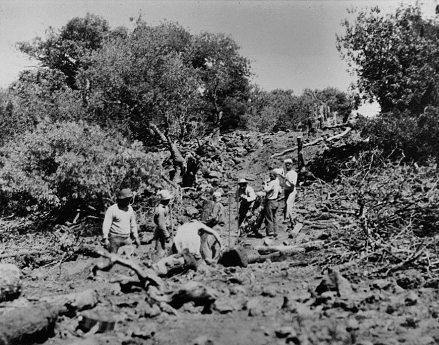
The water from these falls converge into Manoa Stream. Mānoa Valley formerly supported a large population with scores of lo‘i kalo that were watered by the many freshwater streams. (ASM)

“When we had seen the piece of land appropriated by Kalaimoku or Mr. Pitt to our use, and had given directions to the natives who cultivated the taro on the land, we indulged ourselves with a pleasant bath in a cooling stream that waters the valley, and we returned across a part of the mountain which lies between that place and Honoruru valley.” (Missionaries Chamberlain, Loomis, Blatchely and Bingham; Damon)

“The taro patches that followed the stream bed down the center of the valley were now either vegetable gardens, pasture land, or abandoned. … AIso much of the stream’s water had been diverted for the use of the island’s increasing population. The taro farms that were in the valley from the time the first foreign observer stepped into it were gone for good.” (DeLeon)

“In 1919 the Hawaii Sugar Planters’ Association established an experimental substation in the rear of the valley. Here sugar cane was raised for experimental purposes. Trees from all over the Pacific were also brought to the substation to see how they would adapt to the Hawaiian environment. The substation became Lyon Arboretum, which is part of the University of Hawaii.” (DeLeon)

There is something about falling water that fascinates a human being.

As noted above, here is Waihī Nui (‘trickling water’), Mānoa Falls. It’s in the backyard of Hawai‘i’s largest population and visitor destination. A bus line takes you within walking distance to the trailhead.

It is one of the most popular trail destinations on O‘ahu; Mānoa Falls sees an average of 200,000 visitors annually.  (DLNR)  The Mānoa Falls Trail is part of DLNR’s Na Ala Hele Trail & Access Program.

The video (done by DLNR) shows people down by the falls.  Don’t go there; rather, there is a viewing area contained by a rock wall at the falls – heed all warning and other signs, do not go beyond the rock wall.

The State does not charge a fee to hike this trail. The Mānoa Falls Trail is open seven days a week – sunup to sundown. The parking lot is managed by Paradise Park and is not associated with the management of the state trail.

The beginning of the trail goes through a shipping container into a big open lush field used as a location for many movies. The trail continues past the field, then crosses over a natural wood footbridge through a grove of Eucalyptus trees.

The 0.8-mile trail (each way) gradually ascends through a rainforest that eventually transitions into bamboo. There is a low-lying rest area on the right of the trail with benches, interpretive sign and tree arch throne.

Continue up ascending gravel terrace steps until you round the corner that reveals the water fall from a distance. On the left you will another rest stop with a bench and interpretive sign. There is one more short section of terrace steps that leads up to a nice flat section of trail that gently takes all the way to small section of cement steps.

Ascend up the steps and now you are at the falls viewing area. On your left is a bench and viewing area is straight ahead. The viewing area is contained by a rock wall.

Signs are posted indicating to not go beyond that point, and of the potential danger of landslide. Do not go beyond the rock wall viewing area, closed area signs or into pool area or to upper pools.  (DLNR)

© 2024 Ho‘okuleana LLC

Filed Under: General, Hawaiian Traditions, Place Names Tagged With: Hawaii, Manoa, Manoa Falls, Waihi Nui

August 12, 2024 by Peter T Young Leave a Comment

Kalaupapa

“The Makanalua peninsula – often simply referred to as ‘Kalaupapa’ or ‘the Kalaupapa peninsula’ – includes three ahupua‘a. Kalaupapa National Historical Park contains 10,725 acres over 12 square miles, including 2,000 acres of ocean.”

“Owners of the land include the State Department of Land and Natural Resources, the State Department of Hawaiian Home Lands (1,247 acres) and The National Park Service (23 acres at the Kalaupapa Lighthouse …). Some smaller land holdings at the top of the North Shore cliffs that separate the peninsula from topside Molokai are privately owned.” (Ka Ohana O Kalaupapa)

“The park service has a $250,000 a year lease with DHHL which runs through 2041, and another lease with DLNR which expires in 2029.” (OHA)

State law (HRS §326-34) states that the county of Kalawao consists of that portion of the island of Molokai known as Kalaupapa, Kalawao and Waikolu, and commonly known or designated as the Kalaupapa Settlement, and is not a portion of the County of Maui, but is constituted a county by itself.

Access to Kalaupapa is severely limited.  There are no roads to the peninsula from “topside” Molokai. Land access is via a steep trail on the pali (sea cliff) that is approximately three miles long with 26 switchbacks.

Kalaupapa National Historical Park became a unit of the National Park System in 1980. The primary story being told at Kalaupapa is the forced isolation from 1866 until 1969 of people from Hawaiʻi afflicted with Hansen’s disease (leprosy) to the remote northern Kalaupapa peninsula on the island of Molokai. (NPS)

The Park differs significantly from most other national parks in that nearly all of the 8,725 acres of land, 2,000 acres of water, and improvements within the authorized boundary may remain in non-Federal ownership to be managed by the National Park Service through cooperative agreements.

The primary responsibilities for the State Department of Health at Kalaupapa are to provide food, housing, health care, and social services for the patient community.  Patients have the right to take and utilize fish and wildlife resources without regard to Federal fish and game laws and regulations.

On a national level, Congress established the Park per (PL 96-565 (1980)):

  • to preserve and interpret the Kalaupapa settlement for present and future generations;
  • to provide a well-maintained community in which the Kalaupapa leprosy patients are guaranteed that they may remain at Kalaupapa as long as they wish and to protect the current lifestyle of these patients and their individual privacy. In addition, Congress called for preservation and maintenance of the present character of the community and its historic sites and structures.
  • to provide that the preservation and interpretation of the settlement be managed and performed by patients and Native Hawaiians to the extent practical, and that training opportunities be provided to such persons in management and interpretation of the settlement’s cultural, historical, educational, and scenic resources.

Under Lease No. 231, DHHL leases 1,247-acres of land at Kalaupapa to the National Park Service to and including July 14, 2041, “solely as an integral part of the Kalaupapa National Historical Park established by Public Law 96-565 and for the purposes expressed therein.”

The park has formal twenty-year cooperative agreements with the State of Hawaiʻi, Departments of Health, Transportation, and Land and Natural Resources. The cooperative agreements allow for shared responsibilities.

“The feared and then-untreatable disease arrived in Hawaii with merchant sailors in the 1840s. ‘The disease became epidemic. There arose a fear that perhaps Hawaii would become a bastion of leprosy,’ according to Dr S Kalani Brady, a professor and physician in Hawaii who treats the islands’ remaining Hansen’s disease patients. This fear spurred the authorities to take harsh action.” (NIH)

On January 6, 1866, nine men and three women were sent to what is commonly known as the Kalaupapa peninsula because of a new government policy that called for the isolation of anyone diagnosed with leprosy.

They would be the first of an estimated 8,000 people from Hawaii who would be taken from their families and relocated, first in the original settlement on the windward side of Kalawao and, later, at Kalaupapa on the leeward side. (Ka Ohana O Kalaupapa)

“[T]hey processed as criminals anyone suspected of having a telltale skin blemish. First, the person was arrested and examined, naked, by a circle of experts. Those convicted were boated to the Kalaupapa settlement on Molokai Island … and were left to spend the rest of their curtailed lives void of medical support, rule of law or any further contact with family.”

“[M]ore than 8,000 Hawaiians with leprosy were confined on the island of Molokai, where they could not escape due to the high cliffs on one side and shark-infested ocean on the other.” (NIH)

“Nine (9) patients remain of those individuals that chose to remain as residents in Kalaupapa after the repeal of Hawaii’s isolation law in 1969. Now ranging in age from 80 to 97 years, these individuals continue to suffer some disabilities related to Hansen’s disease, but also deal with chronic diseases and conditions commonly associated with aging.” (DOH, (2022))

Congress authorized a Kalaupapa memorial and in 2022, the Hawai‘i legislature appropriated $5-million for the Kalaupapa Memorial, to be located in Kalawao across from St Philomena – the names of the Hawai‘i residents removed from their homes and relocated to Kalaupapa Peninsula will be engraved in polished granite. (Tsai)

The memorial, designed in consultation with architects, planners, Native Hawaii cultural specialists and descendants of Kalaupapa residents, will consist of two-interlocking circles representing those who were forced to relocate and those they left behind and their descendants. According to Ka Ohana o Kalaupapa, the intersection of the two circles represents the reunification that most residents were never able to realize. (Tsai)

​Kalaupapa has been home for 100 years for people once banished from society, but it is in transition due to its ever-decreasing patient population. The settlement is much quieter than it once was. There are fewer buildings. Life today is lived at a somewhat slower pace. (NPS)

So, what’s next?

“[W]hen there is no longer a resident patient community at Kalaupapa, the Secretary [of the Interior] shall reevaluate the policies governing the management, administration, and public use of the park in order to identify any changes deemed to be appropriate.” (Public Law 95-565, Sec. 109, dated Dec. 22, 1980, to establish Kalaupapa National Historical Park)

“With the patient population getting smaller, there has been a tendency lately to refer to a time in the near future at Kalaupapa ‘when there are no more patients.’ The ‘Ohana does not believe such a time will ever come to be. While the patient population may no longer be with us physically, they will always be present spiritually. They will always be part of this land.” (Ka Ohana O Kalaupapa)

Per the NPS’ Revised General Management Plan (2021), “In the near term, Kalaupapa Settlement would continue to function much as it does today. …”

“In the long term, the NPS would strive to maintain buildings, structures, and cultural landscape features within Kalaupapa Settlement that are eligible for listing in the National Register and/or contribute to the NHL [National Historic Landmark] ….”

 “In the long term, houses and other structures may be adaptively reused and could be managed by other entities, such as agency partners, organizations, and concession operations, pursuant to appropriate agreements or contracts.”  (NPS)

© 2024 Ho‘okuleana LLC

Filed Under: General, Place Names Tagged With: Kalawao, Molokai, Hawaii, Kalaupapa

August 11, 2024 by Peter T Young Leave a Comment

Barrage Terraces

In pre-contact (prior to Captain Cook) times, kalo (taro) played a vital role in Hawaiian culture. It was not only the Hawaiians’ staple food, but the cultivation of kalo was at the very core of Hawaiian culture and identity.

The early Hawaiians probably planted kalo in marshes near the mouths of rivers. Over years of progressive expansion of kalo lo‘i (flooded taro patches, pondfields) up slopes and along rivers, kalo cultivation in Hawai‘i reached a unique level of engineering and sustainable sophistication.

Hawaiians knew the productive advantages of growing wetland taro and placed the greater effort in this area very early, when required to increase food production capabilities for the rapidly increasing number of people.

By the time of Captain Cook’s visits in 1778 and 1779, every large river valley in the islands contained many loʻi (pondfields,) and each was systematically irrigated by means of ditches delivering water to the fields spread throughout the valley.

Usually, water was fed into an irrigation ditch from a stream. A loose-rock dam built across the stream allowed water to flow between and over the top of the rocks to provide for farmers living downstream. The dam functioned to raise the water level just high enough at that point to permit water to flow into the ditch leading to the terraces.

In this way the amount and speed of the water could be controlled. If too much water was found to be flowing into the ditch, a few stones could be removed from the dam, thus lowering the water level and reducing the volume of water entering the ditch.

The speed of the flow of water into the pondfields was controlled by the length and slope of the ditch. By varying the length and grade of the ditch, its builders were able to maintain a constant and low-level gradient over variegated terrain. The flow through the pond fields was controlled by the height of the terraces.

Captain George Vancouver visited Hawai‘i in 1792 and wrote, “Our guides led us to the northward through the village [Waikiki], to an exceedingly well-made causeway, about twelve feet broad, with a ditch on each side.”

“This opened to our view a spacious plain…the major part appeared divided into fields of irregular shape and figure, which were separated from each other by low stone walls, and were in a very high state of cultivation.” (Vancouver)

In 1815, the explorer Kotzebue added to these descriptions by writing about the gardens and the artificial ponds that were scattered throughout the area:

“The luxuriant taro-fields, which might be properly called taro-lake, attracted my attention.  Each of these consisted of about one hundred and sixty square feet, forms a regular square, and walled round with stones, like our basins.”

“This field or tank contained two feet of water, in whose slimy bottom the taro was planted, as it only grows in moist places. Each had two sluices. One to receive, and the other to let out, the water into the next field, whence it was carried farther.” (Kotzebue)

Of the lo‘i types, “More common are stone-faced pondfields constructed either on [alluvial] slopes or alluvial terraces (SB), but not directly in stream channels; this is the dominant pondfield type ….”

“[T]he stone facing is generally a veneer of one-stone or two-stone thickness. Such facings apparently add stability to pondfields on steeper slopes; they may also be a means of removing unwanted loose stone from the soil media.”

[But, they are not the only type of lo‘i.] “These pondfields have been artificially filled, in contrast to the barrage fields which catch stream sediment.” (Kirch)

Stone-walled barrage pondfields “are what Spencer and Hale (1961:8) term ‘narrow channel barrage terraces.’ They were constructed by building a barrage of stones across a narrow stream channel (usually intermittent or with little flow) …”

“… and allowing soil and rock to accumulate behind the stone facing, thus creating a level planting surface which spread and impounded the channel’s waterflow.”  (Kirch)

The barrage was sometimes “in sequential system of terraces … [providing] high level of context for function as an agricultural terrace and/or for water or soil retention or movement”. (Kamakakūokalani)

David Malo explained how a taro garden could keep a large number of people in vegetable food continuously: “Some farmers did not plant a great deal at a time. They would plant a little, and after waiting a few months, they planted more land.”

“So they continued to plant a little at a time during the months suitable for planting. The food did not all ripen at once, and by this plan the supply was kept up for a long time and they had no lack of food.”  (Malo)

An acre of irrigated pondfields produced as much as five times the amount of taro as an acre of dryland cultivation. Over a period of several years, irrigated pondfields could be as much as 10 or 15 times more productive than unirrigated taro gardens, as dryland gardens need to lie fallow for greater lengths of time than irrigated gardens.

Rev. Armstrong suggested that there would be ‘food enough for ten persons’ on an acre of average taro land in Honolulu, that is, subsistence for ten persons.

“With proper management, kalo (taro) land needs no rest. So the natives tell me. Let the water be kept constantly upon it and the weeds cleared out and that is all that is needed. The kalo plants, however, must be changed every crop. It requires about a year to bring a crop of kalo to maturity.”  (Armstrong)

Rev. Johnson of Hanalei, Kauai, a noted wetland taro-producing valley, suggested that 25 people subsist on an acre of good taro land.

Writing from his experiences on the well-watered windward side of Oʻahu, Rev. Parker wrote: “An acre of kalo land would furnish food for from twenty to thirty persons, if properly taken care of. It will produce crops for a great many years in succession, without lying fallow any time.”

Rev. Bishop, writing from ʻEwa District on Oʻahu, suggested that 15-20 people could be fed from an acre of taro: “Good kalo land, irrigated by water, improves by cultivation. It only requires time enough between crops to rot the weeds, which serve as manure.”

Rev. Emerson lived and worked in Waialua District on Oʻahu where several large rivers and numerous springs watered the land.  He wrote: “Twenty persons, I think can be fed on an acre of good kalo land.”

“The land can generally be cultivated perpetually, if it has two or three months between each crop, in which to decompose the weeds which might grow during the time the kalo was ripening.”

“I have a large kalo patch that has not been left to rest one month at a time for fifteen years, and yet it produces as largely as fifteen years since. I presume the same parch was cultivated centuries before I knew it. It requires one year for kalo to come to maturity.” (Bishop)

© 2024 Ho‘okuleana LLC

Filed Under: Hawaiian Traditions Tagged With: Hawaii, Loi, Kalo, Taro, Pondfield, Barrage Terrace

August 10, 2024 by Peter T Young Leave a Comment

Pōhakuloa CCC Camp

In 1876, the legislature passed “An Act for the Protection and Preservation of Woods and Forests” in response to water crisis in Honolulu due to deforestation and decrease in stream flow Nuʻuanu Stream, the main source of water for Honolulu. 

In 1882, the first government tree nursery was established to provide tree seedlings for reforestation of mauka lands above Honolulu. 50,000 tree seedlings are planted on the denuded slopes of Tantalus (Honolulu). (DLNR-DOFAW)

In 1903, the Hawaii Territorial Legislature passed Act 44 establishing the Board of Agriculture and Forestry, predating the USDA Forest Service by one year. Act 44 expanded on the Forestry Act of 1876 and provided the legal vehicle for the creation of reserves encompassing private as well as public lands.

The Forest Reserve System was created by the Territorial Government of Hawai’i through Act 44 on April 25, 1903.  It was cooperative arrangement between the Hawai‘i Sugar Planters Association and the territorial government.

Plantations needed wood for fuel, but they also needed to keep the forests intact to draw precipitation from the trade winds, which in turn fed the irrigation systems in the cane fields below. (DLNR-DOFAW)

The first Territorial forester, Ralph S Hosmer, suggested that the forest had been declining in the uplands as a result of fire, grazing and insects. In order to preserve the forest, it was necessary to keep the ungulates out. From 1924 to 1926 hundreds of thousands of pigs, sheep, cattle and goats were reportedly removed from Hawaii’s Territorial forests.

But the planters were also worried about hunters in the woods starting fires from their camps. Likewise, the commercial ranchers were also wary of individual hunters who could also shoot cattle from the ranch.  (Peter Mills)

Then the US economy took a hit … after a decade of national prosperity in the Roaring Twenties, Americans faced a national crisis after the Crash of 1929. The Great Depression saw an unemployment rate of more than twenty-five percent in the early 1930s. (pbs)

As a means to make work Franklin Delano Roosevelt authorized the New Deal; the Civilian Conservation Corps (CCC) succeeded the Emergency Conservation Work agency, which started in 1933. In 1939, the CCC became part of the Federal Security Agency. (It was eliminated in 1943.) (UH Mānoa)

The purpose of the CCC and its predecessors was to provide employment in forestry and conservation work. It “brought together two wasted resources, the young men and the land, in an effort to save both.” (NPS)

From FDR’s inauguration on March 4, 1933, to the induction of the first CCC enrollee, only 37 days had elapsed. The goals of the CCC according to the law were: “1) To provide employment (plus vocational training) and 2) To conserve and develop ‘the natural resources of the United States.’”

By the end of the third year, there were 2,158-CCC camps in the nation and 1,600,000-men had participated in the program. (NPS)

There were five primary CCC camps built in Hawaiʻi (the CCC Compound at Kokeʻe State Park, the most intact today; what is now a YMCA camp at Keʻanae on Maui; a research facility on the Big Island; Hawaiian Homes Property with only two buildings remaining on the Big Island; and part of Schofield Barracks in Wahiawa on Oʻahu.) Other temporary campgrounds were spotted in work areas around the Islands. (NPS)

While the first 57 CCC enrollees on Hawaiʻi Island began working in 1934, it was not until June of 1935 the first CCC camp was established (in Hawai‘i National Park – as Hawai‘i Volcanoes National Park was originally called), which housed 200 enrollees.

The territorial foresters’ camp at Keanakolu was expanded into a Civilian Conservation Corps (CCC) field camp. All of these buildings are still standing today.

Additional camps were also constructed around Mauna Kea Forest Reserve boundaries to house crews of CCC enrollees. In 1935, a CCC camp was at Pōhakuloa.  It included a cluster of buildings and tents that included a recreation/ dining hall, two bunkhouses, two cottages, seven cabins, and seven outbuildings.

Pu‘u Pōhakuloa is a cinder cone overlooking the PTA headquarters area on the Saddle Road.  Pōhakuloa means long stone.  It also refers to a deity of the forest lands that extended across Mauna Loa towards Mauna Kea. Pōhakuloa, the deity, was a form of the akua Kū, a lover of Poliʻahu, a patron of canoe makers, and in his human form an ʻolohe expert and woodworker,

The hill gives its name to the respective Pōhakuloa references in this area.  One early name was associated with a Civilian Conservation Corps (CCC) camp in this area.

The Civilian Conservation Corps (CCC) undertook fencing, road building and visitor facilities on Mauna Kea.  The CCC built a stone cabin at Hale Pōhaku, which gained its name (house of stone) from that structure. The cabin at Hale Pōhaku provided a shelter for overnight hikers, hunters and snow players.

In 1935-36, as part of the effort to eradicate wild sheep from the mountain, the CCC took on the project of building a fence around the Mauna Kea Forest Reserve (over 60 miles of fencing).  Sheep drives were then carried out in an attempt to eliminate the sheep from the reserve.

The CCC brought water down to Pōhakuloa from a mountain spring … “The CCC days … Up the gulch, up on the mountain, remember, they tapped one of the springs up there …”

“Yes, they had one of the pipes going up.  You can see the pipe when you go, it’s coming down.” (Jess Hannah; Maly) “[T]hat water for Pōhakuloa, there’s a spring, Hopukani Spring.  CCC boys built the pipeline.” (Davd Woodside; Maly) The spring provided a “continuous supply of pure water.” (Bryan; ASM) (Spring water is no longer used; water is trucked in from Hilo or Waimea.)

The advent of World War II brought an end to the CCC program, as the remaining manpower and funding for the program were redirected toward the war effort.

By July 1, 1942, all Territory of Hawaiʻi CCC camps were closed, transferred to the military, or abandoned.  The Army operated Camp Pōhakuloa between 1943 and 1945.  The army also took over the old CCC camp house at Pōhakuloa and used it during the war.

After the end of the CCC programs and World War II, the old CCC facilities at Pōhakuloa were primarily used by staff of the Territorial Divisions of Forestry, Fish and Game including lodging by sheep and bird hunters or by other members of the public seeking recreational accommodations.

“Sheep hunters usually gather at Pohakuloa, the lodge maintained by the Hawaiian Board of Forestry and Agriculture. Here they spend the night under piles of blankets (because of the 6,500 foot elevation, the nights are almost always cold) and start out before sunrise for the mountain ridges.”

“They climb to the ten thousand foot elevation, where wild sheep and goats are in abundance. The Board of Forestry encourages hunting, as the animals have caused serious erosion by eating vegetation, and some authorities believe that the sheep and goats will never be entirely exterminated.”

“In its desire to provide hunting facilities, the Territory maintains not only Pohakuloa lodge, with its bedding accommodations for fifty people, but smaller lodges at Kemole and Kahinahina.” (Paradise of the Pacific, May 1948; Maly)

In 1954, the Division of Territorial Parks was created, and the former CCC facilities became part of Pōhakuloa Park, also called “Pohakuloa Hunting Lodge”.

The division began a series of improvements that would eventually replace the existing CCC cabins with all new buildings. (No physical evidence of the original CCC structures remain, as they were removed by 1968.)

In August 1962, DLNR’s Division of State Parks officially assumed all responsibility for administering these facilities and booking overnight accommodations. Forestry, Fish and Game staff continued to use a number of older structures.

The transformation of the Pōhakuloa CCC camp into the Pōhakuloa Park and later Mauna Kea State Recreation Area happened between 1961 and 1970.

The first of these improvements was a picnic area south of the Saddle Road from the CCC cabins. In 1961, major improvements to the Park began with the addition of new cabins. The first three cabins, variously called the “Housekeeping,” “Family,” or “Vacation” cabins, were built northeast of the former CCC complex, followed by two more the following year.

These five identical cabins, built on post-and-pier foundations, were prefabricated cedar structures manufactured by Loxide Structures of Tacoma, Washington. The cabins were roofed with cedar shakes and were replaced with corrugated metal in 1989.

Each of these cabins was named after a native Hawaiian plant as illustrated by a wooden plaque near its door with the plant name. In 1963, the existing comfort station was built, using a combination of fir, pine, and hollow tile.

A new headquarters building, caretaker’s cabin, and a storage building were constructed. Each of these were pre-fabricated by Pan-Abode Company in Washington State. The buildings are tongue-in-groove cedar log cabins built on post-and-pier foundations and roofed with cedar shakes.

The two “Family” cabins (now the ADA accessible cabins) were also built near the cluster of vacation cabins on the other side of the recreation area. These cabins, like the other new buildings, were prefabricated tongue-ingroove cedar kit cabins supplied by the Pan-Abode Company.

With the construction of the Comfort Station, the park’s picnic area was relocated from south of Saddle Road to its present location.

At its meeting on March 28, 2014, BLNR approved the management transfer of the State Park to the Department of Parks and Recreation, County of Hawai‘i; and approved the withdrawal of the park area from the Mauna Kea Forest Reserve and set aside to the County for park purposes.

The park was renamed Gilbert Kahele Recreation Area in 2019.  The late Hawai‘i Island State Senator, Gilbert Kahele, “worked just down the road from the recreation area for 34 years as Director of the Public Works Division at the Pōhakuloa Training Area.”

“When he served in the state legislature he was instrumental in achieving park improvements by way of the transfer of the management to Hawai‘i County.” (Kahele; DLNR Release) Lots here is from Cultural Surveys, ASM and Rosendahl.)

© 2024 Ho‘okuleana LLC

Filed Under: Buildings, Place Names, Prominent People, Economy, General Tagged With: Hawaii, Mauna Kea, Civilian Conservation Corps, CCC, Pohakuloa, Pohakuloa Training Area, Gilbert Kahele

August 9, 2024 by Peter T Young Leave a Comment

Arcadia

“As one enters the grounds the pure style of the white structure is more impressive.  Simplicity, which always spells tase, reigns supreme, and the grassy terrace on one side of the broad walk advancing to meet one, is a quiet spot of beauty …”

“… as well as a sign of the hospitality which will always endear the Governor and his wife to the public and their intimate friends.” (Evening Bulletin, Jan 18, 1908)

In 1907, a new home was built “where their old cottage stood for so many years”. (Evening Bulletin, Jan 18, 1908) “Arcadia” was “known as a center of culture and refinement”. (Hawaiian Gazette, June 20, 1899)

Born October 29, 1863, in Grass Valley, California, Walter Francis Frear was the son of Walter and Fannie E (Foster) Frear. He descended on his father’s side from Hughes Frere, a French Huguenot who emigrated to New York from Flanders in 1676 and was one of the twelve founders of New Paltz, New York.  On his mother’s side, he is a descendant of George Soule, who came to America with the Mayflower Pilgrims.

Arriving in the Islands with his parents at the age of seven, Mr. Frear first saw Hawaii on Christmas morning, 1870. He graduated from O‘ahu College in 1881 and received his AB degree at Yale University in 1885.

After serving as an instructor at O‘ahu College, Mr. Frear entered Yale Law School, receiving an LL.B. degree in 1890 and was awarded the Jewell prize for the best examination at graduation. In 1910 the honorary degree of LL.D. was conferred on him by Yale University.

Returning to Hawaii, he was appointed second judge, First Circuit Court, by Queen Liliu‘okalani on January 1, 1893, just before the revolution which ended the monarchy, and was appointed second associate justice of the Supreme Court by the Provisional Government, March 7, 1893.

Frear married Mary Emma Dillingham Frear on August 1, 1893. Mary was a daughter of Benjamin F Dillingham, one of the most prominent businessmen and entrepreneurs in Hawaiʻi, and Emma Louise Smith, daughter of missionaries Rev and Mrs Lowell Smith, who had come to Hawaiʻi from New England in 1833.

During the Republic of Hawai‘i, Mr. Frear was made first associate justice of the Supreme Court, January 6, 1896. In 1898, following annexation by the US, he was appointed by President McKinley a member of the commission to recommend to Congress legislation concerning Hawaii.

Frear was appointed chief justice of the Supreme Court, Territory of Hawai‘i, June 14, 1900, serving until August 15, 1907. He was appointed Hawai‘i’s third Governor in 1907 by President Roosevelt; Frear remained in office until 1913.

The Frear home, known as “Arcadia,” was located at 1434 Punahou Street.  (Punahou74) “There is a feeling of space and comfort all over the house. Nothing is over-done. … The bedrooms are all dainty and possess the same restful atmosphere.”  (Evening Bulletin, Jan 18, 1908)

“Always interested in the Greek language, the Frears chose a name in it for their home. Horses, cats and other pets also were often given Greek names.  Arcadia has been variously translated as peace, rest an beauty, of ‘the home of pastoral simplicity and happiness.’ The Frears had originally met when he was her Greek teacher.” (Star Bulletin, April 10, 1965)

“It is certainly a house of culture, of rest, and of peace.  That atmosphere pervades everything, and on feels on intimate terms with the host and hostess from the moment of entering it portals.”

“It is also a home, a place to live in, and the sympathetic natures of the occupants are felt immediately. That Governor and Mrs Frear will be one with the public and its needs goes without saying, for they believe heart and soul in ding all in their power for the general good of mankind.”

Walter died January 22, 1948 in Honolulu.  Mary died on January 17, 1951. “Arcadia. The stately home … at 1434 Punahou St, together with all the land [about 3-acres] and improvements [was] bequeathed to Punahou School under the terms of Mrs’ Frear’s will … [and she] requests her residence be known as the ‘Walter and Mary Frear Hall.’”. (Honolulu Advertiser, Feb 2, 1951)

Punahou considered such options as faculty housing but, by the fall of 1955, the facility had been remodeled to accommodate the kindergarten. Classes were held there until May 1962. (Punahou74)

Then, “The present home will be torn down to make way for the new Arcadia … The project will be built and owned by the Central Union Church.” (Honolulu Advertiser, April 15, 1965)

“Punahou had announced plans for the retirement home there last October but for tax reasons decided to lease it to the [Central Union] church instead.” (Star Bulleting, Feb 25, 1965)

“Ground was broken … for the $7.4 million Arcadia ‘retirement’ apartment building to be located on the site of the old Frear home at 1434 Punahou Street.”

“Instead of the customary shovel-full of dirt, the ground-breaking ceremony featured a hitching-post ‘transplanting’.  A metal hitching post at the side of the home, which dates back to 1907, was moved to a special container, which will be given a permanent niche when the Arcadia project is completed.”  (Honolulu Advertiser, April 15, 1965)

© 2024 Ho‘okuleana LLC

Filed Under: Schools, Economy, General, Buildings, Prominent People Tagged With: Hawaii, Oahu, Makiki, Walter Francis Frear, Punahou Preparatory School, Arcadia, Mary Emma Dillingham Frear

  • « Previous Page
  • 1
  • …
  • 72
  • 73
  • 74
  • 75
  • 76
  • …
  • 561
  • Next Page »

Images of Old Hawaiʻi

People, places, and events in Hawaiʻi’s past come alive through text and media in “Images of Old Hawaiʻi.” These posts are informal historic summaries presented for personal, non-commercial, and educational purposes.

Info@Hookuleana.com

Connect with Us

  • Email
  • Facebook
  • LinkedIn
  • Twitter
  • YouTube

Recent Posts

  • Lusitana Society
  • “Ownership”
  • ‘Holy Moses’
  • Mikimiki
  • Doubtful Island of the Pacific
  • John Meirs Horner
  • Prostitution

Categories

  • Missionaries / Churches / Religious Buildings
  • Hawaiian Traditions
  • Military
  • Place Names
  • Prominent People
  • Schools
  • Sailing, Shipping & Shipwrecks
  • Economy
  • Voyage of the Thaddeus
  • Mayflower Summaries
  • American Revolution
  • General
  • Ali'i / Chiefs / Governance
  • Buildings

Tags

Albatross Al Capone Ane Keohokalole Archibald Campbell Bernice Pauahi Bishop Charles Reed Bishop Downtown Honolulu Eruption Founder's Day George Patton Great Wall of Kuakini Green Sea Turtle Hawaii Hawaii Island Hermes Hilo Holoikauaua Honolulu Isaac Davis James Robinson Kamae Kamaeokalani Kamanawa Kameeiamoku Kamehameha Schools Lalani Village Lava Flow Lelia Byrd Liliuokalani Mao Math Mauna Loa Midway Monk Seal Northwestern Hawaiian Islands Oahu Papahanaumokuakea Marine National Monument Pearl Pualani Mossman Queen Liliuokalani Thomas Jaggar Volcano Waikiki Wake Wisdom

Hoʻokuleana LLC

Hoʻokuleana LLC is a Planning and Consulting firm assisting property owners with Land Use Planning efforts, including Environmental Review, Entitlement Process, Permitting, Community Outreach, etc. We are uniquely positioned to assist you in a variety of needs.

Info@Hookuleana.com

Copyright © 2012-2024 Peter T Young, Hoʻokuleana LLC


Loading Comments...