Some of the surfers and hippies were intent on inventing a new culture. Others were simply escaping from Mainland restrictions during and after “the summer of love.” (Youngblood)
It was part of the commune culture that started in the early-1960s on the continent, initially in the cities, then expanding into other areas, including Hawaiʻi. By 1969, Newsweek estimated that there were 10,000 hippies in more than 500 communes. (Miller)
On Maui, David Joseph made the Banana Patch available to them, “an Open Land community set in a valley of banana trees.” It was called the Banana Patch (or simply the Patch.)
“Since (1964,) a dozen homemade houses had been built by young people … The owner, an older man … was a native Hawaiian who shared (the) big-hearted attitude towards the homeless”. (Ramon; diggers)
“I was 21 years old when I came here. I met a family on Maui. Mr and Mrs Joseph extended an invitation to me to live on their Banana Patch in Haiku.”
“My boyfriend and I were homeless and without work at the time. It was a wonderful opportunity for someone like me. … . He loved to build shacks and let people live for free in them.” (Reyes) “There were only two rules: don’t touch the bananas and don’t strike your brothers.” (Quayle)
Twenty-six houses were scattered across the floor and up both sides of the valley. Ginger, taro, corn, okra, cucumbers, squash, broccoli, brussel sprouts, tomatoes, radishes, sweet potatoes, Irish potatoes, lima beans, black-eye peas, papayas, plums, mountain apples, grapes, oranges, bananas, lemons, passion fruit and blackberries were planted in small clearings.
Joseph “bought the land in 1950 from my father-in-law. It was a very lonesome spot. After 14 years these children came. They were peaceful and wanted no violence, were vegetarians and liked to live alone, exploring the world.”
“I talked to them and they were very good children. I invited them to the Patch and told them you must build a roof over your heads. During the next five years, I met about 2,000 people in and out. I now have friends all over the world.” (Joseph; Quaye)
The late-1960s saw an invasion of hippies, which came as “quite a shock to the local community. There was a lot of conflict.” Problems included complaints from longtime residents that hippies were dirty, collected welfare and didn’t work. (Maui News)
Nudity was the norm. The strange newcomers clashed with the establishment and were accused of freeloading and stealing. (Hurley)
There were two major encampments on Maui. One was in the kiawe scrub behind Oneloa Beach at Makena. The other was “Banana Patch” in Haiku, where a kindhearted landowner allowed the construction of a shanty town. (Youngblood)
Local Police conducted raids at Banana Patch, as well as Makena and Honolua. Charges ranged from indecent exposure, trespassing or both. Sentences were up to 60-days in jail, but would be commuted if the person left Maui immediately. (Schou)
“The County doesn’t like what I’m doing”, said Joseph, who has allowed all comers to live on his land and build their dwellings according to personal taste.
“The County Attorney’s office said Joseph was given the opportunity to comply with regulations and Joseph sought to show that the shacks were exempt from the codes because they were built in a farm zone.”
“He took an adamant stand, positive that he was ‘doing a good thing,’ and his lawyers argued during several hearings in Second Circuit Court that the County was acting against the Banana Patch because it disliked the inhabitants.” (Honolulu Star-Bulletin; Quayle)
Faced with fines nearing $15,000 and two years in jail on 28 violations of building codes, land use laws and health regulations, Joseph felt it was time to sell. His public defender attorney, Phil Lowenthal bought the property.
A deal was made between Joseph’s attorneys and the government. “The deal, Joseph disclosed, involves the dropping of all charges against him if he tears down the Patch homes.” (Quayle)
After a hepatitis outbreak at Banana Patch, state health workers quarantined the site. (Schou) The Patch was closed. The 25 shacks in the banana patch that were in violation of County regulations were taken down and trees planted in their stead. (Quayle)
Joseph described the closing of the Banana Patch as “an insane disgrace of political power on the part of the Mayor” and “a blow to freedom” which would “do more harm than good”.
With constant court battles since June, 1969, and personal appearances in court “about four times”, Joseph estimates it ”cost Maui County $100,000 easy” to prosecute the case. (Quayle)
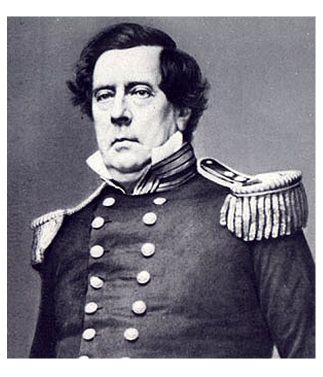
After leaving the Banana Patch, David Joseph went to live in Kokomo, Maui near Makawao. His Hawaiian wife Hanamaikai, from Hana, had a stroke and passed away. Joseph passed away on July 6, 1981. (Quayle) The image shows David Joseph in 1978 (Banana Patch Fantasy Productions.)