Mai ka hikina a ka Ia i
Kumukahi a ka welona a ka Iā i Lehua.
From the sunrise at Kumukahi to
the fading sunlight at Lehua.
From sunrise to sunset. Kumukahi, in Puna, Hawai‘i, was called the land of the sunrise and Lehua, the land of the sunset. This saying also refers to a life span-from birth to death. (Pukui, #258)
Kumukahi is a place of importance and a place of healing. Practitioners of la‘au lapa‘au often prayed to Kumukahi and his brother Palamoa as “deities of healing” when gathering and applying traditional Hawaiian herbal medicine. These practitioners would face the Hikina (East) and chant their prayers at sunrise from where ever they were living in the islands. (Lopes)
Kumukahi is translated as the ‘beginning/first source, chief, or teacher,’ in reference to the “first source” of wisdom, knowledge or of knowing.
This is because of its location in relation to the sun, Kānehoalani (an akua who is, in one story, Pele’s father) and what the sun represents, as the easternmost point of Hawaiʻi.
It is the beginning of our collective consciousness as people of Hawaiʻi, which establishes Kumukahi as a wahi pana (living and celebrated place) and a wahi moʻolelo (a storied place). (Hawai‘i County)
Kumukahi was also noted as a “leina a ka uhane,” a place where the soul of a person would leap from this world into the next after death. (Lopes)
Kumukahi was named for a migratory hero from Kahiki (Tahiti) who stopped here and who is represented by a red stone. Two of his wives, also in the form of stones, manipulated the seasons by pushing the sun back and forth between them. One of the wives was named Ha‘eha‘e. Sun worshipers brought their sick to be healed here. (Pukui)
In some accounts, Kumukahi is a kolea bird and is referred to as “the messenger of the gods.” According to Pukui, Kumukahi was the name of a “kanaka aiwaiwa,” a divine being who loved sports, especially holua sledding.
For this reason Pele, the akua wahine of the volcano, was fond of him. Kumukahi often produced sporting events in which his people participated. Pele often joined in on these particular festivities in the form of an attractive woman.
However, on one such occasion, Pele, disguised as an old woman, requested to participate and was denied. In her anger, she chased Kumukahi to the sea where she covered him with her lava. (Lopes)
At the tip of Cape Kumukahi were a number of stone cairns, built of the rough lava from the surrounding flow, which are said to have been built by the various monarchs of the Hawaiian kingdom upon assuming the throne. Some reference them as Ki‘i Pōhaku Ali‘i – King’s Pillars.
In 1823, William Ellis and members of the ABCFM toured the island of Hawai‘i seeking out community centers in which to establish church centers for the growing Protestant mission.
Settlement patterns in Puna tend to be dispersed and without major population centers. Villages in Puna tended to be spread out over larger areas and often are inland, and away from the coast, where the soil is better for agriculture. (Escott)
This was confirmed on William Ellis’ travel around the island in the early 1800s, “Hitherto we had travelled close to the sea-shore, in order to visit the most populous villages in the districts through which we had passed.”
“But here receiving information that we should find more inhabitants a few miles inland, than nearer the sea, we thought it best to direct our course towards the mountains.” (Ellis, 1823)
Ellis noted, “The population of this part of Puna, though somewhat numerous, did not appear to possess the means of subsistence in any great variety or abundance; and we have often been surprised to find the desolate coasts more thickly inhabited than some of the fertile tracts in the interior …”
“… a circumstance we can only account for, by supposing that the facilities which the former afford for fishing, induce the natives to prefer them as places of abode; for they find that where the coast is low, the adjacent water is generally shallow.”
When the Lighthouse Board assumed control of Hawai‘i’s lighthouses in 1904, it began work on a plan to erect major lights to better mark approaches to the islands. Funds for Makapu‘u Lighthouse were secured in 1906, money for Molokai lighthouse was obtained in 1907, and Congress made an appropriation for Kilauea Point Lighthouse in 1908.
These aids to navigation were seen as “material benefit to the business .community, to shipping interests, insurance interests and mercantile interests. … [T]he next one we have recommended is for a first order light at Cape Kumukahi, the easternmost point on the Island of Hawaii.” (PCA, Nov 4, 1908)
“There is at present no landfall light for vessels bound to Hawaii by way of Cape Horn. Several vessels have within recent years gone ashore on Kumukahi Point. This is the first land sighted by vessels from the southward and eastward.”
“The shipping from these directions now merits consideration, and with the improvement of business at Hilo the necessity for a landfall light on this cape grows more urgent. It is estimated that a light at this point can be established for not exceeding $75,000, and the Board recommends that an appropriation of this amount be made therefor.” (Report of the Lighthouse Board, 1908)
On December 31, 1928, the US government purchased fifty-eight acres on Cape Kumukahi from the Hawaiian Trust Company for the sum of $500. During the following year, a thirty-two-foot wooden tower capped with an automatic acetylene gas light was built at the cape for local use. It was replaced in 1933 by a 125-foot pyramidical galvanized steel tower. (Lighthouse Friends)
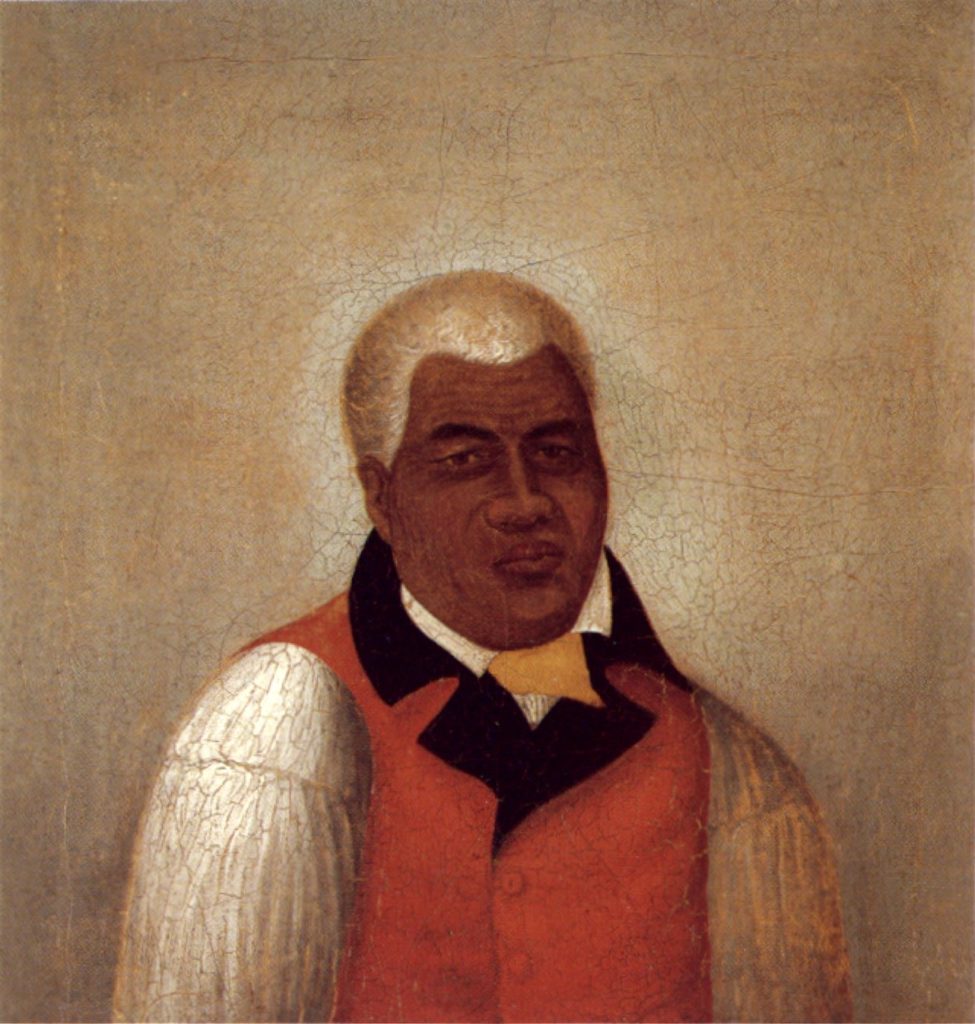
“Life was peaceful for several years along the Puna coastline until a lava flow threatened Kapoho in 1955. [Kumukahi lightkeeper Joe] Pestrella stayed at his post to watch over the lighthouse as the lava advanced.”
“The following year, he received the “Civil Servant of the Year” award from the U.S. Coast Guard for his bravery in staying at his post. At the time, Ludwig Wedemeyer, leader of the Hilo Coast Guard station, noted it was the first time a Hawai‘i Island resident had received such an award from the Coast Guard.” (Laitinen)
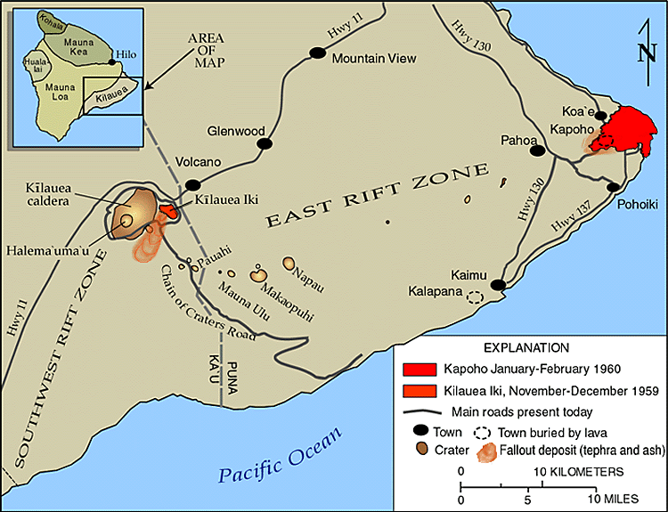
On January 12, 1960, over 1,000 earthquakes were recorded near Kapoho Village, just above Kumukahi. The earthquakes grew in size and frequency, creating large fractures along the Kapoho Fault overnight. The 1960 Kīlauea eruption began on the night of January 13.
For the first two weeks, Kapoho village remained virtually intact except for a blanket of pumice and ash that covered everything. The lava flow issuing from the growing cinder cone was moving in the opposite direction of town.
Things changed on January 27th when very fluid lava poured from the vents and fed massive ‘a‘ā flows that moved southwestward through the streets of town. By midnight, most of Kapoho had been destroyed.
By January 28, lava destroyed Coast Guard residences near Cape Kumukahi, but the lighthouse was spared. The Koa‘e Village fell victim to lava flow progression, losing the community hall, a local church and one residence. The eruption stopped February 19. (USGS)
“After the 1960 eruption ended, an electric line was run from Kapoho Beach Lots to the lighthouse to restore power, and the light became automated. Joe was transferred to a lighthouse on O‘ahu, and when he retired in 1963, he was the last civilian lighthouse keeper in Hawai‘i.” (Laitinen)
With prevailing NW trade winds and nothing between it and the America continents, except thousands of miles of open ocean, Kumukahi has some of the cleanest air in the Northern Hemisphere.
The Kumukahi light tower is also used as a monitoring station to test air quality. Since 1993, scientists have been taking ambient air samples every week for chemical analysis.
The long-term data records supplied by these samples are fundamental to understanding changes in atmospheric composition of gases affecting stratospheric ozone, climate and air quality, and provide an avenue to detect unexpected changes in these chemicals.
The 2018 eruptions interrupted the sampling efforts and NOAA scientists have undertaken novel development of an uncrewed aircraft system (UAS) “hexacopter” that will enable the lab to not only recommence a long-standing mission that was recently forced to halt, but paves the way toward enhanced operations in the future. (NOAA)