Images of Old Hawaiʻi

  • Home
  • About
  • Categories
    • Ali’i / Chiefs / Governance
    • American Protestant Mission
    • Buildings
    • Collections
    • Economy
    • Missionaries / Churches / Religious Buildings
    • General
    • Hawaiian Traditions
    • Other Summaries
    • Mayflower Summaries
    • Mayflower Full Summaries
    • Military
    • Place Names
    • Prominent People
    • Schools
    • Sailing, Shipping & Shipwrecks
    • Voyage of the Thaddeus
  • Collections
  • Contact
  • Follow

October 20, 2022 by Peter T Young Leave a Comment

Pāhoa

Early settlement patterns in the Islands put people on the windward sides of the islands, typically along the shoreline.  However, in Puna on the Island of Hawaiʻi, much of the district’s coastal areas have thin soils and there are no good deep water harbors. The ocean along the Puna coast is often rough and windblown.

As a result, settlement patterns in Puna tend to be dispersed and without major population centers. Villages in Puna tended to be spread out over larger areas and often are inland, and away from the coast, where the soil is better for agriculture.  (Escott)

This was confirmed on William Ellis’ travel around the island in the early 1800s, “Hitherto we had travelled close to the sea-shore, in order to visit the most populous villages in the districts through which we had passed. But here receiving information that we should find more inhabitants a few miles inland, than nearer the sea, we thought it best to direct our course towards the mountains.”  (Ellis, 1823)

An historic trail once ran from the modern day Lili‘uokalani Gardens area in Hilo to Hāʻena along the Puna coast. The trail is often referred to as the old Puna Trail and/or Puna Road. There is an historic trail/cart road that is also called the Puna Trail (Ala Hele Puna) and/or the Old Government Road.

This path was essentially the main thoroughfare through the Puna district before the late-1800s.  Pāhoa was oʻioʻina (a resting place) on the trail.  (Papakilo)  Then it grew to become the principal town of lower Puna.

The evolving trail (first by foot, then by horse, cart and buggy, and finally by automobile) likely incorporated segments of the traditional Hawaiian trail system often referred to as the ala loa or ala hele.  (Rechtman)

The full length of the Puna Trail, or Old Government Road, might have been constructed or improved just before 1840. The alignment was mapped by the Wilkes Expedition of 1804-41.  (Escott)

People who traditionally had lived along the Puna coast were moving toward Hilo and into the more fertile upland areas of Puna in order to find paid work and to produce cash crops for local markets and for export.

The focus began to shift to the center of the Puna District and the developing sugar and related industries near ʻŌlaʻa, Hilo and the volcano region.

Before the turn of the century, railroad operations began – with lines running into Hilo. A main railroad line and several feeder lines were constructed in the early-1900s from Keaʻau to locations in lower Puna District.

The major line ran from Hilo through Keaʻau to the Kapoho area.  A branch line ran from the ʻŌlaʻa Sugar Mill up past present day Glenwood. A second branch line ran to Pāhoa town.

Some suggest this is how Pāhoa received its name.  “Then the train was put in from Hilo to Puna. One spur went up into Pāhoa; it was like a dagger into the forest. I‘m told this is how Pāhoa got its name. (Pāhoa means dagger.)”  (Edwards; Cultural Surveys)

People began to work in the inland areas to grow sugarcane. The new road, the Pāhoa branch of the railroad, sugarcane agriculture and a logging venture all combined to create Pāhoa as a population center in the region.  (Rechtman)

Macadamia nuts and papaya were introduced in 1881 and 1919; at the turn of the century, large-scale coffee cultivation was attempted.  Over 6,000-acres of coffee trees were owned by approximately 200-independent coffee planters.

This fledgling industry couldn‘t compete with more successful ventures located in other districts, and after a few decades the coffee industry in Puna was abandoned.  (Cultural Surveys, Rechtman)

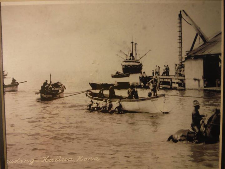
By 1901, sugar dominated the island’s industry and landscape, and Hilo was the epicenter of production and export. Railroads connected sugar mills and sugar plantations in Hilo, the Hāmākua and Puna. The railroad also connected the mills to the wharves at Hilo Bay.

Early on, one of the major export items transported by the railroad was timber.  Starting in 1907, the Hawaiian Mahogany Company began cutting trees to clear land for sugarcane. The logs were brought to Pāhoa Town to be milled, then sent to Hilo Harbor and eventually shipped to the US Mainland as railroad ties for the Santa Fe Railroad.

The lumber mill facilities and the railroad line that served them were located near the center of town where the Akebono Theater is located.

In 1909, the company was renamed Pāhoa Lumber Company. In 1913, the main mill facilities were lost in a fire; it was rebuilt that year the company was renamed the Hawaiian Hardwood Company.

The company closed down in 1916 when the Santa Fe Railroad ended its contract to buy lumber. The defunct company then leased its mill facilities, buildings and railroad tracks to the expanding ʻŌlaʻa Sugar Company.  (Rechtman)

Today, Pāhoa Town has a main street – the former highway route before the construction of the by-pass road – that still retains much of the original street-wall of plantation-era structures, as well as some significant stand-alone buildings.

Most of the uses are commercial or civic.  The County has acquired a large tract of land within Pāhoa Town, which presents a significant opportunity for community revitalization and a possible catalyst for economic activity.  (Puna CDP)

© 2022 Hoʻokuleana LLC

Filed Under: Economy, General, Place Names Tagged With: Hawaii Island, Puna, Pahoa, Sugar, Coffee, Macadamia Nuts, Hawaii

October 16, 2022 by Peter T Young Leave a Comment

Pua‘a Pepeiaohao

With the arrival of Western ships, new plants and animals soon found their way to the Hawaiian Islands.

The simple‐seeming gift of a few cattle given to Kamehameha I by Captain George Vancouver in 1793 made a major impact on the Hawai`i’s economy and ecosystem.

Having never seen animals with horns before, the Hawaiian called them pua‘a pepeiaohao, literally “pigs with iron ears.”

It also spawned a rich tradition of cowboy and ranch culture that is still here today.

Spaniards introduced the first cattle to Veracruz, Mexico in 1521.  Vancouver picked up descendants of these animals from the Spanish mission in Monterey when he set off across the Pacific, intending to use them as food and gifts.

Cattle were not the only animals introduced to Hawai`i during this period.  In 1778, Captain Cook left both goats and pigs.

British introduced sheep in the 1790s and they all soon roamed on Mauna Kea and Hualālai.  In 1803, American Richard Cleveland presented horses ‐ a stallion and a mare ‐ to Kamehameha.

When Vancouver landed additional cattle at Kealakekua in 1794, he strongly encouraged Kamehameha to place a 10‐year kapu on them to allow the herd to grow.

In the decades that followed, cattle flourished and turned into a dangerous nuisance.  By 1846, 25,000-wild cattle roamed at will and an additional 10,000-semi‐domesticated cattle lived alongside humans.

A wild bull or cow could weigh 1,200 to 1,500-pounds and had a six‐foot horn spread.  Vast herds destroyed natives’ crops, ate the thatching on houses, and hurt, attacked and sometimes killed people.

Kamehameha III lifted the kapu in 1830 and the hunting of wild cattle was encouraged.  The king hired cattle hunters from overseas to help in the effort; many of these were former convicts from Botany Bay in Australia.

Hunting sometimes ended in inadvertent tragedy.  In 1834, the trampled dead body of Scottish botanist David Douglas, for whom the Douglas Fir tree is named, was discovered in a cattle-trap pit on Mauna Kea.

Hawaiʻi’s wild cattle population needed to be controlled for safety reasons, but the arrival of cattle hunters and Mexican vaquero (“Paniolo”) also happened to coincide with an economic opportunity.

In the early-1830s, trade in sandalwood slowed down as island forests became depleted.  At about the same time, whaling ships hunting in the north Pacific began wintering in Hawaiian waters.

Ships provisioning in Hawaiʻi ports provided a market for salt beef, in addition to hides and tallow.  With the economic push of providing provisions to the whaling fleets, ranching became a commercial enterprise that grew in the islands.

Cattle ranching remains an important export and food industry in Hawai‘i. Currently, ranchers provide calves for finishing on the mainland and produce cattle for local consumption.

Cattle are Hawaii’s third most valuable agricultural commodity, worth about $44.8 million in 2017, though a history of having to respond to the whims of greater market forces has forced ranchers to constantly adapt to new changes in the supply chain. And for the past 30 years, cow-calf operations have been the best way for ranchers to make a living.

In 2019-2020, Idaho billionaire Frank VanderSloot assumed the leases for and purchased the slaughterhouses on O’ahu near Kapolei and on the Big Island in Paauilo, which together account for 70% of the state’s animal harvest capacity.

VanderSloot, founder of wellness company Melaleuca (the largest online wellness shopping club), recently completed upgrades to the O’ahu operation and work on the Big Island facility is underway. (Civil Beat)

When living in Waimea, I had a brief experience in “ranching.”

We picked up a day-old dairy bull calf from an Āhualoa dairy; we named him “Freezer Burn.”  We removed the middle seat and transported him back home in our VW van.  (I know; real cowboys don’t name their steers.)

After bottle-feeding him and briefly pasturing him, he ditched the premises and hooked up with part of the Parker Ranch herd.

© 2022 Ho‘okuleana LLC

Filed Under: Economy, General Tagged With: Pua‘a Pepeiaohao, Cattle

October 15, 2022 by Peter T Young Leave a Comment

Kona Sugar

Kona’s first sugar plantation was started by Judge C. F. Hart in 1869; a small mill was erected and a  dozen horses were used to pull the rollers. The plantation, which covered 50 acres, was unprofitable and soon abandoned. (Social History of Kona)

In 1899, Kona’s first and only sugar mill was built in Wai‘aha.  Sugarcane was grown mauka of a railroad track that was built to support the mill. (Maly)

The Kona Sugar Co, was established for the purpose of cultivating sugar cane and manufacturing sugar and generally to carry on a sugar plantation and general agricultural business. (Hawaii Supreme Court)

In the early 1900s, the Kona Sugar Co, under the auspices of a number of affiliated companies, constructed a railway line from Wai‘aha, North Kona, to Keōpuka in South Kona. The railway was built at approximately the 700-foot elevation. The train that ran on this railroad was a 3 ft. wide narrow gauge. (Birnie, Maly) The railway was intended to run 30-miles.

“The Kona Sugar Company failed completely”.  (Hawaii Supreme Court) In 1906, the West Hawaii Railway and the Kona Development Company were formed. “The Kona Development Company is a successor of the old Kona Sugar Company and will take over its property.” (Hawaiian Star, Apr 5, 1906)

“The Kona Development Co. has its prime field of operations in North Kona, and the Kona Agricultural Co. a corresponding relation to South Kona, the two being closely allied, while the railroad is primarily designed to connect them up and carry sugar cane from their respective plantations to the mill of the Kona Development Co which is situated in North Kona.”

“Seven miles of the track have been built, three miles more is under construction and it is proposed, from the proceeds of the bonds, to build an extension of twenty-two miles, making a total of thirty-two miles. As stated it will be a general public road and do a common carrying business as well as the transportation of cane for its owning companies.” (Pacific Commercial Advertiser, Oct 30, 1907)

The railway ended up to be a total of about 11-miles.  “they have a railroad track somewhere around – below Kainaliu. From just below Konawaena School, that’s quite a ways down, toward the ocean, they had the railroad. They used to haul the cane on the train to Holualoa. KD [Kona Development Company] Mill. They call KD Mill.”

“That’s where they crush the cane. But until then, they have a station built. They used to slide the cane – bundle up the cane with a chain – and then they slide through the cable, down to the train track.”  (Yosoto Egami; Social History of Kona)

“The cane was cut in the fields. They had a cable wire from way up here or whatever field they had, reach down to the railroad. The railroad had cars. Up here, they bundle the cane, and they hook it on the wire with a roller. The wire had enough slope, so they grease that roller all the time. It went down fast. Then, it went down there [to the railroad]. Had a switch there.”

“The bundle of cane dropped right into the truck [railroad car], see? (And one man would pick up the rollers and take it back up to the field.) Then, the train hauled it back to the sugar mill to grind it. Oh, was quite a job.” (John DeGuair, Sr, Social History of Kona)

“Mr. Kondo was the owner of the railroad … In Kona, the sugar was transported to the railway by means of cables, cultivation took place mauka of the railway. Mr. Ide remembers hearing from Jack Greenwell, that Masao Kuga invented a trigger on the cable from which the sugar would fall when it reached its destination near the railway.” (Maly)

“Although the greater part of the work on the plantations of the [Islands] is done by Japanese, there is but one plantation in the Islands exclusively owned and managed by men of that race.”

“This is the Kona Development Company property which has about 2500 acres under cultivation in the Kona district. From an area of 1285 acres this plantation produced 3205 tons of sugar in 1919.”

“The plantation is managed by T. Konno, a Japanese who gained his knowledge of the sugar industry as a contract planter at Papaaloa on the Hilo coast of Hawaii. He, with a number of countrymen, organized a company and took over the property from J. B. Castle and associates in 1915.”

“The cane land of the Kona Development Company lies amidst fields of coffee for which the Kona district is most noted, industrially. The Kona Development Company, with lands cultivated by small farmers, gives employment to several hundred persons.”

“At the end of the last grinding season, the Kona Development Company began making some needed improvements in its mill. The old brick and stone foundations of the power room were removed and a new boiler was installed. The mill has a capacity for making 30 tons of sugar in 12 hours.”

“Arrangements have been made recently for the saving and marketing of all the molasses from the mill. To do this tanks, with a capacity of 100,000 gallons have been erected at the mill, which is situated just above Kailua. Previously the only use made of the molasses was its consumption for feed and fuel.”

“The Kona plantation is favored by the fertility of its soil which does not make replanting at the end of two or three crops necessary. The stools of the cane continue to bear for many years. Under the management of T Konno the planted area has increased 500 acres.”

“Throughout the district under cultivation the plantations operates a narrow gauge railway upon which the cane is hauled to the mill to be ground.”

“The Waterhouse Trust Company are the Honolulu agents of the Kona Development Company.  The skilled employees are as follows: T. Uchimura, bookkeeper; T. Kudo, office Assistant; A.N. Smith, chemist; F. Sato, engineer; N. Tokunaga, sugar boiler; C. Suzuki, mill and railroad superintendent …”

“… D. Tatsuno, head luna; K. Sasaki, Kainaliu section timekeeper; T. Iseri, Holualoa section timekeeper; Manuel Silva & Frank Mederios, lunas; Henry deAguiar, Holualoa section luna; Y. Hatanaka, private secretary to T. Konno.” (Honolulu Star-Bulletin, Centenary Number, April 12, 1920)

The Kona Development Mill quit operations on July 3, 1926.  “As the concern has been bankrupt for some time, the 1927 crop had been entirely neglected”. (Hawaii Tribune Herald, June 25, 1926) The companies went into foreclosure and receivership and the assets were sold at public auction.

“Sugar cane, it is feared, is a thing of the past in Kona, and energies are next to be devoted to raising coffee and cotton more extensively.”  (Hawaii Tribune Herald, June 25, 1926)

Then (1928), the Treasurer of the Territory of Hawaii issued notices of the intent to dissolve the Kona Development Company and West Hawaii Railroad Company.  Shortly thereafter (1931), the County Engineer surveyed the abandoned West Hawaii railroad right-of-way for road purposes.

Today, Hienaloli Road follows the alignment of the West Hawaii Railway and remnants of the sugar mill may be seen along that road (as well as a stacked rock truss near Hualalai Road).

© 2022 Ho‘okuleana LLC‘

Filed Under: General Tagged With: Kona, Sugar, Kona Sugar

October 14, 2022 by Peter T Young Leave a Comment

Kāneʻohe Pineapple

Sugarcane was introduced to Koʻolaupoko in 1865, when the Kingdom’s minister of finance and foreign affairs, Charles Coffin Harris, partnered with Queen Kalama to begin an operation known as the Kāneʻohe Sugar Company.  (History of Koʻolaupoko)

By 1865, four plantations were in production, at Kualoa, Kaʻalaea, Waiheʻe and Kāneʻohe, and in the early 1880s, four more at Heʻeia, Kāneʻohe, Kahaluʻu and Ahuimanu, with a total of over 1,000-acres in cultivation in 1880.  (Coles)

After almost four decades of a thriving sugar industry in Koʻolaupoko, the tide eventually turned bad and saw the closures of all five sugar plantations by 1903. The closures were due to poor soil, uneven lands and the start-up of sugar plantations in ʻEwa, which were seeing much higher yields.

As sugar was on its way out in Koʻolaupoko, rice crops began to emerge as the next thriving industry.  (History of Koʻolaupoko)  In 1880 the first Chinese rice company started in the nearby Waiheʻe area. Abandoned systems of loʻi kalo were modified into rice paddies. The Kāneʻohe Rice Mill was built around 1892-1893 in nearby Waikalua.

By 1880, there were five sugar plantations in Kāneʻohe and a plantation and mill in Heʻeia. In the 1890s, the Heʻeia mill had its own railroad. By 1903 the growing of rice took over the production of sugar which had declined in Koʻolaupoko. Rice was grown in the Heʻeia wetland until the early 1920s. (Camvel)

Pineapples are typically grown in large fairly flat tracts of well-drained inter-mountain land that is composed of what is affectionately termed Hawaiian red dirt (the red color is due to the presence of the oxides of Fe). (Rubin, SOEST)

From 1901 to 1925 lands previously unused for agriculture were being covered up with pineapple fields, especially the hillsides and upslopes.  It was estimated that approximately 2500 acres of land throughout the Ko‘olaupoko region was converted to pineapple cultivation. (History of Koʻolaupoko)

The plantation was established in the windward side of O‘ahu around 1900 by the Hawaiian Development Company and became known as Koolau Fruit Company.

JB Castle and Walter MacFarlane were the key promoters of this early pineapple venture. In 1909, the Hawaiian Cannery Co began operating a small cannery at Kahalu‘u.  And by 1910, Castle was in possession of a thousand acres in Ahuimanu which were suitable for pineapple.

The following year, the Hawaiian Pineapple Co, which James D Dole had founded in 1901, bought out Castle’s Koolau Fruit Co., Ltd and sold it five years later to Libby, McNeil & Libby.

Libby, McNeil & Libby, with control of the Kahalu‘u land, built a large-scale cannery on the site; the cannery had an annual capacity of 250,000-cans.  (Thompson, Kahaluu)

Ten years later, the cannery represented a quarter of a million-dollar investment with a maximum of 750 regular employees, plus an additional 125 at the height of the harvesting season.

The company used a narrow-gauge railway to move the canned fruit to a wharf at the Waikāne Landing, from there sampans took the product to Honolulu for transshipment to other ports. (Conde, Light Railways)

The pineapple cannery along with numerous old-style plantation houses popped up and became known as “Libbyville” (named after its owners, Libby, McNeill, and Libby). (St John’s by the Sea now occupies the site.)

At its peak, 2,500 acres were under pineapple cultivation on Windward O‘ahu, and of this a large percentage was in the Kāne‘ohe Bay region.

The change in landscape to the Windward side by 1914 is reflected in the following sentences: “At last we reached the foot of the Pali … Joe and I looked over the surrounding hills, but looked in vain for the great areas of guava through which but a few months ago we had fought and cut our way.”

“As far as the eye could reach pineapple plantations had taken the place of the forest of wild guava.” (Cultural Surveys)  Libby’s pineapple covered the southern portion of Kāneʻohe, what is now the Pali Golf Course, Hawaiian Memorial Park and the surrounding area.

While Libby managed the operation of large tracts of land, it was noted that, “… much of the pineapple production was carried out by individual growers on small areas of five to 10 acres.”

“A man, a mule, a huli plow and a hoe provided most of the power and the equipment for these smaller operations. This was the typical pineapple production pattern in the area of Waikāne, Waiāhole, Kahaluʻu and ‘Ahuimanu.”

By 1923, it was evident that pineapple cultivation on the Windward area could not keep up with that in other O‘ahu areas. Crops on the Windward side were not yielding tonnages as compared with the Leeward side, fields were smaller, with wilt more prevalent, and growing costs considerably higher. Plantings were therefore reduced.

By this time, the condition of the Pali Road had been improved, and trucks with solid tires were available, so that the struggling pineapple operation found it more economical to haul the fresh pineapple to a central Libby Cannery in Honolulu.

The relatively inefficient, high production costs of operating many small, scattered fields resulted in a decision to discontinue pineapple growing on the Windward side.

The result was the closure of the cannery in 1923.   After the closure of the cannery, the pineapple fields were left to grow over and was then converted to grazing pasture land for cattle.  (History of Koʻolaupoko)

© 2022 Ho‘okuleana LLC

Filed Under: Economy, General, Place Names, Prominent People Tagged With: Libby, Kaneohe, Sugar, Pineapple

October 13, 2022 by Peter T Young Leave a Comment

Sandwich Islander Tax

Within ten years after Captain Cook’s 1778 contact with Hawai‘i, the islands became a favorite port of call in the trade with China.  The fur traders and merchant ships crossing the Pacific needed to replenish food supplies and water.

The maritime fur trade focused on acquiring furs of sea otters, seals and other animals from the Pacific Northwest Coast and Alaska.  The furs were mostly sold in China in exchange for tea, silks, porcelain and other Chinese goods, which were then sold in Europe and the United States.

Needing supplies in their journey, the traders soon realized they could economically barter for provisions in Hawai‘i; a triangular trade network emerged linking the Pacific Northwest coast, China and the Hawaiian Islands to Britain and the United States (especially New England).

After acquiring the “Louisiana Purchase” in 1803, under the directive of President Thomas Jefferson, the Lewis and Clark Expedition, also known as the “Corps of Discovery Expedition” (1804–1806), was the first transcontinental expedition to the Pacific coast undertaken by the United States.

As early as 1811, Hudson’s Bay Company (HBC) had already hired twelve Hawaiians on three year contracts to work for them in the Pacific Northwest.  That year John Jacob Astor built Fort Astoria, it was later sold to the North West Company.

Comfortable with the service from the Hawaiians, in 1817, North West sent a ship “to bring as many of the Sandwich Islanders to the Columbia river as we could conveniently accommodate.”  (Corney)

The number of Hawaiians working as contract laborers for the Hudson’s Bay Company steadily grew.  The large number of Hawaiian workers in the village at Fort Vancouver led to the name “Kanaka Town” in the early 1850s – “Kanaka” is the word for “person” in the Native Hawaiian language.

Historians suggest “that young Hawaiian males left Hawaiʻi as workers on whaling ships and traveled to China, Europe, Mexico, and the US mainland. In addition, many ventured into the Pacific Northwest territory, worked in the fur trade, and ended up settling in those areas.” (pbs-org)

Sandwich Islanders (Hawaiians) came to Oregon Country as seamen. Many remained in Oregon to work under contract as laborers, servants and craftsmen.

The growing population of Hawaiian into the Oregon Country resulted in growing concerns.

Then, in 1845, the Oregon legislature addressed a bill designed to reduce the flow – it was called the Sandwich Islander Tax.

It was an attempt to raise revenue by taxing employers of these Islanders, and it reflects the notion that they will not become permanent residents of Oregon.

A transcript of original drafting of the bill notes, “An Act concerning the introduction of Sandwich Islanders or natives from any of the adjoining islands.”

“Sec 1 Be it enacted by the house of Representatives of Oregon Territory as follows  – That all persons who shall hereafter introduce into Oregon Territory any Sandwich Islanders or natives from any of the neighboring Islands for a term of Service shall pay a tax of five dollars for each person so introduced;”

“Sec 2 Each and every person in this Territory shall pay a tax of three dollar per annum for each and every Sandwich Islander or any native from a neighbouring Island that they keep in their service for a term of years’”

“Sec 3 The revenue arising from said tax shall be assessed and collected as other Taxes are assessed and collected, and paid into the Territorial Treasury the same time the other Territorial Revenue is paid in.”

While introduced, the bill never passed.

“The bill to tax Sandwich Islanders, was read a third time, and indefinitely postponed.”  (December 18, 1845; Oregon Archives)

The intent was later disclosed, “For the taxation of the Sandwich Islanders, employed almost exclusively as servants and laborers, by the HB Company, and intended merely to annoy and embarass the gentlemen in charge of the said company.”  (Oregon Historical Quarterly, 1909)

However, on October 15, 1862, Oregon Governor Addison C Gibbs approved the law that had passed the House of Representations (October 8, 1862) and Senate (October 13, 1862) that stated:

“That each and every negro, Chinaman, kanaka and mulatto (“mixed” or “biracial,”) residing within the limits of this state, shall pay an annual poll tax of five dollars, for the use of the county in which such negro, Chinaman, kanaka and mulatto may reside.”

“That every such negro, Chinaman, kanaka and mulatto, shall, between the first day of January and the first day of March, of each year, pay to the county treasurer of the county in which he may reside, the sum of five dollars, and thereupon said treasurer shall make out and deliver to such person a receipt”.

“When such negro, Chinaman, kanaka and mulatto shall fail and neglect to pay the tax required by section second of this act, then it shall be the duty of the sheriff of the county wherein such tax payer may reside or be found, to immediately collect such tax, with the additional sum of one dollar, and mileage, which additional sum and mileage shall go to the sheriff, as his fees; the balance shall be paid into the county treasury, and the sheriff is required to make return to the county treasurer of the taxes collected under the provisions of this act, on the first Monday of June, and every three months thereafter.”

“Should such negro, Chinaman, kanaka or mulatto, fail to pay the tax required by section second of this act, and should the sheriff be unable to collect the same, or make the same out of property belonging to such tax payers, then it is made the duty of the sheriff to arrest such negro, Chinaman, kanaka or mulatto, and put him at work on the public highways, under the direction of the road supervisor …”

“… such taxpayers shall be required to work one day on such highways, for every half-dollar of such tax due and unpaid, and in addition thereto, shall be allowed his board, which shall be paid by the county in which such labor is performed, and the sheriff shall be allowed by the county court a reasonable sum for his service.”

© 2022 Hoʻokuleana LLC

Filed Under: General, Place Names, Economy Tagged With: Hawaii, Kanaka, Hudson's Bay Company, Sandwich Islander Tax, Oregon

  • « Previous Page
  • 1
  • …
  • 88
  • 89
  • 90
  • 91
  • 92
  • …
  • 267
  • Next Page »

Images of Old Hawaiʻi

People, places, and events in Hawaiʻi’s past come alive through text and media in “Images of Old Hawaiʻi.” These posts are informal historic summaries presented for personal, non-commercial, and educational purposes.

Info@Hookuleana.com

Connect with Us

  • Email
  • Facebook
  • LinkedIn
  • Twitter
  • YouTube

Recent Posts

  • Tutasi
  • Lurline
  • About 250 Years Ago … ‘Give Me Liberty, Or Give Me Death’
  • About 250 Years Ago … Stamp Act
  • Telling Time
  • Arterials
  • Place Names

Categories

  • General
  • Ali'i / Chiefs / Governance
  • Buildings
  • Missionaries / Churches / Religious Buildings
  • Hawaiian Traditions
  • Military
  • Place Names
  • Prominent People
  • Schools
  • Sailing, Shipping & Shipwrecks
  • Economy
  • Voyage of the Thaddeus
  • Mayflower Summaries
  • American Revolution

Tags

Albatross Al Capone Ane Keohokalole Archibald Campbell Bernice Pauahi Bishop Charles Reed Bishop Downtown Honolulu Eruption Founder's Day George Patton Great Wall of Kuakini Green Sea Turtle Hawaii Hawaii Island Hermes Hilo Holoikauaua Honolulu Isaac Davis James Robinson Kamae Kamaeokalani Kameeiamoku Kamehameha Schools Lalani Village Lava Flow Lelia Byrd Liberty Ship Liliuokalani Mao Math Mauna Loa Midway Monk Seal Northwestern Hawaiian Islands Oahu Papahanaumokuakea Marine National Monument Pearl Pualani Mossman Quartette Thomas Jaggar Volcano Waikiki Wake Wisdom

Hoʻokuleana LLC

Hoʻokuleana LLC is a Planning and Consulting firm assisting property owners with Land Use Planning efforts, including Environmental Review, Entitlement Process, Permitting, Community Outreach, etc. We are uniquely positioned to assist you in a variety of needs.

Info@Hookuleana.com

Copyright © 2012-2024 Peter T Young, Hoʻokuleana LLC


Loading Comments...