Waimanalo Military Reservation was created in 1917 by Presidential Executive Order, and later renamed to Bellows Field in 1933 (named after Lieutenant Franklin Barney Bellows, a war hero who was killed in action during World War I while on a reconnaissance flight near St. Mihiel, France, on September 13, 1918.)
The land was leased from Waimanalo Sugar Plantation. It was used as the bivouac area and a target practice area by the Coastal Artillery, which strung a line of 90-mm guns along the beach. During the 1930s, Bellows was used as a bombing and gunnery range by aircraft from Luke (Ford Island,) Wheeler and Hickam Fields.
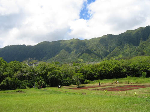
Back then, the field was nothing but overgrowth of sugar cane and guava. The only clearings were for training areas and tents where the men slept. It was a training area for the infantry, coast artillery and Air Corps. There was a wooden traffic control tower and a single asphalt runway, 983-feet long and 75-feet wide.
Bellows Field was used for training both air and ground forces. During the mid-1930s the Air Corps chiefly used this area for a strafing and bombing practice site. Those operations extended into 1938, when the total Air Corps personnel on duty only consisted of five to ten men supplied from Wheeler Field.
Bellows was a sub-post of Wheeler Field until July 22, 1941 when it became a separate permanent military post under the jurisdiction of the Commanding General, Hawaiian Department. Overnight, an accelerated construction program began and Bellows began to grow. Two-story wooden barracks and a new and larger runway started filling the landscape.
Bellows was among those installations attacked by the Japanese during the Pearl Harbor attack. The 44th Pursuit Squadron had 12 P-40’s located at Bellows on December 7th, 1941. Unfortunately the planes had been flown the day before the attack and the aircraft guns had been removed for cleaning. (Trojan)
Two military members were killed (Lt. Hans Christenson and Lt. George Whiteman) and six wounded at Bellows. They included three pilots of the 44th Pursuit Squadron who were at Bellows for gunnery training and attempted to take off in their P-40s. One of the pilots had to swim to shore when his badly damaged aircraft crashed into the ocean.
Also swimming ashore the next day was the commander of a Japanese two-man midget submarine which grounded on the reef off of Bellows. Ensign Kazuo Sakamaki, captured by Cpt. David Akui and Lt. Paul S. Plybon, was the first US prisoner of war taken in WW II. His companion, Petty Officer Second Class Kiyoshi Inagaki, died and his remains later washed up on the shore. (hawaii-gov)
With the outbreak of war, Bellows was transformed almost overnight into an important facility where aircraft were prepared for their duty in the Pacific Theater. Hundreds of men and aircraft flowed through Bellows requiring more runways and facilities.
Five runways, the longest 6,290-feet, were in two different airfields, connected by a taxiway – they were identified as “Bellows Field (Army)” to the south and “Bellows Field Bombing Range (Emergency)” to the north.
Later (1955,) the north Bellows airfield was “closed” and the south field was labeled simply as “Bellows,” without any kind of military designation. The field was also described as “Not attended.”
The south Bellows airfield may have been used for some time during the 1950s as a civilian airfield of some type. The runways at Bellows were eventually closed in 1958 and the base was used for other purposes.
In 1960, the U.S. Army built two Nike-Hercules anti-aircraft missile sites at Bellows, which were operated full-time by the Hawaiʻi Army National Guard for the aerial defense of Hawaii until inactivated in 1970. The communications transmitter facility replaced the Kipapa area transmitter and receiver sites. The Army National Guard continued at Bellows until 1995.
Later, Bellows was operated and maintained by members of the 15th Communications Squadron. Its transmitters were the principal ground-to-air link with aircraft (particularly military aircraft) flying to and from Hawaiʻi; and they provided communications for Presidential flights and others carrying high-level government officials. (The facility was decommissioned in the 1980s or 1990s.)
This communications network was one of the reasons the runways at Bellows went out of use; an antenna was located right in one of the runways. In addition, a large communication building was constructed right in the middle of the crossed runways.
The Bellows property was renamed Bellows Air Force Station (AFS) in 1968. In 1970 the US Air Force offered part of Bellows to the State of Hawaiʻi for use as a general aviation airport, but opposition by the nearby Waimanalo community was so strong that the state had to decline.
In 1999, the Marine Corps acquired about 1,050-acres for the Marine Corps Training Area Bellows (MCTAB;) it’s now part of Marine Corps Base Hawaiʻi, headquartered in Kāneʻohe Bay. MCTAB adds significant training capabilities and maneuver space for non-live fire military training activities.
The Marines and other services use the training areas to conduct amphibious, helicopter and motorized exercises in conjunction with troop land maneuver training. It is currently the only place in Hawaiʻi where amphibious landings can transition directly into maneuver training areas for realistic military training.
The Air Force’s property at Bellows is now limited to the recreational facilities. The Bellows Recreation Center is composed of 102 beach cottages, a small exchange & a beach club. Bellows is still depicted as an abandoned airfield on recent Sectional Charts.
The facility also serves as all-service beach-front recreational area for active-duty and retired military personnel, civilian employees of the Department of Defense, dependents and guests.
On most weekends and holidays, the Marines continue a practice started by the Air Force to open the Bellows Beach training area to the general public, in cooperation with the City and County of Honolulu. (Lots of information here from hawaii-gov and Trojan.)