Images of Old Hawaiʻi

  • Home
  • About
  • Categories
    • Ali’i / Chiefs / Governance
    • American Protestant Mission
    • Buildings
    • Collections
    • Economy
    • Missionaries / Churches / Religious Buildings
    • General
    • Hawaiian Traditions
    • Other Summaries
    • Mayflower Summaries
    • Mayflower Full Summaries
    • Military
    • Place Names
    • Prominent People
    • Schools
    • Sailing, Shipping & Shipwrecks
    • Voyage of the Thaddeus
  • Collections
  • Contact
  • Follow

August 27, 2024 by Peter T Young Leave a Comment

Old Koloa Town

“Koloa is the product of all of the peoples and cultures who have come to live there … ‘Families were close, and there was more than enough love for children and the elderly. . . . Hard work and character were respected as were other old fashioned values such as cleanliness, decency and courtesy.’”

“‘Crime was virtually unknown . . . the people of Koloa did not have to contend with the negative aspects we have in so many parts of our country today: illegitimacy, drug use, senseless violence at a presumed slight, or the rioting and looting that destroy a community . . .”

“. . . those who were old enough to remember Koloa as children and are still with us agree the high water-mark was in the thirties; and the tide has been receding slowly since’”. Donohugh; Bushnell)

“The last direct hit [to Kauai] was by Hurricane Dot in 1959. Dot passed south of Oahu but took a sudden turn to the north and hit Kauai, its eye passing right over Lihue.”

On November 23, 1982, “Hurricane Iwa aimed winds gusting to 110 mph at Hawaii Tuesday and 5,000 residents of Kauai island were evacuated from the storm that posed the fiercest threat to the islands since 1959.” (UPI)

“Property loss was estimated at $130 million by Thomas C. Hamner, the Federal emergency relief coordinator. … Some landmarks are gone, particularly along the island’s south coast, which were hit by the strongest winds.” (NY Times)

Old Kōloa Town grew up around the Plantation industry, attracting people to come work there from many different countries. Plantation workers not only labored, lived and shopped on the plantation, they also received medical care.

Kōloa’s buildings housed plantation stores and services for these people, including Kauai’s first hotel. Kōloa was the center of agriculture and, as such, became the center of activity for Kauai.

“Of course, we heard there was going to be a hurricane, so I had the radio on. And I was watching. And they start telling that, ‘You people better be prepared with candles or something because the lights going off.’  And I looked around all over the place, and I just couldn’t find one candle. And I thought, ‘I better go up to the store and get one.’”

“When I opened the door, it was just cats and dogs. It was raining and blowing. I said, ‘Oh, no. I’m not going.’ So I shut the door, and then I looked in all the drawers, and finally I found one big one that in the restaurants, in the hotels, they use in the cup?”

“Those, yeah. I had one of those, so I thought, ‘Oh, this should last.’ So I had it here. I sat here and I looked outside and it was blowing gales. And I thought, ‘Chee, I better sit here. And just in case the house should come down, then if I lay down between here, then it will protect me.’”

“Then, next morning, early, I went out, I see my neighbor’s house, Aoki’s house, the roof had all flown away, the living room. And then, the roof flied, was way over on the other side of the bridge and some was on the bushes.” (Kōloa resident, Masako Hanzawa Sugawa; UH Oral History)

Hurricane ʻIwa damaged some of the structures in the town, most were simply old.  Then, a group called Kōloa Town Associates (KTA) persuaded the Smith‐Waterhouse Family Partnership to grant the group a long-term lease on the property comprising the core of the town.

The stated intention was to restore the historic structures in this part of Kōloa. Project architect Spencer Leineweber and landscape architect Michael S Chu collaborated in preparing the overall master plan and detailed design work for the restoration and repair of Old Koloa Town.

The challenge for the design team was to preserve the town without imposing twentieth century aesthetics. The focus for the development was on three major principles: design, organization, and economic restructuring. (Leineweber & Chu)

“As he had done with several Chinatown properties, Gerrell is trying out his ‘preservation and profit’ formula to ‘return Koloa Town to its original appearance’ and attract more visitors to Kauai.” (SB, May 12, 1983)

“[Bob] Gerell … doing business as Koloa Town Associates, has signed a 67-year lease with the Mabel P Waterhouse Trust. Waterhouse has owned much of the town’s commercial property since 1850.”

“Gerell has begun refurbishing 18 buildings on four acres of land in the original town … He plans to demolish some ‘unsalvageable’ structures and build six or seven new structures with space for up to 25 tenants.” (SB May 12, 1983)

“When we took over, there were 18 original plantation-style buildings. Our intent was to renovate them back to this original appearance. We were able to save 13, but the rest were in such bad condition that they had to be torn down.” (Gerell, SB, Aug 29, 1984)

“The design development of the oldest area, known as the Kahalewai Court, concentrated on restoration of the old general store and the old hotel building. Since the Yamamoto Store has the strongest visual image for Koloa, this area will become the visual gateway to the development.”

“The area will have an open lawn for outdoor performances. A dry stream bed will meander through the area to provide a necessary relief drainage system. It is quite common in older developments that the buildings are not always positioned in the most ideal locations for drainage.”

“Since the existing relationship with the ground was critical to the overall perception and scale of the buildings, a secondary drainage system that was not foreign to the old town was added so that the original ground drainage patterns could remain.”

“The second area in the town’s development was the Plantation House Shops. As the plantation expanded, housing for the workers began to develop around the town. A portion of these residential buildings will be developed into small craftsman-style shops. The landscape development in this area will be residential in scale and have that ‘chopsuey’ look of many plantation villages.”

“The last area of the town to develop was the false front ‘old west’ commercial structures. These buildings will once again have canopies over the sidewalk and boardwalks connecting the buildings to each other. Large shop windows that have been boarded up for years will once again display merchandise.” (Leineweber & Chu)

The wooden walkway along Kōloa Road in front of the buildings was added to facilitate tourist shopping. Some attention was paid to exterior features such as false fronts to give an appearance from the street similar to the original. Kōloa Town Associates named the resulting group of new buildings ‘Old Kōloa Town’ and leased them to businesses catering to tourists.

Although the majority of the structures were in an extremely dilapidated condition when the project began, the emphasis of the renovation was to bring the historic assets of the town back into focus. Techniques for accomplishing this include the careful repair of cornice moldings, small window panes, decorative rail work, as well as substantial replacement of structural beams and roofings. (Leineweber & Chu)

“One of the distinct advantages of a shopping center, organization of the tenants, was applied to Koloa. Since the developer, Mr. Robert Gerell, has a sixty-seven-year master lease with the landowner, all of the shops can have a similar lease. This arrangement gives them common marketing advantages (promotions, sales, common store hours, signage).”

“The merchants begin to give up the idea of being the biggest and the best on the block and seek a stronger image of being part of a larger whole.”

“The revitalization of any area cannot happen overnight. The emphasis is not on instant solution to problems that have taken years to develop. A gradual but steady program of improvements based on a flexible master plan is essential in anticipating the dynamics of this town of Koloa.” (Leineweber & Chu)

Monkeypod trees are the signature of Kōloa Town. The trees line Kōloa, Weliweli, Waikomo and Po‘ipū Roads. They enhance the character and atmosphere of Hawai‘i’s first plantation town.

Two monkeypod seeds were been brought to Hawai‘i from Mexico by Mr. Peter Brinsdale who was the American Consul in 1847. The seeds were germinated and the seedlings planted. One was planted in Kōloa. The second seedling was planted in Honolulu. This tree was removed when the Alexander Young Hotel was built on the site.

Old Koloa Town is part of the region’s Holo Holo Kōloa Scenic Byway.  We prepared the Corridor Management Plan for the Byway. The CMP was recognized with a “Preservation Commendation” from Historic Hawai‘i Foundation and the American Planning Association – Hawaiʻi Chapter presented Hoʻokuleana LLC with the “Community-Based Planning” award.

© 2024 Ho‘okuleana LLC

Filed Under: General, Buildings, Economy Tagged With: Iwa, Hurricane Iwa, Gerell, Leineweber, Chu, Hawaii, Kauai, Koloa, Hurricane

July 2, 2024 by Peter T Young Leave a Comment

Manaiakalani

A messenger sent by Maui,
Sent to bring Kane and his set,
Kane and Kanaloa, Kauokahi,
And Maliu.
Throwing out sacred influences, uttering prayers,
Consulting oracles, Hapuʻu the god of the king.
The great fish-hook of Maui,
Manaiakalani,
The whole earth was the fish-line bound by the knot
(A Song for Kualiʻi – Kualiʻi was a celebrated chief of Oahu, who reigned in about 1700 AD. (Journal of the Polynesian Society))

The demi-god Māui is the subject of extraordinary stories throughout Polynesia. In many of the accounts he is a mischievous trickster, stealing the secret of fire and helping his mother to dry kapa by lassoing the sun to slow its progression across the sky.  (Bishop Museum)

A Manaiakalani story suggests that Maui pulled up the islands by tricking his brothers into letting him come out to fish with them.

The brothers never took him out because whenever they did he would catch a scrawny little fish.  He said he sought to prove that he is as skilled as they were.

He prepares the sacred hook, baiting it with the wing of the pet bird of the goddess Hina. Māui tells his brothers that once he starts to haul in the catch, not to look back until he is finished.

Māui casts the hook into the water and catches the enormous ulua fish Pimoe.

The brothers strain against the fish and soon parts of Pimoe are above the surface of the water, immediately turning to stone. The brothers cannot resist any longer and turn around to see their catch.

But when they do, the line breaks and rather than one enormous island, Māui, the earth-fisher, is only able to raise up the eight separate Islands of Hawaiʻi.

Another story related to Manaiakalani tells of Māui’s attempt to rearrange the Islands of the group and assemble them into one solid mass.”

“Having chosen his station at Kaʻena Point, the western extremity of Oʻahu, from which the island of Kauai is clearly visible on a bright day, he cast his wonderful hook, Mana-ia-ka-Iani, far out into the ocean that it might engage itself in the foundations of Kauai.”

“When he felt that it had taken a good hold, he gave a mighty tug at the line. A huge boulder, the Pōhaku O Kauai, fell at his feet.”

“The mystic hook, having freed itself from the entanglement, dropped into Pālolo Valley and hollowed out the crater, that is its grave.”  (Manaiakalani, therefore, formed Kaʻau Crater.) (Emerson)

Finally, in frustration, Māui throws his hook into the sky where it becomes a constellation, still easy to see in the spring and summer months, known by Western astronomers as the tail of Scorpio.  (Bishop Museum)

In the Hawaiian sky of Kau (summer season, May to October), Manaiakalani (The Chief’s Fishline) is visible for most of the night, just as Ke Ka o Makali‘i (The Canoe- Bailer of Makali’i) is visible for most of the night in the sky of Hoʻoilo (winter season, November to April.)

Like other stars and groups of stars, Manaiakalani is used in celestial navigation as directional clues when they rise and set. On cloudy nights, when only parts of the sky are visible, navigators may recognize isolated stars or star groups and imagine the rest of the celestial sphere around them.  The image shows a depiction of Maui and Manaiakalani.

© 2024 Hoʻokuleana LLC

Filed Under: Hawaiian Traditions, Place Names Tagged With: Pohaku O Kauai, Kaau Crater, Manaiakalani, Hawaii, Maui, Kauai

June 20, 2024 by Peter T Young Leave a Comment

Nāpali

Kauai nui moku lehua pane‘e lua i ke kai
Great Kauai of the lehua groves which seem to move two-by-two to the shore (Maly)

Kauai is the oldest of the eight main Hawaiian islands, and the island consists of one main extinct shield volcano estimated to be about 5-million years old, as well as numerous younger lava flows (between 3.65-million years to 500,000-years old). The island is characterized by severe weathering.  (DLNR)

Historically, it was divided into several districts and political units, which in ancient times were subject to various chiefs—sometimes independently, and at other times, in unity with the other districts. These early moku o loko, or districts included Nāpali, Haleleʻa, Koʻolau, Puna and Kona (Buke Mahele, 1848; May.)

Although Nāpali, on the northwestern portion of the Island, is remote and difficult to access, many may not realize that for about a thousand years, Hawaiians lived along the Nāpali coast, farming, fishing and worshiping.  There are irrigation ditches, terraced fields, house platforms, heiau (temples and shrines) and graves.”

“The design of these places took into account the natural topography and environment, and as a result these ancient sites often blend into the landscape. … The aspects of the land that Hawaiians sought for their sites – level ground, ocean access and availability of fresh water (hold true today.)”  (DLNR)

The Nāpali valleys were intensively cultivated and the larger valleys such as Kalalau were densely inhabited. Taro was raised in terraced loʻi along the streams and other crops such as bananas, sugar cane and sweet potato were grown above the loʻi.

Other plants including wauke and mamaki for bark cloth and kukui nuts for food and oil for light were grown in the gulches.  There were overland trails connecting many of these valleys and these areas were also accessed via canoe.  (Handy; Maly)

Land use records from 1856-1857 show that lands in Kalalau, Pohakuao and Honopu valleys were being used for the cultivation of kalo, olona and kula. In the late-1800s Hanakoa and Hanakāpīʻai were also used for coffee cultivation. Kalalau was abandoned in 1919 and then used for cattle grazing in the 1920 for a limited time.  (DLNR)

“The mountains along the shore, for eight or ten miles, are very bold, some rising abruptly from the ocean, exhibiting the obvious effects of volcanic fires; some, a little back, appear like towering pyramids”.  (Hiram Bingham, 1822)

“There is a tract of country on the west coast of the island, through which no road is practicable.”  (Bowser, 1880; Maly) “For twenty miles along the northwestern coast of Kauai there extends a series of ridges, none less than 800-feet high, and many nearly 1,500-feet, terminating in a bluff that is unrivalled in majesty. Except for a very narrow, dangerous foot-path, with yawning abysses on each side, this bluff is impassable.”    (The Tourist’s Guide, Whitney, 1895)

The trail was originally built around 1860 (portions were rebuilt in the 1930s) to foster transportation and commerce for the residents living in the remote valleys.

Local labor and dynamite were used to construct a trail wide enough to accommodate pack animals loaded with oranges, taro and coffee being grown in the valleys. Stone paving and retaining walls from that era still exist along the trail.

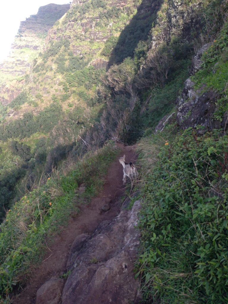
It traverses 5-valleys over 11-miles, from Hāʻena State Park to Kalalau Beach, where it is blocked by sheer, fluted cliffs (pali;) it drops to sea level at the beaches of Hanakāpīʻai and Kalalau. The first 2 miles of the trail, from Hāʻena State Park to Hanakāpīʻai Beach, make a popular day hike.  (DLNR)

“Innumerable streams, forming wonderful cascades as they leap hundreds of feet in their tempestuous decent, pour over this bluff in the rainy season, and become mist before they reach the ocean. Beyond the raging surge, unbroken by any protecting reef, dashes against the precipitous walls of rock.”

“(T)he tourist can see all that has been described from Wednesday morning until Saturday evening, when the steamer returns to Honolulu.  If, however, he has time and the inclination to remain another week, there are many points of interest that can tempt him to make a longer stay, sights and scenes that can never be forgotten…”  (The Tourist’s Guide, Whitney, 1895)

“Here, about mid-way of what the natives call the Parre (Pali,) we landed, where is an acre or two of sterile ground, bounded on one side by the ocean, and environed on the other by a stupendous rock, nearly perpendicular, forming at its base a semicircular curve, which meets the ocean at each end. In the middle of the curve, a stupendous rock rises to the height, I should say, of about 1,500-feet.” (Bingham)

“Like Kalalau they had a trail from the table land above over the top of Kamaile and zigzagging down through the cliffs some 3,000-feet to the valley below but even this trail was difficult. At one place you have to jump a crevice only three feet wide but it goes down straight like a chimney and if you slipped you would only fall 800 feet to the rocks below. They call it the Puhi.”  (Knudsen, late-19th-century)

“(At) Nuʻalolo Kai the fishermen built and kept their canoes and the beach must have been lined with them for the landing is most always safe as the channel is narrow and a big reef to the north protecting it.” (Knudsen)

“During the Māhele, the King granted lands to the Kingdom (Government), the revenue of which was to support government functions. In the Nāpali District, the ahupuaʻa of Kalalau, Pohakuao, Honopu, Hanakāpīʻai and one-half of Hanakoa were granted to the Government Land inventory.”

“Portions of the lands that fell into the government inventory were subsequently sold as Royal Patent Grants to individuals who applied for them. The grantees were generally long-time kamaʻāina residents of the lands they sought… Thirty grants were sold in the Nāpali District to twenty-seven applicants; the lands being situated in Kalalau and Honopu.” (Hawaiian Government, 1887; Maly)

The upper region of the area was put into Territorial Forest Reserve (Nā Pali – Kona Forest Reserve) for protection in 1907. Even before that time, the concern for native forest prompted cattle eradication activities in this area during 1882 and 1890.

For most backpackers in good condition, hiking the 11-miles will take a full day. Camping permits for the Kalalau Trail are only issued for Kalalau Valley however the permits allow for 1-night camping (each way) at Hanakoa. Hanakoa and Kalalau, are the only two authorized areas for camping along the Kalalau trail.

Hanakoa is roughly 6 miles from the trailhead. Hikers are encouraged to stop/camp at Hanakoa if they possess a permit for Kalalau and need a break or anticipate bad weather. A stopover at Hanakoa, counts as one night, and therefore reduces the total number of nights permitted at Kalalau.

DLNR State Parks does not offer stand alone “hiking permits.” In order to hike from Haena State Park to Hanakāpī‘ai Beach or Hanakāpī‘ai Falls visitors need to purchase Parking and Entry Reservations for Hā‘ena SP. Make parking and entry reservations at www.gohaena.com. 

In order to hike past Hanakāpī‘ai Beach along the Kalalalau Trail a valid camping permit for Napali Coast State Wilderness Park is required whether or not you choose to camp.

Other than hiking the coast, the only way to legally access shore areas in Nāpali Coast State Wilderness Park is by boat. Personal or rented kayaks and guided kayak tours may land at two permitted areas, and motorized raft tours take passengers on shore at Nu’alolo Kai. These zodiac tours enjoy a scenic view of the coast, with snorkeling, lunch and guided tour through an archaeological complex.

One of the nicest ways to see Nāpali Coast is by paddling down the coast. This activity is permitted only during the summer months, between May 15 and September 7. Unpredictable sea conditions make it potentially unsafe during the remainder of the year. The most popular way to travel by kayak is to start from the Ha’ena (eastern) end of the coast and pull out at Polihale Beach, on the western end of the coast. This takes advantage of the prevailing currents and trade winds

Day use landings are allowed at Miloliʻi during the summer (May 15 through Labor Day) without a permit. No other boat landings are permitted within the park. Kayak landings are prohibited at all other beaches in the park, including Hanakāpīʻai, Honopu and Nuʻalolo Kai. (This only summarizes some of DLNR’s rules; review and know the rules before you go.)

© 2024 Hoʻokuleana LLC

Filed Under: Place Names Tagged With: Kalalau, Hawaii, Kauai, Na Pali, Nualolo Kai, Milolii, Honopu, Napali

June 9, 2024 by Peter T Young Leave a Comment

Nāwiliwili

A pua ka wiliwili,
A nanahu ka mano;
A pua ka wahine uʻi,
A nanahu ke kanawai.

When flowers the wiliwili,
Then bites the shark;
When flowers a young woman.
Then bites the law.  (Emerson)

Most sources suggest Nāwiliwili, Kauai takes its name from the wiliwili tree (nā is the plural article, as in “the wiliwili trees” or “place of the wiliwili trees.”)  A native tree, its flowers and pods are used for lei, and its light wood was once used for surfboards, outriggers and net floats …”

“… somewhat as Honolulu was originally called Ke Awa o Kou, or Kou Landing, from the groves of that seaside tree known there in primitive times, so not only this southeasterly bay of Kauai, together with the stream emptying into … took their name from the blossoms of the wiliwili trees which grew in great numbers on the rocky slopes above the bay.”  (Damon)

One of the first things that William Hyde Rice saw on landing in this bay in 1854, as a boy of eight, was the orange-red flash of wiliwili blossoms on trees clinging to the cliff above the beach. And one of the last things he did for his beloved home-island was to plant young wiliwili trees above the bay that the significance of its name might be kept in fresh remembrance.  (Damon)

Handy suggests a kaona (hidden meaning) for the name Nāwiliwili based on a reduplication of the word wili, which means “twisted,” as in the meandering Nāwiliwili Stream.  (Cultural Surveys)

The ahupuaʻa of Nāwiliwili and the surrounding area was permanently inhabited and intensively used in pre-Contact times. The coastal areas were the focus of permanent house sites and temporary shelters, heiau, including koʻa and kūʻula (both types of relatively small shrines dedicated to fishing gods) and numerous trails.

There were fishponds and numerous house sites and intensive cultivation areas within the valley bottoms of Nāwiliwili Stream.  The dryland areas (kula) contained native forests and were cultivated with crops of wauke (paper mulberry,) ‘ʻuala (sweet potatoes) and ipu (bottle gourd.)

The archaeological record of early Hawaiian occupation in the area indicates a date range of about 1100 to 1650 AD for pre-contact Hawaiian habitations. A land use pattern that may be unique to this part of the island, or to Kauai, in general, in which lo‘i (irrigated terraced gardens) and kula lands in same ʻāpana (portion of land,) with houselots in a separate portion. (Cultural Surveys)

Hiram Bingham, walking from Waimea toward Hanalei in 1824 noted, “a country of good land, mostly open, unoccupied and covered with grass, sprinkled with trees, and watered with lively streams that descend from the forest-covered mountains and wind their way along ravines to the sea, – a much finer country than the western part of the island”.

In the 1830s, Governor Kaikioʻewa founded a village at Nāwiliwili that eventually developed into Līhuʻe. The name Līhuʻe was not consistently used until the establishment of commercial sugar cane agriculture in the middle 19th century; and from the 1830s to the Māhele, the names Nāwiliwili and Līhuʻe were used interchangeably to refer to this area. (McMahon)

Līhuʻe (literally translated as ‘cold chill’) dates to when Kaikioʻewa moved his home from the traditional seat of government, Waimea, to the hilly lands overlooking Nāwiliwili Bay on the southeastern side of Kauai.

He named this area Līhuʻe, in memory of his earlier home on Oʻahu. The name, Līhuʻe, was unknown on Kauai before then; the ancient name for this area was Kalaʻiamea, “calm reddish brown place.”  (Līhuʻe on Oʻahu is in the uplands on the Waianae side of Wahiawa; Kūkaniloko is situated in Līhuʻe.)  (Fornander)

In early sailing ship history, Nāwiliwili Bay was deemed to be virtually the only natural harbor on Kauai. However, since the bay opened directly to the tradewinds, other protected anchorages at Kōloa and Waimea Bay, on the west side of the island, were used.

“It is doubtful that anywhere on earth, in a supposedly usable landing place, have ladies and children – and even men – been subjected to so much nerve-wrecking hardship and danger as they have met with here during and immediately following the holiday season. It has been necessary to toss passengers from gangways into small boats (hit or miss) as the waves surged; and to take them aboard in the same dangerous fashion.”

“Baggage and valuables have been overturned into the bay, and have been lost. It seems like a miracle that, not a few, but many, lives have not been sacrificed; and this can only be accounted for, perhaps, by the fact that the sailors of the ships are expert in manipulating their landing boats and handling passengers in turbulent waters.”

“In the winter months passenger traffic at Nāwiliwili is paralyzed and there is no such thing as freight business on account of the exposed condition of one of the most beautiful and serviceable harbor prospects of which we have knowledge. The great sugar industry has to draw away from its largest, most natural and most convenient port, and carry on its shipping in a “catch-as-catch-can” sort of fashion, in small bays.”  (The Garden Island, January 9, 1917)

“Nāwiliwili Bay, situated on the south eastern coast of the island of Kauai, is divided naturally into an outer and inner harbor by a reef extending north and south. Inside of the reef is a basin of considerable area, which consists of several deep water channels with shoals between, but is not accessible to vessels under present conditions, as harbor improvements have never been undertaken.”

“The present anchorage, which has been used for many years, is in the outer harbor, about a mile from the landing, which is the passenger traffic terminal of the island, in former years this also was the shipping point of Lihue and Grove Farm plantations, also of the merchants and farmers of the surrounding country.”

“Owing to the difficulties and delays encountered through the necessity of vessels lying at such a great distance from the landing, Nāwiliwili was abandoned as a shipping point by the plantations.”  (Forbes; The Garden Island, December 7, 1915)

Then, in the early 1920s, (largely financed and directed by GN Wilcox) a breakwater was built making for a safer passage.  Later, a seawall was built and wooden landing jutted out into the Bay.

After agriculture became an important industry with the growing of sugar cane at Līhuʻe Plantation, the development of a modern harbor facility at Nāwiliwili began. Congress approved funds for a breakwater and dredging of a turning basin and on July 22, 1930, thousands celebrated the arrival of the “Hualālai” to the new facilities at Nāwiliwili.

Other improvements by the Territorial government were subsequently carried out. After Statehood, the State government continued to make additional improvements.  (Okubo)

© 2024 Hoʻokuleana LLC

Filed Under: Place Names Tagged With: Hawaii, Kauai, Kaikioewa, Lihue, Nawiliwili

May 3, 2024 by Peter T Young Leave a Comment

“Not A Planned Community”

At the time of Captain Cook’s contact with the Hawaiian Islands the land was divided into several independent Chiefdoms.  By succession and right of conquest, each High Chief was owner of all the lands within his jurisdiction.

Although the chiefs controlled the land and extracted food and labor from the makaʻāinana who farmed the soil, “everyone had rights of access and use to the resources of the land and the sea … The people were sustained by a tradition of sharing and common use.”

Kamehameha III divided the lands in a process known as the Great Māhele (1848.)  Ultimately, it transformed land tenure from feudal-like/communal trusteeship to private ownership.

Hui Kūʻai ʻĀina O Hāʻena (Hāʻena Cooperative to Purchase Land) was one of many groups formed by people after the Mānele and Kuleana Act.  Members held shares in the total land area, and the land was used collectively. That is, unlike the kuleana lands (individual homesteads,) Hui lands were not divided into individual parcels.

These cooperatives formed, in part, to retain traditional ways of life on the land, which were typically thwarted by the legal system shifting to Western ways.  A fundamental precept of the hui was sharing, collectively, on the land.  (Andrade)

Over the next century, changes that were affecting the rest of the Hawaiian Islands gradually reached Hāʻena. Among the most important of these were changes that eventually brought about the break-up of the Hui Kūʻai ‘Āina and resulted in the partitioning of the lands that had been held in common.

The path to this break-up was one whereby, over time, shares in the Hui were sold, transferred or auctioned off away from the original members and their families, and into the hands of newcomers from outside. (PacificWorlds)

Later, the Taylor family purchased a parcel of coastal land in the area.  “My family sailed over from O‘ahu in August of 1968. That first morning we came down here in an old Valiant station wagon. We looked around and ate our lunch on one of the flat rocks that are still over there by the stream.”

“My parents fell in love with this place, went back to our house on O‘ahu and sold that place. They sold the boat, sold the house, sold everything and moved to Kauaʻi.” (Tommy Taylor)

Howard Taylor (brother to actress Elizabeth Taylor) went to acquire building permits to construct his family home on the property. However, the State would not grant him such a permit, since they were planning to condemn the land.

At the same time, however, they insisted that he still pay full taxes on the land. In disgust, Taylor turned the land over to the “flower power people” – they called it Taylor Camp.

Started in the spring of 1969, “Taylor Camp was not a planned community.  The land … had been loaned … to a small group of people who had been squatting at several of the county parks on Kauaʻi during 1968 and 1969.”

“The county police had shooed the group from one park to another and the county was taking legal action against them when Mr Taylor offered them the use of a small parcel of land bordering the beach at Hāʻena point.”  (Riley)

By 1970, the original group of thirteen men, women and children of Taylor Camp were gone; soon, waves of hippies, surfers and troubled Vietnam vets found their way to Taylor Camp and built a clothing-optional, pot-friendly village at the end of the road on the island’s north shore.

“The campers wanted to escape the mainland, the political situation, the Vietnam War.  There were dropping out, trying to get away and these people found Kauaʻi.”  (Taylor; Wehrheim)

Abandoning the tent village, by 1972 there were 21-permanent houses at Taylor Camp. All of them were tree houses, since local authorities would not issue them permits for ground dwellings.

In addition to the houses in the camp there was a communal shower, an open air toilet, a small church and even a cooperative store which operated on and off until the camp’s closing. (Riley)

“We were a Kauaʻi community at the end of the road in the seventies living like some of our local neighbors were living.  No electricity, no one had anything.  … It was very, very simple, very, very slow.” (Rosenthal; Wehrheim)

“It wasn’t a free for all type of place.  A lot of people came through and wanted to build something and stay but they couldn’t.  There was sort of a council and general rules to keep the peace and the order. … So everybody had to be approved by the elders”.  (Baricchi; Wehrheim)

“The camp also became an informal pool of causal labor.  While some of the campers worked legitimate jobs and a few even owned their own businesses, many – living on welfare, food stamps, unemployment and growing marijuana – welcomed causal labor”.

“In the morning builders or farmers in need of strong backs could pull up in their trucks and find a few campers willing to work cheap.”  (Wehrheim)

Kauaʻi’s north shore boomed with surfers and hippies to a point where more than 350-people were in and around Taylor Camp.

“It was getting to be a mess.  It wasn’t a commune anymore.  The communal life just didn’t work.  There were too many freeloaders.  There were only two or three people that were gathering, buying and cooking the food … but the people eating were not even cleaning up … That’s what started the break-up.  (Harder: Wehrheim)

“(I)t was really kind of stressful, when we had so little and there were freeloaders mooching, not contributing anything.  Soon it evolved into, ‘We are not doing this communal thing anymore!’ “

“And people started building little shelters and then everybody said, ‘Okay, we will do our individual house and we will do our individual cooking,’ and so the commune ended”.(Harder; Wehrheim)

Folks on the outside added to the pressures.  “There was a lot of tension between the locals and the hippies … We were the devil – evil incarnate.… The locals who knew us didn’t think that, but the politicians, the elected officials, they needed a bad guy”.  (Rosenthal; Wehrheim)

“People did not like Taylor Camp, because it was different.  Like you have homeless in Honolulu living on the beach – that was Taylor Camp. … People just did not like hippies.  They weren’t wearing clothes and they were planting marijuana all over the place.”  (Malapit; Wehrheim)

Then, the headlines told the future, “Condemnation for Park;” “All the land on the North side of Kauaʻi between Limahuli Stream and the end of the road at Hāʻena is about to be taken over by the State through condemnation proceedings. A State Park is planned for the area.”  (Garden Island, May 17, 1971)

In 1974, after five years of bureaucratic government maneuvers, the State government finally formally condemned and acquired Howard Taylor’s land.  But some of the residents didn’t leave and they made claims back upon the State.

The dragged-out eviction proceedings and other legal challenges wore on the campers and they finally dropped all claims against the State and left voluntarily.   Many moved to the Big Island.

In 1977, government officials torched the camp – leaving little but ashes and memories of “the best days of our lives.”  (Wehrheim) (Much of the information and images here are from John Wehrheim’s Taylor Camp book – that was an unanticipated, but much appreciated arrival at my door one day.)

The original 13: Victor Schaub,  Sondra Schaub (with 4-year old daughter Heidi Schaub,) Webb Ford, Carol Ford, John Becker, George Berg, Jr, Thomas Carver, Teri Ann Rush, John Rush, Kirby Nunn, Wendy Nunn, Jackie Nixon and Gail Pickolz.  (Wehrheim)

© 2024 Hoʻokuleana LLC

Filed Under: Economy, General Tagged With: Limahuli, Haena, Hawaii, Kauai, Taylor Camp

  • « Previous Page
  • 1
  • 2
  • 3
  • 4
  • 5
  • …
  • 19
  • Next Page »

Images of Old Hawaiʻi

People, places, and events in Hawaiʻi’s past come alive through text and media in “Images of Old Hawaiʻi.” These posts are informal historic summaries presented for personal, non-commercial, and educational purposes.

Info@Hookuleana.com

Connect with Us

  • Email
  • Facebook
  • LinkedIn
  • Twitter
  • YouTube

Recent Posts

  • Hawaiian Room
  • Normal School
  • Pohaku O Kauai
  • Andover Theological Seminary
  • Queen of the Silver Strand
  • Lanai Tsunami
  • Maliko Gulch Inverted Siphon

Categories

  • Missionaries / Churches / Religious Buildings
  • Hawaiian Traditions
  • Military
  • Place Names
  • Prominent People
  • Schools
  • Sailing, Shipping & Shipwrecks
  • Economy
  • Voyage of the Thaddeus
  • Mayflower Summaries
  • American Revolution
  • General
  • Ali'i / Chiefs / Governance
  • Buildings

Tags

Albatross Al Capone Ane Keohokalole Archibald Campbell Bernice Pauahi Bishop Charles Reed Bishop Downtown Honolulu Eruption Founder's Day George Patton Great Wall of Kuakini Green Sea Turtle Hawaii Hawaii Island Hermes Hilo Holoikauaua Honolulu Isaac Davis James Robinson Kamae Kamaeokalani Kamanawa Kameeiamoku Kamehameha Schools Lalani Village Lava Flow Lelia Byrd Liliuokalani Mao Math Mauna Loa Midway Monk Seal Northwestern Hawaiian Islands Oahu Papahanaumokuakea Marine National Monument Pearl Pualani Mossman Queen Liliuokalani Thomas Jaggar Volcano Waikiki Wake Wisdom

Hoʻokuleana LLC

Hoʻokuleana LLC is a Planning and Consulting firm assisting property owners with Land Use Planning efforts, including Environmental Review, Entitlement Process, Permitting, Community Outreach, etc. We are uniquely positioned to assist you in a variety of needs.

Info@Hookuleana.com

Copyright © 2012-2024 Peter T Young, Hoʻokuleana LLC


Loading Comments...