At the time of Cook’s arrival (1778,) the Hawaiian Islands were divided into four kingdoms: (1) the island of Hawaiʻi under the rule of Kalaniʻōpuʻu, who also had possession of the Hāna district of east Maui; (2) Maui (except the Hāna district,) Molokaʻi, Lānaʻi and Kahoʻolawe, ruled by Kahekili; (3) Oʻahu, under the rule of Kahahana; and at (4) Kauaʻi and Niʻihau, Kamakahelei was ruler.
“At that time Kahekili was plotting for the downfall of Kahahana and the seizure of Oahu and Molokai, and the queen of Kauai was disposed to assist him in these enterprises.” (Kalākaua) Kamakahelei was married to Kāʻeokūlani (Kāʻeo – younger brother of Kahekili.) Kamakahelei and Kāʻeo had a son Kaumualiʻi (born in 1778 at Holoholokū.)
Kahekili and his eldest son and heir-apparent, Kalanikūpule, conquered Kahahana, adding Oʻahu under his control. And, in the late-1780s into 1790, Kamehameha conquered the Island of Hawai‘i and was pursuing conquest of Maui and eventually sought to conquer the rest of the archipelago.
The rich resources of the region, the shoreline fishponds, the numerous springs, and the fertile lands along the streams made ‘Ewa a prize for competing chiefs. Battles were fought for and on ‘Ewa lands, sometimes from competing O‘ahu chiefs, and sometimes by invading chiefs from other islands. (Cultural Surveys)
At the death of Kahekili in 1793, Kāʻeo became ruling chief of Maui, Molokaʻi and Lānaʻi. Kalanikūpule was ruler of Oʻahu. Homesick for his friends, Kāʻeo set out to return to Kauaʻi by way of Waialua and then to Waimea. He learned of a conspiracy to kill him and by November, 1794, Kāʻeo and Kalanikūpule were ready to fight. (Kamakau)
Kāʻeo was successful after some initial skirmishes. On December 12, 1794, a great battle was fought in the area between Kalauao and ‘Aiea in ‘Ewa. Kalanikūpule’s forces surrounded Kāʻeo. (Cultural Surveys)
Kāʻeo with six of his men escaped into a ravine below ‘Aiea and might have disappeared there had not the red of his feather cloak been seen from the boats at sea and there shots drawn the attention of those on land. Hemmed in from above, he was killed fighting bravely. (Kamakau)
This war, called Kukiʻiahu, was fought from November 16 to December 12, 1794 at Kalauao in ‘Ewa. (Kamakau) (It wasn’t long after that Kalanikūpule battled Kamehameha, again; and lost to Kamehameha at the Battle of Nuʻuanu.)
Kalauao Ahupua‘a (the multitude of clouds) extends from the East Loch of Pearl Harbor to the crest of the Koʻolau Range, generally following Kalauao Stream. Kalauao Spring is located near the Pearl Harbor coast.
The Kalauao Spring included two natural springs of percolating water. In ancient times, the springs irrigated taro loʻi. Later, the ancient taro lo‘i and ʻauwai (irrigation ditches) were modified and expanded to support rice cultivation.
In 1904, the area was described as, “On the morning of June 2nd, for instance, our destination was Aiea. At ten minutes past seven we boarded the first passenger train going towards Honolulu.”
“For a distance of eight miles the road skirts the shore and then turns landwards or mauka through rice and sugar plantations, Ewa Mill, Waipahu, Pearl City. …”
“Like all rice fields in Hawaii, this one is worked entirely by Chinamen, they alone being able to endure the conditions of location and climate necessary for the cultivation of this cereal.”
“On one side of the railroad track was the broad, muddy inland lake or bay of salt water, Pearl Harbor; on the other side were the terraced plots or fields, flooded to a depth of several inches with water and separated by narrow raised earthen ridges on which the careful Chinaman doubtless succeeded in walking, but which many times proved treacherous to our unsteady feet.”
“A rice plantation, laid out as it generally is on the low flats at the foot of a valley, where mountain streams empty into the sea, is an ideal collecting ground for certain kinds of algae.” (Thrum 1904)
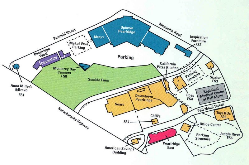
In 1928, Moriichi and Makiyo Sumida began farming assorted wetland produce on a two-acre plot of land at the springs. Back then, the area of the springs contained many small farms growing similar produce — bananas, taro, rice, and watercress. Through the ensuing years, the Sumida property grew as they acquired neighboring leases and, by 1950, watercress became the sole crop. (NPS)
A small waterfall along Kalauao Stream, named Kahuawai (or Kahuewai), was located along the coastal trail connecting Honolulu to Waiʻanae. Kahuawai (water gourd container) was indicated to have been “a favorite resting place exclusively for chiefs”. (Cultural Surveys)
Kahuawai was a noted bathing place since ancient times and was guarded so that any one did not bathe in it except the chiefs. Later it was used by all. Kākuhihewa’s daughters and the hero Kalelealuaka (their husband) bathed in this pool. Kāʻeokūlani, the chief of Kauaʻi also bathed here when he came to war here on Oʻahu. (Cultural Surveys)
Loko Opu, a large fishpond (approximately 10.5-acres in size) located in Kalauao along the Pearl Harbor coast, is said to have been built by the chiefess Kalamanuʻia. (Cultural Surveys)
During the Māhele, much of the lands in the ahupua‘a of ‘Ewa, as in other districts, were awarded to Ali‘i Nui (high chiefs), who were either the grandchildren or great-grandchildren of Kamehameha I.
Half of the ahupua‘a of Kalauao was awarded to Laura Konia (either granddaughter or grandniece of Kamehameha I;) the other half of Kalauao Ahupua‘a was awarded to John Meek, an important merchant in the sandalwood trade.
Today, the Pearl Country Club covers much of the lower section of Kalauao. Pearlridge Shopping Center is on the lowest side of Kalauao (Pearlridge Uptown was opened in 1972, with an expansion in 1976 to include Pearlridge Downtown.) Pearlridge surrounds the evidence of the water resources of old, Kalauao Spring that benefits the Sumida watercress farm.