Images of Old Hawaiʻi

  • Home
  • About
  • Categories
    • Ali’i / Chiefs / Governance
    • American Protestant Mission
    • Buildings
    • Collections
    • Economy
    • Missionaries / Churches / Religious Buildings
    • General
    • Hawaiian Traditions
    • Other Summaries
    • Mayflower Summaries
    • Mayflower Full Summaries
    • Military
    • Place Names
    • Prominent People
    • Schools
    • Sailing, Shipping & Shipwrecks
    • Voyage of the Thaddeus
  • Collections
  • Contact
  • Follow

December 8, 2022 by Peter T Young Leave a Comment

Secret Back-Door Short Cut

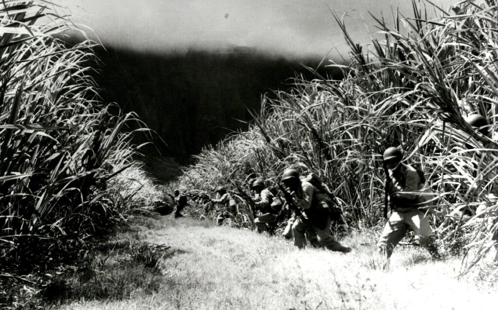
The United States became a world power and acquired overseas holdings as a result of the Spanish-American War. Hawai‘i’s strategic location made it critical to the military interests of the United States.  (Ireland)

The initial studies for the defense of O‘ahu’s south shore called for seacoast batteries westward along the shoreline from Diamond Head to a point immediately west of the Pearl Harbor Channel.

As early as 1901 consideration was given to placing seacoast guns in the vicinity of Waikiki, where two 10-inch guns on barbette carriages were proposed to supplement the fire of the gun and mortar batteries at Diamond Head as well as those projected for the entrance to Pearl Harbor, thus protecting both Pearl and Honolulu Harbors.  (Gaines)

In 1913, Oahu had eight coastal batteries guarding the naval base at Pearl Harbor and the port of Honolulu, including four at Ft. Kamehameha; one at Ft. Armstrong; two at Ft. DeRussy and one at Ft. Ruger. The Navy had dredged the harbor and placed the dredge material at Ft. Kamehameha to build up the submerged land. (Army Corps 100 Years in Hawaii)

The early 1920s saw major changes in the US Army in Hawaii. The Hawaiian Division was formed of infantry and artillery brigades at Schofield Barracks in 1921.

The Artillery District of Honolulu was redesignated the Hawaiian Coast Artillery District on April 5, 1921, moving its headquarters from Fort Ruger to the Alexander Young Hotel in downtown Honolulu until facilities at Fort Shafter were available on June 21, 1921.  (Gaines)

Between the two world wars, nearly a dozen more coast artillery reservations for seacoast batteries, searchlights, fire control stations, and command posts were established on tracts of land of various sizes and placed under the Honolulu Harbor defenses.

Prior to World War II, only the slightest defenses were provided for Oahu’s Windward Coast and North Shore. Shortly before World War II, the Harbor Defense Honolulu was also directed to oversee the initial defense of a new naval air station on Oahu’s

Windward Coast, at Kaneohe Bay. (The Harbor Defenses of Kaneohe Bay was constituted as a separate command in the latter part of 1941.)

During World War II, more gun batteries and fire control installations were built throughout the Honolulu harbor defenses.

During much of this same time, “Hawaii has started in the footsteps of America by projecting a railroad around the island of Oahu, and actually perfecting, within the period from April 1st, 1889, to January 1st, 1890, a well equipped railroad in running order, extending from Honolulu along the southern shore of the island to a temporary terminus at Ewa Court House, a distance of twelve miles.”

“A hundred men told him his scheme was infeasible where one offered encouragement. He believed he was right, and so put forth every endeavor to secure a franchise, which was granted to him only after vigorous legislative opposition to the measure.”

“With all the disadvantages that remoteness from the manufacturing centers of America offered, Mr. Dillingham undertook the contract of building and equipping the railroad. Rails were ordered in Germany, locomotives and cars in America, and ties in the home market; rights of way were amicably secured, surveyors defined the line of road, and grading commenced.”

“The work was prosecuted with the utmost speed consistent with stability and safety, and there was hardly a day’s delay from the time grading commenced, in the spring of 1889, till September 4th following, when the first steam passenger train, loaded with excursionists, left the Honolulu terminus, and covered a distance of half a mile.”  (Whitney)

The OR&L railroad had built a spur from the coast to Wahiawa in 1905, to haul cane and pineapples down to the coast and later to haul men and supplies from Pearl Harbor to Schofield Barracks in Wahiawa through Waikakalaua Gulch in Waikele.

Right after the attack on Pearl Harbor the Army commandeered their entire stock of rails and bridge timbers.

A cut-off between Wahiawa and the windward side of the island was vital to defense, the brass decided it had some 90-ton railway guns for coast defense and feared that enemy attack might sever the main line and make it impossible to spot them along the shoreline in case the Japanese tried to make a landing.

The cut-off was be a sort of a secret back-door short cut. And so, an extremely hush-hush track was laid down from Wahiawa to Haleiwa.

The OR&L only had two miles of steel in stock, and the cut-off was pieced out with light plantation rail.  This “secret railroad” provided a short cut from Pearl Harbor to Army facilities at Kahuku on the north shore of O‘ahu and then over to the windward side.

Fortunately, it was never needed; and, the chances of the heavy guns ever negotiating it successfully were slim, to say the least. (Kneiss)

With the end of World War II came the realization that many of the various batteries and coastal defense guns were no longer capable of meeting the needs of the US military in Hawaiʻi. The giant guns were cut up and sold for scrap, having never fired a shot in anger or defense.

© 2022 Ho‘okuleana LLC

Filed Under: Military Tagged With: Army, Military, OR&L

December 7, 2022 by Peter T Young Leave a Comment

“Something was happening”

The Japanese attack on Pearl Harbor on December 7, 1941 lasted 110 minutes, from 7:55 am until 9:45 am. Japanese naval forces included 4 heavy aircraft carriers, 2 heavy cruisers, 35 submarines, 2 light cruisers, 9 oilers, 2 battleships and 11 destroyers.

The attacking forces came in two waves, the first consisting of 183 aircraft which included 40 torpedo planes, 49 level bombers, 51 dive bombers and 43 fighters. The second wave included 170 planes, 54 of them level bombers, 80 dive-bombers and 36 fighters.  Over 350 Japanese planes were involved in overall attack.

As a result of the December 7, 1941 attack, there were 2,403-people killed and 1,178-wounded. Among the deceased were 2,008-Navy personnel, 109-Marine, 218-Army and 68-civilians.  (navy-mil)

For part of the attack, and aftermath, first, let’s look back.

In 1899, Gorokichi Nakasugi, a Japanese shipbuilder, brought a traditional 34-foot Japanese sailing sampan to Hawai‘i; this led to a unique class of vessels and distinctive maritime culture associated with the rise of the commercial fishing industry in Hawai‘i.

(The term ‘Sampan,’ although usually associate with the Japanese in Hawaiʻi, comes from the Chinese language, meaning three (san) boards (ban,) describing a small simple skiff.)  (VanTilburg)

Japanese-trained shipwrights adapted the original sampan design to the rough waters of the Hawaiian Islands.  The fishermen used traditional live bait, pole-and-line method of fishing and unloaded their catches of aku (bonito, skipjack) and ahi (yellow-fin tuna) at Kewalo Basin.

Local Japanese fishermen opened the commercial tuna industry in Hawaiʻi in conjunction with the innovation of modern packing plants.  It was the ability to can tuna for the distant market which really made possible the expansion and modernization of the fishing fleet.  The industry benefited American canneries.

Vessels began to change with time, as well.  Gasoline engines were fitted into boats beginning in 1905, and more suitable marine diesels by 1927. Shortly thereafter the prominent deckhouse made its appearance.  The Sampans became perfectly adapted to the rough waters between the islands.  (VanTilburg)

The sampan aku fleet was based at Kewalo Basin by 1930, and the McFarlane Tuna Company (later known as Hawaiian Tuna Packers) built a shipyard there in 1929 and a new tuna cannery at the basin in 1933.

By 1940, there were over 450-sampans in the Territory of Hawaiʻi, making the commercial fishery the Islands’ third largest industry behind sugar and pineapple.

That brings us to December 1941, more specifically, December 4 – four sampans (Kiho Maru, Myojin Maru, Shin-ei Maru and the Sumiyoshi Maru) set out for fishing off Oʻahu’s leeward coast.

Later, on the morning of December 7, the Ward (US Destroyer No. 139,) conducting routine antisubmarine patrols in the Hawaiian area, had the distinction of firing the first American gun in anger during the Pacific war.  She searched for a suspected submarine and subsequently fired shots at its conning tower.

(In 2002, the University of Hawaiʻi, Hawaiʻi Undersea Research Lab (HURL) team found the submarine about three to four miles off Pearl Harbor and verified it was hit and sunk by the Ward.  (Burlingame))

Heading home, the Ward soon spotted a Japanese fishing sampan, one of many that was a familiar sight in the waters in the Hawaiian archipelago (not part of the four noted before.)

A fisherman suddenly started waving a white flag perhaps he had seen the determined depth-charge attacks and thought that the Americans would bomb anything that moved. Ward slowed and closed to investigate and took the small craft in tow to turn her over to the Coast Guard for disposition.

Nearing the harbor entrance around 0800, those on deck heard the sound of gunfire and explosions, as smoke began to boil into the skies over Pearl Harbor. (Dictionary of American Naval Fighting Ships)

“Something was happening.”

The Ward had returned and witnessed the December 7, 1941 attack on Pearl Harbor.

On the morning of December 8, newspapers announced that all unidentified boats approaching Oʻahu would be fired upon. It was feared that the local fishing fleet, manned predominantly by Japanese might have had rendezvous with Japanese warships. (Roehner)

Then, the fateful day for the four sampans as they were heading home.  “All of a sudden, there were four or five Army P40s flying over us.  Each picked out a target and attacked.”

The war-planes strafed the four fishing boats (Kiho Maru, Myojin Maru, Shin-ei Maru and the Sumiyoshi Maru) about 2-miles off Barber’s Point, about 10-miles west of Pearl Harbor, killing six civilians (nine crewmen survived the mid-morning attack, but most were wounded – most of the crew on the boats were American citizens.)

After the planes attacked, a destroyer arrived on the scene and dispatched launches to tow the sampans, with the dead and wounded, back to Kewalo Basin.  They were then taken to a civilian hospital where the wounded were kept under armed guard.    (European Stars and Stripes, December 9, 1977)

The dead were brought from the waterfront to Hosoi Funeral Parlor. They were: Ogawa Mataichi, Kaichi Okada, Sutematsu Kida, Kiichi Kida, Kiho Uyehara, Riyozo Okogi.  (Scrapbook of Women of WWII Hawaiʻi)

Again on December 12th, sampans were strafed off of both Kailua and Kohala coasts.  (VanTilburg)

World War II had the single largest impact on the sampan fishing industry.   During the war, the fleet was immediately limited to operating only during certain narrow hours in a few selected near shore areas. This, of course, was devastating to the fishery. By the end of 1942, the annual yield was down by a staggering 99%.  (VanTilburg)

In 1967, 26 years after the incident, the widow of the Kiho Maru skipper received $8,000.  Another received about $2,500 and proceeds from the sale of fish that was in his boat on the day of the attack.  (European Stars and Stripes, December 9, 1977)


© 2022 Hoʻokuleana LLC


Filed Under: Military Tagged With: Hawaii, Oahu, Pearl Harbor, Sampan, Kewalo Basin

December 2, 2022 by Peter T Young Leave a Comment

“East Wind, Rain”

Takeo Yoshikawa, a Japanese spy, arrived in Honolulu on March 27, 1941, aboard the Japanese liner Nitta Maru.  His papers identified him as Tadashi Morimura, the name he was always referred to while in the Islands (and subsequent investigative records.)  (He’ll be referred to here by his real name, Yoshikawa.)

Born on March 7, 1914, Yoshikawa had been approached in 1936 to work as a civilian for Japan’s naval intelligence service: “Since I had been studying English, I was assigned to the sections dealing with the British and American navies. I became the Japanese navy’s expert on the American navy.”

“I read everything; diplomatic reports from our attachés, secret reports from our agents around the world. I read military commentators like Hanson Baldwin (New York Times military affairs editor.)” Yoshikawa also studied Jane’s Fighting Ships and memorized the silhouettes of all the American ships, something that would later prove critical.  (Savela)

Posing as junior diplomat, Yoshikawa was to keep current on the status of the US fleet and its anchorages, reporting his observations to Tokyo by coded telegraph messages.  Thanks to Hawaiʻi’s large Japanese-American population, Yoshikawa easily blended in.

When Kita briefed Yoshikawa, he reminded him, “Don’t make yourself conspicuous; maintain a normal, business-as-usual attitude, keep calm under all circumstances; avoid taking unnecessary risks; stay away from guarded and restricted areas and be aware of the FBI.” (Prange; Savela)

In keeping with his cover, Yoshikawa avoided illegally entering military bases or stealing classified documents. He shunned cameras and notepads, relying instead on memory. He supplemented his observations with items of interest gleaned from daily newspapers.

Yoshikawa familiarized himself with the principal Hawaiian Islands and their military installations, which were concentrated on Oʻahu. He frequently relied on a hired cab driven by John Mikami, a Japanese-Hawaiian who often performed chores for the consulate.  (Deac)

Other times, Yoshikawa was chauffeured by Richard Kotoshirodo, a consular clerk. It did not take long for Yoshikawa to scout out the various US Army and Navy bases on central, southern and eastern Oʻahu. Predictably, the focus of his attention was Pearl Harbor, the nearly landlocked US Pacific Fleet anchorage on the south coast of the island.

The assignment fit into a plan outlined in January 1941 by Combined Fleet Commander Isoroku Yamamoto. The plan called for an aerial assault on Hawaiʻi as the opening move of a war between the United States and Japan. Yoshikawa was to become his country’s only military spy in the islands and Yamamoto’s most valuable source of current information on Oʻahu.  (Deac)

And with its relatively open landscape, sloping elevations, and limited restrictions on movement, he readily compiled useful intelligence. His encyclopedic knowledge of US ships and his methodical charting of their movements made his reports all the more valuable.  His contribution to the Japanese effort was ultimately “an important one.”  (Savela)

Yoshikawa did not work alone.  Later joining him in espionage was a ‘sleeper agent’ Bernard Otto Julius Kuehn and his family, Nazi spies sent to the Islands by Nazi Propaganda Minister Joseph Goebbels.  (Washington Times)

The Kuehns arrived in Hawaiʻi in 1935, they blended in, and waited; no one seriously suspected that Caucasians would carry on espionage for the Empire of Japan, so Kuehn, his wife Friedel, their daughter and son, Hans Joachim, were virtually inconspicuous as a white family on the windward side.

However, every member of the family contributed towards collecting and documenting military activities at Pearl Harbor from 1935 right up to the day the bombs fell from Japanese aircraft.

On December 2, days before the attack, Kuehn provided specific – and highly accurate – details on the fleet in writing. That same day, he gave the consulate the set of signals that could be picked up by nearby Japanese submarines.  (FBI)

At midafternoon on December 6, Yoshikawa made his final reconnaissance of Pearl Harbor from the Pearl City pier.  Back at the consulate, he coordinated his report with Kita, and then saw that the encoded message was transmitted to Tokyo.

At 1:20 am on December 7, 1941, on the darkened bridge of the Japanese aircraft carrier Akagi, Vice Admiral Chui­chi Nagumo was handed the following message:

“Vessels moored in harbor: 9 battleships; 3 class B cruisers; 3 seaplane tenders, 17 destroyers. Entering harbor are 4 class B cruisers; 3 destroyers. All aircraft carriers and heavy cruisers have departed harbor…. No indication of any changes in US Fleet or anything unusual.”  (Savela)

In the early morning of December 7, 1941, Japanese pilots flew toward the island of Oʻahu from six aircraft carriers (the Akagi, Kaga, Soryu, Hiryu, Shokaku and Zuikaku;) two waves of planes attacked various military installations on Oʻahu.

The prearranged coded signal “East wind, rain,” part of the weather forecast broadcast over Radio Tokyo, alerted Japanese Consul General Nagao Kita in Honolulu, and others, that the attack on Pearl Harbor had begun.

The first wave of 183-planes (43-fighters, 49-high-level bombers, 51-dive bombers and 40-torpedo planes) struck its targets at 7:55 am.  The second wave of 167-Japanese planes (35-fighters, 54-horizontal bombers and 78-dive bombers) struck Oʻahu beginning at 8:40 am.

The Japanese consulate staff locked the consulate doors and began burning all their codebooks and classified material. “Smoke was pouring out of the chimney.”   At about 9:30 am, December 7, the consulate staff was arrested and later shipped to Phoenix, Arizona.

By 9:45 am, the Japanese attack on Oʻahu was over.

© 2022 Hoʻokuleana LLC

Takeo Yoshikawa
Japanese Consulate Staff-Honolulu-(NationalArchives)
Japan's Spy in Hawaii-(Barclay)
Nitta-maru_1940
SPY, WIFE, HERO - TAKEO YOSHIKAWA, HIS WIFE, ETSUKO, AND HIS LIFETIME HERO, ADMIRAL TSOROKU YAMAMOTO, SUPREME COMMANDER AND PLANNER OF THE JAPANESE ATTACK FORCE THAT ATTACKED PEARL HARBOR. EXCLUSIVE PHOTO BY RON LAYTNER FOR EDIT INTERNATIONAL.
SPY, WIFE, HERO – TAKEO YOSHIKAWA, HIS WIFE, ETSUKO, AND HIS LIFETIME HERO, ADMIRAL TSOROKU YAMAMOTO, SUPREME COMMANDER AND PLANNER OF THE JAPANESE ATTACK FORCE THAT ATTACKED PEARL HARBOR. EXCLUSIVE PHOTO BY RON LAYTNER FOR EDIT INTERNATIONAL.
Takeo Yoshikawa-(Barclay)
SITTING ON HIS HORSE 'JONNY' THE LEGENDARY PEARL HARBOR SPY, TAKEO YOSHIKAWA, SAID "I WAS BORN IN THE DAYS OF THE GREAT JAPANESE EMPIRE WHEN THE YAMATO RACE WALKED TALL ACROSS ASIA AND BOYS WERE DESTINED FOR GREATNESS." EXCLUSIVE PHOTO COPYRIGHT BY RON LAYTNER, EDI INTERNATIONAL.
SITTING ON HIS HORSE ‘JONNY’ THE LEGENDARY PEARL HARBOR SPY, TAKEO YOSHIKAWA, SAID “I WAS BORN IN THE DAYS OF THE GREAT JAPANESE EMPIRE WHEN THE YAMATO RACE WALKED TALL ACROSS ASIA AND BOYS WERE DESTINED FOR GREATNESS.” EXCLUSIVE PHOTO COPYRIGHT BY RON LAYTNER, EDI INTERNATIONAL.
"IN MY YOUTH I WAS A SAMURAI. I BELIEVED IN WAR AND DEATH IN BATTLE. I SHAPED HISTORY. NOW I AM OLD AND BELIEVE IN PEACE AND LOVE." TAKO YOSHIKAWA, THE PEARL HARBOR SPY, INTERVIEWED BEFORE HIS DEATH IN 1984. WORLD EXCLUSIVE PHOTOGRAPH COPYRIGHT BY RON LAYTNER AND EDIT INTERNATIONAL.
“IN MY YOUTH I WAS A SAMURAI. I BELIEVED IN WAR AND DEATH IN BATTLE. I SHAPED HISTORY. NOW I AM OLD AND BELIEVE IN PEACE AND LOVE.” TAKO YOSHIKAWA, THE PEARL HARBOR SPY, INTERVIEWED BEFORE HIS DEATH IN 1984. WORLD EXCLUSIVE PHOTOGRAPH COPYRIGHT BY RON LAYTNER AND EDIT INTERNATIONAL.
WATCHING THE NEW JAPAN THROUGH HIS WINDOW, THE OLD SPY SAID: "I AM NOT SORRY ABOUT PEARL HARBOR - ONLY THAT JAPAN HAS NOT HONORED ME. ALL THOSE WHO DIED IN THE ATTACK - ALL THE AMERICANS AND THE FEW JAPANESE TOO - THEY DIED FOR THE GLORY OF HISTORY," SAID UNREPENTENT JAPANESE SUPER SPY TAKEO YOSHIKAWA, WHO WAS DIRECTLY RESPONSIBLE FOR PROVIDING JAPANESE FORCES WITH INTELLIGENCE FROM PEARL HARBOR. EXCLUSIVE PHOTO COPYRIGHT BY RON LAYTNER FOR EDIT INTERNATIONAL.
WATCHING THE NEW JAPAN THROUGH HIS WINDOW, THE OLD SPY SAID: “I AM NOT SORRY ABOUT PEARL HARBOR – ONLY THAT JAPAN HAS NOT HONORED ME. ALL THOSE WHO DIED IN THE ATTACK – ALL THE AMERICANS AND THE FEW JAPANESE TOO – THEY DIED FOR THE GLORY OF HISTORY,” SAID UNREPENTENT JAPANESE SUPER SPY TAKEO YOSHIKAWA, WHO WAS DIRECTLY RESPONSIBLE FOR PROVIDING JAPANESE FORCES WITH INTELLIGENCE FROM PEARL HARBOR. EXCLUSIVE PHOTO COPYRIGHT BY RON LAYTNER FOR EDIT INTERNATIONAL.
THE MOST EFFECTIVE SPY IN HISTORYM TAJEI ISGUJAWAM DRUBJS TI FIRGET UB NATSYTANA IB SGUBIJY USKABDM "JAPAN NOW THINKS ONLY OF MONEY AND HOW TO WIN NEW MRKETS," HE SAID SADLY. EXCLUSIVE PHOTO COPYRIGHT BY RON LAYTNER FOR EDIT INTERNATIONAL.
THE MOST EFFECTIVE SPY IN HISTORYM TAJEI ISGUJAWAM DRUBJS TI FIRGET UB NATSYTANA IB SGUBIJY USKABDM “JAPAN NOW THINKS ONLY OF MONEY AND HOW TO WIN NEW MRKETS,” HE SAID SADLY. EXCLUSIVE PHOTO COPYRIGHT BY RON LAYTNER FOR EDIT INTERNATIONAL.

Filed Under: Military Tagged With: Pearl Harbor, Bernard Kuehn, Takeo Yoshikawa, Hawaii, Oahu

November 16, 2022 by Peter T Young Leave a Comment

Kolekole

From Kūkaniloko (royal birth stones near Wahiawa,) the winter solstice (December 21) occurs when the sun is aligned with Kolekole.

The Waiʻanae ahupuaʻa has an un-typical shape – it has two parts: Waiʻanae Kai, on its western side, runs from the ocean to the Waiʻanae Mountains (like a typical ahupuaʻa;) however, Waiʻanae Uka continues across Oʻahu’s central plain and extends up into the Koʻolau Mountains.

Kolekole Pass forms a low crossing point through the Waiʻanae Mountains.  A prehistoric trail crossed Kolekole pass linking Waiʻanae Uka with Waiʻanae Kai.

As a result, the trail was of strategic importance. Kolekole Pass is not far from the base of Mount Kaʻala, the highest summit on O‘ahu, an important place in Hawaiian religion, ceremony, legend and perhaps celestial observations.

When Kahekili was reigning as king of Maui, and Kahahana was king of Oʻahu, it was during this period that Kahahawai, with a number of warriors, came to make war on Oʻahu (Kahahawai was a strategist for Kahekili.)

A decisive battle in the war between Kahekili and Kahahana, fought in the Waiʻanae mountain range, took place near Kolekole Pass.

“Kahahawai told them to prepare torches. When these were ready they went one evening to the top of a hill which was near to the rendezvous of the enemies where they lighted their torches.”  (Fornander)

“After the torches were lit they moved away to a cliff called Kolekole and hid themselves there, leaving their torches burning at the former place until they died out. The enemies thought that Kahahawai and his men had gone off to sleep. They therefore made a raid … But Kahahawai and his men arose and destroyed all the people who were asleep on the hills and the mountains of Kaʻala. Thus the enemies were annihilated, none escaping.”  (Fornander)

Therefore, the conquest of Oʻahu by Kahekili was complete through the bravery and great ingenuity of Kahahawai in devising means for the destruction of the enemy.  Oʻahu remained until the reign of Kalanikūpule, Kahekili’s son – until Oʻahu was conquered by Kamehameha in 1795.

Near Kolekole Pass is the Kolekole Stone, which is described as a “sacrificial stone,” but the story that victims were decapitated over this stone may be a fairly recent rendition. Older stories suggest the stone represents the Guardian of the Pass, a woman named Kolekole.

Reportedly, Kolekole was a place where students practiced lua fighting. Students practiced their techniques on “passing victims” on the “plains of Leilehua.”  Lua was an “art” that involved dangerous hand-to-hand fighting in which the fighters broke bones, dislocated bones at the joints, and inflicted severe pain by pressing on nerve centers.

This form of fighting involved a number of skills: “first, how to grasp with the hands, second, how to prod with a kauila cane; third, how to whirl the club called the pikoi or ikoi that had one end … tied with a rope of olona fibers.”  (Na Oihana Lua Kaula 1865 – Army)

In the late-1800s, James I Dowsett had ranching interests on lands now occupied by Fort Shafter, Schofield Barracks and Wheeler Army Airfield; portions of the latter two were part of his extensive Leilehua Ranch. Cattle from George Galbraith’s Mikilua Ranch in Lualualei Valley on the Waiʻanae coast may have been herded across Kolekole Pass to pasture on Leilehua Ranch plateau lands.

With later US military use in Waiʻanae and Central Oʻahu, passage through Kolekole Pass provided a convenient short cut across the Waiʻanae Mountains between Schofield Barracks and Lualualei Naval Magazine.  The Army’s 3rd Engineers corps constructed vehicular passage in 1937.

Kolekole Pass, is located at the northern corner of the Lualualei Valley and connects the Waianae coast with Waianae Uka (the present Schofield Barracks.)

On the morning of December 7, 1941, six Japanese carriers transported torpedo planes, dive bombers and fighters to a point about 220 miles north of Oʻahu.  Launching the aircraft in two waves, the attackers achieved total surprise and wreaked havoc.

Contrary to general belief, the attacking aircraft did not come through Kolekole Pass west of Wheeler but flew straight down the island.  Most of the attacking planes approached Pearl Harbor from the south.  Some came from the north over the Koʻolau Range, where they had been hidden en route by large cumulus clouds.  (hawaii-gov)

In 1997, a 35-year-old, 35-ton white steel cross at Kolekole Pass was ordered dismantled by the Army – threatened with lawsuit, they chose removal, rather than fighting a separation of church and state claim.

The first cross at the pass was put up in the 1920s; later, a metal one was erected in 1962.  It was later replaced with an 80-foot flagpole that flew an American flag.

© 2022 Hoʻokuleana LLC


Filed Under: Ali'i / Chiefs / Governance, Military, Place Names Tagged With: Kalanikupule, Kolekole Pass, Kahahawai, Lua, Waianae, Hawaii, Oahu, Kahahana, Kahekili, Schofield Barracks

September 18, 2022 by Peter T Young Leave a Comment

Ho‘olehua Airport

When Emory Bronte and Ernest Smith made history on July 15, 1927 with the first successful trans-Pacific flight by civilians, there was no airport on Molokai.

They were expected to land at Wheeler Field on Oahu, but ran out of fuel over Molokai and crashed into kiawe trees on the southeast coast of Molokai.

Later that year, the Territorial Governor signed Executive Order No. 307 setting aside an area of 204.8 acres of Territorial land at Ho‘olehua, Molokai; the Territorial Legislature appropriated funds for an airport.

On December 15, 1927, what was then called Ho‘olehua Airport was placed under the control and management of the Territorial Aeronautical Commission. It was effectively a level grassy field that was marked and cleared so that take offs and landings could be made.

It was proposed to eventually fully-improve the field for all commercial and military purposes.  The field could be used by the large and heavy trans-Pacific land planes expected to pass through the Territory.

Inter-Island Airways inaugurated interisland air service from Honolulu to Molokai on November 11, 1929 in Sikorsky S-38 amphibians.  The fare was $17.50.

By the end of 1929, a small waiting room and telephone booth were added and a pole and windsock were erected. In 1930, it was renamed Molokai Airport.

The Army got interested in the airport in 1931 and by 1937 Molokai Airport consisted of three runways—1,000, 2,600 and 2,600 feet long, 300 feet wide with 100 feet of grading on each side.  The Army called it Homestead Field Military Reservation.

Molokai Airport was one of the principal airports of the Territory during the pre-war development of aviation in the Islands.   The Army maintained a radio station and Inter-Island Airways, Ltd. had a Station House at the field.

On December 7, 1941 the airport was taken over by the Army and Navy and the services remained in possession until 1947.  During this period the U.S. Army made extensive improvements (two paved runways, one 4,400 feet in length and the other 3,200 feet in length, each with a width of 200 feet; taxiways, plane parking areas and runway lighting.

By agreement with the Army, the Territory assumed responsibility for the operation and maintenance of the airport in 1947 under the management of the Hawaii Aeronautics Commission.

In addition to its peace-time function, the airport had continuing importance to the Army and Navy.  The extension of the North-South Runway was particularly important because the runway was not adequate for large aircraft except with restricted loading.

Location of this field was such that during heavy rains excess mud and water flowed onto the operating area, sometimes necessitating closing the field until an emergency crew was able to clean up.  A system of drainage ditches was designed and completed in September 1953 to alleviate this.

Hawaiian Airlines, Ltd. and Trans-Pacific Airlines, Ltd., provided scheduled service to Molokai, and Andrew Flying Service flew on a non-scheduled basis.

A new Molokai Airport Terminal was officially dedicated on June 15, 1957 with pioneer aviator Emory Bronte in attendance.

In the mid-1970s, there were preliminary planning for moving the site of Molokai Airport.  The engineering analysis to be used in the site selection for a new airport for Molokai continued.  Construction of new hotel facilities on Molokai accounted for the increase in passengers served at Molokai Airport. 

The site study for a new Molokai Airport was completed in 1978 with a recommendation that 500 to 600 acres of land be set aside in the northwest corner of the island.

The report recommended against immediate construction at the new site in view of the high cost for a new airport compared to the relatively low air traffic to Molokai.  The estimated cost was $25.8 million in 1978.

The report recommended continued improvements to the existing airport at Hoolehua until such time that traffic warranted the construction of the new airport.

A renovated passenger terminal and support facilities were dedicated on October 19, 1994. The 24,000 square foot terminal had an upgraded passenger waiting area, ticket lobby, air cargo handling facilities and tenant lease area.  (Information here is from Hawai‘i DOT Airports.)

© 2022 Ho‘okuleana LLC

Filed Under: General, Military, Place Names, Economy Tagged With: Hoolehua Airport, Homestead Field Military Reservation, Molokai, Molokai Airport

  • « Previous Page
  • 1
  • …
  • 15
  • 16
  • 17
  • 18
  • 19
  • …
  • 45
  • Next Page »

Images of Old Hawaiʻi

People, places, and events in Hawaiʻi’s past come alive through text and media in “Images of Old Hawaiʻi.” These posts are informal historic summaries presented for personal, non-commercial, and educational purposes.

Info@Hookuleana.com

Connect with Us

  • Email
  • Facebook
  • LinkedIn
  • Twitter
  • YouTube

Recent Posts

  • Protecting a Forest, Preserving a Culture
  • Sharing the Spirit of America – SharingTheSpiritOfAmerica
  • Ahahui Hoʻoulu a Hoʻola Lahui
  • Hōkūle‘a Was An Official US Bicentennial Project
  • About 250 Years Ago … E Pluribus Unum – ‘Out of Many, One’
  • 250-Years Ago … Declaration of Independence
  • 250 Years Ago … Comparing American & Hawaiian ‘Declarations’ … and War

Categories

  • Place Names
  • Prominent People
  • Schools
  • Sailing, Shipping & Shipwrecks
  • Economy
  • Voyage of the Thaddeus
  • Mayflower Summaries
  • American Revolution
  • General
  • Ali'i / Chiefs / Governance
  • Buildings
  • Missionaries / Churches / Religious Buildings
  • Hawaiian Traditions
  • Military

Tags

Albatross Al Capone Ane Keohokalole Archibald Campbell Bernice Pauahi Bishop Charles Reed Bishop Downtown Honolulu Eruption Founder's Day George Patton Great Wall of Kuakini Green Sea Turtle Hawaii Hawaii Island Hermes Hilo Holoikauaua Honolulu Isaac Davis James Robinson Kamae Kamaeokalani Kameeiamoku Kamehameha Schools Lalani Village Lava Flow Lelia Byrd Liberty Ship Liliuokalani Mao Math Mauna Loa Midway Monk Seal Northwestern Hawaiian Islands Oahu Papahanaumokuakea Marine National Monument Pearl Pualani Mossman Quartette Thomas Jaggar Volcano Waikiki Wake Wisdom

Hoʻokuleana LLC

Hoʻokuleana LLC is a Planning and Consulting firm assisting property owners with Land Use Planning efforts, including Environmental Review, Entitlement Process, Permitting, Community Outreach, etc. We are uniquely positioned to assist you in a variety of needs.

Info@Hookuleana.com

Copyright © 2012-2024 Peter T Young, Hoʻokuleana LLC

Loading Comments...