Athens was named for goddess Athena after she disputed Poseidon’s claim (he plunged his trident into the ground and unleashed a salt water spring to symbolize his power as god of the sea.) Athena planted an olive tree, saying that it represented peace and prosperity.
Zeus intervened and asked the other gods and goddesses to settle the matter by deciding who had given them the better gift. All of the gods voted for Poseidon and the goddesses for Athena, but as Zeus abstained, the women’s votes outnumbered the men’s by one, and Athena won.
Today, the olive branch continues as a symbol of peace and prosperity.
Hawaiʻi has an endemic olive, the Olopua (it is found only in Hawaiʻi.) It belongs to the Oleaceae or Olive family which include olives, as well as forsythia, ash, privet, jasmine and pīkake.
The early Hawaiians had a number of uses for the very durable hard wood. Though it was difficult to work with and they fashioned spears (ihe,) digging sticks (ʻōʻō,) adze handles (ʻau koʻi,) daggers for warfare (pāhoa) and rasps for making fish hooks.
The strong wood was also used for posts, rafters and thatching posts or purlins in house (hale) construction. It was a preferred firewood, as it burned with a hot flame even when green.
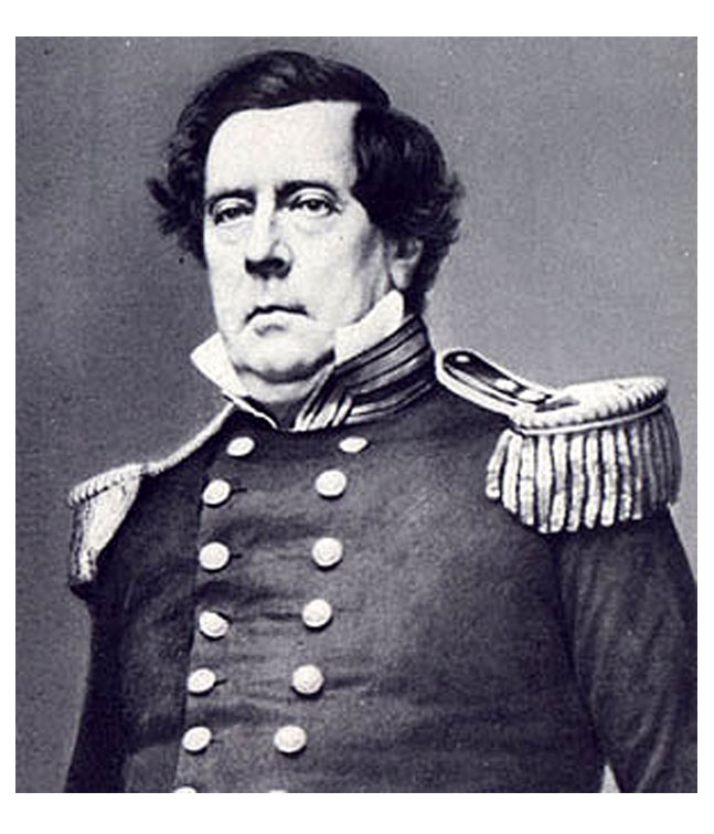
Olives were also imported to Hawaiʻi – for its leaf tea, fruit and oil. Don Francisco de Paula Marin (known to the Hawaiian as “Manini”) was a Spaniard who arrived in the Hawaiian Islands in 1793 or 1794 (at about the age of 20.)
Marin was known for his interest in plant collecting and brought in a wide variety of new plants to Hawai‘i. His gardens were filled with trees, vines and shrubs – including olives.
Another early olive importer was another Kamehameha ally, Captain Alexander Adams (he arrived in Hawaiʻi in 1811;) among other crop plants, he brought olives from California.
Later, attempts were made (and/or encouraged) to expand Hawaiʻi’s agricultural diversity.
“We welcome His Honor Judge Jones back from his trip to Oliva Wainiha, Kauai, whither he went last week to plant olive trees and grape vines on his plantation.”
“We are glad to know that our people are taking a lively interest in the matter of introducing fruits from abroad, and that a spirit of enterprise has taken hold which, if persevered in, will in due time bring forth good results. Every man should remember that ‘he who causes one more blade of grass to grow is a benefactor,’ and has not lived in vain.” (Hawaiian Gazette, March 19, 1879)
“We noticed in our last Issue that a number of olive trees in fine condition had been imported by Mr. Bush. We have since learned that they were imported by Mr. Bush for Judge Jones, who has started a new Industry at Wainiha, Kauai.”
“He has a vineyard of 10,000 assorted vines and several hundred olive trees now growing and in a flourishing condition. We understand that be intends to add yearly to the number of his olives and vines, and for that purpose the late importation was made.” (Pacific Commercial, March 6, 1880)
Then a newspaper article raised an interesting perspective, “In Southern California at the present time there are 2,500,000 olive trees, and the product of these trees is in ever increasing demand. The trees yield to the owner from three to seven dollars each, according to age.”
“The California pickled olive is gaining in favor in the East and is competing strongly with the olives from the Mediterranean seaboard, the fruit from the Pacific Slope being of finer quality. If Southern California can raise olives, undoubtedly the Hawaiian islands can.” (Hawaiian Star, March 11, 1898)
Some took on the challenge, “Some years ago olives were grown up on this Island and shown to be a practical success. The trees were sturdy although not scientifically grown and bore fruit that an expert from Greece stated to be superior to any grown in Ionia.”
“’The trees were first planted by Judge Jones,’ said John Emmeluth this morning ‘and afterwards came into my hands. The growing of olives seems to be satisfactory and easy enough in these islands but in this instance were not properly looked after in the Initiatory stages of their growth.’” (Hawaiian Star, December 16, 1901)
“From my observation it takes about twelve years for the trees to bear, a long time for the small farmer to wait for his profits, but It must be remembered that the trees can be cultivated as a subsidiary Issue for the first few years and that they will grow on the rocky uplands that could not be cleared and used for ordinary crops.”
“The greatest trouble we experienced and on which among other causes finally stopped the growing of olives was the destruction of the fruit by the birds, the trees flowered readily and if, as soon as the olive showed in fruitage, I covered the branch with netting and kept off the depredations of the birds, the fruit yield was most satisfactory.”
“I don’t think it was the mynahs that did the damage but rather the small rice birds that roosted in the branches over night and made their breakfasts on my young olives in the morning. I imagine that they have similar troubles elsewhere and have found means of counteracting the difficulty. I think that there is little doubt but what the olive could he grown here successfully and profitably.” (Hawaiian Star, December 16, 1901)
Reportedly, Eben Parker Low planted olive trees around his hometown of Waimea on the Island of Hawaiʻi around 1895.