Images of Old Hawaiʻi

  • Home
  • About
  • Categories
    • Ali’i / Chiefs / Governance
    • American Protestant Mission
    • Buildings
    • Collections
    • Economy
    • Missionaries / Churches / Religious Buildings
    • General
    • Hawaiian Traditions
    • Other Summaries
    • Mayflower Summaries
    • Mayflower Full Summaries
    • Military
    • Place Names
    • Prominent People
    • Schools
    • Sailing, Shipping & Shipwrecks
    • Voyage of the Thaddeus
  • Collections
  • Contact
  • Follow

March 28, 2025 by Peter T Young Leave a Comment

Maui Alaloa

The canoe was a principal means of travel in ancient Hawaiʻi.

Canoes were used for inter-village coastal and interisland travel, while trails within the ahupuaʻa provided access between the uplands and the coast.

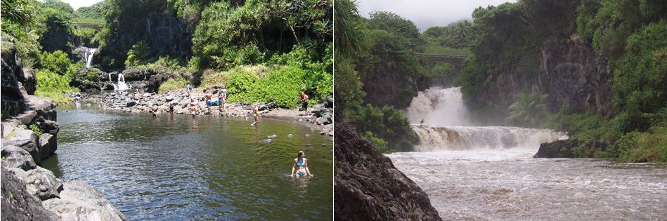
Most permanent villages initially were near the sea and sheltered beaches, which provided access to good fishing grounds as well as facilitating canoe travel between settlements.

At about the same time of Christopher Columbus crossing the Atlantic to America (he was looking for an alternate trade route to the East Indies,) Piʻilani was ruler of Maui.

According to oral tradition, Piʻilani unified the entire island of Maui and ruled in peace and prosperity, bringing together, under one rule, the formerly-competing eastern (Hāna) and western (Wailuku) multi-district kingdoms of the Island.

Piʻilani’s prosperity was exemplified by a boom in agriculture and construction of heiau, fishponds, trails and irrigation systems.  Famed for his energy and intelligence, Piʻilani constructed the West Maui phase of the noted Alaloa, or long trail (also known as the King’s Highway.)

Ancient trails facilitated trading between upland and coastal villages and communications between ahupuaʻa and extended families. These trails were usually narrow, following the topography of the land.  Sometimes, over ʻaʻā lava, they were paved with waterworn stones (ʻalā or paʻalā).

Pi‘ilani died at Lāhainā and the kingdom of Maui passed to his son, Lono-a-Piʻilani (Lono.) Pi‘ilani had directed that the kingdom go to Lono, and that Kiha-a-Piʻilani (Kiha – Lono’s brother) serve under him in peace.

In the early years of Lono’s reign all was well … that changed.

Lono became angry, because he felt Kiha was trying to seize the kingdom for himself.  Lono sought to kill Kiha; so Kiha fled in secret to Molokaʻi and later to Lānaʻi. When Kiha, with chiefs, warriors and a fleet of war canoes, made their way to attack Lono; Lono trembled with fear of death, and died. (Kamakau)

Kiha assumed power over Maui.  Like his father, the reign of Kiha was, “eminently peaceful and prosperous, and his name has been reverently and affectionately handed down to posterity”. (Fornander)

Kiha resumed what his father had started in West Maui.  Kiha laid the East Maui section and connected the island.  This trail was the only ancient pathway to encircle any Hawaiian island (not only along the coast, but also up the Kaupō Gap and through the summit area and crater of Haleakalā.)

Kiha connected the entire island with a network of trails to aide his people in their travels which gave him quick access to all parts of his kingdom.

Four to six-feet wide and 138-miles long, this rock-paved path facilitated both peace and war.  It simplified local and regional travel and communication, and allowed the chief’s messengers to quickly get from one part of the island to another.  The trail was used for the annual harvest festival of Makahiki and to collect taxes, promote production, enforce order and move armies.

Missionaries Richards, Andrews and Green noted in 1828, “a pavement said to have been built by Kihapiʻilani, a king … afforded us no inconsiderable assistance in traveling as we ascended and descended a great number of steep and difficult paries (pali.)” (Missionary Herald)

By the middle-1820s, significant changes in the Hawaiian Kingdom were underway. The missionaries, who arrived in April 1820, selected key stations generally coinciding with the traditional Royal Centers, which by this time, were also developing as trade points with foreign vessels.

The development of trails to western-style roadways was initiated to facilitate access to mission stations, landings, and key areas of resource collection.

Until the 1840s, overland travel was predominantly by foot and followed the traditional trails. By the 1840s, the use of introduced horses, mules and bullocks for transportation was increasing, and many traditional trails – the ala loa and mauka-makai trails within ahupuaʻa – were modified by removing the smooth stepping stones that caused the animals to slip.

Eventually, wider, straighter trails were constructed to accommodate horse drawn carts. Unlike the earlier trails, these later trails could not conform to the natural, sometimes steep, terrain. They often by-passed the traditional trails as more remote coastal villages became depopulated due to introduced diseases and the changing economic and social systems.

Sometimes, the new corridors were constructed over the alignments of the ancient trails, or totally realigned, thus abandoning – for larger public purposes – the older ala loa. In addition to these modifications in trail location and type due to changing uses, trails were also relocated as a result of natural events such as lava flows, tsunami, and other occurrences. The Hawaiian trail system was and will remain dynamic.

Hoapili is credited with improving the King’s Highway (in early 1800s – portions were called Hoapili Trail, initially built during the reign of Pi‘ilani.)  Hoapili commissioned road gangs for the work. The Rev. Henry Cheever noted that these road gangs were largely composed of prisoners who had been convicted of adultery; Cheever called it “the road that sin built.”  (Samson)

By the early 1850s, specific criteria were developed for realigning trails and roadways, including the straightening of alignments and development of causeways and bridges. This system of roadwork, supervised by district overseers, and funded through government appropriations – with labor by prisoners and individuals unable to pay taxes in another way – evolved over the next 40 years.

With the passing of time, emphasis was given to areas of substantial populations. Because of the on-going decline of the Hawaiian population, and the near abandonment of isolated communities formerly accessed by the ala loa and earlier alanui aupuni, segments were abandoned.

In the later years of the Hawaiian monarchy, the need to define and protect Hawaiian trails and roadways was recognized, particularly in support of native tenants living in remote locations. Often these native tenants` lands were surrounded by tracts of land held by single, large landowners who challenged rights of access.

In 1892, Queen Liliʻuokalani and the Legislature of the Kingdom of Hawaiʻi signed into law an “Act Defining Highways, and Defining and Establishing Certain Routes and Duties in Connection Therewith,” to be known as The Highways Act, 1892.

“All roads, alleys, streets, ways, lanes, courts, places, trails and bridges in the Hawaiian Islands, whether now or hereafter opened, laid out or built by the Government, or by private parties, and dedicated or abandoned to the public as a highway, are hereby declared to be public highways.”

© 2025 Hoʻokuleana LLC


Filed Under: Ali'i / Chiefs / Governance, Hawaiian Traditions, Place Names Tagged With: Piilani, Hoapili, Lonopiilani, Kihapiilani, Hawaii, Maui, Ala Loa, Trails

September 27, 2024 by Peter T Young 1 Comment

Honolua, Maui

In northwest Maui, the district the ancients called Kaʻānapali, there are six hono (bays,) which are legendary:  from South to North, Honokowai (bay drawing fresh water), Honokeana (cave bay), Honokahua (sites bay,) Honolua (two bays), Honokohau (bay drawing dew) and Hononana (animated bay).

This area was likely settled between 600-1100 AD. By about the 15th century, all of Nā Hono were under the realm of Pi’ilani, the ruling chief of Maui, Kahoʻolawe, Molokai and Lānai.

During his reign, Piʻilani gained political prominence for Maui by unifying the East and West of the island, bringing rise to the political status of Maui.

Piʻilani’s power eventually extended from Hāna on one end of the island to the West, in addition to the islands visible from Honoapiʻilani – Kahoʻolawe, Molokai and Lānai.

Piʻilani (“stairway to heaven”) unified West Maui; his territory included the six West Maui bays (Nā Hono A Pi‘ilani,) a place he frequented with his court to relax, fish and surf.

One of these, Honolua, is the subject of this summary.

Settlement patterns of Honolua followed patterns elsewhere, permanent habitation around the coastal and near shore lands, as well as the inland Honolua valley land. The forested and ridge-top lands were used for gathering forest products, and for forest plantings of various utilitarian Hawaiian plants.

Ancient Hawaiian villages on Maui were generally placed at the mouths of the larger gulches or at least within sight of the sea. Both pre-contact and historic features have been identified in the coastal and nearshore lands region. It can be inferred that the coastal lands were settled since the pre-contact period and extensively used during the historic period.  (Cultural Surveys)

Piʻilani had two sons, according to legend, one of whom, Kihaʻaʻpiʻilani, surfed at Honolua Bay.

Kekaulike, a descendant of Piʻilani, later became chief. He had two sons, Kauhiʻaimoku a Kama and Kamehamehanui, who engaged in civil war.

Honolua Bay was a landing site for Peleʻioholani, ruling chief of Kauai and Oʻahu (mid- to late-1700s,) an ally of Kauhiʻaimoku a Kama. Warriors would convene at Honolua Valley, prior to traveling to Honokahua Bay.

Through the Māhele, the bulk of Honolua was awarded to William C Lunalilo (later King Lunalilo) on June 19, 1852.  In addition, kuleana lands were awarded to native tenants.

After Lunalilo’s death, his will established a trust to build a home to accommodate the poor, destitute and inform people of Hawaiian (aboriginal) blood or extraction, with preference given to older people.

Eventually, the land subsequently transferred several times, culminating with HP Baldwin in 1889.

Honolua (and neighboring Līpoa Point) was used in a variety of ways, coffee and cattle (Honolua Ranch, starting in late-1880s,) pineapple (Baldwin Packers and later Maui Land and Pineapple, starting in 1912,) an alternative airplane landing field (1920) and West Maui Golf Club (1926.)  Later, portions were included in the Kapalua Resort area (Kapalua Land Company, 1974.)

In 1946, a tsunami was generated by a magnitude 7.1 earthquake in the Aleutian Islands.  This tsunami struck Hawaiʻi on April 1st.  Wave run-up at Honolua was recorded at 24-feet, destroying coastal improvements.

Honolua Bay was the historic starting point for the Hōkūleʻa’s first trip to the South Pacific.  As part of the US Bicentennial, on May 1, 1976, Captain Kawika Kapahulehua and Navigator Mau Pialug, departed Honolua Bay for Papeʻete, Tahiti.

Mau navigated the leg to Tahiti with only his traditional knowledge and skills while the return leg was navigated using modern methods and tools.

Following the ill-fated 1978 capsizing of Hōkūleʻa, Nainoa Thompson successfully navigated a second voyage to Tahiti – a 6,000 mile round trip – with Mau on board in 1980.

In 1979, the Honolua-Mokulēʻia Marine Life Conservation District was established to conserve and replenish marine resources in Mokulēʻia and Honolua Bays.

With the protections and management through the Marine Life Conservation District, Honolua has some of the best snorkeling on Maui.

Today, on a good day, Honolua is reportedly one of the best surfing spots in the world.  Breaking wave heights associated with the largest north and northwest swells range between 10-20-feet near Honolua Bay.

© 2024 Hoʻokuleana LLC

Filed Under: Place Names Tagged With: Kihapiilani, Hawaii, Maui, Piilani, Na Hono A Piilani, Honolua, Hokulea

April 25, 2024 by Peter T Young Leave a Comment

America

Lots of things were happening in the Islands around the time Columbus crossed the Atlantic in 1492 on the Nina, Pinta and Santa Maria.

About that time, four major leaders ruled over various Islands in the Hawaiian Islands: Māʻilikūkahi on Oʻahu, ʻUmi-a-Līloa on Hawaiʻi, Piʻilani on Maui and Kukona on Kauai.

Early in his reign, Māʻilikūkahi moved to Waikīkī and was probably one of the first chiefs to live there (prior to that, Oʻahu chiefs typically lived at Waialua and ‘Ewa.)  Waikīkī remained the Royal Center of Oʻahu aliʻi, until Kamehameha I moved the seat to Honolulu.

What is commonly referred to as the “ahupuaʻa system” is a result of the firm establishment of palena (boundaries) that Mā’ilikūkahi set up around the Island.  This system of land divisions and boundaries enabled a konohiki (land/resource manager) to know the limits and productivity of the resources that they managed.

ʻUmi-a-Līloa (ʻUmi) from Waipiʻo, son of Līloa, also moved the Hawaiʻi Island Royal Center about this time, from Waipi‘o to Kona.  He, too, started to divide the lands following the mauka-makai orientation.

ʻUmi started a significant new form of agriculture in Kona; archaeologists call the unique method of farming in this area the “Kona Field System.” (These are long, narrow fields that ran along the contours, along the slopes of Mauna Loa and Hualālai; farmers then planted different crops, according to the respective rainfall gradients.

Piʻilani’s reign showed a boom in construction of heiau, fishponds, trails and irrigation systems.  Famed for his energy and intelligence, Piʻilani constructed the West Maui phase of the noted Alaloa, or long trail (also known as the King’s Highway;) his son, Kihapiʻilani laid the East Maui section and connected the island.

Missionaries Richards, Andrews and Green noted in 1828, “a pavement said to have been built by Kihapiʻilani, a king … afforded us no inconsiderable assistance in traveling as we ascended and descended a great number of steep and difficult paries (pali.)” (Missionary Herald)

Kukona, on Kauai became a symbol of the very highest ideals of chivalry in battle.  He once captured all four chiefs of Hawaiʻi, Oʻahu, Maui and Molokaʻi and had the opportunity to kill them all.  However, he preferred peace and allowed them to return safely home with a promise that they never again make war on Kauai.

As noted by Fornander: “The war with the Hawaii chief, and the terrible defeat and capture of the latter, as well as Kukona’s generous conduct towards the four chiefs who fell into his hands after the battle, brought Kauai back into the family circle of the other islands, and with an eclat and superiority which it maintained to the last of its independence.”

Back to Columbus and America …

Columbus wanted to find a new route to the Far East, to India, China, Japan and the Spice Islands. If he could reach these lands, he would be able to bring back rich cargoes of silks and spices.

Columbus called all the people he met in the islands Indians because he was sure that he had reached the Indies. When Columbus reached Cuba, he thought it was the mainland of Japan.

“At no time during the life of Columbus, nor for some years after his death, did anybody use the phrase ‘New World’ with conscious reference to his discoveries. … It was supposed that he had found a new route to the Indies by sailing west, and that in the course of this achievement he had discovered some new islands.”  (Fiske)

“At the time of his death their true significance had not yet begun to dawn upon the mind of any voyager or any writer.”  Still believing that he had found a new route to the East Indies, Columbus died in 1506.

It wasn’t until 1499, when an Italian an explorer, financier, navigator and cartographer, Amerigo Vespucci (March 9, 1454 – February 22, 1512,) sailed back to the area Columbus ‘discovered.’

Columbus found the new land; but Vespucci, by travelling down the coast, came to the realization that it was not India at all, but an entirely new continent.

What should they call it?

It wasn’t until a German clergyman and amateur geographer (Martin Waldseemüller) and his Alsatian proofreader (Matthias Ringmann) reportedly put the name “America” on the new land mass (April 25, 1507 – the first written use of America.)  (They made up the name, using a feminized Latin version of Vespucci’s first name.)

Waldseemüller and Ringmann were at work on a reproduction of Ptolemy’s treatise on geography, to which they were adding a preface entitled ‘Cosmographiae Introductio.’  They determined to incorporate the story of Amerigo Vespucci’s voyages into this work, and Ringmann, who was acting as editor, wrote an introduction.

“Now, these parts of the earth have been more extensively explored and a fourth part has been discovered by Amerigo Vespucci.  Inasmuch as both Europe and Asia received their names from women, I see no reason why any one should justly object to calling this part Amerige, i.e., the land of Amerigo, or America, after Amerigo, its discoverer, a man of great ability.” (Cosmographiæ Introductio of Martin Waldseemüller)

“(T)he name America was, for the time  being, restricted to the southern part of the  New World. After the lapse of three decades, however, another German cartographer applied the name America to the northern portion of the Western Hemisphere.”  (Cosmographiæ Introductio of Martin Waldseemüller)

But the new name didn’t completely catch on, at first.

The Pilgrims, in signing the Mayflower Compact (1620,) noted they were headed to Virginia.  The Massachusetts Bay Colony (1628) and its initial laws Massachusetts Body of Liberties (1641) reference being in New England.  In the mid-1700s, the British Colonies were referenced into the New England Colonies (northern,) Middle Colonies and Southern Colonies.

The earliest recorded use of this term in English dates to 1648, in Thomas Gage’s The English-American: A New Survey of the West Indies.

It wasn’t until 1740, in the Battle of Cartagena de Indias (a fight between Britain and Spain in what is now known as Columbia,) that the British colonists on the continent were called ‘Americans’ for the first time (about 3,600-colonial troops supported the British effort – the Spanish won.)  (nih-gov)

The name ‘United States of America’ appears to have been used for the first time in the Declaration of Independence (1776.) (At least no earlier instance of its use in that precise form has been found.)  (Burnett)

Back to Columbus … President Franklin D Roosevelt created the first federal observance of Columbus Day in 1937; Richard Nixon established the modern holiday by presidential proclamation in 1972.  Columbus Day is observed the second Monday in October; it’s a federal holiday, it is not a State holiday in some states.

© 2024 Hoʻokuleana LLC

Filed Under: General, Ali'i / Chiefs / Governance Tagged With: Hawaii, Umi-a-Liloa, Piilani, Mailikukahi, Kukona, Waldseemuller, Ringmann, Columbus, America

February 27, 2024 by Peter T Young Leave a Comment

ʻOheʻo

Although the canoe was a principal means of travel in ancient Hawaiʻi, extensive cross-country trail networks enabled gathering, harvesting other necessities for survival.

Famed for his energy and intelligence, King Piʻilani and his son Kiha constructed the legendary Alaloa or long trail known as the King’s Highway.

It was built about the time Christopher Columbus was crossing the Atlantic, before there were roads in Hawaiʻi.  Back then, they were trails and Piʻilani was ruler of Maui.

According to oral tradition, Piʻilani unified the entire island of Maui, bringing together under one rule the formerly-competing eastern (Hāna) and western (Wailuku) multi-district kingdoms of the Island.   Piʻilani ruled in peace and prosperity.

Four to six feet wide and 138-miles long, this rock-paved path facilitated both peace and war.  It simplified local and regional travel and communication, and allowed the chief’s messengers to quickly get from one part of the island to another.  The trail was used for the annual harvest festival of Makahiki and to collect taxes, promote production, enforce order and move armies.

The southeastern section of the island of Maui, comprising the districts of Hāna, Kīpahulu, Kaupo and Kahikinui, was at one time a Royal Center and central point of kingly and priestly power – Piʻilani ruled from here (he built Hale O Piʻilani – near Hāna.)  This section of the island was also prominent in the later reign of Kekaulike.

Royal Centers were where the aliʻi resided; aliʻi often moved between several residences throughout the year. The Royal Centers were selected for their abundance of resources and recreation opportunities, with good surfing and canoe-landing sites being favored.

Long before the first Europeans arrived on Maui, Kīpahulu was prized by the Hawaiian aliʻi for its fertile land and abundant ocean.  The first written description of the region was made by La Pérouse in 1786 while sailing along the southeast coast of Maui in search of a place to drop anchor:

“I coasted along its shore at a distance of a league (three miles) …. The aspect of the island of Mowee was delightful.  We beheld water falling in cascades from the mountains,  and running in streams to the sea,  after having watered the habitations of the natives,  which  are  so numerous  that a  space of  three or four leagues (9 – 12 miles, about the distance from Hāna to Kaupō) may be  taken for  a single village.” (La Pérouse, 1786; Bushnell)

“But all the huts are on the seacoast, and the mountains are so near, that the habitable part of the island appeared to be less than half a league in depth.  The trees which crowned the mountains, and the verdure of the banana plants that surrounded the habitations, produced inexpressible charms to our senses…”

“… but the sea beat upon the coast with the utmost violence, and kept us in the situation of Tantalus, desiring and devouring with our eyes what it was impossible for us to attain … After passing Kaupō no more waterfalls are seen, and villages are fewer.” (La Pérouse, 1786; Bushnell)

With the development of the whaling industry on the island in 1880s the southeastern Maui population started to decline as people moved to main whaling ports, such as Lāhainā.  In the early-1900s, one of the regular ports of call for the Inter-Island Steam Navigation Company was here at Kīpahulu. Steamships provided passenger service around Maui and between the islands.

Kīpahulu Landing also provided a way for growers and ranchers to ship their goods to markets. (Today the land where Kīpahulu Landing existed is private but protected with a conservation easement, overseen by the Maui Coastal Land Trust (now part of the Hawaiian Islands Land Trust.))

The Hāna Sugar Plantation, formed in 1864, gradually increased production by expanding cane plantings toward Kīpahulu Valley.  (Cusick)

However, shortly after World War II, Paul I Fagan, an entrepreneur from San Francisco, bought the Hāna Sugar Co, formed a ranch and started tourism on this part of Maui.

It had been only 20-years since Hāna was linked to the outside world by a rough dirt road, and it would be almost two decades more before it was paved.

In 1946, Fagan built a small six-room inn, called Kaʻuiki Inn (it was later expanded). Fagan’s guests consisted of his friends as well as sportswriters, one of which gave Hana the current name of “Heavenly Hana.”  (Maui College)

Near here was ʻOheʻo; here was a succession of several waterfalls tumbling from one pool into another and so on up the gulch.  (One interpretation of the name Oheo is “moving origin” – suggesting all pools as one (Yardley.))

In order to entertain guests and promote tourism in East Maui, employees at Fagan’s Inn crafted a legend that these pools had been reserved exclusively for Hawaiian Royalty and, therefore, were considered a sacred site.  (Cusick)

Billed as Hawaiʻi’s “Seven Sacred Pools” to attract tourists, ʻOheʻo Gulch actually has a series of 24 bowls that carry water down the slopes of 10,023-foot Mount Haleakalā to the sea.  (NY Times)

Then in the 1960s, Kīpahulu residents Charles Lindbergh and Sam Pryor, and philanthropist Laurance Rockefeller, concerned that public use of this area may be lost, worked to protect it.  Through their efforts, Kīpahulu Valley and ʻOheʻo Gulch became the Kīpahulu District of Haleakala National Park on January 10, 1969.  (NPS)

This part of the Park is located about 15-minutes past Hāna town, near mile marker 42 on the Hāna Highway (Road to Hana) after it turns into Highway 31. 

© 2024 Hoʻokuleana LLC

Filed Under: Place Names, Economy Tagged With: Kaupo, Oheo, Hawaii, Hana, Haleakala, Maui, Piilani, Paul Fagan, Seven Sacred Pools, Haleakala National Park, Hotel Hana, Kipahulu

October 9, 2023 by Peter T Young 1 Comment

Columbus – Mā‘ilikūkahi – Pi‘ilani – Umi – Kukona

At about the same time of Christopher Columbus crossing the Atlantic to America (he was looking for an alternate trade route to the East Indies,) exciting stuff was happening here in the Hawaiian Islands.

The political governance and land management system by Aliʻi-ai-moku, was expanding and developing after two centuries since its inception, and there was a wake of progress taking place on our shores.

It was a natural progression, which began with three brothers as the first Aliʻi-ai-moku in the 12th century; Kumuhonua on Oʻahu, Olopana on Hawaiʻi, and Moikeha on Kauai, as grandsons of Maweke.  (Yardley)

When they arrived from Tahiti with their new system, their first cousins were already serving as High Chiefs – “Laakona, High Chief of Ewa; Nuakea, Queen Consort of Molokai; Moi, kaula (prophet) of Molokai; and Hinakaimauliawa, High Chiefess of Koolau.” (Beckwith, Yardley)

Then, in the time of Columbus, the new Aliʻi-ai-moku were: Māʻilikūkahi on Oʻahu, Piʻilani on Maui, ʻUmi-a-Līloa on Hawaiʻi and Kukona on Kauai.

Māʻilikūkahi – Oʻahu

Māʻilikūkahi is honored as the first great king of O‘ahu and legends tell of his wise, firm, judicious government.  He was born ali‘i kapu at the birthing stones of Kūkaniloko; Kūkaniloko was one of two places in Hawai‘i specifically designated for the birth of high ranking children, the other site was Holoholokū at Wailua on Kauai.

Soon after becoming aliʻi, Māʻilikūkahi moved to Waikīkī.  He was probably one of the first chiefs to live there. Up until this time Oʻahu chiefs had typically lived at Waialua and ‘Ewa.  From that point on, with few exceptions, Waikīkī remained the Royal Center of Oʻahu aliʻi, until Kamehameha I moved the seat to Honolulu.

Māʻilikūkahi is noted for clearly marking and reorganizing land division palena (boundaries) on O‘ahu.  Defined palena brought greater productivity to the lands; lessened conflict and was a means of settling disputes of future aliʻi who would be in control of the bounded lands; protected the commoners from the chiefs; and brought (for the most part) peace and prosperity.

Fornander writes, “He caused the island to be thoroughly surveyed, and boundaries between differing divisions and lands be definitely and permanently marked out, thus obviating future disputes between neighboring chiefs and landholders.”

Kamakau tells a similar story, “When the kingdom passed to Māʻilikūkahi, the land divisions were in a state of confusion; the ahupuaʻa, the ku, the ʻili ʻaina, the moʻo ʻaina, the pauku ʻaina, and the kihapai were not clearly defined.”

“Therefore, Māʻilikūkahi ordered the chiefs, aliʻi, the lesser chiefs, kaukau aliʻi, the warrior chiefs, puʻali aliʻi, and the overseers (luna) to divide all of Oʻahu into moku, ahupuaʻa, ʻili kupono, ʻili ʻaina, and moʻo ʻaina.”

What is commonly referred to as the “ahupuaʻa system” is a result of the firm establishment of palena (boundaries.)  This system of land divisions and boundaries enabled a konohiki (land/resource manager) to know the limits and productivity of the resources that they managed.

Piʻilani – Maui

According to oral tradition, Piʻilani unified the entire island of Maui, bringing together under one rule the formerly-competing eastern (Hāna) and western (Wailuku) multi-district kingdoms of the Island.   In the 1500s, Chief Piʻilani (“stairway to heaven”) unified West Maui and ruled in peace and prosperity.  His territory included the six West Maui bays, a place he frequented.

Piʻilani’s prosperity was exemplified by a boom in agriculture and construction of heiau, fishponds, trails and irrigation systems.  Famed for his energy and intelligence, Piʻilani constructed the West Maui phase of the noted Alaloa, or long trail (also known as the King’s Highway.)

His son, Kihapiʻilani laid the East Maui section and connected the island.  This trail was the only ancient pathway to encircle any Hawaiian island (not only along the coast, but also up the Kaupō Gap and through the summit area and crater of Haleakalā.)

Four to six feet wide and 138-miles long, this rock-paved path facilitated both peace and war.  It simplified local and regional travel and communication, and allowed the chief’s messengers to quickly get from one part of the island to another.  The trail was used for the annual harvest festival of Makahiki and to collect taxes, promote production, enforce order and move armies.

Missionaries Richards, Andrews and Green noted in 1828, “a pavement said to have been built by Kihapiʻilani, a king … afforded us no inconsiderable assistance in traveling as we ascended and descended a great number of steep and difficult paries (pali.)” (Missionary Herald)

Piʻilanihale Heiau in Hāna, Maui is Hawaiʻi’s largest heiau that is still intact.  Standing over 40-feet high, the stone platform is 289-feet by 565.5-feet; Piʻilanihale Heiau is a stepped lava rock platform the size of nearly two football fields.

This wall contains the most unusual feature of the Heiau, the immense retaining wall that fills a gully between the two ridges comprising the Heiau foundation.  According to Cordy, this wall is unique in Hawaii: “it is built of superbly fitted stones ….. and has four [terraced] steps up its face.”

In addition to serving as a heiau, some archaeologists believe this structure may also be the residential compound of a high chief, perhaps that of King Piʻilani.  The royal compound probably would have included the king’s personal temple.  The literal translation of Piʻilanihale is “house (hale) [of] Piʻilani.”

ʻUmi – Hawaiʻi Island

ʻUmi-a-Līloa (ʻUmi) from Waipiʻo, son of Līloa, defeated Kona chief Ehunuikaimalino and united the island of Hawai‘i.  He then moved his Royal Center from Waipi‘o to Kona.

At about the time of ʻUmi, a significant new form of agriculture was developed in Kona; he is credited with starting it.  Today, archaeologists call the unique method of farming in this area the “Kona Field System.”

The Kona Field System was planted in long, narrow fields that ran across the contours, along the slopes of Mauna Loa and Hualālai.  As rainfall increases rapidly as you go up the side of Hualālai, the long fields allowed farmers to plant different crops according to the rainfall gradients.

In lower elevations all the way to the shore, informal clearings, mounds and terraces were used to plant sweet potatoes; and on the forest fringe above the walled fields there were clearings, mounds and terraces which were primarily planted in bananas.

This intensive agricultural activity changed farming and agricultural production on the western side of Hawai’i Island; the Kona field system was quite large, extending from Kailua to south of Honaunau

In the lower reaches of the tillable land, at elevations about 500-feet to 1,000-feet above sea level, a grove of breadfruit half mile wide and 20 miles long grew.  Sweet potatoes grew among the breadfruit.  Above the breadfruit grove, at elevations where the rainfall reached 60-70 inches or more, were fields of dry land taro.

The Kona Field System was described as “the most monumental work of the ancient Hawaiians.”  The challenge of farming in Kona is to produce a flourishing agricultural economy in an area subject to frequent droughts, with no lakes or streams for irrigation.

Kukona – Kauai

Kukona (7th aliʻi ʻaimoku  of Kauai,) whose name in Hawaiʻi became a symbol of the very highest ideals of chivalry in battle, was born in Kōloa and fought his defining battle at Poʻipū.  He was born and led during the 1400s.

During the 15th century, an ambitious chief of Hawaiʻi who had already conquered three other islands, tried to seize Kauai. He was accompanied into battle by the combined armies and chiefs of Maui, Molokai and Oʻahu. The war is known as the War of Ka‐welewele. The much smaller forces defending Kauai, led by Kukona and his son Manokalanipo, soundly defeated the invaders after leading them inland and then surrounding them at the shore.

Kukona captured all four chiefs of Hawaiʻi, Oʻahu, Maui and Molokai. He had the opportunity to kill them all and assume leadership over the islands. However, he preferred peace and allowed them to return safely home with a promise that they never again make war on Kauai.

As noted by Fornander: “The war with the Hawaii chief, and the terrible defeat and capture of the latter, as well as Kukona’s generous conduct towards the four chiefs who fell into his hands after the battle, brought Kauai back into the family circle of the other islands, and with an eclat and superiority which it maintained to the last of its independence.”

This peace lasted for four hundred years; the peace was called ka lai loa ia Kamaluohua (The Long Peace of Kamaluohua – named for the captured Maui chief who, while Kukona was sleeping, stated to the others, “Let us do no hurt to Kukona, because he has been kind to us. Here we are in his hands, but he has not put us to death. Let us then treat him kindly.” (Malo))

Peace lasted until Kamehameha I made his conquest attempts at the turn of the nineteenth century.  In an effort to avoid bloodshed, in 1810, Kauai King Kaumualiʻi negotiated a peaceful settlement of his unconquered kingdom to King Kamehameha I of Hawaiʻi.

Today, people of Kauai proudly proclaim that their island was never conquered over the centuries, even when larger armies attempted to do so.   Few of this world’s monarchs can boast of so deep a concern for the welfare of their people as those demonstrated on Kauai.

Several monumental actions were taking place in Hawaiʻi with a new form of land description, major infrastructure, an adaptive form of agriculture, and peaceful, chivalrous governance.  At about the same time, Europeans made their ‘discovery’ of the American continents.

The image shows a map of the Islands from Lahainaluna Engravings (1837.)

© 2023 Hoʻokuleana LLC

Na Mokupuni O Hawaii Nei-Kalama 1837

Filed Under: Economy, General, Ali'i / Chiefs / Governance Tagged With: Columbus, Kaumualii, Hawaii, Umi-a-Liloa, Piilani, Mailikukahi, Kukona

  • 1
  • 2
  • 3
  • Next Page »

Images of Old Hawaiʻi

People, places, and events in Hawaiʻi’s past come alive through text and media in “Images of Old Hawaiʻi.” These posts are informal historic summaries presented for personal, non-commercial, and educational purposes.

Info@Hookuleana.com

Connect with Us

  • Email
  • Facebook
  • LinkedIn
  • Twitter
  • YouTube

Recent Posts

  • Women Warriors
  • Rainbow Plan
  • “Pele’s Grandson”
  • Bahá’í
  • Carriage to Horseless Carriage
  • Fire
  • Ka‘anapali Out Station

Categories

  • Hawaiian Traditions
  • Military
  • Place Names
  • Prominent People
  • Schools
  • Sailing, Shipping & Shipwrecks
  • Economy
  • Voyage of the Thaddeus
  • Mayflower Summaries
  • American Revolution
  • General
  • Ali'i / Chiefs / Governance
  • Buildings
  • Missionaries / Churches / Religious Buildings

Tags

Albatross Al Capone Ane Keohokalole Archibald Campbell Bernice Pauahi Bishop Charles Reed Bishop Downtown Honolulu Eruption Founder's Day George Patton Great Wall of Kuakini Green Sea Turtle Hawaii Hawaii Island Hermes Hilo Holoikauaua Honolulu Isaac Davis James Robinson Kamae Kamaeokalani Kamanawa Kameeiamoku Kamehameha Schools Lalani Village Lava Flow Lelia Byrd Liliuokalani Mao Math Mauna Loa Midway Monk Seal Northwestern Hawaiian Islands Oahu Papahanaumokuakea Marine National Monument Pearl Pualani Mossman Queen Liliuokalani Thomas Jaggar Volcano Waikiki Wake Wisdom

Hoʻokuleana LLC

Hoʻokuleana LLC is a Planning and Consulting firm assisting property owners with Land Use Planning efforts, including Environmental Review, Entitlement Process, Permitting, Community Outreach, etc. We are uniquely positioned to assist you in a variety of needs.

Info@Hookuleana.com

Copyright © 2012-2024 Peter T Young, Hoʻokuleana LLC


Loading Comments...