Images of Old Hawaiʻi

  • Home
  • About
  • Categories
    • Ali’i / Chiefs / Governance
    • American Protestant Mission
    • Buildings
    • Collections
    • Economy
    • Missionaries / Churches / Religious Buildings
    • General
    • Hawaiian Traditions
    • Other Summaries
    • Mayflower Summaries
    • Mayflower Full Summaries
    • Military
    • Place Names
    • Prominent People
    • Schools
    • Sailing, Shipping & Shipwrecks
    • Voyage of the Thaddeus
  • Collections
  • Contact
  • Follow

March 1, 2023 by Peter T Young Leave a Comment

Ala Wai Canal

A son of Mā’ilikūkahi (who ruled about the time Columbus crossed the Atlantic) was Kalona-nui, who in turn had a son called Kalamakua. Kalamakua is said to have been responsible for developing large taro fields in what was once a vast area of wet-taro cultivation on Oʻahu: the Waikiki-Kapahulu-Mōʻiliʻili-Mānoa area.

The early Hawaiian settlers gradually transformed the marsh above Waikīkī Beach into hundreds of taro fields, fish ponds and gardens.  For centuries, springs, taro lo‘i, rice paddies, fruit and vegetable patches, duck ponds and fishing areas were a valuable means of subsistence for native Hawaiians and others.

Formerly the home of Hawaiian royalty, including King Kamehameha, Waikīkī, meaning “spouting waters,” once covered a much broader area than it does today.

The ahupuaʻa, or ancient land division, of Waikīkī actually covered the area extending from Kou (the old name for Honolulu) to Maunalua (now referred to as Hawai’i Kai).

Waikīkī’s marshland, the boundaries of which changed seasonally, once covered about 2,000-acres (about four times the size of Waikīkī today) before the marshes were drained.

During the first decade of the 20th-century, the US War Department acquired more than 70-acres in the Kālia portion of Waikīkī for the establishment of a military reservation called Fort DeRussy.

They drained and filled the area, so they could build on it.  Thus, the Army began the transformation of Waikīkī from wetlands to solid ground.

In the early-1900s, Lucius Pinkham, then President of the Territorial Board of Health and later Governor, developed the idea of constructing a drainage canal to drain the wetlands, which he considered “unsanitary.”  This called for the construction of a canal to reclaim the marshland.

The Waikīkī Reclamation District was identified as the approximate 800-acres from King and McCully Streets to Kapahulu Street, near Campbell Avenue down to Kapiʻolani Park and Kalākaua Avenue on the makai side (1921-1928.)

The dredge material not only filled in the makai Waikīkī wetlands, it was also used to fill in the McKinley High School site.

During the 1920s, the Waikīkī landscape would be transformed when the construction of the Ala Wai Drainage Canal, begun in 1921 and completed in 1928, resulted in the draining and filling in of the remaining ponds and irrigated fields of Waikīkī.

The initial planning called for the extension of the Ala Wai Canal past its present terminus and excavate along Makee Island in Kapiʻolani Park, connecting the Canal with the ocean on the Lēʻahi side of the project.

However, funds ran short and this extension was contemplated “at some later date, when funds are made available”; however, that never occurred.

By 1924, the dredging of the Ala Wai Canal and filling of the wetlands stopped the flows of the Pi‘inaio, ‘Āpuakēhau and Kuekaunahi streams running from the Makiki, Mānoa, and Pālolo valleys to and through Waikīkī.

Walter F. Dillingham’s Hawaiian Dredging Company dredged the canal and sold the material he had dredged to create the canal to build up the newly created land.  The canal is still routinely dredged.

During the course of the Ala Wai Canal’s initial construction, the banana patches and ponds between the canal and the mauka side of Kalākaua Avenue were filled and the present grid of streets was laid out.  These newly created land tracts spurred a rush to development.

With construction of the Ala Wai Canal, 625-acres of wetland were drained and filled and runoff was diverted away from Waikīkī beach.  The completion of the Ala Wai Canal not only gave impetus to the development of Waikīkī as Hawai‘i’s primary visitor destination, but also expanded the district’s potential for residential use.

During the period 1913-1927, the demand for housing in Honolulu grew along with the city’s population.  Waikīkī helped satisfy this demand; the large kamaʻāina landholdings virtually disappeared and the area started to be subdivided.

Before reclamation, assessed values for property were at about $500-per acre and the same property was reclaimed at ten cents per square foot, making a total cost of $4,350-per acre.  The selling price after reclamation, $6,500 to $7,000-per acre, showed the financial benefit of the reclamation efforts.

From an economic point of view, without the Ala Wai Canal, Waikīkī may never have developed into the worldwide tourist attraction it is today.

In 1925, the City Planning Commission requested the citizens of Honolulu to submit suitable Hawaiian names for the renaming of the Waikīkī Drainage canal; twelve names were suggested.

The Commission felt that Ala Wai (waterway,) the name suggested by Jennie Wilson was the “most euphonic”.  (An engineer with the Planning Commission was quick to note that, “the fact that Mrs. Wilson is the mayor’s wife had nothing to do with the choice of the name.”)

In November 1965, a storm, classified as a 25-year event, overflowed the Ala Wai Canal banks and flooded Ala Wai Boulevard.

Ala Wai Canal and the historic walls lining the canal are owned by the State of Hawaiʻi. The promenades on the mauka side of the Ala Wai Canal are owned by the State, and by, Executive Ordered to the City and County of Honolulu, the promenades on the makai side are owned by the City.

The promenades on both sides of the Ala Wai Canal are maintained by the City Department of Parks and Recreation.  The Ala Wai Canal is listed in the National and State registers of historic places.

© 2023 Hoʻokuleana LLC

Filed Under: Economy, General, Place Names Tagged With: Makiki, Waikiki, Kalamakua, Oahu, Pinkham, Mailikukahi, Ala Wai Canal, Johnny Wilson, Palolo, Manoa, Dillingham, Hawaiian Dredging, Fort DeRussy, Ala Wai, Hawaii

January 3, 2023 by Peter T Young Leave a Comment

Palolo Municipal Golf Course

The first public golf course in the US was the Van Cortlandt Golf Course in the Bronx, New York in 1895.  Since that time many other cities developed their own facilities both for local use and the tourist industry.

Honolulu’s first golf course was a private course built by Samuel Damon in 1898 at Moanalua Valley.  Built four miles beyond the nearest trolley line (which ended at Pālama), it was too far outside of town to use for those without private transportation.

Another private course, located in Manoa Valley, was begun in 1904, as well as O‘ahu Country Club opened in 1906 and Waialae in 1928.

Planning for a Honolulu municipal golf course was underway in 1925.  The City Planning Commission wanted a location that was not too far away from the center of the population that had access from the transit system.

They decided to concentrate their efforts for a site in Kalihi, but the price was unmanageable.  “In March 1926 Palolo Valley landowners CF Wright and CA Long approach the [Planning] Commission with a proposal to sell their land to the City for a golf course site at 8 cents per square foot”.

“The Commission decided to recommend that the Board of Supervisors [equivalent to what we call the City Council] take advantage of the Palolo Valley site for an eighteen hole golf course.” (Stephenson)

“[T]he City Planning Commission on May 13, 1926, decided to formally endorse the Palolo Valley golf course site to the City Board of Supervisors. … On December 6, 1931, the Palolo Municipal Golf Course was officially opened.” (Stephenson)

“Honolulu’s new municipal golf course, a nine-hole layout off Palolo avenue, will be thrown open to the public today with a team match bringing together the best golfers on this island as the attractions.”

“The match begins promptly at 8 am, and the players will start off in fivesomes, representing teams of Haoles, Hawaiians, Japanese, Chines and the Braves.”  (Honolulu Advertiser, December 6, 1931) “Senator Francis Brown, one of Hawaii’s best golfers, will shoot the first ball”. (Star Bulletin, Dec 5, 1931)

“You turn off Waialae road onto the Palolo belt road which branches off Waialae opposite the King’s Daughter’s home. You then drive straight up the valley on the Palolo road, the links being on the right hand side of the road about a mile from Waialae.” (Star Bulletin, Dec 5, 1931)

“Eventually the Palolo course should be extended to 18 holes.  As it is now Honolulu has a regulation nine hole municipal course.”

“This is a fine start and it won’t be long before the links start bringing money into the revolving fund, even with the low fees that are to be charged.” (Star Bulletin, Deb 9, 1931)

“The demise of the Palolo Municipal Golf Course began during World War II.  On September 22, 1944, the Honolulu City Planning Commission granted variances from existing zoning regulations to allow construction of temporary prefabricated houses on 2400 to 2500 square foot plots on the golf course.”

“This was done to help alleviate the existing wartime housing shortage.  The continued shortage of housing precluded reopening the golf course.”  (Stephenson)

Interest then went to the Territorial Fair Grounds, just mauka of the Ala Wai Canal, and the ultimate expansion of the Ala Wai Golf Course as the municipal course.

The first Territorial Fair was held during June 10-15, 1918; over a six-day period, one hundred and eighteen thousand tickets of admission were sold.  With that initial success, the Chamber sought “A Bigger and Better Fair.”

A second fair was held June 9-14, 1919.  “Help Win the War!” was the slogan that made the first Fair a success and it was based on common sense and a real need.

In 1921, the Territorial legislature appropriated funds from the “general revenues of the Territory of Hawaii for the purpose of purchasing and improving land to be used for territorial fair and amusement park purposes.”

A site was selected and “set aside for territorial fair and amusement park purposes that portion of the government lands lying mauka of the proposed Waikiki drainage canal (Ala Wai) and adjacent to Kapahulu road.”

Then field work was undertaken for the Fair Commission in connection with improvements of the fairgrounds and amusement park: polo field and race track; grandstand site was surveyed; two baseball diamonds and two indoor baseball diamonds were staked out.

The Territorial fair continued for a number of years.  However, it’s not clear why the use of the site transitioned from a Fair Grounds to something else – but a transition appears apparent, starting in 1923.

Reportedly, golf started at the Fair Grounds in 1923, when someone placed a salmon can down as its first hole.  A year later, three more holes were built for a total of four.  By 1931 five more holes were designed and it became a nine-hole course.   It was renamed the Ala Wai Golf Course.

The second nine was added in 1937, and the original clubhouse followed in 1948. In the 1980s, a new water feature was added and the course was also fitted with a new sprinkler system. The driving range was relocated to make room for expansion of the Honolulu Zoo in 1989 and, finally, a new clubhouse was built in 1990.

© 2023 Ho‘okuleana LLC

Filed Under: General Tagged With: Ala Wai Golf Course, Golf, Palolo Municipal Golf Course, Hawaii, Palolo

March 21, 2019 by Peter T Young 1 Comment

Before the Ala Wai

Waikīkī was once a vast marshland whose boundaries encompassed more than 2,000-acres (as compared to its present 500-acres we call Waikīkī, today).

The name Waikīkī, which means “water spurting from many sources,” was well adapted to the character of the swampy land of ancient Waikīkī, where water from the upland valleys would gush forth from underground.

Three main valleys Makiki, Mānoa, and Pālolo are mauka of Waikīkī and through them their respective streams (and springs in Mānoa (Punahou and Kānewai)) watered the marshland below.

As they entered the flat Waikīkī Plain, the names of the streams changed; the Mānoa became the Kālia and the Pālolo became the Pāhoa (they joined near Hamohamo (now an area mauka of the Kapahulu Library.))

While at the upper elevations, the streams have the ahupuaʻa names, at lower elevations, after merging/dividing, they have different names, as they enter the ocean, Pi‘inaio, ‘Āpuakēhau and Kuekaunahi.

The Pi‘inaio (Makiki) entered the sea at Kālia (near what is now Fort DeRussy as a wide delta (kahawai,) the ‘Āpuakēhau (Mānoa and Kālia,) also called the Muliwai o Kawehewehe (“the stream that opens the way” on some maps,) emptied in the ocean at Helumoa (between the Royal Hawaiian and Moana Hotels).

The Kuekaunahi (Pālolo) once emptied into the sea at Hamohamo (near the intersection of ‘Ōhua and Kalākaua Avenues.) The land between these three streams was called Waikolu, meaning “three waters.”

The early Hawaiian settlers gradually transformed the marsh into hundreds of taro fields, fish ponds and gardens. Waikiki was once one of the most productive agricultural areas in old Hawai‘i.

Beginning in the 1400s, a vast system of irrigated taro fields and fish ponds were constructed. This field system took advantage of streams descending from Makiki, Mānoa and Pālolo valleys which also provided ample fresh water for the Hawaiians living in the ahupua‘a.

From ancient times, Waikīkī has been a popular surfing spot. Indeed, this is one of the reasons why the chiefs of old make their homes and headquarters in Waikīkī for hundreds of years.

Waikīkī, by the time of the arrival of Europeans in the Hawaiian Islands during the late eighteenth century, had long been a center of population and political power on O‘ahu.

The preeminence of Waikīkī continued into the eighteenth century and is illustrated by Kamehameha’s decision to reside there after taking control of O‘ahu by defeating the island’s chief, Kalanikūpule.

Following the Great Mahele in 1848, many of the fishponds and irrigated and dry-land agricultural plots were continued to be farmed, however at a greatly reduced scale (due to manpower limitations.)

In the 1860s and 1870s, former Asian sugar plantation workers (Japanese and Chinese) replaced the taro and farmed more than 500-acres of wetlands in rice fields, also raising fish and ducks in the ponds.

By 1892, Waikīkī had 542 acres planted in rice, representing almost 12% of the total 4,659-acres planted in rice on O‘ahu.

However, drainage problems started to develop in Waikīkī from the late nineteenth century because of urbanization, when roads were built and expanded in the area (thereby blocking runoff) and when a drainage system for land from Punchbowl to Makiki diverted surface water to Waikīkī.

Nearly 85% of present Waikīkī (most of the land west of the present Lewers Street or mauka of Kalākaua) were in wetland agriculture or aquaculture.

During the first decade of the 20th century, the US War Department acquired more than 70-acres in the Kālia portion of Waikīkī for the establishment of a military reservation called Fort DeRussy.

The Army started filling in the fishponds which covered most of the Fort – pumping fill from the ocean continuously for nearly a year in order to build up an area on which permanent structures could be built. Thus the Army began the transformation of Waikīkī from wetlands to solid ground.

In accordance with the law, a reclamation project was proposed and conducted under the pretext of doing sanitation. This project aimed to dig a canal (Ala Wai Canal of today) in the center of Waikiki and reclaim all these swamps by earth and sand dug out from the construction of the canal.

During the 1920s, the Waikīkī landscape would be transformed when the construction of the Ala Wai Drainage Canal, begun in 1921 and completed in 1928, resulted in the draining and filling in of the remaining ponds and irrigated fields of Waikīkī.

Soon after, in 1928, the construction of the Royal Hawaiian Hotel was completed (joining the Moana Hotel (1901,) marking the beginning of Waikīkī as a world-class tourist attraction.

Follow Peter T Young on Facebook 

Follow Peter T Young on Google+ 

Follow Peter T Young on LinkedIn  

Follow Peter T Young on Blogger

© 2019 Hoʻokuleana LLC

1893_over_GoogelEarth-Streams_Ponds_Taro-Waikiki-broader
'Diamond_Head_from_Waikiki',_oil_on_canvas_painting_by_Enoch_Wood_Perry,_Jr.,_c._1865
Waikiki_and_Helumoa_Coconut-(from_Ewa_end_of_Helumoa)-1870
Waikiki-1868
Waikiki-1868
Helumoa_with_the_Apuakehau_stream_in_the_foreground
Helen_Whitney_Kelley_-_'Rice_Paddies',_watercolor,_1890
ʻApuakehau_Stream,(WC)_ca._1890
Manoa_Valley_from_Waikiki,_oil_on_canvas_by_Enoch_Wood_Perry_Jr.-1860s
Waikiki-Kalia_to_Moana-1920
Waikiki-Moana_Hotel-1920
Honolulu_Harbor_to_Diamond_Head-Wall-Reg1690-1893-Waikiki_portion-note_fish_ponds-rice_fields_-formerly_used_as_taro_loi-
Ala Wai Dredging-HSA
Ala_Wai_Dredging-(hdcc-com)
Ala_Wai-Channel_being_dredged-UH_Manoa-(2411)-1952

Filed Under: Place Names Tagged With: Palolo, Manoa, Fort DeRussy, Makiki, Ala Wai Canal, Piinaio, Hawaii, Apuakehau, Waikiki, Kamehameha, Oahu, Mailikukahi, Kuekaunahi

July 18, 2014 by Peter T Young 1 Comment

Pālolo

Waikīkī (“water spurting from many sources”) ahupuaʻa lies between Honolulu (from the west side of Makiki Valley) and Maunalua (the east side of Wailupe) – essentially from Piʻikoi Street to the ʻĀina Haina/Niu Valley boundary.

Three main valleys Makiki, Mānoa, and Pālolo are mauka of Waikīkī and through them their respective streams (and springs in Mānoa (Punahou and Kānewai)) watered the marshland below.

As they entered the flat Waikīkī Plain (and merge and separate,) the names of the streams changed; the Mānoa became the Kālia and the Pālolo became the Pāhoa (they joined near Hamohamo (now an area mauka of the Kapahulu Library.))

While at the upper elevations, the streams have the ahupuaʻa names, at lower elevations, after merging/dividing, they have different names, as they enter the ocean, Pi‘inaio, ‘Āpuakēhau and Kuekaunahi.

The Pi‘inaio (Makiki) entered the sea at Kālia (near what is now Fort DeRussy as a wide delta (kahawai.))  The ‘Āpuakēhau (Mānoa and Kālia,) also called the Muliwai o Kawehewehe (“the stream that opens the way” on some maps,) emptied in the ocean at Helumoa (between the Royal Hawaiian and Moana Hotels.)

The Kuekaunahi (Pālolo) once emptied into the sea at Hamohamo (near the intersection of ‘Ōhua and Kalākaua Avenues.)  The land between these three streams was called Waikolu, meaning “three waters.”

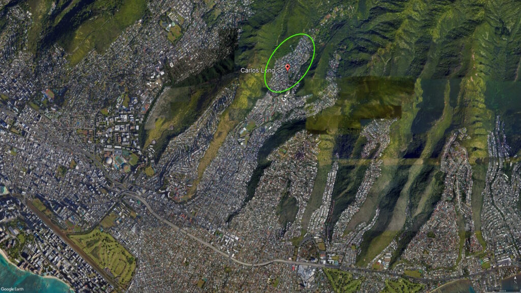
Pālolo valley, within the ahupuaʻa of Waikīkī, has ʻili for kalo (taro loʻi) and forest products that benefitted other portions of the ahupuaʻa (such as ʻĀina Haina, Wailupe, Niu and areas near the beach) – they are essentially ʻili lele (jumping ʻili) that provide these resource lands (wetland for kalo and mauka forest lands) to the other areas of the ahupuaʻa that do not have them.

According to legend, Kākuhihewa, Māʻilikūkahi’s descendent six generations later, encountered the supernatural rooster, “Kaʻauhelemoa” who flew from Pālolo valley and landed at Waikīkī to challenge Kākuhihewa by scratching the ground.  The place was then named “Helumoa” which means “chicken scratch.”

Kākuhihewa felt that the appearance of the supernatural rooster was an omen, so he planted a grove of trees, which later multiplied into an estimated 10,000-coconut trees (this is the area in and around the Sheraton Waikīkī hotel.)

Fast forward a few centuries.

Pālolo Valley was once home to a golf course, rock quarry, two dairies and, during World War II, an airfield.

Pālolo Elementary School first opened its doors in September 1921 under the leadership of Principal William Kekepa. Its first buildings were converted military barracks and the school was next to a golf course.

Opened in 1931, the nine-hole Pālolo course was first one open to the masses (the Islands’ first course, Moanalua Valley course, opened in 1898; Oʻahu Country Club opened in 1906, Waiʻalae in 1928.)  Later, that golf course was turned into a public housing project that is now Pālolo Valley Homes.

A May 1941 article in the Honolulu Advertiser titled “Army Maps Areas to Be Evacuated in Event of Emergency” informed civilians that 86,000-persons living in Honolulu resided in danger zones, and that half would have to evacuate in the event of a war.  (Johnson)

The Pālolo evacuation camp, which the Office of Civilian Defense had erected in case of another Japanese attack, was later turned over to the Hawaiʻi Housing Authority (HHA) and converted into wartime public housing for several hundred families.  (HHF)

Additional shelters for evacuees were built in Pālolo; however, they were “held in readiness for evacuees in connection with (another) attack.”  The Pālolo Valley Camp never accommodated Islanders displaced after the initial attack on December 7. A memorandum written in February 1942 confirmed that Pālolo remained unoccupied.

The HHA also developed public housing.  Members of a Congressional subcommittee, which came to investigate Honolulu’s housing situation (in Pālolo and elsewhere) in March 1945, learned of “hot bed apartments” where as many as eighteen men occupied one room in three shifts.

With the conclusion of World War II, the Pālolo School Camp was closed as they were deemed unsatisfactory for occupancy.  The Pālolo Evacuation Camp adjacent to the 362-unit emergency housing project in Pālolo remained in operation.

Pālolo provided post-war housing opportunities; a three-bedroom home in 1950 cost about $11,500.  In 1955, the Pālolo Golf Course was replaced by Jarrett Middle School and the Pālolo Valley District Park.  More housing was also provided.

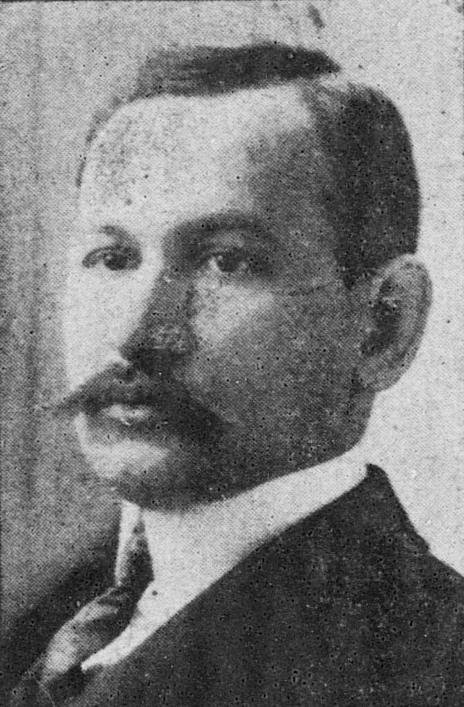
Jarrett Middle School was established in 1955. The school was named in honor of William Paul Jarrett (1877-1929,) who was a delegate to the US Congress when Hawaiʻi was a Territory. Mr Jarrett gained national and international recognition for his efforts as a humanitarian.

After it closed in 1951, the rock quarry became a 200-home residential subdivision and the airfield was developed into Pālolo Valley Housing.  (Shellabarger)  (Lots of information here from Green and Johnson.)

The image shows a map of Pālolo in 1881.  In addition, I have added other related images in a folder of like name in the Photos section on my Facebook and Google+ pages.

Follow Peter T Young on Facebook  

Follow Peter T Young on Google+    

Follow Peter T Young on LinkedIn  

© 2014 Hoʻokuleana LLC

Filed Under: Place Names Tagged With: Hawaii, Waikiki, Oahu, Kuekaunahi, Kakuhihewa, Palolo

Images of Old Hawaiʻi

People, places, and events in Hawaiʻi’s past come alive through text and media in “Images of Old Hawaiʻi.” These posts are informal historic summaries presented for personal, non-commercial, and educational purposes.

Info@Hookuleana.com

Connect with Us

  • Email
  • Facebook
  • LinkedIn
  • Twitter
  • YouTube

Recent Posts

  • April Fool
  • King of Handcuffs
  • Declaratory Act
  • Hui Panalāʻau
  • Arakawas
  • “Honolulu’s Tropical Jewel”
  • California Girl, Wenona

Categories

  • General
  • Ali'i / Chiefs / Governance
  • Buildings
  • Missionaries / Churches / Religious Buildings
  • Hawaiian Traditions
  • Military
  • Place Names
  • Prominent People
  • Schools
  • Sailing, Shipping & Shipwrecks
  • Economy
  • Voyage of the Thaddeus
  • Mayflower Summaries
  • American Revolution

Tags

$20000 Albatross Battery Salt Lake Carl Winstedt Code Talkers Collegia Theatre David Howard Hitchcock Department of Hawaiian Home Lands Diamond Head Four Minute Men Freeman H-4 Hailima Hale Halawai Hale O Lono Hawaiian Pineapple Day Hilo High School Hobbamock James Colnett James Hay Wodehouse James I John Oldham Kamanawa Kamehameha V Kona Field System Kukaniloko Kuleana Labor Day Lunalilo Home Mao Merchant Street Na Pali One Horse Open Sleigh Panic of 1819 Pedro Menendez Picture Bride President Lines Quilt Resolution Samuel Damon Scotch Coast Titian Ramsey Peale Upena Poepoe William Reed Yoshio Harada

Hoʻokuleana LLC

Hoʻokuleana LLC is a Planning and Consulting firm assisting property owners with Land Use Planning efforts, including Environmental Review, Entitlement Process, Permitting, Community Outreach, etc. We are uniquely positioned to assist you in a variety of needs.

Info@Hookuleana.com

Copyright © 2012-2021 Peter T Young, Hoʻokuleana LLC


Loading Comments...