“In 1878 the Kingdom of Hawaii, with King Kalakaua at its head, honored Captain Cook at the centenary celebration of discovery. The permanent memorial established in Honolulu at that time was the splendid statue of Kamehameha the Great which stands upon a high pedestal in front of the Judiciary Building.”
“The Hawaiian Historical Society sponsored the first movement to honor Captain Cook in a sesquicentennial [150th] celebration in Hawaii in 1928.”
“[Albert Taylor], in 1925, proposed a major celebration to include the official visits of warships of England and America, these to visit Waimea, Kauai, where Cook first landed, and Kealakekua Bay, Hawaii, where Cook was killed, and at the latter place to fire an international salvo.”
“Strangely enough the original plan was carried out to the letter in August, 1928. Bruce Cartwright, at this same time proposed the issuance of commemorative stamps and a coin.” (Taylor)
“The Taylor-Cartwright plan … particularly, included formal invitations to be addressed to the Governments of Great Britain, United States, Australia, New Zealand and Canada to participate; with request that the British and United States governments send warships to Hawaii …”
“… that the United States government issue commemorative Captain Cook stamps and a silver 50-cent coin; that speakers of note, particularly in historical fields, be invited to make addresses …”
“… that a bronze tablet be set just beneath the surface of the water at Kaawaloa, Kealakekua Bay, Hawaii, where Capt. Cook ‘fell on his face in the water,’ as his chroniclers state …”
“… that a monument be erected at Waimea, Kauai, where Cook set up his astronomical instruments, and where William Whatman, a seaman, was buried, Capt. Cook there reading the burial service of the Church of England, the first recorded Christian service ever held in the Hawaiian Islands.” (Taylor)
In a unique incident, “Mrs. Benjamin Franklin Pitman and her son, Theodore Pitman the artist, of Boston, presented a beautiful bronze tablet to the Cook Commission, commemorating Captain Cook.”
“The tablet was given, also, to commemorate the ancestors of Mrs. Pitman’s husband, who was part-Hawaiian, descendant of the Chief Hoolulu, who, in May, 1819, secretly took possession of the bones of Kamehameha the Great from the temple of Kamakahonu, at Kailua, Hawaii, and as secretly hid them, supposedly in a cave on the coast, a location never revealed again.” (Taylor)
The Pitman Tablet Commemorative of Captain James Cook reads, “Capt. James Cook Forerunner of Modern Civilization in the Pacific Ocean. In Hawaii 1778-1779. In Memory of the High Chief Hoolulu, High Chiefess Kinoole and her son Keola-O-Kalani (Benjamin Franklin Pitman). Presented by Mrs. Benjamin Franklin Pitman, Benjamin Pitman and Theodore Baldwin Pitman – Sculptor.”
“On August 1, Theodore Baldwin Pitman, an artist and sculptor of Boston, accompanied by his mother, Mrs. Benjamin Franklin Pitman, arrived on the steamer ‘Malolo,’ bringing a beautiful bronze memorial tablet to honor Captain Cook …”
“… and which was to be formally presented by them to the Territory of Hawaii through the Cook Commission, the tablet also serving to honor Hawaiian ancestors of the sculptor.” (Pitman)
“At this juncture a variation from the set speeches came when Colonel Iaukea announced that Mrs. Benjamin Franklin Pitman, widow of the late Benjamin Keola-o-kalani Pitman, born in Hilo, Hawaii, but raised in Boston, and her son, Mr. Theodore B. Pitman …”
“… would present a beautiful bronze tablet to the Territory of Hawaii to honor Captain Cook, and in memory of her husband’s and her son’s Hawaiian ancestors.”
“Mrs. Pitman, addressing herself to the Secretary of War, the Governor, the Chairman and ‘citizens of the Territory,’ said: ‘When it was my privilege, twelve years ago, to come to these beautiful Islands in company with my husband, Benjamin Franklin Keola-o-kalani Pitman …”
“… who, after an absence of over fifty years, was led, providentially I believe, to return to the land of his birth that he might realize, before he was called to his final home, the loving interest that, unknown to him, had followed him like a protecting spirit all his days …”
“… because he was the grandson of your great High Chief Hoolulu and the son of Kinoole, the beloved High Chiefess of Hilo – the wonderful hospitality and love extended to us not only by the Hoolulu family, but by all those who had become imbued with the spirit that pervades these Islands, filled our hearts with gratitude and a desire to manifest in some way our sincere appreciation.”
“‘On this great occasion, the Sesquicentennial of the discovery of the Hawaiian Islands by the noted explorer, Captain James Cook, the way has been opened to us through the Chairman of this Commission, Colonel Curtis P Iaukea, not only to do honor to Captain Cook, but to make a permanent demonstration of our feelings.”
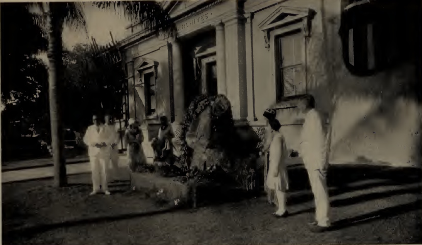
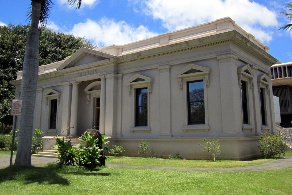
The Pitman Tablet was unveiled at Archives of Hawai‘i Building and officially accepted by Governor Lawrence McCully Judd on February 14, 1930.
“Master Theodore Pitman, Jr., son of the sculptor, who with his wife, all of Boston, were present, was accorded the honor of unveiling the tablet. He lifted the old Hawaiian Royal ensign from the tablet, and revealed its golden beauty to the assemblage.”
“The sculptor had achieved a marvelous result, and his inspiration was the moment Captain Cook, in the ‘Resolution,’ was skirting the shore of Kauai.”
“Out at sea was a Hawaiian outrigger canoe, and in it, a paddle in hand and standing, was an Hawaiian, his back to the beholder, looking toward the strange ship from abroad. In the background are the shores and mountains and valleys of Kauai.”
“Flanking this scene, for artistic embellishment, were two lofty cocoa- nuts. Between the branches of the trees is a medallion of Captain Cook, a startling likeness that seems to change and live as light rays travel over the surface. The unveiling met with a round of applause.” (Pitman)