Images of Old Hawaiʻi

  • Home
  • About
  • Categories
    • Ali’i / Chiefs / Governance
    • American Protestant Mission
    • Buildings
    • Collections
    • Economy
    • Missionaries / Churches / Religious Buildings
    • General
    • Hawaiian Traditions
    • Other Summaries
    • Mayflower Summaries
    • Mayflower Full Summaries
    • Military
    • Place Names
    • Prominent People
    • Schools
    • Sailing, Shipping & Shipwrecks
    • Voyage of the Thaddeus
  • Collections
  • Contact
  • Follow

February 27, 2015 by Peter T Young Leave a Comment

Food Forest

It’s not food for human use – it’s a forest managed to provide habitat and food for recovering endangered bird species.

The Keauhou Bird Conservation Center (KBCC) Discovery Forest is a project and part of Hawaiʻi Forest Institute’s (HFI) Mahalo ʻĀina: Give Back to the Forest Program.

HFI’s Mahalo ʻĀina: Give Back to the Forest program seeks to expand public and private partnerships to gain support for the protection and perpetuation of Hawaii’s forest resources.

The objectives of the KBCC Discovery Forest are to:
• Restore an endemic forest canopy with koa;
• Restore an endemic forest understory with fruiting trees and shrubs;
• Improve habitat quality for endemic wild birds;
• Provide hands-on experiential education for local students; and
• Provide forest materials (fruits, browse, and perching) for captive birds KBCC.

Using captive propagation and release techniques, KBCC is reestablishing self-sustaining populations of critically endangered Hawaiian birds in the wild.

The Hawai‘i Endangered Bird Conservation Program breeds endangered Hawaiian birds in captivity, for release back into the wild.

For Phase I, HFI began work with KBCC and other community partners to create the Discovery Forest with 1,200 koa and other native trees. This project is providing service learning opportunities for youth volunteers and helping to develop habitat and food for native birds.

Koa trees are an essential part of native Hawaiian forests. They improve soil quality through a chemical process called nitrogen fixation, allowing other native plants, like the fruiting trees necessary for native bird life, to grow in the nutrient-poor, lava-based soil.

In addition, koa are the dominant crown cover in some areas, providing watershed protection and playing a large part in Hawaiian culture.

Koa is important from a conservation perspective because it provides habitat for native plants and animals. Although birds do not eat koa fruit, they forage on insects on and within the tree itself, and use cavities in koa for nesting.

Once a koa forest is established, understory fruiting species that are key to the diets of rare bird species can be planted in the area. Fruiting species include hōawa, kōlea, maile, māmaki, māmane, ‘ōhelo, ‘ōlapa, pilo and ‘ie’ie. (San Diego Zoo)

Notable long-term program efforts and successes include:
• Nēnē – (the State Bird) recovering from fewer than 50 birds to nearly 2,000
• ʻAlala – captive flock that has grown to 95
• Puaiohi – recovering from only a few dozen to approximately 500 (found only on Kaua‘i)
• Palila – a new population has been established on the north slope of Mauna Kea

The trees planted school groups are the beginning of a new native tree forest that will support the native bird species in the future.

This site, at an elevation of about 4,000-feet, was once grazed by cattle and was primarily covered in non-native kikuyu grass; forest restoration helps add to the existing collection of native species.

The land is owned by Kamehameha Schools and leased to KBCC, which is part of the Hawaiʻi Endangered Bird Conservation Program, a partnership between the San Diego Zoo Global Institute for Conservation Research, US Fish and Wildlife Service, and DLNR’s Division of Forestry and Wildlife.

The project to re-establish the koa forest has been funded through the support of the Hawai‘i Community Foundation and the Hawai‘i Tourism Authority. The koa seedlings were donated by the Three Mountain Alliance.

HFI was awarded a DLNR Division of Forestry & Wildlife (DOFAW) Forest Stewardship Program grant to develop a forest stewardship plan for the approximately 200-acre Discovery Forest site. (HFI)

Click the following link for more on Mahalo ʻĀina: Give Back to the Forest Program.
http://www.mahaloaina.org

I am honored and proud to serve as a director on the Hawaiʻi Forest Institute, an organization dedicated to promote the health and productivity of Hawaiʻi’s forests, through forest restoration, educational programs, information dissemination and support for scientific research.

Among other projects The Mahalo ‘Āina: Give Back to the Forest will benefit Kaʻūpūlehu Dryland Forest, LaʻiʻŌpua Dryland Habitat Preserve, Kaloko Makai Dryland Forest Preserve, Panaʻewa Zoo Discovery Forest, ʻĀina Mauna Christmas Tree Demonstration Project and Honolulu Zoo Children’s Discovery Forest. (Lots of information and images here is from HFI.)

Follow Peter T Young on Facebook 

Follow Peter T Young on Google+ 

Follow Peter T Young on LinkedIn  

Follow Peter T Young on Blogger

© 2015 Hoʻokuleana LLC

students learn about the endangered birds-HFI
students learn about endangered birds-HFI
Koa-seedling-HFI
Koa-seedling-HFI
team-work-planting-HFI
planting-partners-HFI
performing-an-ole-to-encourage-good-growth-HFI
oo-bar-plantings-HFI
learning-from-auntie-rosanna-HFI
Koa-seedlings-HFI
Koa-seedlings-HFI
gel-dipping-koa-seedlings-HFI
Happy-students-plant_seedling-HFI
Happy-students-plant-seedling-HFI
HFIA-tree-planting-at-Keauhou-BCS-group-3-1-2014-HFI
hiking-to-the-planting-site-HFI
Iwi-and-Kirk-give-planting-demonstration-HFI
Iwi-describes-the-process-HFI
Kirk-Derasin-dips-the-seedlins-in-the-dry-water-mixture-HFI
Kirk-Derasin-talks-about-the-koa-seedlings-HFI

Filed Under: General Tagged With: Hawaii, Forestry, Hawaii Forest Institute, Hawaii Forest Industry Association

February 25, 2015 by Peter T Young 1 Comment

Hilo Airport

The history of aviation on the Big Island dates back to June 10, 1911 when Clarence H. Walker came to Hilo for an exhibition flight in his Curtiss Biplane. There were no airports on the island, so Hoʻolulu Park was selected for the runway.

The first successful flight from Honolulu to the Big Island was made on March 24, 1919 by Army Maj Hugh Kneer in a US Army hydroplane. He landed in Kūhio Bay; he brought a bag of mail, thus beginning air mail service between Honolulu and Hilo by Army planes.

The first commercial flight to the Big Island took place when Martin Jensen piloted the Lewis Tours aircraft Malolo into a perfect landing at Hoʻolulu Park on a flight from Kahului. The first passengers on this historic flight were Mr and Mrs Walter Eklund.

In December 1920, a ramp was built by the Hawaiian Contracting Company in Radio Bay in Hilo to haul visiting seaplanes from the bay onto land.

On February 25, 1925, Speaker of the House Norman K Lyman of Hilo introduced a resolution requesting the governor to set aside 50 acres of land at Waiākea for a landing field. This was amended to 100 acres the following day by the Aviation Committee.

A resolution was also introduced authorizing Territory officials to use convict labor to level the land for the landing field.

Work on Hilo Airport began July 17, 1925. Six county prisoners were joined by 40 Oʻahu convicts upon the completion of the Waiākea Prison Camp buildings.

Using tools donated by the County, the 46-prisoners began on September 8, 1925. Use of prison labor had its problems; in 1926, several escaped (and later caught.) The escapes and captures continued.

Most of the site was cleared by the end of the year. A 400 by 2,000-foot field was surveyed heading into the prevailing winds. They started to level the site using dredge material from the nearby Hilo Bay Breakwater project.

In February 1928, Major Clarence M Young, then Secretary of Aeronautics, US Department of Commerce, came to Hawaiʻi to inspect aviation facilities and promote commercial aviation in the Territory.

On February 11, 1928, Major Young was flown to Hilo in the Bird of Paradise for the purpose of dedicating the new airport (the same plane that Army Lts Maitland and Hegenberger used in making the first successful flight to Hawaiʻi on June 29, 1927.)

Inter-Island Airways (later renamed Hawaiian Air) began the first regularly scheduled passenger service between the islands on November 11, 1929 using Sikorsky S-38 amphibians. The fare was $32 between Honolulu and Hilo. Inter-Island Airways’ terminal was dedicated at Hilo Airport on March 22, 1930.

A second and third runways were added and the airport was renovated (the renovation dedication ceremony was held May 2, 1941.)

At the outbreak of World War II, Hilo Airport was taken over by the Army Engineers, and an Air Corps fighter squadron was stationed there. US Army Engineers constructed military installations and continued the expansion of runways, taxiways and parking aprons.

The construction of the Naval Air Station started shortly thereafter on all the necessary facilities to base and train two full air groups. The name of Hilo Airport was changed to General Lyman Field on April 19, 1943.

It was named to honor Brigadier General Albert Kualiʻi Brickwood Lyman, who was born at Paʻauhau and was the first native Hawaiian (he was also part-Chinese) to attain the rank of general or admiral in the US Armed Forces.

After the war, military operations at Hilo Airport steadily decreased. Permission to operate General Lyman Field as a commercial airport was granted the Territory by letter from the Commanding General, Armed Forces, Mid-Pacific, dated September 30, 1946.

Later, with construction of a new passenger terminal and conversion to commercial use, on December 3, 1953 the new administration and terminal building were dedicated.

On January 27, 1967, The Civil Aeronautics Board (CAB) heard testimony on applications from Pan American, United and Northwest Airlines on their proposals to provide direct service from the Mainland to Hilo.

Senator Daniel Inouye testified that “a common fare (the same price for a ticket to all points in Hawaiʻi from the Mainland) was not only important to Hawaiʻi County but to all Neighbor Islands. They are growing at a snail’s pace while Oʻahu is growing in leaps and bounds.” He suggested that a common fare would help to balance the inequity.

Direct jet routes to Hilo from the Mainland were approved by the CAB on April 17, 1967 for United, Pan Am and Northwest.

The airlines could not fly between Honolulu and Hilo but permitted round trip passengers from the continent to fly between islands for $5-$9 regardless of where they originally landed in the islands. (So, visitors arrived into Honolulu or Hilo, did island hopping for under $10 a segment and flew home out of the other airport.)

It was a shot in the arm for the Hilo visitor industry and an added benefit was air freight for East Hawaiʻi’s farmers (about 40,000-pounds of papayas left for Los Angeles on the first direct United Air Lines jet flight form Hilo.) A number of trans-Pacific carriers took advantage and served Hilo.

Expanded service required expanded facilities and on April 30, 1976 a new passenger terminal was dedicated. The 105-foot high FAA Traffic Control Tower opened on November 2, 1979.

The common fare didn’t last long, and in January 1979, citing economic concerns, Continental Airlines ceased service between the mainland and Hilo, ending 10 years of association.

Along with regular passenger service, Continental carried one million pounds of cargo each month. Five months later, United Airlines announced that it would also cease direct flights out of San Francisco.

In 1989, the airport’s name was changed to Hilo International Airport and the main passenger terminal was named for General Lyman. The terminal was rededicated to Lyman on September 29, 1993.

In 2010, Hilo International Airport was served by two interisland carriers, two commuter airlines, and several aerial sight-seeing tour companies. It no longer had scheduled Trans-Pacific service. (Lots of information here is from hawaii-gov.)

Follow Peter T Young on Facebook 

Follow Peter T Young on Google+ 

Follow Peter T Young on LinkedIn  

Follow Peter T Young on Blogger

© 2015 Hoʻokuleana LLC

Aviaition field, January 30, 1928, Hilo
Hilo Airport, Hawaii, June 25, 1929
North end of Hilo airfield, August 1927
Awaiting expected arrival of first plane to land on Hilo Field, January 30, 1928 (plane did not arrive this date)
Center section of Hilo Airport showing prisioners at work loading recently acquired one yard truck
Coral supply for Hilo Airport, 1927
Hilo Airport 1928
Hilo Airport 1928
Hilo Airport, Hawaii, with Hilo Wharf in the background. c1930
Gathering at Aviation prison camp, October 10 1927, Hilo
Dedication of Hilo Airport December 5, 1953-Visitor Info
Dedication of_Hilo Airport December 5, 1953
Dedication of Hilo Airport-December 5, 1953
Air Cargo Terminal, Hilo Airport, 1950s
Hilo International Airport, Hawaii, 1989
General Lyman Field, Hilo, Hawaii July 10, 1963
General Lyman plaque

Filed Under: Economy Tagged With: Hawaii Island, Hilo, General Albert Kualiʻi Brickwood Lyman, Lyman Field, Hawaii

February 24, 2015 by Peter T Young 1 Comment

Alexander & Baldwin Building

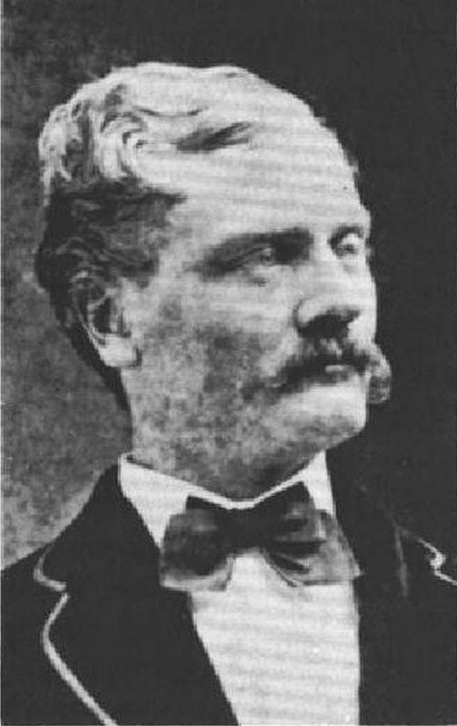
In 1843, Samuel Thomas Alexander and Henry Perrine Baldwin, sons of early missionaries to Hawaiʻi, met in Lāhainā, Maui. They grew up together, became close friends and went on to develop a sugar-growing partnership.

In 1869, they purchased 12-acres of land in Makawao and the following year an additional 559-acres. That same year, the partners planted sugar cane on their land marking the birth of what would become Alexander & Baldwin (A&B.)

Fast forward to 1924 … sons Wallace M Alexander and Harry A Baldwin served on the A&B board. On February 24, 1924, the board decided to purchase land and build a new home headquarters in Honolulu.

The Alexander & Baldwin Building was planned as a memorial to ST Alexander and HP Baldwin and designed as a prestige home office, with sufficient budget to insure both. A primary concern of the owners was that the building be “uniquely Hawaiian” in appearance. (NPS)

“My foremost thought architecturally was to produce a building suitable to the climate, environment, history and geographical position of Hawaii…the location of Honolulu at the crossroads of the Pacific, in close touch with the Orient, gave sufficient reason for allowing Chinese architecture to clearly influence the design.”

“…the exotic Chinese influence is so subtle that it would not be noted by a casual observer. However, it is there in every detail of the design. On the exterior it is most pronounced in the window ornamentation, in the circular “Good Luck” signs at the main entrance portico on Bishop Street and the long life signs in the column capitals.” (CW Dickey, its architect)

Founded in 1870, A&B was nearly 60 years old when the building was built in 1929. During its construction, people were fascinated with its construction. (One day, four artesian wells were tapped, spewing a flood of water.)

The cornerstone laying ceremony took place November 21, 1928. Reverend Norman C Schenck, in giving tribute to the company’s founders, stated “Out of the past come precious memories of those whose noble purposes, indomitable wills and might endeavors have laid the foundations for our beloved Hawaiʻi.” (A&B)

Originally designed with a 39-foot ceiling in the ‘public floor’ (the central first floor,) it started as a 3-story structure with basement. Two tiled murals on the mauka and makai sides, the sailing ship ‘John Ena’ at Port Allen, Kauai (mauka) and Kahului Harbor and ʻIao Valley (makai) sat 29-feet above the workers on the first floor.

In making each mural, the artist (Jessie Stanton) first painted a picture and made a full-sized rendering of it. It was gridded out at the size of the tiles; individual tiles were manufactured matching each square in the grid – then applied to the wall.

Modifications in 1959 added a mezzanine level, lowering the lower-floor ceiling to 14-feet and creating a new second level that now houses the boardroom (mauka,) offices and lunchroom (makai.)

Other renovations/remodels took place over the years. The 100,000 or so clay tiles in the roof replicated the original roof. The last renovation to the building was in 2006.

The steel-framed, reinforced concrete building has Hawaiian, Chinese and other features; most notable is the Dickey Hawaiian roof (high peak, double pitch.)

The building had its grand opening on September 30, 1929. The Star-bulletin editorial called the building “the architectural expression of triumph of human courage, ingenuity, seen and unseen, which beset the pioneers of industrial Hawaiʻi.” (A&B)

A&B was one of Hawaiʻi’s five major companies (that emerged to providing operations, marketing, supplies and other services for the plantations and eventually came to own and manage most of them.) They became known as the Big Five.

Hawaiʻi’s Big Five were: C Brewer (1826;) A Theo H Davies (1845;) Amfac – starting as Hackfeld & Company (1849;) Castle & Cooke (1851) and Alexander & Baldwin (1870.)

The historic Alexander & Baldwin building (on the State and National Register of Historic Places) remains in the heart of the core of Honolulu’s financial and business district.

Follow Peter T Young on Facebook 

Follow Peter T Young on Google+ 

Follow Peter T Young on LinkedIn  

Follow Peter T Young on Blogger

© 2015 Hoʻokuleana LLC

Alexander & Baldwin Building-PP-7-4-006-00001 - Copy
Alexander & Baldwin Building-PP-7-3-001-00001 - Copy
Alexander & Baldwin Building-PP-7-3-011-00001 - Copy
Alexander & Baldwin Building-PP-7-3-010-00001 - Copy
Alexander & Baldwin Building-PP-7-4-004-00001 - Copy
Alexander & Baldwin Building-PP-7-3-029-00001 - Copy
Alexander & Baldwin Building-PP-7-4-013-00001 - Copy
Alexander & Baldwin Building-PP-7-4-003-00001 - Copy
IMG_3899
IMG_3888
IMG_3883
IMG_3893
IMG_3906
IMG_3908
IMG_3903

Filed Under: Buildings Tagged With: Hawaii, Oahu, Downtown Honolulu, Big 5, Alexander and Baldwin

February 20, 2015 by Peter T Young Leave a Comment

C Brewer

C Brewer & Co, Ltd began at a distant date under a different name, and is a result of the growth through the changes of time and circumstances rather than of any one definite act. (Thrum)

The following are the various names which the firm was known: James Hunnewell, Hunnewell & Peirce, Peirce & Hinckley, Peirce & Brewer, C Brewer & Co, SH Williams & Co, C Brewer 2d, C Brewer & Co Ltd. (The Friend, January 1, 1867)

In its early years, the following are the names of those who have been connected with this firm as partners: James Hunnewell, Thomas Hinckley, Henry A Peirce, Charles Brewer, JFB Marshall, Francis Johnson, William Baker Jr, Stephen H Williams, Benjamin F Snow, Charles Brewer 2d, Sherman Peck, CH Lunt, HAP Carter and I Bartlett. (The Friend, January 1, 1867)

If an exact date and a single act are to be assigned, it was on Monday, December 8, 1817, when James Hunnewell, officer of the brig Bordeaux Packet, agreed with Andrew Blanchard, master, to remain at Honolulu after the sale of the vessel. (Thrum)

He would dispose of the balance of her cargo and invest and forward the proceeds. This was the beginning of the long business career of Hunnewell connected with the Islands, and his first act in settling there. (Thrum)

Hunnewell first came to the Islands aboard the ‘Packet’ in October 1816. He agreed to stay (December 8, 1817) and traded his boat and cargo for sandalwood, “We were the only traders on shore at Honolulu that had any goods to sell.” There was no currency at the time, so they generally traded for sandalwood. (Hunnewell, The Friend)

At first, business was generally in small transactions and by barter. American goods of nearly all sorts were received and sold on consignment. (Thrum)

After trading sandalwood in China and then back to the northeast, Hunnewell returned to the Islands in 1820 on the ‘Thaddeus,’ “This was the memorable voyage when we carried out the first missionaries to the Hawaiian Islands.” He stayed … “it was urged by some of the chiefs that knew me on my previous voyage that I should remain instead of a stranger to trade with them.” (Hunnewell)

Later, in 1825, he negotiated with the American Board of Commissioners for Foreign Missions, “to take the missionary packet out, free from any charge whatever on (his) part for sailing and navigating the vessel – provided the Board would pay and feed the crew, and allow (him) to carry out in the schooner to the amount (in bulk) of some forty to fifty barrels”. (Hunnewell)

Then in 1826, with a stock of merchandise, he then purchased the premises of John Gowen (to which he added some land by exchange in 1830.) “As soon as I secured this place, I landed my cargo, and commenced retailing it…” (Hunnewell)

In October, 1828, Captain Marcus T Peirce, an old and intimate friend of Hunnewell’s, arrived in the brig Griffin from the north-west coast. He gave up the command of his vessel to Captain MW Green, he preferring to return home.

In doing so, he requested that Hunnewell to take charge of his younger brother, Henry A Peirce, who had been a clerk with him. Young Peirce first worked for $25 per month and board until September, 1830; after that he was given a share in the profits.

Hunnewell decided to return home on the continent (November 20, 1830) and left Peirce in charge; Hunnewell thought he would come back to the Islands, but never did. Hunnewell decided to remain at home, and Peirce accepted his offer to loan him funds enough to enable him to carry on the business himself and take the establishment at an appraised value.

“The name … James Hunnewell was early associated with the commercial interests of these Islands, and his long and useful life was marked by such constant goodwill to my kingdom, that I shall always cherish his memory with sincere regard.” (Kamehameha V to Hunnewell’s son; Thrum)

Peirce took Hinckley as a partner; but Hinckley retired due to his health. Next, Charles Brewer arrived (on his third voyage to the Islands,) just before Hunnewell left for home. (Hunnewell, The Friend) For a while, Brewer commanded Peirce’s vessels on their voyages to China and the Russian possessions.

In December, 1835, a co-partnership was formed by Peirce and Brewer. Under this partnership, the firm of Peirce & Brewer conducted a general merchandise and commission business at Honolulu. (Peirce)

“Mr. Peirce had been absent from home twelve years, and was anxious to go back and visit his family. He made me an offer to join him as a partner in business, which offer I accepted, and in one month from that time, Mr. Peirce left Honolulu for Boston, where he remained a year or more, returning by the way of Mexico and South America.” (Brewer)

“When I was received as a partner in business with Mr. Henry A. Peirce, I continued the firm name of Peirce & Brewer until Mr. Peirce retired, in 1843. I then continued the business as C Brewer & Co., with my nephew C Brewer, 2d, until the year 1845.” (Brewer)

That year, there was a merger with the firm of Marshall & Johnson (established in 1841 by James B. Marshall and Francis Johnson.) Brewer returned to Boston. “We arrived in Boston on March 26, 1849, and from that time, my sea life may be said to have ended.” (Brewer)

This association ended in 1847 and the business was taken over by SH Williams & Co, composed of Stephen H Williams, James B Marshall, William Baker Jr, and, a year later, Benjamin F Snow.

It was not until 1859 that the firm again and finally resumed the name of C Brewer & Co, when in September of that year, Charles Brewer II, a nephew of Captain Brewer, engaged in partnership with Sherman Peck and took over the business. (Nellist)

The second Brewer retired in the summer of 1861, but the business was continued under the Brewer name. At about this time the sugar industry was making its first strides and C Brewer & Co became agent for a plantation at Makawao, Maui.

In 1863, it had acquired holdings in Wailuku plantation, in 1866 Brewer became agent for Waiheʻe plantation. In 1869 a son of Charles Brewer, John D Brewer, and IB Peterson were admitted as partners. A man who was destined to make C Brewer & Co. famous, Peter Cushman Jones, was admitted to partnership on Jan. 1, 1871.

C. Brewer & Co., Ltd., was incorporated on Feb. 7, 1883, with Peter Cushman Jones as president and manager; absorption of William G Irwin & Co. by C. Brewer & Co., Ltd., followed E. Faxon Bishop’s elevation to the presidency. (Nellist)

The Brewer company grew, as did a handful of others – primarily in businesses associated with the booming economy. Since the early/mid-1800s, until relatively recently, five major companies emerged and dominated the state’s economic framework. Their common trait: they were founded in agriculture – sugar and pineapple.

They became known as the Big 5: Amfac – starting as Hackfeld & Company (1849;) Alexander & Baldwin (1870;) Theo H. Davies (1845;) Castle & Cooke (1851) and C Brewer (1826.)

The decline in agricultural mono-cropping and a changing economy to the visitor industry, Brewer and the others lost their dominance. Longtime Brewer Chair, JWA ‘Doc’ Buyers, bought out the company and moved its headquarters to Hilo (2001.) The company, at the time Hawaiʻi’s oldest continuously operating company, dissolved in 2006.

A lasting legacy of the company is the C Brewer Building, constructed in 1930, the last and smallest of the ‘Big Five’ home office buildings to be built in downtown Honolulu.

Charles_Brewer_(1804–1885)
Brewer Building-Burlingame-SB
19990624 CTY C BREWER BUILDING
Brewer Building-HHF
C.Brewer_and_Company_Specimen_Stock_Certificate,_made_by_American_Bank_Note_Co.

Filed Under: Economy, Buildings Tagged With: C Brewer, James Hunnewell, Hawaii, Sugar, Big 5

February 5, 2015 by Peter T Young 1 Comment

Palena

What is commonly referred to as the “ahupuaʻa system” is a result of the firm establishment of palena (place boundaries.)  This system of land divisions and boundaries enabled a konohiki (land/resource manager) to know the limits and productivity of the resources that he managed.

Ahupuaʻa served as a means of managing people and taking care of the people who support them, as well as an easy form of collection of tributes by the chiefs.  Ultimately, distribution of people throughout the Islands helped in preserving resources.

A typical ahupuaʻa (what we generally refer to as watersheds, today) was a long strip of land, narrow at its mountain summit top and becoming wider as it ran down a valley into the sea to the outer edge of the reef.  If there was no reef then the sea boundary would be about one and a half miles from the shore.

Defined palena brought greater productivity to the lands; lessened conflict and was a means of settling disputes of future aliʻi who would be in control of the bounded lands; protected the commoners from the chiefs; and brought (for the most part) peace and prosperity.  (Beamer, Duarte)

Typically, natural features served as boundary markers: summit peaks, ridge crests, streams, volcanic cones, etc.  Additional markers were placed to note the ahupua‘a boundary – so called because the boundary was marked by a heap (ahu) of stones surmounted by an image of a pig (pua‘a,) or because a pig or other tribute was laid on the altar as tax to the chief.

Māʻilikūkahi is recognized as the first great chief of O‘ahu and legends tell of his wise, firm, judicious government.  He was born ali‘i kapu at the birthing stones of Kūkaniloko; Kūkaniloko was one of two places in Hawai‘i specifically designated for the birth of high ranking children, the other site was Holoholokū at Wailua on Kauaʻi.

Soon after becoming aliʻi, Māʻilikūkahi moved to Waikīkī.  He was probably one of the first chiefs to live there. Up until this time, Oʻahu chiefs had typically lived at Waialua and ‘Ewa.  From that point on, with few exceptions, Waikīkī remained the Royal Center of Oʻahu aliʻi, until Kamehameha I moved the seat to Honolulu.

Māʻilikūkahi is noted for clearly marking and reorganizing land division palena (boundaries) on O‘ahu.  Defined palena brought greater productivity to the lands; lessened conflict and was a means of settling disputes of future aliʻi who would be in control of the bounded lands; protected the commoners from the chiefs; and brought (for the most part) peace and prosperity.

Fornander writes, “He caused the island to be thoroughly surveyed, and boundaries between differing divisions and lands be definitely and permanently marked out, thus obviating future disputes between neighboring chiefs and landholders.”

Kamakau tells a similar story, “When the kingdom passed to Māʻilikūkahi, the land divisions were in a state of confusion; the ahupuaʻa, the ku, the ʻili ʻāina, the moʻo ʻāina, the pauku ʻāina, and the kihāpai were not clearly defined.”

“Therefore, Māʻilikūkahi ordered the chiefs, aliʻi, the lesser chiefs, kaukau aliʻi, the warrior chiefs, puʻali aliʻi, and the overseers (luna) to divide all of Oʻahu into moku, ahupuaʻa, ʻili kupono, ʻili ʻaina, and moʻo ʻāina.”

On Maui, Kalaihaʻōhia, a kahuna (priest, expert,) is credited with the division of Maui Island into districts (moku) and sub-districts, during the time of the aliʻi Kakaʻalaneo at the end of the 15th century or the beginning of the 16th century.  (McGerty)

On the Island of Hawaiʻi, ʻUmi-a-Līloa (ʻUmi) from Waipiʻo, son of Līloa, also started to divide the lands following this similar mauka-makai orientation.

ʻUmi also started a significant new form of agriculture in Kona; archaeologists call the unique method of farming in this area the “Kona Field System.” (These are long, narrow fields that ran along the contours, along the slopes of Mauna Loa and Hualālai; farmers then planted different crops, according to the respective rainfall gradients.)

The Kona Field System was described as “the most monumental work of the ancient Hawaiians.”  The challenge of farming in Kona is to produce a flourishing agricultural economy in an area subject to frequent droughts, with no lakes or streams for irrigation.

Traditionally, the Island of Kaua‘i was divided into five moku (districts): Haleleʻa, Kona, Koʻolau, Nāpali and Puna. However, after the battle of Wahiawa in 1824, the land of Kaua‘i was redistributed and district boundaries changed. The new district names became: Hanalei, Kawaihau, Līhuʻe, Kōloa and Waimea.  (Cultural Surveys)

The size of the ahupuaʻa depended on the resources of the area with poorer agricultural regions split into larger ahupuaʻa to compensate for the relative lack of natural abundance. Each ahupuaʻa was ruled by an aliʻi or local chief and administered by a konohiki.

These natural land divisions were the result of the flow of water over the land (streams or springs.)  In keeping with the concept of wealth being fresh water, the traditional land tenure system in ancient Hawaiʻi had at its very core the presence of water.  Although of many shapes and sizes, the typical ahupuaʻa consisted of three area types: mountain, plain and sea.

Later, during the Mahele and subsequent testimony before the Land Commission, properties were identified by the ahupuaʻa and the boundaries were known.

Fearing the loss of knowledge of the ancient palena, on June 26, 1862 a bill providing for Commissioners of Boundaries notes, “Owners of said lands require a settlement of the boundaries of said lands, for the reason of the death and consequent loss of the testimony of witnesses necessary for the just settlement of such boundaries.”  (Beamer, Duarte)

More formal mapping was made to preserve the traditional locations, with provisions noting, “Lands will be mapped to make clear the ancient ahupuaʻa boundaries, or in some cases maps will be made to make clear `iwi (boundary of a land division smaller than an ahupuaʻa), at the place where one’s land ends.”

Surveys conducted and maps produced during the Māhele and Boundary Commission era were some of geography’s earliest encounters with Hawaiʻi and its people.

Mapping was applied to aid in the transition from the traditional system of land “tenure” to that of fee simple and leasehold ownership and to record traditional knowledge of boundaries and places. (Beamer, Duarte)

The image shows what is believed to be an ahupuaʻa marker on the ridge at Kuliʻouʻou valley (from a collection from John Dominis Holt (DMY.))

© 2015 Hoʻokuleana LLC

Filed Under: Hawaiian Traditions, Place Names Tagged With: Hawaii, Umi-a-Liloa, Great Mahele, Mailikukahi, Ahupuaa, Palena, Kalaihaohia

  • « Previous Page
  • 1
  • …
  • 633
  • 634
  • 635
  • 636
  • 637
  • …
  • 661
  • Next Page »

Images of Old Hawaiʻi

People, places, and events in Hawaiʻi’s past come alive through text and media in “Images of Old Hawaiʻi.” These posts are informal historic summaries presented for personal, non-commercial, and educational purposes.

Info@Hookuleana.com

Connect with Us

  • Email
  • Facebook
  • LinkedIn
  • Twitter
  • YouTube

Recent Posts

  • Fire
  • Ka‘anapali Out Station
  • Lusitana Society
  • “Ownership”
  • ‘Holy Moses’
  • Mikimiki
  • Doubtful Island of the Pacific

Categories

  • Prominent People
  • Schools
  • Sailing, Shipping & Shipwrecks
  • Economy
  • Voyage of the Thaddeus
  • Mayflower Summaries
  • American Revolution
  • General
  • Ali'i / Chiefs / Governance
  • Buildings
  • Missionaries / Churches / Religious Buildings
  • Hawaiian Traditions
  • Military
  • Place Names

Tags

Albatross Al Capone Ane Keohokalole Archibald Campbell Bernice Pauahi Bishop Charles Reed Bishop Downtown Honolulu Eruption Founder's Day George Patton Great Wall of Kuakini Green Sea Turtle Hawaii Hawaii Island Hermes Hilo Holoikauaua Honolulu Isaac Davis James Robinson Kamae Kamaeokalani Kamanawa Kameeiamoku Kamehameha Schools Lalani Village Lava Flow Lelia Byrd Liliuokalani Mao Math Mauna Loa Midway Monk Seal Northwestern Hawaiian Islands Oahu Papahanaumokuakea Marine National Monument Pearl Pualani Mossman Queen Liliuokalani Thomas Jaggar Volcano Waikiki Wake Wisdom

Hoʻokuleana LLC

Hoʻokuleana LLC is a Planning and Consulting firm assisting property owners with Land Use Planning efforts, including Environmental Review, Entitlement Process, Permitting, Community Outreach, etc. We are uniquely positioned to assist you in a variety of needs.

Info@Hookuleana.com

Copyright © 2012-2024 Peter T Young, Hoʻokuleana LLC


Loading Comments...