When chief Kekaulike died, his younger son Kamehamehanui (uncle to Kamehameha I) was named heir to rule Maui. In 1738, Kauhi‘aimokuakama (Kauhi,) his older brother, began to wage war to win the title of ruling chief.
Battles were fought across West Maui, from Ukumehame to Honokowai. Kamehamehanui engaged the forces of his uncle from Hawai‘i to fight with him, whose troops numbered over 8,000, and Kauhi brought troops of warriors from O‘ahu.
The war ended with the battle Koko O Nā Moku (“Bloodshed of the Islands.”) Over several days, the blood of fallen warriors from both sides flowed from a stream into the shorebreak and caused the ocean to turn red. (Kamehamehanui won.) (Kāʻanapali Historical Trail)
This occurred in the moku (district) of Kāʻanapali (“divided cliffs.”) A prominent feature noted at the beach is Pu‘u Kekaʻa (“the rolling hill”) – the outcrop that separates portions of the beach (commonly known as “Black Rock.”)
It was “ka leina a ka ‘uhane” – the place where a person’s soul left the earthly realm for the afterlife (these were usually at the westernmost point of the island.)
It was also a place for “lele kawa” (cliff jumping;) Kahekili gained respect from many warriors for his leaps from Pu‘u Kekaʻa, as most were frightened of the spirits who were in the area. (Kāʻanapali Historical Trail)
The island of Maui is divided into twelve moku; Kāʻanapali, Lāhainā, Wailuku, Hāmākuapoko, Hāmākualoa, Koʻolau, Hāna, Kīpahulu, Kaupō, Kahikinui, Honuaʻula and Kula.
An area in the moku of Kāʻanapali is referred to as Nā Hono A Piʻilani (The Bays of Piʻilani (aka Honoapiʻilani.)) In the 1500s, Chief Piʻilani (“stairway to heaven”) unified West Maui and ruled in peace and prosperity. His territory included the West Maui bays, a place he frequented.
From South to North, six of the identified bays are Honokōwai (bay drawing fresh water), Honokeana (cave bay), Honokahua (sites bay,) Honolua (two bays), Honokōhau (bay drawing dew) and Hononana (animated bay).
In the late-1800s and early-1900s there was a horse racing track (Koko O Na Moku Horse Racing Track) at Kāʻanapali Beach that stretched from the present day Kāʻanapali Beach Hotel to the present day Westin Maui Resort. Horse races ended in 1918.
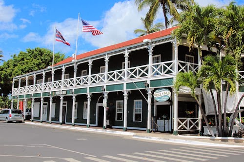
In 1860, James Campbell started the Pioneer Mill Company; sugar cultivation proved to be very profitable. He later sold his interest in the Mill and, after subsequent transfers, in 1960, Pioneer Mill Company became a wholly owned subsidiary of American Factors (Amfac – one of Hawaiʻi’s Big 5.)
Kāʻanapali was the terminus for the plantation railroad; a landing on the northerly side of Puʻu Kekaʻa with a wharf and off-shore moorings served as the primary loading spot for shipping processed sugar from the island and bringing in supplies for the plantation camps.
After the sugar industry’s peak in 1930, production, acreage in sugar and profits declined. Seeing hard times ahead, Amfac took 1,200-acres of Pioneer Mill Company land out of cane to develop as a visitor resort destination (in 1999, Pioneer Mill closed its sugar operations.)
Then, a few years before Hawaiʻi became a state, before Maui County even had a mayor, in 1956, Pioneer Mill’s board of directors got together for a lūʻau on the beach near Puʻu Kekaʻa. There, they sketched out the whole Kāʻanapali Beach Resort master planning venture. (mauitime-com)
Seven years later, the grand opening for the Sheraton (the second, following the Royal Lāhianā completed the year before) put Kāʻanapali on the map as a resort area and featured celebrities like Bing Crosby, golfer Sam Snead and then-California Governor Pat Brown. It was a groundbreaking place, in more ways than one. (mauitime-com)
The land set-aside by Amfac became Hawaiʻi’s first master-planned resort. When it opened in 1962, it became known as the Kāʻanapali Beach Resort.
Today, along its 3-mile coastline, this self-contained resort has over 5,000 hotel rooms, condominium suites, timeshares and villas; 2-championship golf courses (in 1962, Bing Crosby took the inaugural shot on the Royal Kāʻanapali Course) and 35-tennis courts. It accommodates over half-a-million visitors each year.
Kāʻanapali Beach was ranked “Best Beach in America” in 2003 (Dr. Beach.) A beach walk runs parallel with the sand the entire length of Kāʻanapali interconnecting the five major resort hotels and six condominiums and timeshares, as well as the numerous recreational, shopping, dining and other activities in the area.
Twenty-five years after it started, the Urban Land Institute recognized Kāʻanapali Beach Resort with an Award of Excellence for Large-Scale Recreational Development.
In the early years, Kāʻanapali Airport, built on an old coastal road in 1961, serviced the resort first by transporting workers and materials for the new development and then it brought guests in/out.
Take-offs and landings were a thrill for pilots and passengers; the Airport’s runway (01-19) started just 30-feet from the shoreline and extended north a short 2,615-feet. Kahekili Beach Park now sits on the former Airport site.
The Airport was used exclusively by the commuter aircraft of Royal Hawaiian, initially using Cessna 402 aircraft. In 1987, Hawaiian Airlines built the nearby Kapalua Airport; the State took over that facility in 1993.
They must be doing something right, Maui and the visitor destinations of Lāhainā-Kāʻanapali-Kapalua continue to lead the neighbor islands in room occupancy and they lead the state in average daily room (ADR) rates and revenue per available room (ADR x occupancy rate.)
At the same time properties like the Kāʻanapali Beach Hotel are recognized as Hawaii’s Most Hawaiian Hotel for demonstrating an ongoing responsibility, commitment and dedication to honoring and perpetuating the Hawaiian culture for generations to come.


")


")
")

")

")

")
")

")