On November 16, 1889, the Oahu Railway and Land Company (OR&L) began operating O‘ahu. OR&L wasn’t just about a railroad, it had ‘land’ components, as well. The railway owned 2,200-acres in fee simple in the peninsula.
First they laid-out and constructed the improvements, then invited the public on a free ride to see the new residential community.
It was Hawai‘i’s first planned suburban development and held a contest, through the newspaper, to name this new city. The winner selected was “Pearl City” (the public also named the main street, Lehua.)
As noted in Whitney’s 1890 Tourist Guide, “The new town of Pearl City, another offspring of our railroad enterprise, rests on one of the loveliest slopes of Pearl Harbor’s borders.”
“A handsome depot and several residences built in new styles of architecture present a decidedly attractive appearance. The town is bisected by a wide boulevard, from either side of which extend well graded avenues. A landscape gardener is engaged in beautifying the borders of the thoroughfares, and setting out trees of all the varieties that flourish in this generous climate.”
“Pearl City will afford pleasant homes for those who desire recreation after the day’s toils in Honolulu. (Whitney; Tourist Guide, 1890) The marketing went so well; ultimately, lots were auctioned off to the highest bidder.
Later, the Pearl City Tavern opened in 1939 under the ownership of George & Irene Fukuoka. Advertiser restaurant writer Francee King noted in an article in 1970, “George Fukuoka started a small eatery just across the street from where Pearl City Tavern now stands.”
“In two years it had burst its seams with customers, and he made the move to a larger place in the present location. It soon became evident that more expansion was necessary as customers passed the word that Pearl City Tavern was an excellent place to eat. And, so over the years it grew until it became the impressive double-dining room complex that we know as PCT.”
“George Fukuoka’s way has always been to provide superior foods and superior services for his patrons. Always he has searched for new and different dished to tempt the appetite.” (King Adv, Feb 15, 1970)
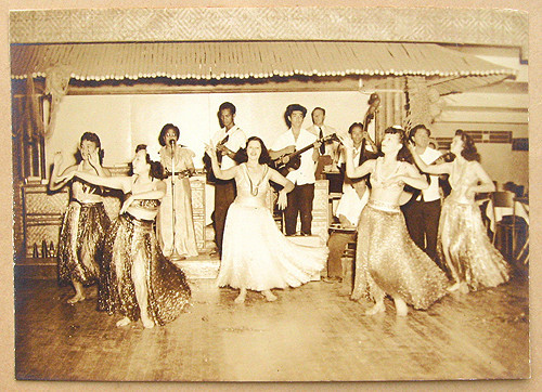
A Nippu Jiji article in 1942 noted, “One of rural Oahu’s favorite recreation spots, the Pearl City Tavern is celebrating its second anniversary this month. In the last two years it has grown from a lunch counter and fountain to a large cafe with a bar, and a ballroom that will accommodate 600 dancers.”
“It started with three employees and now has 40. A few months ago, the Pearl City Tavern contributed 11,000 to the army and navy relief funds. Red Cross and newspaper subscriptions for rural Oahu service men.
The tavern was home to a group of live monkeys, that amused and entertained bar & restaurant patrons from a habitat behind a glass window at the bar.
“Take time to visit the fascinating Monkey Bar. The ‘floor show’ they put on is amusing and delightful, a bonus pleasure at cocktail time. You are also invited to the beautiful Roof Garden, where bonsai trees of many shapes, sizes and varieties are on display” (King) (George Fukuoka was a noted bonsai collector.)
The Fukuokas were an enterprising couple who turned their tavern into a self-contained entertainment complex. Besides the famous monkeys who lived in a plexiglass cage behind the bar, there was dancing and musical entertainment, a separate Japanese restaurant featuring an organist, a souvenir shop that sold ceramic monkey mugs emblazoned with the tavern logo. (Hawaiian Time Machine)
The “Monkey Bar” at the PCT was a popular drinking spot for servicemen. “Fifty years ago, it was a roadside joint with screen windows and an 8- by 12-foot dance floor. Now, a modern bar and restaurant are decorated with hanging plants, Japanese paper screens and a coin-operated Karaoke machine with sing-along video lyrics.”
“Usually pilots had a favorite watering hole wherever they called home. Around Oahu it was at PCT. The bar was actually a pretty nice restaurant and seemed to grow larger all the time, probably from the revenue garnered from all of those pilots.” (Naval Aviator in Landers)
“Used to be the sailors threw beer at the monkeys and the monkeys responded by throwing s – – – back at the sailors,” said bartender Duane Sato, 32, a Pearl City native well-versed in monkey bar lore.
“There was another monkey that walked along the bar with a tin cup. If a customer didn’t put any money in the cup, the monkey was trained to spill the guy’s drink.”
Later, “The bar was approximately 40 feet long and behind it was a glassed enclosed cage full of monkeys, mostly long tailed spider monkeys. The monkeys would run, jump, swing, climb or pick fleas from each other. It was like being in a zoo, especially at night when the clientele began to get inebriated.” (Sailor)
For many of the Sailors, the main pursuit in the tavern was to agitate Marines (and vice versa), not monkeys. ”If you wanted to learn to fight, that was the place to do it.” (Sailor)
“We’d love to fistfight the Marines, and it was easy to instigate them. All you had to do was try to dance with their girlfriends. That guaranteed a brawl every time.” (Sailor, Daily News)
“Military Police duties were performed mostly on post, no patrols off post except during the first two days of each month during pay day, which was the first day of each month. There were occasional patrols off post when troops visited the beaches on weekends, and to the Pearl City Tavern in Pearl City”.
“The Pearl City Tavern, which we referred to as the Monkey Bar, was a popular GI hangout, and was the dividing line for the two MP Companies jurisdictions. There was considerable rivalry between the two MP Companies, and some animosity also.”
“On two or three occasions the MPs from Honolulu arrested our patrols in Pearl City for being out of their jurisdiction, and our MPs in turn arrested a couple of their patrols when the occasion arose. That’s what caused the friction between the two companies. (Army MP Tropic Lightning Museum))
“In my day, we were all over the legal limit before we arrived. If you’re going to drink in a bar filled with monkeys, you have to be loaded before you get there.” (Sailor, Daily News)
Pearl City Tavern closed in 1993 (and the building later razed to make way for a car dealership). In 2018, George and Irene Fukuoka were inducted (posthumously) into the Hawai‘i Restaurant Association Hall of Fame.