The year was 1900 when William and Herb Young arrived in Hawai’i to enter this promising new line of business.
At the tum of the century, Honolulu’s waterfront was well known throughout the Pacific, being as the Territory of Hawai‘i had been annexed to the United States in 1898, and its largest city was the port of call for vessels east- and west-bound.
Ships came around the Horn laden with general merchandise; vessels from the West Coast might be carrying produce or livestock, while those from Australia carried coal.
In Honolulu, they would discharge their cargoes, then load up with sugar bound for distant ports. Interisland trade was serviced by local steamship companies with a combined fleet of eighteen vessels, plus a “mosquito fleet” of independent operators that owned interisland vessels.
The Young brothers weren’t strangers in the harbor life that awaited them. The family hailed from San Diego – four boys, Herb, William, Jack and Edgar, and older sister, Edith. The family patriarch, John Nelson Young, was a sailor.
The boys must have inherited this nautical bent because, at an early age, they were hiring themselves out for fishing trips using a small skiff that they sailed around the bay.
In the summer of 1899, all four boys ran a glass-bottomed boat excursion at Catalina Island. After the season ended, Herb landed a berth on a schooner bound for the Hawaiian Islands, and William decided to join him on what he would later call ‘the great adventure.’
They had made passage on the Surprise, a two-masted schooner engaged as an interisland carrier to serve the Kona Sugar Company. Twenty-nine year old Herb had served as chief engineer during the ten-day journey from San Francisco, while William, then age twenty-five, served before the mast.
The company that was to become Young Brothers began as a an enterprising series of small jobs utilizing skills that Herb and William added to along the way.
By the end of the year, Young Brothers was becoming established as a small but prospering harbor business. Younger brother Jack, age eighteen at the time, had arrived on October 16, 1900, to join the growing partnership.
Then steps in a fledgling Hawaiʻi company, also seeing expansion opportunities, and it was through shipment of Libby’s pineapple from Molokai to Libby’s processing plant in Honolulu that Young Brothers expanded into the freight business.
In the early years of the company, the brothers carried supplies and sailors to ships at anchor outside the harbor, as well as run lines for anchoring or docking vessels. They also gave harbor tours and took paying passengers to participate in shark hunts.
Libby’s need to ship fruit from the growing area on Molokai, to pineapple processing on Oʻahu created an opportunity for the brothers. The brothers, using their first wooden barges, YB1 and YB2, hauled pineapples from Libby’s wharf to Honolulu. “That’s how (Young Brothers) started the freight.” (Jack Young Jr)
Youngest of all, Edgar (who was born January 21, 1885 in San Diego), arrived in July 1901, but being only fifteen at the time, he attended Honolulu High School. (YB 100 yrs)
Graduating high school in 1904, Edgar then sailed aboard the ‘Alameda’ on July 27, 1904 for San Francisco to attend Cooper Medical Cooper. Newspaper accounts note that Edgar reported safe from the 1906 earthquake and fire.
(In 1908, Cooper Medical College was transferred to Stanford University. Instruction by Stanford University began in 1909 and continued in San Francisco until 1959, at which time the Stanford School of Medicine opened on the Stanford campus.)
On Marcy 9, 1907, Edgar married Eunice Mae Hilts. Then, Edgar returned to the Islands, “Dr. Young is a graduate of the Cooper Medical School of San Francisco, and while in that city he had a laboratory of his own.”
“Dr. Edgar Young, who graduated eight years ago from the Honolulu High School, and well known in Honolulu by the young people of the city, has taken up practise at Kahului.”
“He is under regular appointment by the railroad and will be given some of the work of Puunene plantation, which was too heavy for one physician to carry alone. It is likely, too, that when he can spare the time, he will be called to Wailuku to assist in that part of Maui, where the work also is unusually exacting, and demands more time than one physician can usually give.”
“His coming to Maui is much appreciated by the other physicians here as well as the people as a whole. He has brought with him his wife and child. A new house will probably be erected in Kahului on the beach on the Wailuku side of the cottage occupied by Elmer R. Bevins.” (Star Bulletin, August 12, 1912)
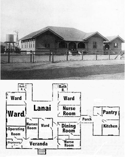
Edgar later substituted for Dr Durney at the Kula Sanitarium. (SB, Sept 19, 1917) Edgar went to Kauai and in addition to general medical practice, he was superintendent of the 35-bed Lihue Hospital (American Medical Directory (1921)).
“He practiced in Hawaii for many years [on Kauai (including Lihue Plantation) and Maui (including Kahului RR Co)]. He left Honolulu for California just before outbreak of war in December, 1941. Owing to ill health, he had been inactive for the past four years.” (Star-Bulletin, Dec 27, 1943)
Edgar Young died on December 23, 1943 (polio ‘finished him’ (Jack Young Jr), in San Diego, at the age of 58, and was buried in Cypress View Mausoleum And Crematory in San Diego.


 and patients at the Bishop Home in Kalaupapa")


")


