In the Lāhainā region, the kula kahakai (near-shore lands) were thickly populated, chiefly residences and places of worship dominated the landscape. There were also found across this landscape, fishponds, taro pond fields and groves of selected trees of importance in various facets of Hawaiian life. (Maly)
On the kula (gentle sloping flat lands) that extend behind the coastal region and reach to the valleys and mountain slopes, were found extensive agricultural fields planted in both wet land and dry land methods. (Maly)
The primary valleys behind Lele (original name for area now known as Lāhainā) included Kahoma, Kanahā and Kaua‘ula. The natural stream alignments from these valleys were modified and extended in ancient times, with large and small ʻauwai (irrigation channels) constructed to feed thousands of lo‘i kalo (taro pond fields) in which the primary food crop of the Lāhainā region residents was grown. (Maly)
Over the centuries, a sophisticated system of ʻauwai, lo‘i kalo and loko i‘a kalo (fish and taro ponds) was engineered, and extended across the otherwise arid kula lands, down to the near-shore settlements. (Maly)
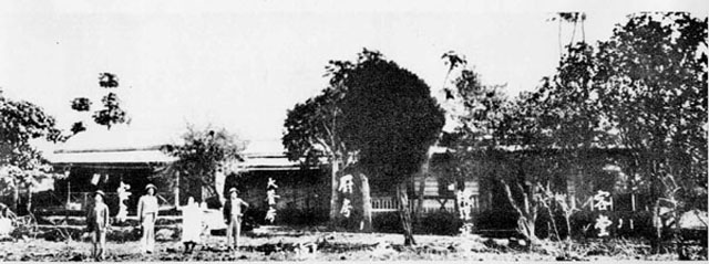
Near the central area of the present Lāhainā Town is an area that was once a taro patch – it was King Kamehameha III’s personal taro patch, which he tended to regularly. Reportedly, he felt “that common work has dignity.”
The natural waterways supplying these taro patches were eventually re-routed to provide fresh water for the community as Lāhainā grew.
“We found Lahaina very much like all that we had ever heard of—Lahaina. Its citizens hospitable, its streets magazines of red dust, its taro patches green, its trees ambrosial, and its breezes refreshing.” (The Polynesian, July 18, 1846)
Lāhainā’s Pioneer Hotel (as it was initially known) was built by George Alan Freeland on a portion of what has been referred to as ”Āpuakēhau,” the King’s Taro Patch (a remaining part can be seen near the water’s edge and is part of the Ala Hele Moʻolelo O Lāhainā (Lāhainā Historic Trail.))
Born in Cobham, England, Freeland was a miner, a provincial police officer and in the livery and grocery business in Canada. He married Amabel Kahuhu of Lānaʻi and settled in Lāhainā to raise three sons and four daughters. (star-bulletin)
Starting as a modest 10-room hotel with a common bathroom down the hall when it was initially completed in late-1901, it remains open today with 34-modern guest rooms.
New construction in 1965, that matches the 1901 waterfront wing and removal of the theater behind the hotel, added two sides and two wings to the block. Of the two new wings, the lower floors are businesses and the upper are hotel rooms. The original wing retains offices, restaurant and bar.
Several suggest that later-renamed Pioneer Inn was the first Lāhainā and West Maui hotel; however, a 1901 Maui News report notes that the Lāhainā Hotel was open before the Pioneer. While not the oldest, it is one of the oldest hotels in the islands still in operation (Volcano House started in the mid-1800s.)
A notice in the Hawaiian Star, October 9, 1901, noted “New Hotel For Lahaina. Articles of association were filed yesterday by the Pioneer Hotel Company, with the principal place of business at Lahaina, Island of Maui.”
“The object of the association Is to conduct a general hotel and restaurant business, and billiard tables. … The officers and principal stockholders are J. J. Newcomb, president, twenty-five shares; A Aalberg, secretary, twenty-five shares; P. Nicklas, treasurer, two shares; George Freeland, thirty-five shares.”
Three weeks later, the newspaper reported “George Freeland, manager of the Pioneer hotel at Lahaina, is in town for the purpose of purchasing supplies and furniture for the establishment. He will return to Lahaina nest Tuesday. (Honolulu Republican, October 31, 1901)
“Lahaina now boasts two new and up-to-date hotels. Matt. McCann has just finished and moved into his new hosterie (Lahaina Hotel,) and is not able to handle all the travel at present, consequently he is compelled to turn away guests this week.”
“The Pioneer Hotel is practically completed and under the management of Mr. Freeland, will be thrown open for the reception of guests about December 1.” (Maui News, November 23, 1901)
While short on hotels, “there is a plethora of saloons in Lahaina and now that a man can get a drink whenever and almost wherever he wants it …”
“… the people seem to care less about getting drunk, judging from the fact that there have been fewer arrests for drunkenness in Lahaina during the past month than for any previous month this year.” (Maui News, November 23, 1901) (McCann and Freeland each had a liquor license for their hotels.)
Almost immediately following the completion of his hotel, Freeland began forming subsidiaries of the Pioneer Hotel Company; the Pioneer Saloon, the Pioneer Theatre, the Pioneer garage and the Pioneer Wholesale Liquor Company.
Later, prohibition on the continent meant that George was forced to shut down his liquor company. The saloon became the hotel’s business office.
Before Lahaina Harbor was built in the 1950s, the ocean channel fronting Pioneer Inn was barely navigable during high surf; passengers who rode on dinghies to board ships faced the possibility of being swamped. “You took your chances through the surf.” (star-bulletin)
In the attached image album note the old Pioneer Inn menu and the tag line at the bottom, “A Haven for Whalers and World Travelers.”
Over the past 100 years, Pioneer Inn has hosted scores of famous names, such as Hawaiʻi’s last queen (Liliʻuokalani,) Mark Twain, Jack London, Sun Yat-sen, Jackie Kennedy and author Tom Robbins. (Seattle Post-Intelligencer)
The Pioneer Inn was later joined by resort development at Kāʻanapali Beach Resort (Royal Lāhainā 1961, then the Sheraton, 1962) and the Kapalua Resort (Kapalua Bay Hotel, 1978) – and a lot of other development along the West Maui Coast.
Here is a related story on the Lahaina – Lanai connection of the Pioneer Inn:
https://imagesofoldhawaii.com/pioneer-inn-maunalei-sugar-connection/