No keia heiau oia ke kapu enaena.
(Concerning this heiau is the burning tabu.)
‘Enaena’ means ‘burning with a red hot rage.’ The heiau was so thoroughly ‘tabu,’ or ‘kapu,’ that the smoke of its fires falling upon any of the people or even upon any one of the chiefs was sufficient cause for punishment by death, with the body as a sacrifice to the gods of the temple. (Westervelt)
Oral traditions trace the origin of Hawaiian luakini temple construction to the high priest Pā’ao, who arrived in the islands in about the thirteenth century. He introduced several changes to Hawaiian religious practices that affected temple construction, priestly ritual, and worship practices.
Prior to his coming, the prayers, sacrifices, and other ceremonial activities that the high chief and his officiating priest performed could be observed by the congregation, who periodically responded as part of the ceremony.
After Pā’ao’s arrival, temple courtyards, which were sometimes built on hillsides to add to their massiveness, were enclosed with high stone walls, preventing the masses from participating as freely in the worship ceremonies.
In addition, new gods; stronger kapu; an independent, hereditary priesthood; wooden temple images; and human sacrifices became established parts of the religious structure. Pā’ao erected the first luakini (Wahaula) at Puna, Hawaiʻi, followed by Moʻokini Heiau at Kohala. These structures signaled a new era in Hawaiian religious practices. (NPS)
On the southeast coast of Hawaiʻi near Kalapana is one of the largest, oldest and best preserved heiau. Its walls are several feet thick and in places ten to twelve feet high. It is divided into rooms or pens, in one of which still lies the huge sacrificial stone upon which victims – sometimes human – were slain before the bodies were placed as offerings. (Westervelt, 1915)
“At our visit to the scene we were shown the small cove, deep down the jagged bluffs of Puna’s coast line, at the southern end of Wahaʻula premises, where the bones of the slain were washed, and to this day is known as Holoinaiwi.” (Thrum, 1904)
This heiau is now called Wahaʻula (red-mouth). In ancient times it was known as Ahaʻula (the red assembly), possibly denoting that at times the priests and their attendants wore red mantles in their processions or during some part of their sacred ceremonies. (Westervelt)
“The Heiau of Wahaʻula is built on an ʻaʻa flow, and the ascent to it is by terraces. Upon the first terrace the female members of the royal family brought their offerings which were taken by the priests. Beyond this first terrace no female was allowed to pass.”
“Two more terraces brings one to the enclosure or temple, in the shape of a quadrangle 132 feet long, by 72 feet wide. A stone wall encloses the temple, 6 feet high and 4 feet wide. The main entrance faces the East, flanked on either side by two smaller entrances. Immediately in front of this entrance stand the remains of the old temple, which was destroyed by the ʻaʻa flow on which the present one stands.”
“Across the southern end extends a stone platform some 3 feet high built in the shape of two semi-circles connected by a straight platform. Between these semi-circles was placed the presiding deity, and on either hand were placed the offerings of fruits, etc., while immediately in front, on a small raised platform were placed the human sacrifices, which were always slain in the main entrance to the heiau.”
“Immediately in front of this altar for human sacrifices, and extending across the enclosure, stood the priests’ house. sacred to them alone. In the rear of this was the royal house, where the members of the royal family assembled during the days devoted to the sacrifices. The rest of the enclosure was paved.” (Thrum)
“Water-worn pebbles were carried from the beach and strewn over the floor, making a smooth place for the naked feet of the temple dwellers to pass without injury from the sharp-edged lava. Rude grass huts built on terraces were the abodes of the priests and high chiefs who visited the places of sacrifice.”
“Elevated, flat-topped piles of stones were built at one end of the temple for the chief idols and the sacrifices placed before them. Simplicity of detail marked every step of temple erection.” (Westervelt)
“(I)in the original enclosure of the heiau of Wahaʻula was a sacred grove, said to contain one or more specimens of every tree growing on the Hawaiian group, a number of which, or their descendants, had survived when he visited the place in 1869. … It was built in the quadrangular or parallelogram form which characterized all the heiaus built under and after the religious regime introduced by Pāʻao.” (Fornander)
Beyond the heiau, on the makai side of the trail, is pointed out the footprint of Niheu, a demi-god, as well as the mark of an arrow which he shot at another demi-god who came to fight him. Further west, makai of the place where the trail turns mauka, is Kamoamoa, where the ranch driving pens are.
Here are two wells with fair water, and also a fine natural arch by the sea. Here are also a few interesting rock carvings. The most easily found of these is about a hundred yards from the paddock extension towards Kalapana, and may be located by following the line of this extension’s makai wall in an easterly direction.
The trail is straight, with a bad grade, but paved, until it has reached well up the bluff, where it passes the Pea house, the last habitation before the Crater Hotel is reached. From Pea’s it is a good eight miles to the Makaopuhi crater. The trail is narrow, passes through splendid forest, and is, though seldom used, quite easily followed. (Kinney, 1913)
“Tradition credits a rebuilding of the temple to Imaikalani, a famous chief of Puna, and Kaʻū, in the time of Keawenui-a-umi, in the sixteenth century. It was repaired again in the time of Kalaniʻōpuʻu, about 1770, and in the time of Kamehameha I, it had its final renovation.” (Thrum)
“This was the last heiau destroyed when the ancient tabus and ceremonial rites were overthrown by the chiefs just before the coming of Christian missionaries. At that time the grass houses of the priests were burned and in these raging flames were thrown the wooden idols back of the altars and the bamboo huts of the soothsayers and the rude images on the walls, with everything combustible which belonged to the ancient order of worship. Only the walls and rough stone floors were left in the temple. (Westervelt)
Kīlauea’s ongoing Puʻu ʻŌʻō eruption started on January 3, 1983 when ground fissures opened up and “curtains of fire” (long thin fountains of molten lava) issued from a 3½-miles long discontinuous fissure system in the remote rainforest of the middle east rift zone of the volcano.
Since then, about 500-acres have been added to the Big Island (that volume of lava could have filled 1.5-million swimming pools. The coastal highway has been closed since 1987, as lava flows covered 8 miles to as great a depth as 80 feet. 214-homes were destroyed.
“The apprehensions uniformly entertained by the natives, of the fearful consequences of Pele’s anger, prevented their paying very frequent visits to the vicinity of her abode; and when, on their inland journeys, they had occasion to approach Kirauea, they were scrupulously attentive to every injunction of her priests, and regarded with a degree of superstitious veneration and awe the appalling spectacle which the crater and its appendages presented.”
“The violations of her sacred abode, and the insults to her power, of which we had been guilty, appeared to them, and to the natives in general, acts of temerity and sacrilege; and, notwithstanding the fact of our being foreigners, we were subsequently threatened with the vengeance of the volcanic deity, under the following circumstances.” (Ellis, 1831)
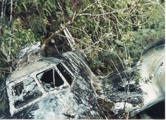
The Wahaʻula Heiau was threatened three times in 1989 and once in 1990, but the lava flowed only up to the walls before diverting around them, but destroyed the visitor center and related facilities (built by the National Park Service in 1964, was destroyed by lava in June 1989.) However, a subsequent 1997 flow breached the walls and covered the heiau. (star-bulletin)