Images of Old Hawaiʻi

  • Home
  • About
  • Categories
    • Ali’i / Chiefs / Governance
    • American Protestant Mission
    • Buildings
    • Collections
    • Economy
    • Missionaries / Churches / Religious Buildings
    • General
    • Hawaiian Traditions
    • Other Summaries
    • Mayflower Summaries
    • Mayflower Full Summaries
    • Military
    • Place Names
    • Prominent People
    • Schools
    • Sailing, Shipping & Shipwrecks
    • Voyage of the Thaddeus
  • Collections
  • Contact
  • Follow

May 30, 2025 by Peter T Young Leave a Comment

Summertime

In a lot of respects, with or without kids, school vacation schedules seem to set how we operate our lives.

Until the middle of the 19th century, Americans used the word vacation the way the English do, the time when teachers and students vacate the school premises and go off on their own.  (Siegel; NPR)

Summer … Memorial Day to Labor Day, right?  Well, maybe before, but why?

A first thought is the historic reason for the season of summer vacations is so kids can go work on the family farm.  There are a number of reasons summer vacation came about, but the farming calendar isn’t one of them.

There used to be two basic school schedules – one for urban areas and the other for rural communities.

In the past, urban schools ran year-round. For example, in 1842 New York City schools were in class for 248 days. Rural schools took the spring off to plant, and the autumn off to harvest. (The summer actually isn’t the busiest time in agriculture.)
Short school years with long vacations are not the norm in Europe, Asia, or South America. Children in most industrialized countries go to school more days per year and more hours per day than in America.

Rural schools typically had two terms: a winter term and a summer one, with spring and fall available for children to help with planting and harvesting. The school terms in rural schools were relatively short: 2-3 months each.  (Taylor)

In addition, in rural areas, the summer term was considered “weak.” The summer term in rural neighborhoods tended to be taught by young girls in their mid- to late-teens. On the other hand, schoolmasters, generally older males, taught the winter terms. Because of this, the summer terms were seen as academically weaker.  (Lieszkovszky; NPR)

It’s hot in the summer. The school buildings of the 19th-century weren’t air-conditioned. Heat during the summer months would often become unbearable.    (Lieszkovszky; NPR)

In 1841, Boston schools operated for 244-days while Philadelphia implemented a 251-day calendar. In the beginning of the 19th-century, large cities commonly had long school years, ranging from 251 to 260 days.  During this time, many of these rural schools were only open about 6-months out of the year.  (Pedersen)

In the 1840s, however, educational reformers like Horace Mann moved to merge the two calendars out of concern that rural schooling was insufficient and then-current medical theory and concerns over student health in the urban setting.

“(A) most pernicious influence on character and habits … not infrequently is health itself destroyed by over-stimulating the mind.”  (Mann)

This concern over health seemed to have two parts.  As noted above, there was the concern that over-study would lead to ill-health, both mental and physical; the other concern was that schoolhouses were unhealthy in the summer (heat, ventilation, etc.)  (Taylor)

Attendance became another problem.  The city elite could afford to periodically leave town for cooler climates.  School officials, battling absenteeism, saw little advantage in opening schools on summer days or on holidays when many students wouldn’t show up. Pressure to standardize the school calendar across cities often led campuses to “the lowest common denominator” – less school.    (Mathews; LA Times)

In the second half of the 19th-century, school reformers who wanted to standardize the school year found themselves wanting to lengthen the rural school year and to shorten the urban school year, ultimately ending up by the early 20th-century with the modern school year of about 180 days.  (Taylor)

Summer emerged as the obvious time for a break: it offered a break for teachers, generally fit with the farming needs and alleviated physicians’ concerns that packing students into sweltering classrooms that would promote the spread of disease.  (Time)

While it’s clear historically that 3-month layoff from school was not based on farming needs – for most of the country – in Hawaiʻi there was a farm-based reason for the break from studies, at least from 1932 to 1969.

It happened in Kona.

By the 1890s, the large Kona coffee plantations were broken into smaller (5+/- acres) family farms.  By 1915, tenant farmers, largely of Japanese descent, were cultivating most of the coffee. Many hours were spent cleaning and weeding the land, pruning the trees, harvesting the crop, pulping the berries and drying them for the mills.

These were truly family farms.  “At that time, we used to work until dark. You see, no matter how young you were, you have to work. Before going to school, we pick one basket of coffee, then go to school. We come home from school and we pick another basket.” (Tsuruyo Kimura; hawaii-edu)

Konawaena was the regional school; it was first established as an elementary school, about 1875.  By 1917, they were pushing to get a Kona high school (at the time, Hilo High, established in 1905, was the only high school on the island.)

In 1920, the Territory acquired land for a new school and in 1921, the new Konawaena accommodated students up to the 9th-grade; classes through the senior year were added by the 1924-25 school year.

Konawaena means “the Center of Kona,” and it lived up to its name.  “Everything possible has been done to make the community feel that the school belongs to them. A Kona Baseball League has been organized and all league games are played on the school diamond” (Crawford, 1933; HABS)

The Kona area was observed as being “different socially from the rest of the Islands” (Crawford, 1933; HABS.)  Coffee farming was the main reason for the difference. This labor-intensive crop thrived best in the steep lava slopes of the Kona districts.

“The labor problem is one that will have to be seriously considered.  As coffee culture increases, the need of a greater supply of labor will be strongly felt, particularly at picking time. A large force is then needed for three or four months, after which, if coffee alone is cultivated, there is need only of a small part of the force required for picking.”  (Thrum)

These labor and  land factors meant a non-industrial, small-farm type of agriculture, very different from the industrial trends in the growing sugar and pineapple plantations that developed in other areas of the Islands.

The school went beyond recreational activities to accommodate the surrounding community.

In 1932, the school’s ‘summer’ vacation was shifted from the traditional Memorial Day to Labor Day (June-July-August) to August-September-October, “to meet the needs of the community, whose chief crop is coffee and most of which ripens during the fall months.” (Ka Wena o Kona 1936; HABS)

In 1935, the legislature recognized the ‘Konawaena Coffee Vacation Plan’ and passed legislation such that “The teachers of the Kona District … shall be paid, under such conditions as the Department of Public Instruction (now DOE) may require, their monthly accruing salaries during the months of September and October of each year during which such plan is in operation.”    (Session Laws, 1935)

This “coffee harvest” school schedule and the “coffee vacation” lasted until 1969 (Honolulu Star Bulletin 1969; HABS.)

And now, in Hawaiʻi and across the country, there are varying arrangements for school schedules and vacations.  Some areas have lost the 3-month layover; but most are trending with a total 180 to 200-days of instruction, with various schedules in arranging the breaks.

© 2025 Hoʻokuleana LLC

Filed Under: Economy, General, Place Names Tagged With: Coffee, Hilo High, Konawaena High, Hawaii, Hawaii Island, Kona, Kona Coffee

May 22, 2025 by Peter T Young Leave a Comment

Kīlauea Military Camp

What once began as an idea by Hilo Board of Trade members for a training ground for the National Guard and an Army “vacation and health recruiting station” has become one of Hawaii’s most unique resorts for the military. (KMC)

Let’s look back.

In 1898, Lorrin Thurston owner of Volcano House and head of the Hawai‘i Promotion Committee (forerunner to the Hawai‘i Visitors and Convention Bureau) worked closely with the Inter-Island Steam Navigation Company to create an excursion business from Honolulu to his hotel at Kīlauea.

Although he sold his interest in Volcano House to hotelier George Lycurgus (1858–1960) in 1904, Thurston continued to promote Kīlauea and Hawai‘i’s other natural sites.

He helped with the establishment of the Hawaiʻi National Park, an entity to encompass both Kīlauea and Haleakalā.  Hawai‘i’s new National Park, established August 1, 1916, was the thirteenth in the new system and the first in a US territory.  (Chapman)

Besides its volcanic interest, the park is noted for its fine examples of tropical vegetation (some forest species being extremely rare;) its native birdlife which is unique in the entire world; its Polynesian archaeology and history; and its character as an international park.  (Edward G Wingate, Superintendent, 1939)

The history of the Park generally mirrors the history of Kīlauea Military Camp (KMC.)

Interest in Kīlauea as a military training and rest area began in September 1911, when Companies A and F, Twentieth Infantry, arrived. They were followed two years later by one hundred men from Company D, First Infantry, who camped near the Volcano House.  (Nakamura)

Thurston helped negotiate a lease for about 50-acres of land from Bishop Estate; trustees held the lease (they included Ex officio the Commander of the Army Department of Hawaii; Ex officio the Commanding General of the National Guard of Hawaii; Lieut Col John T. Moir, National Guard, Island of Hawaiʻi; GH Vicars of Hilo and LA Thurston of Honolulu and Hilo.)

In the early years, to get there, off-island folks took steamer ships to either Hilo or Punaluʻu (from Hilo they caught a train to Glenwood and walked/rode horses to Volcano; one mile west of the Volcano House; a five-mile railroad took passengers to Pahala and then coaches hauled the visitors to the volcano from the Kaʻū side.) Later, the roads opened.

“Tours of all the islands are arranged.  Connected with the Inter-Island Steam Navigation Company is the world-famous Volcano House overlooking the everlasting house of fire, as the crater of Halemaʻumaʻu is justly named. “

“A night’s ride from Honolulu and an hour by automobile and you are at the Volcano House in the Hawaii National Park on the Island of Hawaiʻi, the only truly historic caravansary of the Hawaiian Islands.”  (The Mid-Pacific, December 1933)

The Camp is located at an elevation of 4,000-feet, directly on the belt road around the island (the road was later relocated mauka of the Camp.)

KMC greeted its first group of US Army Soldiers from Company A, 2nd Infantry, November 6, 1916. Three buildings for dining and recreation were still unfinished, so the visiting Soldiers were expected to provide their own sleeping tents.

A couple weeks later, November 17, KMC was officially opened, and many Soldiers came to this unique site through 1917.

Encouraged by local boosters, including John Giles and Lorrin Thurston, KMC became a mainstay of the volcano park for the next three decades.  (Chapman)

From the latter part of 1916 into early-1917, the newly designated Kīlauea Military Camp witnessed a steady stream of military units.

Then, WWI broke out and virtually all of the troops in Hawai‘i prior to 1917 had transferred to the continental US, many of them then moving on in succeeding months to the trenches of France and Belgium.  (Chapman)

To keep the place going, school summer programs and Boy Scouts stayed at the camp.  Following WWI, the trustees transferred their KSBE lease to the Park Service.  By late-1921, soldiers on recreation leave started to return to the Camp and the facilities started to expand.

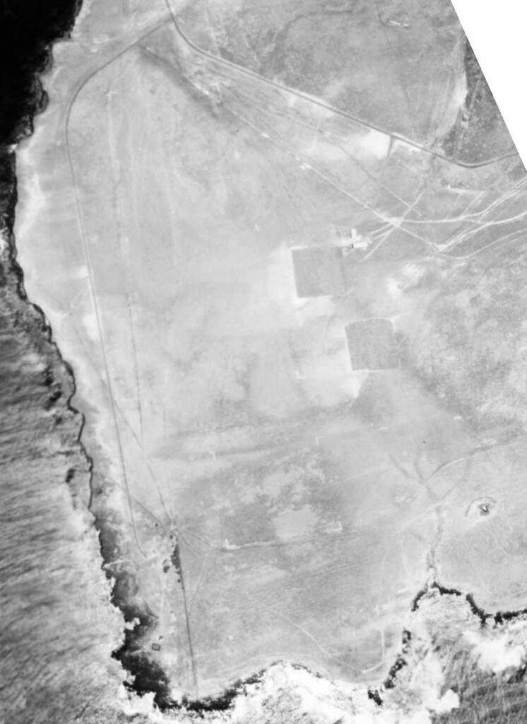
The last major addition to KMC was the provision of an airfield; in 1924, the Army built a landing strip just south of Halemaʻumaʻu (known as Sand Spit Horst.)

However, within a few months an explosive eruption at Halemaʻumaʻu threw boulders onto the site.  (Another runway was built closer to the Camp – it was named Boles Field in honor of the Park’s first Superintendent, Thomas R Boles.)

As part of the original agreement, the Navy built its own rest and recreation camp on a 14-acre parcel adjacent to KMC in 1926. The Navy camp was transferred to KMC’s control in 1935, however, due to a slow resolution of the lease agreement between the Park Service and the Navy.  (KMC)

In 1941 it became an important staging ground for the war. From March to October 1942, KMC became the headquarters for the Twenty-seventh Division of the Army. The troops used the buildings at KMC for quarters and the grounds for training.

The R&R Camp also became an internment camp.  The first detainees arrived in the afternoon of December 7, 1941. Most did not stay at KMC for long, however; within a few months all were transferred to Sand Island on Oʻahu.  (Nakamura)

In June 1942 the Battle of Midway changed the tide of the war, and KMC was again re-activated as a rest and recreation camp, but it also continued to support tactical training of troops. In October 1943, the decision was made to return the Camp to a fully recreational facility.  (Nakamura)

In the postwar period, General Dwight D. Eisenhower stayed for a few days at KMC in 1946.  In 1949, the Army opened KMC to members of all branches of the military.  (Chapman)

On, July 1, 1961, Hawaiʻi National Park’s units were separated and re-designated as Haleakalā National Park and Hawaiʻi Volcanoes National Park.  The relationship between the military and Park Service was not always smooth.

Today, Kīlauea Military Camp is open to all active and retired armed forces, Reserve/National Guard, dependents, other uniformed services, and current and retired Department of Defense civilians, including Coast Guard civilians and sponsored guests.

© 2025 Hoʻokuleana LLC

Filed Under: Military Tagged With: Dwight D Eisenhower, Boles Field, Lorrin Thurston, Hawaii, Hawaii Island, Volcano, Kilauea Military Camp, Internment, Hawaii Volcanoes National Park

May 21, 2025 by Peter T Young Leave a Comment

Hopu

Hopu, “was born about the year 1795, in Owhyhee, one of the Sandwich Islands.  After my mother had left me, she went and told one of my sisters to take my life away … (however, his) aunt took a blanket with her … (took him in her arms and took him) into her own brother’s house.”  (Hopu)

“Then her brother said unto his wife, this child shall be our son, for his name shall be called Nauhopoouah Hopoo, and we will be his feeders. So they nourished (him)”.  He lived with his uncle until he was four; then returned to his parents until he was eight (later living with his brother.)

“Among the American traders who frequently visit the Sandwich Islands, was Captain Brintnal, of New-Haven, (Conn.) who in 1807, touched and tarried some time at Owhyhee, one of these Islands.”  That year, Hopu and Henry ʻŌpūkahaʻia sailed with Captain Brintnall on the ‘Triumph.’

The Triumph set sail for the Pacific Coast of North America to pick up sealers, one of whom, Russell Hubbard, was a Yale student from Connecticut. Six months later the ship returned to Hawaiʻi, then went on to China, and finally New York. During the long voyage Hubbard tutored Henry and Hopu in English, and taught them about the Bible.  (Cook)

The ship returned to America by the way of China, and arrived at New-Haven early in the fall of 1809.  On their arrival on the continent, Hopu was given an additional name Thomas.

“After Hopoo had lived for a season in New-Haven, his disposition seemed inclined rove than to study.  He rejected an invitation of Obookiah to go with him to Andover and be taught.”  (ABCFM)  However, he learned to write and spell some basic words.  He chose the life of a sailor – he served on an American ship in the War of 1812.

After returning from his last voyage, he hired himself out in several families as a servant or coachman.  For about nine months, Hopu settled down with a Grangor family at Whitestown, NY. He lived with various families, until September 1815, when he returned to New-Haven, joined ʻŌpūkahaʻia and resumed his studies, including religious instruction.   (Narrative of Five Youth, 1816)

“In this place I become acquainted with many students belonging to the College. By these pious students I was told more about God than what I had heard before … I could understand or speak, but very little of the English language. Friend Thomas (Hopu) went to school to one of the students in the College before I thought of going to school.”  (ʻŌpūkahaʻia)

Hopu and ʻŌpūkahaʻia stayed together in school at Litchfield Farms from the late-1816 until April 1817, when they started their training at the Foreign Mission School in Cornwall. Of the four Hawaiian boys who came with the pioneer party, Hopu was best prepared to serve, for he had proved a good scholar, even in theology. (Kelley)

On October 23, 1819, the Pioneer Company of American Protestant missionaries set sail on the Thaddeus for the Islands.  These included two Ordained Preachers, Hiram Bingham and his wife Sybil and Asa Thurston and his wife Lucy; two Teachers, Mr. Samuel Whitney and his wife Mercy and Samuel Ruggles and his wife Mary; a Doctor, Thomas Holman and his wife Lucia; a Printer, Elisha Loomis and his wife Maria; a Farmer, Daniel Chamberlain, his wife and five children.

With the missionaries were four Hawaiian students from the Foreign Mission School, Thomas Hopu, William Kanui, John Honoliʻi and Prince Humehume (son of Kauaʻi’s King Kaumuali‘i.)  (Unfortunately, ʻŌpūkahaʻia died suddenly of typhus fever in 1818 and did not fulfill his dream of returning to the islands to preach the gospel.)

They reached Hawaii on March 30, 1820. When the boat which they had sent to a landing on the Kohala coast, returned to the vessel, these were the tidings given to the missionaries: “Kamehameha is dead; his son Liholiho is king. The tabus are at an end; the idols are burned; the temples are destroyed.  There has been war. Now there is peace.”  (HEA) They later landed in Kailua-Kona, April 4, 1820.

Hopu and Kanui remained with the Thurstons and Holmans at Kailua to serve as interpreters and aides to the king. Hopu was reunited with his father, who moved his family to Kailua, where Hopu cared for him teaching him to know Jesus and praying with him faithfully. He also served the king’s household and aided Thurston by translating his teachings and preaching.  (Kelley)

Later at Lāhainā, “Hopu, in visiting the back part of Maui with the king, was particularly attracted by one of the daughters of the land.  When he returned to Honolulu, he brought to our cottage the girl of eighteen, wishing to commit her to me for special training.”  (Thurston)

Hopu declared “since the Almighty has excited in my heart such yearnings for her, I think it is his will that I marry her.” Lucy Thurston named her Delia.

“Their marriage (August 11, 1822) was publicly solemnized in the church. The king and principal chiefs were there.  (It was the first Christian marriage in the Islands.)”

“Hopu appeared as usual in his gentlemanly black suit. By his side stood Delia, dressed in a … complete and fashionable dress in white, was added a trimmed straw bonnet. It was the first native woman’s head that had been thus crowned.”  (Thurston)

After helping Bingham in Honolulu for some time, Hopu settled in Kailua where he kept busy teaching, holding Sabbath meetings for the governor, assisting in translating the Bible, and caring for his father (who died after four years at the age of 80. His funeral service was the first missionary one to be held in Hawaiʻi.)  (Kelley)

Throughout those early missionary years in Hawaiʻi, Hopu appears here and there preforming his duties; forcibly delivering a sermon, spreading cheer, comforting and aiding to those suffering.

Chester Lyman, visiting the islands in 1846 found Hopu working in a store in Honolulu. He reports he was over 50 and an interesting man.  He has been a consistent and useful man since he returned and is now one of the deacons of the Kailua Church where he resides.  (Kelley)  The image shows Thomas Hopu.

© 2025 Hoʻokuleana LLC


Filed Under: Missionaries / Churches / Religious Buildings Tagged With: ABCFM, Henry Opukahaia, Thomas Hopu, Hopu, Hawaii, Hawaii Island, Hiram Bingham, American Board of Commissioners of Foreign Missions

May 7, 2025 by Peter T Young 1 Comment

Kawaihae Harbor

Kawaihae is also generally referenced as Pelekane, which means ‘British,’ possibly named after the Young and the Davis families who lived there (when Isaac Davis (born in Pembrokeshire, Wales) died in 1810, his friend and co-advisor to Kamehameha, John Young (an Englishman born in Liverpool,) looked after Davis’ children.)

The vicinity around what is now Kawaihae Harbor (“the water of wrath”) has been the scene of many important events, from the killing of Kamehameha’s rival and cousin, Keōua in 1791, to interactions with foreign visitors, including Captain George Vancouver of Great Britain, Otto von Kotzebue of Russia, and dignitaries from France, the United States and other nations.

Kamehameha had a house here.  Following his death in 1819 and the succession of Liholiho to rule as Kamehameha II, Kawaihae served as the initial Royal Center for Liholiho, who sought consolidation of his forces and consecration of his leadership role, there.  (Kelly)

When the Pioneer Company of the American Protestant missionaries arrived the next year, they first stopped at Kawaihae; this is where the missionaries first learned that the kapu system had been abolished and heiau were destroyed.

Kawaihae’s position as the center of inter-island trade and transport on northwest Hawai‘i is detailed in a description published in the Merchant’s Magazine and Commercial Review in 1858:

“Kawaihae is a small village in the bay of the same name in the western shore of Hawaii…It derives its importance from being the port of the rich and extensive grazing uplands of Waimea, one of the finest agricultural districts of the islands, which has not yet developed its full resources.”

“Forty or fifty whale ships have annually visited this port for the last few years, to procure salted beefs and Irish potatoes, which are considered the finest produced in the islands.“

Features of the village in 1861 were described by Charles de Varigny, the secretary of the French Consulate in Honolulu (who later served Kamehameha V as finance minister and minister of foreign affairs.)

Varigny observed how much of the village was given over to its commercial functions: “The village consists chiefly of a single large wooden structure which serves as a country store and warehouse for the products of the district. Around the shop are clustered several makeshift buildings providing annexes for further storage.”

“A small wharf serves for the departure and landing of travelers. At a short distance from shore floats an old stripped-down vessel, its melancholy hull balancing at anchor and providing storage for products arriving from Honolulu.” (pacificworlds)

Over time, Kawaihae and Waimea (up the hill) developed a synergistic relationship.  The area was a canoe landing area, whether for commerce or combat.  (This is where Maui’s chief Kamalālāwalu landed in his assault against Lonoikamakahiki’s Hawaiʻi forces (Lono won.))  But Kawaihae’s presence was really focused on commerce as a landing site.

A 1914 map of Kawaihae Village shows a concentration of development along the shoreline; the uplands of the Kawaihae region remained undeveloped pasture land.

During WWII war years (1941-1945,) Kawaihae’s role as the shipping outlet for Waimea was intensified.  Troops were shipped in and out through Kawaihae. At the southern end of the bay, in Kawaihae 2, amphibious landing exercises were conducted and military emplacements were set up in the area of Puʻukohola Heiau.

The war in the Pacific had been over less than a year when on April 1, 1946, an earthquake off the Aleutian Islands caused a tsunami that devastated the Hawaiian Islands.  Although no lives were lost at Kawaihae, its effects wiped out commercial fishing activity there and it was reported that the tsunami “…was the beginning of the end for the Kawaihae Fishing Village. People left.”  (Cultural Surveys)

The old landing had been destroyed in the 1946 tsunami and the one built in 1937 had proven unsafe in high seas. By the 1950s, the need for improved harbor facilities at Kawaihae was apparent.

The Kawaihae Deep-Draft Harbor project was authorized by the US Congress in 1950; to be constructed were: “an entrance channel 400 feet wide, approximately 2,900 feet long, and 40 feet deep; a harbor basin 1,250 feet square and 35 feet deep; and a breakwater with a maximum crest elevation 13 feet above low water and approximately 4,400 feet long, of which 3,200 feet would be protected with heavy stone revetment.”

The harbor was created by dredging part of an extensive coral reef which extended 4,000-feet seaward and ran along the shore more than a mile south of Kawaihae town; the reclaimed reef area created a coral flat peninsula that extends approximately 1,000-feet makai (seaward) of the piers across the natural reef, forming a beach along the south harbor boundary and terminating at the outer breakwater.

The harbor’s construction was hailed as an “economic shot in the arm,” for sugar planters in the Kohala region of the island would no longer had to ship their crops overland to Hilo or to Kailua-Kona. The harbor would serve military needs as well. The Army was about to acquire a 100,000-acre training site nearby and could unload supplies at Kawaihae Harbor.  (Cultural Surveys)

At the completion of construction in 1959 (officially dedicated on October 5, 1959,) the Kawaihae facilities included an inter-island terminal, mooring areas, and a large harbor basin with a wide entrance channel.  Harbor modifications in 1973 widened the entrance channel and enlarged the basin (a little over 71-acres.)

The South Kawaihae Small Boat Harbor entrance channel and 850-foot West breakwater was constructed as part of Operation Tugboat and completed in December 1970.  As part of Project Tugboat, the Army used conventional high explosives to blast an 830-foot entrance channel, 120-feet wide/12-feet deep and a 200 by 200-foot turning basin.

(“Project Tugboat” was conducted by the Army’s Nuclear Cratering Group; perhaps because of this, some suggest nuclear explosives were used to clear the small boat harbor.  However, twelve 10-ton charges of an aluminized ammonium nitrate slurry explosives (placed 36-feet deep and 100 to 120-feet apart) were used; they were meant to simulate the yield of a nuclear explosion, but were not radioactive.)

After years of delay, it was recently announced that a project to improve the eastern portion of Kawaihae Small Boat Harbor is moving forward.  Among the improvements are a 445-foot long floating dock, as well as a 47-foot-long access ramp, gangway and 25 berthing stalls. Later a paved access road and new water system is planned.

© 2025 Hoʻokuleana LLC


Filed Under: General, Place Names, Prominent People, Sailing, Shipping & Shipwrecks, Economy Tagged With: Kamehameha, Liholiho, Kamehameha II, John Young, South Kohala, Kawaihae, Puukohola, Pelekane, Hawaii, Hawaii Island, Isaac Davis

April 28, 2025 by Peter T Young 5 Comments

James Wight

James Wight was born in India in 1814 of Scotch-Irish parentage; he received liberal education at the University of Edinburgh, where he graduated in 1836.

At 22 years of age, he went to Australian with the intention of practicing his profession as physician, but his interest was for business pursuits.  After thirteen years practicing medicine, there he abandoned the profession and migrated to Hawaiʻi.  (Hawaiian Gazette, September 5, 1905)

Wight, with the initial intent to go to the gold fields of California, came to Hawaiʻi in 1850 with his wife (Jane Tompkins Wight – formerly of Cape Colony, South Africa, now called Cape of Good Hope.)

On August 2, 1850, they went from Honolulu to Kawaihae and from there to Mahukona in an open boat.

While attempting to land ashore at Mahukona on the Big Island of Hawaiʻi, the small boat was ship wrecked during a storm.  Their 13-month old daughter Ada Wight drowned during the tragedy.

Once ashore, Dr. Wight was made aware of white parishioners living close by. He made the decision to venture out and get help for his ailing family.  (Restarick)

They were given a grass house and there during the night, Jane Wight gave birth to a child while the dead one lay in the room.  (The Wights had 13 children, six of whom died before they were grown.)

The Wights were persuaded to stay in Hawaiʻi; he became an influential community leader, serving as postmaster, circuit judge (1852-1863,) representative to the territorial government (1886) and a member of the house of noble (1886-87.)  In the House, he was noted for his independent stand and those were trying times.

He enjoyed remarkably good health during his long life and Dr. Wight’s home was noted for its hospitality. His word was his bond and during his long residence he was seldom involved in litigation. Of the thousands who have been in his employ, all speak of him as a generous though firm employer.

Although he had no inclination to practice medicine, he was always ready to assist any sufferer needing the services of a physician.    (Hawaiian Gazette, September 5, 1905)

He had initially established a store with a pharmacy and carried on business until 1884, when he sold it to SG Wilder.  Wight then turned his business interest to land investments and Hawaiʻi’s emerging sugar and cattle industries.

He became interested in sugar when the Kohala Plantation was started and paid quite an interest in that concern. He established the Hālawa Plantation and conducted it for a number of years.    (Hawaiian Gazette, September 5, 1905)

Wight bought Puakea and built the first animal mill on the Island to process sugar and began raising cattle.  (Wight’s daughter Clara and her husband Howard Rattenbury Bryant continued the cultivation of sugar cane at Puakea until 1930 when the last crop was milled and the operation closed.)  Parker Ranch later leased the Puakea lands from the Estate and finally purchased the ranch in 1944.

Wight was reportedly one of the first to import orchids from England and ironwood trees from Australia.  Mrs. Wight owned the first carriage seen in Kohala. It had a single seat with a perch forward for the driver.

In approximately 1860, the family purchased a large parcel of land that looked out over the ocean on which to build their homestead.

They built a home, Greenbank, on 22-acres in Kohala; it was once a showcase home and social center of the Kohala district for many years.  (The property is reportedly haunted; a stone shark god idol at the property was later given to Bishop Museum.)

Several buildings were added to the estate, including additional residence, caretaker quarters and a carriage house for his buggy. Later years would include a greenhouse adjacent to the main house where some of the first botanical species in the state were grown.

Dr. James Wight passed away on the morning of September 2, 1905 at Kohala; he was the oldest and one of the most respected of the foreign settlers in that district.

He had been closely identified with the progress of the islands for more than fifty-five years.  (Hawaiian Gazette, September 5, 1905)  (Lots of images and information here from greenbankhawaii.)

© 2025 Hoʻokuleana LLC

Filed Under: General, Economy, Buildings, Place Names, Prominent People Tagged With: Greenbank, James Wight, Hawi, Hawaii, Hawaii Island, Kohala, North Kohala

  • « Previous Page
  • 1
  • 2
  • 3
  • 4
  • …
  • 37
  • Next Page »

Images of Old Hawaiʻi

People, places, and events in Hawaiʻi’s past come alive through text and media in “Images of Old Hawaiʻi.” These posts are informal historic summaries presented for personal, non-commercial, and educational purposes.

Info@Hookuleana.com

Connect with Us

  • Email
  • Facebook
  • LinkedIn
  • Twitter
  • YouTube

Recent Posts

  • Women Warriors
  • Rainbow Plan
  • “Pele’s Grandson”
  • Bahá’í
  • Carriage to Horseless Carriage
  • Fire
  • Ka‘anapali Out Station

Categories

  • Hawaiian Traditions
  • Military
  • Place Names
  • Prominent People
  • Schools
  • Sailing, Shipping & Shipwrecks
  • Economy
  • Voyage of the Thaddeus
  • Mayflower Summaries
  • American Revolution
  • General
  • Ali'i / Chiefs / Governance
  • Buildings
  • Missionaries / Churches / Religious Buildings

Tags

Albatross Al Capone Ane Keohokalole Archibald Campbell Bernice Pauahi Bishop Charles Reed Bishop Downtown Honolulu Eruption Founder's Day George Patton Great Wall of Kuakini Green Sea Turtle Hawaii Hawaii Island Hermes Hilo Holoikauaua Honolulu Isaac Davis James Robinson Kamae Kamaeokalani Kamanawa Kameeiamoku Kamehameha Schools Lalani Village Lava Flow Lelia Byrd Liliuokalani Mao Math Mauna Loa Midway Monk Seal Northwestern Hawaiian Islands Oahu Papahanaumokuakea Marine National Monument Pearl Pualani Mossman Queen Liliuokalani Thomas Jaggar Volcano Waikiki Wake Wisdom

Hoʻokuleana LLC

Hoʻokuleana LLC is a Planning and Consulting firm assisting property owners with Land Use Planning efforts, including Environmental Review, Entitlement Process, Permitting, Community Outreach, etc. We are uniquely positioned to assist you in a variety of needs.

Info@Hookuleana.com

Copyright © 2012-2024 Peter T Young, Hoʻokuleana LLC


Loading Comments...