“The pineapple is quite beautiful as it grows. When it is little and you look down into it as I did into the corn when I painted it – it is very handsome – and later when it is big and has not turned ripe it is a wonderful green and purple sort of color – very beautiful among its foliage …” (Georgia O’Keeffe; Saville)
James Drummond Dole founded Hawaiian Pineapple Company in 1901. Within a few years pineapple production at Wahiawa had increased that Dole planned a cannery at Iwilei, near the shipping facilities of Honolulu Harbor.
Later (1922,) Dole bought the Island of Lānaʻi and transformed it into the largest pineapple plantation in the world, with 20,000 farmed acres and a planned plantation village to house more than a thousand workers and their families.
The ad agency for Dole was looking for something special for a national magazine advertising campaign; in exchange for an all-expense-paid trip, they asked Georgia O’Keeffe to submit two paintings from Hawai‘i. She was also free to paint for herself.
The second of seven children of Wisconsin dairy farmers, Georgia Totto O’Keeffe (November 15, 1887 – March 6, 1986) knew by age ten that she wanted to become an artist. In 1908, she won a prize for a still-life oil painting. After a short hiatus, she painted in earnest and in 1917 held her first solo show (organized by Alfred Stieglitz, her future husband.)
O’Keeffe became one of the greatest female artists of the 20th century. Best known for her still-life paintings, she painted natural settings at their most basic: large-scale flowers, bones and landscapes.
On January 30, 1939, O’Keeffe and Stieglitz headed to New York’s Grand Central Station to start the trip. Nine days later, she stepped off the Lurline, was draped with ʻilima and crown flower lei and found herself in the Islands. (Stelle)
She spent her first month in Hawai‘i on O‘ahu. After 2-weeks, she finally saw a pineapple field; it was “all sharp and silvery stretching for miles off to the beautiful irregular mountains. … I was astonished – it was so beautiful.” (O’Keeffe; Steele)
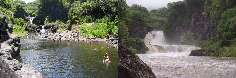
On March 10, she moved to Maui and ended up in Hāna. “This seems to be the best yet. The trip over by plane was fine – I will be off in the far away some where – but every one says is the good place. The flying was very good and I am fine – 9 in the morning on a new island seems good – Wish you could see it.” (Postcard, O’Keeffe to Stieglitz, March 10, 1939; Saville)
She was hosted by the Willis Jennings family (he was manager of the Hāna sugar plantation;) “You would laugh to see where I am now – almost at the end of the road on Maui – a little sugar plantation town – at the managers house – the only white family for 60 miles and it is different as the man in Honolulu told me it would be – The mans wife is not at home but his daughter is”. (Letter, O’Keeffe to Stieglitz, March 12, 1939; Saville)
Twelve-year-old Patricia Jennings became her companion and guide for the next ten days. “The road to Hāna was there, but not paved all the way. We always took a picnic lunch because you never knew how long it would take.” (Patricia Jennings; Tarleton)
O’Keeffe would drive the family car to favorite island sites with Patricia, then send the girl off to amuse herself while she painted. The one exception was when a sudden ‘Īao Valley shower made them retreat to the car. Patricia watched, without speaking, enthralled by the brush in her hand, the effortless glide of oil paints onto canvas. (Tarleton)
“It is hard to tell about the islands—the people have a kind of gentleness that isn’t usual on the mainland. I feel that my tempo must definitely change to put down anything of what is here—I don’t know whether I can or not—but it is certainly a different world—and I am glad I came.” (O’Keeffe to Stieglitz, March 12, 1939; Saville)
From Hāna she spent a few days in Wailuku, then, headed to Volcano on the Big Island. “We drove about hundred and 75 miles—part of it through as tropical woods as I have seen—about a third of it along the sea—then up to the top of the volcano where they left me at the (Volcano House) hotel – It was a good day” (O’Keeffe to Stieglitz, March 31, 1939; Saville)
“I didn’t care for that place. I don’t like steam coming out of the earth and holes in the road where the earth has opened up and not closed properly – and great bumps about a foot high where the pavement just rose up and didn’t go down.” (O’Keeffe to Stieglitz, March 31, 1939; Saville) She soon left the Volcano area and headed to the Kona Inn.
“I guess we did this area of the island pretty thoroughly – First we watched fishermen bringing in their net of fish in a little bay -what beautiful fish – every color and many queer shapes – very very beautiful color – the men swim and dive about – have quite a time gathering their net in.” (O’Keeffe to Stieglitz, April 3, 1939; Saville)
“All day I was driving over here (Hilo) from Kona Inn and it was a wonderful day – Warm and lovely and blue this morning – the loveliest part the Parker Ranch – quite like (New Mexico) but it is high and the lower part of the island – shore line and sea floating off in space like a map far below with no edge where it went off into the sky – sky became water and water became sky – and all so delicate and lovely – It was as beautiful as anything I’ve ever seen.” (O’Keeffe to Stieglitz, April 9, 1939; Saville)
She returned briefly to O‘ahu and sailed for California on the Matsonia on April 14. More than six months after her arrival in Hawaiʻi, O’Keeffe had produced 20-paintings, not one included a pineapple and she subsequently “submitted depictions of a papaya tree and the spiky blossom of a lobster’s claw heliconia” for the Dole ads.
Some creative ad copy featuring the heliconia noted, “Hospitable Hawaiʻi cannot send you its abundance of flowers or its sunshine. But it sends you something reminiscent of both – golden fragrant Dole Pineapple Juice”;– it ran nationally in Vogue and the Saturday Evening Post. (Yagi)
For the other ad, “(t)actful Art Director Charles Coiner,” as Time Magazine reported in 1940, “spouted to Painter O’Keeffe about the beauty of pineapples in bud, urg(ing) her to give the pineapple a break. He phoned Honolulu, had a budding plant put aboard the Clipper.”
“Thirty-six hours later the plant was delivered to the O’Keeffe studio in Manhattan. ‘It’s beautiful, I never knew that,’ exclaimed Artist O’Keeffe… She promptly painted it, and Dole got a pineapple picture after all.” (Yagi)
A year after her Hawaiʻi trip, in 1940, she bought a house at Ghost Ranch, in New Mexico. After Stieglitz died in 1946, she settled his estate and moved to New Mexico permanently. There in the wilderness and isolation she continued to paint, and she remained in New Mexico until her death at the age of 98. (Steele)
There is an interesting side note to this story; one day, I received an unrelated FB message asking about Willis Jennings (Patricia’s father.) Unrelated to that, earlier that same day, I received word that Patricia Jennings Morriss Caldwell had just passed away at the age of 87. Patricia Jennings is the mother of my HPA classmate, Lex Morriss.