

by Peter T Young Leave a Comment


by Peter T Young Leave a Comment
“Our native forests are being rapidly depleted through the operation of several factors. Opinions may differ as to the relative importance of these factors, but the undeniable fact remains that the forests are disappearing at an alarming rate and the denudation has already gone so far on many of our important watersheds as to jeopardize the water supply obtained therefrom.”
“Cattle and Hilo grass are the most potent factors in bringing about the final elimination of our native forest trees, shrubs, vines and ferns.”
“The first problem to be considered in any constructive forestry plan should be the protection and preservation of our native forests; in other words, we should take steps to keep what we still have.”
“To do this we must build fences to keep out animals and plant barrier forests of strong introduced trees to hold back and smother out the Hilo grass.”
“In selecting trees and shrubs for our forest planting, we should give preference to those that show ability to spread spontaneously through the free production of seed that will be carried by natural agencies such as wind and birds.” (Watt, McLennan, Knudsen & Lyon; Hawaiian Planters Record, Vol XX, 1919)
“There are water-conserving native forests still covering areas of considerable extent in these Islands …. These forests are doomed to destruction if prompt protective and constructive measures are not adopted for their preservation.”
“If we would save what is left of our native rain-forests we must eliminate the cattle now present in them, prevent their further invasion by stock with proper fences, and build barrier forests along their exposed edges.”
“These measures should be instituted at once, not in one small area only, but throughout the Islands wherever there is a native forest of any extent.”
“Some seem to think that reforestation in these Islands means the immediate replacement of the native trees with foreign stock. Such a course is altogether inadvisable.”
“We should first save what we still have in the way of forests and create our new forests on the large areas from which the native forests have nearly or quite disappeared.”
“At a recent meeting of the Committee on Forestry of the H. S. P. A., the following resolution was adopted: ‘RESOLVED, That it is the desire of this Committee that the preservation and extension of the native forest be the main consideration in all planting operations undertaken on our forest areas.’” (Hawaiian Planters Record, Vol XX, 1919)
“The primary object of all forest plantings on our watersheds must be to revive and create plant formations, including trees, shrubs, ferns and mosses, which will grow in a harmonious society and afford the greatest possible water-conserving capacity. No pure-culture forest can equal a mixed plant society in this respect.”
“Reforestation as commonly dealt with in text-books on forestry or as practiced by foresters in various parts of the world, aims at the creation of pure-culture forests.”
“Our reforestation problem is, therefore, unique; we have no precedent to go by. Ecological botanists have, however, supplied us with many careful analyses of such forest formations as we desire to create on our own watersheds.”
“Our problem is to build similar forest-formations, using such material as is already available in the Islands, and importing such additional material as is needed to round out our new plant societies.”
“The forest-formations which we must create are of two general types: barrier-forests and deep or interior rain-forests.”
“I employ the term barrier-forest to include the plant formations which must constitute the outer exposed edge of our forests and form the transition from denuded areas to rain-forest.”
“We should first concern ourselves with these barrier-forests, for such forest-formations must be built up along the exposed edges of all the existing remnants of our native rain-forests if these remnants are to be preserved, and they must also be constructed along the margins of any area on which we could create a new rain-forest.”
“It is then quite evident that the barrier-forest must be constructed first in any reforestation project we may undertake. It follows, therefore, that our first problem is to get together the proper components for a barrier-forest formation.”
“Experimental plantings looking toward the building of rainforest formations can be started as soon as plants are available for the purpose.”
“This work must progress more slowly than that in the barrier-forest formations and should be undertaken first on denuded areas where the native forest has nearly or quite disappeared.” (Lyon; Proceedings of the HSPA, 1919)


by Peter T Young Leave a Comment
The basis for the name was conceived during World War I when German soldiers gave the United States Marines opposing them in battle the name “Devil Dogs,” because of their battlefield accomplishments and valor of the Marines [and “never give up” spirit]. (Devil Pups)
The Marines who organized this youth citizenship program chose the term “Devil Pups” to describe the quality of teen who can complete this program. (Southern Utah Devil Pup)
“Devil Pups are [14] – to 17-year-old high school students from all over California [and, now, beyond] who assemble each summer here for 10-day physical fitness and citizenship training sessions. Sometimes the Pups are referred to as junior Marines.”
“They also are taken to Marine training sessions and to firing ranges, where they observe weapon firing, tanks, artillery and aerial firing. But otherwise they have little contact with firearms.” (LA Times, Advertiser, Aug 24, 1970)
‘‘The Idea caught on and in the summer of 1954 we were able to send 30 boys to Camp Pendleton for a one-week trial program of training in physical fitness and respect for authority and the flag.’” (San Bernardino County Sun, Aug 20, 1982)
“Duncan Shaw, a Los Angeles Marine Corps reserve officer [and] president of the Devil Pups since it was inaugurated, said, ‘The idea started here when we read of some high school boys who had torn the American flag, kicked it around and generally behaved like idiots.’”
“‘We thought maybe we could do something about it in a small way by starting a health education and citizenship program for teen-agers. … Since then the program has grown and has been most successful.’”
“‘We have liaison officers in each town of any size who work with the Boy Scouts, the Salvation Army and other groups and clubs to select boys for the program. A boy, however, does not have to belong to a club to get on the program so long as his parents’ permission is given.’”
“‘We are not trying to run a juvenile delinquency school. Any deserving boy is welcome. We simply put them through a regimented program of health education and citizenship, try to develop a competitive spirit and give them lectures on the American flag and what it means to be an American.’” (Evening Vanguard, Nov 18, 1964)
“One of the more enthusiastic supporters of the Devil Pups program is Richard Charest, 16, of Anaheim, Calif., who was impressed by the physical fitness aspects. ‘I think we ought to get more of these idiots off the streets – who are fouling up on drugs – and involve them in a program like this.”
“This would clean up the United States. There is a lot of garbage out there in the streets and we ought to clear them out by involving them and teaching them about citizenship and the flag,’ he said.” (LA Times, Advertiser, Aug 24, 1970)
“‘We had considerable trouble with the Devil Pups that first year. Nearly all of them were juvenile delinquents and weren’t about
to be changed in one week. They almost tore their building apart.’”
“‘Today’s Devil Pups are the pick of the crop, from all parts of the community, to be sure, but to be accepted, they must show their interest in the program. Then they are interviewed and and tested physically before they are sent here to camp,’ [Maj. Tom Vener, USMCR] said.” (San Bernardino County Sun, Aug 20, 1982)
The program is not a ‘mini boot camp’ or recruiting organization for the Marine Corps. The 10-day program is a combination of outdoor physical exercises, inspirational classroom lectures and demonstrations of Marine Corps operations.
The activities during both increments are overseen by our Encampment Commander and his executive staff (employees of Devil Pups, Inc.). Each day, the running, diving, and hiking exercises are balanced with inspiring classroom sessions. The “Role Model” classroom segments are conducted by an assortment of board members, veterans, and Devil Pups alumni. (Devil Pups)
“Since 1954 we have not asked our participants to pay tuition to attend our program. We spend the entire year raising the funds we need which go towards the cost of the camp including counselor fees, food, transportation, clothing, insurance, fundraising, office supplies, and more.”
“Devil Pups, Inc. raises 100% of the funds for 100 youth to attend our camp every year, which is budgeted at a rough cost of $975 per Pup. We want every Pup not to be hindered from acceptance due to financial reasons, and have been doing so since we started 70 years ago. We want them all to have an equal opportunity to participate.” (Devil Pups)
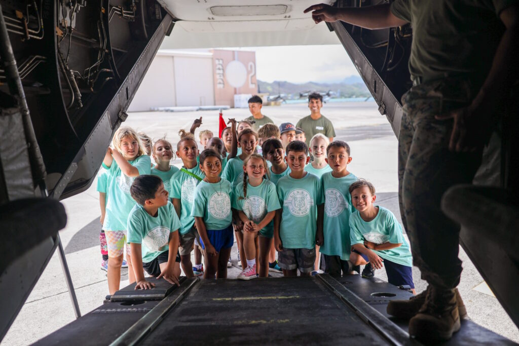
For at least the last couple of years including on August 16, 2024, “The [MCBH Lifestyle Insights, Networking, Knowledge, and Skills (LINKS) program of the] Marine Corps Family Team Building hosted the [Little] Devil Pups workshop, which included a miniature physical fitness test, water gun shooting range, vehicle and aircraft tours, and a readiness class.”
This was for children with parents living or working at MCBH; the MCBH included a Homecoming Run, a resource fair and homecoming sign making.
“The Devil Pups Youth Program For America is all about helping young boys and girls build confidence and learn about responsibility while taking on new challenges.” (U.S. Marine Corps by Lance Cpl. Samuel Estridge)


by Peter T Young Leave a Comment
The early Polynesian settlers to Hawaiʻi brought sugar cane with them and demonstrated that it could be grown successfully in the islands.
Fast forward … Hawai‘i’s economy turned toward sugar in the decades between 1860 and 1880; these twenty years were pivotal in building the plantation system.
Sugar‐cane farming gained this prestige without great difficulty because sugar cane soon proved to be the only available crop that could be grown profitably under the severe conditions imposed upon plants grown on the lands which were available for cultivation. (HSPA 1947)
In 1876, the legislature of Kamehameha III passed a law declaring all “forest lands” to be government property in an effort to conserve the forests from further encroachment on the seaward side by the plantations’ need for fuel and on the mountain side from grazing animals.
Founded in 1895, the Hawaiian Sugar Planters’ Association (HSPA), dedicated to improving the sugar industry in Hawai‘i, has become an internationally recognized research center. (It was in 1996 when HSPA expanded its research interest besides sugarcane and acquired its current name Hawai‘i Agriculture Research Center (HARC), expanding its research on tropical crops and forests.)
Interestingly, it was the sugar growers, significant users of Hawai‘i’s water resources, who led the forest reserve protection movement. On May 13, 1903, the Territory of Hawaiʻi, with the backing of the Hawaiʻi Sugar Planters’ Association, established the Board of Commissioners of Agriculture and Forestry. (HDOA)
The Forest Reserves were established as a cooperative arrangement between the Hawaiʻi Sugar Planters Association and the territorial government.
Plantations needed wood for fuel, but they also needed to keep the forests intact to draw mist precipitation from the trade winds, which in turn fed the irrigation systems in the cane fields below.
Their own consumption of fuel had clearly been contributing to the decline of the forest at lower elevations, where flume systems transported large quantities of wood, as well as cane. (Mills)
The link between tree-planting and the sugar planters can be seen particularly clearly in the career of Harold Lyon, who arrived in Hawai‘i in 1907 as a plant pathologist in the employ of the Hawaiian Sugar Planters’ Association (HSPA).
Lyon was a strong voice for forests; neglect of the islands’ forests would be “suicidal,” for ‘‘everything fails with the failure of our water supply’’.
Johnny Ah San, who worked as a territorial forester, noted, “And then HSPA had a man down at Nāuhi Nursery, and they planted trees. Then before the war [WWII], Roosevelt had the WPA [Works Progress Administration], so the men planted trees in the forest.” (Johnny Ah San; Maly)
The Nāuhi (‘the yams’) facility was interchangeably referred to as a Nursery and Experimental Station (and, apparently, also called Nāuhi Camp). The Hilo Forest Reserve was the site of cooperative reforestation efforts by the HSPA and Territorial foresters and later by the Civilian Conservation Corps under the direction of the Bureau of Forestry.
Over 100 varieties of temperate trees and plants were tested at the Experiment Station at Nāuhi; many of which succeeded to the point of naturally reproducing.
Nāuhi Cabin (a small building with three out-structures) was part of the Nāuhi Gulch Experiment Station, which was established in 1924. It is located in the ahupua‘a of Honohina at about 5,100 feet above sea level. A nursery that was part of the Experiment Station is no longer standing. (Tuggle)
The purpose of Nāuhi Gulch Experiment Station, which operated until the beginning of World War II, was to “introduce, propagate and plant out in the adjacent forest lands various species and varieties of temperate zone, both northern and southern, trees and other plants”.
To this end, over 78 varieties of fruit trees and over 30 varieties of other temperate zone trees and plants were tested. Surrounding the cabin now is a wild landscape of feral garden flowers like roses, daisies, and nasturtiums, as well as apple, pear, and plum trees.
In 1941, wild pigs in the Nāuhi gulch-Pihā area were noted by Lyon: “Of special interest to us at this time are your remarks regarding the prevalence of wild hogs in the Nāuhi Gulch-Pihā region. They undoubtedly do a great deal of damage there.”
“If, for any reason, this Territory is compelled to produce its own food supply, we could organize a campaign which would remove most of these hogs from the forest and, at the same time, yield a goodly amount of excellent food for our people.” (Tuggle)
The cabin was part of a complex that included several buildings and an orchard on 47 acres of land leased from Lili‘uokalani Trust. In 1945, Territorial forester Bryan reported on the conditions at the by-then abandoned station (Bryan 1945):
“There has been no work done at this station for a considerable period of time, and it is in a run-down state at the present time. Fences are in need of repairs, wild pigs are numerous and have done some damages in the orchard, and it will require considerable labor and effort to bring it back to its former appearance.”
Nāuhi Cabin has been used by the National Biological Survey. Formed in 1993, their mission was to gather, analyze, and disseminate the biological information necessary for the sound stewardship of natural resources and to foster understanding of biological systems and the benefits they provide to society. It is now known as USGS’s Biological Resource Division (BRD).


by Peter T Young Leave a Comment
There are two rivers in the Hawaiian Islands bearing the name of Wailuku. One is on the Island of Maui, flowing out of a deep gorge in the side of the extinct volcano ‘Īao. The other Wailuku River is on the Island of Hawaii.
The Wailuku is the longest river in Hilo (twenty-six miles.) Its course runs from the mountains to the ocean. The Wailuku is the boundary between Hilo Palikū in the north and Hilo One on the south.
Hawaiians were impressed by this Wailuku and wove a dramatic tale around several interesting geologic features within the river.
Hina, the moon goddess and mother of Maui, lived in the cave beneath Rainbow Falls, concealed by the mist of the falls. Each day she beat and dried her kapa in the sun.
Far above the cave, in the bed of the river, dwelt Kuna. [Kuna is a variety of freshwater eel [or Mo‘o (dragon)] said to have been introduced from abroad. (Parker)] That portion of the river runs bears to this day the name ‘Waikuna’ or ‘Kuna’s river.’
Kuna often tormented Hina by sending over great torrents of water or by rolling logs and boulders down the stream. This would block the stream below the falls to dam the river and drown Hina.
Hina was frequently left with but little protection, and yet from her home in the cave feared nothing that Kuna could do. Precipices guarded the cave on either side, and any approach of an enemy through the falling water could be easily thwarted.
During a particularly intense storm, Mo‘o Kuna moved a huge boulder over the falls and into the river, where it fit perfectly and prevented water from flowing farther. Water level beneath the falls began to rise.
Hina, realizing her danger, signaled her son. With two powerful strokes, he paddled his canoe from Maui to the mouth of the Wailuku. He rushed upstream and split the damming boulder with a single blow, thereby saving his mother.
By this time, Kuna had fled upstream. Maui found Kuna hiding in a hole beneath the river. He tried to spear Kuna, but Kuna escaped. Finally, Kuna found deep hiding holes and thought to be safe.
Maui again found Kuna and called upon Pele to send lava into the river to drive out Kuna. The red-hot burning stones in the water made the pools boiling and the steam was rising in clouds – Kuna uttered incantation after incantation, but the water scalded and burned Kuna.
Kuna leaped from the pools and fled down the river. The waters of the pools are no longer scalding, but they have never lost the tumbling, tossing, foaming, boiling swirl which Maui gave to them when he threw into them the red-hot stones with which he hoped to destroy Kuna, and they are known today as the ‘Boiling Pots.’ (Westervelt, USGS)
Despite the name, the water is not normally hot. The only time in the modern history of the river that the water was heated was in 1855 and 1856 when a lava flow from Mauna Loa advanced across the Saddle between that volcano and Mauna Kea. Lava flowed into the Wailuku River channel, but did not cross it, about 4 miles above the Boiling Pots. (BIVN)
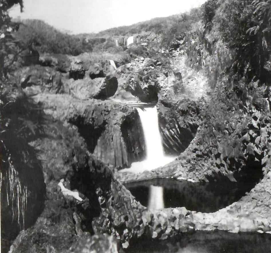
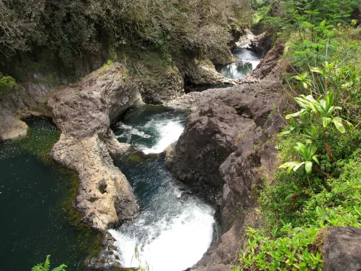
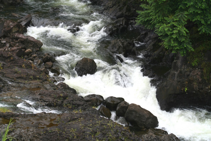
The Boiling Pots is about 1.5 miles upstream from Rainbow Falls and is a succession of eroded, hollowed out terraced pools that fill with the flow of the river. When the river is engorged with storm runoff, the ‘pots’ fill to the brim, become turbulent and appear to ‘boil.’ (HawaiianAir)
The Wailuku River is an important landmark to geologists, because it marks the approximate boundary between the lava flows of Mauna Kea and Mauna Loa. It is the state’s longest river and the southernmost that carries water all year.
According to the USGS, the river was formed by at least two lava flows coming from Mauna Kea, the oldest, the ‘Anuenue flow (as old as 10,500 years), is the same flow that formed the thick lip of Rainbow Falls and most of the rounded, gray boulders at Boiling Pots.
Tracing the flows up and down the Wailuku tells a geologic story of a river that had already deeply cut into Mauna Kea and Mauna Loa flows when it was filled by the ‘Anuenue flow over 10,000 years ago. Many of these boulders are frozen into a younger pahoehoe flow, named after the Punahoa ahupua‘a and about 3,100 years old.
The filling caused the river to shift in many places and resume its erosional downcutting before lava again ventured into the river 3,100 years ago. (The Hawaiian and the geologic versions of the Wailuku River story have many similarities, including the pools – ‘pots.’ (USGS)
The pots, each about 50-feet in diameter, are eroded into the 10,500 year old Mauna Loa lava flow. When the water is low, the river does not flow over some of the pot rims but it continues to flow through them. (USGS)
An average of 275-million gallons of water flows through the Wailuku to Hilo daily – during intense storms, the discharge can be more than 20 times greater. On average, the Wailuku transports approximately 10 tons of suspended sediment into Hilo Bay each day.
About a half mile up the river from the boiling pots is Peʻepeʻe Falls. Waiānuenue Avenue (rainbow (seen in) water) is named for the most famous waterfall, Ka Wailele ʻO Waiānuenue, Rainbow Falls on the Wailuku River.
DLNR operated the Wailuku River State Park, here. There are two separate park areas, Boiling Pots and Rainbow Falls. Flash flooding is common, and because there are no lifeguards, many have perished in the river by getting sucked into the water and becoming trapped within concealed lava tubes and caves.
The best way to experience this beautiful and deadly natural phenomena is from a cement overlook, just a short walk from the paved parking lot.


