Images of Old Hawaiʻi

  • Home
  • About
  • Categories
    • Ali’i / Chiefs / Governance
    • American Protestant Mission
    • Buildings
    • Collections
    • Economy
    • Missionaries / Churches / Religious Buildings
    • General
    • Hawaiian Traditions
    • Other Summaries
    • Mayflower Summaries
    • Mayflower Full Summaries
    • Military
    • Place Names
    • Prominent People
    • Schools
    • Sailing, Shipping & Shipwrecks
    • Voyage of the Thaddeus
  • Collections
  • Contact
  • Follow

October 29, 2021 by Peter T Young 3 Comments

Heʻeia Sugar

Heʻeia is one of nine ahupuaʻa of Kāneʻohe Bay (this makes up most of the Koʻolaupoko moku (district.))  In early times, the land was intensely cultivated and fish ponds lined the Bay (30 walled fishponds were noted in the Bay in 1882 – including the two largest (Heʻeia and Moliʻi) fishponds remaining in Hawaiʻi.)

 “Southeastward along the windward coast, beginning with Waikāne and continuing through Waiāhole, Kaʻalaea, Kahaluʻu, Heʻeia and Kāne’ohe, were broad valley bottoms and flatlands between the mountains and the sea which, taken all together, represent the most extensive wet-taro area on Oʻahu.” (Handy, Devaney)

As early as 1789, Portlock described this area: “Indeed, I had some reason to think, that the inhabitants on that part of the island were more numerous than in King George’s Bay (Maunalua Bay)”.

“… the bay all around has a very beautiful appearance, the low land and valleys being in high state of cultivation, and crowded with plantations of taro, sweet potatoes, sugar-cane, etc. interspersed with a great number of coconut trees”.

The open waters of the bay were also probably heavily fished within the limitations of the kapu system, and fishing rights were allocated as part of the respective ahupua’a.  (Coles)

Chief Abner Paki (father of Bernice Pauahi Bishop and hānai father of Queen Liliʻuokalani) was granted the land of Heʻeia in 1848, apparently in recognition of allegiance to the Kamehameha Dynasty and also for a longer ancestral family interest in this land. Kelly reports that some of Paki’s ancestors can be traced to a Maui line of chiefs that had conquered Kahahana, the ruling chief of O‘ahu about 1785.

Apparently, one of Paki’s uncles was charged with managing Heʻeia under the Maui rulership. Kelly suggests: “At least part of Paki’s connection with the land of Heʻeia may stem from his uncle’s earlier residence in that land, and may have been the reason why Paki was made konohiki of Heʻeia.” (Carson)

Sugarcane was introduced to Koʻolaupoko in 1865, when the Kingdom’s minister of finance and foreign affairs, Charles Coffin Harris, partnered with Queen Kalama to begin an operation known as the Kāneʻohe Sugar Company.  (History of Koʻolaupoko)

By 1865, four plantations were in production, at Kualoa, Kaʻalaea, Waiheʻe and Kāneʻohe, and in the early 1880s, four more at Heʻeia, Kāneʻohe, Kahaluʻu and Ahuimanu, with a total of over 1,000-acres in cultivation in 1880.  (Coles)

McKeague’s Sugar Plantation was in Heʻeia; starting in 1869, John McKeague (from Coleraine near Belfast, Ireland – February 12, 1832 – January 25, 1899) leased the Heʻeia ahupuaʻa from Charles and Bernice Pauahi Bishop – he had a partner, his uncle, Dr Alexander Kennedy.

About a decade later, McKeague added a mill and other improvements.  (The Plantation was also known as Heʻeia Sugar Company, as well as Heʻeia Agricultural Company.)

“Mr John McKeague, the proprietor of the Heʻeia Sugar Plantation at Koʻolaupoko, Oʻahu, has completed the erection of an entire new mill and buildings, and on Wednesday last, he very hospitably entertained a large party of his friends and acquaintances, on the occasion of firing up and setting to motion the machinery of his new plant.”

“Mr Young, the manager of the Honolulu Iron Works (by whom the machinery was built,) and several other practical engineers were present, and everybody, including Mr McKeague himself, pronounced the running of the works as perfectly satisfactory.”

“The mill can turn out ten tons of sugar per diem.  The machinery has all the modern improvements…. The works are located on rising ground, whereby each story has a ground floor.”

“The proprietor has built a dock on the water front below the mill, alongside which a vessel can load and unload freight – a vast improvement on the old boat and scow system.  Altogether, it may be said that the mill and works of Heʻeia are among the finest and best appointed of any on the Islands.”  (Pacific Commercial Advertiser, December 14, 1878)

Unfortunately, on February 12, 1879, McKeague received a severe injury by a fall from his horse in an accident crossing the Pali, “by reason of which his mind became impaired to such an extent as to render his intellect incoherent and his judgment defective so as to unfit him for the transaction of business.”  (Supreme Court Records)  A guardian (TA Lloyd) was appointed to represent his interests.

For the 1880 season, the plantation was renting 2,500-acres, 650 of which were for sugarcane, with 250 actually under cultivation, and having a mill capacity of 10 tons/day, expecting 600 tons that season. (Devaney)

June 30, 1882, John McKeague sold to the Heʻeia Sugar Plantation Company, a corporation “organized and existing under the laws of the State of California, USA, and carrying on business at Heʻeia, Koʻolaupoko, Island of Oʻahu, as cultivator and manufacturer of sugar and other products of sugarcane”.  (Supreme Court Records)

Heʻeia had a good landing place, in which the sugar was shipped in barges, to be put on board schooners which lie out about the sixth part of a mile from the shore.  In the late-1800s, all supplies were brought to the windward side from Honolulu by the schooner JA Cummins, which made twice a week trips, picking up sugar grown in Heʻeia and Waimanalo, and rice from the area.  (Devaney)

In 1880, the region reported 7,000-acres available for cultivation; in 1883 a railroad was installed at Heʻeia, and by the summer of that year it was noted that the railroad had allowed a much greater amount of land to be harvested, even allowing cane from Kāneʻohe to be ground at Heʻeia; however, the commercial cultivation of sugar cane was short-lived.  (Devaney)

After almost four decades of a thriving sugar industry in Koʻolaupoko, the tide eventually turned bad and saw the closures of all five sugar plantations by 1903. The closures were due to poor soil, uneven lands and the start-up of sugar plantations in ʻEwa, which were seeing much higher yields.

As sugar was on its way out in Koʻolaupoko, rice crops began to emerge as the next thriving industry.  (History of Koʻolaupoko)  In 1880 the first Chinese rice company started in the nearby Waineʻe area. Abandoned systems of loʻi kalo were modified into rice paddies. The Kāneʻohe Rice Mill was built around 1892-1893 in nearby Waikalua.

Another commercial crop, pineapple, was also grown here, starting around 1910.  By 1911, Libby, McNeill & Libby gained control of land there and built the first large-scale cannery at nearby Kahaluʻu with an annual capacity of 250,000-cans; growing and canning pineapples became a major industry in the area for a period of 15 years (to 1925.)

© 2021 Hoʻokuleana LLC


Filed Under: Economy, Place Names Tagged With: Kaneohe Bay, Libby, McKeague Sugar, Heeia, Heeia Sugar, Koolaupoko, Hawaii, Oahu

March 26, 2020 by Peter T Young Leave a Comment

Ahupuaʻa ‘Anomalies’

Typically, we think of ahupuaʻa in the general context of the modern day watershed – from the mountains to the sea (ridges to reefs,) affording occupants access to the various climatic and resource zones.

Ahupuaʻa served as a means of managing people and taking care of the people who support them, as well as an easy form of collection of tributes by the chiefs. Ultimately, this helped in preserving resources.

Shaped by island geography, ahupuaʻa varied in shape and size (from as little as 100-acres to more than 100,000-acres.)

Each ahupuaʻa had its own name and boundary lines. Often the markers were natural features such as a large rock or a line of trees or even the home of a certain bird. A valley ahupuaʻa usually used its ridges and peaks as boundaries.

In ancient Hawaiian times, relatives and friends exchanged products. The upland dwellers brought poi, taro and other foods to the shore to give to kinsmen there. The shore dweller gave fish and other seafood. Visits were never made empty-handed but always with something from one’s home to give.

Ahupuaʻa contained nearly all the resources Hawaiians required for survival. Fresh water resources were managed carefully for drinking, bathing and irrigation.

A typical ahupuaʻa was a long strip of land, narrow at its mountain summit, becoming wider as it ran down a valley into the sea to the outer edge of the reef. If there was no reef, then the sea boundary would be one-mile from the shore.

However, there are several ‘anomalies’ to this conventional ahupuaʻa layout.

Some include multiple parts, even skipping over water. Others do not have contact with the ocean, nor reach a mountain peak. Another includes portions of a couple of mountains. Here are some examples (there are others, as well.)

On the island of Hawaiʻi, the ahupuaʻa of Kīʻao in the moku (district) of Kāʻu is land-locked and doesn’t reach the ocean. (Paman) In addition, it doesn’t reach a mountain summit.

Also on the Island of Hawaiʻi, the ahupuaʻa of Humuʻula starts at the summit of Mauna Loa, crosses the saddle between the two mountains and skirts along the side of Mauna Kea and eventually runs down to the ocean along the Hāmākua coast.

This traversing along a relatively similar contour on the side of Mauna Kea is unique; in addition, in doing so, it essentially cuts off the numerous ahupuaʻa along the South Hilo, North Hilo and Hāmākua coasts to the Mauna Kea summit.

Interestingly, the entire island of Kahoʻolawe is part of the Honuaʻula moku (district) across the ocean on Maui. Kahoʻolawe is not its own ahupuaʻa; rather, it is divided into ʻili (smaller land units within ahupua‘a.)

Historically, a “cloud bridge” connected Kahoʻolawe with the slopes of Haleakalā. The Naulu winds brought the Naulu rains that are associated with Kahoʻolawe (a heavy mist and shower of fine rain that would cover the island.)

Heʻeia on the windward side of Oʻahu runs from the mountains to the sea, but also crosses over a portion of the water in Kāneʻohe Bay and includes a portion of a Mōkapu peninsula across the Bay.

The Waiʻanae ahupuaʻa also has an un-typical shape – it is sometimes referred to in two parts: Waiʻanae Kai, on its western side, runs from the ocean to the Waiʻanae Mountains (like a typical ahupuaʻa – this portion of Waiʻanae runs from the mountain to the sea.)

From there, however, the section referred to as Waiʻanae Uka continues across Oʻahu’s central plain and extends up into the Koʻolau Mountains – extending approximately 15-miles from the Waianae Mountains to the Koʻolau Mountains and ends up overlooking the windward coastline. (Each section is within the same ahupuaʻa.)

Waimānalo is another Oʻahu ahupuaʻa that is ‘anomalous’ to the ‘ridges to reefs’ characterization of the ‘typical’ ahupuaʻa.

Waimānalo extends from the ridge behind Keolu Hills, around Makapuʻu and ending at Kuliʻouʻou Ridge (Koʻolaupoko Hawaiian Civic Club;) it essentially wraps over the Koʻolau range from the windward coast to the leeward coast Oʻahu.

Waimānalo incorporates what was once the large fishpond of Maunalua, now known as Hawaiʻi Kai. Kamakau notes, “The ahupuaʻa of Waimānalo, including the fishpond at Maunalua and the travelling uhu of Makapuʻu, belonged to Mauimua (First-Maui.)” (Koʻolaupoko Hawaiian Civic Club)

The image shows a map of the Islands with some of the anomalies to the typical’ ahupuaʻa.

Follow Peter T Young on Facebook 

Follow Peter T Young on Google+ 

Follow Peter T Young on LinkedIn  

Follow Peter T Young on Blogger

© 2020 Hoʻokuleana LLC

Statewide-Some_Ahupuaa_Anomalies-GoogleEarth
Hawaii-Humuula-Kiao-Ahupuaa-GoogleEarth
Hawaii-Humuula-Ahupuaa-GoogleEarth
Hawaii-Kiao-Ahupuaa-GoogleEarth
Maui-Honuaula-Moku-GoogleEarth
Oahu-Waianae-Heeia-Waimanalo-Ahupuaa-GoogleEarth
Oahu-Waianae-Ahupuaa-GoogleEarth
Oahu-Heeia-Ahupuaa-GoogleEarth
Oahu-Waimanalo-Ahupuaa-GoogleEarth
Typical_Ahupuaa_Layout_and_Land_Uses-(UH-DURP)

Filed Under: Hawaiian Traditions, Place Names Tagged With: Koolau, Koolaupoko, Kahoolawe, Ahupuaa, Waianae, Honuaula, Humuula, Hawaii, Waimanalo

January 25, 2019 by Peter T Young Leave a Comment

Sky Ranch

It’s not clear when it opened, but in the 1940s and ‘50s, there is clear evidence of the “Kailua Airport” on the Windward side of O‘ahu, reportedly, privately-owned and operated by Bob Whittinghill.

When work was started in 1948 on the new airport in Kailua-Kona, to avoid confusion with the Kailua Airport on Oʻahu, the Big Island’s airport was named “Kona Airport.”

In 1954 it was “enlarged and improved to handle an expected resurgence of prospective fliers. (T)he airport is prepared to offer flying lessons under a complete ‘pay-as-you-fly’ program.” (Advertiser, May 23, 1954)

It was generally referred to as ‘Sky Ranch’ and “was a grass field in Kailua, windward side of Oahu. It was located parallel to the southern fence of Kaneohe Marine Base, near the Mōkapu gate to the base, and west of Mōkapu Boulevard.”

“The runway was where the east/west portion of ‘Aikahi Loop is now. It would have appeared in any sectional published pre-1960. It had a 200′ asphalt strip & about 1,800′ of grass, and power lines at the East end, along Mōkapu Blvd.”

“There was a large Quonset hut as a hangar, shop combination, and a small raised house that served as the office & bathroom. There was a gasoline-powered pump & 3,500 gallon tank of 80/87 avgas.”

“The field was operated by Robert Whittinghill, who was an instructor at the state aircraft mechanic school at Honolulu Airport.” (Hurd; Freeman)

“One man who’s licked the commuting problem over the Pali is Bob King of Kailua who lives a block away from the Kailua Sky Ranch landing strip and works at Honolulu airport. He usually flies to work.”

“It takes him an average of seven minutes over the Pali, about 16 minutes by way of Koko head. He claims flying is six time safer that driving a car, 12 times safer than driving across the Pali.” (Krauss, March 2, 1959)

Besides recreational and commuter flying, there were other aviation activities there. “(N)ews has arrived from Hawaii of the formation of the Hawaii Soaring Club with Woody Brown as President.”

“Plans call for the operation of Pratt-Reads from Kailua Sky Ranch on Oahu with Kipapa Field as a secondary base of operations. We are glad to hear these beautiful islands which have in the past been the site of some interesting soaring flights will once again be the scene of soaring activity.” (Soaring, Jan-Feb, 1959)

Likewise, “Parachuting is rapidly becoming a very popular sport. Quite ordinary young men – and women – are jumping from aircraft every weekend all over the United States, including Hawaii.”

The Aloha Sky Divers “meets every Sunday at the Kailua Sky Ranch, a short walk from the Pali Palms. Its members, floating down under colored canopies, have become a familiar sight in these parts.” Star Bulletin, July 14, 1961)

In addition, “Oahu’s only Air Scout squadron has been launched at Kailua Sky ranch, where a model plane meet is scheduled. … a clubhouse with work shop has been made available for both the Boy Scouts and the model plane enthusiast of Windward Oahu.”

“Bob Whittinghill is adviser for the aero squadron, composed of Boy Scouts 14 and over … the model plane meet set for today is the third held by Kailua Sky ranch. The two earlier meets drew about 1,000 persons at each event”. (Advertiser, May 24, 1954)

“Robert Whittinghill (leased) Kailua Sky Ranch from Kaneohe Ranch Company on a short-notice basis.” (Star-Bulletin, October 29, 1956) While pressure was building to keep the air field for recreational flights, ultimately, pressure for residential home development overcame that.

“About 15 planes will leave this weekend on a final, nostalgic flight from the Kailua Sky Ranch, Oahu’s only remaining private airport for light planes.”

“The planes will head for temporary quarters at busy Honolulu Airport as bulldozers move in to plow the Sky Ranch airstrip for a housing subdivision.” (Star-Bulletin, July 20, 1961)

“‘Aikahi Park, a prestige home development designed for families growing in stature and size, is being opened this Labor Day weekend by Centex-Trousdale.” (Prices ranged from $25,050 to $27,350, “on low rent Kaneohe Ranch Co 55-year leasehold land.”)

“Homes in the park have been designed by Vladimir Ossipoff, FAIA, who has won many architectural awards for local residences. They are in Hawaiian styles with three and four bedrooms, the latter containing fireplaces.” (Star-Bulletin, September 2, 1962)

Whittinghill also ran (since 1947) the Aero-Tech Division of Honolulu Technical School, a State education arm for training aviation mechanics, situated in a hanger at Honolulu International Airport. (Advertiser, September 18, 1963)

Follow Peter T Young on Facebook 

Follow Peter T Young on Google+ 

Follow Peter T Young on LinkedIn  

Follow Peter T Young on Blogger

© 2019 Hoʻokuleana LLC

Kailua-Mokapu-Aerial-(2444)-1952-(portion-Kailua-Airfield)
Kailua-Mokapu-Aerial-(4290)-1963-(mass_grading_Aikahi_Park_takes_out_the_Kailua-Airfield)
Kailua-Mokapu-Aerial-(2508)-1959-(portion_noting_Kailua-Airfield)
Kailua-Mokapu-Aerial-(2444)-1952-(portion_noting_Kailua-Airfield)
Kailua Sky Ranch-Aikahi
Sky Ranch-USGS_Mokapu-1952-portion
Sky Ranch-USGS_Mokapu_1952-portion
Sky Ranch0O_Mokapu_1969-Portion
Airfields_HI_Oahu_N_htm_480a3116

Filed Under: General, Place Names, Economy Tagged With: Hawaii, Kailua, Koolaupoko, Mokapu, Kailua Airfield, Sky Ranch

October 28, 2018 by Peter T Young 2 Comments

Koʻolau Volcano

O‘ahu used to be nearly twice as big as it is now. (Thompson) The Island consists of two major shield volcanoes: Waiʻanae and Koʻolau; the eroded remnants of which are the Waiʻanae Range and the Koʻolau Range.

Waiʻanae is the older of the two (breaking the ocean surface ~3.9 to ~2.8 million-years ago) and makes up the western part of O‘ahu. Koʻolau volcano started as a seamount above the Hawaiian hotspot around 4-million years ago. It broke sea level some time prior to 2.9-million years ago.

Koʻolaupoko, one of O‘ahu’s six ancient moku (districts,) is bounded by Kalaeoka‘ō‘io, which is a point near the center of the northeast coast at Kualoa; the crest of the Koʻolau Range to the west; and Makapuʻu Point on the southeastern tip of the island.

This expanse also generally delineates the extent of Koʻolau Volcano – effectively from and including Kāne‘ohe to Kailua to Waimānalo. A significant landslide and ongoing erosion reshaped the volcano.

About 2-million years ago, much of the northeast flank of Koʻolau volcano was sheared off and material was swept onto the ocean floor (named the Nuʻuanu Avalanche) – one of the largest landslides on Earth.

The Pali is the remaining edge of the giant basin, or caldera, formed by the volcano. At its base are the towns of Kāne’ohe, Kailua and Waimānalo – beyond that, open ocean. The other half of the caldera, an area the size of Brooklyn, tore away and tumbled into the ocean. (Sullivan)

Material swept more than 140-miles north of O‘ahu and Molokai. For the last 85-miles of its journey, the avalanche traveled uphill by about 1000 feet, leaving jumbled blocks – once part of O‘ahu – scattered over more than 9,000-square miles of seafloor. (Sinton)

Residual ridges, remnants of the old Koʻolau volcano, extend northeast from the Pali. These include the Mokulua islands, Olomana, Kapaʻa (where the quarry is,) Mahinui (Oneawa, Kalaheo) and Keolu Hills.

Mōkapu Peninsula (where Marine Corps Base Hawai‘i is situated) is evidence of subsequent secondary volcanic eruptions that formed Ulupaʻu Crater (the large hill on the Kailua side of the peninsula,) Pu‘u Hawaiiloa (the central hill that originally had the base control tower, now has radar (‘the hill’,)) Pyramid Rock and the nearby Moku Manu (Bird Island.)

Following a period of dormancy, Koʻolau erupted about 1-million years ago (known as the Honolulu Volcanic Series) and created landmarks such as Lēʻahi (Diamond Head,) Hanauma Bay, Pūowaina (Punchbowl Crater) and Āliapaʻakai (Salt Lake.) Another tuff cone is Mānana Island (Rabbit Island.)

Pounded by the tradewind and rains, the windward side of O‘ahu is more weathered than the leeward areas of the island, and now this vast caldera wall is reduced to a line of sheer cliffs stretching from Makapuʻu to Kualoa and beyond.

The flat valley floors are extensively eroded, and are now mostly joined, studded here and there with isolated remnant peaks and ridges connected to the central range. (Klieger)

Coral reefs and marine terraces were formed at different elevations due to the changing sea levels over time. There are some broad lowland areas in the lower reaches of deeply alluvial valleys. (Moberly)

It was the broadness of this coastal plain (which included swampy areas near the shore) that distinguished Koʻolaupoko from other areas of O‘ahu, and most likely helped account for the intensity and productiveness of agriculture.

The abundant rainfall produces constantly flowing streams that supported the vast expanse of wetland kalo (taro) lo‘i (pondfields) that once extended throughout Koʻolaupoko. (Klieger)

Because Kāne’ohe Bay has a deep lagoon between an outer reef and the shore, the reef is considered by some geologists to be a barrier reef, the only example in Hawaii. Several fishponds lined the bay.

Mokoliʻi (Chinaman’s Hat) and Mokuoloe (Coconut Island) are erosional remnants of the bedrock Koʻolau basalt; Kapapa and Kekepa (Turtleback) Islands are of limestone; and Ahu O Laka Island is a sand bar that is uncovered at low tide. (Moberly)

Follow Peter T Young on Facebook 

Follow Peter T Young on Google+ 

Follow Peter T Young on LinkedIn  

Follow Peter T Young on Blogger

© 2018 Hoʻokuleana LLC

Koolau_Range-Kaneohe
Koolau Range-Kaneohe Bay-Mokapu
Koolau_Range
Koolau_Range
Koolau_Range-Waimanalo
Koolau_Mountains_from_Wahiawa_by_Helen_Thomas_Dranga
Tradewinds and the Koolau-Jokiel
Mokolii lava flows-Jokiel
Koolau_Caldera-Aerial_Image_(UH_Manoa-Rowland_&_Garcia)
Koolau Caldera-OregonState
Kawainui-200-years_ago_(State_Parks)
Kawainui-6,000-years_ago_(State_Parks)
Nuuanu Avalanche-Jokiel
Koolau_Caldera-Map_(UH_Manoa-Rowland_&_Garcia)
Nuuanu Avalanche-tamu
Young and Present-Koolau Caldera-SOEST
Oahu-Waianae-Koolau-Caldera-SOEST

Filed Under: General, Place Names Tagged With: Nuuanu Avalanche, Hawaii, Oahu, Koolau, Koolaupoko, Waianae

October 18, 2018 by Peter T Young Leave a Comment

Hygienic Dairy

“Sugarcane was introduced to Ko‘olaupoko in 1865, when the Kingdom’s minister of finance and foreign affairs, Charles Coffin Harris, partnered with Queen Kalama to begin a partnership known as the Kāne‘ohe Sugar Company.”

“After Queen Kalama passed away in 1870, Mr. Harris purchased the land from her estate to continue the sugar production, which, by 1880, was yielding as much as 500 tons of sugar annually. At about this time, the He‘eia Agricultural Company (HAC) was also cultivating about 250 acres of sugarcane”.

“To transport the sugar, HAC built a pier in Kāne’ohe Bay (He‘eia Kea pier) so that rail cars could take the sugar out to ocean vessels for transportation to Honolulu harbor.”

“The ocean steamer ‘J.A. Cummins’, owned by John Adams Cummins of the Waimanalo Sugar Plantation Company, made trips twice a week between He‘eia and Honolulu, exporting sugar and returning with supplies and goods.”

“After almost four decades of a thriving sugar industry in Ko‘olaupoko, the tide eventually turned bad and saw the closures of all five sugar plantations by 1903. The closures were due to poor soil, uneven lands, and the start-up of sugar plantations in `Ewa, which were seeing much higher yields.”

“As sugar was on its way out in Ko‘olaupoko, rice crops began to emerge as the next thriving industry. The demand for rice in Hawai‘i increased as the number of Asian sugar workers migrating to the islands from Japan and China increased. In the upland areas of Kāne‘ohe and He‘eia, Chinese farmers converted terraces and abandoned taro patches (lo‘i) to rice paddies.”

“Another agricultural crop, pineapples, emerged throughout Ko‘olaupoko in the early 1900s as sugar and rice steadily declined. From 1901 to 1925 lands in several ahupua`a previously unused for agriculture were now being covered up with pineapple fields, especially the hillsides and upslopes.”

“It was estimated that approximately 2500 acres of land throughout the Ko‘olaupoko region was converted to pineapple cultivation. A pineapple cannery along with numerous old-style plantation houses popped up in 1911, and became known as ‘Libbyville’ (named after its owners, Libby, McNeill, and Libby).”

“The pineapple industry in Ko‘olaupoko did not prosper as well as those on the ‘Ewa plains of central O‘ahu though, and the result was the closure of the cannery in 1923.”

“After the closure of the cannery, the pineapple fields were left to grow over and was then converted to grazing pasture land for cattle.”

“By the mid-1920s, large landholdings were converted to ranch land, such as the Judd Family’s Kualoa Ranch, the McFarlane Family’s Dairy in Ahuimanu, and the ranch lands of the Kāne‘ohe Ranch Company, which was originally a part of 20,000 acres belonging to Queen Kalama.” (History of Ko‘olaupoko)

“Today Ahuimanu is proud of the fact that it has one of the best dairies on Oahu. This dairy is called the Hygienic Dairy and is visited by many people. The dairy was started in 1924 by Mr Young.”

“At that time it was called the Ahuimanu Stock Farm. It was located below its present site. Mr. Young raised cows, pigs and chickens. There were about ninety milking cows in his herd.”

“In 1927 Mr. Young shifted his dairy to the present site. In 1930 he sold it to (Col Charles E) Davis.” (Hawaii Educational Review, 1938)

“Work is being rushed on the new hygienic dairy which the Ahuimanu stock farm is building on its property in windward Oahu. A milk house and a milking barn are under construction.” (Star Bulletin, June 23, 1931)

Apparently, the operation fell under hard economic times and in November 1931, creditors were organizing and bankruptcy was contemplated. In 1932, the dairy property was sold at auction to Shattauer, the former manager.

“Located in the very heart of the picturesque Ahuimanu Valley, a section of Oahu rich in legends and Hawaiian folklore, lies the Hygienic Dairy, one of the most up to date and modern in the territory.”

“Ownership of the dairy was taken over the first of the year by Herman von Holt and GW Knowles, who have been sparing no expense in making constant improvements. The herd now consists of many high grade cows. (Advertiser, February 12, 1934)

“The Hygienic Dairy, Ltd., has acquired 5,000 acres of land at Ahuimanu on a long term lease from the He‘eia Co., according to Herman von Holt, president of the dairy.”

“The estate adjoins 2,000 acres already controlled by the dairy, in addition to 1,000 acres at Kaneohe. The company therefore has 8,000 acres of grazing land for a herd of 1,000 cattle.”

“GW Knowles Is vice president and general manager of the dairy company. The New Fair Dairy Is the distributing agency. (Nippu Jiji, February 12, 1937)

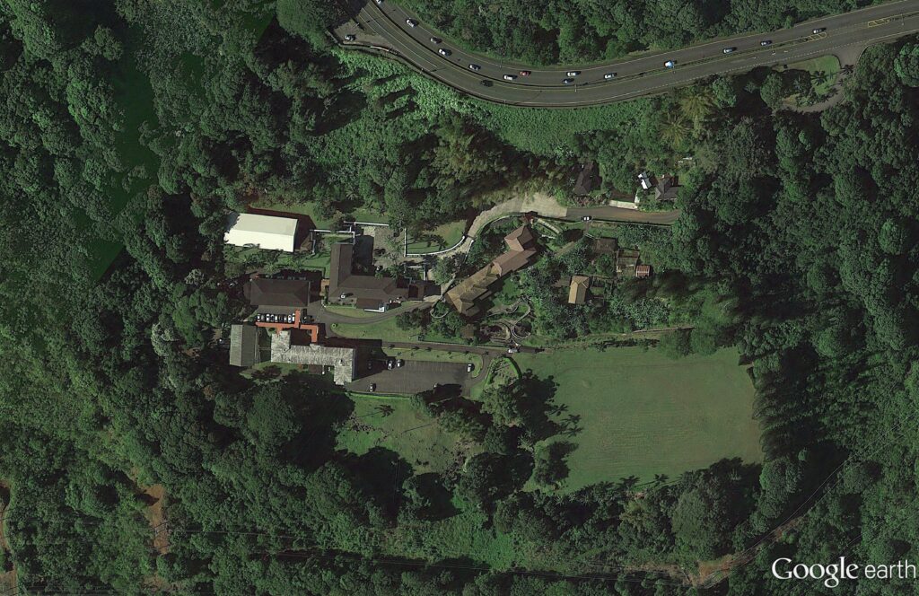
The remaining remnant of the Hygienic Dairy (reportedly once the largest dairy in the state) is the Hygienic Store. “Simon Chong, took over the store from the dairy in 1950”.

“(It) was a full-service gas station and general store, complete with fresh meat and produce, hardware and rubber boots. In the late ’70s, the Chongs leased the store to Millie Kim, who ran it with her son Michael through 2003, when So Cha Hashimoto took over.” (Keany; Honolulu)

Follow Peter T Young on Facebook 

Follow Peter T Young on Google+ 

Follow Peter T Young on LinkedIn  

Follow Peter T Young on Blogger

© 2018 Hoʻokuleana LLC

hygenic_store_Chong-Honolulu
Hygienic Dairy Bottle-eBay
Ahuimanu Farm Dairy-1-4 pint
Ahuimanu Farm Dairy-SB-June 23, 1931
Hygienic Store
Hygienic Store
Hygienic Store
Hygienic Store
Hygienic Store
Hygienic Store

Filed Under: Economy, General, Buildings Tagged With: Hygienic Store, Hygienic Dairy, Hawaii, Koolaupoko

  • « Previous Page
  • 1
  • 2
  • 3
  • 4
  • 5
  • 6
  • Next Page »

Images of Old Hawaiʻi

People, places, and events in Hawaiʻi’s past come alive through text and media in “Images of Old Hawaiʻi.” These posts are informal historic summaries presented for personal, non-commercial, and educational purposes.

Info@Hookuleana.com

Connect with Us

  • Email
  • Facebook
  • LinkedIn
  • Twitter
  • YouTube

Recent Posts

  • Ka‘anapali Out Station
  • Lusitana Society
  • “Ownership”
  • ‘Holy Moses’
  • Mikimiki
  • Doubtful Island of the Pacific
  • John Meirs Horner

Categories

  • Military
  • Place Names
  • Prominent People
  • Schools
  • Sailing, Shipping & Shipwrecks
  • Economy
  • Voyage of the Thaddeus
  • Mayflower Summaries
  • American Revolution
  • General
  • Ali'i / Chiefs / Governance
  • Buildings
  • Missionaries / Churches / Religious Buildings
  • Hawaiian Traditions

Tags

Albatross Al Capone Ane Keohokalole Archibald Campbell Bernice Pauahi Bishop Charles Reed Bishop Downtown Honolulu Eruption Founder's Day George Patton Great Wall of Kuakini Green Sea Turtle Hawaii Hawaii Island Hermes Hilo Holoikauaua Honolulu Isaac Davis James Robinson Kamae Kamaeokalani Kamanawa Kameeiamoku Kamehameha Schools Lalani Village Lava Flow Lelia Byrd Liliuokalani Mao Math Mauna Loa Midway Monk Seal Northwestern Hawaiian Islands Oahu Papahanaumokuakea Marine National Monument Pearl Pualani Mossman Queen Liliuokalani Thomas Jaggar Volcano Waikiki Wake Wisdom

Hoʻokuleana LLC

Hoʻokuleana LLC is a Planning and Consulting firm assisting property owners with Land Use Planning efforts, including Environmental Review, Entitlement Process, Permitting, Community Outreach, etc. We are uniquely positioned to assist you in a variety of needs.

Info@Hookuleana.com

Copyright © 2012-2024 Peter T Young, Hoʻokuleana LLC


Loading Comments...