Images of Old Hawaiʻi

  • Home
  • About
  • Categories
    • Ali’i / Chiefs / Governance
    • American Protestant Mission
    • Buildings
    • Collections
    • Economy
    • Missionaries / Churches / Religious Buildings
    • General
    • Hawaiian Traditions
    • Other Summaries
    • Mayflower Summaries
    • Mayflower Full Summaries
    • Military
    • Place Names
    • Prominent People
    • Schools
    • Sailing, Shipping & Shipwrecks
    • Voyage of the Thaddeus
  • Collections
  • Contact
  • Follow

September 26, 2019 by Peter T Young 6 Comments

Mōʻiliʻili Karst

Prior and into the 1800s, Mōʻiliʻili was an agricultural community. It was transformed in the early 20th century into a self-contained town center with expanded businesses along King Street by Japanese immigrants who made Mōʻiliʻili their home.

This area is part of the Waikīkī ahupuaʻa.  Waikīkī was once a vast marshland whose boundaries encompassed more than 2,000-acres.  Here, the Mānoa and Pālolo streams (and springs in Mānoa (Punahou and Kānewai)) watered the marshland below.

With the arrival and settlement of the Hawaiians, this area gradually transformed from marsh into hundreds of taro fields, fish ponds and gardens.  The broad expanse of the Waikīkī ahupuaʻa was once one of the most productive agricultural areas in old Hawai‘i.

In the 1860s and 1870s, former Asian sugar plantation workers (Japanese and Chinese) replaced the taro and farmed more than 500-acres of wetlands in rice fields, also raising fish and ducks in the ponds.  By 1892, Waikīkī had 542 acres planted in rice, representing almost 12% of the total 4,659-acres planted in rice on O‘ahu.

During the 1920s, the Waikīkī landscape would be transformed when the construction of the Ala Wai Drainage Canal, begun in 1921 and completed in 1928, resulted in the draining and filling in of the remaining ponds and irrigated fields of Waikīkī.

Many residents of the Mōʻiliʻili area (and beyond) may not be aware that just a few feet below their feet, cars, houses and businesses are remnant caverns and caves (and water) in the Mōʻiliʻili underground.

During the island’s formative stage, the sea level was more than 25 feet higher than its present level. This period of sea level elevation is responsible for the deposit of fossil reef limestone in southern coastal Oʻahu, including up to the region we now know as Mōʻiliʻili.

The weathering and erosion of Oahu’s dormant volcanoes, the Waianae and Koʻolau, paired with the rise and retrieval of the sea level resulted in the formation of “interbedded marine and terrestrial deposits”.

The underground cave system is thought to be part of the original channel of Mānoa stream – people call it the Mōʻiliʻili Karst (Karst being a geological formation shaped by the dissolution of a layer or layers of soluble bedrock, such as limestone.)

The wide upslope section of the cave is centered near the intersection of University Avenue and South King Street (down slope from the University Avenue – H-1 interchange.)  The lower edge is located at the intersection of University Avenue and Kapiʻolani Boulevard.

The environment above the karst is highly urbanized, containing busy streets, buildings and businesses. The consequences of such urbanization are evident. Before damages due to urbanization and cave-ins, the Mōʻiliʻili Karst contained a half-mile cave that seemed to be a single connected structure.

There were several ponds that were fed by the karsic springs. One was located west of University Avenue, upslope of Beretania Street (near the UH makai campus.) The Kānewai underground pond was important to Hawaiian culture, because its water was said to have healing properties.

According to Hawaiian folklore, fish swam underground from the sea to this pool to eavesdrop on the fishermen who frequented this area and listen to the fishers’ plans.

Another important spring-fed pond was the Hausten (formerly Kumulae) pond. Originally, the pond was a favorite of Queen Kamāmalu (sister of Kamehameha IV and V).  The Queen and her brothers loved swimming in the ponds, which were also said to have healing powers.  The pond became the site of the Willows restaurant, and served as an attraction to customers there.

In 1934, a construction project downslope struck a master conduit of the karst. This caused massive water drainage of the upslope area; “for more than four months, an average of 3.8 x 10⁷ L was pumped daily before the hole could be sealed and construction resumed.” The total amount pumped before the leak could be sealed was greater than one billion gallons of water.

The spring-feed ponds vanished within 24 hours.  There have been several instances of collapses since the dewatering. One instance in 1952 involves the Standard Trading store falling through the ground into the karst below it.  Another instance involves the emergence of a large cavern downslope from the King-University intersection.

The leak was repaired, but had changed the karst forever. Several spots in the formation were deliberately filled.  Cave-ins greatly reduced the size of the cave network, and changed access to the underground.

The Mōʻiliʻili Karst (Mōʻiliʻili Water Cave) is the only place where bare limestone can be seen; the cave is approximated to be as high as ten feet, and have depth of up to five feet in places.

It is entered by only by a drainage grate, and despite the impacts of human intrusion, “construction fill, metal pilings, and trash swept into the system by floodwaters,” the cave has been able to retain its cool and clear water.

Follow Peter T Young on Facebook 

Follow Peter T Young on Google+ 

Follow Peter T Young on LinkedIn  

Follow Peter T Young on Blogger

© 2019 Hoʻokuleana LLC

MoiliiliCave-(bishopmuseum)-1897
Moiliili-Karst_-(star-bulletin)
Moiliili_Cave-(alohafrom808-com)
Moiliili-Water-Cave
Moiliili_Cave-(punynari)
Moiliili_Cave_(punynari)
Moiliili_Karst-(alohahawaii808-com)
Moiliili_Karst_(punynari)
Moiliili_Water-Cave-(punynari)
Moiliili-Karst-(alohahawaii808-com)
Moiliili-Karst-(punynari)
Moiliili-Karst_(punynari)
Moiliili-Water_Cave-(punynari)
Moiliili-Water-Cave-(punynari)
Moiliili-Water-Cave-steel_support-(punynari)
Moiliili-Water-Cave-support-(punynari)
Moiliili-Karst_entry-pipe
Moiliili-Karst-entry-(punynari)
Moiliili-Karst_entry-(punynari)
Moiliili-Karst_entry-pipes-(punynari)
Moiliili-Karst_entry_pipes
Moiliili_Cave-map
Moiliili_Water_Cave-(halliday)-map

Filed Under: General, Place Names Tagged With: Hawaii, Waikiki, Karst, Moiliili

October 28, 2013 by Peter T Young Leave a Comment

Kapaʻakea Spring

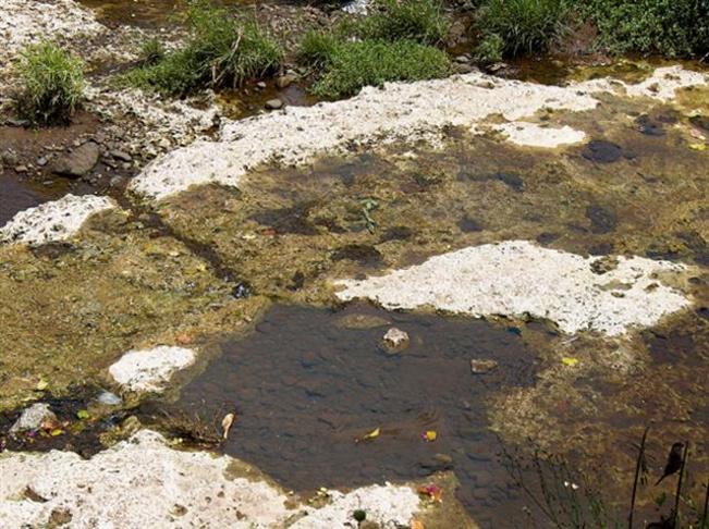
It was once a perched water-table pond and spring.

It was originally known as Kumulae Spring (Pond – also Kapaʻakea and later Hausten Spring/Pond) and was reportedly the property of Kamāmalu (sister of Kamehameha IV and V.)  She and her brothers loved swimming in the pond; they and others shared food and drinks there.

The spring is the subject of an old legend that tells of a wondrous princess upon whom men’s eyes were forbidden to gaze.  The princess loved the waters of the spring and from time to time she would go there at night and bathe.  In time, the waters of the spring became known for its healing powers.  (Kanahele)

As in much of Oʻahu, geologically, the bedrock is actually reef limestone.  Lava from the upslope Sugarloaf covered the limestone and cooled (with a thickness of about 40-feet.) After cooling of the Sugarloaf lava, alluvium and marshy lagoon sediments accumulated atop much of the limestone.  A few inches of soil covered the top.  (Halliday)

Groundwater flow cut through the limestone forming a karstic drainage system (Karst being a geological formation shaped by the dissolution of a layer or layers of soluble bedrock, such as limestone.)   This region, in and around the lower portions of the University of Hawaiʻi, became part of the Mōʻiliʻili Karst.   Caverns and perched water-table springs and ponds were exposed at the surface.

The best-known of theses ponds was Kumulae.  By the early-1920s, Mr. Hausten purchased and cleared the land, and stocked the pond with koi which interbred with existing fish.   The large clear fishpond quickly became a noted attraction.

It was the family’s garden home with beautiful tropical gardens of flora and fauna.  Emma McGuire “Ma” Hausten was an avid gardener and planted white ginger, water lilies, plumeria from the South Seas, willow trees, kukui trees, breadfruit and fruit trees as well as Hawaiian herbs and medical plants.

The gardens thrived and people asked if they might use the tropical setting for weddings, luaus and parties.  Finally, in the mid-1930s limited private parties were held.  (Willows)

Then, ‘tragedy’ happened.  In the autumn of 1934, the Hausten pond disappeared without warning, draining in less than 24 hours.

It turns out, construction activities downslope from the King-University intersection struck a master conduit in the underground watered cave system.   Water drained out.  Upslope, the results of this dewatering were dramatic.

The master conduit was eventually resealed, the cave’s water table temporarily recharged, but the karst was never the same again.  There have been several instances of collapses since the dewatering. One instance in 1952 involves the Standard Trading store falling through the ground into the karst below it.  Another instance involves the emergence of a large cavern downslope from the King-University intersection.

During World War II, times were tough.  An offer was made for the property; but instead of selling, the family decided to serve light lunches and drinks. In 1944, the Willows Restaurant opened as a club by Emma’s daughter, Kathleen Perry, along with husband Al (30-year musical director of Hawaii Calls,) her brothers Allan and Walter McGuire and other family members.  Together, they presided over a gracious era of Hawaiian music and hospitality during the late-1940s and 1950s.  (Willows)

But after the dewatering, the historic pond was never the same, the continuing drop in the water table especially impacted the Willows Restaurant. The willow trees wilted and the restaurant lost its attractiveness and its customers.

New sinkholes developed. “People living in the vicinity made their way into the caves through holes in their yards and speared fish by the hundreds.”  Several houses “lurched” and settled.  Sidewalks cracked and water and gas mains ruptured. Some trees sank almost 3-feet.  (Halliday)

The spring dried up and a remnant of the pond had to be lined with concrete.  A manmade water feature surrounded by rock and plants has been built to recreate the ambience of the old days.

In 1998, the site was sold and restored.  The Willows re-opened its doors on the threshold of a new millennium in 1999, after six years of being closed.

The image shows the Willows Restaurant and pond.   In addition, I have added other related images in a folder of like name in the Photos section on my Facebook and Google+ pages.

Follow Peter T Young on Facebook  

Follow Peter T Young on Google+  

© 2013 Hoʻokuleana LLC

Filed Under: Place Names Tagged With: Kumulae Spring, Hawaii, Oahu, Kapaakea, Victoria Kamamalu, Hawaii Calls, Kamamalu, Karst, Willows Restaurant, Moiliili

Images of Old Hawaiʻi

People, places, and events in Hawaiʻi’s past come alive through text and media in “Images of Old Hawaiʻi.” These posts are informal historic summaries presented for personal, non-commercial, and educational purposes.

Info@Hookuleana.com

Connect with Us

  • Email
  • Facebook
  • LinkedIn
  • Twitter
  • YouTube

Recent Posts

  • Shaka
  • Teshima’s
  • Waikīkī’s Construction Evolution
  • A Building Tells Stories About Buildings
  • Saint Patrick’s Day
  • No Taxation Without Representation
  • Ka Iwi

Categories

  • General
  • Ali'i / Chiefs / Governance
  • Buildings
  • Missionaries / Churches / Religious Buildings
  • Hawaiian Traditions
  • Military
  • Place Names
  • Prominent People
  • Schools
  • Sailing, Shipping & Shipwrecks
  • Economy
  • Voyage of the Thaddeus
  • Mayflower Summaries
  • American Revolution

Tags

1846 Albatross Albert Gerbode Battery Salt Lake Blue Men Carl Carlsmith Charles II Christmas Tree Collegia Theatre Constance Frederica Gordon-Cumming David Howard Hitchcock Department of Hawaiian Home Lands Diamond Head Francisco Coronado French H-4 Hale O Lono Hana Pier Honolulu Female Academy Honolulu Streets James Hay Wodehouse Kalama Tract Kamanawa Kamehameha V Kona Field System Kukaniloko Kukuihoolua Kuleana Lunalilo Home Mao Merchant Street Merrymount Mitchellism Na Pali Nu Kaliponi Picture Bride Polly Thomson Resolution Robert Dollar Samuel Damon Ship Trap Socialism Tot William Reed Witch Trials

Hoʻokuleana LLC

Hoʻokuleana LLC is a Planning and Consulting firm assisting property owners with Land Use Planning efforts, including Environmental Review, Entitlement Process, Permitting, Community Outreach, etc. We are uniquely positioned to assist you in a variety of needs.

Info@Hookuleana.com

Copyright © 2012-2021 Peter T Young, Hoʻokuleana LLC


Loading Comments...