Images of Old Hawaiʻi

  • Home
  • About
  • Categories
    • Ali’i / Chiefs / Governance
    • American Protestant Mission
    • Buildings
    • Collections
    • Economy
    • Missionaries / Churches / Religious Buildings
    • General
    • Hawaiian Traditions
    • Other Summaries
    • Mayflower Summaries
    • Mayflower Full Summaries
    • Military
    • Place Names
    • Prominent People
    • Schools
    • Sailing, Shipping & Shipwrecks
    • Voyage of the Thaddeus
  • Collections
  • Contact
  • Follow

June 14, 2022 by Peter T Young Leave a Comment

1850

“When I found I had crossed that line, I looked at my hands to see if I was the same person. There was such a glory over everything; the sun came like gold through the trees, and over the fields, and I felt like I was in Heaven.” Harriet Tubman

Born into slavery on Maryland’s Eastern Shore in 1822, she was named Araminta by her enslaved parents, Ben and Rit Ross. Nearly killed at the age of 13 by a blow to her head, “Minty” recovered and grew strong and determined to be free.

Changing her name to Harriet upon her marriage to freeman John Tubman in 1844, she escaped five years later when her enslaver died and she was to be sold. One hundred dollars was offered for her capture.

In 1849 Harriet Tubman learned that she and her brothers Ben and Henry were to be sold. Financial difficulties of slave owners frequently precipitated sale of slaves and other property.

The family had been broken before; three of Tubman’s older sisters, Mariah Ritty, Linah, and Soph, were sold to the Deep South and lost forever to the family and to history.

Despite additional dangers resulting from the Fugitive Slave Act of 1850, Tubman risked her life and ventured back to the community where she was born to rescue family, friends, and others.

The act required the reporting and arrest of anyone suspected of being a runaway slave, eliminated protections for suspected runaways, and provided economic incentives to kidnap people of African descent.

In September of 1850, Harriet was made an official “conductor” of the Underground Railroad. This meant that she knew all the routes to free territory and she had to take an oath of silence so the secret of the Underground Railroad would be kept secret.

Vowing to return to bring her family and friends to freedom, she spent the next ten years making about 13 trips into Maryland to rescue them. She also gave instructions to about 70 more who found their way to freedom independently.

Through the Underground Railroad, Tubman learned the towns and transportation routes characterizing the South—information that made her important to Union military commanders during the Civil War.

As a Union spy and scout, Tubman often transformed herself into an aging woman. She would wander the streets under Confederate control and learn from the enslaved population about Confederate troop placements and supply lines.

Tubman helped many of these individuals find food, shelter, and even jobs in the North. She also became a respected guerrilla operative. As a nurse, Tubman dispensed herbal remedies to black and white soldiers dying from infection and disease.

A lifelong humanitarian and civil rights activist, she formed friendships with abolitionists, politicians, writers and intellectuals. She knew Frederick Douglass and was close to John Brown and William Henry Seward.

She was particularly close with suffragists Lucretia Coffin Mott, Martha Coffin Wright, and Susan B. Anthony. Intellectuals in New England’s progressive circles, such as Ralph Waldo Emerson, William Lloyd Garrison, Bronson Alcott, Harriet Beecher Stowe, Franklin B. Sanborn, and Mrs. Horace Mann, befriended her, and her work was heralded beyond the United States.

Tubman showed the same zeal and passion for the campaign to attain women’s suffrage after the American Civil War as she had shown for the abolition of slavery.

Harriet Tubman died in 1913 in Auburn, New York at the home she purchased from Secretary of State William Seward in 1859, where she established the Harriet Tubman Home for the Aged. She was buried with military honors at Fort Hill Cemetery.  (NPS)

In the Islands …

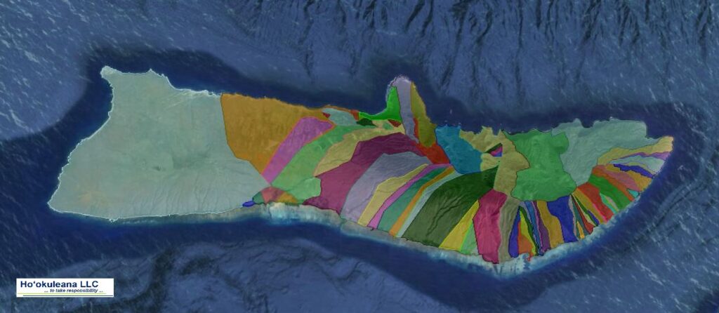
In 1848, King Kamehameha III fundamentally changed the land tenure system to a westernized paper title system through the Māhele.  The lands were formally divided among the king and the chiefs, and the fee titles were recorded in the Māhele book.

In 1850, a law was passed allowing these “native tenants” to claim fee simple title to the lands they worked.  Those who claimed their parcel(s) successfully acquired what is known as a kuleana.

Deeds executed during the Māhele conveying land contained the phrase “ua koe ke kuleana o na kānaka,” or “reserving the rights of all native tenants,” in continuation of the reserved tenancies which characterized the traditional Hawaiian land tenure system.  (Garavoy)

Contemporary sources of law, including the Hawai‘i Revised Statutes, the Hawai‘i State Constitution, and case law interpreting these laws protect six distinct rights attached to the kuleana and/or native Hawaiians with ancestral connections to the kuleana.

These rights are:

  • reasonable access to the land-locked kuleana from major thoroughfares;
  • agricultural uses, such as taro cultivation;
  • traditional gathering rights in and around the ahupua‘a;
  • a house lot not larger than 1/4 acre;
  • sufficient water for drinking and irrigation from nearby streams, including traditionally established waterways such as ‘auwai; and
  • fishing rights in the kunalu (the coastal region extending from beach to reef).

The 1850 Kuleana Act also protected the rights of tenants to gain access to the mountains and the sea and to gather certain materials.

The Kuleana Act did not allow the maka‘āinana to exercise other traditional rights, such as the right to grow crops and pasture animals on unoccupied portions of the ahupua’a. The court’s interpretation of the act prevented tenants from making traditional use of commonly cultivated land.  (MacKenzie)

Kawaiaha‘o Church Clock

Kawaiahaʻo Church (Stone Church) generally marked the eastern edge of town; it was constructed between 1836 and 1842.  The “Kauikeaouli clock,” donated by King Kamehameha III in 1850, still tolls the time to this day.

Honolulu Streets Named

It wasn’t until 1850 that streets received official names. On August 30, 1850, the Privy Council first officially named Honolulu’s streets; there were 35‐streets that received official names that day (29 were in Downtown Honolulu, the others nearby.)

At the time, the water’s edge was in the vicinity of what we now call Queen Street.  Back in those days, that road was generally called ‘Makai,’ ‘Water’ or Ali‘i Wahine.’  (Gilman)

Beginning of the Mormon Mission

“The Mormons are said to have commenced their mission in 1850. Their converts are scattered over all the islands.   They number about nine per cent of all those who in the census returns have reported their religious affiliations.  This mission owns a small sugar plantation at Laie, on the island of Oʻahu.”  (The Friend, December 1902)

The Church traces its beginnings to Joseph Smith, Jr.  On April 6, 1830 in Western New York, Smith and five others incorporated The Church of Jesus Christ of Latter-day Saints in Fayette, New York.

In the summer of 1850, in California, elder Charles C Rich called together more elders to establish a mission in the Sandwich Islands.  They arrived December 12, 1850.  Later, more came.

Honolulu Fire Department

Alexander “Alick” Cartwright worked as a clerk for a broker and later for a bank, and, weather permitting, played variations of cricket and rounders in the vacant lots of New York City after the bank closed each day.

Rounders, like baseball, is a striking and fielding team game that involves hitting a ball with a bat; players score by running around the four bases on the field (the earliest reference to the game was in 1744.)

Cartwright played a key role in formalizing the first published rules of the game of baseball, including the concept of foul territory, the distance between bases, three-out innings and the elimination of retiring base runners by throwing batted baseballs at them.

The man who really invented baseball spent the last forty-four years of his long life in Hawai‘i and laid out Hawai‘i’s first baseball diamond, now called Cartwright Field, in Makiki.  Cartwright went on to teach people in Hawai‘i how to play the game; and, he did a lot more when he was here.

In Hawaiʻi, he continued the volunteer fire fighting activities he had learned as a member of the Knickerbocker Engine Company No. 12 in New York City – and, he was part of Honolulu’s first Volunteer Fire Brigade.

Shortly thereafter, the Honolulu Fire Department was established on December 27, 1850, by signature of King Kamehameha III, and was the first of its kind in the Hawaiian Islands, and the only Fire Department in the United States established by a ruling monarch. Cartwright was appointed Chief Engineer of the Department and shortly thereafter, he became Fire Chief.

“The ordinance by Kamehameha III, December 27, 1850, establishing the Honolulu Fire Department, required each householder

to keep at least two buckets hanging handy, for fire use exclusively, and further ordered that they be brought to every fire.”

“The bucket part was probably the most effective, as the only other equipment at that time was a hand engine and 150 feet of homemade canvas hose through which, by constant relays on the pump handles, water could be thrown some sixty feet.”  (Thrum)

Aside from his duties at the Honolulu Fire Department, Cartwright also served as advisor to the Queen.  Cartwright was the executor of Queen Emma’s Last Will & Testament, in which she left the bulk of her estate to the Queen’s Hospital when she died in 1885.  Cartwright also served as the executor of the estate of King Kalākaua.

Post Office Established in Honolulu

The first mention of a postal system in Hawaii was an enactment of the Legislature on April 27, 1846, relating to the handling of inter-island mails. It was entitled “An Act to Organize the Executive Departments of the Hawaiian Islands,”

With the US Post Office initiating a regular mail service by steamship between the east coast and California and Oregon, and a subsequent treaty between the US and Hawaii (ratified August 9, 1850) in which an article provided for the safe transmission of the mails between the two countries, the Hawaiian government decided that the 1846 statute governing internal correspondence was insufficient to handle foreign mails.

The Privy Council, therefore, passed a decree on December 20, 1850, and the 1851 Legislature enacted a law that established a Post Office in Honolulu (temporarily in the Polynesian Office). The Council appointed a Postmaster, Henry M. Whitney, and set up rates for renumeration to ships’ captains for carrying the mails.  (DAGS)

© 2022 Ho‘okuleana LLC

Filed Under: Prominent People, Economy, General, Buildings, Missionaries / Churches / Religious Buildings, Place Names Tagged With: 1850, Harriet Tubman, Honolulu, Kawaiahao, Mormon, Honolulu Streets, Great Mahele, Polynesian, Alexander Cartwright, Post Office, Postal Service, Baseball, Rights of Native Tenants

June 8, 2022 by Peter T Young Leave a Comment

Mākaha

The ahupuaʻa of Mākaha, between Waiʻanae Ahupuaʻa to the southeast and Keaʻau Ahupua‘a to the northwest, extends from the coastline to the Waiʻanae Range.

Pukui noted Mākaha means “fierce;” Roger C. Green suggests it relates to “fierce or savage people” once inhabiting the valley.

Green refers to “…the ʻŌlohe people, skilled wrestlers and bone-breakers, by various accounts [who] lived in Mākaha, Mākua, and Keaʻau, where they often engaged in robbery of passing travelers.”  (Cultural Surveys)

Earliest accounts describe Mākaha as a good-sized inland settlement and a smaller coastal settlement.  These accounts correlate well with a sketch drawn by Bingham in 1826 depicting only six houses along the Mākaha coastline.

Green describes Mākaha’s coastal settlement as “…restricted to a hamlet in a small grove of coconut trees on the Keaʻau side of the valley, some other scattered houses, a few coconut trees along the beach, and a brackish water pool that served as a fish pond, at the mouth of the Mākaha Stream.” (Cultural Surveys)

This stream supported traditional wetland agriculture – kalo (taro) – in pre-contact and early historic periods

Supporting this, Māhele documents note Mākaha’s primary settlement was inland where waters from Mākaha Stream could support lo‘i and kula plantings. Although there is evidence for settlement along the shore, for the most part, this was limited to scattered, isolated residents.

A “cluster” of habitation structures was concentrated near Mākaha Beach, near the Keaʻau side of Mākaha where there is also reference to a fishpond.

John Papa ʻĪʻī described a network of Leeward O‘ahu trails, which in early historic times crossed the Waiʻanae Range, allowing passage from Central O‘ahu through Pōhākea Pass and Kolekole Pass.

The old coastal trail probably followed the natural contours of the topography. With the introduction of horses, cattle and wagons in the 19th century, many of the coastal trails were widened and graded to accommodate these new introductions.  The Pu‘u Kapolei trail gave access to the Waiʻanae district from Central O‘ahu, which evolved into the present day Farrington Highway.

Kuhoʻoheihei (Abner) Pākī, father of Bernice Pauahi, was given the entire ahupuaʻa of Mākaha by Liliha after her husband, Boki, disappeared in 1829.

In 1855, after Chief Pākī died, the administrators of his estate sold the Mākaha lands to James Robinson and Co. Later, in 1862, one of the partners, Owen Jones Holt, bought out the shares of the others.

The Holt family dominated the social, economic and land-use activities in Mākaha until the end of the 19th century. During the height of the Holt family presence, from about 1887 to 1899, the Holt Ranch raised horses, cattle, pigs, goats and peacocks.

Mākaha Coffee Company bought land for coffee cultivation in the Valley, although coffee never caught on. On Holt’s death in 1862, the lands went into trust for his children.

By 1895 the OR&L rail line reached Waiʻanae.  It then rounded Kaʻena Point to Mokuleʻia, eventually extending to Kahuku.  Another line was constructed through central O‘ahu to Wahiawa.

The Holt Ranch began selling off its land in the early-1900s.

In 1908, the Waiʻanae Sugar Company moved into Mākaha and by 1923, virtually all of lower Mākaha Valley was under sugar cane cultivation.  The plantation utilized large tracks of Lualualei, Waiʻanae and Mākaha Valley.

In the 1930s, Waiʻanae Plantation sold out to American Factors Ltd (Amfac.)  They started looking for a water source to increase production of the thirsty crop.  They tunneled for water; Glover Tunnel, named for the contractor, was 4,200-feet long and had a daily water capacity of 700,000-gallons. The water made available was mainly used for the irrigation of sugar.

For a half century, Mākaha was predominantly sugarcane fields.  However, by the middle of the century, the operations were no longer profitable and the plantation started to liquidate.

In 1946, the Dillinghams announced that they were discontinuing rail service, citing decline in tonnage, rising labor costs and tsunami damage in the system. On October 17, 1946 the stockholders of American Factors (owners of the Waiʻanae Sugar Company) voted to liquidate.

Chinn Ho’s Capital Investment Corporation bought the Mākaha lands and looked to resort development in the Valley.  He envisioned a travel destination that would be the next Kaʻānapali or even Waikiki, with golf courses, condominiums and hotels.

When the Mākaha big surf break was discovered and the eventual Mākaha International Surfing Championship was underway, tourists starting coming to Waiʻanae in the 1950s, as pioneer surfers made Mākaha Beach famous.

In 1969, the Mākaha Resort was built, including Mākaha Inn and Country Club, with an 18-hole course with tennis courts, restaurant and other golf facilities was opened for local and tourist use.

Over the decades, the resort has had several starts and stops, as well as a number of transfers of ownership.

© 2023 Hoʻokuleana LLC

Filed Under: Place Names Tagged With: Bernice Pauahi Bishop, Oahu, Sugar, Coffee, Oahu Railway and Land Company, Boki, Paki, Amfac, Waianae, Hawaii, Makaha, James Robinson, Liliha

June 2, 2022 by Peter T Young Leave a Comment

Volcano Golf Course

The records of the Māhele ‘Āina note, Victoria Kamāmalu, a granddaughter of Kamehameha I, claimed and received the ‘ili of Keauhou during the Māhele.  Victoria Kamāmalu died on May 29th, 1866, at the age of 28 years.

Her lands were inherited by her father, Mataio Kekūanāoʻa.  Kekūanāoʻa died two years later, on November 24th, 1868. His lands – including those he’d inherited from his own children and relatives – were inherited by his daughter, Luta ‘Ruth’ Keʻelikōlani (Princess Ruth, half sister of V. Kamāmalu).

Keʻelikōlani died on May 24, 1883. Her lands – including those she inherited from her own father, siblings, husband, and relatives – were inherited by her cousin, Bernice Pauahi Bishop.

Bernice Pauahi Bishop (Pauahi), daughter of Laura Konia and Abner Paki, inherited the lands of her parents – Abner Paki, who died on June 13, 1855, leaving Pauahi his six (6) Māhele lands and numerous parcels; and Laura Konia, who died on July 2, 1857, leaving Pauahi her ten (10) Māhele lands.

Pauahi also inherited the six (6) Māhele lands of her aunt, ‘Akahi, who died on October 8,1877; and the lands of her cousin, Keʻelikōlani on May 24, 1883 – these lands included the ‘ili of Keauhou, which embrace Kīlauea.

Bernice Pauahi Bishop died on October 15, 1884, her combined lands were dedicated to the establishment of the trust forming the Bishop Estate and the subsequent forming of Kamehameha Schools.

On June 4, 1920, Bishop Estate agreed to a trade with the Territory of Hawaii, exchanging approximately 12,035 acres of Keauhou for Government land at Mohokea, Ka‘ū.

The agreement excluded unrecorded leases between the Estate and the Volcano House Company; OT Shipman (for Keauhou Ranch); the Kilauea Military Camp and Territorial Guard; the County of Hawai‘i; and eleven individuals, holding leasehold residential lots.

The agreement of 1920 provided the Territory of Hawaii, with the lands necessary to form the Kilauea section of Hawaii National Park. The Territory subsequently transferred the Keauhou-Kilauea parcel to the United States Government in 1922. (Maly)

In 1863, the first formal lease of Keauhou was granted by Chiefess Kamāmalu and her father, M. Kekūanaoʻa, to F.B. Swain.  By 1865 the lease had transferred to C.E. Richardson, who with partners, Wm. Reed, Geo. Jones, and L. Kaina, who in addition to further developing ranching and a pulu harvesting business at Keauhou, also developed a new a Volcano House.

The facility served visitors to the Volcano, and those traveling between Kaʻū and Hilo or Puna. The growing facilities were made in a mixture of Hawaiian and western architecture. The first, all-wooden Volcano House, was built in 1877, and remains not far from where it was originally built, to the present-day.

In the years leading up to establishment of the National Park, the National Guard of Hawaiʻi and the United States Army established a military reserve (Kīlauea Military Camp) in Keauhou, for purposes of training, recreation and health. The Volcano House Hotel also secured a lease from the Trustees of the Bishop Estate to develop the Volcano Golf Course. (Maly)

The oldest on Hawaii island, Volcano golf course began in 1921 as three holes marked by stakes. (VGCC) “[T]he [initial] golf course was pasture.  At that time [Arthur Brown had Keauhou Ranch and they] ran the milk cows, horses and cattle and all that.  In the golf course they ran what they called their working horses and the milk cows.”

“And the golf course … the putting area was all fenced off so the cattle wouldn’t bother that.  Then of course the biggest part of the ranch ran up Mauna Loa side.”  (Morgan Arthur Brown Oral History Interview)

Then, in 1922, they constructed a 9-hole course, “a real golf course.”  “It all came to pass when the management of the Volcano House, an up-to-date hostelry, maintained for the convenience of the … tourists, suddenly realized that it was not living up to the prescribed reputation of being up-to-date inasmuch as it had failed to provide, like other first-class tourists’ hotels, a golf course.”

“True its chief reason for existence is the Volcano, but the Englishman and his sense of honor, the hotel management felt that it could not conscientiously permit the establishment to be broadcasted as a hotel of the first-class unless it sported all the emendations credited to other first-class hotels.”

“And so, in taking stock of the Volcano House’s short comings, with was disclosed that the only thing of note which appeared to be lacking was a golf course.”

“[O]n a recent Sunday a nine-hole links was formally thrown open to those who cared to risk a few golf balls.  Risk is hardly the word.  Sacrifice would be better, as the course is dotted here and there with pukas (lava holes) and, although they have been wired over, the balls have an exasperating habit of slipping under the wire.”

“Then, again, if the golfer happens to be a particularly strong-armed individual, he is apt to send one skidding into the nineteenth hole – in this instance the crater itself.”

“On the other hand, the flow of lava from the crater has provided natural hazards such as bunkers and traps and the chap engaged to lay pit the course really didn’t have such a hard job of it.  In fact, the course is the only one of its kind today and is certainly a unique one.”

“As everybody knows, golf requires keen nerves and concentration of mind and muscle and the ordinary golfer who attempts the volcano course after the first time usually encounters opposition from an unexpected quarter.  As the volcano is in a state of constant activity, gas and steam occasionally and suddenly issue from the pukas.” (Pittsburgh Post-Gazette, June 11, 1922)

“The new golf links in the section adjacent to the tree-molds are already proving popular and offer a sporting nine holes that will arouse the keenest skill of the most inveterate player.”

“The golf links, which have been laid out at the expense of the Kilauea Volcano House so will not be run for profit.  A small green fee is being charged and it is hoped that in due course.”

“As the links become better known, this will be sufficient to pay the cost of a permanent attendant and to erect something in the nature of a shelter-house for the players in the event of showers.” (Star Bulletin, June 10, 1922)

From this humble beginning, the course finally grew to an 18-hole layout two and half decades later (1946). C Brewer acquired the course in 1968 and their renovations included a redesign by legendary golf course architect Jack Snyder. C Brewer also oversaw the construction of a $200,000 clubhouse, which was damaged by fire in 2019. (VGCC)

Kamehameha Schools found someone to take over the lease for the Volcano Golf Course and Country Club. In 2020, the previous lessee of the 156-acre golf course unexpectedly abandoned the property four years before the termination of the lease.  (Hawaii Tribune Herald)

© 2022 Ho‘okuleana LLC

Filed Under: Economy, General, Military, Place Names Tagged With: Hawaii, Volcano, Kilauea Military Camp, Hawaii Volcanoes National Park, Golf, Volcano Golf Course

May 31, 2022 by Peter T Young Leave a Comment

Lāhainā (1823)

“Lāhainā, Island of Maui, Saturday evening, May 31 (1823). After a very rough but splendid night, at sunrise this morning the wild mountains that overhang the district of Lahaina were in distinct view, and we advanced rapidly to the anchorage.”

“The settlement is far more beautiful than any place we have yet seen on the islands. The entire district, stretching nearly three miles along the sea-side, is covered with luxuriant groves …”

“… not only of the cocoa-nut, (the only tree we have before seen, except on the tops of the mountains,) but also of the bread-fruit and of the kou, a species of cordia, an ornamental tree, resembling, at a distance, a large and flourishing, full, round-topped apple-tree …”

“… while the banana plant, tapa, and sugar-cane, are abundant, and extend almost to the beach, on which a fine surf constantly rolls.”

“The picture presented is purely Indian in all its features, from the bare and lofty trunks of the cocoa-palm, with their tufted summits, nodding like plumes in the breeze, to the thatch of a rude hut …”

“… here and there peeping from beneath the broad leaves of the plantain, and the richness of more lowly growth: he whole forming a delightful foreground to the noble exhibition of mountain scenery in the distance.”

“On coming to an anchor, Karaimoku expressed his regret that there was no house at the disposal of himself or the queen, suitable for our accommodation: and wished us to procure a temporary residence with Mr. Butler, an American established here, till houses could be provided for us by Keōpūolani.”

“Under the guidance of Mr. Loomis, Mr. Richards and myself accordingly landed for this purpose. We were soon met by Keōua, the governor of Lahaina, to whom I delivered a letter of introduction from his friend Laʻanui, at Oahu, and proceeded in search of the plantation of Mr. Butler.”

“We found his enclosure pleasantly situated about a quarter of a mile directly in rear of the landing-place, and were received by him in a kind and friendly manner.”

“When acquainted with our object in coming to Lahaina, he proffered every assistance in his power, and tendered his best house for the reception of our families.”

“His civility greatly prepossessed us in his favour, and made us almost forget that we were in the land of strangers.”

“He returned to the barge with us, to bring the ladies on shore; and early in the afternoon our whole number were comfortably and quietly settled in the midst of his luxuriant grounds.”

“The thick shade of the bread-fruit trees which surround his cottages – the rustling of the breeze through the bananas and the sugar-cane – the murmurs of the mountain streams encircling the yard – and the coolness and verdure of every spot around us …”

“… seemed, in contrast with our situation, during a six months’ voyage, and four weeks’ residence on the dreary plain of Honoruru, like the delights of an Eden …”

“… and caused our hearts to beat warmly with gratitude to the Almighty Being, who had brought us in safety to the scene of our future labours, and had at once provided us with so refreshing an asylum.”

“Before dark, the chiefs had all our effects landed, and secured in the storehouse of the governor, while our private baggage was brought to the house we occupy by the attendants of the queen.”

“Nor did their attentions cease here. Early in the evening, a supply of ready-cooked provisions, with vegetables and fruits, abundantly sufficient for the Sabbath, were sent to us by different individuals.”

“Mr. Butler hospitably prepared our first repast: and, though somewhat fatigued, we are now ready to retire to rest, prepared for the suitable observance of the holy day on which we are bordering. May it be the beginning of many blessed Sabbaths to the degraded inhabitants of Lāhainā!”

“Sabbath, June 1. Early this morning a messenger came to inform us that Keōpūolani, the princess, and chiefs, were waiting for us to come and worship with them.”

“We accordingly hastened to the beach, to erect an altar to the true God, where heretofore idols only have been served. Our temple was the work of the hands of the Almighty. Its only pillars were those that support the foundations of the earth, and its canopy the broad arch of heaven.”

“But we doubt whether a purer flame of devotion would have glowed in our bosoms, had we knelt before the Lord on pavements of marble, or addressed his throne from the midst of carving and gold.”

“About three hundred and fifty persons had encircled the tent, pitched for the temporary accommodation of the queen, in a grove of kou trees, near a brick building, now used as a storehouse, but once the residence of the late king when he visited Maui. We have seldom witnessed a more orderly and attentive audience.”

“A portion of scripture was read from the Tahitian version, by Taua, a Tahitian Christian, assistant Missionary to Mr. Ellis, who is attached to the retinue of the queen, in the capacity of private instructor and chaplain; after which other appropriate services were performed.”

“The chiefs desired to have the services repeated in the afternoon; and the queen requested us not only to worship God with her thus, on the Sabbath, but to attend prayers regularly, with herself and daughter, every morning at sunrise and every evening at sunset.” (The entire text, here, is from CS Stewart.)

© 2022 Hoʻokuleana LLC

Lahaina as seen from Lahainaluna-(portion_Lahainaluna_engraving)-1838

Filed Under: General, Ali'i / Chiefs / Governance, Missionaries / Churches / Religious Buildings, Place Names Tagged With: Hawaii, Maui, Kalanimoku, Charles Stewart, Keopuolani, Lahaina, 2nd Company, Edmund Butler

May 19, 2022 by Peter T Young Leave a Comment

Hawaiian Woods – Hawaiian Royal Residences

Most houses at the time of Cook’s contact consisted of a framework of posts, poles and slender rods – often set on a paving or low platform foundation – lashed together with a coarse twine made of beaten and twisted bark, vines, or grassy fibers.  This was then covered with ti, pandanus or sugarcane leaves, or a thatch of pili grass or other appropriate material.

When covered with small bundles of grass laid side by side in overlapping tiers, these structures were described as resembling haystacks.  One door and frequently an additional small “air hole” provided ventilation and light, while air also passed through the thatching.  Grass or palm leaves covered the raised earth floors of these houses.

When a chief needed a house, his retainers assembled the materials and erected the structure under the direction of an individual (kahuna) expert in the art of erecting a framework and applying thatch.

Many of these more modern royal residences were named – some were named after the material they were made from.  Here are three such royal residences.

Hale Kauila (Downtown Honolulu – Queen Kīna‘u)

Hale Kauila (house built of kauila wood) once stood on the street in downtown Honolulu that still bears the name of this large council chamber or reception room (some refer to it as Kina‘u’s house.)

While the thatch is attached in the usual way, the posts are much higher than usual and have squared timber; but the most foreign touch, apart from the windows, are the cross braces at the top and between the posts and the plate (they were never used in genuine native work.)

The description by Captain du Petit-Thouars of this house (which he calls the house of the Queen Kīna‘u:) “This house, built in wood and covered with dry grasses, is placed in the middle of a fortification closed with a fence.”

“The platform on which it rests is high above the ground in the yard about 30 centimeters and it is surrounded, externally, a covered gallery which makes it more pleasant.”

“Its shape inside, is that of a rectangle lengthens; in one end, there is a flat shape by a wooden partition which does not rise to the roof.”

“This piece serves as a bedroom, in the remaining of the area, box, and at the other end, there is a portion of the high ground from 28 to 30 centimeters, which is covered with several mats: it is this kind of big couch that was placed the ladies and they are held lying on one side or stomach, or they stand to receive and to make room.”

Hale Lama (Waikīkī – King Kamehameha V)

King Kamehameha V’s Waikīkī home was built in 1866.  It was called Hale Lama.  As described by George Kanahele, the residence “was quite modest with only one bedroom, but was notable for its neo-Hawaiian architecture – a low, rectangular-shaped structure, with a high-pitched, hipped roof that was thatched and descended to the poles of the lanai that sounded three of the four exterior walls.”

“The design suited Waikiki’s climate perfectly.  The high pitched roof allowed for the upward expansion of warm air, thus cooling the inside of the house, and the wide overhanging eaves kept out both sun and rain, while inviting the serenity and beauty of the natural setting.”

“It has been mentioned that the lama wood was especially used for building houses of the gods, that is, the thatched houses within the enclosures of the heiau or luakini, and its use in building the house for King lot, Kamehameha V, gave an excuse for its reported use by an old kahuna in the King’s establishment, for a house of prayer, and I am assured by an old resident that prayers to the gods were frequently offered therein”.

After the Kamehameha V’s death in 1872, the house and property went to went to Princess Ruth who bequeathed the property to Princess Bernice Pauahi Bishop.  The Princess and her husband Charles Bishop renovated and enlarged the house with servant quarters.

Hale Kamani (Lāhainā – Princess Nahiʻenaʻena)

When Keōpūolani returned to Maui to live her final years, she had a house on the beach in Lāhainā; her daughter, Nahiʻenaʻena, lived in her own home next door – Nahiʻenaʻena called her house Hale Kamani.

It had an early and convenient addition to the common grass house in a land where the people lived so generally in the open air, was the lanai, with extensions of the rafters at the same or a slightly reduced slope.

This verandah was, generally speaking, the most comfortable part of the house.  This lanai was often detached as in the Hale Kamani and was sometimes large with walls of coconut leaves intertwined, and a nearly flat roof of similar substance which was intended to furnish shade rather than shelter from heavy rain.

At least one other Royal Residence was named after a native wood ‘Āinahau (Princess Kapi‘olani’s home in Waikīkī;) however, it was named such because it was situated in a hau grove, not that its wood was used in the structure.

© 2022 Hoʻokuleana LLC

Filed Under: Ali'i / Chiefs / Governance, Hawaiian Traditions, Place Names Tagged With: Ainahau, Kinau, Kauila, Hawaii, Helumoa, Oahu, Lama, Kamehameha V, Kamani, Maui, Lahaina, Nahienaena, Keopuolani, Kaiulani

  • « Previous Page
  • 1
  • …
  • 74
  • 75
  • 76
  • 77
  • 78
  • …
  • 154
  • Next Page »

Images of Old Hawaiʻi

People, places, and events in Hawaiʻi’s past come alive through text and media in “Images of Old Hawaiʻi.” These posts are informal historic summaries presented for personal, non-commercial, and educational purposes.

Info@Hookuleana.com

Connect with Us

  • Email
  • Facebook
  • LinkedIn
  • Twitter
  • YouTube

Recent Posts

  • Foodland
  • Kauhale
  • Story of the American Soldier
  • Order of Kamehameha I
  • Maunalei Sugar
  • Kapalua
  • Baptism of Kalanimōku

Categories

  • General
  • Ali'i / Chiefs / Governance
  • Buildings
  • Missionaries / Churches / Religious Buildings
  • Hawaiian Traditions
  • Military
  • Place Names
  • Prominent People
  • Schools
  • Sailing, Shipping & Shipwrecks
  • Economy
  • Voyage of the Thaddeus
  • Mayflower Summaries
  • American Revolution

Tags

Albatross Al Capone Ane Keohokalole Archibald Campbell Bernice Pauahi Bishop Charles Reed Bishop Downtown Honolulu Eruption Founder's Day George Patton Great Wall of Kuakini Green Sea Turtle Hawaii Hawaii Island Hermes Hilo Holoikauaua Honolulu Isaac Davis James Robinson Kamae Kamaeokalani Kameeiamoku Kamehameha Schools Lalani Village Lava Flow Lelia Byrd Liberty Ship Liliuokalani Mao Math Mauna Loa Midway Monk Seal Northwestern Hawaiian Islands Oahu Papahanaumokuakea Marine National Monument Pearl Pualani Mossman Quartette Thomas Jaggar Volcano Waikiki Wake Wisdom

Hoʻokuleana LLC

Hoʻokuleana LLC is a Planning and Consulting firm assisting property owners with Land Use Planning efforts, including Environmental Review, Entitlement Process, Permitting, Community Outreach, etc. We are uniquely positioned to assist you in a variety of needs.

Info@Hookuleana.com

Copyright © 2012-2024 Peter T Young, Hoʻokuleana LLC

Loading Comments...