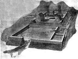
“The spread of civilization and the utilization of wild lands, added to the destruction of animals for food, adornment, clothing, and sport, threaten the very existence of many species of native birds and mammals.”
“The necessity of regulating the killing of game was perceived early in our colonial history, and even the need of caring for our insectivorous birds found recognition about 1850.”
“Only in comparatively recent years, however, has the importance been recognized of protecting the large class of birds which, although they do not destroy insects or other creatures inimical to agricultural interests, are nevertheless worthy of preservation because of their beauty, grace, and harmlessness.”
“If such birds add nothing to our material wealth, they beautify the world and greatly increase the joy of living.”
“Though by no means the first to recognize the importance of protecting its wild life, the United States has taken a leading place among the nations of the world in this respect”
“One of the most efficient of the conservation measures adopted by the Government is the setting apart here and there of islands and sterile tracts of land, worthless for other purposes, upon which our native wild birds and mammals may live and perpetuate their kind for the pleasure and profit of our own and future generations.” (Yearbook of the US Dept of Agriculture, 1911)
“The National bird reservations under the care of the Department of Agriculture already number 51 and play a very important part in the preservation of our wild game and birds.”
“One of the most unique and interesting of these is the Hawaiian Islands Bird Reservation in the mid-Pacific, which, at certain seasons of the year, harbors millions of sea fowls that repair thither to establish rookeries and rear their young.”
“The following is the executive order setting apart this refuge:”
Executive Order No. 1019. It is hereby ordered that the following islets and reefs, namely: Cure Island, Pearl and Hermes Reef, Lysianski or Pell Island, Laysan Island, Mary Reef, Dowsetts Reef, Gardiner Island, Two Brothers Reef, French Frigate Shoal, Necker Island, Frost Shoal and Bird Island …”
“… situated in the Pacific Ocean at and near the extreme western extension of the Hawaiian Archipelago between latitudes 23° and 29° north, and longitudes 160° and 180° west from Greenwich, and located within the area segregated by the broken lines …”
“… are hereby reserved and set apart, subject to valid existing rights, for the use of the Department of Agriculture as a preserve and breeding ground for native birds.”
“It is unlawful for any person to hunt, trap, capture, wilfully disturb, or kill any bird of any kind whatever, or take the eggs of such birds within the limits of this reservation except under such rules and regulations as may be prescribed from time to time by the Secretary of Agriculture.”
“Warning is expressly given to all persons not to commit any of the acts herein enumerated and which are prohibited by law. This reservation to be known as the Hawaiian Islands Reservation.” Signed by Teddy Roosevelt, February 3, 1909.
The names have changed, a bit, but the place remains the same.
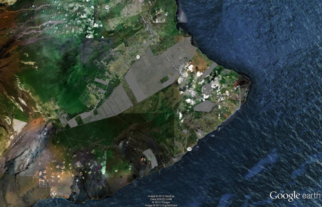
“This refuge consists of a dozen or more islands, reefs, and shoals that stretch westward from the archipelago proper for a distance of upwards of 1,500 miles toward Japan. The average distance between them is something like 100 miles.”
“Some of them, like Necker, Bird Island, and French Frigate Shoal, are masses of volcanic rock thrust up out of the ocean and so steep and rugged as generally to be inaccessible to anything without wings.”
“Others are little more than diminutive sand spits, snatched from the grasp of ocean by the aid of coral animals. Still others are larger, and a few, like Laysan, being covered with sandy soil, are clothed with a more or less flourishing growth of shrubs, vines, and grasses.” (Yearbook of the US Dept of Agriculture, 1911)
“As the islands are part of our National possessions and have been set apart as a bird reserve, the care and the protection of their avian inhabitants would seem clearly to devolve upon the Federal Government. It is true that their remoteness and inaccessibility render it difficult to guard them properly.”
“An effort, however, will be made to secure from Congress sufficient funds to provide for the services of a warden for Laysan and for an assistant. It is hoped also to secure a small power boat of adequate size to enable trips to be made between Laysan and the other islands and Honolulu.”
“These measures, if supplemented by an occasional visit from one of the Government cutters during the height of the breeding season, will insure the continued safety of the nesting colonies. From a variety of causes sea birds are being reduced in numbers almost everywhere, chiefly as the result of plumage hunting and of the growing scarcity of breeding sites.”
“Hence these island bird colonies, one of the wonders of the world, will become of increasing importance with each succeeding year. They should be regarded as a National heritage, and the birds be adequately protected, not only for the sake of our own citizens, but for those of other countries whose people go down to the sea in ships.”
“Otherwise these birds will suffer the fate that overtook those on Marcus Island, also one of our possessions, where, as reported by Bryan, in six years a colony of albatrosses almost as large as that of Laysan was reduced to less than a score of birds through the unchecked activities of feather hunters.” (Yearbook of the US Dept of Agriculture, 1911)
Unlike all other islands and atolls in the Northwestern Hawaiian Islands, Kure Atoll is the only land area owned by the state of Hawaiʻi – all of the other Northwestern Islands are owned by the US government.
While I was at DLNR, we created Refuge rules that established “a marine refuge in the Northwestern Hawaiian Islands for the long-term conservation and protection of the unique coral reef ecosystems and the related marine resources and species, to ensure their conservation and natural character for present and future generations.“
This started a process where several others followed with similar protective measures. The BLNR unanimously adopted the State’s Refuge rules, President George W Bush declared it a Marine National Monument and UNESCO designated it a World Heritage Site.
To me, this action reflects the responsibility we share to provide future generations a chance to see what it looks like in a place in the world where you don’t take something.
One of the issues about the rules, and in protecting the place, relates to access. Due to the sensitivity of the area, permits are limited – so, rather than taking the people to the place, there are tools now in place to bring the place to the people.