Images of Old Hawaiʻi

  • Home
  • About
  • Categories
    • Ali’i / Chiefs / Governance
    • American Protestant Mission
    • Buildings
    • Collections
    • Economy
    • Missionaries / Churches / Religious Buildings
    • General
    • Hawaiian Traditions
    • Other Summaries
    • Mayflower Summaries
    • Mayflower Full Summaries
    • Military
    • Place Names
    • Prominent People
    • Schools
    • Sailing, Shipping & Shipwrecks
    • Voyage of the Thaddeus
  • Collections
  • Contact
  • Follow

October 24, 2024 by Peter T Young Leave a Comment

United Nations

States first established international organizations to cooperate on specific matters. The International Telecommunication Union was founded in 1865 and the Universal Postal Union was established in 1874.

In 1899, the International Peace Conference was held in The Hague to elaborate instruments for settling crises peacefully, preventing wars and codifying rules of warfare. It adopted the Convention for the Pacific Settlement of International Disputes and established the Permanent Court of Arbitration, which began work in 1902.

The League of Nations, conceived during the first World War and established in 1919 under the Treaty of Versailles, was established “to promote international cooperation and to achieve peace and security.” (The League of Nations ceased its activities after failing to prevent the Second World War.)

On January 1, 1942, representatives of 26-Allied nations fighting against the Axis Powers met in Washington, DC to pledge their support for the Atlantic Charter by signing the “Declaration by United Nations”. This document contained the first official use of the term “United Nations”, which was suggested by US President Franklin Delano Roosevelt.  (UN)

The United Nations officially came into existence on October 24, 1945, when the Charter was ratified by the five permanent members of the Security Council (China, France, the Soviet Union, United Kingdom and United States) and the majority of other signatories.

The United Nations was founded by 51 countries as an international organization committed to maintaining international peace and security, developing friendly relations among nations and promoting social progress, better living standards and human rights. (UN)

The UN needed a home.

At the height of world capital search in late-1945, the United Nations and newspaper accounts typically reported that between thirty and fifty suggestions for the headquarters site had been received.

The range and scope of proposals indicated the previously unexplored public fascination with the prospect of creating a “capital of the world” and offered a source base for investigating the evolving relationship between local, regional and national identity, and global consciousness.  (Capital of the World)

Hawaiʻi got caught up in this, as well.

At the July 4, 1945 meeting of the National Governor’s Association, Hawaiʻi Governor Ingram M Stainback was successful in amending the group’s motion “we respectfully invite and urge all of you to use your good offices to locate the headquarters and capitol site of the United Nations organization at some place within the continental United States of America.”

Stainback noted, “I think Hawaiʻi would be a good place to locate the headquarters and suggest the word ‘continental’ be removed.”  (His amendment passed unanimously.)  (NGA)

Folks in Hawaiʻi then got to work and Governor Stainback initiated a campaign to attract the UN to Honolulu.  In contrast to other contenders, who stressed their proximity to world capitals, the Hawaiians stressed the advantages of being “far enough removed from any of the potentially explosive situations of the world.”  (Capital of the World)

“A resolution adopted by the Hawaiian Senate emphasized that Hawaiʻi is especially appropriate for UNO headquarters because it is the home of Pearl Harbor, whose treacherous bombing brought the United States into the war and gave the world a symbol of unity of action.”  (Herald Harper, November 23, 1945)

“The decision to propose Hawaiʻi as the permanent site of the United Nations Capitol was made relatively late, after other cities (nearly 250-across the US) had prepared elaborate campaigns to ‘sell’ themselves.  However, a highly effective presentation was prepared and shipped to London by Hawaiʻi’s committee”.  (Dye)

“A huge book presenting Hawaiʻi’s invitation, the most comprehensive yet presented, signed by IM Stainback, Governor of the Territory, and Hawaiʻi’s leading businessmen and industrialists, has been received in London for consideration by the UNO’s preparatory commission.” (Herald Harper, November 23, 1945)

“The huge volume was sent with an attractive cover with a tapa cloth and flower lei design and a decorative map emphasizing Hawaiʻi’s central location in the Pacific.  It was mounted on a wooden standard for ease in reading.  The word ‘Hawaiʻi’ was spelled out on the cover in letters hard-carved of wood.”  (Dye).

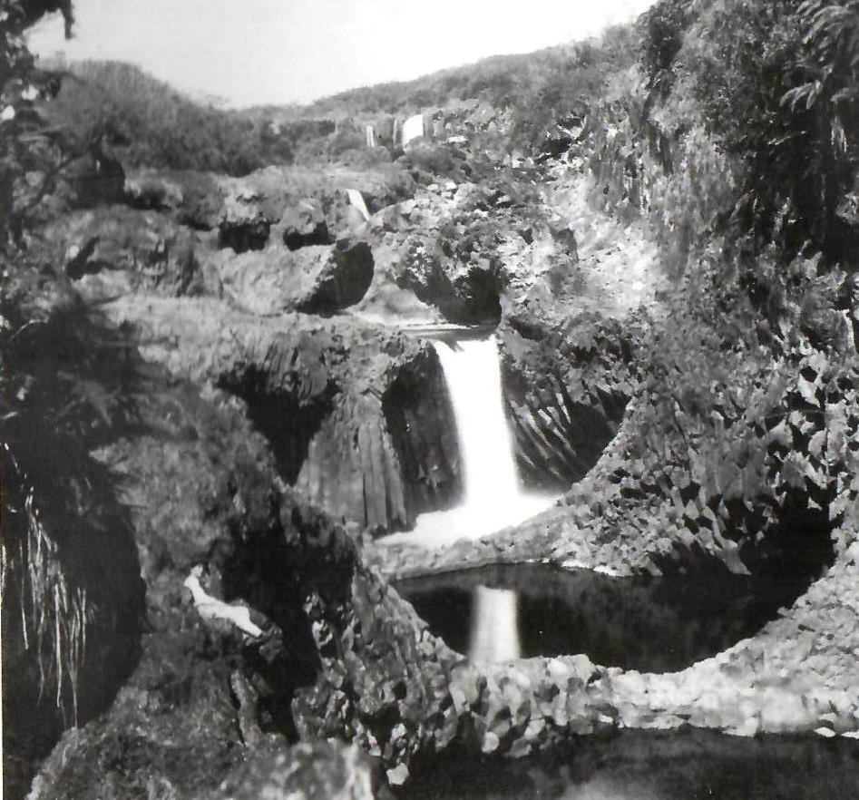
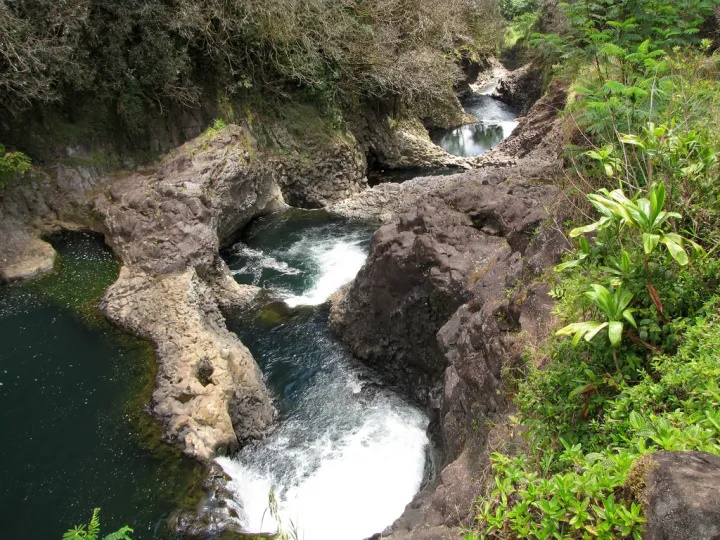
The site of the Hawaiʻi proposal? … Waimanalo.

However, the dream of the UN moving its sweet home to Nalo Town was short-lived.

A site committee of the United Nations Preparatory Commission voted after two hours of bitter debate to locate the permanent headquarters of UNO in the Eastern US. (United Press, December 22, 1945)

In the end, they picked New York.  A last-minute offer of $8.5-million by John D Rockefeller, Jr, for the purchase of the present site was accepted by a large majority of the General Assembly on December 14, 1946. New York City completed the site parcel by additional gifts of property.  (UN)

The cornerstone was laid on October 24, 1949; the United Nations headquarters in New York is made up of four main buildings: the Secretariat, the General Assembly, Conference Area (including Council Chambers) and the Library.

The tallest of the group, consists of 39 stories above ground and three stories underground. The exterior facings of the 550-foot tall Secretariat Building are made exclusively of aluminum, glass and marble.  (UN)

This was not the first lost-opportunity for international awareness.  In early-visioning for the home of the UN, President Franklin D Roosevelt “thought that the Secretariat of the organization might be established at Geneva, but that neither the Council nor the Assembly meetings should be held there.”

“He believed that the Assembly should meet in a different city each year, and that the Council should have perhaps two regular meeting places, one being in the Azores in the middle of the Atlantic and the other on an island in the Hawaiian group in the middle of the Pacific.”

“He felt that locating the Council in the Azores or the Hawaiian Islands would bring the benefit of detachment from the world. Being at heart a naval man, he liked the perspective obtained from surveying the world from an island out at sea.”

“(Roosevelt) had been eager, in the later thirties, to promote a meeting of the heads of nations on a battleship or on such an island as Niʻihau.”

© 2024 Hoʻokuleana LLC

Filed Under: Economy, Place Names Tagged With: Hawaii, Waimanalo, United Nations, Niihau

October 21, 2024 by Peter T Young Leave a Comment

Kona Lagoon

“Originally called the ‘Kona Hawaiian Resort,’ the new hotel’s developers renamed it ‘to better reflect its environment and because operations will be under management of Hawaiian Pacific Resorts, operators of Hilo Lagoon.’” (HTH, Nov 9, 1972)

“Located next to the Keauhou Beach Hote on Alii Drive, the new Lagoon is a joint venture between Hawaiian Pacific Management Resorts and Mitsubishi of Japan.” (HTH, May 30, 1973)  The 462-room hotel opened April 6, 1973

“A prime feature of the resort will be a 600 person capacity convention hall in Polynesian longhouse design.” (HTH, May 30, 1973) “With the completion of the Kona Lagoon hotel recently my list of impressive buildings on this island is up not one, but two!”

“Portions of this new hotel are the equivalent of an artistic museum of Hawaiian history. The main lobby is a bifurcated sort of a structure with an ‘island’ in the middle on which there is a pictorial history that really amounts to an art gallery.”

“The presentation is vital and the art good, and with enough variations in style to denigrate any possibility of the boredom that can sometimes come with historic subjects.” (Von Garske, HTH, Agu 4, 1974)

“The Kona Lagoon is the third large-scale resort hotel in Keauhou, joining the 314-room Keauhou Beach Hotel operated by Amfac and the 550-room Kona Surf operated by Interisland Resorts. The Bishop development south of Kailua Village now has nearly 1,500 guest rooms in a project that has cost more than $40 million to date.”

“The Lagoon features a 700-seat convention building known as the Polynesian Long House, a highly decorative structure in front of the hotel along AIii Drive. … The resort has two dining facilities – the Tonga Dining Room and the Wharf Gourmet Restaurant – two bars and a specialty Japanese steak house.”

“Another feature is a salt water lagoon surrounding the hotel with first floor guests encouraged to leap immediately from their rooms into the water.” (HnlAdv, March 21, 1974)

“When the Kona Lagoon Hotel opened its doors, guests and staff reported a wide variety of unexplained phenomena – shadowy figures roaming the hallways, disembodied screams piercing the night, and lights flickering without cause. Such events led to whispers of a curse, a belief that the hotel was built upon land that the living were never meant to inhabit.” (AmericanGhostWalks)

“The property was sold in May 1986 through a foreclosure auction … to Otaka Inc.” (Hnl Adv, May 7, 1988) In 1987, Azabu USA, a subsidiary of Azabu-Jidosha, a foreign car bought the Kona Lagoon from Otaka. (SB, April 17, 1987) About a year later, they announced the hotel would close for a 17-month reconstruction to turn it into an all-suites resort. (SB, April 15, 1988)

“When the hotel closed in 1988, the official reason was because the Japanese owners ran out of money and were unable to obtain additional financing.” (Harry Helms)

“Some people think the Kona Lagoon Hotel was cursed from the start. Surrounded by ancient temples and archaeological sites, it was built on the dwelling place of supernatural twin sisters, ‘aumakua who took the form of lizards, according to Hawaiian legend.”

“Security guards hired to watch the property when the 462-room hotel closed in 1988 were frightened at night, said Joe Castelli, who lives at the neighboring Keauhou Kona Tennis and Racquet Club.”

“They told me that they would see lights up there and hear Hawaiians singing and talking,” Castelli said. “…But when they got there, they didn’t find anything. So they said they just didn’t go anymore.”  (HnlAdv, Oct 14, 2002)

“Construction of the hotel obliterated the legendary Keawehala Pond, once thought to be inhabited by twin sisters who wielded extraordinary powers. These superwomen were the fierce protectors of local fresh water, who could transform themselves into formidable 30-foot lizards known as mo‘o.”

“The giant edifice of concrete and glass also infringed on nearby heiaus, sacred Hawaiian temples. … One of these sacred Hawaiian temples, called a luakini, was specifically dedicated to human sacrifice.”

“This ancient walled structure, built from native volcanic rocks, was 7-feet high. Providing a platform for carved wooden idols called ki‘i, which represent Hawaiian gods, the fortress-like enclosure protected thatched huts that held drums and offerings. This luakini was named Ke‘eku Heiau.” (AmericanGhostWalks)

“Whether or not the property is cursed, it’s true that attempts by landowner Kamehameha Schools and its for-profit subsidiary, Kamehameha Investment Corp., have failed to find a lessee.” (HnlAdv, Oct 14, 2002)  The Kona Lagoon was demolished in 2004.

© 2024 Ho‘okuleana LLC

Filed Under: Economy, Place Names Tagged With: Kona, Keauhou, Bishop Estate, Kona Lagoon, Kamehameha Investment, Hawaii, Kamehameha Schools

October 17, 2024 by Peter T Young Leave a Comment

Nāuhi Cabin

The early Polynesian settlers to Hawaiʻi brought sugar cane with them and demonstrated that it could be grown successfully in the islands.

Fast forward … Hawai‘i’s economy turned toward sugar in the decades between 1860 and 1880; these twenty years were pivotal in building the plantation system.

Sugar‐cane farming gained this prestige without great difficulty because sugar cane soon proved to be the only available crop that could be grown profitably under the severe conditions imposed upon plants grown on the lands which were available for cultivation.  (HSPA 1947)

In 1876, the legislature of Kamehameha III passed a law declaring all “forest lands” to be government property in an effort to conserve the forests from further encroachment on the seaward side by the plantations’ need for fuel and on the mountain side from grazing animals.

Founded in 1895, the Hawaiian Sugar Planters’ Association (HSPA), dedicated to improving the sugar industry in Hawai‘i, has become an internationally recognized research center.  (It was in 1996 when HSPA expanded its research interest besides sugarcane and acquired its current name Hawai‘i Agriculture Research Center (HARC), expanding its research on tropical crops and forests.)

Interestingly, it was the sugar growers, significant users of Hawai‘i’s water resources, who led the forest reserve protection movement.  On May 13, 1903, the Territory of Hawaiʻi, with the backing of the Hawaiʻi Sugar Planters’ Association, established the Board of Commissioners of Agriculture and Forestry.  (HDOA)

The Forest Reserves were established as a cooperative arrangement between the Hawaiʻi Sugar Planters Association and the territorial government.

Plantations needed wood for fuel, but they also needed to keep the forests intact to draw mist precipitation from the trade winds, which in turn fed the irrigation systems in the cane fields below.

Their own consumption of fuel had clearly been contributing to the decline of the forest at lower elevations, where flume systems transported large quantities of wood, as well as cane.  (Mills)

The link between tree-planting and the sugar planters can be seen particularly clearly in the career of Harold Lyon, who arrived in Hawai‘i in 1907 as a plant pathologist in the employ of the Hawaiian Sugar Planters’ Association (HSPA).

Lyon was a strong voice for forests; neglect of the islands’ forests would be “suicidal,” for ‘‘everything fails with the failure of our water supply’’.

Johnny Ah San, who worked as a territorial forester, noted, “And then HSPA had a man down at Nāuhi Nursery, and they planted trees. Then before the war [WWII], Roosevelt had the WPA [Works Progress Administration], so the men planted trees in the forest.” (Johnny Ah San; Maly)

The Nāuhi (‘the yams’) facility was interchangeably referred to as a Nursery and Experimental Station (and, apparently, also called Nāuhi Camp). The Hilo Forest Reserve was the site of cooperative reforestation efforts by the HSPA and Territorial foresters and later by the Civilian Conservation Corps under the direction of the Bureau of Forestry.

Over 100 varieties of temperate trees and plants were tested at the Experiment Station at Nāuhi; many of which succeeded to the point of naturally reproducing.

Nāuhi Cabin (a small building with three out-structures) was part of the Nāuhi Gulch Experiment Station, which was established in 1924. It is located in the ahupua‘a of Honohina at about 5,100 feet above sea level.  A nursery that was part of the Experiment Station is no longer standing. (Tuggle)

The purpose of Nāuhi Gulch Experiment Station, which operated until the beginning of World War II, was to “introduce, propagate and plant out in the adjacent forest lands various species and varieties of temperate zone, both northern and southern, trees and other plants”.

To this end, over 78 varieties of fruit trees and over 30 varieties of other temperate zone trees and plants were tested. Surrounding the cabin now is a wild landscape of feral garden flowers like roses, daisies, and nasturtiums, as well as apple, pear, and plum trees.

In 1941, wild pigs in the Nāuhi gulch-Pihā area were noted by Lyon: “Of special interest to us at this time are your remarks regarding the prevalence of wild hogs in the Nāuhi Gulch-Pihā region. They undoubtedly do a great deal of damage there.”

“If, for any reason, this Territory is compelled to produce its own food supply, we could organize a campaign which would remove most of these hogs from the forest and, at the same time, yield a goodly amount of excellent food for our people.” (Tuggle)

The cabin was part of a complex that included several buildings and an orchard on 47 acres of land leased from Lili‘uokalani Trust. In 1945, Territorial forester Bryan reported on the conditions at the by-then abandoned station (Bryan 1945):

“There has been no work done at this station for a considerable period of time, and it is in a run-down state at the present time. Fences are in need of repairs, wild pigs are numerous and have done some damages in the orchard, and it will require considerable labor and effort to bring it back to its former appearance.”

Nāuhi Cabin has been used by the National Biological Survey. Formed in 1993, their mission was to gather, analyze, and disseminate the biological information necessary for the sound stewardship of natural resources and to foster understanding of biological systems and the benefits they provide to society. It is now known as USGS’s Biological Resource Division (BRD).

© 2024 Ho‘okuleana LLC

Filed Under: General, Place Names, Economy Tagged With: Hawaii, Hilo, Hakalau Forest National Wildlife Refuge, Nauhi Cabin

October 15, 2024 by Peter T Young Leave a Comment

Papaʻāpoho

Papaʻāpoho describes a flat area with a depression or hollow, which is how the island of Papaʻāpoho is shaped.  It’s over 1,000-miles from Honolulu.

This 23.4-million-year-old island is over 1.2-miles across and has a land area of approximately 400-acres, making it the third largest island within the Papahānaumokuākea Marine National Monument (to the northwest of the Main Hawaiian Islands.)

Like its name, the island has an elevated rim (its highest point is a 40-foot-high sand dune) surrounding a broad central depression; its lowest point is a depression to the south that runs as a channel toward the ocean.

“This is a low, sandy island, elevated from 20 to 40 feet above the sea. It is about 1 1/4 miles long, and the northern part one mile wide; the surface is covered with green coarse grass.”

“There is what has been a lagoon near the southern part of the island, in the centre of which fresh water was found by digging 5-feet. Birds, fish, seal and turtle abound here, but not so plentiful as at Laysan Island.”  (Paty, Polynesian, June 6, 1857)

At 10 pm, October 15, 1805, Urey Lisiansky (Yuri Fyodorovich Lisyansky,) an officer in the Imperial Russian Navy and commanding officer of the exploratory sloop-of-war Neva, ran aground on the island.  Captain Lisiansky jettisoned some of the ship’s cargo to free themselves from the shallow waters.

“This island promises nothing to the adventurous voyager but certain danger in the first instance, and almost unavoidable destruction in the event. It stands in the middle of a very perilous coral bank, and, exclusive of a small eminence on the eastern part, lies almost on a level with the sea.”  (A Voyage Round the World, Lisiansky, 1805)

 “As there is no water, so neither are any trees to be seen on this island. We found, however, several large trunks of trees on the beach, which, no doubt, had been thrown up by the sea. … They were like the red-wood tree, that grows on the banks of the river Columbia in America. I am at a loss what conclusion to draw from the appearance of these trunks of trees in so remote a place.”  (A Voyage Round the World, Lisiansky, 1805)

“I also found on the beach a small callabash, which had a round hole cut on one side of it. This could not have been drifted from a great distance, as it was fresh and in good preservation.”  (A Voyage Round the World, Lisiansky, 1805)

Before leaving, Lisiansky named the island and shoal; “To the south-east point of the bank where the vessel grounded, I gave the name of Neva; while the island itself, in compliance with the unanimous wishes of my ship’s company, received the appellation of Lisiansky.”  (A Voyage Round the World, Lisiansky, 1805)

The spelling Lisianski (not Lisyansky) was officially adopted by the US Geographic Board, October 1, 1924. Other names by which the island has been called include: Lisiansky, Lysianski, Lassion and Pell.  (Thrum)

In 1857, King Kamehameha IV asked Captain John Paty to make a voyage of exploration to the Northwestern Hawaiian Islands.  In part, he was sent to investigate the possibility of guano deposits on islands there (for fertilizer for the growing agricultural economy back on the Main Hawaiian Islands.

In addition, he confirmed or corrected the existence (or not) of many islands noted on old charts; “A considerable portion of the time absent has been consumed in looking after islands and banks which do not exist, or are erroneously marked on Blunt’s charts.”  (Paty, Polynesian, June 6, 1857)

In the course of his voyage on the schooner “Manuokawai,” on May 11, 1857, Paty took possession of Lisianski Island for the Hawaiian Kingdom (he had previously annexed Laysan, its nearest neighbor, on May 1, 1857.)

In 1890, George D Freeth, an Englishman who had visited the area as early as 1864, and George N Wilcox, who had previously managed a guano operation on Jarvis Island, formed the North Pacific Phosphate and Fertilizer Company.

March 31, 1893, the Provisional Government of the Hawaiian Islands adopted Act 22, confirming the contract between the Minister of Interior and North Pacific for a license for the removal of guano and phosphates from Lisianski (and Laysan.)

Guano mining (1890s,) the release of rabbits (1903) and mice caused ecological damage to Lisianski, as well as the loss of a breeding population of land birds (the Laysan duck was first reported on Lisianski Island in 1828.)

Feather collecting began on Lisianski about 1904. In response to public outcry about the feather trade, Theodore Roosevelt established the Hawaiian Island Bird Reservation, which included Lisianski, in 1909.

An armed party landed on the island in 1910. They arrested feather poachers and confiscated and destroyed about 1.4 tons of feathers, representing 140,400 birds.  (NOAA)

Today, with poaching at an end, the rabbits exterminated, and the vegetation again spreading over its low sandy surface, Lisianski once more is becoming a populous bird sanctuary.  (janeresture)

It is home to a large Bonin petrel colony (over three-quarters of the Bonin Petrels that nest in Hawaii nest here) and sooty tern colony, as well as a variety of other seabirds.

Lisianski has the only grove of Pisonia grandis trees in the entire Hawaiian Archipelago; this tree is dispersed by seabirds and is favored as a nesting site for many tree-nesting seabird species.

The reefs of Lisianski and surrounding Neva Shoals are called “coral gardens” by some scientists because of their abundance of coral and the variety of growth forms assumed by their colonies, including structures resembling spires, castles, and a variety of other shapes.

Hawaiian monk seals and green sea turtles are common visitors to Lisianski’s sandy white beaches. Migratory shorebirds seen on the island include the kolea (golden plover,) ulili (wandering tattler,) and kioea (bristle-thighed curlew.) The volcanic island is undergoing the slow process of erosion.  (NOAA)

Click HERE for a link to a ‘street view’ of Lisianski.

© 2024 Hoʻokuleana LLC


Filed Under: Place Names, Sailing, Shipping & Shipwrecks Tagged With: Yuri Fyodorovich Lisyansky, GN Wilcox, John Paty, Papaapoho, Lisianski, Hawaii, Papahanaumokuakea Marine National Monument, Kamehameha V, NWHI

October 14, 2024 by Peter T Young Leave a Comment

Boiling Pots

There are two rivers in the Hawaiian Islands bearing the name of Wailuku. One is on the Island of Maui, flowing out of a deep gorge in the side of the extinct volcano ‘Īao. The other Wailuku River is on the Island of Hawaii.

The Wailuku is the longest river in Hilo (twenty-six miles.) Its course runs from the mountains to the ocean. The Wailuku is the boundary between Hilo Palikū in the north and Hilo One on the south.

Hawaiians were impressed by this Wailuku and wove a dramatic tale around several interesting geologic features within the river.

Hina, the moon goddess and mother of Maui, lived in the cave beneath Rainbow Falls, concealed by the mist of the falls. Each day she beat and dried her kapa in the sun.

Far above the cave, in the bed of the river, dwelt Kuna. [Kuna is a variety of freshwater eel [or Mo‘o (dragon)] said to have been introduced from abroad. (Parker)]  That portion of the river runs bears to this day the name ‘Waikuna’ or ‘Kuna’s river.’

Kuna often tormented Hina by sending over great torrents of water or by rolling logs and boulders down the stream. This would block the stream below the falls to dam the river and drown Hina.

Hina was frequently left with but little protection, and yet from her home in the cave feared nothing that Kuna could do. Precipices guarded the cave on either side, and any approach of an enemy through the falling water could be easily thwarted.

During a particularly intense storm, Mo‘o Kuna moved a huge boulder over the falls and into the river, where it fit perfectly and prevented water from flowing farther. Water level beneath the falls began to rise.

Hina, realizing her danger, signaled her son. With two powerful strokes, he paddled his canoe from Maui to the mouth of the Wailuku. He rushed upstream and split the damming boulder with a single blow, thereby saving his mother.

By this time, Kuna had fled upstream. Maui found Kuna hiding in a hole beneath the river. He tried to spear Kuna, but Kuna escaped. Finally, Kuna found deep hiding holes and thought to be safe.

Maui again found Kuna and called upon Pele to send lava into the river to drive out Kuna.  The red-hot burning stones in the water made the pools boiling and the steam was rising in clouds – Kuna uttered incantation after incantation, but the water scalded and burned Kuna.

Kuna leaped from the pools and fled down the river. The waters of the pools are no longer scalding, but they have never lost the tumbling, tossing, foaming, boiling swirl which Maui gave to them when he threw into them the red-hot stones with which he hoped to destroy Kuna, and they are known today as the ‘Boiling Pots.’  (Westervelt, USGS)

Despite the name, the water is not normally hot. The only time in the modern history of the river that the water was heated was in 1855 and 1856 when a lava flow from Mauna Loa advanced across the Saddle between that volcano and Mauna Kea. Lava flowed into the Wailuku River channel, but did not cross it, about 4 miles above the Boiling Pots. (BIVN)

The Boiling Pots is about 1.5 miles upstream from Rainbow Falls and is a succession of eroded, hollowed out terraced pools that fill with the flow of the river. When the river is engorged with storm runoff, the ‘pots’ fill to the brim, become turbulent and appear to ‘boil.’  (HawaiianAir)

The Wailuku River is an important landmark to geologists, because it marks the approximate boundary between the lava flows of Mauna Kea and Mauna Loa. It is the state’s longest river and the southernmost that carries water all year.

According to the USGS, the river was formed by at least two lava flows coming from Mauna Kea, the oldest, the ‘Anuenue flow (as old as 10,500 years), is the same flow that formed the thick lip of Rainbow Falls and most of the rounded, gray boulders at Boiling Pots.

Tracing the flows up and down the Wailuku tells a geologic story of a river that had already deeply cut into Mauna Kea and Mauna Loa flows when it was filled by the ‘Anuenue flow over 10,000 years ago. Many of these boulders are frozen into a younger pahoehoe flow, named after the Punahoa ahupua‘a and about 3,100 years old.

The filling caused the river to shift in many places and resume its erosional downcutting before lava again ventured into the river 3,100 years ago. (The Hawaiian and the geologic versions of the Wailuku River story have many similarities, including the pools – ‘pots.’ (USGS)

The pots, each about 50-feet in diameter, are eroded into the 10,500 year old Mauna Loa lava flow. When the water is low, the river does not flow over some of the pot rims but it continues to flow through them. (USGS)

An average of 275-million gallons of water flows through the Wailuku to Hilo daily – during intense storms, the discharge can be more than 20 times greater. On average, the Wailuku transports approximately 10 tons of suspended sediment into Hilo Bay each day.

About a half mile up the river from the boiling pots is Peʻepeʻe Falls.  Waiānuenue Avenue (rainbow (seen in) water) is named for the most famous waterfall, Ka Wailele ʻO Waiānuenue, Rainbow Falls on the Wailuku River.

DLNR operated the Wailuku River State Park, here. There are two separate park areas, Boiling Pots and Rainbow Falls. Flash flooding is common, and because there are no lifeguards, many have perished in the river by getting sucked into the water and becoming trapped within concealed lava tubes and caves.

The best way to experience this beautiful and deadly natural phenomena is from a cement overlook, just a short walk from the paved parking lot.

© 2024 Ho‘okuleana LLC

Filed Under: General, Place Names Tagged With: Hawaii, Hilo, Wailuku River, Boiling Pots

  • « Previous Page
  • 1
  • …
  • 26
  • 27
  • 28
  • 29
  • 30
  • …
  • 154
  • Next Page »

Images of Old Hawaiʻi

People, places, and events in Hawaiʻi’s past come alive through text and media in “Images of Old Hawaiʻi.” These posts are informal historic summaries presented for personal, non-commercial, and educational purposes.

Info@Hookuleana.com

Connect with Us

  • Email
  • Facebook
  • LinkedIn
  • Twitter
  • YouTube

Recent Posts

  • About 250 Years Ago … George Washington
  • 50-Star US Flag
  • About 250 Years Ago … Stars and Stripes, the US Flag (also US Army Birthday)
  • Kaname Yonamine
  • Moon Nights
  • Kamehameha Day
  • The Hawaiian Club

Categories

  • Schools
  • Sailing, Shipping & Shipwrecks
  • Economy
  • Voyage of the Thaddeus
  • Mayflower Summaries
  • American Revolution
  • General
  • Ali'i / Chiefs / Governance
  • Buildings
  • Missionaries / Churches / Religious Buildings
  • Hawaiian Traditions
  • Military
  • Place Names
  • Prominent People

Tags

Albatross Al Capone Ane Keohokalole Archibald Campbell Bernice Pauahi Bishop Charles Reed Bishop Downtown Honolulu Eruption Founder's Day George Patton Great Wall of Kuakini Green Sea Turtle Hawaii Hawaii Island Hermes Hilo Holoikauaua Honolulu Isaac Davis James Robinson Kamae Kamaeokalani Kameeiamoku Kamehameha Schools Lalani Village Lava Flow Lelia Byrd Liberty Ship Liliuokalani Mao Math Mauna Loa Midway Monk Seal Northwestern Hawaiian Islands Oahu Papahanaumokuakea Marine National Monument Pearl Pualani Mossman Quartette Thomas Jaggar Volcano Waikiki Wake Wisdom

Hoʻokuleana LLC

Hoʻokuleana LLC is a Planning and Consulting firm assisting property owners with Land Use Planning efforts, including Environmental Review, Entitlement Process, Permitting, Community Outreach, etc. We are uniquely positioned to assist you in a variety of needs.

Info@Hookuleana.com

Copyright © 2012-2024 Peter T Young, Hoʻokuleana LLC

Loading Comments...