In 1777, the thirteen colonies were fighting the Revolutionary War with England. Vermont was not one of the 13 Colonies; rather, in January of that year, delegates from towns around Vermont held a convention and declared their independence.
They called the new republic ‘New Connecticut;’ later that year, they changed the name to Vermont. (Vermont Secretary of State)
Although an independent republic, Vermonters fought with the Colonists against the British. A turning point in the revolution was at the Battle of Bennington, Vt. It was a major victory for the Americans and helped to convince France that the rebels were worthy of support.
Between 1777, when Vermont established its independence, and 1791 (when Vermont joined the Union as the 14th state,) Vermont was truly independent – as a republic it had its own coins and its own postal service. (Vermont Secretary of State)
At this same time (October 30, 1789,) Hiram Bingham was born to Calvin and Lydia Bingham in Bennington Vermont. Thirty years later (October 23, 1819,) Bingham led the Pioneer Company of Protestant missionaries to Hawaiʻi.
This is not the only tie Vermont has to the Islands. A lasting legacy is through descendants of another Hawaiʻi missionary, Peter Johnson Gulick, a member of the Third Company of missionaries to the Islands.
First of all, Hawaiʻi-born grandson Luther Halsey Gulick, Jr. MD and his wife Charlotte ‘Lottie’ Emily Vetter founded Camp Fire Girls (now known as Camp Fire.)
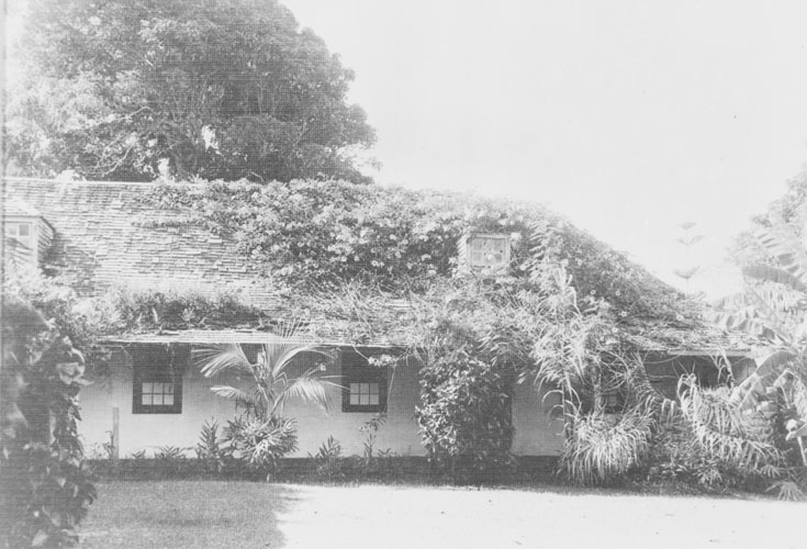
Another Hawaiʻi born grandson Edward Leeds Gulick and his wife Harriet Marie Gulick later settled in Vermont and started the “Aloha Camp” there in 1905. It started as a success and is still going strong today.
“Aloha began as a picnic. Three young couples, one summer day of 1898, were cycling around Lake Morey, seeking the loveliest spot at which to enjoy their lunch, brought from Hanover, NH. At just the very place where all agreed the views were most beautiful, stood a plain, substantial house, with no paint, no blinds, and a porch only big enough for two small chairs.”
“The sign, ‘For Sale; Inquire at the next house,’ fired the imagination, and while Mr. Gulick, ‘just for fun,’ went over to make inquiries, the rest ran around, peeking in at each window, and promptly imagining themselves spending a gay summer in that ideal spot.”
“July 1899 found the Gulicks with a new baby, Harriet, later known to campers as ‘Johnnie, the bugler,’ taking the long ride from New Jersey to their new summer home.”
“The name of the new cottage was a source of lively and humorous discussions. Aloha, meaning ‘Love to you,’ in Hawaiian, was finally chosen, for its euphonious sound, and its kindly meaning. Who better should name this cottage Aloha, than one who was son and grandson of men who had spent their lives in uplifting the natives of those beautiful Islands?”
“For six happy summers Aloha cottage housed the quartette of Gulick children, and their cousins and uncles and aunts and friends, filling it full from the attic down. But just when and how Aloha camp was thought of, it is hard to say.”
“Believing that girls and their parents would soon see the immense advantages of camp life, – the health, the beauty, the sanity, and the wholesome democracy of such a life, – we started bravely in.” (Harriet Farnsworth Gulick)
In 1905 – 15 years before women were allowed to vote, when floor length skirts and lace up boots were mandatory for playing any sport; when popular conduct books for girls encouraged a “retiring delicacy” and declared that “one of the most valuable things you can learn is how to become a good housewife” – Harriet and Edward Gulick created a world in which every girl could discover her most adventurous self.
That world, Aloha Camp on Lake Morey in Fairlee, Vermont, afforded young women the knowledge, skills and freedom to explore wild nature on foot and on horseback, by skiff and by canoe; to kindle campfires in the woods and cook meals in the open air; to pitch tents over rough ground and sleep out of doors under the stars.
“Imagination necessary. The very fabric of human civilization depends on it.” Harriet Farnsworth Gulick wrote these words in a notebook of ideas for assembly talks at Aloha Camp, a camp for girls.
Next, the Gulicks turned their imagination to opportunities for women ‘age eighteen to eighty,’ opening Aloha Club in 1910 on the secluded shore of Lake Katherine in Pike, New Hampshire. The success of Aloha Camp and Aloha Club inspired the Gulicks to imagine how camp could benefit younger girls. Having purchased 400-acres of farmland on Lake Fairlee in Ely, Vermont, they developed Aloha Hive, which opened in 1915.
At the turn of the century (1900,) girls’ camps were rare. Then, the girl camper was about twelve to twenty. She usually came from a home of luxury and enjoyed the novelty of sleeping in tents, the unhampered opportunities for learning to swim, to row, to paddle – in short, to live close to friendly Mother Nature – through eight or nine happy weeks of the camp season. (Coale)
At Aloha Camp, girls received ‘Kanaka’ awards – “The little figure in bloomers is won by a camper whose tent and land adjoining it is perfect as to order and neatness for a week. If to that virtue is added punctuality at all the appointments of a week – meals, assembly, crafts, etc – the girl wins a Kanaka”. (Aloha Kanaka)
Every summer one whole camp has an opportunity to vote for just one girl. It is not the most popular girl; nor the most athletic; nor yet the best-looking. Not any of these. The highest honor the camp has to bestow is given for Camp Spirit – and it goes to the girl who has proved to be the most thoughtful, generous, and kind-in short, the best friend. (Worthington)
After launching Hive, the next question for the Gulick’s imagination was “what about all the little brothers of Aloha and Hive campers?” Far from the military camps that prevailed for boys in those days, they envisioned Camp Lanakila, a camp that promoted a spirit of adventure, discovery, creativeness, respect for others and individual growth.
After Edward Gulick’s death in 1931, Harriet Gulick continued for twenty years as the central, caring presence for all the camps. She passed away in February 1951 at the age of 86. In the mid-1960s, the camps faced a major challenge as members of the Gulick family’s next generation followed pursuits other than the management of Aloha (1905,) Hive (1915) and Lanakila (1922.)
The Aloha Foundation was formed as a nonprofit organization that continues operating the camps and endeavors to sustain the Gulick traditions.
In Hawaiʻi, one of the lasting legacies and reminders of the Gulick family in Hawaiʻi is heard in almost every morning’s Honolulu traffic report with reference to conditions at the Gulick Avenue overpass in Kalihi. (Lots of information here from Aloha Kanaka and Aloha Camp website.)