Shortly after the arrival of Captain James Cook and his crews in 1778, the Chinese found their way to Hawaiʻi. Some suggest Cook’s crew gave information about the “Sandwich Islands” when they stopped in Macao in December 1779, near the end of the third voyage.
As more ships came, crewmen from China were employed as cooks, carpenters and artisans; and Chinese businessmen sailed as passengers to America. Some of these men disembarked in Hawaiʻi and remained as new settlers.
The growth of the Sandalwood trade with the Chinese market (where mainland merchants brought cotton, cloth and other goods for trade with the Hawaiians for their sandalwood – who would then trade the sandalwood in China) opened the eyes and doors to Hawaiʻi. The sandalwood trade lasted for nearly half a century – 1792 to 1843. (Nordyke & Lee)
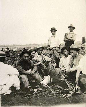
The Chinese pioneered another Hawaiʻi industry – sugar. Starting in the 1850s, when the Hawaiian Legislature passed “An Act for the Governance of Masters and Servants,” a section of which provided the legal basis for contract-labor system, labor shortages were eased by bringing in contract workers from Asia, Europe and North America.
Among the Chinese in the Hawaiian Islands before the importation of sugar labor in 1852, there was a group who settled in Hilo. They were all sugar manufacturers or “sugar masters”; they all married Hawaiian women.
The Chinese names of the men in this group were Hawaiianized; one of them, Zane (or Tseng) Shang Hsien (pronounced In) became known as John Ena. (Chinese ‘Shang’ sounds like John; the last name Ena is pronounced as a long e; he also went by Keoni Ina and a couple other variations of the name.)
John Ena was one of the group of Chinese men who had a sugar plantation and mill on Ponahawai hill; he may have been in Kohala before coming to Hilo.
This early sugar mill was started in 1839 by Lau Fai (AL Hapai,) Zane Shang Hsien (John Ena Sr) and Tang Chow (Akau) along Alenaio stream by today’s Hilo Central Fire Station. Zane Moi (Amoi) had the plantation producing 20,000-lbs of sugar by 1851. But the mill burned down in 1855 and they abandoned the property. (Narimatsu)
In addition to John Ena’s association with the other Chinese in the Ponahawai sugar plantation, he was also associated at various times with Chinese groups in the plantations at Paukaʻa, Pāpaʻikou and Amauʻulu. (Kai)
It is not known how much influence these early sugar plantations had upon the later development of the sugar industry in Hawaiʻi, but it is known that they were the pioneers, struggling with the problems of labor, droughts, fluctuating prices, water supplies, and probably insects, rats and other difficulties that plague the commercial growing of sugar. (Kai)
Sometime before 1842, Ena married Kaikilani “Aliʻi Wahine O Puna;” she is said to be part of the Kamehameha line, going back to Lonoikamakahiki. The Enas had three children: daughters, Amoe Ululani Kapukalakala, born in 1842 (later married to High Chief Levi Haʻalelea and Laura Amoy Kekukapuokekuaokalani, born in 1844 or 1845 (later, Laura Coney.)
An interesting insight into John Ena’s attitude toward the education of his children is noted in a letter written by the Reverend Titus Coan to Dr Charles H Wetmore in 1850, when Dr Wetmore was away from Hilo: “Keoni Ina is anxious to get a strip of land 8 fathoms wide on the makai side of your makai field running from Punahoa Street (formerly Church Street, now Haili) to More’s fence. He says he only wishes to put a dwelling house … (so) that his children may be nearer school.” (Kai)
Dr. Wetmore was apparently not interested in selling this land, but John Ena did get land near to the school. In 1851, he leased almost an acre from a Hawaiian man named Kalakuaioha for twenty years. This was on the Puna side of the present Haili Street, between Kinoʻole and Kilauea Streets. (Kai)
These Chinese settlers were written about by the editor of the Polynesian in 1858 (possibly referring to Amoe Ululani Ena): “In Hilo, I was told, over and over again, the girls of half-Chinese and half-Hawaiian origin were the best educated, the most fluent in the English language, the neatest housewives, and the most likely young ladies. …”
“One young lady of such origin … was married just before I arrived to a chief of considerable wealth, and if all that is said about her is true, he ought to be looking upon himself as one of the happiest and luckiest of men, for besides being possessed of the usual attractions, the bride, they say, is sensible.”
“The gossip in the village Hilo … was that she laid down some most excellent conditions, and only upon receiving a promise that they would be observed, did she consent to renounce her parents care. …”
“But fancy a young country girl, whose world had been the village of Hilo, with an ardent, not to say remarkably well-off lover at her feet, dictating the terms upon which she would consent to become rich, dress handsomely and live in a large house in the metropolis! Ah, John Chinaman, your pains were not thrown away.” (Kai)
A son to John Ena Sr and Kaikilani, John Ena Jr, was born November 18 1845 in Hilo. He is the subject of the rest of this summary.
John Ena Jr worked at various trades until at the age of thirty-four he became a clerk for TR Foster & Co of Honolulu.
This firm owned a fleet of seven schooners plying among the islands and soon acquired its first steamer in 1883 as the Inter-Island Steam Navigation Co, and Ena invested heavily in the stock. He became president of Inter-Island Steam Navigation Co in 1899.
Inter-Island’s ships traveled to Kauai and the Kona and Kaʻū Coasts of the island of Hawai‘i. The Wilder Company served the island of Maui and the windward port of Hilo.
In 1905, Ena merged Inter-Island with the Wilder Company, under the Inter-Island name. (Later, Inter-Island became Inter-Island Airways (1941,) then Hawaiian Airlines (1947.))
Ena was a member of the House of Nobles and the Privy Council under the Kalākaua and Liliʻuokalani and was decorated in 1888 by King Kalākaua.
He served with the Board of Health under the Provisional Government and was a member of the constitutional convention that set up the Republic of Hawaiʻi. He reportedly circulated and published the newspaper Ka Naʻi Aupuni in 1905.
Ena died on December 12, 1906 in Long Beach, California.
When Henry J Kaiser planned and developed his Waikīkī resort in 1954, he and his partner purchased 7.7-acres of Waikīkī beachfront property from the John Ena Estate and several adjoining properties.
In mid-1955 the first increment of what is now the Hilton Hawaiian Village opened for business; the first self-contained visitor resort in Waikīkī. A nearby road, Ena Road, was named after John Ena (Jr.) Image shows John Ena Jr.