Images of Old Hawaiʻi

  • Home
  • About
  • Categories
    • Ali’i / Chiefs / Governance
    • American Protestant Mission
    • Buildings
    • Collections
    • Economy
    • Missionaries / Churches / Religious Buildings
    • General
    • Hawaiian Traditions
    • Other Summaries
    • Mayflower Summaries
    • Mayflower Full Summaries
    • Military
    • Place Names
    • Prominent People
    • Schools
    • Sailing, Shipping & Shipwrecks
    • Voyage of the Thaddeus
  • Collections
  • Contact
  • Follow
You are here: Home / Categories

February 19, 2023 by Peter T Young Leave a Comment

1871 Trail & Alahaka Ramp

“We walked a mile over a raised macadamized road of uniform width; a road paved with flat stones and exhibiting in its every detail a considerable degree of engineering skill.”

“The stones are worn and smooth, and pushed apart in places, so that the road has the exact appearance of those ancient paved highways leading out of Rome which one sees in pictures.” (Mark Twain, Sacramento Daily Union, September 22, 1866)

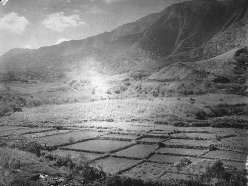
Although the canoe was a principal means of travel in ancient Hawai`i, extensive cross-country trail networks enabled gathering of food and water and harvesting of materials for shelter, clothing, medicine, religious observances and other necessities for survival.

Ancient trails, those developed before western contact in 1778, facilitated trading between upland and coastal villages and communications between ahupua‘a and extended families.

These trails were usually narrow, following the topography of the land. Sometimes, over ‘a‘ā lava, they were paved with water-worn stones.

Alahele (trails) and alaloa (regional thoroughfares) were an integral part of the cultural landscape of South Kona and all Hawai‘i. The alahele provided access for local and regional travel, subsistence activities, cultural and religious purposes, and for communication between extended families and communities. Trails were important features of the cultural landscape.

Historical accounts describe at least two primary trails of regional importance in the South Kona region. One trail crossed the makai (near shore) lands, linking coastal communities and resources together. The other major trail of this region is “Kealaʻehu” (The path of Ehu), which passes through the uplands (in the vicinity of the Mamalahoa Highway.) (Rechtman)

Until the 1840s, overland travel was predominantly by foot and followed the traditional trails. By the 1840s, the use of introduced horses, mules and bullocks for transportation was increasing, and many traditional trails – the ala loa and mauka-makai trails within ahupua‘a – were modified by removing the smooth stepping stones that caused the animals to slip.

Eventually, wider, straighter trails were constructed to accommodate horse drawn carts. Unlike the earlier trails, these later trails could not conform to the natural, sometimes steep, terrain.

It was probably Kuakini, Governor of Hawaiʻi Island from 1819 to 1844, who was very aggressive in building roads with prison labor and took the initiative in modifying trails for horse travel. This often involved throwing out the steppingstones and adding curbstones. (Curbstones enabled animals to follow a path without the rider’s constant guidance.) (NPS)

They often by-passed the traditional trails as more remote coastal villages became depopulated due to introduced diseases and the changing economic and social systems.

By the early-1850s, specific criteria were developed for realigning trails and roadways, including the straightening of alignments and development of causeways and bridges.

“The history of road making in this kingdom does not date far back. The first law that we find recorded was enacted in 1840, which as well as the laws of 1846 and 1850 gave to the Governors a general control of the roads, with power to make new roads and employ prisoners in their construction.”

“But no system of road making has ever been introduced, and the whole subject has been left to be executed as chance dictated. In 1852 road supervisors were made elective by the people, at the annual election in January. This change worked no improvement in the roads, as the road supervisors, in order to remain popular, required the least possible amount of labor, and in many districts an hour or two of work in the morning was considered as a compliance with the road law.”

“Under this law the road supervisors were pretty much to themselves, and though accountable to the Minister of the Interior, they considered favor of their constituents of more importance. This law was found productive of more evil than good, and during the last session of the legislature a new road law was passed, which goes in to force on the 1st of January 1857.”

“This new law gives to the Minister of the Interior the appointment of road supervisors throughout the Kingdom, who are subject to such general instructions (we suppose in regard to the construction of roads) as he may issue.” (Pacific Commercial Advertiser, September 25, 1856)

In 1871, a coastal trail that originally extended from Napoʻopoʻo south to Hoʻokena was repaired, and renamed the 1871 Trail. It is a section of the historic coastal Alaloa (regional trail) and was a primary route of travel between communities, royal centers, religious sites and resources. (It was improved as a ‘two-horse trail’ because it was widened to accommodate two horses.)

The Alahaka Ramp, located near the southern end of the Keanaeʻe Cliffs, is a massive stone ramp that ascends the pali from Keokea into Kiʻilae and connects the 1871 trail to Kiʻilae Village.

It is during this time that a series of large-scale government programs were initiated that focused on improvements to public resources, such as roadways.

It is one of the significant road construction events of this period. Prior to the construction of the ramp, folks used a ladder or rope to get up the slope. Alahaka ramp was built to allow horses to continue on the trail.

The 1871 Trail was used as part of a trade route in Hawaii. Having horses meant that people were able to transport more goods to trade, so it was very important that horses could navigate the trail.

In regards to the Alahaka Ramp, the first reference of a ‘constructed ramp’ is found in a letter to the Minister of the Interior dated February 4, 1868. In this letter, George Hardy, the road supervisor at the time, said:

“In South Kona, I have repaired (a very) bad place known by the name of Alahaka in the village of Kiʻilae, a place of great danger where several horses had been kill’d: and where people were in danger of going up and down. I have made it wide and a substantial road.” (NPS)

As noted in a December 31, 1897 letter, the Alahaka Ramp had fallen into a state of disrepair, when road supervisor TH Wright wrote: “Napoʻopoʻo to Hoʻokena beach road in a fearful condition, it needs repair of the worst kind. The Walahaka pali is very dangerous. This road is used every day for the convenience of the public, going and back to these places.” (NPS)

Wheeled vehicles did not enter Honaunau until 1918; travel in that area continuing to be by horses, mules and donkeys, as well as by foot. Although the area remained somewhat isolated due to the lack of a cart road, better trails continued to be built for mounted traffic.

In 1918 the trail section north of Honaunau was improved for wheeled traffic; however, the section south to Hoʻokena was never modified for motorized vehicles.

In 1951, a large earthquake caused an upper section of the ramp to slough off, which over the next ten years, continued to deteriorate. Twelve years later, the newly established National Park, conducted a rebuilding the entire makai (ocean-facing) side with steel rebar, mortar and stones.

A portion of the 1871 Trail, as well as the Alahaka Ramp are situated within the Puʻuhonua O Honaunau National Historical Park and is available to hike – from Honaunau to Hoʻokena. Two trailheads: at the National Historical Park or Hoʻokena Beach Park. (Round trip is about 6.5-miles.)

© 2022 Hoʻokuleana LLC

1871_Trail-Alahaka_Ramp-NPS
1871 Trail looking north toward the Pu'uhonua, Keanae'e Cliffs to the right
1871 Trail looking north toward the Pu’uhonua, Keanae’e Cliffs to the right
Alahaka Ramp-1871_trail
Alahaka Ramp
Alahaka Ramp
Alahaka Ramp
Alahaka Ramp
1871 Trail
1871 Trail
1871 Trail
1871 Trail
Alahaka Ramp
Alahaka Ramp
Alahaka Ramp
Alahaka Ramp
1871 Trail in 1963
1871 Trail in 1963
NPS Masons stabilize the Alahaka Ramp
Masons repair the Alahaka Ramp-1963
Petrified Niagara
Petrified Niagara
Honaunau_Section_Reg1445-1888
Honaunau_Section_Reg1796-1896
Keei_2-Honaunau-Reg1457

Filed Under: Hawaiian Traditions, Place Names Tagged With: Kona, Puuhonua O Honaunau, Puuhonua O Honaunau National Historical Park, 1871 Trail, Alahaka Ramp, Hawaii

February 18, 2023 by Peter T Young Leave a Comment

Kuāuna

According the research and reporting by noted archaeologists, there were three main technological advances resulting in food production intensification in pre-contact Hawai‘i: (a) walled fishponds, (b) terraced pondfields with their irrigation systems and (c) systematic dry-land field cultivation organized by vegetation zones.

The lo‘i kalo (terraced pondfields), a technological invention by Hawaiian Polynesians, was the development of their extended stone-faced, terraced pondfields (lo‘i) and their accompanying irrigation systems (‘auwai) for the intensive cultivation of wetland taro (kalo.)

“The ground within the lo‘i [was] broken by means of a mattock or ‘ō‘ō. ‘Ō‘ō designates the tool largely used by the natives in cultivation in preference to the implements of modern farmers.”

“The ‘ō‘ō closely resembles in its manner of use the sharpened stick of kauila or other hard wood, used by them previous to their knowledge of iron.  The first metal ‘ō‘ō were blubber spades brought here by the whaling-vessels.”

“The boundaries of a lo‘i depend largely upon the shapes of adjacent lo‘i, and upon the relative positions of the various levels along which the irrigation water is to run.”

“The embankments of the lo‘i are built up of stones and clods of earth. These embankments were commonly known as kuāuna. … Names less frequently used, for the embankments of the lo’i, were ika, kaika and kuaio.”

“In former times the kuāuna between the lo‘i was much wider than at present. They served as a convenient place on which to throw the grass and weeds pulled up from the lo’i until they were wanted as fertilizer.”

“Often sugar-cane, banana plants, or the ki plant, grew luxuriantly on these kuāuna. As kalo land increased in value the kuāuna naturally shrunk in width, and with the advent of the Chinese planter they were often made too narrow to walk upon dry shod. Ho‘ohu meant to run along the bank of a kalo patch.”

“The side or border of an upland kalo field was called iwi. Iwi means a bone, a name applied to the long rows of stones gathered from the mo‘o ‘āina or to a narrow strip of upland to be planted with kalo or potatoes.”

“These iwi always run in the direction of the slope from the sea towards the mountains. As they coincide with the division lines between the fields, the term iwi ‘āina came to mean the boundaries between such lands, and is a term often used in that sense in the descriptions in the Hawaiian language on record in the Land Office.”

“If necessary considerable soil is taken from the lo‘i and put upon the embankments so that the surface of the lo’i will be below the level of the water supply. La‘ola‘o la‘au were the little sticks put down to sustain the kuāuna or bank of the kalo patch.”

“Water is then turned in and is soon soaked up by the broken soil. While the ground is still wet it is dug up or plowed several times. The Hawaiians call this labor mahi-ai. (The Hawaiian Forester and Agriculturist, Volume 11, 1914)

The terraces were irrigated with water brought in ditches (‘auwai) from springs and streams high in the valleys, allowing extensive areas of the valleys to be cultivated.

The irrigation ditches and pondfields were engineered to allow the cool water to circulate among the taro plants and from terrace to terrace, avoiding stagnation and overheating by the sun (which would rot the taro tubers).

An acre of irrigated pondfields produced as much as five times the amount of taro as an acre of dryland cultivation. Over a period of several years, irrigated pondfields could be as much as 10 or 15 times more productive than unirrigated taro gardens, as dryland gardens need to lie fallow for greater lengths of time than irrigated gardens.

In addition, walled pondfields not only produce taro, but were also used to raise an additional source of food, freshwater fish (primarily the Hawaiian goby (‘o‘opu nakea) and certain kinds of shrimp (‘opae)).

Captain George Vancouver visited O‘ahu in 1792 and wrote about the taro gardens in tine Waikīkī-Kapahulu-Mo‘ili‘ili-Manana complex that he observed:

“Our guides led us to the northward through the village [Waikīkī], to an exceedingly well-made causeway, about twelve feet broad, with a ditch on each side.”

“This opened to our view a spacious plain … the major part appeared divided into fields of irregular shape and figure, which were separated from each other by low stone walls, and were in a very high state of cultivation.”

In 1815, the explorer Kotzebue added to these descriptions by writing about the gardens and the artificial ponds that were scattered throughout the area:

“The luxuriant taro-fields, which might be properly called taro-lake, attracted my attention.  Each of these consisted of about one hundred and sixty square feet, forms a regular square, and walled round with stones, like our basins.”

“This field or tank contained two feet of water, in whose slimy bottom the taro was planted, as it only grows in moist places. Each had two sluices. One to receive, and the other to let out, the water into the next field, whence it was carried farther.”

© 2023 Ho‘okuleana LLC

Filed Under: Hawaiian Traditions Tagged With: Kalo, Pondfield, Kuauna, Loi

February 17, 2023 by Peter T Young Leave a Comment

Mauna Loa Boys School

“In 1945 Governor Ingram Stainback requested that Director of Institutions, Thomas B. Vance, concentrate his efforts on developing self-supporting prison industries.”

“With that in mind, Kulani Prison Camp, opened in 1945 as the successor to Waiakea Prison Camp, operated a lumbering enterprise producing logs and milled lumber of native hardwoods as materials to be processed and sold from Oahu Prison’s industrial area.” (Department of Institutions Summary 1939-1958)

The development of Kulani Camp and its means of access, the Stainback Highway, fell under the management of Vance. (Maly)

“Kulani … provided a reservoir of manpower for the construction of public roads on Hawaii …. – roads that would have been economically prohibitive if built under contract.” (Department of Institutions Summary 1939-1958)

Today, Kulani Correctional Facility (KCF) is a 200-bed minimum security prison located on the slope of Mauna Loa, approximately 20 miles south east of Hilo, Big Island of Hawai’i.

In addition to the Kulani Prison Camp, in 1946, they planned the Mauna Loa Boys School. “There is nothing experimental about the boys’ school project. It is to be built four miles from the proposed new prison site”. (Honolulu Advertiser, October 2, 1946)

The plan was to “move delinquent boys from Waialee [on the North Shore of O‘ahu] to Mauna Loa, on Hawai‘i.” (Star-Bulletin, Jan 4, 1947)

In addition, “The purpose of the Mauna Loa camp is to segregate the older juveniles from Koolau where they are an influence on younger delinquents.” (Hawaii Tribune Herald, July 31, 1953)

“Work got under way thus week on Mauna Loa boy’s forestry camp on the Big Island. Because all bids were higher than the territorial department of institutions could afford, prisoners from Kulani project and the boys who will occupy the camp are to finish the work.”

“The camp is five miles north of Kulani Project.” “It is built on the same plan as the new Koolau Boys’ home on Oahu. Forty boys whose ages range from 16 to 19 will be quartered there.” (Star-Bulletin, Oct 5, 1950)

“The Mauna Loa Forestry Camp will open officially tomorrow … ‘I believe that the Mauna Loa Forestry Camp program will quickly evolve into one of the most forward looking steps that the territory has taken in mapping a solution to the problem of youth offenders.’”

“The fourteen young men from Koolau are almost all in the 18 and 19 year old age group. They are a highly selected group of young men who have not only volunteered for the forestry camp assignment but who have insisted on it”.

“‘The plan for the young men to take over the forestry camp at this time,’ Mr. Vance [Director of Public Institutions] said, ‘came about as a result of the Lions trip to the summit of Mauna Loa.’”

“‘Four of the young men from Koolau spent Thursday and Friday nights, at the forestry camp March 20 and 21 and joined the Lions on the Mauna Loa summit trip March 22. They asked their superintendent, Mr. Henry, for a conference with me before the Lions left the mountain summit.’”

“‘The conference was held at the United States weather bureau laboratory atop Mauna Loa. The four young men from Koolau asked for the privilege of completing their own structure at the forestry camp, rather than having Kulani do it for them. They reason that it is their plant.’”

“‘They are not boys; they are young men who are just as capable or heavy construction work as the men at Kulani. Many of the forestry camp’s young men will soon be due for parole or discharge. Before that time, they want to make a constructive contribution to the building of the camp.’”

“‘I was somewhat surprised to find that occupancy of the forestry camp and the initiation of a CCC type of operation represents the realization of a dream to the young men in our training school system just as much as it does to me.’”

“‘When the four Koolau boys’ home visitors to the forestry camp returned to Koolau, they presented their plan to William G Among, superintendent, division of training schools. He and I then conferred and the plan was approved.’”

“‘The fourteen young men at the forestry camp will be housed in the duplex staff apartment of the main structure until they complete their own quarters.’” (Superintendent William Henry, Hawaii Tribune Herald, April 3, 1952)

By 1953 the facility was operational, but legislative appropriations did not make ends meet, “‘We find it impossible to operate Mauna Loa within our budget.’ [William Among, superintendent of the division of training schools] said. “There is an $11 per capita per day expense at Mauna Loa and the legislature has only given $2.60 to meet this.” (Star Bulletin, Sept 8, 1959)

When Territorial House members toured the camp in 1953 they called the project “one of the most expensive and impractical projects ever constructed in the Territory of Hawai‘i”. (DLNR)

“Before it went into full operation there was a change of administrations”. “One man’s dream of a better life for delinquent boys has become an efficiency expert’s nightmare.” “Defenders of the original plan say it was not given a chance.” The camp was closed on October 1, 1953.

However, it was not always rosy when it was operating. “The propensity for escape by these inmates debuted July 19, 1952, when 14 boys walked away from a picnic on Coconut Island and scattered all over Hilo. … It took 25 policemen more than 14 hours to round up the escapee”. There were other escapes.

Likewise, “Inmates at reform schools have a penchant for stealing cars, and those at Mauna Loa Forestry Camp were no exception. On Sept. 17, 1952, three youths stole a panel truck and went for a joy ride up the Stainback Highway …”

On their return, the driver “lost control of the speeding truck. It went off the road and overturned several times.” One of the occupants “was pinned under the wreckage and killed. … [the driver] was later charged with negligent homicide and sentenced to five years in Oahu Prison.” (Warshauer)

“Nobody knows what to do with the Mauna Loa Forestry Camp, rising like a fortress of concrete and steel in a rain-drenched mountain fortress 28 miles from Hilo.” (Star Bulletin, Sept 8, 1959) It was temporarily turned into a warehouse.

Since closure the facility was used intermittently by Kūlani Correctional Facility and by the military for training. (DLNR) “On June 15, 1969, the Division of Forestry and Fish and Game of the state Department of Land and Natural Resources issued a permit to the 29th Infantry for field training. The assaulted the abandoned building June 19-23, 1969, leaving it the wreck it remains today.” (Warshauer)

© 2023 Ho‘okuleana LLC

Filed Under: General, Schools, Economy Tagged With: Hawaii, Hawaii Island, Mauna Loa Boys School, Mauna Loa Forestry Camp

February 16, 2023 by Peter T Young Leave a Comment

Currency Act

The paper money issued by the Massachusetts Bay Colony in 1690 was the first authorized by any government in the Western world.  The Massachusetts Bay Colony financed a military expedition to Canada in 1690 by issuing bills of credit.

Over time, each of the thirteen colonies’ governments had emitted their own currency issues, although Great Britain opposed and tried to suppress them.  Subsequent military campaigns and other expenses by other Colonies were funded with these bills.  In all cases, they were a financial expedient adopted to cover a lack of funds by promising to “pay later.” (American Numismatic Society)

The French and Indian War represented the decisive turning point in British-colonial relations. The Treaty of Paris in 1763 ratified Britain’s undisputed control of the seas and shipping trade, as well as its sovereignty over much of the North American continent east of the Mississippi River, including French Canada.

The British Government had borrowed heavily from British and Dutch bankers to finance the war, and as a consequence the national debt almost doubled from £75 million in 1754 to £133 million in 1763. In order to address this onerous liability, British officials turned to larger import duties on enumerated goods like sugar and tobacco, along with a series of high excise (sales) taxes on goods such as salt, beer, and spirits.

This taxation strategy tended to burden consumers disproportionately. In addition, government bureaucracy expanded in order to collect the needed revenue. As the number of royal officials more than doubled, Parliament delegated new legal and administrative authority to them. Thus, even as British subjects lauded their pre-eminent position in the world, they chafed under the weight of increased debts and tightened government controls.

In 1764, Parliament passed the Currency Act, which banned the use of paper money as legal tender in all colonies. (This effectively took the prohibition of issuance of new bills of credit that had been imposed on New England colonies: Rhode Island, Massachusetts Bay, New Hampshire and Connecticut and extended that prohibition to all of the colonies.)

British merchants had asked for relief from the depreciated currency brought about by deficit financing in Virginia.  It was argued that Parliament sought to control currency depreciation against silver and sterling and to ensure its value for payments of debt to British merchants.   The Act represented an effort to take control of monetary policy from colonial assemblies.

The colonies faced a chronic shortage of hard money, which was being sent across the Atlantic to pay debts in England. To meet the shortage, they resorted to issuing their own paper money. British creditors, however, feared payment in such a depreciated currency.  (JD Lewis)

To protect British merchants and creditors from depreciated colonial currency, this act regulated currency, abolishing the colonies’ paper currency in favor of a system based on the pound sterling.

Effect of the Currency Act

As a result, the colonies suffered a constant shortage of currency with which to conduct trade. There were no gold or silver mines and currency could only be obtained through trade as regulated by Great Britain.

  • The Act banned colonial paper money as legal tender in private transactions.
  • Colonial paper money was accepted for public debt payments such as provincial taxes.
  • It prohibited the extension of paper bills beyond its date of redemption.
  • The Currency Act did not place limits on the amount of paper money in circulation and on the period of redemption.

Opposition to the 1764 Currency Act started immediately. Colonial governments petitioned its repeal as the postwar economic slowdown was being felt in most colonies.

In 1770 Parliament revised the Act and allowed New York to issue bills as legal tender for all types of debt. In 1773 parliament allowed colonial legislatures to print bills to cover costs and to be used as legal tender.

Click to access Currency-Act.pdf

© 2023 Hoʻokuleana LLC

Filed Under: American Revolution Tagged With: American Revolution, Currency Act, America250

February 15, 2023 by Peter T Young Leave a Comment

Dave Guard, Bob Shane and Nick Reynolds

Donald David Guard (October 19, 1934 – March 22, 1991) was born in San Francisco and grew up in Hawai‘i.  Robert Castle Shane (Schoen) (February 1, 1934 – January 26, 2020) was born in Hilo.  Nicholas Wells Reynolds on July 27, 1933 – October 1, 2008) was born in San Diego.

Upon completion of his final year of high school in 1952 at Menlo School, a private prep school in Menlo Park, California, Guard attended nearby Stanford University (graduating in 1957 with a degree in economics).

Shane was born to Margaret (Schaufelberger) and Arthur Castle Schoen, who owned a wholesale business, and whose German family had settled in Hawaii. (Shane was a phonetic spelling of Schoen, adopted by Bob in 1957.)

Shane and Guard were Punahou classmates; they began performing at parties, in the school glee club and school variety shows.

Reynolds was the son of a US Navy Captain; Nick grew up in nearby Coronado, California where he graduated from high school in 1951.

Planning a career in hotel management, Reynolds attended San Diego State College and the University of Arizona. He transferred to Menlo Business College where he met Shane and Guard (from Stanford).

They began performing together at fraternity parties and local beer gardens as Dave Guard and the Calypsonians, sometimes as a trio or occasionally with other friends. At the time, calypso music was extremely popular, and the group played songs like “Jamaica Farwell” and “Come Back, Liza” that Harry Belafonte, the reigning king of calypso, had made popular.

In 1956 Shane graduated and moved back to Hawai‘i to work in his family’s sporting goods business. During that time, he worked up a solo act and got a regular gig at the Pearl City Tavern in Honolulu.

Shane says. “I was billed as Hawaii’s Elvis Presley in 1956, which was the same year he got really popular. It was a great idea because they didn’t have much television in Hawaii yet, so you could do whatever you wanted.”

“I had sideburns and I wore a bright sport coat and stuff like that. And I’ll never forget when I met Elvis in ’63, just briefly, and I told him that’s how I got my start. And he said, ‘What did you want to do that for?’ That’s exactly the way he said it. That’s the only thing I ever said to him.” (Simmons)

While Shane was in Hawai‘i, Reynolds and Guard continued to perform in the Bay Area. They joined up with Menlo College student Joe Gannon and singer Barbara Bogue.

They refashioned themselves as the Kingston Quartet (they maintained their link to calypso music by naming themselves after the capital of Jamaica) and tried to get jobs at various local nightspots; but, they had little success.

The struggling quartet crossed paths with publicist and talent agent Frank Werber, who liked them but felt that Gannon’s bass playing wasn’t good enough. When he suggested he might sign them on if they got rid of Gannon, Bogue said she would leave the group if Gannon was kicked out – so they did, and then she did.

Guard and Reynolds called Bob Shane in Hawai‘i, who was finding life in the family sporting goods business uninspiring. And although he was doing pretty well as a solo performer, he really missed singing in harmony. In March 1957 he came back to California to join the now-renamed Kingston Trio under the management of Frank Werber. (Simmons)

Their close-cropped hair and matching (usually striped) shirts projected a wholesome college-boy image, appealing to television sponsors and to baby boomers reaching their teens.

Most of the songs were led by Shane, whose baritone voice and accomplished guitar accompaniment were essential to the group’s acoustic sound. (Guardian)

In the summer of 1957, comedian Phyllis Diller was forced at the last minute to cancel a weeklong booking at the Purple Onion nightclub, a leading night spot in San Francisco.

Werber, who had an office above the venue, saw this as a perfect opportunity for the new act he had just signed to get some much needed stage experience. He persuaded the Purple Onion to give the slot to his group, the Kingston Trio.

Guard then sent out postcards to 500 people that all three of them knew at Stanford and Menlo, inviting them to a week’s worth of shows at the Purple Onion. The result was a series of sold-out shows. (Eder)

The Kingston Trio was asked to stay on for another week, and then another, and then another. Eventually, their one-week trial booking stretched from June until December.

The group followed the Purple Onion engagement with a national tour that took them to Mr. Kelly’s in Chicago and the Village Vanguard in New York, all of them successful appearances. (Eder)

During that time, word about the Trio’s powerful singing and hilarious stage patter made its way down south to Los Angeles. Various music industry figures, and the occasional movie star, made the trek north to San Francisco to check out what the fuss was all about. Voyle Gilmore, a producer at Capitol records, liked what he heard and signed them to a contract.

In February 1958 the Kingston Trio recorded their first album. (Simmons)  With it, they achieved chart success with the murder ballad Tom Dooley. (The song is based on the true story of Tom Dula, hanged in Statesville, NC in 1868 for the murder of Laura Foster.)  Their rendition reached No 1 in the US singles charts and No 5 in the UK, earning them a Grammy. (Guardian)

On a commercial level, from 1957 until 1963, the Kingston Trio was the most vital and popular folk group in the world, and folk music was sufficiently popular as to make that a significant statement. (Eder)

The Kingston Trio was one of the most critically and commercially successful acts in the American music industry and opened the door for later artists like Bob Dylan and Peter, Paul & Mary. (Menlo College)

Equally important, the original trio,  in tandem with other, similar early acts such as the Limeliters, spearheaded a boom in the popularity of folk music that suddenly made it important to millions of listeners who’d previously ignored it.  (Eder)

In 1959 they performed at both the Newport jazz and folk festivals and recorded four albums, all of which were in Billboard’s Top 10 at the same time.  (Guardian)

The trio made the cover of Life magazine on August 3, 1959, and were voted the Best Group of the Year for 1959 in the pages of both Billboard and Cashbox magazines, the twin recording industry bibles; they also won two Grammy Awards.

By the early-60s, there were lots of Kingston Trio imitators running around: the Highwaymen (from Wesleyan University); Bud & Travis; the Journeymen; the Halifax Three from Canada; and, on the “big-band” folk side, the New Christy Minstrels under Randy Sparks, the Serendipity Singers from the University of Colorado, and the Big 3 (with Cass Elliot) and, later, the Shilos.

For the next few years, the Kingston Trio toured relentlessly, playing on college campuses and in nightclubs across the country.  (Simmons)

The pressure of touring and Guard’s and Shane’s different personalities led to conflict between the two men, and Guard left the group in 1961, to be replaced by John Stewart.  (After leaving the Trio, Guard founded a quartet called the Whiskeyhill Singers.)

Within a few years the American folk music scene had changed, displaying a more political edge, and the Beatles became the new favorites of American teens.

From 1958 to 1964, the Kingston Trio played thousands of shows and had released 19 albums, five of which made it to the top spot on the Billboard charts.  The Beach Boys’ song Sloop John B came from the trio.

The Kingston Trio brought the urban folk revival into the mainstream of American popular culture and made Martin guitars and long-necked banjos must-have items for musicians everywhere. (Simmons)

The trio continued to release albums and enjoy success but Shane failed to change their musical direction to reflect new trends, and they disbanded in 1967. (Guardian)

After a couple of years playing solo, Shane leased and later bought the trio name from the other two members to form the New Kingston Trio, playing past hits and contemporary songs, but without the earlier success.

The reunion gig of the three original members in 1981 was broadcast by PBS in 1982 but plans for further reunions were cancelled when Guard died in 1991. Shane continued to front various lineups of the Kingston Trio until 2004 (when he died). (Guardian)

This era was later recalled and satirized in Christopher Guest’s comedy film A Mighty Wind, in which the Kingston Trio and other collegiate-type folk groups of the period were parodied in the guise of “the Folksmen.” (Eder) There have subsequently been different members in the Kingston Trio – and, it started with a couple guys from Punahou and their friend.

© 2023 Ho‘okuleana LLC

Filed Under: General Tagged With: Nick Reynolds, Calypsonians, Punahou, Kingston Trio, Dave Guard, Bob Shane

  • « Previous Page
  • 1
  • …
  • 221
  • 222
  • 223
  • 224
  • 225
  • …
  • 671
  • Next Page »

Images of Old Hawaiʻi

People, places, and events in Hawaiʻi’s past come alive through text and media in “Images of Old Hawaiʻi.” These posts are informal historic summaries presented for personal, non-commercial, and educational purposes.

Info@Hookuleana.com

Connect with Us

  • Email
  • Facebook
  • LinkedIn
  • Twitter
  • YouTube

Recent Posts

  • About 250 Years Ago … Stars and Stripes, the US Flag (also US Army Birthday)
  • Kaname Yonamine
  • Moon Nights
  • Kamehameha Day
  • The Hawaiian Club
  • Linekona School
  • Kalihi Air Crash

Categories

  • General
  • Ali'i / Chiefs / Governance
  • Buildings
  • Missionaries / Churches / Religious Buildings
  • Hawaiian Traditions
  • Military
  • Place Names
  • Prominent People
  • Schools
  • Sailing, Shipping & Shipwrecks
  • Economy
  • Voyage of the Thaddeus
  • Mayflower Summaries
  • American Revolution

Tags

Albatross Al Capone Ane Keohokalole Archibald Campbell Bernice Pauahi Bishop Charles Reed Bishop Downtown Honolulu Eruption Founder's Day George Patton Great Wall of Kuakini Green Sea Turtle Hawaii Hawaii Island Hermes Hilo Holoikauaua Honolulu Isaac Davis James Robinson Kamae Kamaeokalani Kameeiamoku Kamehameha Schools Lalani Village Lava Flow Lelia Byrd Liberty Ship Liliuokalani Mao Math Mauna Loa Midway Monk Seal Northwestern Hawaiian Islands Oahu Papahanaumokuakea Marine National Monument Pearl Pualani Mossman Quartette Thomas Jaggar Volcano Waikiki Wake Wisdom

Hoʻokuleana LLC

Hoʻokuleana LLC is a Planning and Consulting firm assisting property owners with Land Use Planning efforts, including Environmental Review, Entitlement Process, Permitting, Community Outreach, etc. We are uniquely positioned to assist you in a variety of needs.

Info@Hookuleana.com

Copyright © 2012-2024 Peter T Young, Hoʻokuleana LLC

Loading Comments...