Images of Old Hawaiʻi

  • Home
  • About
  • Categories
    • Ali’i / Chiefs / Governance
    • American Protestant Mission
    • Buildings
    • Collections
    • Economy
    • Missionaries / Churches / Religious Buildings
    • General
    • Hawaiian Traditions
    • Other Summaries
    • Mayflower Summaries
    • Mayflower Full Summaries
    • Military
    • Place Names
    • Prominent People
    • Schools
    • Sailing, Shipping & Shipwrecks
    • Voyage of the Thaddeus
  • Collections
  • Contact
  • Follow

March 15, 2024 by Peter T Young Leave a Comment

Pearl Lochs

The island of Oʻahu is divided into 6 moku (districts), consisting of: ‘Ewa, Kona, Koʻolauloa, Koʻolaupoko, Waialua and Waiʻanae. These moku were further divided into 86 ahupua‘a (land divisions within a moku.)

‘Ewa was divided into 12-ahupua‘a, consisting of (from east to west): Hālawa, ‘Aiea, Kalauao, Waimalu, Waiau, Waimano, Mānana, Waiʻawa, Waipi‘o, Waikele, Hōʻaeʻae and Honouliuli.

‘Ewa was at one time the political center for O‘ahu chiefs. This was probably due to its abundant resources that supported the households of the chiefs, particularly the many fishponds. (Cultural Surveys) ʻEwa was the second most productive taro cultivation area on Oʻahu (just behind Waikīkī.)  (Laimana)

The salient feature of ‘Ewa, and perhaps its most notable point of difference, is its spacious coastal plain, surrounding the deep bays (“lochs”) of Pearl Harbor, which are actually the drowned seaward valleys of ‘Ewa’s main streams, Waikele and VVaipi’o.

The Hawaiian name for Pearl Harbor was Ke-awa-lau-o-Pu‘uloa, The-many (lau)-harbors (awa)-of-Pu‘uloa. Pu‘uloa was the rounded area projecting into the sea at the long narrow entrance of the harbor.  Another and more poetic name was Awawa-lei, Garland (lei)-of-harbors.

The English name ‘Pearl’ was given to it because of the prevalence of pearl oysters (pipi) in the deep harbor waters.  (Handy, Handy & Pukui)

In Hawaiian traditions, Pu‘uloa (Pearl Harbor) consists of three distinct awalau, or lochs, including Kaihuopala‘ai (West Loch), Wai‘awa (Middle Loch) and Komoawa (East Loch).  (Nohopapa, KSBE)  For some time, Pearl Harbor was also known as Pearl Lochs and Pearl River.

These bays offered the most favorable locality in all the Hawaiian Islands for the building of fishponds and fish traps into which deep-sea fish came on the inflow of tidal waters. (Handy, Handy & Pukui)

In Hawaiian traditions, Pu‘uloa (Pearl Harbor) consists of three distinct awalau, or lochs, including Kaihuopala‘ai (West Loch), Wai‘awa (Middle Loch) and Komoawa (East Loch).  (Nohopapa, KSBE) 

‘Loch’ is a Scottish and/or Irish term that refers to a lake or bay that is nearly landlocked. So, when and why did the term ‘loch’ come in as names these awalau?

Let’s look back …

Liholiho was the son of Kamehameha I.  Upon his father’s death Liholiho became Kamehameha II. Liholiho’s reign was also noted for his efforts to ensure the lasting independence of the Hawaiian kingdom.

In 1823, Liholiho and his favorite wife, Kamāmalu, sailed to England to meet with King George IV, the first Ali‘i to travel to England.  King George IV scheduled a meeting for June 21, but it had to be delayed; Liholiho and Kamāmalu became ill.  The Hawaiian court had caught measles, to which they had no immunity.

It is believed they probably contracted the disease on their visit to the Royal Military Asylum (now the Duke of York’s Royal Military School).

Virtually the entire royal party developed measles within weeks of arrival, 7 to 10 days after visiting the Royal Military Asylum housing hundreds of soldiers’ children. On the 8th of July the Queen died, a few days later, King Liholiho died.  His reign was approximately 5-years.

In 1824, Great Britain sent the bodies of Kamehameha II and his Queen back to Hawai‘i on the HMS Blonde, under the command of Lord Byron.

The British Government took advantage of this opportunity to acquire more detailed information concerning the islands; and to that end, included in the personnel of the ship a party of scientists.

Among these was a Lieut. Charles Malden, a surveyor, who during the stay of the ship, made a comprehensive and extensive survey of several harbors and roadsteads (offshore ship mooring areas).

One of these surveys was a fairly complete charting of the whole of Pearl Harbor, with soundings taken throughout the entrance channel and the three main lochs. The chart resulting from this survey was printed in 1841 by the British Hydrographic Office. (Navy)

Today, that map is also identified as Registered Map #437, Honolulu Harbor, South Coast of O‘ahu. (A copy of it is included in the album associated with this post.) It seems others replicated the names of the lochs of that 1825 map in what we now refer to as Pearl Harbor.
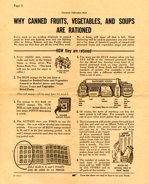
The answer to the previous question of when and why the awalau were called ‘lochs’ comes from the Diary of James Macrae, who was aboard the Blonde and sailed with Malden.  Macrae wrote,

“Pearl River is about seven miles west of Hanarura, and is improperly called a river, being rather inlets from the sea, branching off in different directions.  There are three chief branches, named by the surveyors, the East, Middle and West Lochs.” (Macrae)

While we are familiar with the East, Middle and West Lochs, there were other areas within Pearl Harbor that were also referred to as lochs: Southeast Loch, West Loch Branch and, later, Magazine Loch, Quarry Loch and Merry Loch.

© 2024 Ho‘okuleana LLC

Filed Under: General, Military, Place Names, Sailing, Shipping & Shipwrecks, Economy Tagged With: Lochs, Charles Malden, Awalau, Hawaii, Pearl Harbor, Pearl River, Pearl Lochs

February 7, 2024 by Peter T Young Leave a Comment

Fleet Problem Number 13

It is important to learn from our experiences …

“The aircraft was invented in 1903 and, almost immediately, the military started to look at how to use the technology in combat. But different military branches from different nations moved at different speeds, and many navies considered planes an observation platform and nothing more.”

“In World War I, pilots bombed enemy targets by throwing munitions from their planes, but aerial bombing was still considered a stunt by many, and the U.S. Navy brass was convinced that airplanes weren’t a threat to their capital ships.” (Nye)

“Between the wars, aviation pioneers tried to get the Navy and Army to understand how important planes would be in the next war. Army Gen. William ‘Billy’ Mitchell had some success in 1921 when his men sank the captured German battleship Ostrfriesland in a test.” (Nye)

“[F]rom 1923 to 1940, the Navy ran a series of exercises, collectively called the Navy Fleet Problems, that provided opportunities to test new technology, revise outdated doctrine, prepare for future conflict, and advance a common understanding of naval operations.”

“The fact that the Navy learned lessons in areas such as carrier aviation and submarine tactics with little danger to ships, resources, or personnel made the exercises noteworthy.”

“The Fleet Problems represented a unique period when Admirals, those at the highest level of naval command, critiqued their commanders in an open forum to improve the fleet. Likewise, the commanders, motivated by the same reasons, also felt free to point out institutional deficiencies.” (Sun, US Navy Fleet Problems)

Then … “Lights out, radios silenced, two carriers and their escorts slipped through the night, hiding in squalls and dark clouds. Before dawn, they struck.”

“Fighters snarled across the decks, then scout/attack aircraft, then dive bombers, then torpedo planes. Flashing blue flames, they banked to the southwest toward Oahu. It was a Sunday, and all of Hawaii slept.”

“Below lay Pearl Harbor.”

“The fighters dove first. They demolished aircraft on the ground, knocked out guns and pinned officers and men inside their barracks.”

“Then came the bombers and torpedo planes. They sank every battleship and cruiser in the harbor. ‘Everything went beautifully and according to plan’” an officer wrote afterward. ‘Our squadrons struck their targets shortly after it got light, taking them all by complete surprise.’”

“The date was Sunday, the seventh. But the month was February. And the year was 1932. The attacking carriers were the Saratoga and the Lexington. The fighters were Boeing-built U.S. F-4Bs. And the dive bombers were BM-1s. The sneak attack was commanded by of the U.S. Navy.”

“It was just an exercise.” (LA Times)

“Fleet Problem Number 13 was a mock attack by a ‘militaristic, Asian, island nation against the military base at Pearl Harbor.’”

“The exercise was designed to test Pearl’s defenses and assess its vulnerability to an attack.  The attacking force was under the command of Rear Admiral Harry Yarnell.”

“The admiral was a qualified naval aviator, one of the few admirals to have earned his aviator wings at a time when battleship command was still the path to promotions.”

“In 1927, he took command of the aircraft carrier Saratoga and was instrumental in developing carrier tactics. At the time, carriers were classified as ‘fleet scouting elements.’ They were not valued as capital ships and were considered expendable.”

“Yarnell maintained that Japan ‘had always started operations by attacking before a declaration of war.’ Accordingly, he designed an attack plan that utilized carrier aviation to launch a surprise attack on Pearl Harbor.”

“Pearl’s defenders had anticipated that Yarnell would attack with his battleships. Instead, he left his battleships behind and advanced with the carriers Saratoga and Lexington to a point north-northeast of Hawaii.”

“At dawn, on Sunday February 7, 1932, Yarnell launched his attack with a force of 152 planes from the two carriers. His attack force first attacked the airfields and then proceeded to attack the ships along battleship row.”

“Yarnell achieved total surprise. The airfields were put out of commission, with not a single plane getting airborne during the attack. The attacking force scored multiple hits, they dropped sacks of white flour to simulate bombs, on the battleships.”  (Military-com)

“In 1938, the same wargames were being played again to test Pearl Habor’s defenses. The attacking force was led by Admiral Ernest King, and Admiral Yarnell was working in the background to run the experiment a second time.”

“King took a single aircraft carrier escorted by destroyers to attack Pearl Harbor from the air. Coming in over the Koolau Range, he surprised the military base and won a decisive victory — just as Admiral Yarnell had done so in 1932.”

“As WWII got underway in the Pacific, Japan knew that it could not fend off a full-on assault by the U.S. Navy if the U.S. entered the war. Instead, they needed to launch a pre-emptive strike and hobble the U.S.’s ability to interfere with Japanese operations in the Pacific.”

“Thus, on December 7th, 1941, Japan’s Admiral Yamamoto pulled out the same military plans that Admiral Yarnell used almost 10 years before and launched his own assault on Pearl Harbor. This time, however, his planes would not be carrying ‘flour bombs’ and flares.”

“That Sunday morning, Yamamoto’s planes burst through a wall of clouds over the Koolau Range — and its fighters strafed the U.S. airfields before bombers descended on the island – and only then did the U.S. Navy accept that it should have paid heed to Admirals Yarnell and King when slight embarrassment was the only price it needed to pay.”  (Medium)

“Some think it was distinctly edifying to the Japanese, who [after Yarnell’s decisive exercise] executed what Arthur Radford, a young lieutenant commander and an aide to Yarnell, calls ‘almost a perfect duplicate.’”

“To Americans, however, the exercise was hardly edifying enough. Incredibly, the United States never woke up to the fact that Pearl Harbor–and, therefore, America itself–was vulnerable.”

“In 1932, Radford says, when Yarnell crept up on Hawaii and launched his planes, the exercise was ‘pretty well publicized.’ But Americans paid little attention. The nation was in a seminal transition. Provincial, self-indulgent and distracted by the Great Depression, America was struggling to reawaken to the world.” (LA Times)

© 2024 Ho‘okuleana LLC

Filed Under: Military, Place Names Tagged With: Fleet Problem, Harry Yarnell, Hawaii, Pearl Harbor

December 7, 2023 by Peter T Young 4 Comments

Postcards, Sails, Sheets, Lights, Ads, Fires and Radio Signals

The attack on the US military installation at Pearl Harbor and other parts of Oʻahu by Japan’s Imperial military was one of the most successful surprise attacks in military history.

But an often-overlooked component of the successful attack is that the Japanese Empire had contracted with Bernard Otto Julius Kuehn, a German Nazi, to spy on the American military operations at Pearl Harbor from 1935 (an early ‘sleeper agent’ in espionage.)

The family had been contracted as agents of the Japanese government with the assistance of the Nazi Propaganda Minister Joseph Goebbels. The arrangement was promoted and negotiated by Goebbels as a byproduct of his relationship with Kuehn’s attractive 17-year old daughter, Susie Ruth.  (Washington Times)

The execution of the plan was reminiscent of “one, if by land, and two, if by sea,” the phrase coined by American poet, Henry Wadsworth Longfellow in his poem, Paul Revere’s Ride.

It references the secret signal during Revere’s ride from Boston to Concord on the verge of American Revolutionary War alerting patriots about the route the British troops would take to Concord (two lanterns were shown, the British rowed over to Cambridge.)

The Kuehns arrived in Hawaiʻi in 1935; they started their spying then.  They blended in, and waited.

No one seriously suspected that Caucasians would carry on espionage for the Empire of Japan, so Kuehn, his wife Friedel, their daughter and son, Hans Joachim, were virtually inconspicuous as a white family on the windward side.

Kuehn had houses in Hawaiʻi, lots of money, but no real job. Investigations by the Bureau and the Army, though, never turned up definite proof of spying.  (FBI)

However, every member of the family contributed towards collecting and documenting military activities at Pearl Harbor from 1935 right up to the day the bombs fell from Japanese aircraft.

Paid for his services, in three years he banked more than $70,000; one payment was $14,000 in $100 bills. They had houses in Lanikai and Kailua; these later served as the means of their intricate, yet simple, signaling system.  (Pearl Harbor Board)

The Kuehn family took various means to gather information.

Kuehn would scout the ships at Pearl Harbor.  Daughter Susie Ruth set up a beauty parlor and used it to gather gossip and random information from wives and girlfriends of the military men stationed at Pearl Harbor.  Mother Friedel kept track of all the notes.

Ten-year-old Hans was dressed in a sailor suit and with his father would walk down near the docks.  Many of the sailors thought the little guy was quite cute and some gave him unofficial “tours” of their ships.

Coached by his father, he would ask specific questions and observe everything he saw. Later he would be systematically debriefed by his parents.

The Kuehn family was not working alone; they worked with other Japanese spies attached to the Japanese consulate.

If the Consulate wanted to contact Kuehn, they would send a postcard signed “Jimmie” to his Post Office Box 1476 in Honolulu.  (Pearl Harbor Board)

On December 2, days before the attack, he provided specific – and highly accurate – details on the fleet in writing. That same day, he gave the consulate the set of signals that could be picked up by nearby Japanese submarines.  (FBI)

The set of signals contained eight combinations, each signal represented a number and each number represented the status of the naval fleet at Pearl Harbor.

No. 1 – battle fleet prepared to leave
No. 2 – scouting force prepared to leave
No. 3 – battle fleet left 1 to 3 days ago
No. 4 – scouting fleet left 1 to 3 days ago
No. 5 – air craft carriers left 1 to 3 days ago
No. 6 – battle fleet left 4 to 6 days ago
No. 7 – scout force left 4 to 6 days ago
No. 8 – aircraft carriers left 4 to 6 days ago

Signals were given that represented these respective code numbers.  Part of how they did this was to shine lights out windows and hang sheets on the laundry line.  These were done from their homes in Lanikai and Kailua (using lights in a dormer window.)

One light shining from the window between 7 and 8 pm meant No. 1; one light from 8 to 9 pm meant No. 2 and so forth for Nos. 3 and 4.  Two lights shining from the window from 7 to 8 meant No. 5, etc.  Hanging sheets on the laundry line carried the similar code.

An alternative display of the code used different patterns in the sail of Kuehn’s boat off Lanikai; a sail with/without a star and numbers at different hours represented corresponding references back to the code.

They also arranged the signal through KGMB Want Ads – different advertised items represented different numbers (ie Chinese rug, chicken farm, beauty parlor operator wanted, etc.)

Two other signaling means included garbage fires on a friend’s property on the side of Haleakala on Maui between certain times, representing different code numbers.  Signals were also sent via shortwave radio.  (Pearl Harbor Board)

Following the fateful attack of December 7, 1941, Honolulu Special Agent in Charge Robert Shivers immediately began coordinating homeland security in Hawaiʻi and tasked local police with guarding the Japanese consulate. They found its officials trying to burn reams of paper. These documents – once decoded – included a set of signals for US fleet movements.  (FBI)

All fingers pointed at Kuehn. He had the dormer window, the sailboat and big bank accounts. Kuehn was arrested the next day and confessed, though he denied ever sending coded signals. (FBI)

On February 21, 1942, just 76 days after the tragic attack on Pearl Harbor, a military court in Honolulu found Bernard Otto Julius Kuehn guilty of spying and sentenced to be shot “by musketry” in Honolulu.  His sentence was later commuted to 50 years of hard labor.

He served time in Leavenworth Penitentiary from December 1, 1942 to June 6, 1946 (when his sentence was commuted in order to deport him.)  On December 3, 1948, he was deported to Buenos Aires, Argentina.  (FBI)

Kuehn was one of 91-people convicted of spying against the United States from 1938 to 1945.  (FBI)

© 2023 Hoʻokuleana LLC

20040901-08 PRG SPY HOUSE There are two houses at 557 Kainalu in Kailua that are built very close to each other. This is the two story A fame house that is on the right side of the property. During the late 1930's it served as a den for a German spy who provided intelligence for the Japanese military leading up to the bombing of Pearl Harbor. The present owner, John Piper (225-3555) bought the houses in 1999. PHOTO BY DENNIS ODA. SEPT. 1, 2004. Nikon D2H Focal Length: 13mm White Balance: Direct sunlight Color Mode: Mode I (sRGB) 2004/09/01 12:35:19.1 Exposure Mode: Shutter Priority AF Mode: AF-C Hue Adjustment: 0¡ JPEG (8-bit) Fine Metering Mode: Multi-Pattern Tone Comp.: Auto Sharpening: Auto Image Size: Large (2464 x 1632) 1/250 sec - f/15 Flash Sync Mode: Not Attached Noise Reduction: OFF Exposure Comp.: 0 EV Lens: 12-24mm f/4 G Sensitivity: ISO 200 Image Comment: [#End of Shooting Data Section]
20040901-08 PRG SPY HOUSE There are two houses at 557 Kainalu in Kailua that are built very close to each other. This is the two story A fame house that is on the right side of the property. During the late 1930’s it served as a den for a German spy who provided intelligence for the Japanese military leading up to the bombing of Pearl Harbor. The present owner, John Piper (225-3555) bought the houses in 1999. PHOTO BY DENNIS ODA. SEPT. 1, 2004. Nikon D2H Focal Length: 13mm White Balance: Direct sunlight Color Mode: Mode I (sRGB) 2004/09/01 12:35:19.1 Exposure Mode: Shutter Priority AF Mode: AF-C Hue Adjustment: 0¡ JPEG (8-bit) Fine Metering Mode: Multi-Pattern Tone Comp.: Auto Sharpening: Auto Image Size: Large (2464 x 1632) 1/250 sec – f/15 Flash Sync Mode: Not Attached Noise Reduction: OFF Exposure Comp.: 0 EV Lens: 12-24mm f/4 G Sensitivity: ISO 200 Image Comment: [#End of Shooting Data Section]
Bernard_Julius_Otto_Kuehns_mug_shot_superimposed_over_USS_SHAW_exploding_-_1941
Bernard_Kuehn_mugshot_1941
Bernard_Kuehn-Friedel_Kuehn-(Gettysburg_Times)

Filed Under: Military Tagged With: Bernard Otto Julius Kuehn, Kailua, Lanikai, Hawaii, Oahu, Pearl Harbor, WWII

October 20, 2023 by Peter T Young Leave a Comment

Pearl Harbor Fishponds

During ancient times, various land divisions were used to divide and identify areas of control.  Islands were divided into moku; moku were divided into ahupuaʻa.  A common feature in each ahupuaʻa was water, typically in the form of a stream or spring.

The Island of O’ahu had six Moku: Kona, Koʻolaupoko, Koʻolauloa, Waialua, Waiʻanae and ʻEwa.

‘Ewa was divided into 12-ahupua‘a, consisting of (from east to west): Hālawa, ‘Aiea, Kalauao, Waimalu, Waiau, Waimano, Mānana, Waiʻawa, Waipi‘o, Waikele, Hōʻaeʻae and Honouliuli.

All water sources in each of the twelve ahupuaʻa of ʻEwa met in Puʻuloa.  This was the only moku in all the islands where all waters from its ahupuaʻa did this.

In Hawaiian traditions, Pu‘uloa in ‘Ewa consists of three distinct awalau, or lochs, including Kaihuopala‘ai (West Loch), Wai‘awa (Middle Loch) and Komoawa (East Loch).

In addition to being known for producing high-quality awa (milkfish or mullet), ‘Ewa’s fishponds were also famed for deep-sea fish such as akule (scad varieties), as attested to by the name of one its fishponds (Ka-pa-akule, or “the-akule-enclosure”) in Honouliuli. (KSBE)

Researchers have estimated there were 488 fishponds across the Hawaiian islands prior to contact with westerners. An inventory in 1901 identified 360 fishponds, only 99 of which were active, with an estimated annual production of about 486,000 pounds of ʻamaʻama and 194,000 pounds of awa.

Fishponds disappeared dramatically during the twentieth century. Westernization, development, and changes in land use, especially the spread of invasive mangrove and sediment accumulation from lack of management were the biggest factors, but fishponds were also lost to lava flows and tsunamis. (McDaniel)

“The salient feature of ‘Ewa, and perhaps its most notable point of difference [compared with other districts], is its spacious coastal plain, surrounding the deep bays (“lochs”) of Pearl Harbor, which are actually the drowned seaward valleys of ‘Ewa’s main streams, Waikele and Waipi‘o.”

“The Hawaiian name for Pearl Harbor was Ke-awa-lauo-Pu‘uloa, The-many (lau)-harbors (awa)-of-Pu‘uloa. Pu‘uloa was the rounded area projecting into the sea at the long narrow entrance of the harbor [referring to Waipi‘o peninsula].”

“Another and more poetic name was Awawa-lei, Garland (lei)-of-harbors. The English name “Pearl” was given to it because of the prevalence of pearl oysters (pipi) in the deep harbor waters.”

“These bays offered the most favorable locality in all of the Hawaiian Islands for the building of fishponds and fish traps into which deep-sea fish came on the inflow of tidal waters.” (Handy & Handy, KSBE)

Over the years, Ke Awa Lau O Puʻuloa (Pearl Harbor) has changed dramatically. When the first Westerner, British seafarer Captain James Cook, came to the islands in 1778, a coral reef barred the entrance of the place known as Wai Momi, making it unsuitable as a port for deep-draft shipping. At that time, nearby Honolulu Harbor was an infinitely more hospitable destination.

It wasn’t until 1826 that the US Navy had its first contact with the Hawaiian Islands, when the schooner USS Dolphin sailed into port. After that, it took more than 13 years for the Navy to begin to recognize the potential of Pearl Harbor.

During a routine survey of the area in 1840, an enterprising naval officer determined that the deep inner harbor could be accessed by completely removing the obstructing reef.

As a means of solidifying a site in the central Pacific, the US negotiated an amendment to the Treaty of Reciprocity in 1887.  King Kalākaua in his speech before the opening session of the 1887 Hawaiian Legislature stated (November 3, 1887:)

“I take great pleasure in informing you that the Treaty of Reciprocity with the United States of America has been definitely extended for seven years upon the same terms as those in the original treaty …”

“… with the addition of a clause granting to national vessels of the United States the exclusive privilege of entering Pearl River Harbor and establishing there a coaling and repair station.”

“This has been done after mature deliberation and the interchange between my Government and that of the United States of an interpretation of the said clause …”

“… whereby it is agreed and understood that it does not cede any territory or part with or impair any right of sovereignty or jurisdiction on the part of the Hawaiian Kingdom and that such privilege is coterminous with the treaty.”

“I regard this as one of the most important events of my reign, and I sincerely believe that it will re-establish the commercial progress and prosperity which began with the Reciprocity Treaty.”  (Kalākaua)

Despite gaining exclusive rights to Pearl Harbor in 1887, the US did not make any attempt to take advantage of their claim on this strategic estuary until well after the turn of the century.

It wasn’t until the capture of Manila during the Spanish-American War, when the US needed to establish a permanent way station in the Pacific to maintain control of the Philippines.

Then, for the first time, the American government began to understand the strategic importance of O‘ahu. Annexation soon followed, but even then, little was done to fortify the area or capitalize on the vast potential of Pearl Harbor.

Finally, beginning in 1902, the entry channel was dredged, deepened, and widened to clear an opening at the entrance of the Harbor.  Congress did not officially create a naval base at Pearl Harbor until 1908.  (NPS)

“Cutting the channel through the reef that has for so many years closed Pearl Harbor to navigation, is a task so quietly and withal so speedily done, that half the people of Honolulu have come to think of the great work in that section of the island as a part of the day’s routine.”

“What effect this new harbor will have on the future events of the world no one can exactly forecast. But we do know that this harbor will be a pivotal point about which great incidents of the world’s history will revolve.”

“Pearl Harbor will be the assembling place for great fleets of warships. Let us hope that never during the present century will these fleets be called upon to go forth to battle, but whether they do or not, may they at all times be the barrier of protection for an ever-increasing American influence and an ever-expanding American commerce carried in American merchant ships.”  (Evening Bulletin, December 14, 1911)

“Upon the completion of the dredging operations of Pearl Harbor bar, December 14, 1911, an official entry into the lochs was made by Rear Admiral Thomas in the flagship California, Captain Harlow, and the occasion of joyful recognition of the important event, the end of a great work.”  (Thrum, 1912)

Historical and archaeological studies reveal that more than 20 ancient Hawaiian fishponds once lined the shores of Pearl Harbor. Core samples indicate that many of Pearl Harbor’s fishponds were in use sometime after the 1400s. Others were constructed between the 16th and late 19th centuries.

Unknown elsewhere in Polynesia, shoreline fishponds made of rock or coral walls are considered to be a highly-effective food production invention of the native Hawaiian people.  (Navy)

Traditional accounts indicate several of the fishponds in the Puʻuloa area were believed to have been constructed by Kāne and Kanaloa.  Directing the menehune, they made the pond Kapākule (aka Pākule,) which they stocked with all manner of fish. (Kumupono, Hoakalei)

“On the left side of [Kapākule] pond stood the stone called Hina, which represented a goddess of the sea by that name. Each time the sea ebbed, the rock became gradually visible, vanishing again under water at high tide. Ku, another stone on the right, was never seen above sea level. This stone represented Ku’ula, Red Ku, a god of fish and fishermen. (Pukui)

Two or three of Pearl Harbor’s fishponds remain visible today. The rest generally were filled by agricultural development in the area in the early 1900s, predominantly for sugar cane cultivation.

Loko Oki‘oki‘olepe, near the entrance to West Loch on the west side of the entrance channel, is listed on the National Register of Historic Places.  The pond wall, approximately 1,000 feet long, 4 feet high and 6.5 feet wide, is made of coral chunks and remains relatively intact. It encloses approximately six acres.

A remnant from Loko Pa‘aiau, given a date of between 1327 and 1473 AD based on plant pollen found in sediment core samples, can be seen on the west side of McGrew Point. Two ponds, Loko Kunana and Loko Muliwai, were filled, creating Kuahua Peninsula to the south of where Halawa Stream enters Pearl Harbor.

The largest pond, Loko Hanaloa, on Waipio Peninsula, emptied into West Loch and covered more than 200 acres. Other smaller ponds were in front of Joint Base Pearl Harbor-Hickam’s Boutiki store, at the head of Merry Loch under today’s Ward Field, and at the head of Quarry Loch under today’s Millican Field.  (Navy)

© 2023 Ho‘okuleana LLC

Filed Under: Hawaiian Traditions Tagged With: Hawaii, Pearl Harbor, Fishpond, Puuloa, Ke Awa Lau O Puuloa

October 8, 2023 by Peter T Young Leave a Comment

ʻEwa

Today, you don’t necessarily use the words ʻEwa and Kalo in the same sentence – we tend to think of the ʻEwa district as dry and hot, not as a wetland taro production region.  Some early written descriptions of the place also note the dry ʻEwa Plains.

In 1793, Captain George Vancouver described this area as desolate and barren:  “From the commencement of the high land to the westward of Opooroah (Puʻuloa – Pearl Harbor) was … one barren rocky waste, nearly destitute of verdure, cultivation or inhabitants, with little variation all to the west point of the island. …”

In 1839, Missionary EO Hall described the area between Pearl Harbor and Kalaeloa as follows: “Passing all the villages (after leaving the Pearl River) at one or two of which we stopped, we crossed the barren desolate plain”.  (Robicheaux)

However, not only was ʻEwa productive, its taro was memorable.

Ua ʻai i ke kāī-koi o ‘Ewa.
He has eaten the kāī-koi taro of ‘Ewa.

Kāī is O‘ahu‘s best eating taro; one who has eaten it will always like it. Said of a youth or maiden of ‘Ewa, who, like the Kāī taro, is not easily forgotten.  (ʻŌlelo Noʻeau, 2770, Pukui)

The island of Oʻahu is divided into 6 moku (districts), consisting of: ‘Ewa, Kona, Koʻolauloa, Koʻolaupoko, Waialua and Waiʻanae. These moku were further divided into 86 ahupua‘a (land divisions within a moku.)

‘Ewa was divided into 12-ahupua‘a, consisting of (from east to west): Hālawa, ‘Aiea, Kalauao, Waimalu, Waiau, Waimano, Mānana, Waiʻawa, Waipi‘o, Waikele, Hōʻaeʻae and Honouliuli.

‘Ewa was at one time the political center for O‘ahu chiefs. This was probably due to its abundant resources that supported the households of the chiefs, particularly the many fishponds around the lochs of Puʻuloa (“long hill,) better known today as Pearl Harbor. (Cultural Surveys)  ʻEwa was the second most productive taro cultivation area on Oʻahu (just behind Waikīkī.)  (Laimana)

The salient feature of ‘Ewa, and perhaps its most notable difference, is its spacious coastal plain, surrounding the deep bays (“lochs”) of Pearl Harbor, which are actually the drowned seaward valleys of ‘Ewa’s main streams, Waikele and Waipi‘o…The lowlands, bisected by ample streams, were ideal terrain for the cultivation of irrigated taro.  (Handy, Cultural Surveys)

‘Ewa was known for a special and tasty variety of kalo (taro) called kāī which was native to the district. There were four documented varieties; the kāī ʻulaʻula (red kāī), kāī koi (kāī that pierces), kāī kea or kāī keʻokeʻo (white kāī), and kāī uliuli (dark kāī.)  (Handy)

Handy says about ‘Ewa: “The lowlands, bisected by ample streams, were ideal terrain for the cultivation of irrigated taro. The hinterland consisted of deep valleys running far back into the Koʻolau range.”

“Between the valleys were ridges, with steep sides, but a very gradual increase of altitude. The lower parts of the valley sides were excellent for the culture of yams and bananas. Farther inland grew the ‘awa for which the area was famous.”

“The length or depth of the valleys and the gradual slope of the ridges made the inhabited lowlands much more distant from the wao, or upland jungle, than was the case on the windward coast. Yet the wao here was more extensive, giving greater opportunity to forage for wild foods in famine time. (Handy)

Earlier this century, a few fishermen and some of their families built shanties by the shore where they lived, fished and traded their catch for taro at ‘Ewa. Their drinking water was taken from nearby ponds, and it was so brackish that other people could not stand to drink it.  (Maly)

An 1899 newspaper account says of the kāī koi, “That is the taro that visitors gnaw on and find it so good that they want to live until they die in ‘Ewa. The poi of kai koi is so delicious”. (Ka Loea Kalai ʻĀina 1899, Cultural Surveys) So famous was the kāī variety that ‘Ewa was sometimes affectionately called Kāī o ‘Ewa.

“I think it (wetlands) went all the way behind the Barbers Point beach area. … We’d go swim in the ponds back there, it was pretty deep, about two feet, and the birds were all around. … It seems like when there were storms out on the ocean, we’d see them come into the shore, but they’re not around anymore.”

“The wet land would get bigger when there was a lot of rain, and we had so much fun in there, but now the water has nearly all dried up. They even used to grow wet-land taro in the field behind the elementary school area when I was young. (Arline Wainaha Pu‘ulei Brede-Eaton, Maly Interview)

 ”… Bountiful taro fields covered the plain and countless coconut palms, with several huts in their shade beautified the country side. … The taro fields, the banana plantations, the plantations of sugar cane are immeasurable.” (A Botanist’s Visit to Oahu in 1831, Journal of Dr FJF Meyen, Maly)

“This district, unlike others of the island, is watered by copious and excellent springs that gush out at the foot of the mountains. From these run streams sufficient for working sugar-mills. In consequence of this supply, the district never suffers from drought, and the taro-patches are well supplied with water by the same means.”  (Commander Charles Wilkes, 1840-1841, Maly)

“Rev. Artemas Bishop, in the summer of 1836, removed with his wife and two children from Kailua, Hawaii, to Ewa, Oahu.  … Throughout the district of Ewa the common people were generally well fed. Owing to the decay of population, great breadths of taro marsh had fallen into disuse, and there was a surplus of soil and water for raising food.”  (SE Bishop, The Friend, May 1901)

As in other areas, kalo loʻi converted to rice patties.  “These days at ‘Ewa, the planting of rice is spreading among the Chinese and the Hawaiians, from Hālawa to Honouliuli and beyond. There will come a day when the mother food, taro, shall not be seen on the land.”  (Ka Lahui Hawaii, May 3, 1877, Maly)

Of course, in our discussion of the ʻEwa Moku, we need to remember that it ran from Hālawa to Honouliuli and circled Pearl Harbor.  Much of the watered wetland taro was produced off of streams from the Koʻolau; however, there is considerable mention of the wetland taro of Honouliuli (what we generally refer to today as ʻEwa.)

© 2023 Hoʻokuleana LLC

Filed Under: Place Names, Economy Tagged With: Ewa, Puuloa, Kalauao, Hoaeae, Hawaii, Waimano, Oahu, Waiau, Honouliuli, Manana, Pearl Harbor, Waimalu, Halawa, Waiawa, Waipio, Waikele, Aiea

  • « Previous Page
  • 1
  • 2
  • 3
  • 4
  • 5
  • …
  • 13
  • Next Page »

Images of Old Hawaiʻi

People, places, and events in Hawaiʻi’s past come alive through text and media in “Images of Old Hawaiʻi.” These posts are informal historic summaries presented for personal, non-commercial, and educational purposes.

Info@Hookuleana.com

Connect with Us

  • Email
  • Facebook
  • LinkedIn
  • Twitter
  • YouTube

Recent Posts

  • Lusitana Society
  • “Ownership”
  • ‘Holy Moses’
  • Mikimiki
  • Doubtful Island of the Pacific
  • John Meirs Horner
  • Prostitution

Categories

  • Missionaries / Churches / Religious Buildings
  • Hawaiian Traditions
  • Military
  • Place Names
  • Prominent People
  • Schools
  • Sailing, Shipping & Shipwrecks
  • Economy
  • Voyage of the Thaddeus
  • Mayflower Summaries
  • American Revolution
  • General
  • Ali'i / Chiefs / Governance
  • Buildings

Tags

Albatross Al Capone Ane Keohokalole Archibald Campbell Bernice Pauahi Bishop Charles Reed Bishop Downtown Honolulu Eruption Founder's Day George Patton Great Wall of Kuakini Green Sea Turtle Hawaii Hawaii Island Hermes Hilo Holoikauaua Honolulu Isaac Davis James Robinson Kamae Kamaeokalani Kamanawa Kameeiamoku Kamehameha Schools Lalani Village Lava Flow Lelia Byrd Liliuokalani Mao Math Mauna Loa Midway Monk Seal Northwestern Hawaiian Islands Oahu Papahanaumokuakea Marine National Monument Pearl Pualani Mossman Queen Liliuokalani Thomas Jaggar Volcano Waikiki Wake Wisdom

Hoʻokuleana LLC

Hoʻokuleana LLC is a Planning and Consulting firm assisting property owners with Land Use Planning efforts, including Environmental Review, Entitlement Process, Permitting, Community Outreach, etc. We are uniquely positioned to assist you in a variety of needs.

Info@Hookuleana.com

Copyright © 2012-2024 Peter T Young, Hoʻokuleana LLC


Loading Comments...