Images of Old Hawaiʻi

  • Home
  • About
  • Categories
    • Ali’i / Chiefs / Governance
    • American Protestant Mission
    • Buildings
    • Collections
    • Economy
    • Missionaries / Churches / Religious Buildings
    • General
    • Hawaiian Traditions
    • Other Summaries
    • Mayflower Summaries
    • Mayflower Full Summaries
    • Military
    • Place Names
    • Prominent People
    • Schools
    • Sailing, Shipping & Shipwrecks
    • Voyage of the Thaddeus
  • Collections
  • Contact
  • Follow

June 24, 2022 by Peter T Young 4 Comments

Hawaiʻi Youth Correctional Facility

American and English heritage found those members of society who either cannot care for themselves or who do not fit societal expectations have been the subject of ‘parens patriae’ (parent of the nation,) whereby the state acts as the parent of any child or individual who is in need of protection (i.e., destitute widows, orphans, abused and neglected children and law violators of minority age.)

In 1850, the Kingdom of Hawaiʻi passed its first legislation towards the care and training of Hawaiʻi’s delinquent youth.

Then, the legislature, on December 30, 1864, approved “An act authorizing the board of education to establish an industrial and reformatory school for the care and education of helpless and neglected children, as also for the reformation of juvenile offenders”.

“The only object of the said industrial and reformatory schools shall be the detention, management, education, employment, reformation, and maintenance of such children as shall be committed thereto as orphans, vagrants, truants, living an idle or dissolute life, who shall be duly convicted of any crime or misdemeanor”.  (Hawaiian Commission, Annexation Report, 1898)

In 1864, Kamehameha V created, and placed administratively under the Kingdom’s Board of Education, the Keoneʻula Reformatory School, an industrial and reformatory school for boys and girls in Kapālama.  The first juvenile facility of its kind in the Islands. (The site is now home to the Princess Victoria Kaʻiulani Elementary School on King Street.)

The Board had authority to establish other industrial schools across the Islands. (Jurisdiction shifted from the Board of Education to the Board of Industrial Schools in 1915, then to the Territorial Department of Institutions in 1939.)

The Industrial School model was in response to the belief that segregation in an institutional setting was the most effective way to address the needs of neglected and delinquent youth. Major characteristics of this congregate-care facility included strict regimentation, harsh punishment, unequal treatment for boys and girls, a poor education system and an emphasis on work.

Initially, the board leased nine-acres in Kapālama, initially for 15-boys and 2-girls, and had them grow taro, vegetables and bananas.  In 1903, with the growing population, 75-boys were relocated from Keoneʻula to farmland in Waialeʻe on the North Shore, where wards could learn “habits of industry.”

Farming activities were intended as much to make this facility self-supporting as to provide therapy and training for the wards. Reports about the Waialeʻe institution refer to conditions as always overcrowded.

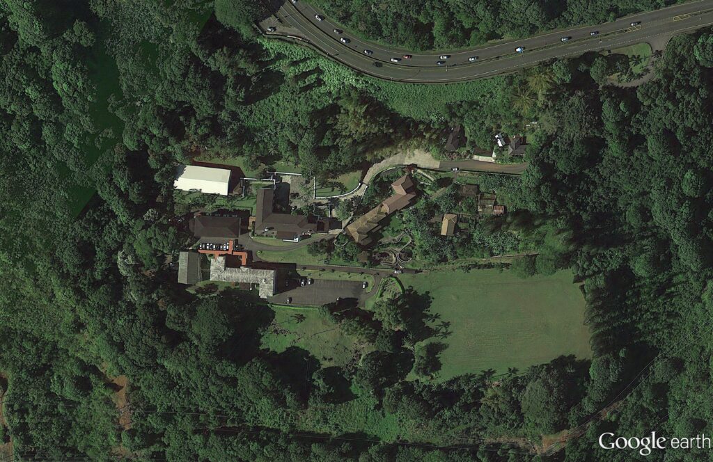
Meanwhile, female wards moved from Kapālama to Mōʻiliʻili, then in the 1920s to the Maunawili Training School on the mauka side of Kalanianaʻole Highway in Kailua, Koʻolaupoko.

The girls’ Maunawili complex included five major buildings sited on approximately 430-acres on the slopes of Olomana.  All the buildings (primarily designed by CW Dickey) were constructed between 1927 and the opening of the school in February 1929, with the exception of the gymnasium which was built in 1938.

According to an early Honolulu Star-Bulletin report, “the buildings are scattered about over the hillside, each different from the other in architectural detail. The effect is pleasing; there is no air of the reform school about the place.”  (NPS)

In 1931, the boys’ facility underwent a name change from Waialeʻe Industrial School to the Waialeʻe Training School for Boys; that year, the girls’ Maunawili complex became known as the Kawailoa Training School.

These were Territorial institutions, in rural Oʻahu, formerly under the Department of Public Instruction but from 1915 were under a Board of Industrial Schools.  (Report of Governor’s Advisory Committee on Crime, 1931)

Delinquent or dependent children under 18 years of age may be committed to these schools by the juvenile courts in proceedings not to be deemed criminal in nature; no child under 14 may be confined in any jail or police station either before, during or after trial, and no child under 18 may be confined with any adult who shall be under arrest, confinement or conviction for any offense.  (Report of Governor’s Advisory Committee on Crime, 1931)

Then, in succeeding decades, various types of facilities and locales were used to house, train and educate the youths.

In 1950, three “cottages” for boys (named, Olomana, Kaʻala and Maunawili) were built on the makai side of Kalanianaʻole Highway from the girls’ Kawailoa Training School in Kailua.  Then, all operations at the Waialeʻe Training School for Boys (111-boys and 45-staff members – the entire population from Waialeʻe) transferred to the new facility and the name changed to the Koʻolau Boys Home.

In 1961, all operations came under a combined administrative unit (including housing both male and female youths) with a new name, the Hawaiʻi Youth Correctional Facility (HYCF,) a branch of the Corrections Division of the reorganized Department of Social Services and Housing.

HYCF is the state’s sole juvenile facility. It’s comprised of two separate facilities with three housing units: two boys’ housing units and a girls’ housing unit (with certain exceptions, HYCF houses boys confined for long terms at the main secure custody facility (“SCF.”)

The SCF is comprised of a central courtyard surrounded by three housing modules, with ten cells and a common area in each module, a school, a gymnasium, kitchen facilities, offices for administrative and medical staff, and two isolation cells.

The Olomana School, Olomana Hale Hoʻomalu and Olomana Youth Center were established since 1985 and provide support services to alienated students throughout the State of Hawaiʻi.

Olomana School (operated by the DOE) offers three main educational programs:  incarcerated youth are served at HYCF; the Olomana Hale Hoʻomalu program is to provide educational and support services to students who are temporarily confined to the juvenile detention facility; and The Olomana Youth Center serves at-risk students from Windward Oahu’s secondary schools and also HYCF students who are in transit.

Due to the pending litigation in 1991 against the State regarding conditions of confinement for women, the temporary Women’s Community Correctional Center (in what was the Koʻolau Boys Home on the makai side of the highway) was remodeled and completed in 1994 as the State’s primary women’s all-custody facility.

Women’s Community Correctional Center (WCCC) is the only women’s prison in Hawaii. It also serves the needs of pre-trial and sentenced female offenders. The facility houses female offenders who are of maximum, medium and minimum custody levels.

The facility is comprised of four (4) structures; Olomana, Kaala, Maunawili and Ahiki Cottages. Every cottage operates in accordance with specific programs and classification levels.  WCCC also offers a 50-bed gender responsive, substance abuse therapeutic community called Ke Alaula.  (Lots of information here from reports from the Auditor, Center on Juvenile and Criminal Justice, Office of Youth Services and NPS.)

© 2022 Hoʻokuleana LLC

Filed Under: General, Schools, Economy Tagged With: Dickey, Women's Community Correctional Center, Hawaii Youth Correctional Facility, Waialee Industrial School, Koolau Boys Home, Maunawili Training School, Hawaii, Oahu, Kailua, Koolaupoko, Kawailoa

March 24, 2022 by Peter T Young Leave a Comment

Olomana

About 6,000 years ago and before the arrival of the Hawaiians, Kawainui (the large [flow of] fresh water) and Ka‘elepulu (the moist blackness) were bays connected to the ocean and extended a mile inland of the present coastline (as indicated by inland deposits of sand and coral.)

A sand bar began forming across Kawainui Bay around 2,500 years ago creating Kawainui Lagoon filled with coral, fish and shellfish.  The Hawaiians probably first settled along the fringes of this lagoon.   Gradually, erosion of the hillsides surrounding Kawainui began to fill in the lagoon with sediments.

About 500 years ago, early Hawaiians maintained a freshwater fishpond in Kawainui; the fishpond was surrounded on all sides by a system of ʻauwai (canals) bringing water from Maunawili Stream (winding/twisted mountain) and springs to walled taro lo‘i (irrigated fields.)

In 1750, Kailua (two seas (probably two currents)) was the Royal Center of power for the district of Koʻolaupoko and a favored place of the O‘ahu chiefs for its abundance of fish and good canoe landings (and probably enjoyed the surf, as well.)  Kawainui was once the largest cultivated freshwater fishpond on Oʻahu.

Farmers grew kalo (taro) in the irrigated lo‘i along the streams from Maunawili and along the edges of the fishponds.  Crops of dryland kalo, banana, sweet potato and sugarcane marked the fringes of the marsh. Fishermen harvested fish from the fishponds and the sea.

In 1845 the first road was built over the Nuʻuanu Pali (cool height – cliff) to connect Windward Oʻahu with Honolulu.  It was jointly financed by the government and sugar planters who wanted easy access to the fertile lands on the windward side of Oʻahu.  Kamehameha III and two of his attendants were the first to cross on horseback.

(In 1898 this road was developed into a highway and was later replaced by the Pali Highway.  When the current Pali Highway and its tunnels opened (1959,) the original roadway was closed and is now used by hikers.)

A story has it that Olomana was a giant and imposing warrior that ruled the area between Makapuʻu and Kualoa, in Windward Oʻahu.

Olomana was famous for his great strength and his enormous height. ʻAhuapau, the king of Oʻahu, was in fear of this man and because of this he never traveled to Koʻolau. From the Makapuʻu point to the Kaʻoio point, at Kualoa, was kapued and sacred to Olomana. (Fornander)

“Olomana was twelve yards, or six fathoms in height, if standing and measured from the head to the feet.“

When Palila arrived at the top of the Nuʻuanu cliff he laid down his club and sped on till he reached Kaʻelepulu, the place where Olomana was standing.

In this flight of the club, Palila seized hold of the end and was carried by it until he lit on the shoulder of Olomana, whereupon Olomana asked Palila: “Where are you from, you most conceited boy? for my shoulder has never been stepped on by anybody, and here you have gone and done it.” (Fornander)

Palila replied: “I am from the kapued temple; from Alanapo in Humuula, Kauai. My name is Palila and I am a soldier.” When Olomana heard this he was afraid and begged of Palila that he be saved.  (Fornander)

Palila, however, refused saying: “You shall not live.”

Palila slayed Olomana by cutting him in half.

Mount Olomana was formed as a result of a sensational battle between Olomana and Palila, a warrior sent by ʻAhuapau, the King of Oʻahu, to slay Olomana.  (KIS)

Part of Olomana became Mount Olomana; the other part of Olomana ended up on the far side of Kawainui as Mahinui, the ridge separating Kāneʻohe from Kawainui, where Kalaheo High School is located.

Olomana (“forked hill”) is actually three peaks; the tallest peak, 1,643-feet high, is named after the legendary giant, Olomana. 

The second flat-topped peak is Pakuʻi at 1,520-feet named after the konohiki for the adjacent fishponds of Ka’elepulu (at what is now generally referred to as  Enchanted Lake)  and the third knife-edged peak is Ahiki at 1,480-feet (nearest Waimānalo) named after the warrior Olomana’s konohiki or overseer responsible for the wetlands of Kawainui.

Geologists note Olomana is a residual ridge, a remnant of the old Koʻolau volcano.   (Other remnants of that volcano include Keolu Hills and the Mokulua Islands.)  (SOEST)

Olomana seems to be a favorite for hikers.  They say it’s for intermediate to expert level hikers.  The trail is approximately 2.5-miles long. The terrain is rugged with many areas only passable with the aid of ropes.

When we lived in Kailua we had a clear view of Olomana; from our house, we could see silhouettes of folks on Olomana’s peak.  Likewise, we regularly saw helicopters hovering over the area, rescuing another of these hikers.

© 2022 Hoʻokuleana LLC

Filed Under: Place Names Tagged With: Hawaii, Oahu, Kailua, Koolaupoko, Maunawili, Kawainui, Olomana

January 30, 2022 by Peter T Young Leave a Comment

Palikū

In 1837, Samuel Northrup Castle arrived in Honolulu as a missionary.  He left Hawaiʻi for a short time, then returned as a businessman for the mission.

With Amos Cooke, he founded Castle & Cooke Company, in 1851 – it grew into being one of Hawaiʻi’s “Big Five” companies.

One of his ten children would surpass him as a businessman; James Bicknell Castle was born November 27, 1855 in Honolulu to Samuel and Mary (Tenney) Castle.

Harold Kainalu Long Castle was born July 3, 1886 in Honolulu, son of wealthy landowner James Bicknell Castle and Julia White, and grandson of Castle & Cooke founder Samuel Northrop Castle.

In 1917, Harold Castle purchased about 9,500-acres of land on the windward side of Oʻahu, in what became Kāneʻohe Ranch.  Later acquisitions added several thousand acres of land, with holdings from Heʻeia to Waimanalo.  The Castle fortune was built on ranching and dairying.

The family had land in Waikīkī, as well; it was formerly called Kalehuawehe. The surf break ‘Castles’ is named after the Castle family’s three-story beachfront home; they called it Kainalu.  They later sold it to the Elks Club, who now use part of the site and lease the rest to the Outrigger Canoe Club.

With the widening and paving of Old Pali Road in 1921 (which helped to initiate the suburban commute across the Koʻolau,) the Castles realized that the Windward side of the island of Oʻahu was a beautiful place to live and could become a vibrant community.  (The Pali Highway and its tunnels opened in 1959.)

In 1927, Harold and his wife Alice Hedemann Castle built a home for themselves that overlooked much of their land holdings.  It was just below the hairpin turn, below the Pali.

They called the home Palikū (Lit., vertical cliff.)

Architect Bertram Grosvenor Goodhue designed it (Goodhue’s other work included Los Angeles Central Public Library, the Nebraska State Capitol and Saint Thomas Church, New York City;) there were 27 rooms with ornamental ironwork, redwood beams, plumbing and electricity – one of the first buildings on the windward side of the island to have those amenities. (Brennan, Honolulu Advertiser)

In 1946, the Castles sold the 22-acre Palikū to the Catholic Church for the Saint Stephen Seminary (the seminary closed in 1970; it’s now the St. Stephen’s Diocesan Center (the driveway is makai, just below the scenic lookout at the hairpin turn.))

St. Stephen’s Seminary was shut down for a time after a mysterious occurrence in October 1946.

Some suggest the seminary was haunted; when one night there were methodical clicking and tapping sounds; invisible pressure on a person in bed; dishes, pots and pans strewn all over – they suggest it was “diabolical obsession.”  Later, “I understand there was some kind of a blessing done,” said Bishop Joseph Ferrario, the retired bishop of Honolulu. (honoluluadvertiser)

After the seminary’s ultimate closure, the facility was transformed into a diocesan center housing various offices of the diocesan curia (a diocesan center (chancery) is the branch of administration which handles all written documents used in the official government of a Roman Catholic diocese.)

The former Castle home also serves as the residence of the Bishop of Honolulu, Clarence Richard Silva, popularly known as Larry Silva (born August 6, 1949), bishop of the Roman Catholic Church. He is the fifth Bishop of Honolulu, appointed by Pope Benedict XVI on May 17, 2005.

In 1962, Castle founded the Harold KL Castle Foundation. On his death in 1967, he bequeathed a sizeable portion of his real estate assets to the Foundation.

Throughout his life, Castle donated land for churches of all different denominations because he felt that churches would bring congregations, congregations would bring stability, and that would benefit the community that was growing around them.

Mr. Castle also donated land and money to Hawaii Loa College, Castle Hospital, ʻIolani School, Castle High School, Kainalu Elementary School and the Mōkapu peninsula land, which would become the Kāneʻohe Marine Corps Base.

His foundation has annually provided millions of dollars in support to worthy causes, a good chunk of it going to the windward side of Oʻahu.

© 2022 Hoʻokuleana LLC

Filed Under: Economy, Buildings, Prominent People Tagged With: Oahu, Kaneohe, Kailua, Kainalu, Harold Castle, Koolaupoko, Kaneohe Ranch, Windward, Mokapu, Paliku, Hawaii, Castle and Cooke

December 12, 2021 by Peter T Young Leave a Comment

Kaiakeakua

Royal Centers were where the aliʻi resided.

The Royal Centers were selected for their abundance of resources and recreation opportunities, with good surfing and canoe-landing sites being favored.

The Hawaiian court was mobile within the districts the aliʻi controlled. A Chief’s attendants might consist of as many as 700 to 1000-followers, made of kahuna and political advisors; servants which included craftsmen, guards, stewards; relatives and others.  (NPS)

Aliʻi often moved between several residences throughout the year.  There was no regular schedule for movement between Royal Centers.  In part, periodic moves served to ensure that district chiefs did not remain isolated, or unsupervised long enough to gather support for a revolt.  (NPS)

For centuries, Kaiakeakua (also spelled Kaiakekua) was a favored place for royalty.

“Perhaps … because it was a place celebrated for the constant appearance of fishes. Sometimes kule, fish that burrow in the sand … for there is sand (at) Kaiakekua …” (John Papa ʻIʻi)

“This sandy stretch, called Kaiakekua was a canoe landing, with some houses mauka of it. … Its fresh water came up from the pāhoehoe and mixed with the water of the sea.”

“It was a gathering place for those who went swimming and a place where the surf rolled in and dashed on land when it was rough. … just makai was a patch of sand facing north, where canoes landed”.  (John Papa ʻIʻi)

“There were chiefs and families of chiefs …(and) … The sands of Kaiakeakua were worn down like a dromedary’s (camel’s) back by the many feet of chiefs and chiefesses tramping over them, and … could be seen at night the sparkle of lights reflected in the sea like diamonds, from the homes of the chiefs…. The number of chiefs and lesser chiefs reached into the thousands”.  (Kamakau)

At about the same time of Christopher Columbus crossing the Atlantic to America (he was looking for an alternate trade route to the East Indies,) ʻUmi-a-Līloa (ʻUmi) moved his Royal Center there.

ʻUmi was famous for his battle with the gods. His wife Piʻikea, had supernatural grandmothers, who were Hapuʻu and Kalaihauola, and who desired to have a grandchild that they might take to Oʻahu to bring up, because the mother of Piʻikea, Laieloheloheikawai, belonged to Oahu.

Laieloheloheikawai sent the supernatural grandmothers to Hawaiʻi to obtain one of Piʻikea’s children. When they arrived in Hawaiʻi ʻUmi refused to permit a child to be taken.  ʻUmi offered to fight the deities at the sandy plains.

However, human beings battle with their hands, clubs and stones, but the gods without hands, and when the battle was fought the gods were victorious over the battle of men. The place is called Kaiakeakua – sea of the god – to this day.  (Fornander)

Lonoikamakahiki ca. 1640-1660 was tested at Kaiakeakua by Kanaloakuaʻana. “I want to be positive of your great skill, hence I have brought you here for that test and to satisfy myself that you are indeed a master.”

“There were about thirty spearmen to throw at the same time. After the men were ready and the spears thrown it was seen that Lonoikamakahiki was not hit by a single one of them.”  The test was continued from 30 spears to 80 spears, and Lonoikamakahiki was not hit.  (Fornander)

Some early writers called this place “Kayakakoua.” Joseph Paul Gaimard, zoologist on a French scientific expedition commanded by Louis de Freycinet during the years 1817-20, speaks of Kayakakoua.

“It is located on the beach and appears to consist of about four hundred houses, if you can apply this term to the smallest of huts which are not more than two or three feet high.”

“There are no streets and the habitations are scattered without any order.  In addition there are three buildings for storing powder and a large storeroom built of stone covered with lime.”

“The dock yards, storehouses and the principal nautical workshops of the king are also located there.  At each end of the town stands a morai (heiau) a simple elevation surrounded by a stake fence and filled with gigantic wooden idols.”

Oh, the name Kaiakeakua has gone out of use … today we simply call this place Kailua (in Kona on the Island of Hawaiʻi.)  The remnant of the once sandy beach of Kaiakeakua sits adjacent to the Kailua Pier – it’s where the Ironman Triathlon World Championship starts each year.

© 2021 Hoʻokuleana LLC


Filed Under: Place Names Tagged With: Royal Center, Kailua, Kailua-Kona, Kaiakeakua, Hawaii, Hawaii Island, Kona

December 1, 2021 by Peter T Young 1 Comment

Kalama Beach Club

Kailua Ahupua‘a is the largest valley on the windward side of O‘ahu, and the largest ahupua‘a of the Koʻolaupoko District.  From the Koʻolau ridge line it extends down two descending ridge lines which provide the natural boundaries for the sides of the ahupua‘a.

When the first Polynesians landed and settled in Hawaiʻi (about 900 to 1000 AD (Kirch) they brought with them shoots, roots, cuttings and seeds of various plants for food, cordage, medicine, fabric, containers, all of life’s vital needs.

“Canoe crops” (Canoe Plants) is a term to describe the group of plants brought to Hawaiʻi by these early Polynesians.  One of these was ‘niu,’ the coconut; they used it for food, cordage, etc.

Later, others saw commercial opportunities from coconuts.

In 1906, Albert and Fred Waterhouse were walking over sand dunes along the approximately one-mile wide by two-and-a-half-mile long area between Kawainui Marsh and the ocean, when they envisioned the idea of planting coconut trees there.

“During the week papers will be filed with the Treasurer for the incorporation of the Hawaiian Copra Co, having lands under (a 29-year) lease from Mr Castle. …”

“(The land) is … two-hundred and fifty acres adapted to the cultivation of cocoanut trees, of which it has twenty thousand, half of which are nearly three feet high and the balance recently planted.”  (Pacific Commercial Advertiser, May 12, 1907)

“The copra is compressed and the extracted oil used in the manufacture of soaps, and as oils in the manufacture of high-grade paints. Another use to which it is put is the manufacture of shredded cocoanut, which is utilized by confectioners and bakers. The fiber is made into hawsers (ropes) for towing purposes.”  (Pacific Commercial Advertiser, May 12, 1907)

They “leveled the sand dunes and smoothed out the sand hillocks,” and planted approximately 320-acres with over 130,000-coconut trees.

Many rows of ironwood trees were also planted as a windbreak and a fence had to be built to keep cattle out.  (Drigot)

Things looked up.

“George A Moore & Co, commission merchants, of San Francisco, see no reason why Hawaiian copra should not compete more than favorably with other South Sea copra in the mainland market.… (He noted,) We beg to call to your attention the large consumption in this market of dried cocoanut, commercially known as copra, which reaches as high as fifteen thousand tons per annum.”

“Cocoanut plantations in the Pacific Islands for the production of copra have now become quite an extensive and profitable venture, and we have no doubt it would prove so to your planters. ” (Peters; Pacific Commercial Advertiser, December 17, 1908)

It didn’t last. … In 1916, the copra/coconut oil enterprise failed.

The Waterhouses sold their “Coconut Grove” to AH Rice, who planned a residential subdivision in the area. In 1924, Earl H Williams, of Liberty Investment Co, acquired 200-acres from Rice and began the subdivision process (the Coconut Grove Tract.)  (Drigot)

In 1925, Harold Kainalu Long Castle opened the first housing tract in Kailua. He named it Kalama in honor of Queen Kalama, wife of Kamehameha III, who had previously owned the land division of Kailua.

The Kalama tract encompasses the area from the Kaneohe side of Ainoni Street to Kaneohe side of Makawao Street, and from the mauka (mountain) side of North Kalaheo to the mauka side of North Kainalu.

The tract was made up of 184 lots, which originally sold for between $1500 and $2500.  The beach fronting the clubhouse has been known since as Kalama Beach.

Castle set aside a large oceanfront parcel for the use of the tract residents as a private beach park. In 1928, a clubhouse and pavilion were built on the property, and it was named the Kalama Beach Club.

The developer, Harold K.L. Castle (1886—1967) and Armstrong, Ltd., donated the Beach Club property and provided the funding for the design and construction of the Club House.  The Club was meant to provide access to the beach for lot owners and as a place to gather.

The property owners were eligible to become members of the Kalama Beach Club once the Club House was completed in 1928.   The original lots were 20,000 square feet and each property owner received a certificate for a one-share interest in the Kalama Community Trust.

Most lots have been subdivided so that there are now approximately 346 parcels with owners that are potential members of the Club. (Kalama Beach Club)

© 2021 Hoʻokuleana LLC

Filed Under: Prominent People, Economy, General, Place Names Tagged With: Kailua, Harold Castle, Coconut Grove, Kailua Beach, Kalama Beach Club, Kalama Tract

  • « Previous Page
  • 1
  • 2
  • 3
  • 4
  • 5
  • 6
  • Next Page »

Images of Old Hawaiʻi

People, places, and events in Hawaiʻi’s past come alive through text and media in “Images of Old Hawaiʻi.” These posts are informal historic summaries presented for personal, non-commercial, and educational purposes.

Info@Hookuleana.com

Connect with Us

  • Email
  • Facebook
  • LinkedIn
  • Twitter
  • YouTube

Recent Posts

  • Walter Murray Gibson Building
  • Hakipuʻu
  • Hilo Coastal Defense
  • Carrollton
  • Merry Christmas!!!
  • Merry Christmas!!!
  • First Christmas Tree

Categories

  • Missionaries / Churches / Religious Buildings
  • Hawaiian Traditions
  • Military
  • Place Names
  • Prominent People
  • Schools
  • Sailing, Shipping & Shipwrecks
  • Economy
  • Voyage of the Thaddeus
  • Mayflower Summaries
  • American Revolution
  • General
  • Ali'i / Chiefs / Governance
  • Buildings

Tags

Albatross Al Capone Ane Keohokalole Archibald Campbell Bernice Pauahi Bishop Charles Reed Bishop Downtown Honolulu Eruption Founder's Day George Patton Great Wall of Kuakini Green Sea Turtle Hawaii Hawaii Island Hermes Hilo Holoikauaua Honolulu Isaac Davis James Robinson Kamae Kamaeokalani Kameeiamoku Kamehameha Schools Lalani Village Lava Flow Lelia Byrd Liberty Ship Liliuokalani Mao Math Mauna Loa Midway Monk Seal Northwestern Hawaiian Islands Oahu Papahanaumokuakea Marine National Monument Pearl Pualani Mossman Quartette Thomas Jaggar Volcano Waikiki Wake Wisdom

Hoʻokuleana LLC

Hoʻokuleana LLC is a Planning and Consulting firm assisting property owners with Land Use Planning efforts, including Environmental Review, Entitlement Process, Permitting, Community Outreach, etc. We are uniquely positioned to assist you in a variety of needs.

Info@Hookuleana.com

Copyright © 2012-2024 Peter T Young, Hoʻokuleana LLC


Loading Comments...