Images of Old Hawaiʻi

  • Home
  • About
  • Categories
    • Ali’i / Chiefs / Governance
    • American Protestant Mission
    • Buildings
    • Collections
    • Economy
    • Missionaries / Churches / Religious Buildings
    • General
    • Hawaiian Traditions
    • Other Summaries
    • Mayflower Summaries
    • Mayflower Full Summaries
    • Military
    • Place Names
    • Prominent People
    • Schools
    • Sailing, Shipping & Shipwrecks
    • Voyage of the Thaddeus
  • Collections
  • Contact
  • Follow

February 7, 2014 by Peter T Young Leave a Comment

Poʻokela Church

The ship Parthian, Captained by Richard D Blinn, sailed from Boston November 3, 1827 and after 148-days at sea, arrived at Honolulu March 30, 1828. On board were 16-missionaries in the Third Company to the Islands.  Among them were Jonathan Smith Green (December 20, 1796 – January 5, 1878) and his wife Theodosia Arnold Green (April 33, 1792 – October 5, 1859.)

The Greens were assigned to Lāhainā on the island of Maui until 1831, then Hilo for one year.  In 1833, they moved to Wailuku, back on Maui, and built one of the first permanent houses there.  The house is now known as the Bailey House, a two-story lava stone structure with 20” thick walls and a high-pitched roof covered with wood shingles.

In 1828, Green was part of a small group of non-Hawaiians to first climb Haleakalā (with Lorrin Andrews and physician Dr. Gerrit P Judd.) They were followed by a US Navy expedition led by Commander Charles Wilkes in 1841, and later, others. Significant public interest was generated by written accounts of these visits that determined that Haleakalā would eventually become a destination for tourism.  (NPS)

Over the years Green served in various roles and supported and helped construct several schools and churches.

The present Kaʻahumanu Church is actually the fourth place of worship for the Wailuku congregation. The original congregation, under the leadership of the Green, was first forced to hold their meetings in a shed.

During its first year, Queen Kaʻahumanu, the Kuhina Nui of the Kingdom and convert to Christianity, visited the congregation and asked that when the congregation built an actual church, it be named for her.  The congregation’s small shed meeting house soon proved too small as the service held there attracted as many as 3,000 worshippers. In 1834, a larger meeting house with a thatched roof was erected by the congregation.

The Central Female Seminary (Wailuku Female Seminary – the first female school begun by the missionaries) opened July 6, 1837, under Green, with six girls, which increased to an average of 30-students. Subsequently, this school moved to Makawao.
Green experimented with growing wheat in Wailuku in 1854.  “Had I engaged in the business of wheat raising with the sole or even chief view of making money, I should not be a little mortified, but greatly so, with my want of success, for I have, thus far, failed to clear any thing.”

“My chief object, however, was to introduce the grain into the country, and persuade in people to cultivate it. In this I have succeeded, and I am more than content.”  (JS Green, The New England Farmer, March 8, 1855)

First known as Makawao Foreign Church and Congregation, Makawao Union Church received a charter from the Hawaiian government in 1861, although Green had been holding services in his Makawao home from 1857.

On February 7, 1843, Green moved to Makawao and helped the Hawaiians in the Makawao area form the first self-supporting church in Hawaiʻi at Poʻokela (foremost, best, superior, prime, outstanding.)

He continued to serve as the pastor of Poʻokela Church, as well as the Makawao Union Church which was started to meet the needs of the English speaking, foreign community around Makawao.

He preached two sermons and conducted Bible studies on Sundays; gave a public lecture on Wednesdays; and held monthly prayer meetings, one for the conversion of the world, one for schools, one for seamen and one for the enslaved.  (Poʻokela Church)

Green’s first wife died October 5, 1859 and on September 5, 1861 he married Asaneth Spring.  In 1878, at the age of 82, Jonathan Green died.  Asenath Green, and daughters Laura and Mary, continued to advise the church.

Mrs Green applied to the Hawaiian Evangelical Associate (HEA) for assistance and ministers were obtained for a time.  From 1885 to 1889, the reverend John Kalama pastored the church.  The following years saw a transition from Hawaiian to English-speaking services.

In 1904, Poʻokela Independent Church gave up its independence and merged with the HEA.  Shortly thereafter, the church fell into disrepair.

“No services have been held at Poʻokela Church during the last five months on account of the dilapidated condition of the roof, part of which was blown away by the storm. Fortunately through the assistance of Maui’s generous friend and the Hawaiian Board, the building was repaired, and once more historic Poʻokela is looking fresh and comfortable, and ready for religious services. These began Sunday, May 5th, with a good old rally meeting.”  (Hawaiian Evangelical Association, 1907)

“The repairs of the historic Poʻokela Church (‘which was fast tumbling to ruins,’) so dear to many former students of the present Maunaolu Seminary, and so closely associated with the life and work of the splendid missionary family, the Greens, are now begun in earnest.”  (The Friend, March 1, 1907)

“The wood of which the ceiling is made is sweet scented and not found in these islands or in the states, and is supposed to have been imported from China about the time that Father Green built this church.”  (Maui News, March 2, 1907)

During WWII, church buildings were converted to classrooms for the primary grades of Makawao School (the US Army took over the school for a military hospital.)  “Aunty” Kalama provided the vision and energy to keep things moving.

Following the war, a reopening of the church took place.  With the changing demographics of the region, the church evolved into a multi-ethnic church.

In 1999, a concrete floor was installed in the church (at a Christmas Eve service, a person’s foot went through the old wooden floor (the carpet saving him from going all the way through.))

A century after its last roof repair, the church needed reroofing, again.  Built without nails, each peg had to be removed individually from the hand-hewn beams in the repair process. The church congregation raised a large tent to accommodate our meetings as well as Sunday services for members and visitors. (2009-2010)  (Lots of information here from Poʻokela Church.)

The image shows Poʻokela Church.  In addition, I have added other images in a folder of like name in the Photos section on my Facebook and Google+ pages.

Follow Peter T Young on Facebook  

Follow Peter T Young on Google+    

© 2014 Hoʻokuleana LLC

Filed Under: Missionaries / Churches / Religious Buildings Tagged With: Hawaii, Haleakala, Maui, Makawao, Pookela Church, Makawao Union Church, Kaahumanu Church, Wailuku Female Seminary, Jonathan Green

February 2, 2014 by Peter T Young 8 Comments

First Foreigners to Find Hawaiʻi

Until recently, it was generally thought that initial Polynesian discovery of Hawai‘i happened around AD 300–750.

However, with significant advances in radiocarbon dating and the targeted re-dating of key Eastern Polynesian and Hawaiian sites has strongly supported and suggested that initial Polynesian discovery and colonization of the Hawaiian Islands occurred between approximately AD 1000 and 1200.  (Kirch)

Later, in the dawn hours of January 18, 1778, on his third expedition, British explorer Captain James Cook on the HMS Resolution and Captain Charles Clerke of the HMS Discovery first sighted what Cook named the Sandwich Islands (that were later named the Hawaiian Islands.)

Cook continued to sail along the coast searching for a suitable anchorage.  His two ships remained offshore, but a few Hawaiians were allowed to come on board on the morning of January 20, before Cook continued on in search of a safe harbor.

On the afternoon of January 20, 1778, Cook anchored his ships near the mouth of the Waimea River on Kauaʻi’s southwestern shore.  After a couple of weeks, there, they headed to the west coast of North America.

Hawaiian lives changed with sudden and lasting impact, when western contact changed the course of history for Hawai‘i.

But, was Cook the first foreigner to find Hawaiʻi?

“Old Spanish charts and a 1613 AD Dutch globe suggest that explorers from Spain had sighted Hawaiʻi long before Captain Cook.  When Cook arrived in 1778, galleons laden with silver from the mines of Mexico and South America had been passing south of Hawaiʻi for two centuries on annual round trip voyages of 17,000 miles between Acapulco and Manila.”  (Kane)

“It seems to be almost certain that one Juan Gaetano, a Spanish navigator, saw Hawaii in 1555 AD. A group of islands, the largest of which was called La Mesa, was laid down in the old Spanish charts in the same latitude as the Hawaiian Islands, but 10 degrees too far east.”  (Hawaiʻi Department of Foreign Affairs, 1896)

There are undoubted proof of finding the Hawaiian Islands by the Spaniard, Juan Gaetano. This is the first known record of the islands among the civilized nations. There are evident references to this group in the legends of the Polynesians in other Pacific islands.  (Westervelt 1923)

La Perouse noted, when he briefly visited the Islands (1786,) “In the charts, at the foot of this archipelago, might be written: ‘Sandwich Islands, surveyed in 1778 by Captain Cook, who named them, anciently discovered by the Spanish navigators.’”  (La Perouse, Fornander)

“By all the documents that have been examined, it is demonstrated that the discovery dates from the year 1555 and that the discoverer was Juan Gaetano or Gaytan. The principal proof is an old manuscript chart, registered in these archives as anonymous, and in which the Sandwich Islands are laid down under that name, but which also contains a note declaring that he called them Islas de Mesa”.  (Spanish Colonial Office letter to the Governor of the Philippines, The Friend May 1927)

“It is true that no document has been found in which Gaytan himself certifies to this fact, but there exist data which collectively form a series of proofs sufficient for believing it to be so. The principal one is an old manuscript chart … in which the Sandwich Islands are laid down under that name…” (The Friend May 1927)

“(H)e called them “Islas de Mesa” (Table Islands.) There are besides, other islands, situated in the same latitude, but 10° further east, and respectively named “La Mesa” (the table), “La Desgraciado” (the unfortunate), “Olloa,” and “Los Monges” (the Monks.)”

Gaetano passed through the northern part of the Pacific and found large islands which he marked upon a chart as “Los Majos.” The great mountains upon these islands did not rise in sharp peaks, but spread out like a high tableland in the clouds, hence he also called the islands “Isles de Mesa,” the Mesa Islands or the Table Lands. One of the islands was named “The Unfortunate.” Three other smaller islands were called “The Monks.”  (Westervelt 1923)

In 1743, English captain George Anson set sail for the Pacific to attack Spanish galleons (English and Spain were at war at the time.)  Overcoming the ‘Nuestra Senora de Covadonga,’ he found a “chart of all the ocean between the Philippines and the coasts of Mexico.”  A cluster of islands were noted in mid-ocean; the island La Mesa is on the same latitude of the Island of Hawaiʻi and its southern contour resembles the southern coastline of Hawaiʻi; however, they are noted east of their actual location.  (Kane)

Until 1744 and the development of the chronometer, determining longitude was an historic problem for navigators.  Longitude (East-West) was estimated by distances a ship covered within various periods of time, estimated by the ship’s speed during each period.  (Kane)

Ship speed was measured with a block of wood attached to a line with knots tied at intervals.  The ‘log’ was cast from the sterns and the number of ‘knots’ run out during a certain time interval enabled the navigator to calculate his speed.  However, this method doesn’t address the west-bound ocean current that would effectively place a position east of its true position.  (Kane)

Fortunately, however, the Spanish made no use of this find, thus permitting the Hawaiians to escape the sad fate of the natives of the Ladrones and Carolines under Spanish dominion.  (White 1898)

Juan Gaetano may not have been the first Spaniard, here.  Stories suggest an earlier arrival of shipwrecked Spaniards at Keʻei, Kona Moku (district,) Island of Hawaiʻi.

There is fairly complete evidence that a Spanish vessel was driven ashore on the island of Hawaii in 1527, it being one of a squadron of three which sailed from the Mexican coast for the East Indies.  (White 1898)

“A well known Hawaiian tradition relates that in the reign of Keliiokaloa, son of Umi, a foreign vessel was wrecked at Keei, South Kona, Hawaii. According to the tradition, only the captain and his sister reached the shore in safety. From their kneeling on the beach and remaining a long time in that posture, the place was called Kulou (to stoop, to bow,) as it is unto this day.”  (Alexander 1892)

“The natives received them kindly and placed food before them. These strangers intermarried with the Hawaiians, and were the progenitors of certain well known families of chiefs, as for instance, that of Kaikioewa, former Governor of Kauai.“  (Alexander 1892)

Jarves expanded on the story, “In the reign of Kealiiokaloa, son of Umi, thirteen generations of kings before Cook’s arrival, which, according to the previous calculation, would bring it near the year 1620, a vessel, called by the natives Konaliloha, arrived at Pale, Keei, on the south side of Kealakeakua bay, Hawaii.”

“Here, by some accident, she was drawn into the surf, and totally wrecked; the captain, Kukanaloa, and a white woman, said to be his sister, were the only persons who reached the land. As soon as they trod upon the beach, either from fear of the inhabitants, or to return thanks for their safety, they prostrated themselves, and remained in that position for a long time. The spot where this took place, is known at the present day, by the appellation of Kulou, to bow down. The shipwrecked strangers were hospitably received, invited to the dwellings of the natives, and food placed before them.”  (Jarves 1843)

The image shows a chart noting the correct location of the Islands and the Table Islands suggested in the Spanish Chart (this was used by La Perouse, who looked for, but did not find the Table Islands.).  In addition, I have included other related images in a folder of like name in the Photos section on my Facebook and Google+ pages.

Follow Peter T Young on Facebook  

Follow Peter T Young on Google+    

© 2014 Hoʻokuleana LLC

Filed Under: General, Sailing, Shipping & Shipwrecks Tagged With: Hawaii, Captain Cook, La Perouse, Spanish, Gaetano, Islas de Mesa

January 29, 2014 by Peter T Young Leave a Comment

Solomon Lehuanui Kalaniomaiheuila Peleioholani

Solomon Lehuanui Kalaniomaiheuila Peleioholani (also called Peleioholani the 4th or Lehuanui, or simply, Peleioholani) (1843-1916) was the son of Peleioholani (uncle to the Kings Kamehameha IV and Kamehameha V) and Piikeakaluaonalani (mother.)

His great grandfather was the high chief Keʻeaumoku (father of Kaʻahumanu,) one of the ablest supporters of Kamehameha I.

Keʻeaumoku distinguished himself in the battle of Mokuʻōhai, (a fight between Kamehameha and Kiwalaʻo in July, 1782 in which Kamehameha won and put the island of Hawaiʻi under his control – this led to his ultimate control of all the islands.)

Keʻeaumoku killed Kiwalaʻo in a hand-to-hand combat; however, Keʻeaumoku’s mamo ʻahuʻula (feather cape) was bloodstained in that fight.  The cape, named “Eheukani” was later passed down through generations to Peleioholani.

Solomon LK Peleioholani, one of the highest surviving Hawaiian chiefs, was the man who stood before Lunalilo when he was crowned King of the Hawaiian Islands, wearing the famous cape, helmet and necklace, and also stood before Kalākaua at his coronation.  (Pacific Commercial Advertiser, January 22, 1902)

Unfortunately, “Eheukani” was later lost and presumed destroyed, along with other chiefly regalia and precious possessions belonging to Solomon LK Peleioholani, during the great Chinatown Fire of 1900.

As a boy, Peleioholani was the protégé of Kamehameha IV and his Queen Emma and the companion of their son Prince Albert (“Ka Haku O Hawaiʻi, “The Lord of Hawaiʻi.”)

During the short life of the little Prince, Peleioholani was his playmate, and both were treated with utmost respect by all they met. During this time, Peleioholani lived at the residence of Kekūanāo’a (hānai father of Bernice Pauahi Bishop.)  (Pacific Commercial Advertiser, January 22, 1902)

After the Prince’s death, Peleioholani traveled; for five years, he made voyages visiting the South Seas, Japan, Manila and the Indian Ocean.  (Pacific Commercial Advertiser, January 22, 1902)

One day, a steamer came into port and Peleioholani was given an opportunity to go with her to Australia. He remained there, became a British subject, drilled with the Australians who were to do service for the Queen in Africa, and he went in a transport to the eastern coast of South Africa, arriving there as a sub-officer.

He was a Hawaiian Chief who fought in Africa.

“Destiny seems to have called him to become a soldier as his ancestors were warriors in the service of Kamehameha I. The blood of brave men flowed through his veins and from his infancy he had heard almost daily the tales of the deeds done by his great grandfather”.  (Pacific Commercial Advertiser, January 22, 1902)

The blacks were on the shore that day, October 22, 1869, when the troops commenced to land. The ships opened fire upon them and attempted to land men in launches. Seven of the latter were disabled.

From one of them Peleioholani was forced to swim back to the ship, carrying nothing but his sword and belt.  He obtained another launch and thus from 2 until 5:30 o’clock in the afternoon the landing went on, the troops finally driving the enemy back.  (Pacific Commercial Advertiser, January 22, 1902)

When they went to England, Queen Victoria (Prince Albert’s godmother) gave Peleioholani a service medal for bravery on the battlefields of Africa.

The Queen asked is nationality. “I told her I was Hawaiian. I told her my great grandfather had accompanied Kamehameha II to England. I told her Kamehameha V was my King.”  (Peleioholani, Pacific Commercial Advertiser, January 22, 1902)

In 1874, he returned to Hawaiʻi and was a well-respected genealogist.  For many, Peleioholani was considered an important Hawaiian antiquarian and the final word in Hawaiian genealogy, especially of the chiefs and royal families.

He also wrote of the Hawaiian history.  One work, ‘The Ancient History of Hookumu-ka-lani Hookumu-ka-honua,’ was a commentary of the ancient Hawaiian cosmogonies (creation theories.)

One of Peleioholani’s theories in that book notes, “The ancestors of the Hawaiian race came not from the islands the South Pacific – for the immigrants from that direction were late arrivals there – but from the northern direction (welau lani,) that is, from the land of Kalonakikeke, now known as Alaska.”

Peleioholani was a High Chief, and in many ways both the pinnacle and terminus of the old royal blood lines from Maui, Oʻahu, Hawaiʻi and Kauaʻi.

His grandparents were among those who sided with Kamehameha I to achieve unity of the islands. His father was an uncle to the Kings Kamehameha IV and Kamehameha V and he was himself one of the highest ranking chiefs in the Hawaiian Islands.  (kekoolani-org)

Besides being a direct lineal descendant of all the last independent ruling kings, he was also descended from what Hawaiian scholar Mary Pukui called the “chiefs of Pōkano,” chiefs of unblemished bloodline from remote times.  (kekoolani-org)

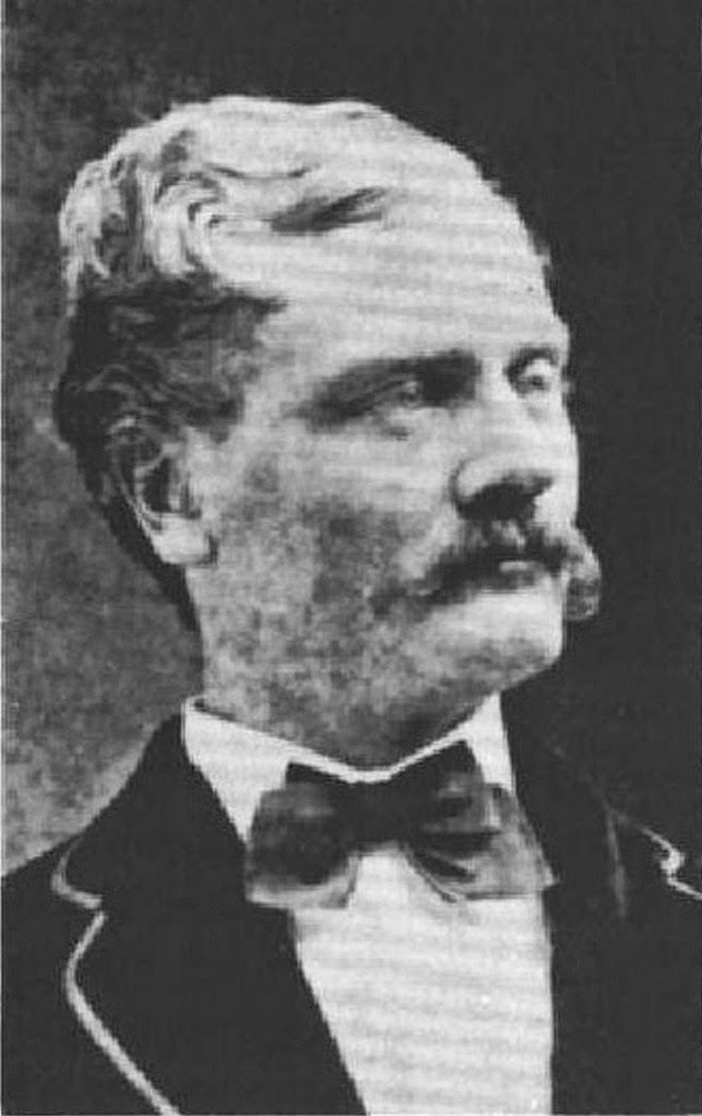
The image shows Solomon LK Peleioholani in 1903 in a holiday pageant costume.  (Lots of information here from Pacific Commercial Advertiser, January 22, 1902 and kekoolani-org.)

© 2014 Hoʻokuleana LLC

Filed Under: Prominent People Tagged With: Kamehameha, Kaahumanu, Keeaumoku, Solomon Lehuanui Kalaniomaiheuila Peleioholani, Prince Albert, Pokano, Peleioholani, Hawaii, Kalonakikeke, Kalakaua, Kekuanaoa, Queen Victoria, Lunalilo

November 28, 2013 by Peter T Young Leave a Comment

Happy Thanksgiving !!!

No one knows when the first western Thanksgiving feast was held in Hawaiʻi, but from all apparent possibilities, the first recorded one took place in Honolulu and was held among the families of the American missionaries from New England.

According to the reported entry in Lowell Smith’s journal on December 6, 1838: “This day has been observed by us missionaries and people of Honolulu as a day of Thanksgiving and praise to Almighty God. Something new for this nation. The people turned out pretty well and they dined in small groups and in a few instances in large groups. We missionaries all dined at Dr. Judd’s and supped at Brother Bingham’s. … An interesting day; seemed like old times – Thanksgiving in the United States.”

The first Thanksgiving Proclamation in Hawaiʻi appears to have been issued on November 23, 1849, and set the 31st day of December as a date of Thanksgiving. This appeared in ‘The Friend’ on December 1, 1849.

The following, under the signature of King Kamehameha III, named a day in December as a day of public thanks. The Thanksgiving Proclamation of 1849 read, in part:

“In accordance with the laws of this Kingdom, and the excellent usage of Christian Nations, it has pleased his Majesty, in council, to appoint the Thirty-first day of December, next, as a day of public thanksgiving to God, for His unnumbered mercies and blessings to this nation; and people of every class are respectfully requested to assemble in their several houses of worship on that day, to render united praise to the Father of nations, and to implore His favor in time to come, upon all who dwell upon these shores, as individuals, as families, and as a nation.”  (Signed at the Palace. Honolulu, November, 23, 1849.)

“It will be seen by Royal Proclamation that Monday, the 31st of December has been appointed by His Majesty in Council as a day of Thanksgiving. We are glad to see this time-honored custom introduced into this Kingdom.”

The celebratory day of Thanksgiving changed over time.  On December 26, 1941 President Roosevelt signed into law a bill making the date of Thanksgiving a matter of federal law, fixing the day as the fourth Thursday of November.

Thanksgiving is a major holiday celebrated in the United States, with origins dating back centuries to Colonial times.

The faith of celebrating a harvest of plenty was a dramatic event in early Colonial America, since food supplies were far from dependable. Years of massive starvation were as common as times of plenty.  Their celebration of Thanksgiving continues today.

Although Native Americans were known to have harvest celebrations for centuries, if not millennia, before arrival of Europeans, the heart of Thanksgiving is a time of sharing the bounty of autumn and celebrating common survival.

The site and date of origin of Thanksgiving are matters of great dispute, with regional claims being made by widely disparate locations in North America. The chief claims are: Saint Augustine, Florida – 1565; Baffin Island, Canada – 1578; Jamestown, Virginia – 1619 and Plymouth, Massachusetts – 1621.

In Hawaiʻi, the Makahiki celebrated the harvest and Lono, the god of fertility and rain. It is similar in timing and purpose to Thanksgiving, Oktoberfest and other harvest celebrations (beginning in late-October or early-November when Makaliʻi (the Pleiades constellation) is first observed rising above the horizon at sunset, the Makahiki period continued for four months.)

Tributes in the form of goods and produce were given to the chiefs.  Success of the harvest was commemorated with prayers of praise made to the Creator, ancestral guardians, caretakers of the elements and various deities – particularly Lono.

The land was allowed to rest and rejuvenate for the next growing season; it was a time of peace.  The image shows Makaliʻi, the Pleiades constellation (NASA-WC.)

Happy Thanksgiving!!!

© 2013 Hoʻokuleana LLC

Filed Under: General Tagged With: Hawaii, Thanksgiving, Makalii, Pleiades

September 26, 2013 by Peter T Young Leave a Comment

Marine Corps Base Hawaiʻi

The US military first established a presence on the Mōkapu peninsula in 1918 when President Woodrow Wilson signed an executive order establishing Fort Kuwaʻaohe Military Reservation on 322-acres on the northeast side of Mōkapu.

The Army stayed there until August 1940 when the Navy decided to acquire all of Mōkapu Peninsula to expand Naval Air Station Kāneʻohe; it included a sea plane base, it began building in September 1939 and commissioned on February 15, 1941.

Between 1939 and 1943, large sections of Kāneʻohe Bay were dredged for the dual purposes of deepening the channel for a sea plane runway and extending the western coastline of the peninsula with 280-acres of coral fill.

As of December 1941, two of five planned, steel hangars had been completed, each measuring 225-feet by 400-feet.

On Sunday morning, December 7, 1941, two waves of Japanese Imperial Navy aircraft bombed and strafed Kāneʻohe Naval Air Station, several minutes before Pearl Harbor was attacked.

Of the 36 PBY Catalina “flying boats” based here, 27 of 33 on the ground or moored in Kāneʻohe Bay were destroyed. Only three planes, out on patrol at the time of the attack, escaped and they suffered air-to-air combat damage.

Following repairs, a 5,700-foot land runway was built and 14-inch guns were brought to be set atop the edge of Ulupaʻu Crater in the seven-story deep “Battery Pennsylvania” as part of the coastal defense of Windward Oʻahu.

One of the 14-inch guns was from the USS Arizona; construction of Battery Pennsylvania was completed in August 1945. The huge gun was fired only once, in celebration, a few days before Japan’s formal surrender on V-J Day, September 2, 1945.  The firing shook and, some said, “cracked” the crater.

In 1941, this reservation became known as Camp Ulupaʻu; a year later it was redesignated as Fort Hase. It was never as permanent as the Navy’s air station side of the peninsula. Historic photos show tents and wooden structures dominating the landscape, even in August 1945. After the war, Fort Hase was rapidly emptied.

After the armistice was signed aboard the USS Missouri in Tokyo Bay on September 2, 1945, thousands of military members of all services began to pass through Pearl Harbor and other military installations in Hawaiʻi, including Kāneʻohe Naval Air Station, bound for discharge on the US Mainland and return to civilian life.

On April 1, 1946, all Kāneʻohe NAS residents and workers were evacuated as nearly 25-foot waves from the Alaska tsunami washed over the peninsula, nearly covering the runway and the Fort Hase areas before rapidly receding back to the sea.

In May of 1949, Kāneʻohe Bay NAS was decommissioned and placed in a maintenance status. All property (except buildings) was transferred to NAS Barbers Point.

The Navy put Mōkapu Peninsula land up for lease, but no interested parties came forward. By June 1950, only a small security detail remained.

The following year, in 1951, the Marine Corps decided that Mōkapu Peninsula would make an excellent home for a combined air-ground team, consolidated all landholdings and, in January 1952, commissioned Marine Corps Air Station Kāneʻohe Bay.

In 1953, the base became the home of the 1st Provisional Marine Air-Ground Task Force.

In 1993, the Navy moved its “Orion” and helicopter squadrons to MCAS, Kāneʻohe Bay from NAS, Barber’s Point, which had been selected for closure under the Base Realignment and Closure Act (BRAC)

In April 1994, the Marine Corps consolidated all of its installations in Hawaiʻi, under a single command — Marine Corps Base Hawaiʻi (MCBH).

Today, MCB Hawaiʻi continues to serve as a fully functional operational and training base for US Marine Corps forces. The Marine Corps Air Station (MCAS) here operates a 7,800-foot runway that can accommodate both fixed wing and rotor-driven aircraft.

Navy and Marine Corps units headquartered at MCB Hawaiʻi Kāneʻohe Bay, include air, ground and combat service support elements; non-operational tenants include a branch health care clinic; a judicial court; a commissary facility; veterinary services; and various Marine Corps schools and academies.

All US military units located in Hawaiʻi, and others within the Pacific theater, fall under the command of the US Pacific Command, which is headquartered – along with US Marine Corps Forces, Pacific – at Camp HM Smith, on Oʻahu.

The Commanding General of MARFORPAC also commands 12 Marine Corps bases and stations in Arizona, California, Hawaiʻi and Japan, and operational forces in Okinawa and Hawaiʻi, afloat on naval shipping and forward-deployed to Southwest Asia. The Commander, MCB Hawaiʻi, is responsible for all Marine Corps installations and facilities in Hawaiʻi.

The image shows Marine Corps Base Hawaiʻi.  In addition, I have added some other images in a folder of like name in the Photos section on my Facebook and Google+ pages.

Follow Peter T Young on Facebook  

Follow Peter T Young on Google+  

© 2013 Hoʻokuleana LLC

Filed Under: Military Tagged With: Fort Hase, Marines, Fort Kuwaaohe, Hawaii, Oahu, Kaneohe Bay, Kaneohe, Marine Corps Base Hawaii, Mokapu

  • « Previous Page
  • 1
  • …
  • 553
  • 554
  • 555
  • 556
  • 557
  • …
  • 567
  • Next Page »

Images of Old Hawaiʻi

People, places, and events in Hawaiʻi’s past come alive through text and media in “Images of Old Hawaiʻi.” These posts are informal historic summaries presented for personal, non-commercial, and educational purposes.

Info@Hookuleana.com

Connect with Us

  • Email
  • Facebook
  • LinkedIn
  • Twitter
  • YouTube

Recent Posts

  • Missionary, Educator … Former Slave
  • Historic Downtown Hilo Walking Tour
  • Memorial Park
  • About 250 Years Ago … King Declares Colonies in Open Rebellion
  • Sybil’s Rocking Chair
  • Overthrow
  • Foodland

Categories

  • Economy
  • Voyage of the Thaddeus
  • Mayflower Summaries
  • American Revolution
  • General
  • Ali'i / Chiefs / Governance
  • Buildings
  • Missionaries / Churches / Religious Buildings
  • Hawaiian Traditions
  • Military
  • Place Names
  • Prominent People
  • Schools
  • Sailing, Shipping & Shipwrecks

Tags

Albatross Al Capone Ane Keohokalole Archibald Campbell Bernice Pauahi Bishop Charles Reed Bishop Downtown Honolulu Eruption Founder's Day George Patton Great Wall of Kuakini Green Sea Turtle Hawaii Hawaii Island Hermes Hilo Holoikauaua Honolulu Isaac Davis James Robinson Kamae Kamaeokalani Kameeiamoku Kamehameha Schools Lalani Village Lava Flow Lelia Byrd Liberty Ship Liliuokalani Mao Math Mauna Loa Midway Monk Seal Northwestern Hawaiian Islands Oahu Papahanaumokuakea Marine National Monument Pearl Pualani Mossman Quartette Thomas Jaggar Volcano Waikiki Wake Wisdom

Hoʻokuleana LLC

Hoʻokuleana LLC is a Planning and Consulting firm assisting property owners with Land Use Planning efforts, including Environmental Review, Entitlement Process, Permitting, Community Outreach, etc. We are uniquely positioned to assist you in a variety of needs.

Info@Hookuleana.com

Copyright © 2012-2024 Peter T Young, Hoʻokuleana LLC