Beginning well before 1600, the North American fur trade was the earliest global economic enterprise. The North American fur trade was a response to declining populations of fur-bearing animals in Western Europe and the cost of purchasing and importing furs from Russia.
Eventually, all of the North American colonies, even the Carolinas, produced some furs for markets in Europe, and there was a lively trade in furs and deer hides out of Louisiana, but the best furs were to be obtained north of the Great Lakes.
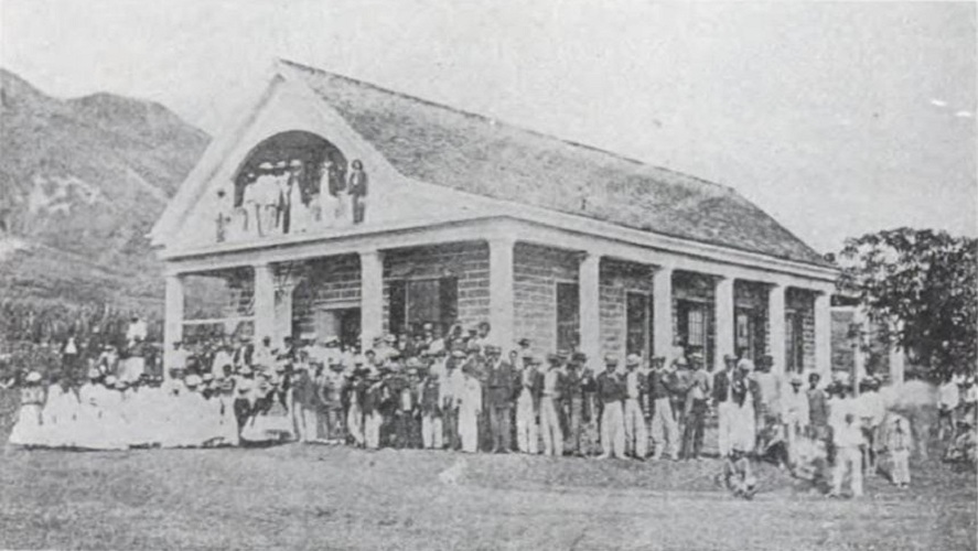
Then, from 1775-1783, war was waging on the eastern side of the continent. The main result was an American victory and European recognition of the independence of the United States.
When US independence closed the colonial trade routes within the British empire, the merchantmen and whalers of New England swarmed around the Horn (around southern Africa), in search of new markets and sources of supply.
Supplying Explorers and Traders
The opening of the China trade was the first and most spectacular result of this enterprise; the establishment of trading relations with Hawai‘i followed shortly.
Within ten years after Captain Cook’s 1778 contact with Hawai‘i, the islands became a favorite port of call in the trade with China. The fur traders and merchant ships crossing the Pacific needed to replenish food supplies and water.
The maritime fur trade focused on acquiring furs of sea otters, seals and other animals from the Pacific Northwest Coast and Alaska. The furs were mostly sold in China in exchange for tea, silks, porcelain and other Chinese goods, which were then sold in Europe and the United States.
Needing supplies in their journey, the traders soon realized they could economically barter for provisions in Hawai‘i; for instance any type of iron, a common nail, chisel or knife, could fetch far more fresh fruit meat and water than a large sum of money would in other ports.
A triangular trade network emerged linking the Pacific Northwest coast, China and the Hawaiian Islands to Britain and the United States (especially New England).
The Hawaiian Islands first entered the international economic scene in the latter-18th century when its ports and favorable climate made the Islands an ideal winter harbor and stopover for merchant ships, whalers and explorers’ vessels who needed to replenish food and water supplies, or make necessary repairs. (Duncan)
Practically every vessel that visited the North Pacific in the closing years of the 18th century stopped at Hawai‘i for refreshment and recreation.
Fur trading on the coast remained profitable from the 1780s into the 1820s, but the successful trade in furs depended entirely on the locale. Some parts of the coast, such as Nootka Sound and Clayoquot Sound, witnessed a complete collapse of the sea otter population after only a decade of intense hunting. (Igler)
Sandalwood
Sandalwood (ʻiliahi) has been highly prized and in great demand through the ages; its use for incense is part of the ritual of Buddhism. Chinese used the fragrant heart wood for incense, medicinal purposes, for architectural details and carved objects.
Sandalwood was first recognized as a commercial product in Hawai‘i in 1791 by Captain Kendrick of the Lady Washington, when he instructed sailors to collect cargo of sandalwood. From that point on, it became a source of wealth in the islands, until its supply was ultimately exhausted.
It was not until the opening years of the 19th that the sandalwood business became a recognized branch of trade. Trade in Hawaiian sandalwood began as early as the 1790s; by 1805 it had become an important export item.
Sandalwood trade was a turning point in Hawai‘i, especially related to its economic structure. It moved Hawai‘i from a self-sufficient economy to a commercial economy. This started a series of other economic and export activities across the islands.
In 1811, an agreement between Boston ship captains and Kamehameha I established a monopoly on sandalwood exports, with Kamehameha receiving 25% of the profits. As trade and shipping brought Hawaiʻi into contact with a wider world, it also enabled the acquisition of Western goods, including arms and ammunition.
Between about 1810 and 1820, the major item of Hawaiian trade was sandalwood. Sandalwood, geography and fresh provisions made the Islands a vital link in a closely articulated trade route between Boston, the Northwest Coast, and Canton, China.
By 1830, the trade in sandalwood had completely collapsed. Hawaiian forests were exhausted and sandalwood from India and other areas in the Pacific drove down the price in China and made the Hawaiian trade unprofitable.
Whaling
From the 16th century through the 19th century, whale oil was used principally as lamp fuel and for producing soap. (Britannica)
The over-fishing of “on shore” New England whales in the 1700s forced local whalers to venture “offshore”, journeying further west in search of their lucrative prey.
The first New England whalers rounded Cape Horn in 1791, and fished off both the Chilean and Peruvian coasts. Many sailed around South America and onward to Japan and the Arctic.
In 1819, the New Bedford whaler Balaena (also called Balena,) and the Nantucket whaler Equator became the first American whalers to visit Hawai‘i. A year later, Captain Joseph Allen discovered large concentrations of sperm whales off the coast of Japan, setting off an exodus of whalers to this area.
These ships might have sought provisions in Japan, except that Japanese ports were closed to foreign ships. So Hawaiian ports became the major ports of call for whalers. (NPS)
When whaling was strong in the Pacific (starting in 1819 and running to 1859,) Hawaiʻi’s central location between America and Japan whaling grounds brought many whaling ships to the Islands. Whalers needed food and the islands supplied this need from its fertile lands.
The whaling industry had a major effect upon Hawaiian commerce and trade. As the Northwest fur trade decreased and sandalwood supplies and values dropped, the whaling industry began to fill the economic void.
Whaling had been “an economic force of awesome proportions in these Islands for more than forty years,” enabling King Kamehameha III to finally pay off the national debts accumulated in earlier years. (NPS)
Sugar
The early Polynesian settlers to Hawaiʻi brought sugar cane with them and demonstrated that it could be grown successfully in the islands; sugar was a canoe crop.
It appears Cook was the first outsider to put sugarcane to use. One of his tools in his fight against scurvy (severe lack of vitamin C (ascorbic acid) in your diet) was beer. Others later made rum from the sugarcane.
But beer and rum were not a typical sugar use. Since it was a crop that produced a choice food product that could be shipped to distant markets, its culture on a field scale was started in about 1800. Hawaiʻi had the basic natural resources needed to grow sugar: land, sun and water.
Hawai‘i’s economy turned toward sugar in the decades between 1860 and 1880; these twenty years were pivotal in building the plantation system.
What encouraged the development of plantations in Hawaiʻi? For one, the gold rush and settlement of California opened a lucrative market. Likewise, the Civil War virtually shut down Louisiana sugar production during the 1860s, enabling Hawai‘i to compete with elevated prices for sugar.
In addition, the Treaty of Reciprocity-1875 between the US and the Kingdom of Hawai‘i eliminated the major trade barrier to Hawai‘i’s closest and major market.
For nearly a century, agriculture was the state’s leading economic activity. It provided Hawai‘i’s major sources of employment, tax revenues and new capital through exports of raw sugar and other farm products. The industry came to maturity by the turn of the century; the industry peaked in the 1930s. (However, a majority of the plantations closed in the 1990s.)
As an economic entity, sugar gradually replaced sandalwood and whaling in the mid‐19th century and became the principal industry in the islands, until it was succeeded by the visitor industry in 1960.
Pineapple
Christopher Columbus brought pineapple, native of South America, back to Europe as one of the exotic prizes of the New World. (‘Pineapple’ was given its English name because of its resemblance to a pine cone.)
Although sugar dominated the Hawaiian economy, there was also great demand at the time for fresh Hawaiian pineapples in San Francisco, and, later, canned pineapple.
The first profitable lot of canned pineapples in Hawai‘i was produced by Dole’s Hawaiian Pineapple Company in 1903 and the industry grew rapidly from there. (Bartholomew)
The demand for canned pineapples grew exponentially in the US and in 1922, a revolutionary period in the history of Hawaiian pineapple; Dole bought the island of Lanai and established a vast 200,000-acre pineapple plantation to meet the growing demands.
Lanai throughout the entire 20th century produced more than 75% of world’s total pineapple. More land on the island of Maui was purchased by Dole.
Then, pineapple production on O‘ahu began a steady decline. In 1991, the Dole Cannery closed. The Dole Plantation tourist attraction, established in 1950 as a small fruit stand but greatly expanded in 1989 serves as a living museum and historical archive of Dole and pineapple in Hawai‘i.
Crossroads of the Pacific
As trade and commerce expanded across the Pacific, numerous countries were looking for faster passage and many looked to Nicaragua and Panama in Central America for possible dredging of a canal as a shorter, safer passage between the two Oceans.
Finally, in 1881, France started construction of a canal through the Panama isthmus. By 1899, after thousands of deaths (primarily due to yellow fever) and millions of dollars, they abandoned the project and sold their interest to the United States.
After Panamanian independence from Columbia in 1903, the US restarted construction of the canal in 1905. “The opening of the canal will increase Hawaii’s importance as a coaling and general calling station.”
“Tremendous new cargoes of supplies that will cross the Pacific, because of the canal, will need shelter and protection at a common port of supply – Honolulu.” (Hawai‘i Historical Review)
In 1912, this strategy and declaration was claimed in an article in ‘Paradise of the Pacific’ that Hawaiʻi was truly deserving of the name, “Crossroads of the Pacific”.
Before the Panama Canal was ‘officially’ opened for commerce (the canal officially opened on August 15, 1914), “The first commercial business handled by the canal was a shipload of sugar from Hawaii.” It was also “the first continuous ocean-to-ocean trip through the Panama Canal by any vessel.”
The first cargo ship passing westward through the Panama Canal to call at Honolulu was the American Hawaiian Steamship Company’s SS Missourian commanded by Captain Wm. Lyons, on September 16, 1914.
Visitor Industry
Hawai‘i’s first accommodations for transients were established sometime after 1810, when Don Francisco de Paula Marin “opened his home and table to visitors on a commercial basis … Closely arranged around the Marin home were the grass houses of his workers and the ‘guest houses’ of the ship captains who boarded with him while their vessels were in port.”
In the late-1890s, with additional steamships to Honolulu, the visitor arrivals to Oʻahu were increasing. When Hawaiʻi became a US territory (June 14, 1900,) it was drawing cruise ship travelers to the islands; they needed a place to stay.
By 1918, Hawai‘i had 8,000 visitors annually, and by the 1920s Matson Navigation Company ships were bringing an increasing number of wealthy visitors. This prompted a massive addition to the Moana. In 1918, two floors were added along with concrete wings on each side, doubling the size of the hotel.
Between 1950 and 1974, domestic and international visitor numbers shot up to more than 2-million from less than 50,000. Statehood and the arrival of jet-liner air travel brought unprecedented expansion and construction, in Waikīkī and across the Islands.
On March 21, 1927, Hawai‘i’s first airport was established in Honolulu and dedicated to Rodgers. 1959 brought two significant actions that shaped the present day make-up of Hawai‘i, (1) Statehood and (2) jet-liner service between the mainland US and Honolulu (Pan American Airways Boeing 707.) The Visitor Industry remains the primary economic force in the Islands.
A total of 10,424,995 visitors came to Hawaii in 2019 (another record number). That’s more than seven times the state’s population. Tourism represents roughly a quarter of Hawai‘i’s economy.
Resident concerns and impacts of COVID have shifted Hawai‘i Tourism Authority’s focus with more emphasis to address tourism’s impacts. This shift recognizes the need for tourism to provide both a quality visitor experience and enhanced quality of life for Hawai‘i residents.
Plans now call for re-balancing attention from mainly marketing to greater emphasis on ‘destination management’ and support for culture, community and multicultural programs, and natural resources. (HTA Strategic Plan)
Click HERE for an expanded discussion on Hawai‘i and its role in the global economy.