Images of Old Hawaiʻi

  • Home
  • About
  • Categories
    • Ali’i / Chiefs / Governance
    • American Protestant Mission
    • Buildings
    • Collections
    • Economy
    • Missionaries / Churches / Religious Buildings
    • General
    • Hawaiian Traditions
    • Other Summaries
    • Mayflower Summaries
    • Mayflower Full Summaries
    • Military
    • Place Names
    • Prominent People
    • Schools
    • Sailing, Shipping & Shipwrecks
    • Voyage of the Thaddeus
  • Collections
  • Contact
  • Follow

January 18, 2026 by Peter T Young Leave a Comment

Gilberts and Marshalls

“During more than a century and a half (1606-1762), the South Pacific was almost empty of ships. Europeans preferred to trade with the Far East by way of the Cape of Good Hope. … Interest in the broad reaches of the Pacific revived after 1762.”

“Twenty years elapsed, in which important discoveries were made in the South Pacific by three French navigators, Bougainville, La Perouse and D’Entrecasteaux, and by the great Captain James Cook. …” (Morison, Life, May 22, 1955)

“Europeans’ knowledge of the central Pacific developed most rapidly after the establishment of a penal colony at Botany Bay [Australia], and the adoption of the ‘outer passage’ for the return voyage to Europe via Canton.”  (Macdonald)

“Then came two obscure English seamen, not otherwise known to fame, who have left their names, probably for all time, on the Gilberts and Marshalls.”

“William Marshall was master of the Scarborough, and Thomas Gilbert of the Charlotte. Both sailed from England as part of the convoy under Captain Arthur Phillip, RN, first governor of New South Wales, which brought the first convict settlement to Australia.”

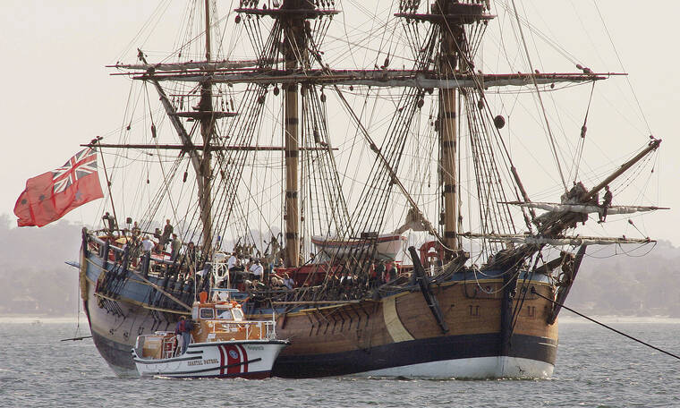
“Their vessels, the Charlotte and Scarborough, were English merchant ships chartered by the Honourable the East India Company to take 334 convicts with a Royal Marine guard, and the marines wives, to Botany Bay, Australia, and thence to Canton in order to load tea for England.  The convoy arrived at Botany Bay Jan. 18, 1788.” (Morison, Life, May 22, 1955)

“With their prisoners discharged and their holds empty, the ships of the First Fleet disbanded and struck north for Canton to pick up cargoes of oriental goods for the return voyage to England a practice that came  to be followed by most British convict vessels in succeeding years.” (Hezel)

Two of the more enterprising captains, Gilbert and Marshall, after discharging their unwilling passengers at Botany Bay, viewing the foundation of Sydney, and taking in wood, water, jerked kangaroo meat and such other provisions as aboriginal Australia afforded, sailed for Canton on May 6, 1788. (Hezel and Morison)

They “brought their ships well around to the east on a course that took them through the archipelagoes that now bear their names.”  (Hezel)

Gilbert was the first European to name and describe what is now Kiribati, arriving on June 20, 1788: “The southernmost island of the chain, I left first for Captain Marshall to name, which he thought proper to name Gilbert’s Island …”

“… the middle, I named Marshall’s Island; and the northernmost, Knox’s Island; – to the large island with the cluster, I gave the name of Mathews’s Island, in honour of the owner of the Charlotte; – the bay, I called Charlotte’s Bay …”

“… the south point, which terminates the beautiful cluster of islands, I have named Charlotte’s Point; and the north point of the island, which forms the bay, Point William.” (Gilbert, Voyage from New South Wales to Canton)

Mathews’s Island, now known as Tarawa, is part of sixteen coral atolls in the part of the Pacific known as Micronesia (the region of “small islands”). Lying across the equator, they form the middle of a long chain which includes the Marshall Islands to the northwest and the Ellice Islands to the southeast.

They are typical atolls (An atoll is a ring-shaped coral reef, island, or series of islets. The atoll surrounds a body of water called a lagoon. (National Geographic)), with few notable features: “the low horizon, the expanse of the lagoon, the sedge-like rim of palm-tops, the sameness and smallness of the land, the hugely superior size and interest of sea and sky.”

“The atoll, like the ship, is soon taken for granted; and the islanders, like the ship’s crew, become soon the centre of attention.  The isles are populous, independent, seats of kinglets, recently civilised, little visited.”

“In the last decade many changes have crept in; women no longer go unclothed till marriage; the widow no longer sleeps at night and goes abroad by day with the skull of her dead husband; and, fire-arms being introduced, the spear and the shark-tooth sword are sold for curiosities.” (Robert Lousi Stevenson)

After making a number of discoveries in the Gilbert Islands, Gilbert and Marshall crossed the equator at 175 degrees east and cruised up along the eastern chain of the Marshalls. (Hezel)

The Marshall Islands, north of the equator and west of the International Date Line, include 29 coral atolls and over 1200 islands and islets, situated in two island chains extending over 800 miles in length. (Kwajalein Atoll is the largest atoll in the Marshall Islands, and the world.)

While their total land area is about 70 square miles, barely larger than Washington, DC, the Marshall Islands have the largest portion of territory made of water of any sovereign state, at over 97%. (NPS)

When Gilbert and Marshall headed to Canton, their route “was probably the first time that anyone had attempted to sail from Australia to China. It may seem strange that the two captains should make such a wide sweep to the eastward as to encounter the Marshalls”. (Morison)

“But the passage through the Torres Strait was one that baffled even Cook; the Moluccas were full of pirates; China Strait between New Guinea and the Louisiades was not discovered until 1873 by Captain Moresby.”

The “captains probably figured on making a good easting in the westerly winds of south latitudes, in order to enjoy a fair slant in the northeast trades to Canton.” (Morison, Life, May 22, 1955)

They made Macao; “The city of Macao, which is situated on an island, at the entrance of the river of Canton, belongs to the Portuguese. It was formerly richer, and more populous than it is at present, and totally independent of the Chinese; but it has lost much of its ancient consequence …”

“… for though inhabited chiefly by the Portuguese, under a governor appointed by the King of Portugal, it is entirely in the power of the Chinese, who can starve or dispossess the inhabitants whenever they please. …”  (Gilbert)

“No occurrences worthy of insertion happening during my stay in China, I shall only add, by way of conclusion, that I was dispatched with the same regularity and expedition as the established Indiamen usually are …”

“…  and proceeded to England with a valuable cargo of teas and china-ware. And here I must not omit to mention, with grateful remembrance, the repeated civilities and attention I received from the supercargoes of the East- India Company, resident there.” (Gilbert)

“When Otto von Kotzebue sailed from Russia in 1813 on the brig Rurick with instructions to search for the Northeast Passage that hypothetical waterway from the Bering Sea into the Atlantic he was ordered to spend the winter months exploring the little-known Marshall Islands.”

“For almost three months in early 1817 he did just this, visiting many of the islands in the Ratak or eastern chain. He returned late in the same year for a shorter visit to the islands before sailing westward on his homeward voyage to Kronstadt.”

“Eight years later, Kotzebue was back in the Pacific on a second voyage of exploration with a higher rank and a larger ship, the Predpriatie. [H]e found time to spend a few weeks in the Marshalls on two separate occasions in 1824 and 1825, renewing old acquaintances and observing the progress of the people there.”

“Culturally speaking, the Marshall Islands were still virgin territory when Kotzebue first visited them in 1817. The people recalled a couple of old stories of ships passing the islands and showed the Russian commander a few scraps of iron that they had presumably salvaged from driftwood washing ashore, but otherwise they were altogether untouched by Western influence.”

“Kotzebue very swiftly learned that he could quickly dispel the initial fear of the islanders with small presents of iron, and he was soon on friendly terms with the people wherever he went.” (Hezel)

“In the 1820s Adam von Krusenstern, the Russian explorer and cartographer, brought together all known information on the Pacific in an atlas and a series of commentaries that were the best of their day.  It was he who named the archipelago stretching  from Makin to Arorae in the Gilbert Islands in recognition of the 1788 sightings by Gilbert and Marshall.” (Macdonald)

© 2026 Ho‘okuleana LLC

Filed Under: Sailing, Shipping & Shipwrecks, Economy, Place Names Tagged With: Hawaii, Kiribati, Australia, Gilbert Islands, Marshall Islands, William Marshall, Thomas Gilbert, Botany Bay

January 17, 2024 by Peter T Young Leave a Comment

Voyages

In 1768, when Captain James Cook set sail on the first of three voyages to the South Seas, he carried with him secret orders from the British Admiralty to seek ‘a Continent or Land of great extent’ and to take possession of that country ‘in the Name of the King of Great Britain’.

While each of the three journeys made by Captain Cook into the Pacific had its own aim and yielded its own discoveries, it was this confidential agenda that would transform the way Europeans viewed the Pacific Ocean and its lands.  (State Library, New South Wales)

Endeavour voyaged to the South Pacific, mainly to record the transit of Venus in Tahiti in 1769. After that, the ship sailed around the South Pacific searching for the “Great Southern Land.” (Wall Street Journal)

After heading west from England, rounding Cape Horn beneath South America and crossing the Pacific, Cook landed the Endeavour in Australia’s Botany Bay on April 29, 1770. To the British, Cook went down in history as the man who ‘discovered’ Australia – despite Aboriginal Australians having lived there for 50,000 years and the Dutch traversing its shores for centuries. (Ward)

When Endeavour sailed around the coast of Australia, on June 11, 1770, she became stuck in a reef, now known as Endeavour Reef (part of the Great Barrier Reef). Cook ordered that all extra weight and unnecessary equipment be removed from the ship to help her float.

The reef had created a hole in the hull which, if removed from the reef, would cause the ship the flood. After several attempts, Cook and his crew successfully freed Endeavour but she was in a dire condition.  She sailed to Batavia, part of the Dutch East Indies, to properly repair her before the voyage home.

After returning to Britain in 1771, the Endeavour was sent to Woolwich to be refitted to be used as a naval transport and store ship, frequently operating between Britain and the Falklands. In 1775 she was sold out of the navy to a shipping company Mather & Co.  She was refitted and renamed Lord Sandwich.

Lord Sandwich was also contracted by the British navy to transport soldiers in 1776 to fight against the American colonists who sought to break free from British control.

In 1776, Lord Sandwich was stationed in New York during the Battle of Long Island that led to the British capture of New York. In August 1778, the British scuttled the Lord Sandwich and four other vessels at Newport Harbor to try to create a blockade to stop a fleet of French warships that had sailed in to support the American forces. (VOA News)

On January 26, 1788, Captain Arthur Phillip guided a fleet of 11 British ships carrying convicts to the colony of New South Wales, effectively founding Australia.

Cook’s second Pacific voyage (1772-1775) aboard Resolution and Adventure aimed to establish whether there was an inhabited southern continent, and make astronomical observations.

Cook set sail from Plymouth on July 13, 1772. Among the personnel on this second voyage were artist William Hodges (1744–1797); young George Vancouver (1757–1798), the future surveyor of North America’s northwest coast.

Two Royal Society astronomers were also on board and Cook tested a chronometer they had to determine longitude by comparing its results with those obtained by lunar observations, his more familiar method.

For the four-month period from November 22, 1772 until March 26, 1773, more than ten thousand miles of sea were traversed, out of sight of land, in fog, around ice fields, dodging icebergs, even dipping at one point below 67° S, just seventy-five miles from undiscovered Antarctica.   (Princeton)

Cook did not rush back to England, though he had the wind with him. He took Resolution down to 55° and kept that “tolerable” parallel going east to Cape Horn for five weeks, covering on one day, under a steady gale, a record 183 miles.

They celebrated Christmas, protected in a cove within what Cook named Christmas Sound (still used today) on the western side of Tierra del Fuego, enjoying dozens of geese they had shot. After passing Cape Horn, Cook explored the vast South Atlantic, west of where he had started when leaving Cape Town two years before.  (Princeton)

Cook’s third and final voyage (1776-1779) of discovery was an attempt to locate a North-West Passage, an ice-free sea route which linked the Atlantic to the Pacific Ocean.  Cook commanded the Resolution while Charles Clerke commanded Discovery.  (State Library, New South Wales)

The Resolution impressed Cook greatly and he called her “the ship of my choice and as I thought the fittest for service she was going upon of any I have seen.” (Hough) She was 14 months old and her tonnage was 462. She had the same flat-floored, apple-cheeked hull.

Resolution’s lower deck length was 110 feet 8 inches, maximum beam was just over 35 feet.  Her crew included 6 midshipmen, a cook and a cook’s mate, 6 quartermasters, 10 marines including a lieutenant, and 45 seamen.

She was fitted with the most advanced navigational aids of the day, including a Gregory Azimuth Compass, ice anchors and the latest apparatus for distilling fresh water from sea water. Twelve carriage guns and twelve swivel guns were carried. At his own expense Cook had brass door-hinges installed in the great cabin.

The support vessel was the Discovery built by G&N Langborn for Mr. William Herbert from whom she was bought by the Admiralty. She was 299 tons, the smallest of Cook’s ships. Her dimensions were: lower deck 91’5″, extreme breadth 27’5″, depth of hold 11’5″, height between decks 5’7″ to 6’1″. Her complement was 70: 3 officers, 55 crew, 11 marines and one civilian.

Cook’s crew first sighted the Hawaiian Islands in the dawn hours of January 18, 1778.  His two ships were kept at bay by the weather until the next day when they approached Kauai’s southeast coast.

On the afternoon of January 19, native Hawaiians in canoes paddled out to meet Cook’s ships, and so began Hawai’i’s contact with Westerners.  The first Hawaiians to greet Cook were from the Kōloa south shore.

The Hawaiians traded fish and sweet potatoes for pieces of iron and brass that were lowered down from Cook’s ships to the Hawaiians’ canoes.

The Islands “were named by Captain Cook the Sandwich Islands, in honour of the Earl of Sandwich, under whose administration he had enriched geography with so many splendid and important discoveries.” (Captain King’s Journal; Kerr)

Hawaiian lives changed with sudden and lasting impact, when western contact changed the course of history for Hawai’i.

At the time of Cook’s arrival (1778-1779), the Hawaiian Islands were divided into four kingdoms: (1) the island of Hawaiʻi under the rule of Kalaniʻōpuʻu, who also had possession of the Hāna district of east Maui; (2) Maui (except the Hāna district,) Molokai, Lanai and Kahoʻolawe, ruled by Kahekili; (3) Oʻahu, under the rule of Kahahana; and at (4) Kauai and Niʻihau, Kamakahelei was ruler.

Throughout their stay, the ships were supplied with fresh provisions which were paid for mainly with iron, much of it in the form of long iron daggers made by the ships’ blacksmiths on the pattern of the wooden pāhoa used by the Hawaiians.

After a month’s stay, Cook got under sail again to resume his exploration of the Northern Pacific. Shortly after leaving Hawaiʻi Island, the foremast of the Resolution broke.  They returned to Kealakekua.  On February 14, 1779, Cook was killed.

At this same time, recall that back in the Atlantic, the American Revolutionary War was still ongoing with the Americans (with support from the French) fighting the British.

“Not long after Captain Cook’s death, an event occurred in Europe, which had a particular relation to the voyage of our Navigator, and which was so honourable to himself, and to the great nation from whom it proceeded”.  (King)

On March 19th, 1779, Monsieur Sartine, secretary of the marine department at Paris, sent to all the commanders of French ships the following statement/directive:

“Captain Cook, who sailed from Plymouth in July, 1776, on board the Resolution, in company with the Discovery, Captain Clerke, in order to make some discoveries on the coasts, islands, and seas of Japan and California …”

“… being on the point of returning to Europe, and such discoveries being of general utility to all nations, it is the king’s pleasure that Captain Cook shall be treated as a commander of a neutral and allied power …”

“… and that all captains of armed vessels, etc., who may meet that famous navigator, shall make him acquainted with the king’s orders on this behalf, but at the same time let him know that on his part he must refrain from all hostilities.”

“By the Marquis of Condorcet we are informed that this measure originated in the liberal and enlightened mind of that excellent citizen and statesman, Monsieur Turgot.”

“Whilst great praise is due to Monsieur Turgot for having suggested the adoption of a measure which hath contributed so much to the reputation of the French government, it must not be forgotten that the first thought of such a plan of conduct was probably owing to Dr. Benjamin Franklin.”

Franklin’s gesture of good will toward Cook was not least among the honors he brought to his fledgling country. On the return of the Discovery and Resolution, they met neither French nor American ships on the way home. (Captain Cook Society)

“All the great remaining voyages of the eighteenth century drew on Cook’s officers. Bligh, Portlock, Vancouver, Colnett, Riou, and Hergest all got their commands and served with great distinction. These men then passed on their skills to a second generation of men such as Flinders and Broughton.”  (Information here is from Australian National Maritime Museum, Ward, RIMAP, MuSEAum. Image “Moment of Contact” by Herb Kane.)

© 2024 Ho‘okuleana LLC

Filed Under: General, Sailing, Shipping & Shipwrecks Tagged With: Captain Vancouver, Discovery, James Cook, Charles Clerke, William Bligh, James Colnett, Endeavour, Resolution, Australia, Transit of Venus, Riou, Nathaniel Portlock, Hergest, Bligh

September 13, 2022 by Peter T Young Leave a Comment

Endeavour

A ship now simply known as RI 2394 lies wrecked on the muddy seabed of Newport Harbor. It had been sunk by the British military in an American harbor.

Its location was forgotten for over two centuries until Australian maritime archaeologists worked with a team in Newport Harbor, Rhode Island, to hunt for clues that confirmed its identity.

Then, … “it is with great pride that after a 22-year program of archival and archaeological fieldwork that, based on a preponderance of evidence approach, I have concluded that an archaeological site known as RI 2394, located in Newport Harbor, Rhode Island, USA, comprises the shipwreck of HM Bark Endeavour.” (Kevin Sumpton, Australian National Maritime Museum)

However, the Rhode Island Marine Archaeology Project, reportedly the lead organization for the study in Newport harbor, says “the report that the Endeavour has been identified is premature.”

Let’s look back …

In the late-1700s, the small seaside village of Whitby was known as a ‘nursery’ for mariners, where expert shipbuilders and the most competent seafarers completed their apprenticeships. This center for commercial trade bred colliers – sturdy ships capable of carrying heavy loads, including coal, across the Baltic Sea and beyond.

They were steady workhorses that could be relied upon. Their solid, flat-floored hulls were adept in navigating shallow harbors and estuaries.

Earl of Pembroke was one such vessel, built by Thomas Fishburn for Thomas Milner in 1764. The ship was used as a coal carrier.

One of its rare and distinguishing features was a ‘deadwood’ or ‘rider’ keelson that ran along the inside bottom of the hull. This reinforcing centerline timber prevented the vessel from breaking its back when loading or unloading cargo in shallow tidal waters.

A March 27, 1768 letter from The Yard Officers, Deptford to The Royal Navy Board stated, “We have surveyed and measured the undermentioned ships recommended to your Honours to proceed on Foreign Service and send you an account of their quantities, condition, age and dimensions …”

“The Earl of Pembroke, Mr Thos. Milner, ownes was built at Whitby, her age three years nine months, square stern bark, single bottom, full built and comes nearest to the tonnage mentioned in your warrant and not so old by fourteen months, is a promising ship for sailing of this kind and fit to stow provisions and stores as may be put on board her.”

A subsequent letter from The Royal Navy to the Secretary of the Admiralty on March 29, 1768 stated, “We desire that you will inform their Lordships that we have purchased a catbuilt bark, in burthen 368 tons, and of the age of three years and nine months, for conveying such persons as shall be thought proper to the southward …”

“… for making observations of the passage of the planet Venus over the disc of the sun, and pray to be favoured with their Lordships’ directions for fitting her for this service accordingly … and that we may also receive Their commands by what name she shall be registered on the list of the Navy.”

An April 5, April 1768 response stated, “We do hereby desire and direct you to cause the said vessel to be sheathed, filled, and fitted in all respects proper for that service, and to report to us when she will be ready to receive men. And you are to cause the said vessel to be registered on the list of the Royal Navy as a bark by the name of the Endeavour”.

Captain James Cook’s first Pacific voyage (1768-1771) was aboard the Endeavour and began on May 27, 1768. It had three aims; establish an observatory at Tahiti to record the transit of Venus (when Venus passes between the earth and the sun – June 3, 1769;) record natural history, led by 25-year-old Joseph Banks; and continue the search for the Great South Land.

When Captain Cook set sail on the first of three voyages to the South Seas, he carried with him secret orders from the British Admiralty to seek ‘a Continent or Land of great extent’ and to take possession of that country ‘in the Name of the King of Great Britain’.

While each of the three journeys made by Captain Cook into the Pacific had its own aim and yielded its own discoveries, it was this confidential agenda that would transform the way Europeans viewed the Pacific Ocean and its lands. (State Library, New South Wales)

Endeavour voyaged to the South Pacific, mainly to record the transit of Venus in Tahiti in 1769. After that, the ship sailed around the South Pacific searching for the “Great Southern Land.” (Wall Street Journal)

After heading west from England, rounding Cape Horn beneath South America and crossing the Pacific, Cook landed the Endeavour in Australia’s Botany Bay on April 29, 1770. To the British, Cook went down in history as the man who ‘discovered’ Australia – despite Aboriginal Australians having lived there for 50,000 years and the Dutch traversing its shores for centuries. (Ward)

When Endeavour sailed around the coast of Australia, on June 11, 1770, she became stuck in a reef, now known as Endeavour Reef (part of the Great Barrier Reef). Cook ordered that all extra weight and unnecessary equipment be removed from the ship to help her float.

The reef had created a hole in the hull which, if removed from the reef, would cause the ship the flood. After several attempts, Cook and his crew successfully freed Endeavour but she was in a dire condition. She sailed to Batavia, part of the Dutch East Indies, to properly repair her before the voyage home.

Captain Cook’s charting of Australia’s east coast paved the way for the establishment of a penal colony. In 1788, British settlers landed in what is now downtown Sydney.

At the time Captain Cook was sailing in the Pacific and bumped into Hawai’i (January 18, 1778) recall that back in the Atlantic, the American Revolutionary War was still ongoing with the Americans (with support from the French) fighting the British.

After returning to Britain in 1771, the Endeavour was sent to Woolwich to be refitted to be used as a naval transport and store ship, frequently operating between Britain and the Falklands. In 1775 she was sold out of the navy to a shipping company Mather & Co. She was refitted and renamed Lord Sandwich.

Lord Sandwich was also contracted by the British navy to transport soldiers in 1776 to fight against the American colonists who sought to break free from British control.

In 1776, Lord Sandwich was stationed in New York during the Battle of Long Island that led to the British capture of New York. In August 1778, the British scuttled the Lord Sandwich and four other vessels at Newport Harbor to try to create a blockade to stop a fleet of French warships that had sailed in to support the American forces. (VOA News)

Cook’s second Pacific voyage (1772-1775) aboard Resolution and Adventure aimed to establish whether there was an inhabited southern continent, and make astronomical observations.

Cook’s third and final voyage (1776-1779) of discovery was an attempt to locate a North-West Passage, an ice-free sea route which linked the Atlantic to the Pacific Ocean. Cook commanded the Resolution while Charles Clerke commanded Discovery. (State Library, New South Wales)

Cook’s crew first sighted the Hawaiian Islands in the dawn hours of January 18, 1778. His two ships, the HMS Resolution and the HMS Discovery, were kept at bay by the weather until the next day when they approached Kauai’s southeast coast.

On the afternoon of January 19, native Hawaiians in canoes paddled out to meet Cook’s ships, and so began Hawai’i’s contact with Westerners. The first Hawaiians to greet Cook were from the Kōloa south shore.

The Hawaiians traded fish and sweet potatoes for pieces of iron and brass that were lowered down from Cook’s ships to the Hawaiians’ canoes.

The Island “were named by Captain Cook the Sandwich Islands, in honour of the Earl of Sandwich, under whose administration he had enriched geography with so many splendid and important discoveries.” (Captain King’s Journal; Kerr)

Hawaiian lives changed with sudden and lasting impact, when western contact changed the course of history for Hawai’i.

At the time of Cook’s arrival (1778-1779), the Hawaiian Islands were divided into four kingdoms: (1) the island of Hawaiʻi under the rule of Kalaniʻōpuʻu, who also had possession of the Hāna district of east Maui; (2) Maui (except the Hāna district,) Molokai, Lanai and Kahoʻolawe, ruled by Kahekili; (3) Oʻahu, under the rule of Kahahana; and at (4) Kauai and Niʻihau, Kamakahelei was ruler.

Throughout their stay, the ships were supplied with fresh provisions which were paid for mainly with iron, much of it in the form of long iron daggers made by the ships’ blacksmiths on the pattern of the wooden pāhoa used by the Hawaiians.

After a month’s stay, Cook got under sail again to resume his exploration of the Northern Pacific. Shortly after leaving Hawaiʻi Island, the foremast of the Resolution broke. They returned to Kealakekua. On February 14, 1779, Cook was killed. (Information here is from Australian National Maritime Museum, Ward, RIMAP, MuSEAum).)

© 2022 Ho‘okuleana LLC

Filed Under: Prominent People, Sailing, Shipping & Shipwrecks Tagged With: Resolution, Discovery, Revolutionary War, Endeavour, Australia, Captain Cook

Images of Old Hawaiʻi

People, places, and events in Hawaiʻi’s past come alive through text and media in “Images of Old Hawaiʻi.” These posts are informal historic summaries presented for personal, non-commercial, and educational purposes.

Info@Hookuleana.com

Connect with Us

  • Email
  • Facebook
  • LinkedIn
  • Twitter
  • YouTube

Recent Posts

  • Martin Luther King at the Hawai‘i Legislature
  • Gilberts and Marshalls
  • It Wasn’t ‘Bloodless’
  • Universal Remedy
  • Aiʻenui
  • Victoria Kamāmalu
  • Ginaca

Categories

  • Military
  • Place Names
  • Prominent People
  • Schools
  • Sailing, Shipping & Shipwrecks
  • Economy
  • Voyage of the Thaddeus
  • Mayflower Summaries
  • American Revolution
  • General
  • Ali'i / Chiefs / Governance
  • Buildings
  • Missionaries / Churches / Religious Buildings
  • Hawaiian Traditions

Tags

Albatross Al Capone Ane Keohokalole Archibald Campbell Bernice Pauahi Bishop Charles Reed Bishop Downtown Honolulu Eruption Founder's Day George Patton Great Wall of Kuakini Green Sea Turtle Hawaii Hawaii Island Hermes Hilo Holoikauaua Honolulu Isaac Davis James Robinson Kamae Kamaeokalani Kameeiamoku Kamehameha Schools Lalani Village Lava Flow Lelia Byrd Liberty Ship Liliuokalani Mao Math Mauna Loa Midway Monk Seal Northwestern Hawaiian Islands Oahu Papahanaumokuakea Marine National Monument Pearl Pualani Mossman Quartette Thomas Jaggar Volcano Waikiki Wake Wisdom

Hoʻokuleana LLC

Hoʻokuleana LLC is a Planning and Consulting firm assisting property owners with Land Use Planning efforts, including Environmental Review, Entitlement Process, Permitting, Community Outreach, etc. We are uniquely positioned to assist you in a variety of needs.

Info@Hookuleana.com

Copyright © 2012-2024 Peter T Young, Hoʻokuleana LLC


Loading Comments...