“She was continuously being reminded of experiences in the Sandwich Islands and the event of her travels seemed to have been the ascent of the volcano of Kilauea” … she wanted to climb Long’s Peak (near Estes Park, Colorado.) (Mills)
Whoa … let’s look back.
Isabella Bird was born in England in 1831. Her father was a Church of England minister. She was very sick as a child and she spent most of her life struggling with various illnesses. In 1850 Bird had an operation to remove a tumor from her spine, which was only partially successful.
Her doctor recommended that she travel; so, in 1854, when she was just 23 her father gave her 100 pounds and said she could visit family in the US until her money ran out. Bird headed to America, and then published her first book about the experience in 1856.
This was just the beginning of her travels, she couldn’t stand the thought of being cooped up at home, she just wanted to travel and write. So she traveled to Canada, then Scotland and Australia.
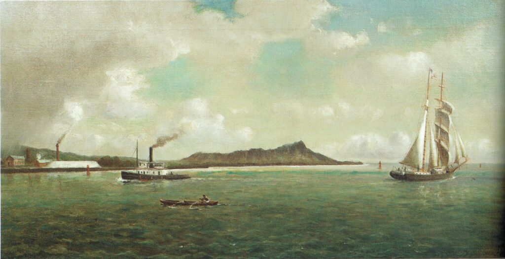
Bird then spent six months in the Sandwich Islands (Hawaiʻi) – the title to another of her books – she climbed an active volcano and then travelled to Colorado. (Walsh)
First, her impressions of Hawaiʻi …
“I was travelling for health, when circumstances induced me to land on the group (Sandwich Islands,) and the benefit which I derived from the climate tempted me to remain for nearly seven months.”
“During that time the necessity of leading a life of open air and exercise as a means of recovery, led me to travel on horseback to and fro through the islands, exploring the interior, ascending the highest mountains, visiting the active volcanoes and remote regions which are known to few even of the residents, living among the natives, and otherwise seeing Hawaiian life in all its phases.”
“I had so completely lived the island life, and acquainted myself with the existing state of the country, as to be rather a kamaʻāina than a stranger”. (Bird, 1875)
“The undeserved and unexpected kindness shown me here, as everywhere on these islands, renders my last impressions even more delightful than my first (“Bright blossom of a summer sea! Fair Paradise of the Pacific!”)
“The people are as genial as their own sunny skies, and in more frigid regions I shall never sigh for the last without longing for the first. … Farewell for ever, my bright tropic dream! Aloha nui to Hawaii-nei!” (Bird)
“The open-air life is most conducive to health, and the climate is absolutely perfect, owing to its equability and purity. Whether the steady heat of Honolulu, the languid airs of Hilo, the balmy breezes of Onomea, the cool bluster of Waimea, or the odorous stillness of Kona, it is always the same.”
“The grim gloom of our anomalous winters, the harsh malignant winds of our springs, and the dismal rains and overpowering heats of our summers, have no counterpart in the endless spring-time of Hawaiʻi.” (Bird)
While in the Islands, Bird learned about a place that supposedly was “the most beautiful country in all of the Americas”. She set out for Colorado, heading to the mountain town of Estes Park.
Gold had been discovered in Colorado in 1859. Among the thousands of adventurers who joined the rush was a Missouri native named Joel Estes. Joel moved his wife Patsy and their four other children to the mountains year-round in 1863. His son Milton had married and fathered two sons by then. The first known white child born in Estes Park was Milton’s third son in February, 1865.
The word “park” was in common usage at that time to describe an open area. William Byers, editor and publisher of the Rocky Mountain News, visited in September, 1864 to attempt a climb of Longs Peak. He wrote an account of his trip which included hospitality extended to him by the Estes family and extolled the virtues of “Estes’ Park.” (Estes Valley Library)
Like the draw of visitors to the natural wonders of Hawaiʻi, Estes Park drew guests to see the mountain wilderness. After several sales of the property there, the 4th Earl of Dunraven arrived in late-December 1872. He opened the area’s first resort, the Estes Park Hotel.
It was about that time the Isabella Bird visited the valley. As with her other adventures, Bird wrote a memoir of their travels. Bird had seen Long’s Peak on first arriving in Estes Park “rising above (the other peaks) in unapproachable grandeur”. (Long’s Peak is named for Major Stephen H Long who came to the mountains on a government scientific expedition in the summer of 1820.)
Fairly soon after her arrival, Bird ascended Long’s Peak with a local guide. Despite her bragging of physical feats and shows of courage elsewhere in her narrative, the difficulty of the climb to Long’s Peak seems to have mastered Bird. She writes: “‘Jim’ dragged me up, like a bale of goods, by sheer force of muscle”. (DeVine)
“I have dropped into the very place I have been seeking, but in everything it exceeds all my dreams… The scenery is the most glorious I have ever seen, and is above us, around us, at every door.” (Bird, A Lady’s Life in the Rocky Mountains)
Bird’s published letters and book were the first thorough account of a tourist experience in the area that later became Rocky Mountain National Park, and she praised everything from the cool temperatures to the brilliant sunsets and the dark evergreens. (NPS)
Considering the influence of the book that told the story of her travels in Colorado, Bird might easily merit the label ‘Mother’ of Rocky Mountain National Park. (The Rocky Mountain National Park was officially formed in 1915.)
Bird’s book sold like hotcakes, mostly in the eastern US and Britain, where a reading public just becoming interested in wilderness travel and conservation was hungry for news of far-flung scenery. (NPS) By the middle of the 1880s, there were sometimes 200 tourists a summer in Estes Park.
A giant boost in tourism to Estes Park came after the turn of the century with the arrival of Freelan Oscar Stanley in 1903 (he was co-inventor with his brother of the Stanley Steamer.)
Impressed by the beauty of the valley and grateful for the improvement of his health, he decided to invest his money – and himself – in the future of Estes Park. The first requirement was a first-class hotel; so, in 1909 he opened the Stanley Hotel. (NPS)
(A later guest to Estes Park and the Stanley Hotel was Stephen King (in room #217.) The story of the Torrence family and the Overlook Hotel is one of the most well-known in horror (“The Shining.”) The work of fiction was inspired by the Stanley.)
Bird stayed in Colorado for a little while before going home to England; and then a marriage offer that she didn’t want inspired her to travel throughout Japan, China, Vietnam, Singapore and Malaysia. She eventually succumbed and married an Edinburgh-based doctor John Bishop.
Bird has been featured in journals, magazines and books. She has inspired plays, and even during her lifetime she was a legend. She wrote over a dozen books and hundreds of articles. (Walsh)
Again, of Hawaiʻi, it “is at last, as it was at first, Paradise in the Pacific, a blossom of a summer sea.” (Bird)