Before Oregon was the 33rd state admitted to the United States in 1859, it was known as the Oregon Territory, and before that, the Oregon Country. On February 14, 1859, Congress granted Oregon statehood.
Edwin Battistella, a professor of English at Southern Oregon University says the name Oregon dates back to a written record of at least 1765, credited to a British soldier named Major Robert Rogers.
“He was a colonial soldier in 1765 who wrote up a proposal to King George III to fund an expedition to find the northwest passage by way of the river the Indians call Ouragon,” Battistella said. King George III denied that request. “For now, we can safely say that the name originated from Major Robert Rogers’ rendering of a Native word for the water route to the Pacific.” (KGW)
The origin is unknown. It may have come from the French word Ouragan (which means Hurricane) and was a former name of the Columbia River.
Other say the word “Oregon” is derived from a Shoshoni Indian expression meaning, The River of the West, originating from the two Shoshoni words “Ogwa,” River and “Pe-on,” West, or “Ogwa Pe-on.” (Rees) That river as we know it today is the Columbia River.
In the word “Ogwa” the syllable “Og” means undulations and is the basis of such words as “river,” “snake,” “salmon,” or anything having a wavy motion. The sound “Pah” means water. Therefore, a river is undulating water. “Pe-on” is contracted from the two syllables, “Pe-ah,” big and “Pah,” water or Big Water meaning the Pacific Ocean. (Rees)
The use of the word webfoot associated with Oregon has a long history. Webfoot was first used by Californians to express their satirical dislike of the Oregonian and his rainy county and was brought to Oregon by California miners settling in or traveling through the territory during the various gold rushes of the late 1850s into the Pacific Northwest.
“In fact, it seems quite probable that webfoot began as a derisive epithet in California during the gold rush of 1848-1849. The Oregonians were among the first to reach the California gold fields, were not beloved by the Californians.”
“The first discovered printed usage in California pf the word webfoot in the sense of Oregon or Oregonian is in the San Francico Sun on May 19, 1853. The writer of the item requested that ‘if you have any web-foot friends bound this way, dissuade them from putting in here, as nothing in the way of supplies can be obtained but water.’” (Mills)
In describing a coming football game between the University of Oregon and Pacific University, the Eugene Guard noted, “The grounds will be somewhat muddy tomorrow, but that never stops an enthusiastic football player. In fact Webfoot boys would rather play on a muddy field than one that is dry and solid.” (Eugene Guard, Nov 28, 1894)
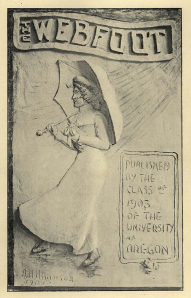
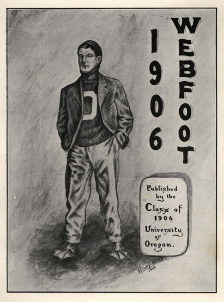
Webfoot caught on and ‘Webfoot State’ became a nickname for the State of Oregon. When the University of Oregon began searching for an athletic nickname in the late 1800s, the name “Webfoots” was the obvious choice. (White) By 1907 statewide sentiment had turned sour toward the term Webfoot, and the 1907 yearbook would adopt the name “The Beaver”.
Through the first two decades of the 20th century, there remained no officially sanctioned mascot for the university. Even as the use of mascots became commonplace at universities around the country, the Oregon teams that went to the Rose Bowl twice in four years after the 1916 and 1919 seasons traveled to Pasadena without one of their own to cheer them on. (University of Oregon)
The word “Web-foot” made its reappearance in print in January 1922 thanks to Oregon Daily Emerald reporter Ep Hoyt, who bestowed the name upon the Oregon Agricultural College football team during its postseason tour of Hawai‘i. (Oregon Alumni)
Oregon’s football team played two games in Hawai‘i – the Star Bulletin stated in a headline, “Webfooters Shut Out Pearl Harbor Navy Team”. The accompanying articles stated, “The Navy put up a good brand of football but the webfooters put up a brand that was better.” (Star Bulletin, Jan 3, 1922) Final score 35 to 0.
The Oregon Webfoots previously beat the University of Hawai‘i 47 to 0. Otto Klum was the new football coach at University of Hawai‘i that year – he had arrived from Portland a couple months before the Oregon game. (Oregonian, Sept 10, 1921)
Later that year, an Emerald editorial argued for the necessity of adopting a team name for University of Oregon sports teams and solicited names from readers.
Professor WG Thatcher argued in favor of Pioneers, while other suggestions included Condors, Eagles, Hawks, Vultures, Bulls, Wild Cats, and Fighting Drakes. Another professor, Jim Gilbert, favored Skinners in tribute to the founder of Eugene. (University of Oregon)
The Chamber of Commerce later stepped in and noted, “Oregon’s misnomer, ‘Webfoot State’ will be discarded”, stating, “that the term ‘webfoot state’ is poor advertising for the state, leading many eastern people to believe that Oregon is a swampy country, deluged by rain winter and summer.” (The Bulletin, Nov 17, 1923)
The debate surrounding the adoption of an official mascot raged for five years from 1922 to 1926. On November 6, 1926, the Eugene Guard and Oregon Daily Emerald jointly announced a new naming contest for the University of Oregon’s sports teams.
Webfoots and Ducks were viewed as “inadequate names” that impute “the harmlessness of doves” on the school’s squads. But the newspaper contest did not end the debate. It wouldn’t be until 1932 that students and alumni voted to confirm Webfoots as the official school mascot. (University of Oregon)
Even after Webfoots was officially adopted by the school in 1926, according to Douglas Card in “The Webfooted Ducks,” “Sportswriters gradually shortened the moniker to Ducks.” (Caputo)
Oregon’s first live mascot had surfaced in the 1920s when “Puddles,” a resident duck of the nearby Millrace, was escorted to football and basketball games by his fraternity-house neighbors.
Puddles and his various offspring were part of the Duck sports scene until the early 1940s when repeated complaints from the Humane Society finally sucked the fun out of bringing a live duck to games. (University of Oregon)
However, Puddles’ memory was preserved in 1947 when Oregon’s first athletic director, Leo Harris, struck a handshake arrangement with Walt Disney. Donald Duck’s likeness could serve as the mascot, as long as it was done in good taste.
The unique deal stood for 20 years, with Walt Disney Productions providing several versions of the duck for Oregon’s use, until the cartoonist’s death in 1966. That’s when both parties realized no formal contract existed granting the University the right to Donald’s image. (University of Oregon) They later formalized the association.
Another Hawai‘i connection, at least for me … when we were kids, our family hosted a couple of the Oregon Duck women’s swim team, when they came to the Islands for UH swim meets.