Images of Old Hawaiʻi

  • Home
  • About
  • Categories
    • Ali’i / Chiefs / Governance
    • American Protestant Mission
    • Buildings
    • Collections
    • Economy
    • Missionaries / Churches / Religious Buildings
    • General
    • Hawaiian Traditions
    • Other Summaries
    • Mayflower Summaries
    • Mayflower Full Summaries
    • Military
    • Place Names
    • Prominent People
    • Schools
    • Sailing, Shipping & Shipwrecks
    • Voyage of the Thaddeus
  • Collections
  • Contact
  • Follow

September 26, 2022 by Peter T Young Leave a Comment

“Swillauea”

In 1898, the US Army built a seawall and filled a submerged coral reef on the ‘Ewa (western) side of Kaʻākaukukui for a gun emplacement at Fort Armstrong to protect the mouth of adjoining Honolulu Harbor.

At the turn of the century, Ala Moana Boulevard was built at what was then the shoreline, and the broad areas on both sides of the future Kapiʻolani Boulevard consisted of rice fields.

The dredging of harbors, offshore areas and the Ala Wai Canal provided fill for the reclamation of the ‘swamps.’  The construction of the Ala Wai stopped the annual flooding of Waikīkī.

At the beginning of the twentieth-century, the stretch of coast makai of Ala Moana Boulevard between Fort Armstrong (Piers 1 & 2 at Honolulu Harbor) and Waikīkī was the site of the Honolulu garbage dump, which burned almost continually.

The residue from burned rubbish was also used to reclaim wetlands.  This residue provided a fill that was quite inert and solid.  Thus, a rubbish dump was considered a cost-free method for a landowner to reclaim swampy land.

Since at least the 1850s, the Hawaiian Monarchy was providing urban public services in Honolulu, including refuse collection and disposal.  Horse-drawn wagons were first used for the collection of refuse; the horses were stabled in Kakaʻako.

Following Annexation and Territorial status (1900,) garbage removal was one of six items listed in the Oʻahu County’s 1905 monthly operating expenses, along with the police and fire departments, the electric light plant, city parks and the Royal Hawaiian Band.  The only direct income for Oʻahu County was its refuse collection fees.

Oʻahu, like many other coastal communities, was ringed with tidelands.  The area was traditionally noted for its fishponds and salt pans, and for the marsh lands where pili grass and other plants could be collected.  About one-third of the coastal plain at Kakaʻako was a wetland.  The entire shoreline was coral rubble bordered by fringing reefs and mudflats.

As time went on, when the fishponds were no longer used, they were more often than not filled with material dredged from the ocean or hauled from nearby areas, garbage and general material from other sources. These reclaimed areas provided valuable new land near the heart of growing urban Honolulu.

The ʻili of Kaʻākaukukui was awarded by land court to Victoria Kamāmalu; Princess Bernice Pauahi Bishop inherited the land, which later became part of the Kamehameha Schools (formerly the Bishop Estate). The Territory of Hawai‘i acquired the land in 1919.

Just as the Army had done at Fort Armstrong, the government built a new seawall, extending east to reclaim more Kaʻākaukukui reef and submerged land.

During the 1920s, the channel and basin on the Waikīkī (eastern) side of the growing Kakaʻako peninsula was dredged as a small boat harbor, called Kewalo Basin, to relieve overcrowding at Honolulu Harbor by the sampan (tuna fishing) fleet.

Hawaiian Dredging Company completed Kewalo Basin’s wharf and channel in 1925, and by 1930 the sampan fishing fleet was relocated to their new base.

In 1930, a garbage incinerator was constructed on Mohala Street (now ʻĀhui Street) near the east end of the Kakaʻako seawall (near Kewalo Basin.)  This moved the open dump fires into a more controlled and contained facility.

In 1931, the City and County of Honolulu dedicated the land on the Waikīkī-side of Kewalo Basin as Moana Park (the name was later changed to Ala Moana (“the path to the sea.”))

After the 1930 incinerator was constructed on ʻĀhui Street, the Star-Bulletin named it “Swillauea” (a play with words associated with the long burning fires of Kīlauea volcano on Hawai‘i Island) and lamented, “… Oh Swillauea-by-the-Sea … a monument to despair, foolishness and ugliness … all the king’s horses and all the king’s men couldn’t find another place to burn the City’s rubbish except in the City’s front yard ….” (Mason Architects)

In the 1940s, another, larger incinerator was added, as well as a significant new seawall, 500-feet seaward of the old shoreline, enclosing more acreage of tidelands to be filled with the post-combusted ash.   (The large boulders laid in the wall lining Kewalo Channel and around the point came from Punchbowl Crater during the initial development of the National Memorial Cemetery of the Pacific by James W. Glover, Ltd.)

Incinerator Number One was later removed from service after the new incinerator on ʻOhe Street was constructed in 1946-48.  With the completion of the seawall in 1949, filling operations began and by the mid-1950s the shallow reef of Ka’ākaukukui was completely covered over.

And, again, in 1950 another seawall was extended and ash filled areas making more usable acreage.  Following statehood in 1959, government officials met to discuss the near-completion of the fill behind the seawall.   As the height increased, the State expressed concern over the mountain of ash which was growing so rapidly.

The State finally told the City in 1971 to stop placing any more ash to the pile.  Parts of the ash pile were then 25 feet above the top of the seawall.

The incinerator was finally shut down in 1977 because it could not meet the increasingly stringent air pollution standards. Then, in 1992, the State constructed Kakaʻako Waterfront Park on the ash pile (the young and young-at-heart now slide on cardboard down the steep grass-covered incinerator ash hill.)

The second incinerator, on ʻOhe Street, was renovated and is now used as the Children’s Discovery Center.  (The initial incinerator on ʻĀhui Street was used in 1952 by United Fishing Agency as part of their fish auction facility – the fish auction has since relocated to the Commercial Fishing Village at Pier 38.)

(Lots of information here is from the Historic American Buildings Survey for the Kewalo Incinerator and Cultural Surveys.)

© 2022 Hoʻokuleana LLC

Filed Under: Place Names, Economy Tagged With: Hawaii, Oahu, Kewalo Basin, Kewalo, Kakaako, Kaakaukukui, Ala Moana

September 24, 2022 by Peter T Young Leave a Comment

Kāʻanapali

When chief Kekaulike died, his younger son Kamehamehanui (uncle to Kamehameha I) was named heir to rule Maui. In 1738, Kauhi‘aimokuakama (Kauhi,) his older brother, began to wage war to win the title of ruling chief.

Battles were fought across West Maui, from Ukumehame to Honokowai.  Kamehamehanui engaged the forces of his uncle from Hawai‘i to fight with him, whose troops numbered over 8,000, and Kauhi brought troops of warriors from O‘ahu.

The war ended with the battle Koko O Nā Moku (“Bloodshed of the Islands.”) Over several days, the blood of fallen warriors from both sides flowed from a stream into the shorebreak and caused the ocean to turn red.  (Kamehamehanui won.) (Kāʻanapali Historical Trail)

This occurred in the moku (district) of Kāʻanapali (“divided cliffs.”)  A prominent feature noted at the beach is Pu‘u Kekaʻa (“the rolling hill”) – the outcrop that separates portions of the beach (commonly known as “Black Rock.”)

It was “ka leina a ka ‘uhane” – the place where a person’s soul left the earthly realm for the afterlife (these were usually at the westernmost point of the island.)

It was also a place for “lele kawa” (cliff jumping;) Kahekili gained respect from many warriors for his leaps from Pu‘u Kekaʻa, as most were frightened of the spirits who were in the area.  (Kāʻanapali Historical Trail)

The island of Maui is divided into twelve moku; Kāʻanapali, Lāhainā, Wailuku, Hāmākuapoko, Hāmākualoa, Koʻolau, Hāna, Kīpahulu, Kaupō, Kahikinui, Honuaʻula and Kula.

An area in the moku of Kāʻanapali is referred to as Nā Hono A Piʻilani (The Bays of Piʻilani (aka Honoapiʻilani.))  In the 1500s, Chief Piʻilani (“stairway to heaven”) unified West Maui and ruled in peace and prosperity.  His territory included the West Maui bays, a place he frequented.

From South to North, six of the identified bays are Honokōwai (bay drawing fresh water), Honokeana (cave bay), Honokahua (sites bay,) Honolua (two bays), Honokōhau (bay drawing dew) and Hononana (animated bay).

In the late-1800s and early-1900s there was a horse racing track (Koko O Na Moku Horse Racing Track) at Kāʻanapali Beach that stretched from the present day Kāʻanapali Beach Hotel to the present day Westin Maui Resort. Horse races ended in 1918.

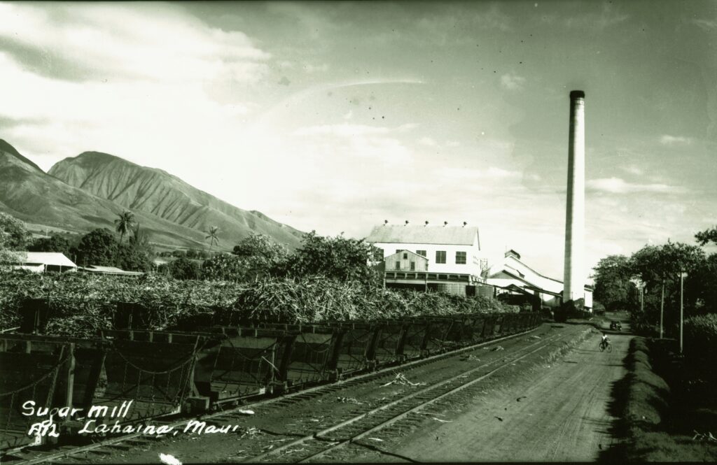
In 1860, James Campbell started the Pioneer Mill Company; sugar cultivation proved to be very profitable.  He later sold his interest in the Mill and, after subsequent transfers, in 1960, Pioneer Mill Company became a wholly owned subsidiary of American Factors (Amfac – one of Hawaiʻi’s Big 5.)

Kāʻanapali was the terminus for the plantation railroad; a landing on the northerly side of Puʻu Kekaʻa with a wharf and off-shore moorings served as the primary loading spot for shipping processed sugar from the island and bringing in supplies for the plantation camps.

After the sugar industry’s peak in 1930, production, acreage in sugar and profits declined.  Seeing hard times ahead, Amfac took 1,200-acres of Pioneer Mill Company land out of cane to develop as a visitor resort destination (in 1999, Pioneer Mill closed its sugar operations.)

Then, a few years before Hawaiʻi became a state, before Maui County even had a mayor, in 1956, Pioneer Mill’s board of directors got together for a lūʻau on the beach near Puʻu Kekaʻa. There, they sketched out the whole Kāʻanapali Beach Resort master planning venture.  (mauitime-com)

Seven years later, the grand opening for the Sheraton (the second, following the Royal Lāhianā completed the year before) put Kāʻanapali on the map as a resort area and featured celebrities like Bing Crosby, golfer Sam Snead and then-California Governor Pat Brown. It was a groundbreaking place, in more ways than one.  (mauitime-com)

The land set-aside by Amfac became Hawaiʻi’s first master-planned resort.  When it opened in 1962, it became known as the Kāʻanapali Beach Resort.

Today, along its 3-mile coastline, this self-contained resort has over 5,000 hotel rooms, condominium suites, timeshares and villas; 2-championship golf courses (in 1962, Bing Crosby took the inaugural shot on the Royal Kāʻanapali Course) and 35-tennis courts.  It accommodates over half-a-million visitors each year.

Kāʻanapali Beach was ranked “Best Beach in America” in 2003 (Dr. Beach.)  A beach walk runs parallel with the sand the entire length of Kāʻanapali interconnecting the five major resort hotels and six condominiums and timeshares, as well as the numerous recreational, shopping, dining and other activities in the area.

Twenty-five years after it started, the Urban Land Institute recognized Kāʻanapali Beach Resort with an Award of Excellence for Large-Scale Recreational Development.

In the early years, Kāʻanapali Airport, built on an old coastal road in 1961, serviced the resort first by transporting workers and materials for the new development and then it brought guests in/out.

Take-offs and landings were a thrill for pilots and passengers; the Airport’s runway (01-19) started just 30-feet from the shoreline and extended north a short 2,615-feet.  Kahekili Beach Park now sits on the former Airport site.

The Airport was used exclusively by the commuter aircraft of Royal Hawaiian, initially using Cessna 402 aircraft.  In 1987, Hawaiian Airlines built the nearby Kapalua Airport; the State took over that facility in 1993.

They must be doing something right, Maui and the visitor destinations of Lāhainā-Kāʻanapali-Kapalua continue to lead the neighbor islands in room occupancy and they lead the state in average daily room (ADR) rates and revenue per available room (ADR x occupancy rate.)

At the same time properties like the Kāʻanapali Beach Hotel are recognized as Hawaii’s Most Hawaiian Hotel for demonstrating an ongoing responsibility, commitment and dedication to honoring and perpetuating the Hawaiian culture for generations to come.

© 2022 Hoʻokuleana LLC

Filed Under: Place Names, Economy Tagged With: Kamehamehanui, Kekaulike, Hawaii, Kauhi, Maui, James Campbell, Piilani, Amfac, Na Hono A Piilani, Kaanapali, Pioneer Mill, Kaanapali Beach Resort Association

September 22, 2022 by Peter T Young Leave a Comment

Hobo Hat

In 1922, an imaginative shipping clerk at the Delaware & Hudson freight station in Wilkes-Barre (Pennsylvania) decided to take an old straw hat and send it on a trip of its very own to see how far it could go.  (Luzerne County Historical Society)

(It was not a completely original idea; word of a traveling hat was found in a North Carolina newspaper from 1908. However, this Hobo Hat was the first to travel around the world.)

Patrick Fagan started the Hobo Hat send off for the Pacific Coast on September 5, 1922, as a way to advertise the good shipping and handling service of the freight line.

Fifty post cards were attached, along with a note asking those freight agents who received the hat to send back a card telling of its travels, and to please keep the hat going.

Mr. Fagan received postcards from Massachusetts, Chicago, and California, before receiving word that the hat was going to be traveling to the Orient via Hawaii, thanks to some friendly staff at the Matson Navigation Company freight office across the country.

In March 1923, Mr. Fagan received a post card from freight agents at Yokohama, Japan telling of the arrival of the hat in good condition, and that it was being sent next to Hong Kong.

The hat also traveled to West Australia, Java in the Dutch Indies, South Africa, and Brazil, before coming back to Hawaii after two years.

By this point, “Mr. Hobo Hat” was a famous world traveler and was traveling aboard the ships of the Dollar Steamship line.  (Luzerne County Historical Society)

“The famous ‘Hobo Hat’ sent on a trip around the world by Patrick Fagan, employee of the Delaware & Hudson freight station, in September 1923, and which is now making its third tour of the globe, was las heard of at Honolulu.”

“Mr Fagan yesterday received a card from MW Mitchell, agent of the Dollar Steamship line, to the effect that the hat had arrived at Honolulu on the SS Garfield February 21 and was presented to the Hon. Wallace R Farrington, governor of the Territory of Hawaii at the executive building.”

“The fame of the hat had probably reached the territory before the hat itself and legislative business was suspended in the Senate and the House of Representatives, temporarily in order that the ‘world tourist’ might be viewed before it started again on the journey.”

“Mr Mitchell said that the hat was decorated and left with the Aloha of Hawaii (the best of luck0 on board the SS President Garfield which departed for Japan on the same day.”

“The owners of the Dollar Steamship Line has a specially made hat box prepared for the hat.  It is a leather case on which has printed’ Mr Hobo Hat’ in large letters and with the words ‘Round the World’ at the bottom.”

“The ‘Hobo Hat,’ an old straw lid, the property of Patrick Fagan of this city, was started on its first trip around the world three years ago for the D&H station yards in this city and is now on its third tour of the world.”  (Wilkes-Barre Record (Pennsylvania, March 23, 1925)

“On the last lap of his third trip around the world. ‘Mr. Hobo Hat’ accompanied by ‘Uncle Joe’ Fordney, former chairman of the House ways and means committee, has landed in this country and is en route to the Capital to pay his respects at the White House to the President.”

“This hobo hat is a battered straw ‘lid’ that started on its wanderings from Wilkes-Barre, Pa., on September 12, 1922. It went first to New York, thence across the continent to the Pacific coast, next to the Orient. It traveled on the steamers President Adams and President Hayes, and its last voyage was on the President Garfield, traveling ‘de luxe’ with a special ticket personally indorsed by Capt. Robert Dollar, president of the Dollar Steamship Co.”

“Mr. Hobo Hat wears many tags in token and testimony of his around the globe voyaging, which now aggregate more than 100,000 miles. In each country and in many important cities, Mr. Hobo Hat has called upon the most prominent persons in political and social life.”  (The Sunday Star (DC), May 10, 1925)

When Hobo Hat finally returned home after all his travels, he was displayed in the window of MacWilliam’s Store in Wilkes-Barre in June 1925 to coincide with Poppy Day for the American Legion, which raised money for the wounded veterans of World War I and their families.

After that, the Hobo Hat was in 1935 when he came to the Wyoming Historical and Geological Society (for Wyoming Valley, PA; now the Luzerne County Historical Society) to be displayed, along with his “entourage” of hat box, autographed ticket, postcards, luggage tags and photographs, and ended up staying to become a permanent part of the collection (donated in 1959 by Patrick Fagan).

In addition to various foreign dignitaries, President Calvin Coolidge’s name is among the now-faded signatures to be found on the ticket, testifying to the widespread popularity that Mr. Hobo Hat once enjoyed.  (Luzerne County Historical Society)

© 2022 Ho‘okuleana LLC

Filed Under: General, Sailing, Shipping & Shipwrecks, Economy Tagged With: Dollar Steamship, Hobo Hat

September 21, 2022 by Peter T Young Leave a Comment

Pioneer Inn – Maunalei Sugar Connection

Getting a little back into posting historical summaries, I have wanted to correct the record on a couple of the prior posts …

I previously posted a summary on the Maunalei Sugar Company on Lanai. I also did one on the Pioneer Inn in Lahaina.

I never knew of a connection between the two.

Then, Rick Towill loaned me a book and I was shocked to learn of their connection – something that never showed up in any of the research I did on each.

You can read the prior posts on each.  I’ll let Ruth Tabrah (who wrote a book on Lanai that Rick loaned me) tell the rest of the story …

“The Hayselden venture was named Lanai Sugar Company. Later, the name was changed to Maunalei Sugar Company. The lands, like much of the old Gibson holdings, were on lease. The annual ground rent on the beach portions was $10 an acre, that of the valley lands $5 an acre.”

“Fred Hayselden had renegotiated many of the Gibson leases in his own name. He 78 bought several small kuleanas outright.”

“Lanai, which had the reputation thirty years earlier of being the sheep raising center of the kingdom, still supported a population of livestock far larger than the human population.”

“There were nearly 50,000 sheep, large herds of goats and hogs, flocks of wild turkeys, but only 174 people on Lanai when Maunalei Sugar Company began.”

“Hayselden worked hard to boost the water resources and the reservoir capacity of the island. Water was the key to high sugar yield and one of the three wells advertised in the prospectus was already in operation. It produced between one and two million gallons of water a day. This was fortunate, since the other two wells did not turn out.”

“The decision was made not to build a mill, but to ship the cane to Olowalu, Maui for grinding. A wharf was built at Halepalaoa and a railroad between there and Keomuku to haul the harvested cane and plantation supplies.”

“Had Walter Murray Gibson been alive, or had Talula been consulted, the engineer would never have torn down the walls of Kahe‘a heiau to make the roadbed. The Hawaiians of Keomuku predicted that because of this, there would be trouble.”

“At first, everything prospered.”

“A spacious verandahed two story building went up. The plantation offices and the company store were on the ground floor. On the second floor were rooms for visitors, a company boarding house and quasi-hotel.”

“Camp houses and barracks were built as the population of Lanai ballooned with contract laborers. Those Lanaians who applied were hired, but the majority of the work force had to be brought in.”

“There were Gilbert Islanders, the first Japanese to arrive on Lanai, and fellow countrymen of that first sugar maker of them all, Wu Tsin, who had been the first Chinese on Lanai nearly a century before.”

“By August 1899 there were 710 laborers at Maunalei. Wages varied for each ethnic group.”

“Chinese were paid either $18.75 or $20 a month depending on their jobs. Japanese field laborers were paid $15 a month for men, $10 a month for women. Cooks earned $15 a month. Carpenters were paid at the rate of $1.50 a day.”

“Since the company made all deductions for room and board in advance, and allowed workers to run up accounts at the company store, many sugar workers on Lanai like their counterparts on the other islands, were always in debt to their employer.”

“The only cash that seemed to reach and stay in working hands was that earned by the Chinese. In Honolulu the most affluent of the merchants were Chinese, and they invested their money in the Maunalei venture to such an extent that they soon owned seventy-five per cent of the shares.”

“For its first year, the company did well.”

“Then, plague flared up among the Chinese laborers.”

“The shacks they lived in were burned, but this did not stop the epidemic. The church at Keomuku was turned into a dispensary. Those who were not already too sick to do so, fled.”

“The curse predicted when the walls of Kahe’a were broken fell heavily now on the plantation. The water in the well turned brackish. The sugar content of the cane was too low to make it worthwhile to harvest.”

“By June of 1900 the payroll of Maunalei Sugar Company carried only 38 men and by March 1901, 12 were left to shut the plantation down.”

“The two-storied company store and hotel was left up until 1905 when it was carefully dismantled, a section at a time, and floated on rafts to Lahaina. There it was hammered together again to become the Pioneer Inn.” (Tabrah)

Whoa … Who knew the Pioneer Inn was originally a structure on Lanai?

All prior research did not note the Maunalei building and Pioneer Inn connection.

In fact, newspaper accounts of that time only noted the formation and construction of the hotel in Lahaina, not that it was formerly built on Lanai and floated to Lahaina and then reassembled.

A notice in the Hawaiian Star, October 9, 1901, noted “New Hotel For Lahaina. Articles of association were filed yesterday by the Pioneer Hotel Company, with the principal place of business at Lahaina, Island of Maui.”

“The object of the association is to conduct a general hotel and restaurant business, and billiard tables. … The officers and principal stockholders are J. J. Newcomb, president, twenty-five shares; A Aalberg, secretary, twenty-five shares; P. Nicklas, treasurer, two shares; George Freeland, thirty-five shares.”

Three weeks later, the newspaper reported “George Freeland, manager of the Pioneer hotel at Lahaina, is in town for the purpose of purchasing supplies and furniture for the establishment. He will return to Lahaina nest Tuesday.  (Honolulu Republican, October 31, 1901)

“Lahaina now boasts two new and up-to-date hotels. Matt. McCann has just finished and moved into his new hosterie (Lahaina Hotel,) and is not able to handle all the travel at present, consequently he is compelled to turn away guests this week.”

“The Pioneer Hotel is practically completed and under the management of Mr. Freeland, will be thrown open for the reception of guests about December 1.”  (Maui News, November 23, 1901)  Thanks, Rick.

© 2022 Ho‘okuleana LLC

Filed Under: Economy, Buildings Tagged With: Lahaina, Pioneer Inn, Hawaii, Maui, Lanai, Maunalei

September 18, 2022 by Peter T Young Leave a Comment

Ho‘olehua Airport

When Emory Bronte and Ernest Smith made history on July 15, 1927 with the first successful trans-Pacific flight by civilians, there was no airport on Molokai.

They were expected to land at Wheeler Field on Oahu, but ran out of fuel over Molokai and crashed into kiawe trees on the southeast coast of Molokai.

Later that year, the Territorial Governor signed Executive Order No. 307 setting aside an area of 204.8 acres of Territorial land at Ho‘olehua, Molokai; the Territorial Legislature appropriated funds for an airport.

On December 15, 1927, what was then called Ho‘olehua Airport was placed under the control and management of the Territorial Aeronautical Commission. It was effectively a level grassy field that was marked and cleared so that take offs and landings could be made.

It was proposed to eventually fully-improve the field for all commercial and military purposes.  The field could be used by the large and heavy trans-Pacific land planes expected to pass through the Territory.

Inter-Island Airways inaugurated interisland air service from Honolulu to Molokai on November 11, 1929 in Sikorsky S-38 amphibians.  The fare was $17.50.

By the end of 1929, a small waiting room and telephone booth were added and a pole and windsock were erected. In 1930, it was renamed Molokai Airport.

The Army got interested in the airport in 1931 and by 1937 Molokai Airport consisted of three runways—1,000, 2,600 and 2,600 feet long, 300 feet wide with 100 feet of grading on each side.  The Army called it Homestead Field Military Reservation.

Molokai Airport was one of the principal airports of the Territory during the pre-war development of aviation in the Islands.   The Army maintained a radio station and Inter-Island Airways, Ltd. had a Station House at the field.

On December 7, 1941 the airport was taken over by the Army and Navy and the services remained in possession until 1947.  During this period the U.S. Army made extensive improvements (two paved runways, one 4,400 feet in length and the other 3,200 feet in length, each with a width of 200 feet; taxiways, plane parking areas and runway lighting.

By agreement with the Army, the Territory assumed responsibility for the operation and maintenance of the airport in 1947 under the management of the Hawaii Aeronautics Commission.

In addition to its peace-time function, the airport had continuing importance to the Army and Navy.  The extension of the North-South Runway was particularly important because the runway was not adequate for large aircraft except with restricted loading.

Location of this field was such that during heavy rains excess mud and water flowed onto the operating area, sometimes necessitating closing the field until an emergency crew was able to clean up.  A system of drainage ditches was designed and completed in September 1953 to alleviate this.

Hawaiian Airlines, Ltd. and Trans-Pacific Airlines, Ltd., provided scheduled service to Molokai, and Andrew Flying Service flew on a non-scheduled basis.

A new Molokai Airport Terminal was officially dedicated on June 15, 1957 with pioneer aviator Emory Bronte in attendance.

In the mid-1970s, there were preliminary planning for moving the site of Molokai Airport.  The engineering analysis to be used in the site selection for a new airport for Molokai continued.  Construction of new hotel facilities on Molokai accounted for the increase in passengers served at Molokai Airport. 

The site study for a new Molokai Airport was completed in 1978 with a recommendation that 500 to 600 acres of land be set aside in the northwest corner of the island.

The report recommended against immediate construction at the new site in view of the high cost for a new airport compared to the relatively low air traffic to Molokai.  The estimated cost was $25.8 million in 1978.

The report recommended continued improvements to the existing airport at Hoolehua until such time that traffic warranted the construction of the new airport.

A renovated passenger terminal and support facilities were dedicated on October 19, 1994. The 24,000 square foot terminal had an upgraded passenger waiting area, ticket lobby, air cargo handling facilities and tenant lease area.  (Information here is from Hawai‘i DOT Airports.)

© 2022 Ho‘okuleana LLC

Filed Under: Place Names, Economy, General, Military Tagged With: Molokai, Molokai Airport, Hoolehua Airport, Homestead Field Military Reservation

  • « Previous Page
  • 1
  • …
  • 92
  • 93
  • 94
  • 95
  • 96
  • …
  • 237
  • Next Page »

Images of Old Hawaiʻi

People, places, and events in Hawaiʻi’s past come alive through text and media in “Images of Old Hawaiʻi.” These posts are informal historic summaries presented for personal, non-commercial, and educational purposes.

Info@Hookuleana.com

Connect with Us

  • Email
  • Facebook
  • LinkedIn
  • Twitter
  • YouTube

Recent Posts

  • Ammo Tunnels
  • 250 Years Ago … Battle of Brooklyn
  • Missionary, Educator … Former Slave
  • Historic Downtown Hilo Walking Tour
  • Memorial Park
  • About 250 Years Ago … King Declares Colonies in Open Rebellion
  • Sybil’s Rocking Chair

Categories

  • Buildings
  • Missionaries / Churches / Religious Buildings
  • Hawaiian Traditions
  • Military
  • Place Names
  • Prominent People
  • Schools
  • Sailing, Shipping & Shipwrecks
  • Economy
  • Voyage of the Thaddeus
  • Mayflower Summaries
  • American Revolution
  • General
  • Ali'i / Chiefs / Governance

Tags

Albatross Al Capone Ane Keohokalole Archibald Campbell Bernice Pauahi Bishop Charles Reed Bishop Downtown Honolulu Eruption Founder's Day George Patton Great Wall of Kuakini Green Sea Turtle Hawaii Hawaii Island Hermes Hilo Holoikauaua Honolulu Isaac Davis James Robinson Kamae Kamaeokalani Kameeiamoku Kamehameha Schools Lalani Village Lava Flow Lelia Byrd Liberty Ship Liliuokalani Mao Math Mauna Loa Midway Monk Seal Northwestern Hawaiian Islands Oahu Papahanaumokuakea Marine National Monument Pearl Pualani Mossman Quartette Thomas Jaggar Volcano Waikiki Wake Wisdom

Hoʻokuleana LLC

Hoʻokuleana LLC is a Planning and Consulting firm assisting property owners with Land Use Planning efforts, including Environmental Review, Entitlement Process, Permitting, Community Outreach, etc. We are uniquely positioned to assist you in a variety of needs.

Info@Hookuleana.com

Copyright © 2012-2024 Peter T Young, Hoʻokuleana LLC

Loading Comments...