Reasoning from observations has been important to modern scientific practice at least since the time of Aristotle (384–322 BC.) A scientific process or scientific method requires observations of nature and formulating and testing the hypothesis. It consists of following four steps.
Scientists observe something and ask questions about a natural phenomenon (scientific observation,) make hypothesis, make predictions about logical consequences of the hypothesis, test the predictions by observational study and create a conclusion on the basis of the information gathered. (Stanford)
Hawaiians in traditional times also made observations of the world around them. Most of the makaʻāinana (common people) were farmers, a few were fishermen. Tenants cultivated smaller crops for family consumption, to supply the needs of chiefs and provide tributes.
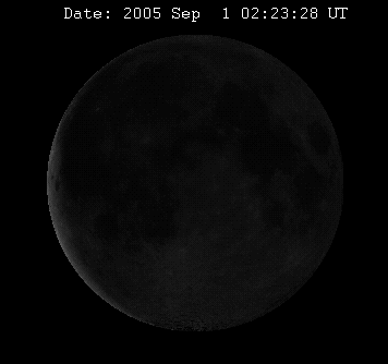
They followed a systematic and careful regimentation of planting in accordance with what had been observed over time, noting the influence of the stages of the moon had on farming and fishing.
https://upload.wikimedia.org/wikipedia/commons/c/c0/Lunar_libration_with_phase2.gif
Following is a summary noted in Handy & Handy with Pukui for planting according to moon phases, together with the names of the ‘Moon Nights,’ are compiled by them from notes derived from a variety of sources:
Hilo (first ‘night.’) The new moon appears ‘slender and twisted’ (hilo.) Fish ‘hide’ in the lagoons on this night, but it is good for deep-sea fishing; food maturing underground will ‘hide,’ but some recommend the day following Hilo for planting, especially sweet potatoes and taro, although they will be small when mature as the new moon is small. This was the first night of the kapu period of Ku.
Hoaka (second ‘night.’) The name means ‘faint light’ or ‘casting a shadow.’ Ghosts cast shadows and frighten fish away. The second night of the Ku kapu.
Ku kahi, Ku lua, Ku kolu, Ku pau (third, fourth, fifth, and sixth ‘nights’.), The names mean ‘First Ku’ ‘Second Ku,’ ‘Third Ku,’ and ‘Last Ku.’ The kapu period of Ku ended with ‘First Ku,’ Recommended for planting sweet potato and taro, which will grow ‘upright’ (ku) in the soil. Recommended also for fishing.
Taros planted on this first night will have but one shoot (ku kahi ), second night will have two (ku lua), and third night will have three (ku kolu.), Bananas planted these nights will stand erect (ku.) The ocean currents change.
‘Ole ku kahi, ‘Ole ku lua, ‘Ole ku kolu, ‘Ole pau (First ‘Ole, Second, Third, Last; seventh to tenth ‘nights’). The tides run high and the sea is rough. Fishing is poor. Not recommended for planting or fishing, for ‘ole means ‘nothing, without, nonproductive.’ Recommended for weeding. However, planting at ‘Ole pau (‘end of non-productivity,’) especially for breadfruit.
Huna (eleventh ‘night’), The name means ‘hidden’ and is recommended for root plants which will flourish, hidden under dense foliage, and especially for gourds which will be hidden under their leaves. Recommended also for fishing, for the fish are hiding-in their holes.
Mohalu (twelfth ‘night.’) Good for planting flowers, which will be round and perfect like the moon all this night; and gourds, potatoes and taro will grow well. Fruits, fish, and seaweed were kapu, for this night was sacred to Kane the life-giver. This is a good ‘night,’ for fishing. ‘The sea is covered with fishing canoes’ (after abolition of kapu).
Hua (thirteenth ‘night’), The name means ‘fruit’ and ‘seed,’ hence it was fruitful on land and sea, especially for many-seeded gourds, The moon is egg-shaped (hua), This night is sacred to Lono, Good fishing.
Akua (fourteenth ‘night.’. All things reproduce abundantly (ho‘oakua.) Fishing is good. This is a kapu night when the gods (akua) are about, and offerings are made to them to increase food (ho‘oulu‘ai) and fish (ho‘oulu i‘a).
Hoku (fifteenth ‘night.’) Hoku kua means ‘lined up close together,’ hence root plants and bananas will be prolific, but fruit will be small. Good for trees in general. Good fishing.
Mahealani (sixteenth ‘night’: full moon.) Mahea means ‘whiter,’ and the plants are so prolific and large that they say ‘whither can we grow?’ Currents run strong, but fishing is good. Good for all work.
Kulu (seventeenth ‘night.’) Kulu means ‘to drop.’ The banana sheath drops off this day exposing the new bunch. Good for potatoes and melons. Currents are strong, but it is a good time for fishing. This was the time for offering first fruits to the gods.
La‘au ku kahi, La‘au ku lua, La‘au pau (First La‘au, Second, Last: eighteenth to twentieth ‘night’). Sweet potatoes, melons, and gourds will run to woody (la‘au) vines. For medicines (la‘au) this is a time favored for gathering herbs and for their preparation by the medical kahuna.
Good for planting banana and other trees (la‘au): the fruit will be so heavy that poles (la‘au) will be required to support them. Favorable for fishing. Breadfruit planted in these days will be hard and woody (la‘au.) Some say bananas will be hard and woody. Some say La‘au pau is a good day for all planting.
‘Ole ku kahu, ‘Ole ku lua, ‘Ole ku pau (First ‘Ole, Seconds, Last: twenty-first to twenty-third ‘night.’) Not recommended for planting or fishing. It is windy and tides run high. A good time for weeding. ‘Lazy days for farmers.’ ‘Ole pau and kaloa ku kahi are the kapu periods of Kanaloa or Kaloa, when offerings are made with prayers.
Kaloa ku kahi, Koloa ku lua, Koloa pau (First kaloa, Second, Last: twenty-fourth to twenty-sixth ‘night.’) Good for fishing. Makaloa and ‘ole shellfish are plentiful. It is a good time to plant bamboo for braiding hats. Plants with long stems (banana, sugar cane, bamboo) will grow long. Potato and yam will run to long vines (ka loa.) Good for wauke, which will develop long stems (ka loa). Pandanus will develop long leaves. The first Kaloa is sacred to Kanaloa with mild kapu.
Kane (twenty-seventh ‘night’). This and the night following Lono, are sacred to Kane. This period was devoted to prayers to Kane and Lono for health and food. The Kane kapu was rigorous.
Lono (twenty-eighth ‘night.’) Prayers for rain. Recommended for melons and gourds (which were ‘bodies’ of Lono.)
Mauli (twenty-ninth ‘night.’) Uli (dark) implies rich, dark-green vegetation. Tides are low. Fishing is good, good day for marriages.
Muku (thirtieth ‘night.’) Bananas will bear bunches one muku long (from tip of fingers of one hand to opposite elbow.) Not recommended for sweet potatoes. Trees and sugar cane will prosper. Fishing is good. The moon is cut off, muku (vanishes.)
The planting calendar may be summarized as follows : On the Ku nights potatoes will grow erect (ku,) also taro. The ‘Ole nights are periods of scarcity (‘ole ) on land and sea. On Huna, roots and gourds will prosper, hidden (huna) under earth or dense foliage. Hua (fruit, seed) means plenty, Akua (deity) supernatural abundance.
In Hoku the fruits will be lined up (hoku hua.) In Mahealani roots will ask ‘ ‘whither can we grow (mahea, whither ; lani (under) heaven?’ Kulu (drop) implies dropping of the fruit sheath.
The la‘au are good for woody growth (la‘au means wood.) The second series of ‘Ole are again periods of dearth. Kaloa indicates long vines and stems. Kane and Lono, nights of prayer for plenty, health, and rain. Mauli implies dark green (uli) vegetation, and Muku long bunches of bananas.
During each month (moon, mahina) there are four kapu periods. Families who worshiped one of the major gods to whom the ‘nights’ were dedicated abstained from work and play and prayed to their gods at the altar (kuahu) in the men’s house (mua.)
The kapu periods were:
On Hila, Hoaka and Kukahi (1st-3rd,) the Ku kapu.
On Mohalu and Hua (12th-13th,) , the Hua (Lono) kapu.
On ‘Ole pau and Kalo aku kahi (23rd-24th,) the Kanaloa kapu.
On Kane and Lono (27th-28th), the Kane kapu.


