On the continent or in the Islands, in the early-1800s there was limited private and public transportation and it was expensive. Thus, workers’ homes were always within two miles of downtown – less than an hour’s walk. For these reasons cities of the mid-1800s were virtually all small, dense and on the water.
Hawaiʻi’s streets, for the most part, started out as trails that were widened and straightened, as horses, buggies and then transit became available. In Honolulu, over time, trails headed mauka following and crossing the Nuʻuanu River, or headed southerly (to Kālia – Waikīkī) or easterly (toward Mānoa.)
Some of the present downtown Honolulu street alignments have origins dating back to 1809. It was about this time that Kamehameha the Great moved his capital from Waikīkī to what is now downtown Honolulu.
A large yam field (pa uhi), footpaths and other sites that existed then, served as the alignment for future streets. The field’s rock walls along its edges would later border King, Alakea, Beretania and Nuʻuanu Streets.
In 1825, Andrew Bloxam (naturalist aboard the HMS Blonde) noted in Honolulu that, “The streets are formed without order or regularity. Some of the huts are surrounded by low fences or wooden stakes … As fires often happen the houses are all built apart from each other. The streets or lanes are far from being clean …” (Clark, HJH)
In 1838, a major street improvement project was started. Honolulu was to be a planned town. Kinaʻu (Kuhina Nui Kaʻahumanu II) published the following proclamation: “I shall widen the streets in our city and break up some new places to make five streets on the length of the land, and six streets on the breadth of the land… .” She designated her husband, Governor Mataio Kekūanāoʻa, to head the project.
As early as 1838, sidewalks along Honolulu streets were constructed, usually of wood. Paved streets were unknown until 1881; in that year, Fort Street was paved.
In 1845, Commander Charles Wilkes criticized the city by saying: “The streets, if so they may be called, have no regularity as to width, and are ankle-deep in light dust and sand … and in some places, offensive sink-holes strike the senses, in which are seen wallowing some old and corpulent hogs.”
It wasn’t until 1850 that streets received official names. On August 30, 1850, the Privy Council first named Hawaiʻi’s streets; there were 35-streets that received official names that day (29 were in Downtown Honolulu, the others nearby.)
Before that, many of the streets had multiple names – mostly related to who or what was on them. Honolulu’s first street names were printed on wooden sign posts, in both English and Hawaiian. In that same meeting, they officially named the City of Honolulu and designated it the capital of the kingdom.
The first sidewalk made of brick was laid down in 1857 fronting a shop on Merchant Street; Hawaiʻi’s first concrete sidewalk (it already had a brick sidewalk) was poured in front of a store on Queen Street in 1886.
As Honolulu grew, so did the number of streets. One relative latecomer to that list was Bishop Street – running mauka-makai, through what is now the core of the downtown business district.
In earlier times, the main streets were Fort or Nuʻuanu (mauka-makai) and Beretania, Merchant and Queen (heading relatively northwest-southeast.) Back then, if you wanted to go up to Nuʻuanu, you took … Nuʻuanu Street.
Bishop Street came into existence around the turn of the century (about 1900.) Initially, it was only a couple of blocks long, between Queen and Hotel Streets.
By 1923, it extended makai to the harbor (absorbing (and realigning) the former Edinburgh Street) – still no further extension mauka. By 1934, it extended mauka to Beretania (it absorbed (and realigned) Garden Street.)
In 1949, Bishop only went to Beretania – with no further mauka extension (it finally popped through and extended/connected to the Pali Highway and became the windward gateway into “Town.”)
Named for Charles Reed Bishop (1822 – 1915), banker, financer, philanthropist and public official and his wife Princess Bernice Pauahi Bishop (1831-1884), great-granddaughter of King Kamehameha I and last surviving heir – whose will and landholdings established the Kamehameha Schools.
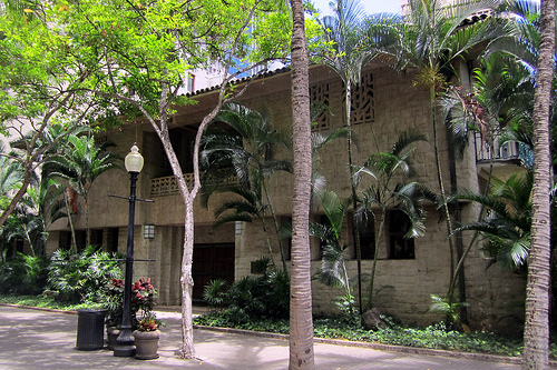
The couple lived for many years near the site of Bishop Trust Building (1000 Bishop Street) – their property was known as Haleʻākala (built by Pauahi’s father Abner Paki;) the building itself is called Aikupika.) When Bishop Street was created, it cut through their property.
CR Bishop came to Honolulu just before the California gold rush of 1849. Mr. Bishop married Bernice Pauahi Paki, daughter of high chief Abner Paki. In 1853, he founded Bishop and Company Bank, now First Hawaiian Bank.
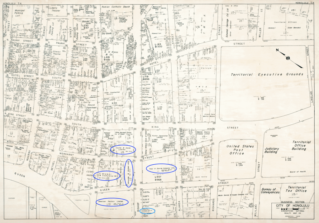
Do you remember the Big Five?
Look at the 1950 map of Honolulu. Did you notice their placement on Bishop Street (and to each other) back then?
Five major companies emerged to provide operations, marketing, supplies and other services for the plantations and eventually came to own and manage most of them. They became known as the Big 5: Amfac – Hackfeld & Company (1849;) Alexander & Baldwin (1870;) Theo H. Davis (1845;) Castle & Cooke (1851) and C. Brewer – (1826.)
Although it took a while to be formed, Bishop Street was and continues to be the center of Hawai‘i commerce and banking – and “the” address to have for your business.
The image is a view toward Diamond Head looking from Fort Street down King Street; Haleʻākala (the Bishop’s house, is marked as “2”. This was taken in 1855.


Leave your comment here: