Kamehameha I began a war of conquest, winning his first major skirmish in the battle of Mokuʻōhai (a fight between Kamehameha and Kiwalaʻo in July, 1782 at Keʻei, south of Kealakekua Bay on the Island of Hawaiʻi.) Kiwalaʻo was killed.
By 1795, having fought his last major battle at Nuʻuanu on O‘ahu with his superior use of modern weapons and western advisors, he subdued all other chiefdoms (with the exception of Kauai).
Then, Kamehameha launched his first invasion attempt on Kauai in April of 1796. About one-fourth of the way across the ocean channel between O‘ahu and Kauai a storm thwarted Kamehameha’s warriors when many of their canoes were swamped in the rough seas and stormy winds, and then were forced to turn back.
With Hawaiʻi Island under Kamehameha’s control, conflict, there, supposedly ended with the death of Keōua at Kawaihae Harbor in early-1792 and the placement of the vanquished chief’s body in the Heiau ‘o Puʻukoholā at Kawaihae.
However, after a short time, another chief entered into a power dispute with Kamehameha; his name was Nāmakehā (the brother of Kaʻiana, a chief of Kauai who had been killed in the Battle of Nuʻuanu.)
Previously, Kamehameha asked Nāmakehā (who lived in Kaʻū, Hawai‘i) for help in fighting Kalanikūpule and his Maui forces on O‘ahu, but Nāmakehā ignored the request.
Instead, Nāmakehā prepared a rebellion against Kamehameha to take place on Hawai‘i Island.
Hostilities erupted between the two that lasted from September 1796 to January 1797.
Kamehameha, on Oʻahu at the time, returned to his home island of Hawaiʻi with the bulk of his army to suppress the rebellion. The battle took place at Kaipalaoa, Hilo.
Kamehameha defeated Nāmakehā. The undisputed sovereignty of Kamehameha was thus established over the entire Island chain (except Kauai and Niʻihau.)
This was the final battle fought by Kamehameha to unite the archipelago. (Kamehameha negotiated a settlement with King Kaumualiʻi for the control of Kauai and Niʻihau, in 1810.)
Although Kamehameha’s warriors had won the battle over Nāmakehā, they then turned their rage upon the villages and families of the vanquished. It so happens that this included the family of ʻŌpūkahaʻia, who had had supported Nāmakehā. They fled to the mountains and hid for several days in a cave.
The warriors found the family and ultimately killed ʻŌpūkahaʻia’s parents and infant brother. (ʻŌpūkahaʻia was captured, later trained as a Kahuna under his uncle, traveled to the continent and ultimately turned to Christianity and was the inspiration for the American missionaries to come to Hawaiʻi.)
Interestingly, it was about the same time of the Nāmakehā Rebellion that Kamehameha decreed Ke Kānāwai Māmalahoe (The Law of the Splintered Paddle.)
A story suggests that Kamehameha I was fighting on the Island of Hawaiʻi. Chasing a couple fishermen (presumably with the intention to kill them), his leg was caught in the reef and, in defense, one of the fisherman hit him on the head with a paddle, which broke into pieces.
Kamehameha was able to escape (because the fisherman fled, rather than finishing him off.) The story continues that Kamehameha learned from this experience and saw that it was wrong to misuse power by attacking innocent people.
Later, Kamehameha summoned the two fishermen. When they came, he pardoned them and admitted his mistake by proclaiming a new law, Kānāwai Māmalahoe – Law of the Splintered Paddle.
The original 1797 law:
Kānāwai Māmalahoe (in Hawaiian:):
E nā kānaka,
E mālama ʻoukou i ke akua
A e mālama hoʻi ke kanaka nui a me kanaka iki;
E hele ka ‘elemakule, ka luahine, a me ke kama
A moe i ke ala
‘A‘ohe mea nāna e ho‘opilikia.
Hewa nō, make.
Law of the Splintered Paddle (English translation:)
Oh people,
Honor thy gods;
Respect alike [the rights of]
People both great and humble;
See to it that our aged,
Our women and our children
Lie down to sleep by the roadside
Without fear of harm.
Disobey, and die.
Kamehameha’s Law of the Splintered Paddle of 1797 is enshrined in the State constitution, Article 9, Section 10: “Let every elderly person, woman and child lie by the roadside in safety”. It has become a model for modern human rights law regarding the treatment of civilians and other non-combatants.
Kānāwai Māmalahoe appears as a symbol of crossed paddles in the center of the badge of the Honolulu Police Department. A plaque, facing mauka on the Kamehameha Statue outside Ali‘iōlani Hale in Honolulu, notes the Law of the Splintered Paddle.
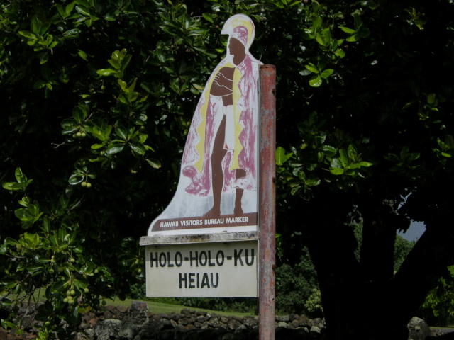
The image shows Kamehameha, as depicted by Herb Kane.